Signs Tagged With Shield
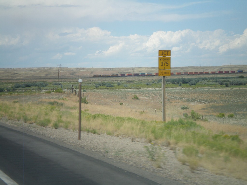
US-30 West Approaching WY-235
US-30 west approaching WY-235.
Taken 08-01-2010

 Granger
Sweetwater County
Wyoming
United States
Granger
Sweetwater County
Wyoming
United States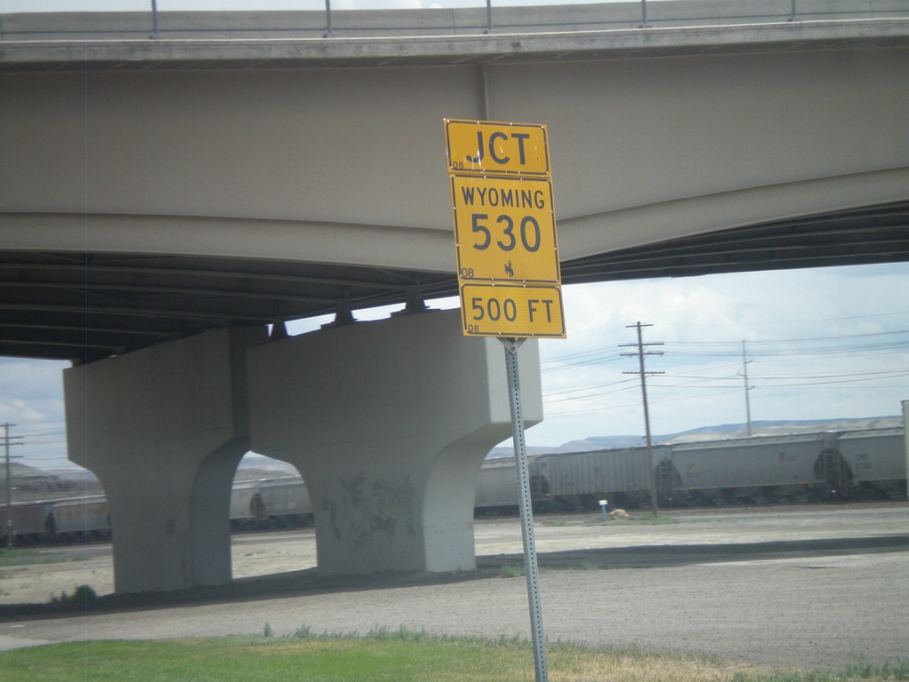
BL-80/Bus. US-30 East Approaching WY-530
BL-80/Bus. US-30 East approaching WY-530.
Taken 08-01-2010


 Green River
Sweetwater County
Wyoming
United States
Green River
Sweetwater County
Wyoming
United States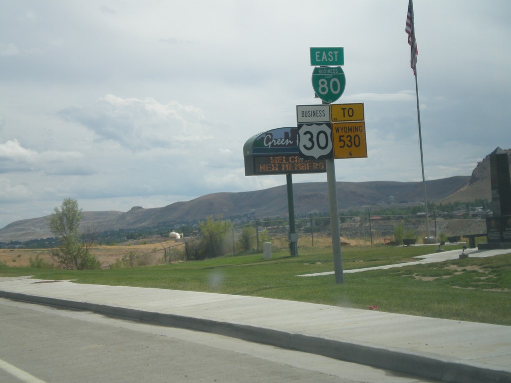
BL-80 East/Bus. US-30 East/To WY-530
BL-80 East/Bus. US-30 East/To WY-530 on W. Flaming Gorge Way in Green River.
Taken 08-01-2010
Green River
Sweetwater County
Wyoming
United States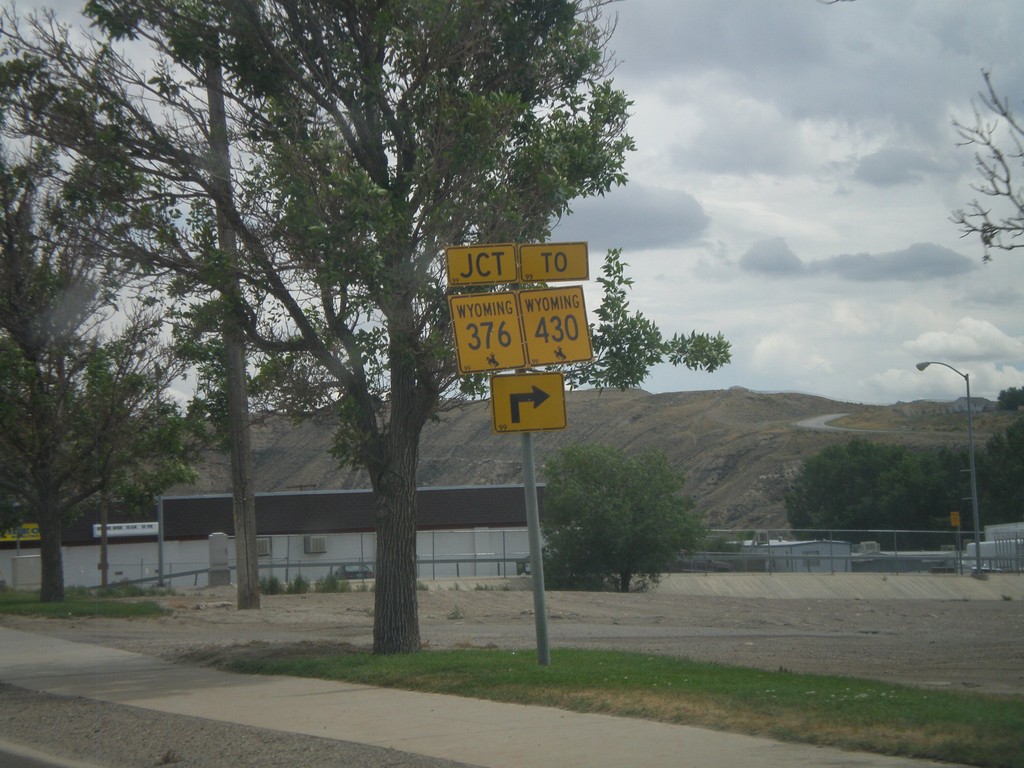
BL-80/Bus. US-30 East at WY-376
BL-80/Bus. US-30 East at WY-376/To WY-430. WY-376 is the Rock Springs Belt Line, which loops across the south side of town.
Taken 08-01-2010

 Rock Springs
Sweetwater County
Wyoming
United States
Rock Springs
Sweetwater County
Wyoming
United States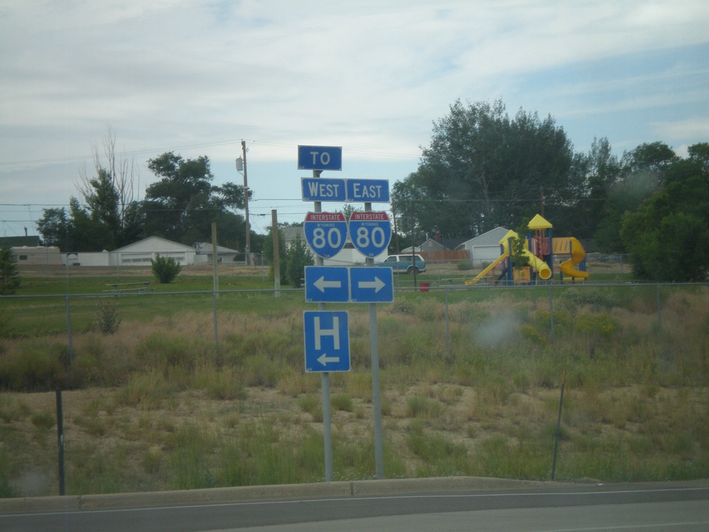
End WY-430 At WY-376
End WY-430 at WY-376, the Rock Springs Belt Route. Turn right on WY-376 for I-80 east. Turn left on WY-376 for I-80 west.
Taken 08-01-2010
 Rock Springs
Sweetwater County
Wyoming
United States
Rock Springs
Sweetwater County
Wyoming
United States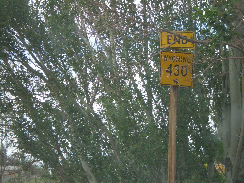
End WY-430 North at WY-376
End WY-430 north at WY-376
Taken 08-01-2010
Rock Springs
Sweetwater County
Wyoming
United States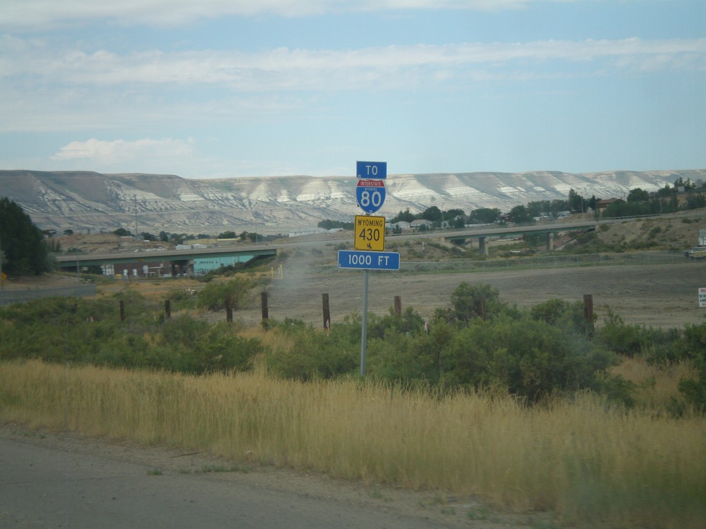
WY-430 North To I-80
WY-430 North (New Hampshire St.) approaching Marchant St. All WY-430 North and I-80 traffic must turn left on Marchant St.
Taken 08-01-2010
Rock Springs
Sweetwater County
Wyoming
United States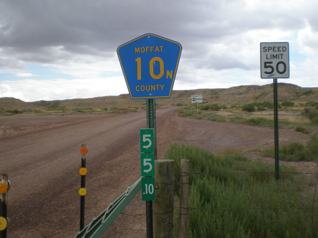
Moffat County 10N - Wyoming-Colorado State Line
Moffat County 10N at the Wyoming-Colorado State Line. The mile marker below the highway shield is a standard Wyoming mile marker, and is for WY-430.
Taken 08-01-2010
 Sweetwater County
Wyoming
United States
Sweetwater County
Wyoming
United States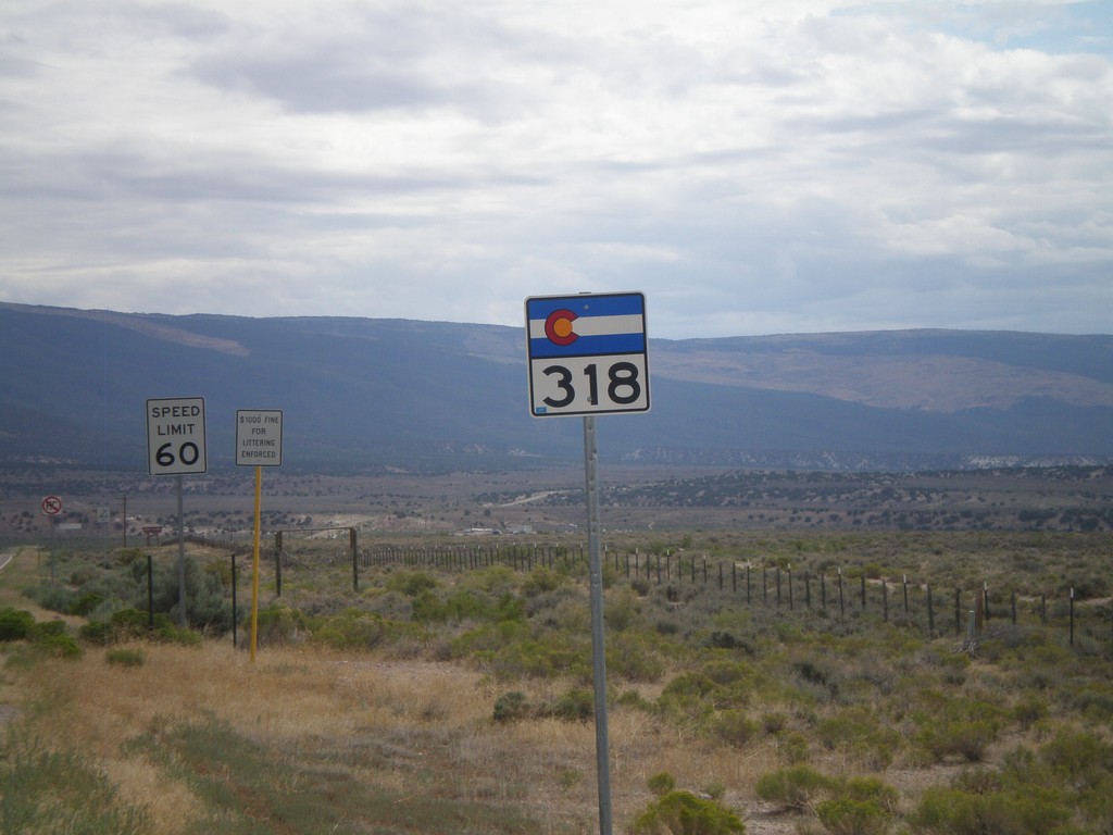
CO-318 East
CO-318 east shield just east of the Utah-Colorado State Line.
Taken 08-01-2010
 Moffat County
Colorado
United States
Moffat County
Colorado
United States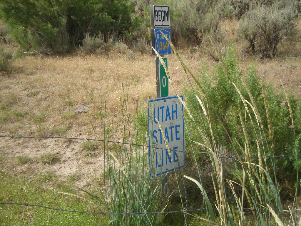
Utah State Line on CR-1364
Utah State Line on CR-1364 (Browns Park Road) at the Wyoming-Utah Border. There is a cattle guard marking the state line.
Taken 08-01-2010
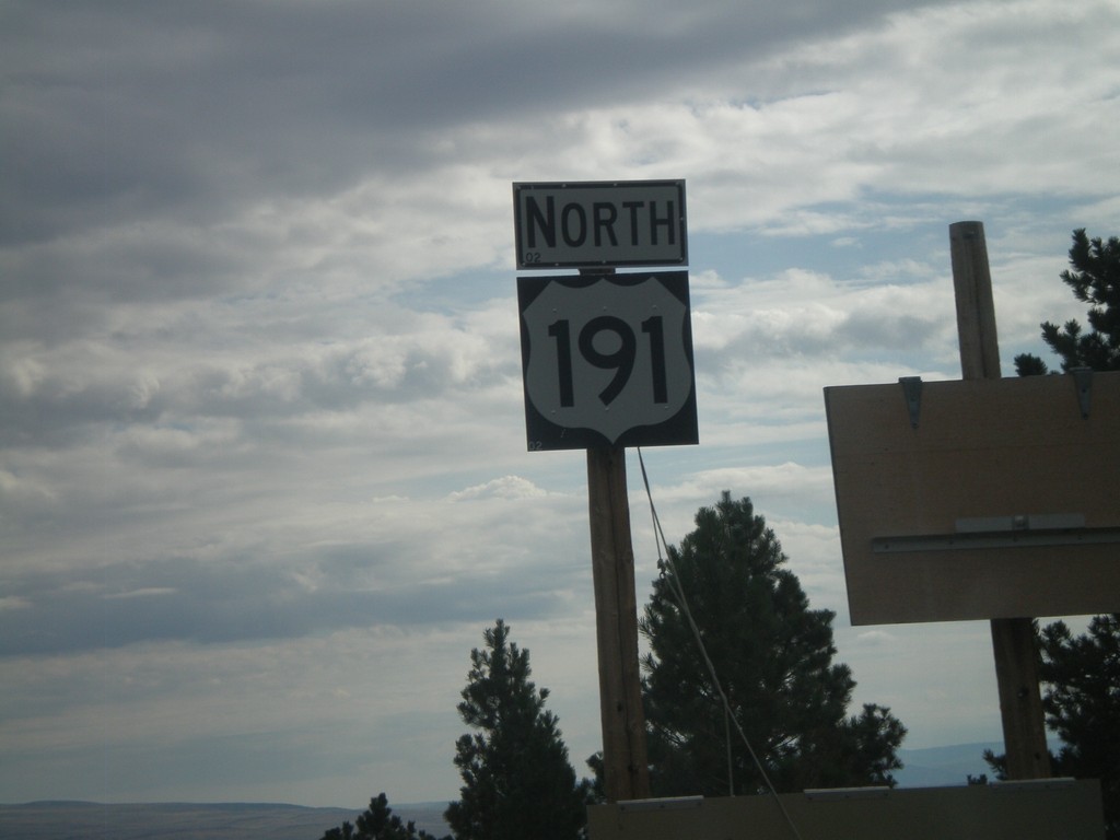
US-191 North
US-191 north just north of UT-44. Folded up sign to the right is a winter road warning for the Wyoming stretch of US-191.
Taken 08-01-2010
 Dutch John
Daggett County
Utah
United States
Dutch John
Daggett County
Utah
United States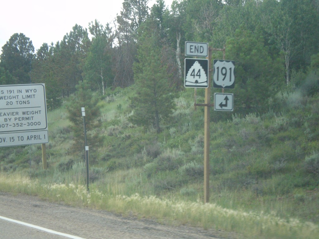
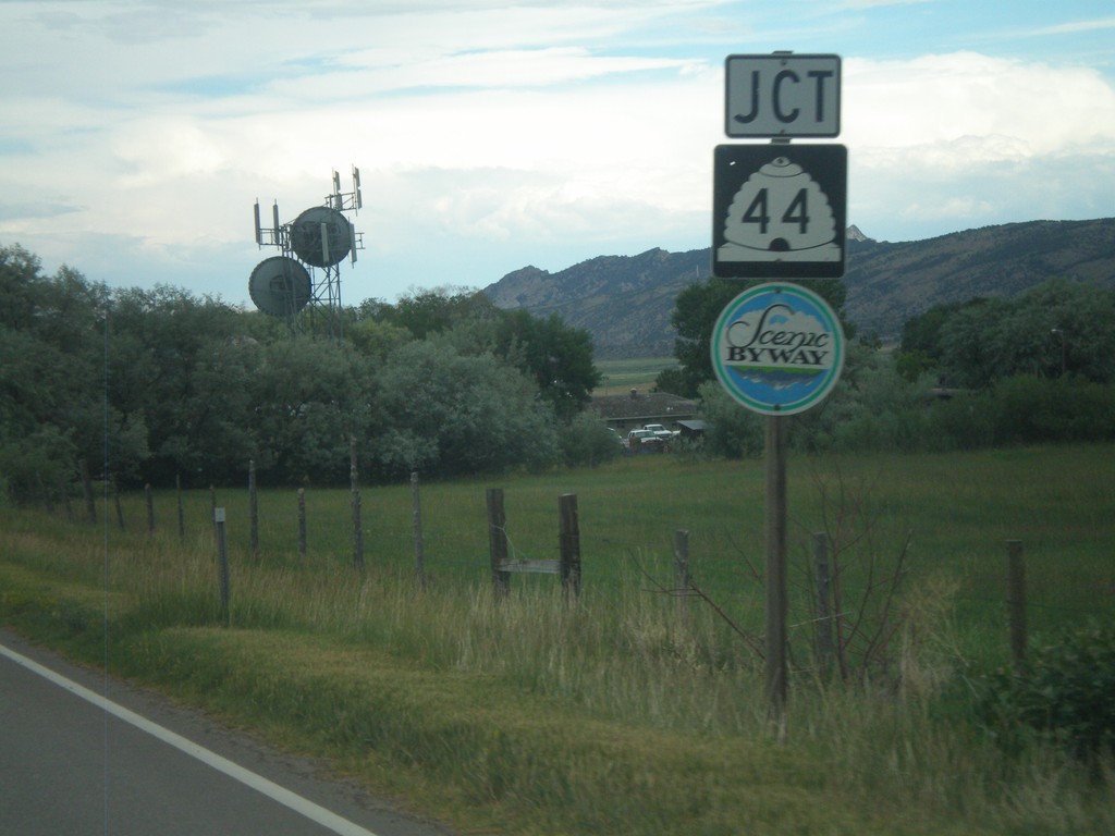
End UT-44 East at US-191
End UT-44 east at US-191.
Taken 08-01-2010
 Dutch John
Daggett County
Utah
United States
Dutch John
Daggett County
Utah
United States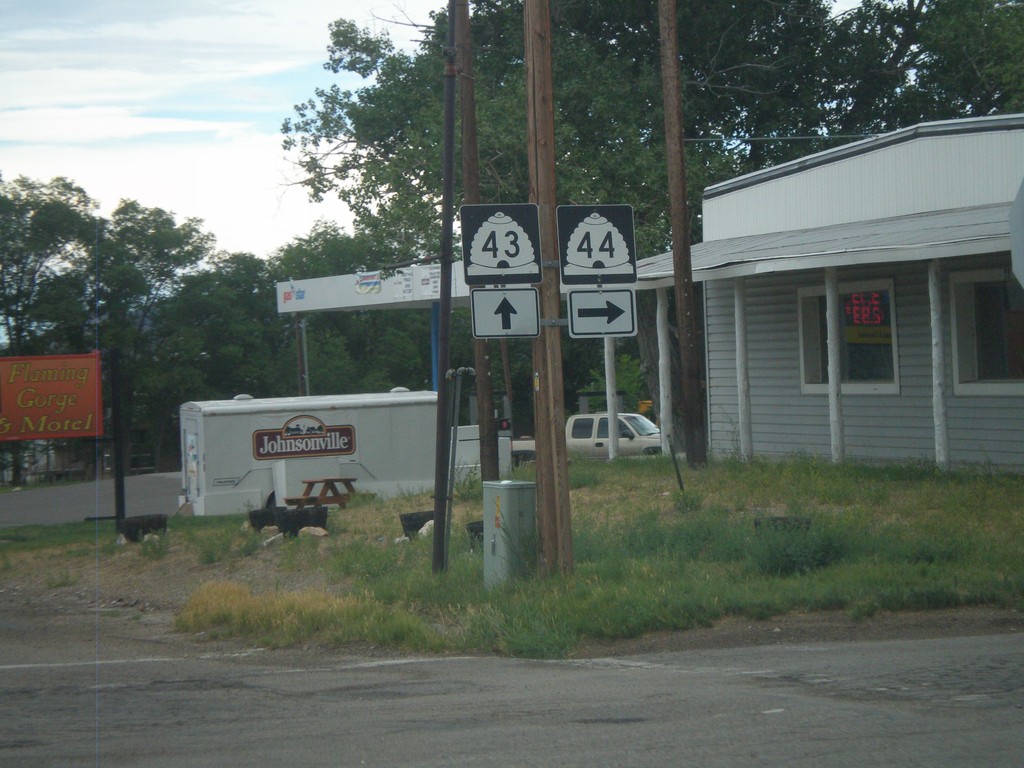
UT-43 East Approaching UT-44
UT-43 east approaching UT-44. UT-44 is a Utah Scenic Byway.
Taken 07-31-2010
 Manila
Daggett County
Utah
United States
Manila
Daggett County
Utah
United States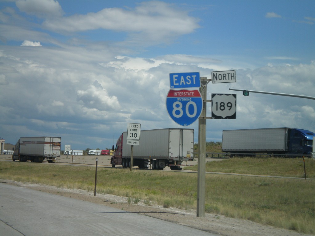
I-80 East/US-189 North
I-80 East/US-189 North at the Utah-Wyoming State Line. The official welcome sign is located after the Wyoming Port of Entry which is located directly on the state line. This is the only indication of the state line.
Taken 07-31-2010
 Evanston
Uinta County
Wyoming
United States
Evanston
Uinta County
Wyoming
United States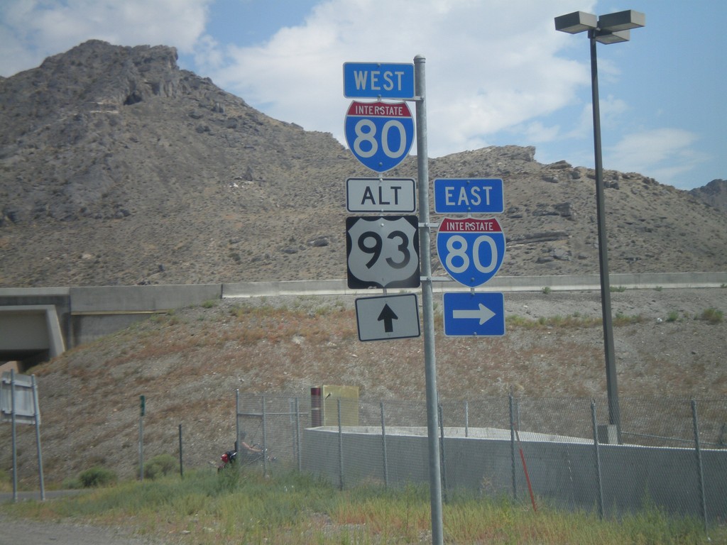
BL-80 West/Alt. US-93 North at I-80
BL-80 West/Alt. US-93 North at I-80 onramps. Alt. US-93 north joins I-80 west to Wells.
Taken 07-31-2010
 West Wendover
Elko County
Nevada
United States
West Wendover
Elko County
Nevada
United States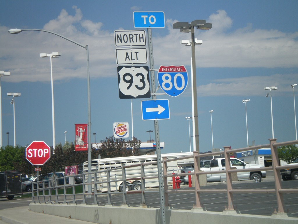
BL-80 West/Alt. US-93 North - To I-80
BL-80 West/Alt. US-93 North on Wendover Blvd. at access road to I-80.
Taken 07-31-2010
West Wendover
Elko County
Nevada
United States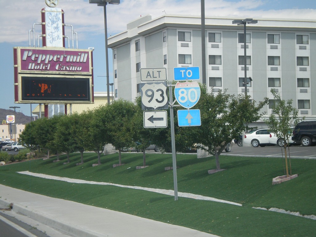
BL-80 West at Alt. US-93
BL-80 west at Alt. US-93. Continue west on BL-80 and Alt. US-93 for I-80. Alt. US-93 follows I-80 west from here to Wells.
Taken 07-31-2010
West Wendover
Elko County
Nevada
United States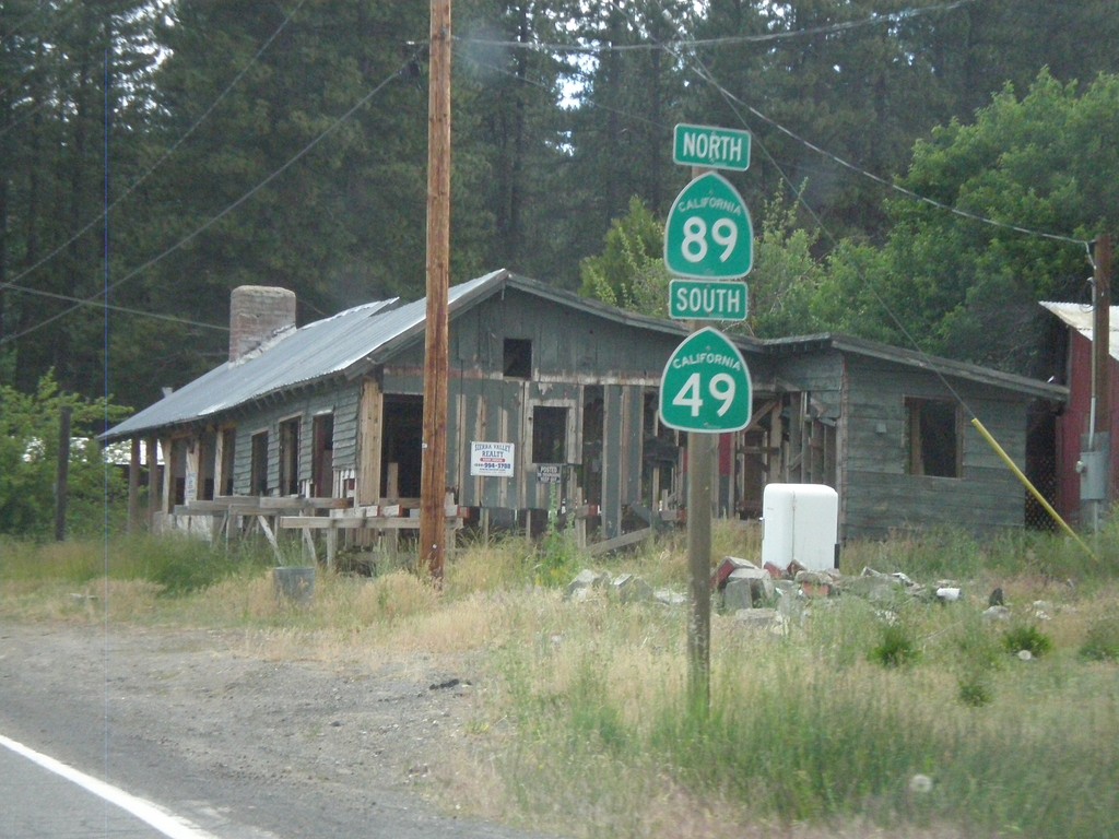
CA-89 North/CA-49 South - Sattley
CA-89 North/CA-49 South in Sattley.
Taken 07-09-2010

 Sattley
Sierra County
California
United States
Sattley
Sierra County
California
United States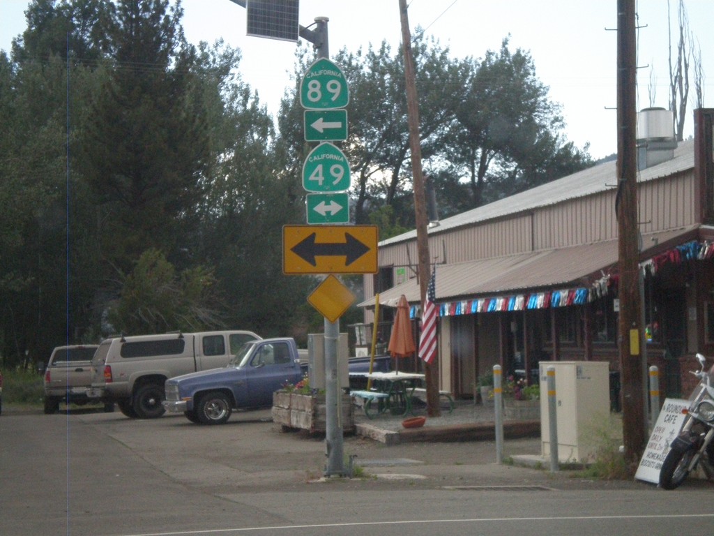
CA-89 North at CA-49
CA-89 North at CA-49. CA-89 north joins CA-49 south to Sattley.
Taken 07-09-2010
Sierraville
Sierra County
California
United States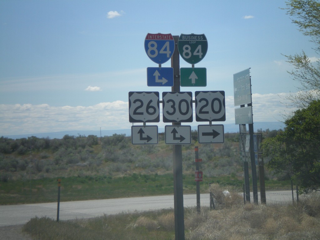
US-20 West at I-84
US-20 west at I-84/US-26/US-30. BL-84 begins here and heads into Mountain Home.
Taken 05-02-2010


 Mountain Home
Elmore County
Idaho
United States
Mountain Home
Elmore County
Idaho
United States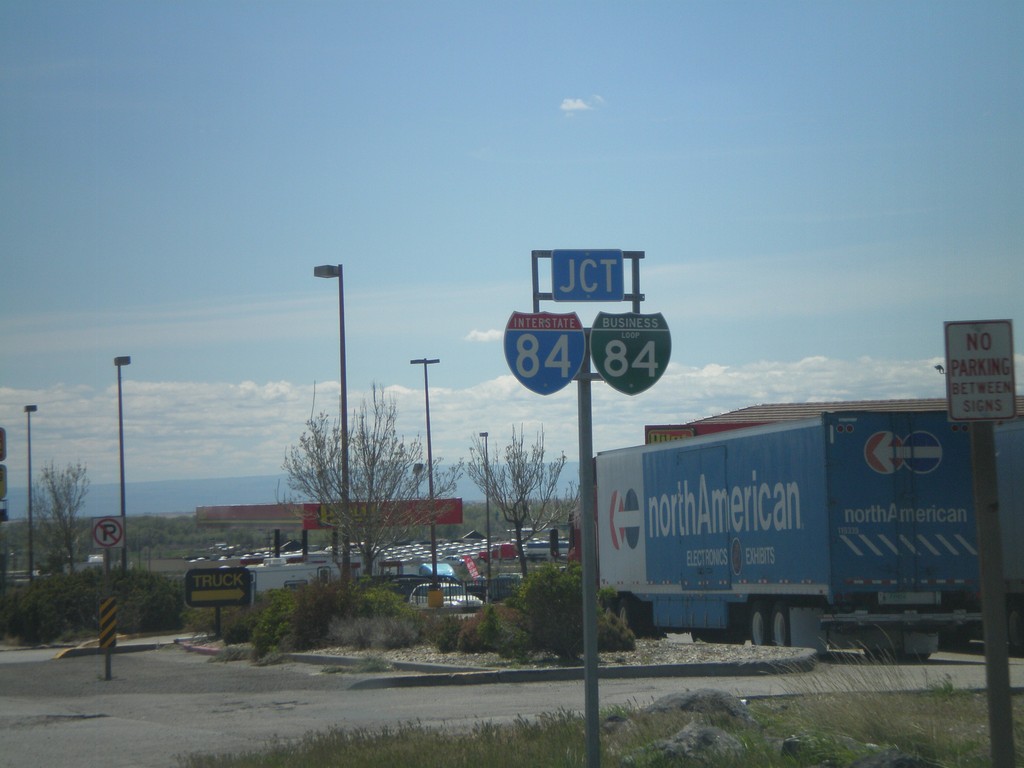
US-20 West Approaching I-84
US-20 West approaching I-84 and BL-84. BL-84 was recently shortened, and rerouted to end at Exit 95 instead of Exit 99. This is now the western end of BL-84 in Mountain Home.
Taken 05-02-2010
Mountain Home
Elmore County
Idaho
United States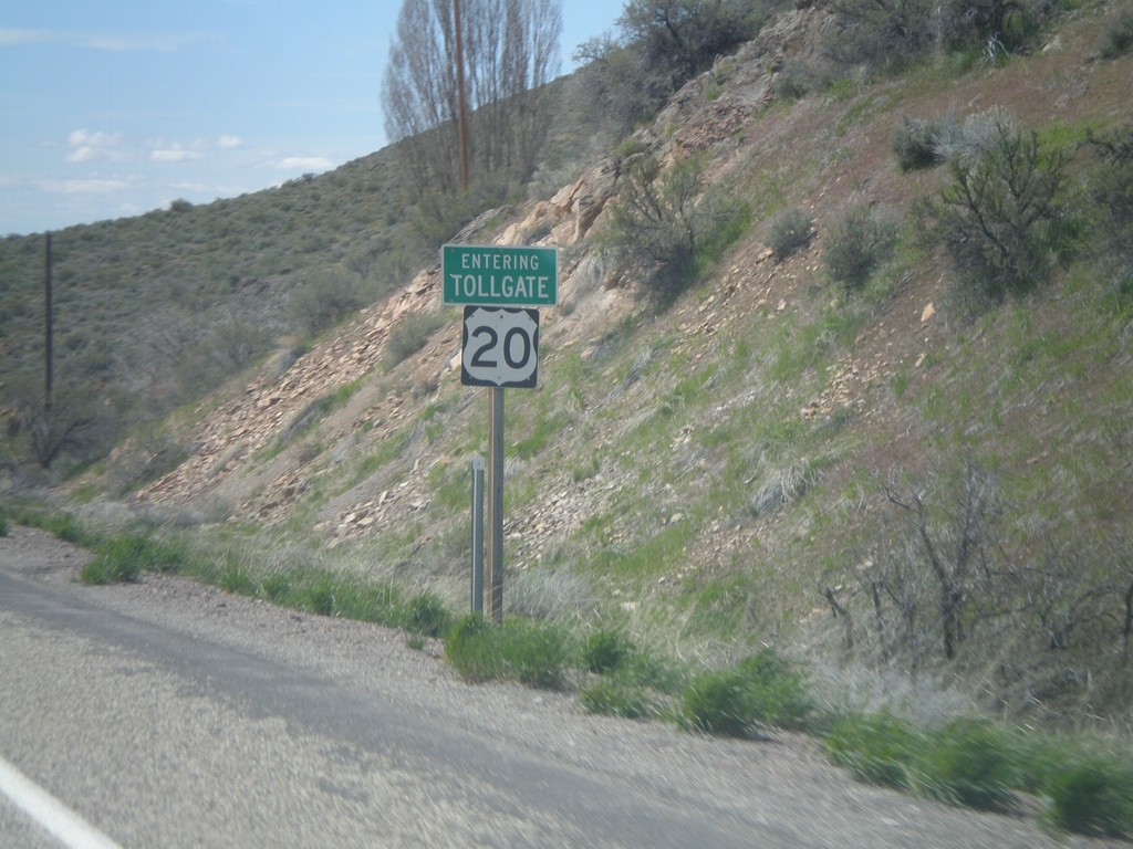
US-20 West - Tollgate
US-20 west - Entering of Tollgate.
Taken 05-02-2010
Mountain Home
Elmore County
Idaho
United States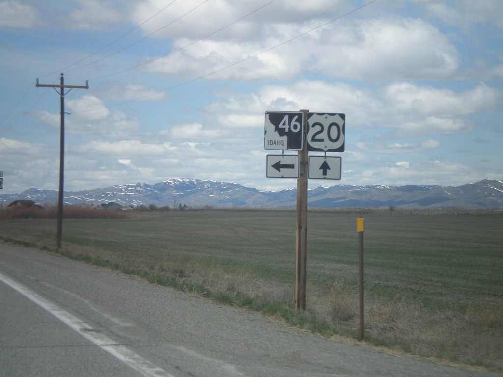
US-20 West at ID-46 South
US-20 west at ID-46 south
Taken 05-02-2010
 Fairfield
Camas County
Idaho
United States
Fairfield
Camas County
Idaho
United States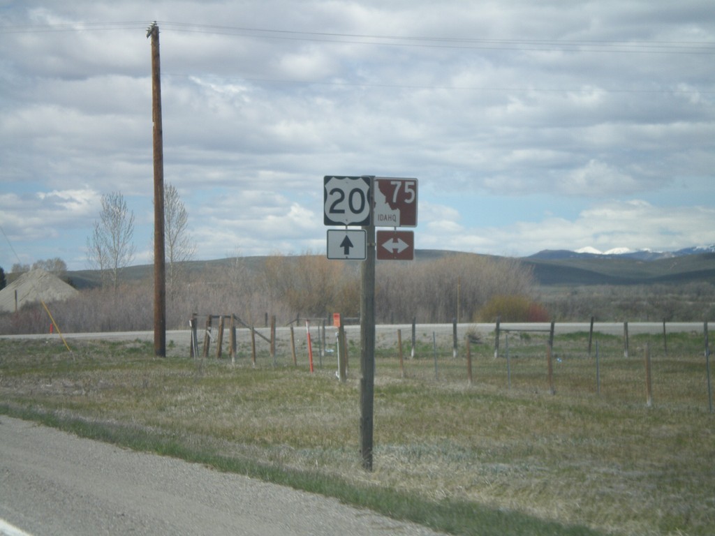
US-20 West at ID-75
US-20 west at ID-75. ID-75 is the Sawtooth Scenic Byway
Taken 05-02-2010
 Stanton Crossing
Blaine County
Idaho
United States
Stanton Crossing
Blaine County
Idaho
United States