Signs Tagged With Shield
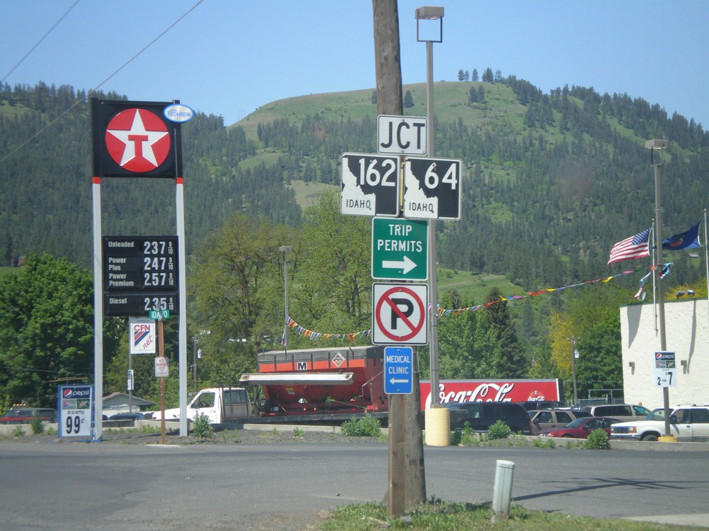
US-12 West approaching ID-162/ID-64
US-12 west approaching ID-162/ID-64.
Taken 05-21-2009


 Kamiah
Lewis County
Idaho
United States
Kamiah
Lewis County
Idaho
United States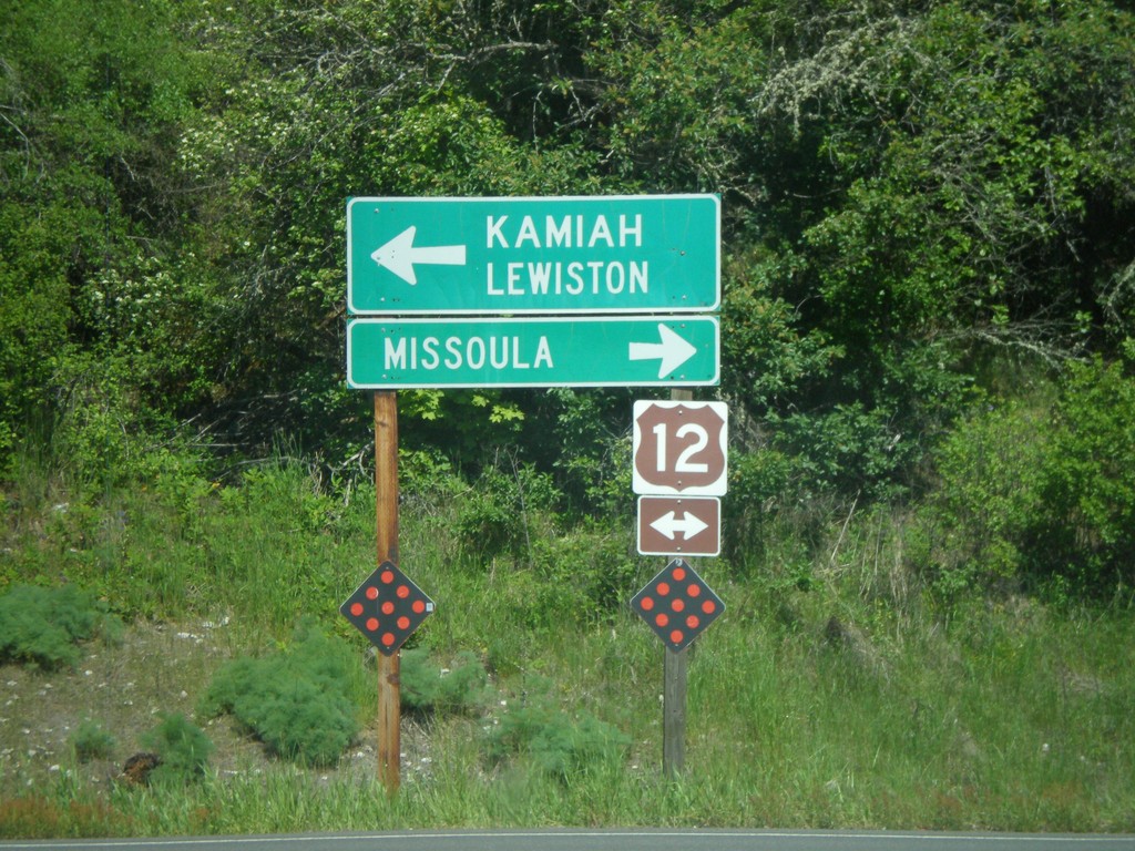
End ID-13 North at US-12
End ID-13 north at US-12. Use US-12 west for Kamiah and Lewiston. Use US-12 east for Missoula (Montana).
Taken 05-21-2009
 Kooskia
Idaho County
Idaho
United States
Kooskia
Idaho County
Idaho
United States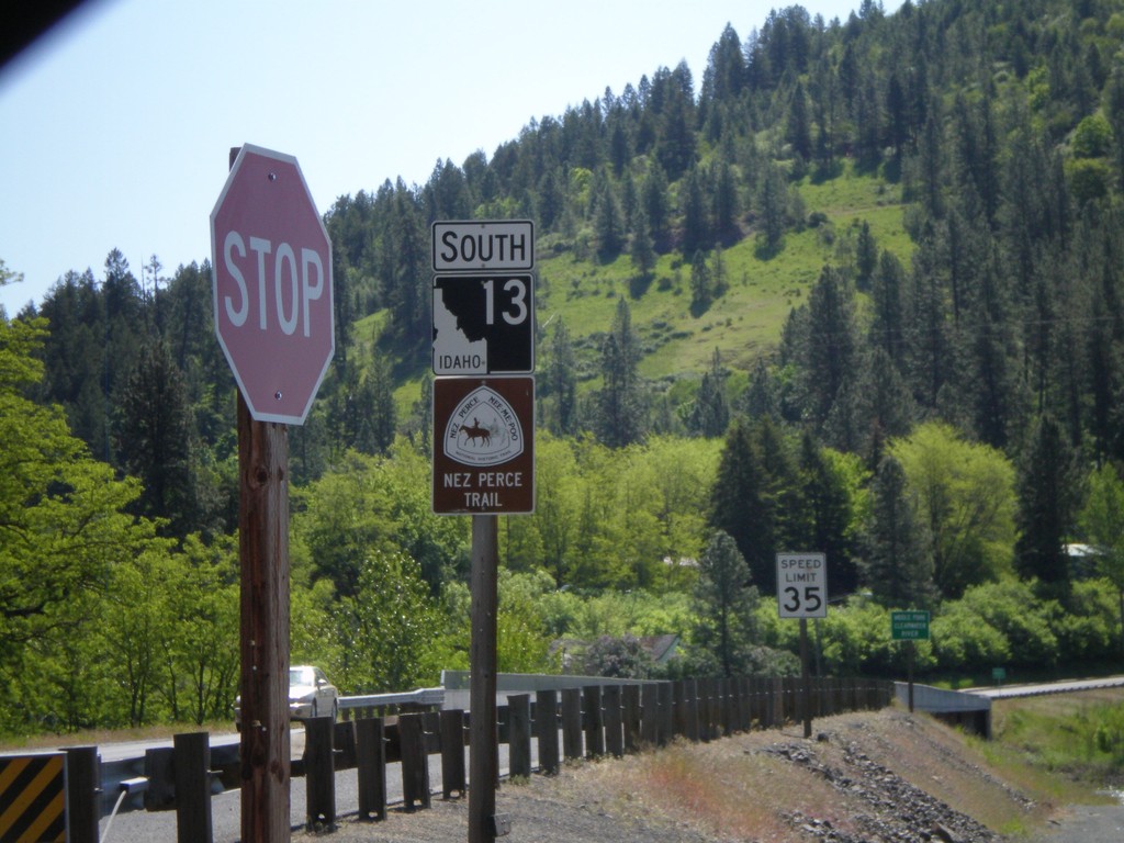
ID-13 South - Nez Perce Trail
Begin ID-13 south. ID-13 is signed as the Nez Perce Trail and Northwest Passage Scenic Byway.
Taken 05-21-2009
Kooskia
Idaho County
Idaho
United States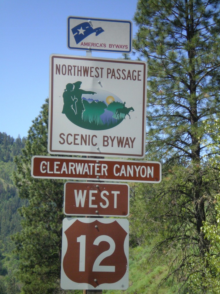
US-12 West - Northwest Passage Scenic Byway
Northwest Passage Scenic Byway (Clearwater Canyon) on US-12 west.
Taken 05-21-2009
Kooskia
Idaho County
Idaho
United States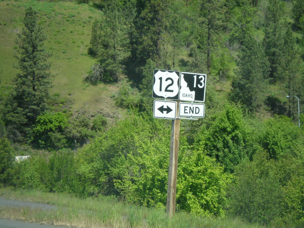
End ID-13 north at US-12
End ID-13 north at US-12
Taken 05-21-2009
Kooskia
Idaho County
Idaho
United States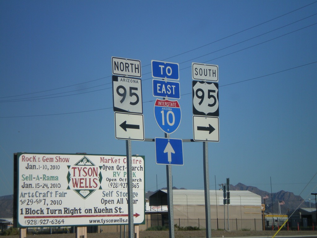
US-95 South at AZ-95
US-95 south at AZ-95.
Taken 03-23-2009


 Quartzsite
La Paz County
Arizona
United States
Quartzsite
La Paz County
Arizona
United States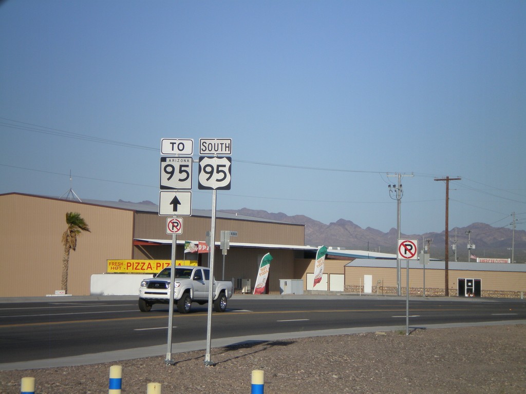
US-95 South To AZ-95
US-95 south to AZ-95.
Taken 03-23-2009
Quartzsite
La Paz County
Arizona
United States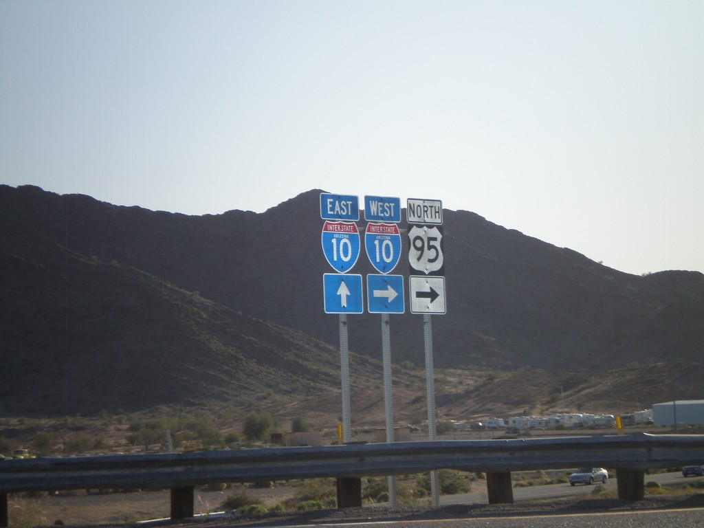
US-95 North at I-10 (Exit 17)
US-95 north at I-10. US-95 joins I-10 west to Blythe, CA.
Taken 03-23-2009
Quartzsite
La Paz County
Arizona
United States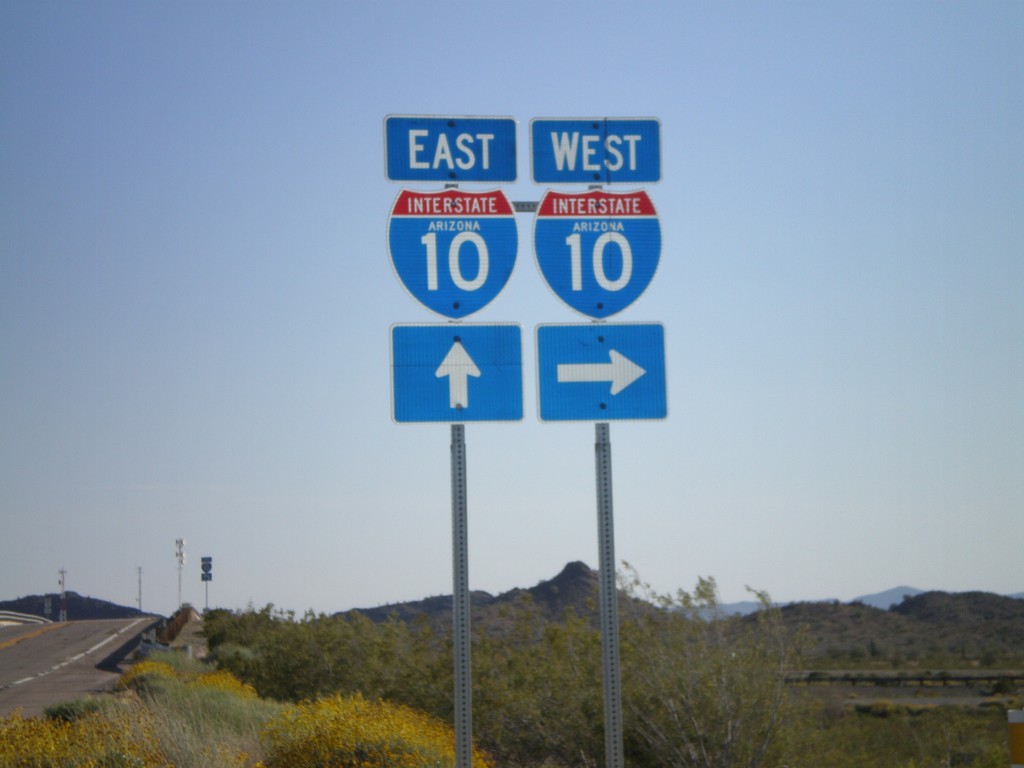
Hovatter Road South at I-10 Onramp
Hovatter Road South at I-10 Onramp (Exit 53)
Taken 03-23-2009
Salome
La Paz County
Arizona
United States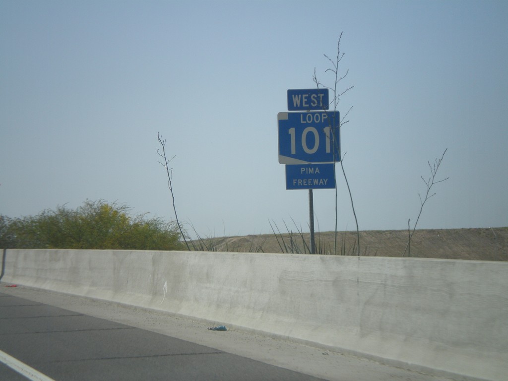
AZ-101 West - Pima Freeway
AZ-101 Loop West - Pima Freeway
Taken 03-23-2009
 Phoenix
Maricopa County
Arizona
United States
Phoenix
Maricopa County
Arizona
United States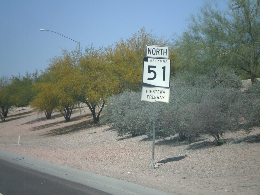
AZ-51 North - Piestewa Freeway
AZ-51 North - Piestewa Freeway. Most freeways in the Phoenix area have names and are signed with the shields.
Taken 03-23-2009
 Phoenix
Maricopa County
Arizona
United States
Phoenix
Maricopa County
Arizona
United States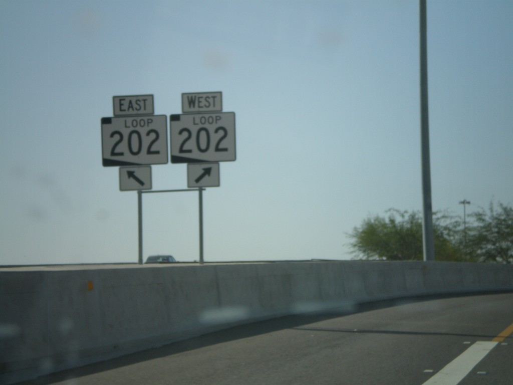
End AZ-101 Loop at AZ-202 Loop
End AZ-101 Loop at AZ-202 Loop.
Taken 03-23-2009
 Chandler
Maricopa County
Arizona
United States
Chandler
Maricopa County
Arizona
United States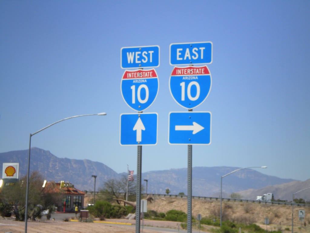
AZ-90 North Approaching I-10
AZ-90 north approaching I-10.
Taken 03-22-2009
 Benson
Cochise County
Arizona
United States
Benson
Cochise County
Arizona
United States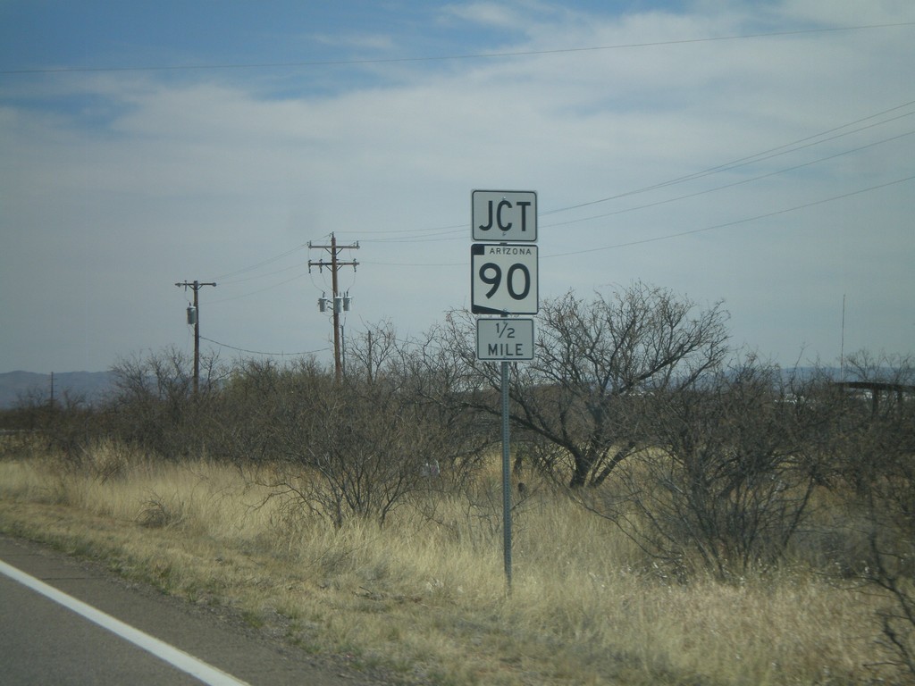
AZ-82 East Approaching AZ-90
AZ-82 east approaching AZ-90.
Taken 03-22-2009
 Huachuca City
Cochise County
Arizona
United States
Huachuca City
Cochise County
Arizona
United States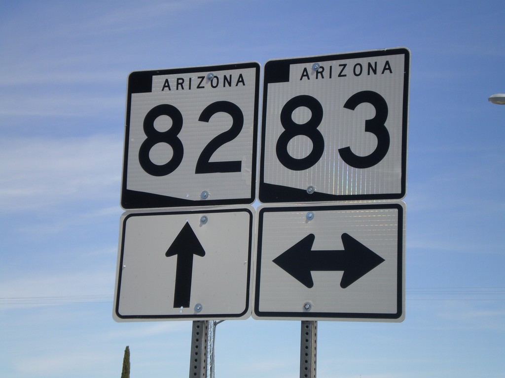
AZ-82 East at AZ-83
AZ-82 east at AZ-83.
Taken 03-22-2009
 Sonoita
Santa Cruz County
Arizona
United States
Sonoita
Santa Cruz County
Arizona
United States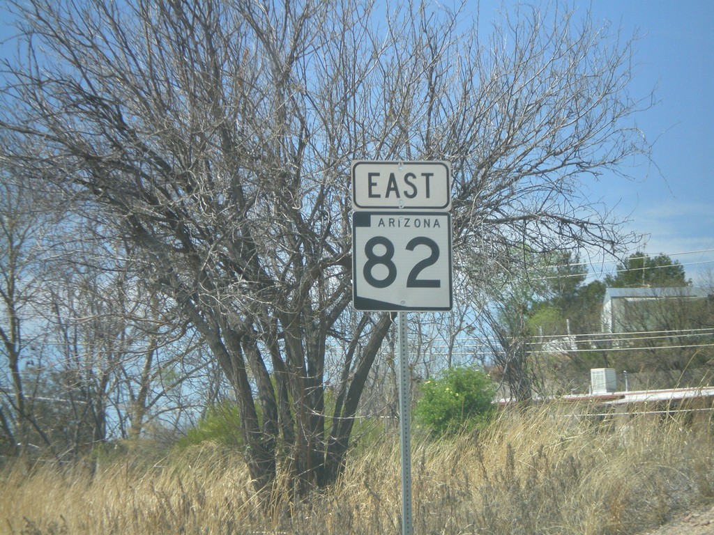
Begin AZ-82 East
First AZ-82 shield eastbound.
Taken 03-22-2009
Nogales
Santa Cruz County
Arizona
United States
AZ-189 North at I-19
AZ-189 north at I-19 onramp.
Taken 03-22-2009

 Nogales
Santa Cruz County
Arizona
United States
Nogales
Santa Cruz County
Arizona
United States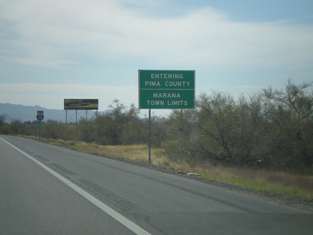
I-10 East - Pima County Line
Entering Pima County on I-10 east. Also entering the town of Marana. Taken on the Pima-Pinal County Line.
Taken 03-22-2009
Marana
Pinal County
Arizona
United States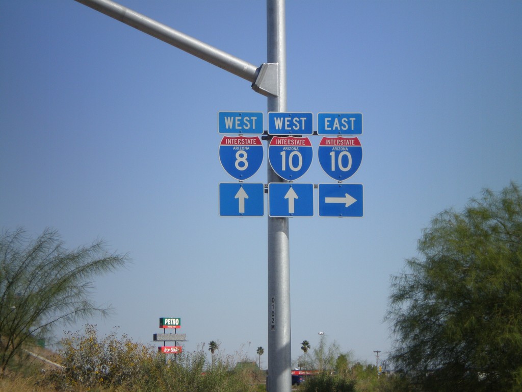
I-10 Onramp at Exit 200
I-10 onramp at Exit 200. For I-8 west traffic use I-10 west. I-8 is the next exit westbound on I-10.
Taken 03-22-2009
 Eloy
Pinal County
Arizona
United States
Eloy
Pinal County
Arizona
United States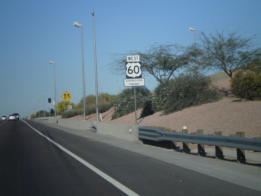
US-60 West - Superstition Freeway
US-60 West - Superstition Freeway
Taken 03-22-2009
 Mesa
Maricopa County
Arizona
United States
Mesa
Maricopa County
Arizona
United States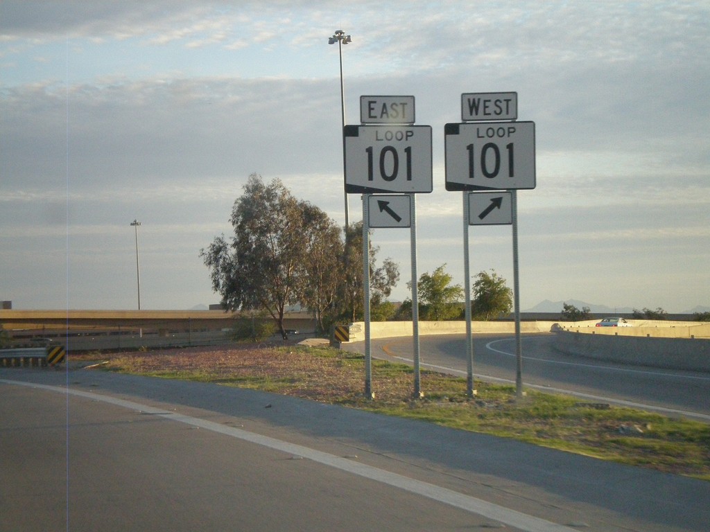
I-17 South at Exit 214C - AZ-Loop 101 Split
I-17 South at Exit 214C - AZ-101 Loop Split.
Taken 03-21-2009
 Phoenix
Maricopa County
Arizona
United States
Phoenix
Maricopa County
Arizona
United States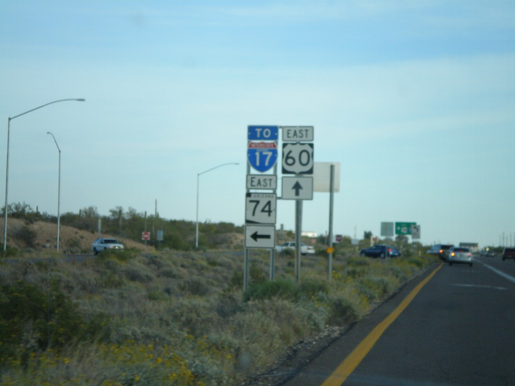
US-60 East Approaching AZ-74
US-60 east approaching AZ-74 east to I-17.
Taken 03-21-2009
 Morristown
Maricopa County
Arizona
United States
Morristown
Maricopa County
Arizona
United States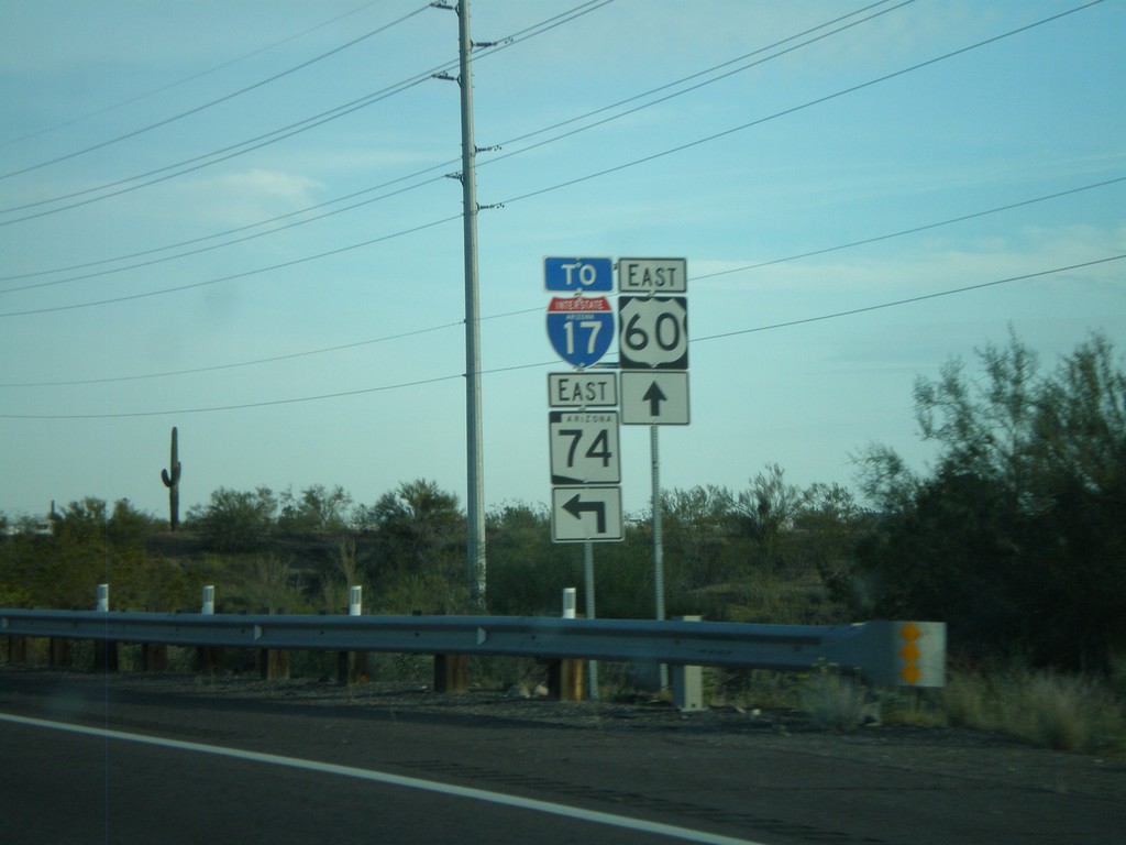
US-60 East Approaching AZ-74
US-60 east approaching AZ-74 east to I-17.
Taken 03-21-2009
Morristown
Maricopa County
Arizona
United States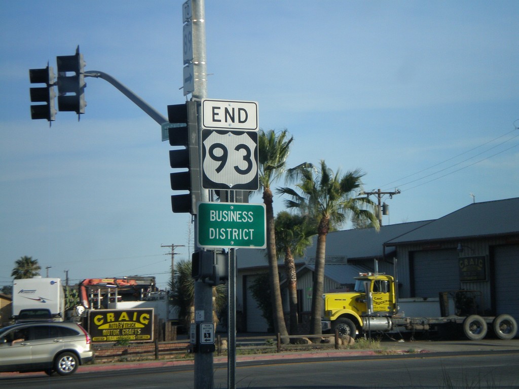
End US-93 South at US-60
End US-93 south at US-60. US-93 continues north from here to Eureka, MT and crosses into Canada at the Port of Roosville. US-93 becomes BC-93 and later AB-93 ending in Jasper, Alberta.
Taken 03-21-2009
 Wickenburg
Maricopa County
Arizona
United States
Wickenburg
Maricopa County
Arizona
United States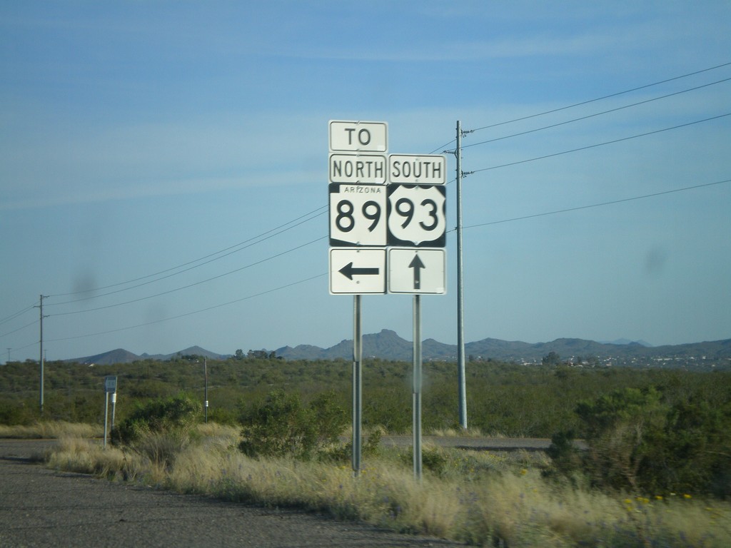
US-93 South at AZ-89
US-93 South at access road to AZ-89 in Yavapai County.
Taken 03-21-2009
 Wickenburg
Yavapai County
Arizona
United States
Wickenburg
Yavapai County
Arizona
United States