Signs Tagged With Shield
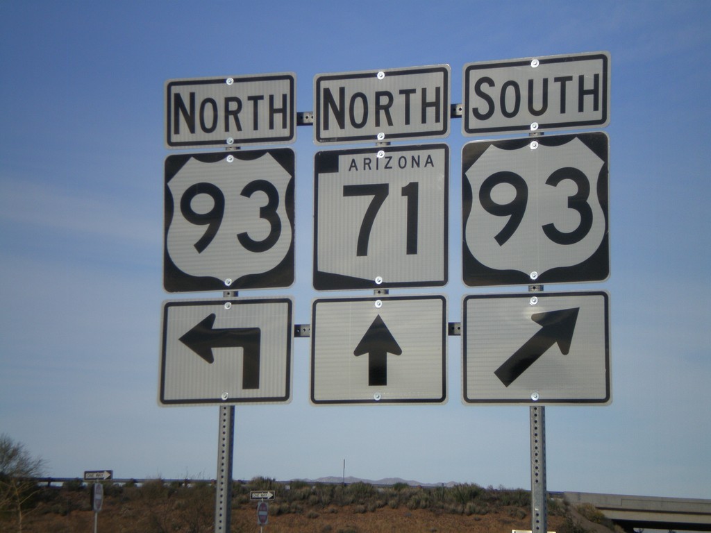
AZ-71 North at US-93
AZ-71 north at US-93.
Taken 03-21-2009

 Congress
Yavapai County
Arizona
United States
Congress
Yavapai County
Arizona
United States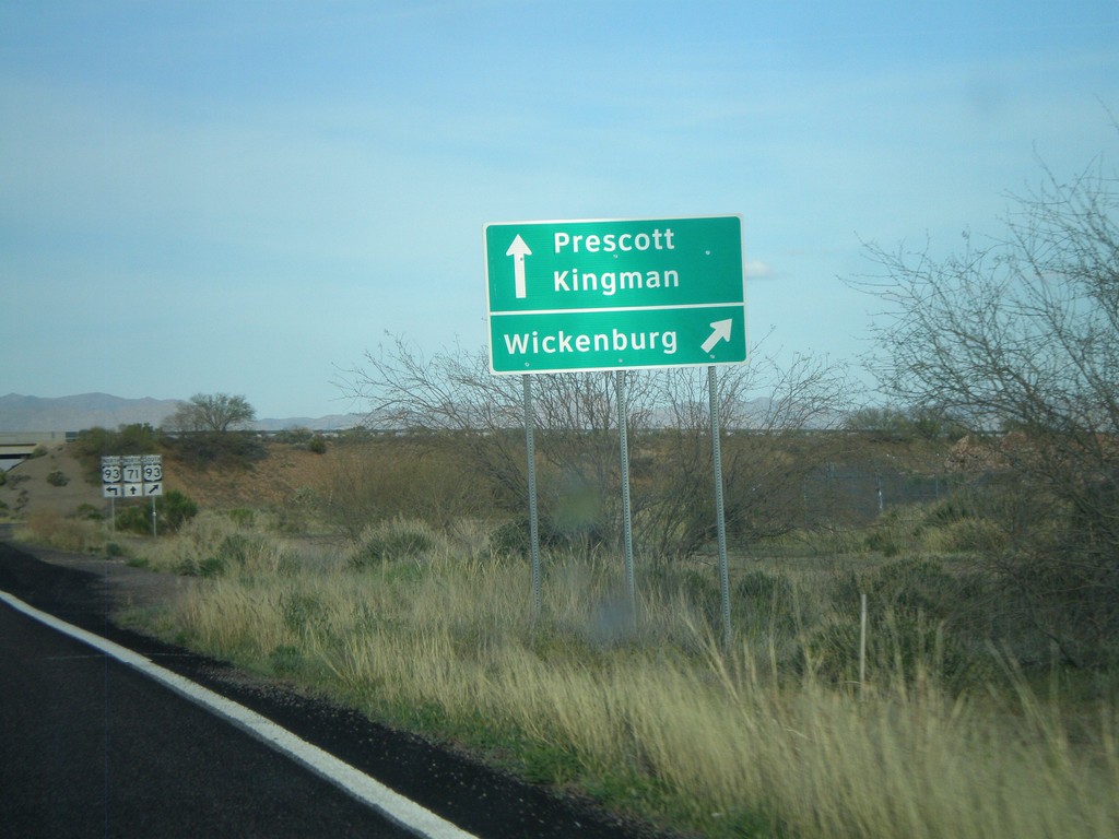
AZ-71 North Approaching US-93
AZ-71 north approaching US-93. Use US-93 south for Wickenburg
Taken 03-21-2009
Congress
Yavapai County
Arizona
United States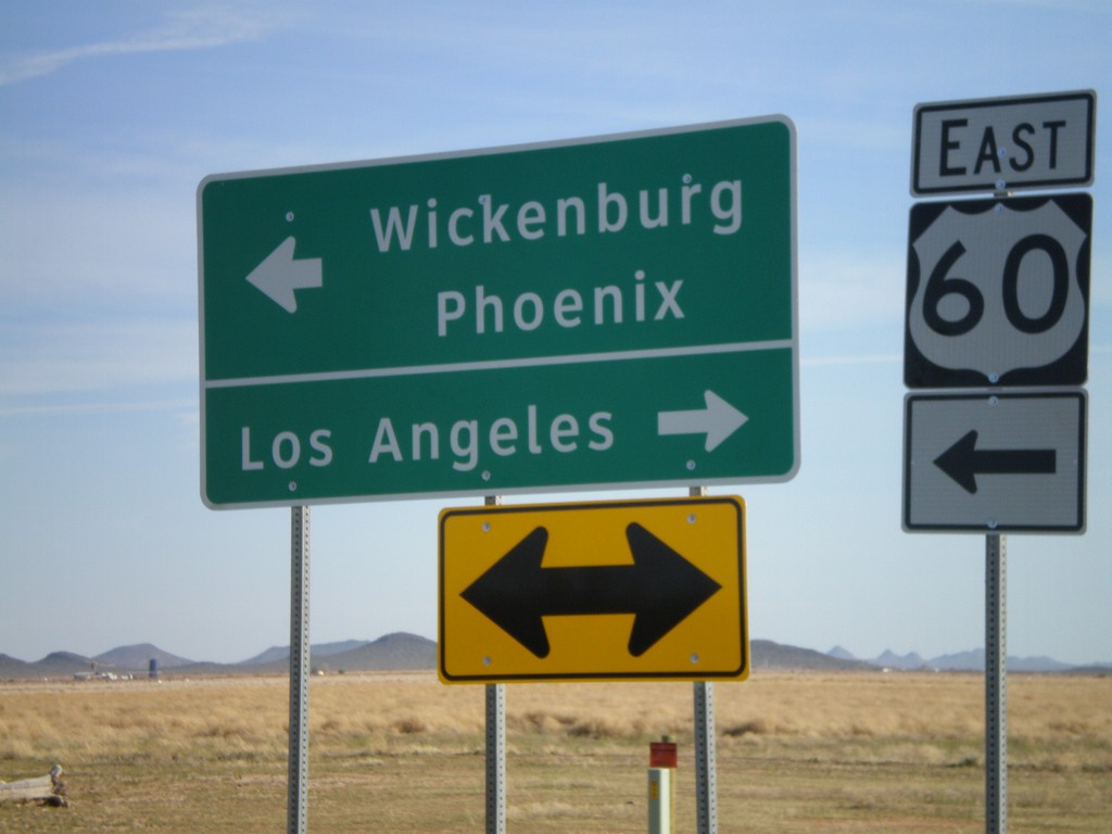
End AZ-71 South at US-60
End AZ-71 south at US-60. Use US-60 east for Wickenburg and Phoenix. Use US-60 west for Los Angeles.
Taken 03-21-2009
 Aguila
Maricopa County
Arizona
United States
Aguila
Maricopa County
Arizona
United States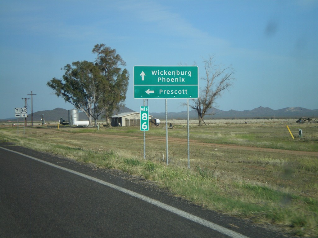
US-60 East at AZ-71
US-60 east at AZ-71 north to Prescott. Continue on US-60 for Wickenburg and Phoenix.
Taken 03-21-2009
Wickenburg
Maricopa County
Arizona
United States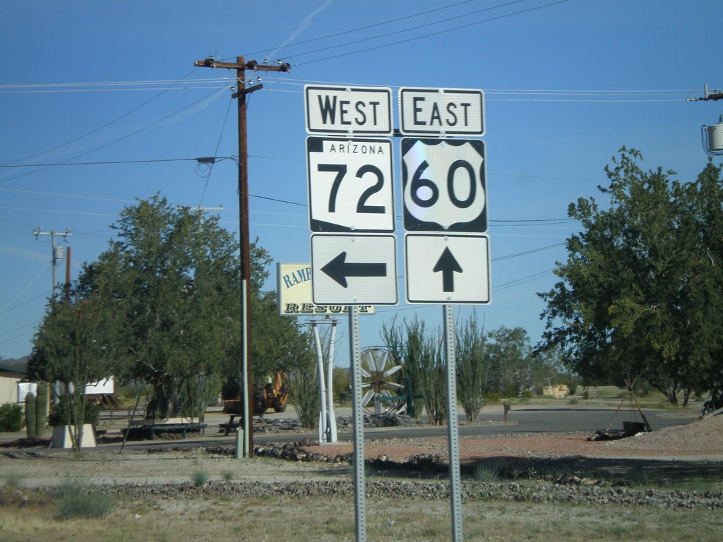
US-60 East at AZ-72
US-60 east at AZ-72 west.
Taken 03-21-2009
 Salome
La Paz County
Arizona
United States
Salome
La Paz County
Arizona
United States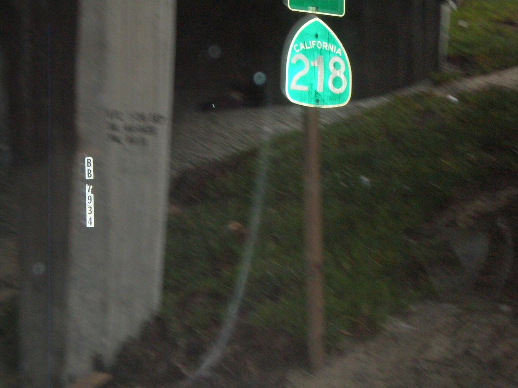
End CA-218 West at CA-1
End CA-218 west at CA-1
Taken 01-01-2009

 Monterey
 County
California
United States
Monterey
Monterey County
California
United States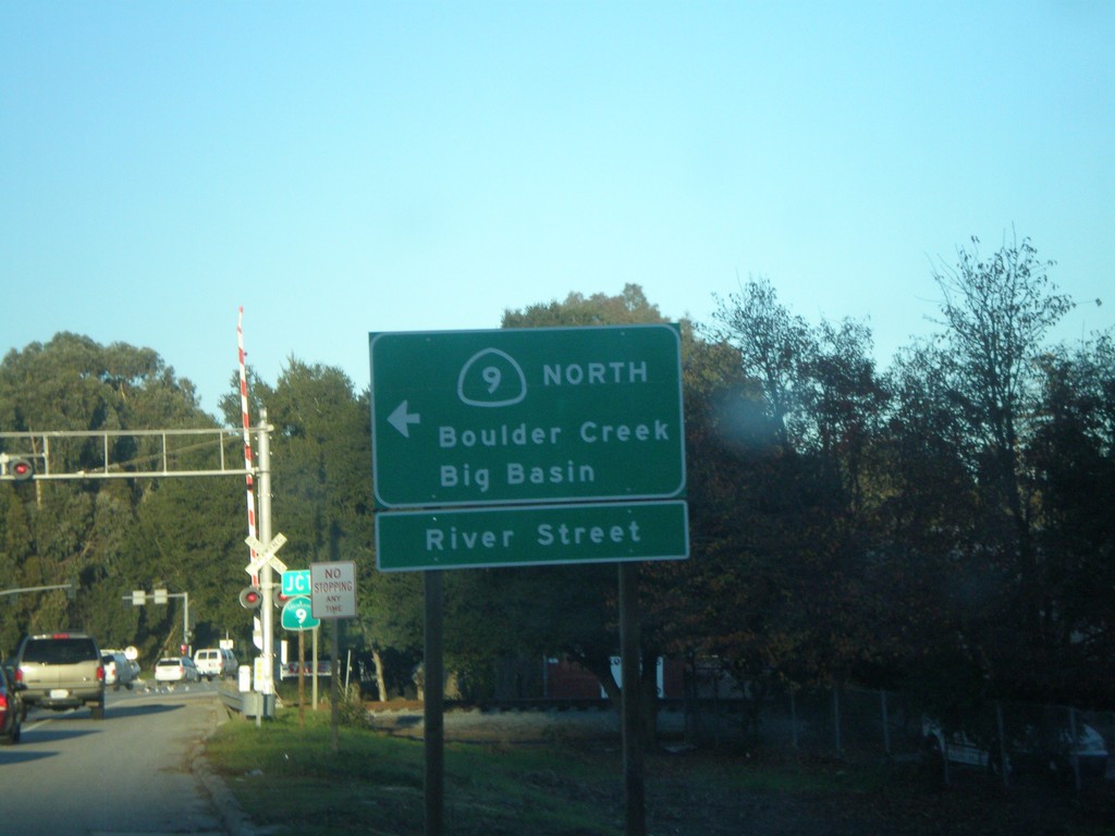
CA-1 South at CA-9 North
CA-1 South at CA-9 (River St.). Turn left for CA-9 North to Boulder creek/Big Basin.
Taken 12-31-2008
 Santa Cruz
 County
California
United States
Santa Cruz
Santa Cruz County
California
United States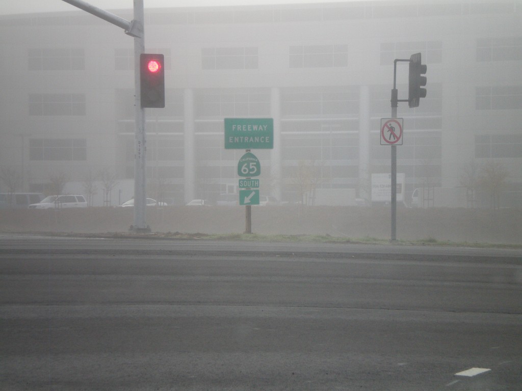
Pleasant Grove Blvd. at CA-65 South (Exit 308)
Pleasant Grove Blvd. at CA-65 South freeway entrance.
Taken 12-30-2008
 Roseville
Placer County
California
United States
Roseville
Placer County
California
United States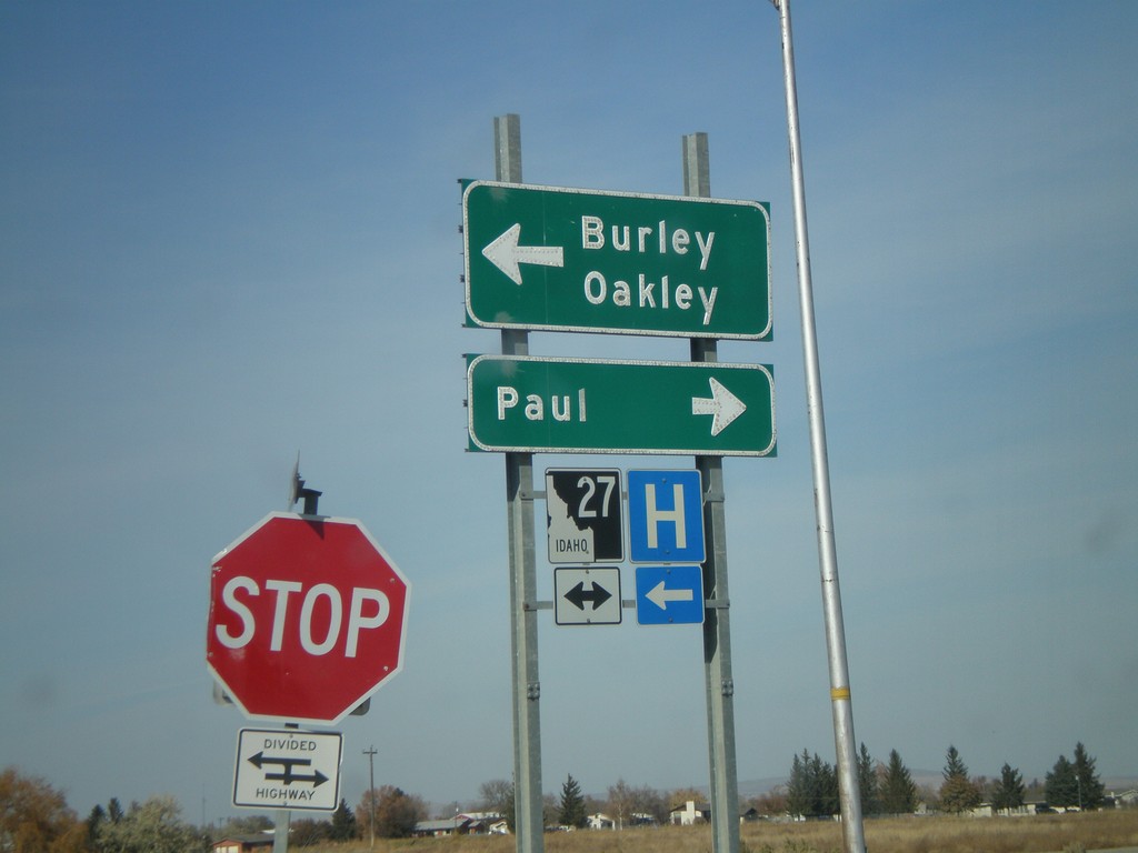
I-84 West Offramp at ID-27
I-84 west Exit 208 offramp at ID-27. Turn right for ID-27 north to Paul; left for BL-84 East/ID-27 south to Burley and Oakley.
Taken 10-26-2008


 Heyburn
Minidoka County
Idaho
United States
Heyburn
Minidoka County
Idaho
United States
UT-102 West at I-84
UT-102 west at I-84 onramp for Exit 40.
Taken 10-26-2008
 Tremonton
Box Elder County
Utah
United States
Tremonton
Box Elder County
Utah
United States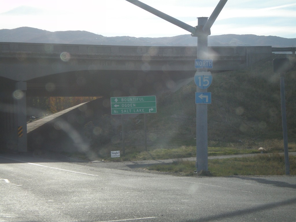
I-15 - Exit 315 Onramp
East 1100 North at I-15. Turn right for I-15 south to Salt Lake. Use left lane for I-15 north to Ogden. Continue east for Bountiful.
Taken 10-26-2008
 North Salt Lake
Davis County
Utah
United States
North Salt Lake
Davis County
Utah
United States
UT-132 East At I-15
UT-132 east at I-15 (Exit 225) in Nephi.
Taken 10-25-2008
 Nephi
Juab County
Utah
United States
Nephi
Juab County
Utah
United States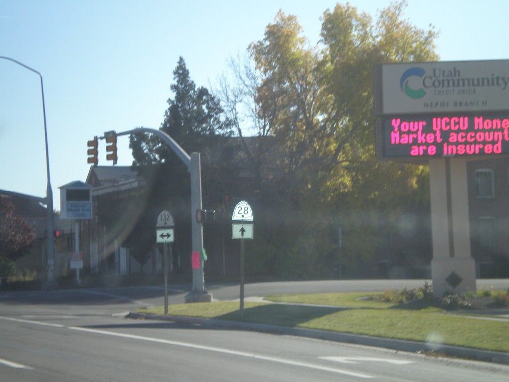
UT-28 South at UT-132
UT-28 south at UT-132. Notice the different shields used for UT-28 and UT-132. The UT-28 style is the newer style.
Taken 10-25-2008
 Nephi
Juab County
Utah
United States
Nephi
Juab County
Utah
United States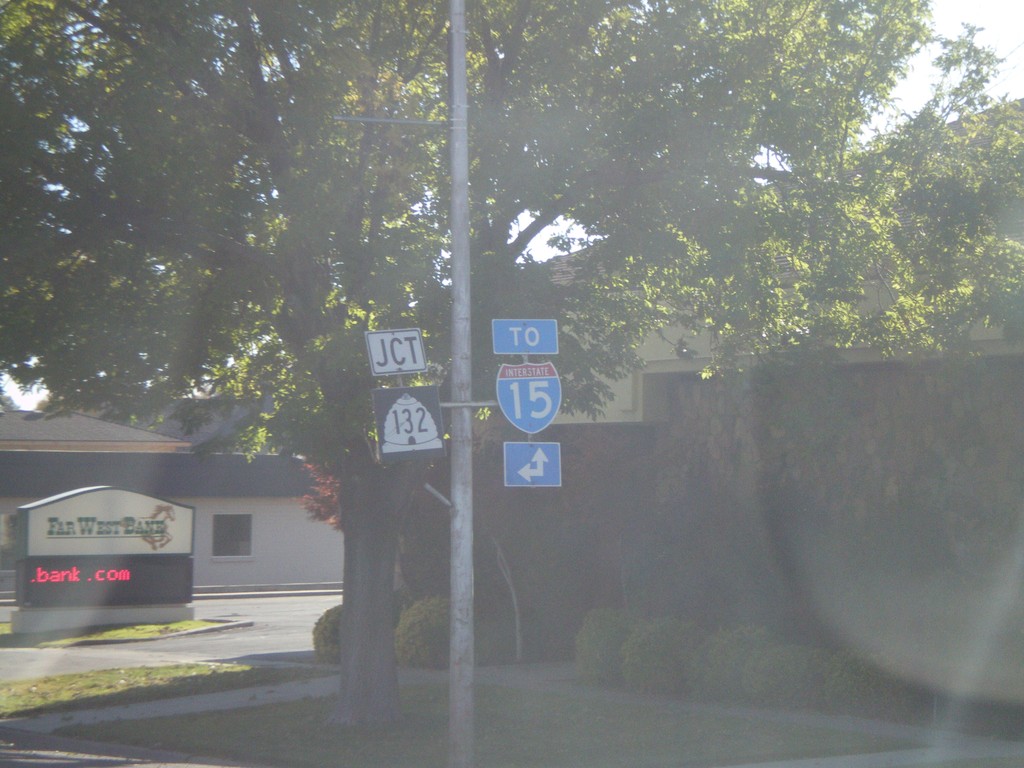
UT-28 South Approaching UT-132
UT-28 south approaching UT-132. For I-15 north use UT-132 east. For I-15 south use UT-28 south.
Taken 10-25-2008
Nephi
Juab County
Utah
United States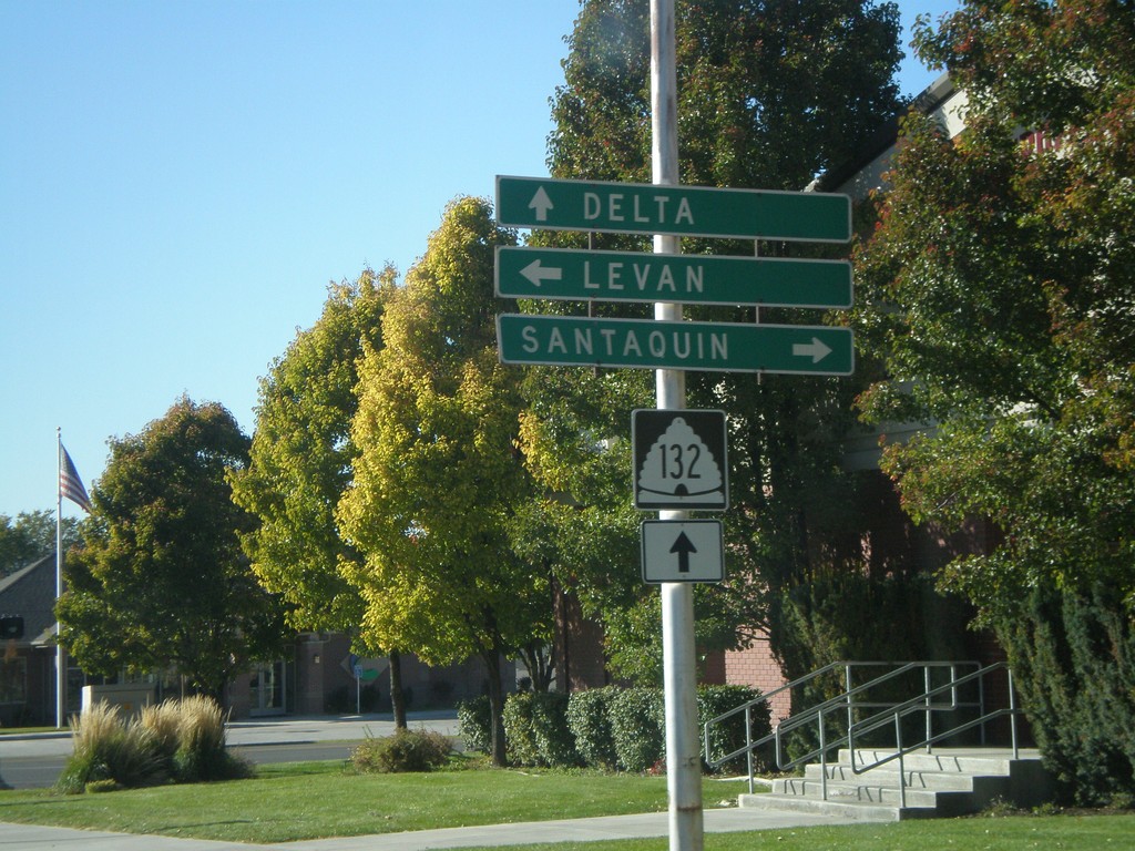
UT-132 West at UT-28
UT-132 west at UT-28. Use UT-28 north for Santaquin. Use UT-28 south for Levan. Continue on UT-132 for Delta.
Taken 10-25-2008
Nephi
Juab County
Utah
United States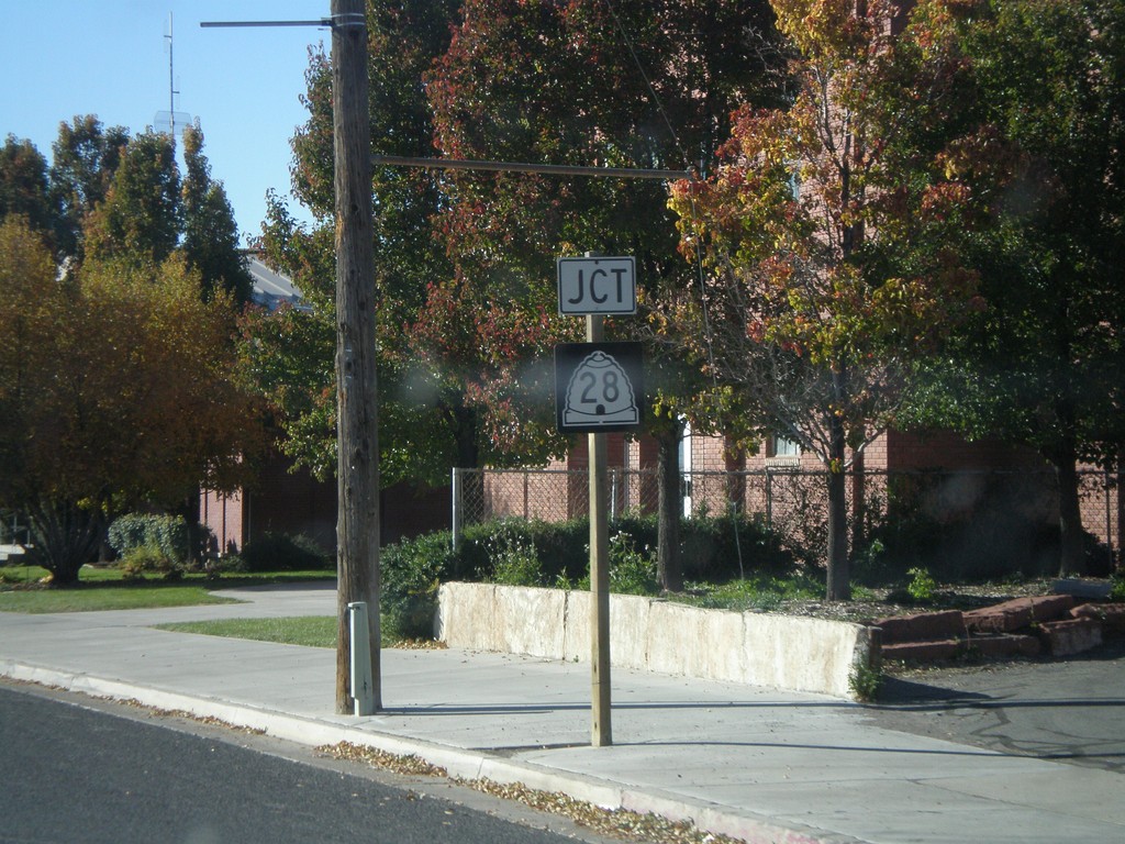
UT-131 West Approaching UT-28
UT-132 west approaching UT-28.
Taken 10-25-2008
Nephi
Juab County
Utah
United States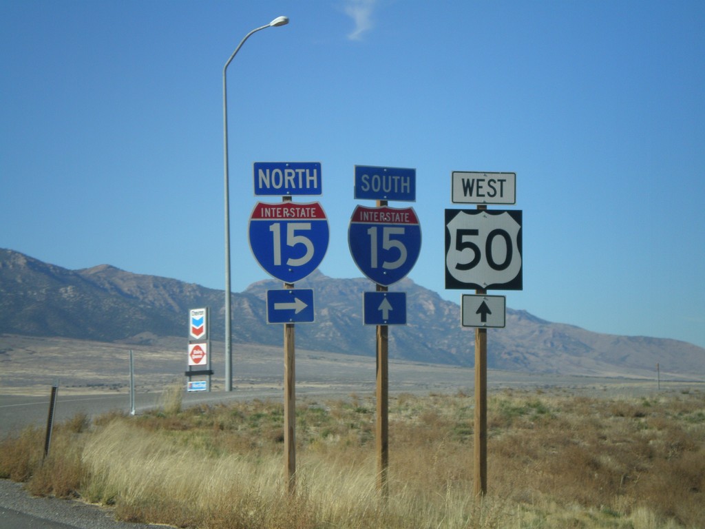
US-50 West at I-15
US-50 west at I-15 in Scipio. Turn right for I-15 north; straight head over freeway for I-15 south. US-50 west joins I-15 south to Holden.
Taken 10-25-2008
 Scipio
Millard County
Utah
United States
Scipio
Millard County
Utah
United States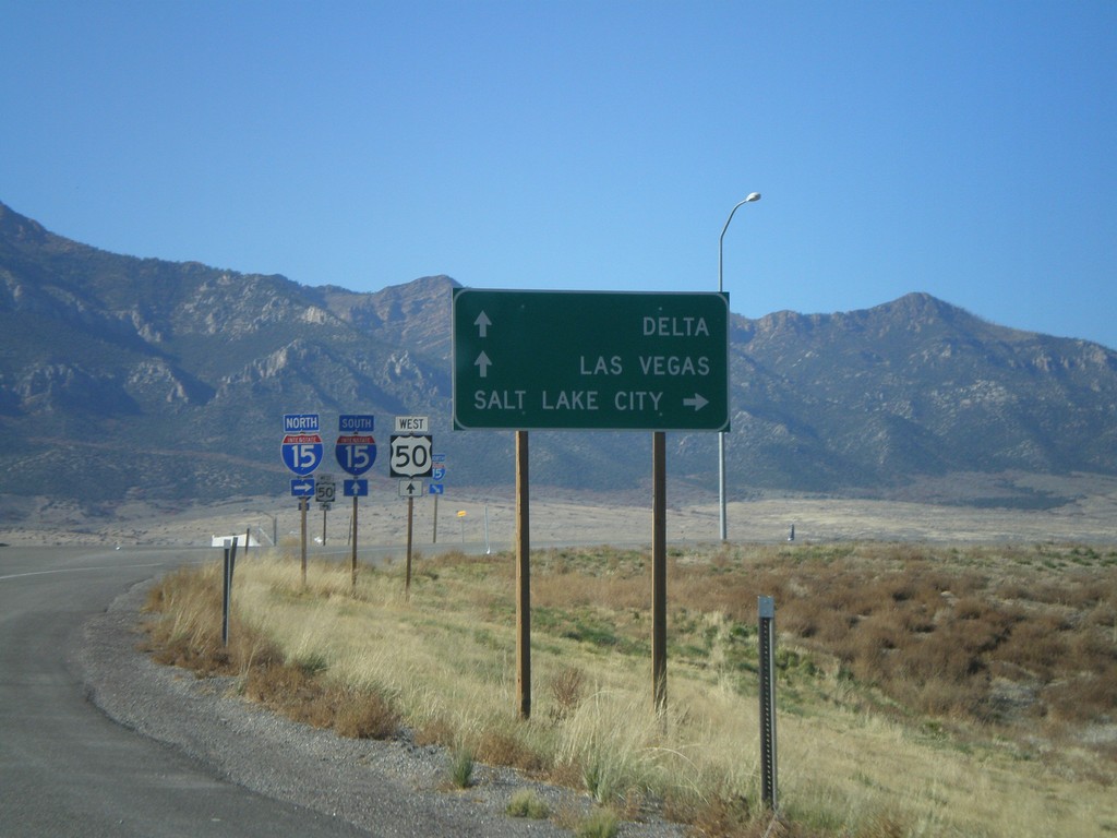
US-50 West at I-15
US-50 west approaching I-15. Use I-15 north for Salt Lake City. Use I-15 south for Las Vegas (Nevada) and Delta (via US-50). US-50 joins I-15 south to Holden.
Taken 10-25-2008
Scipio
Millard County
Utah
United States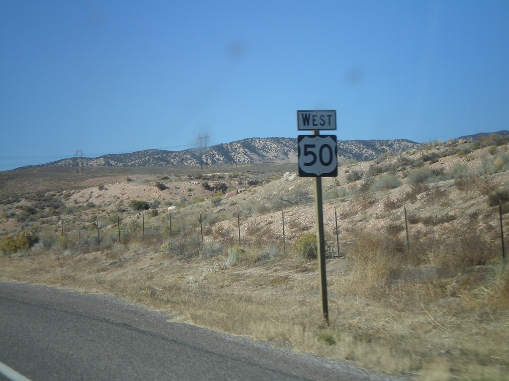
US-50 West Shield
US-50 west. Taken west of UT-260.
Taken 10-25-2008
Aurora
Sevier County
Utah
United States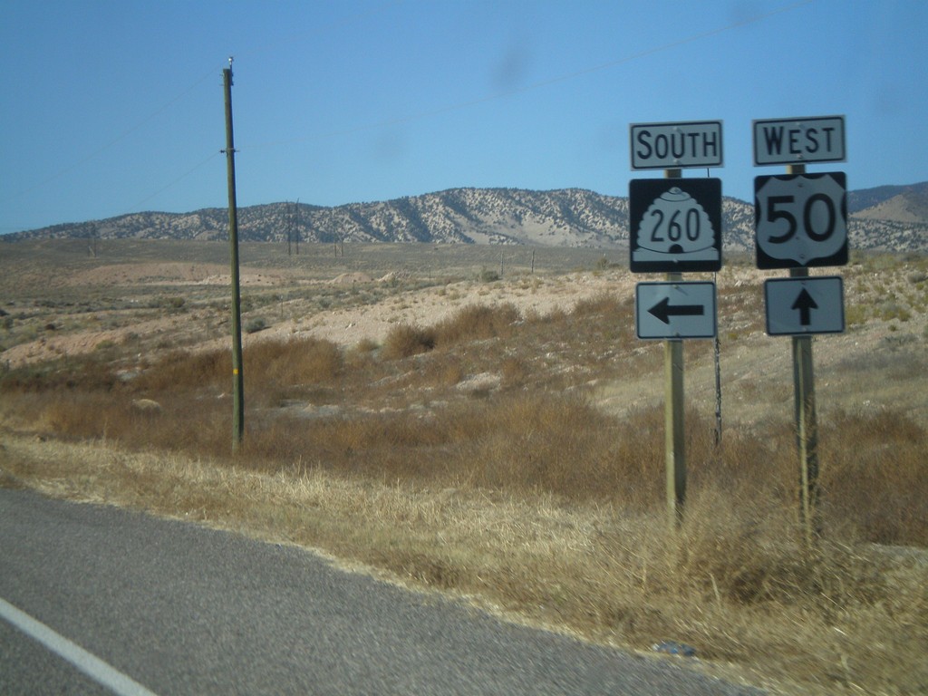
US-50 West at UT-260 South
US-50 west at UT-260 south.
Taken 10-25-2008
 Salina
Sevier County
Utah
United States
Salina
Sevier County
Utah
United States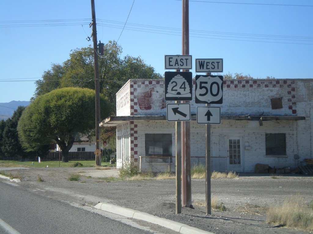
US-50 West at UT-24 East
UT-24 south on US-50 west.
Taken 10-25-2008
 Salina
Sevier County
Utah
United States
Salina
Sevier County
Utah
United States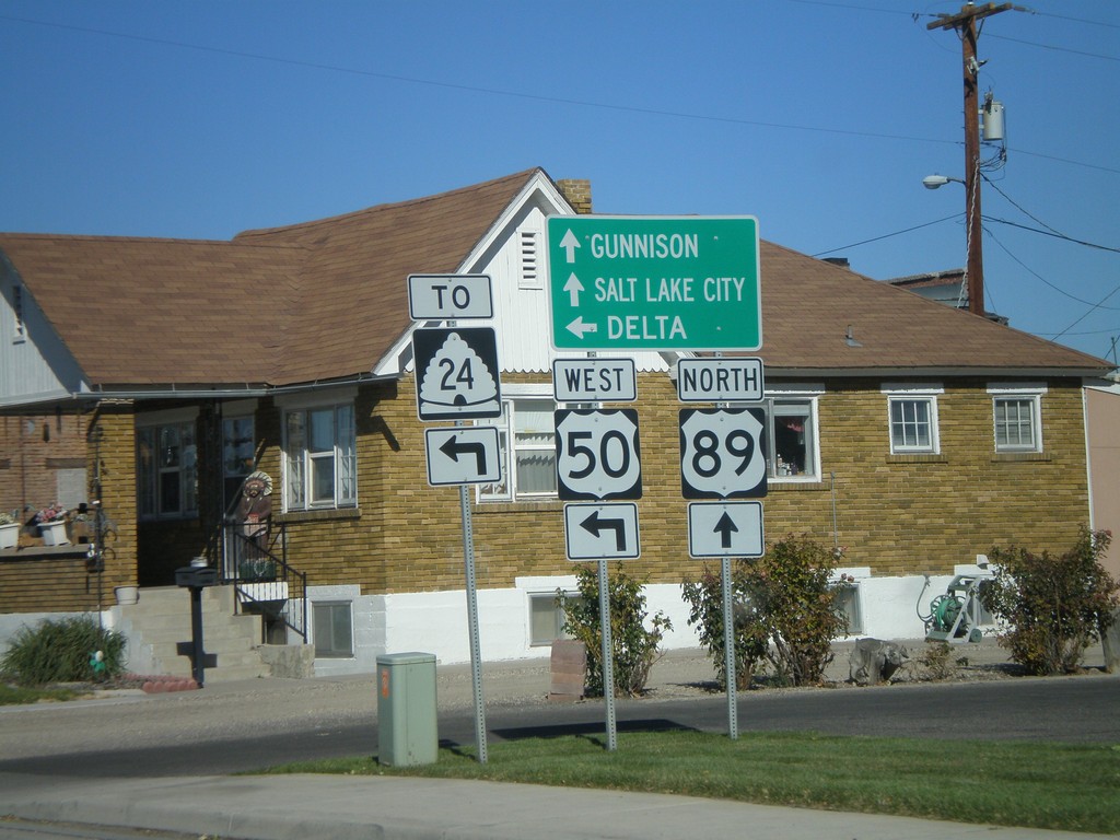
US-89 North/US-50 Jct. - Salina
US-50 west/US-89 north split. Continue on US-89 for Gunnison and Salt Lake. Use US-50 west for UT-24 and Delta.
Taken 10-25-2008
 Salina
Sevier County
Utah
United States
Salina
Sevier County
Utah
United States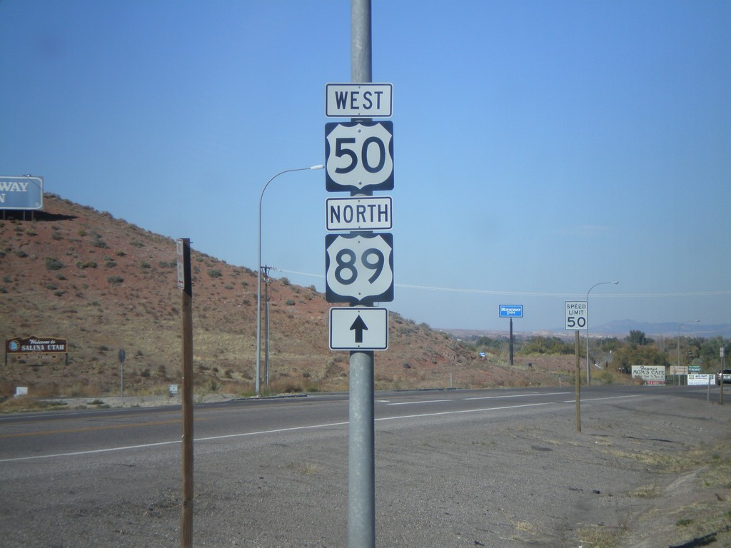
US-50 West/US-89 North - Entering Salina
US-50 west to US-89 north, just north of I-70.
Taken 10-25-2008
Salina
Sevier County
Utah
United States
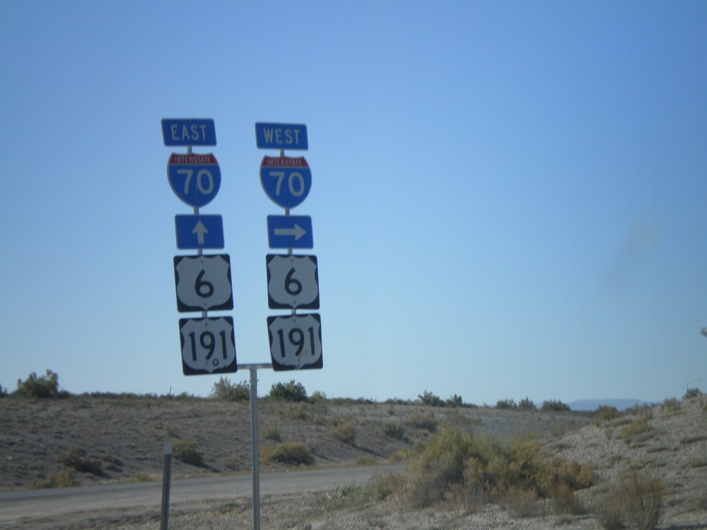
UT-19 West at I-70/US-6/US-191 Onramps
UT-19 west at I-70 west onramp. US-6 and US-191 follow I-70.
Taken 10-25-2008


 Green River
Emery County
Utah
United States
Green River
Emery County
Utah
United States