Signs Tagged With Shield
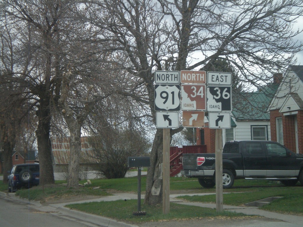
US-91 North/ID-36 East Approaching ID-34
US-91 North/ID-36 East approaching ID-34. The Pioneer Historic Byway leaves US-91 here and continues along ID-34.
Taken 05-01-2010


 Preston
Franklin County
Idaho
United States
Preston
Franklin County
Idaho
United States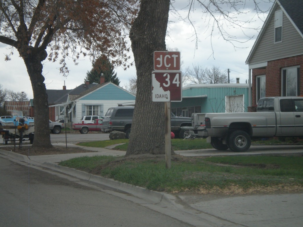
US-91 North/ID-36 East - ID-34 Jct.
US-91 north/ID-36 east approaching ID-34
Taken 05-01-2010
Preston
Franklin County
Idaho
United States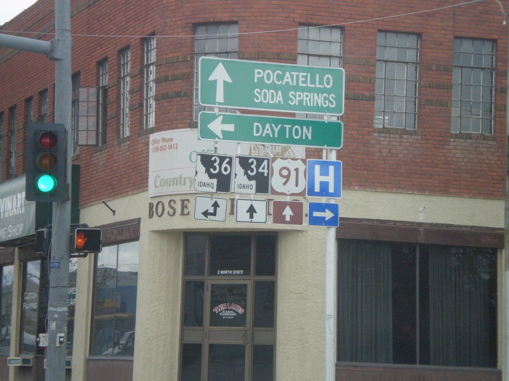
US-91 North at ID-36
US-91 north at ID-36 west. Use ID-36 west for Dayton. ID-36 east joins US-91 north through Preston. Continue on US-91 North/ID-36 east for Pocatello, Soda Springs, and ID-34 junction.
Taken 05-01-2010
Preston
Franklin County
Idaho
United States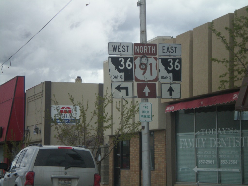
US-91 North Approaching ID-36
US-91 north approaching ID-36
Taken 05-01-2010
Preston
Franklin County
Idaho
United States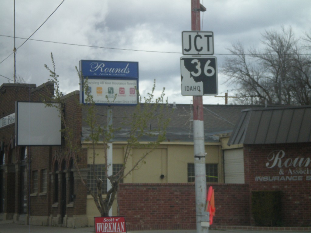
US-91 North Approaching ID-36
US-91 north approaching ID-36
Taken 05-01-2010
Preston
Franklin County
Idaho
United States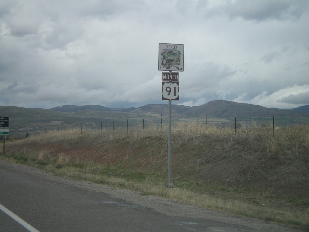
US-91 North - Pioneer Historic Byway
US-91 North - Pioneer Historic Byway. This is the first US-91 shield inside of Idaho.
Taken 05-01-2010
Franklin
Franklin County
Idaho
United States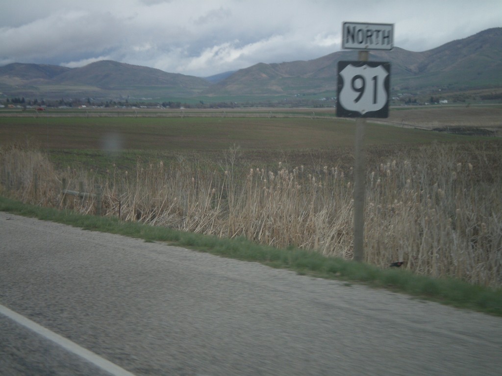
US-91 North
US-91 North taken between UT-61 and the Idaho state line.
Taken 05-01-2010
Lewiston
Cache County
Utah
United States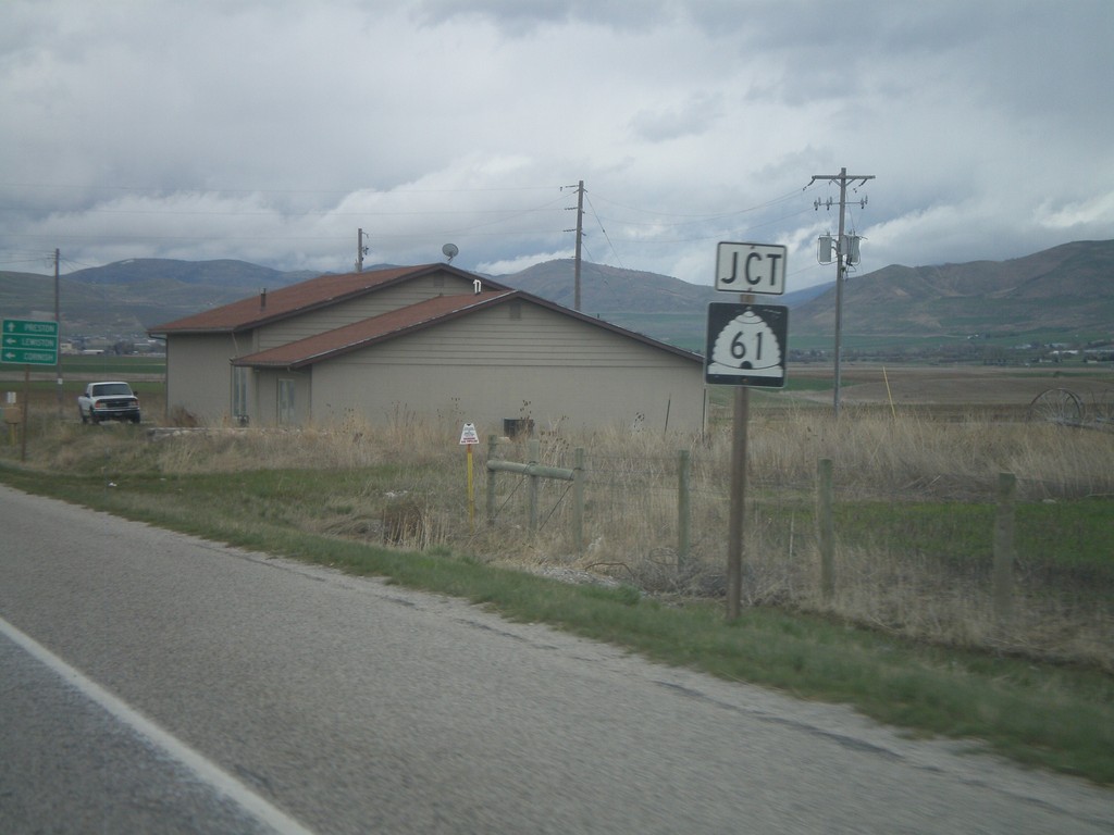
US-91 North approaching UT-61
US-91 north approaching UT-61
Taken 05-01-2010
 Lewiston
Cache County
Utah
United States
Lewiston
Cache County
Utah
United States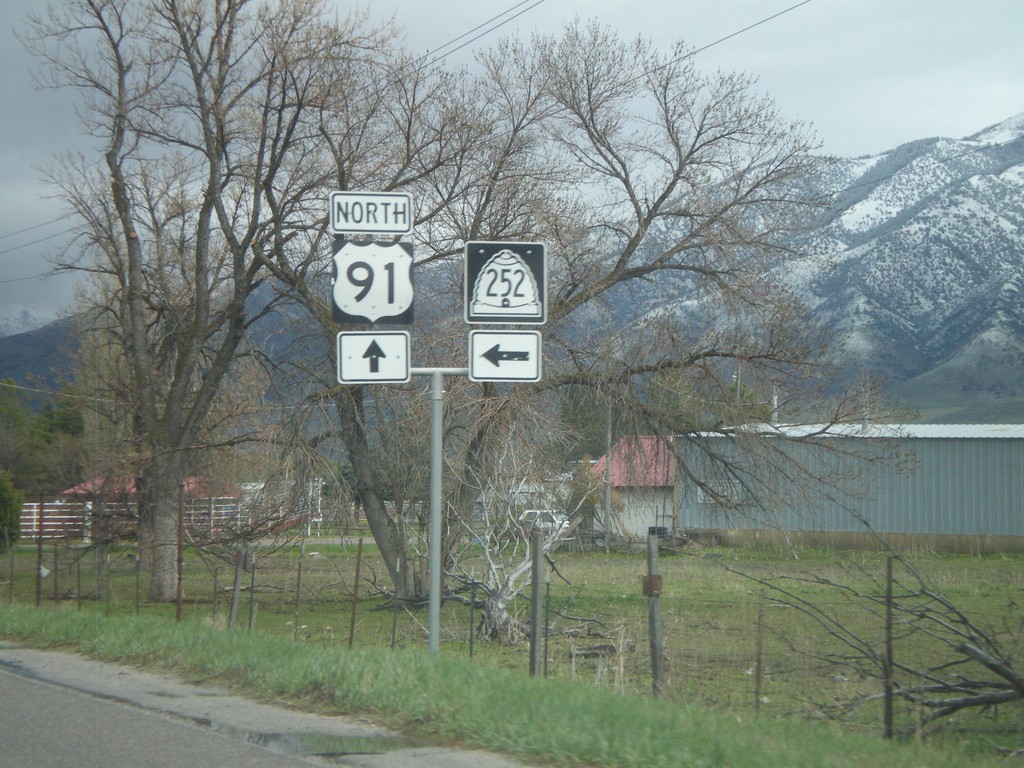
US-89/US-91 North at UT-252
US-89/US-91 north at UT-252
Taken 05-01-2010

 Logan
Cache County
Utah
United States
Logan
Cache County
Utah
United States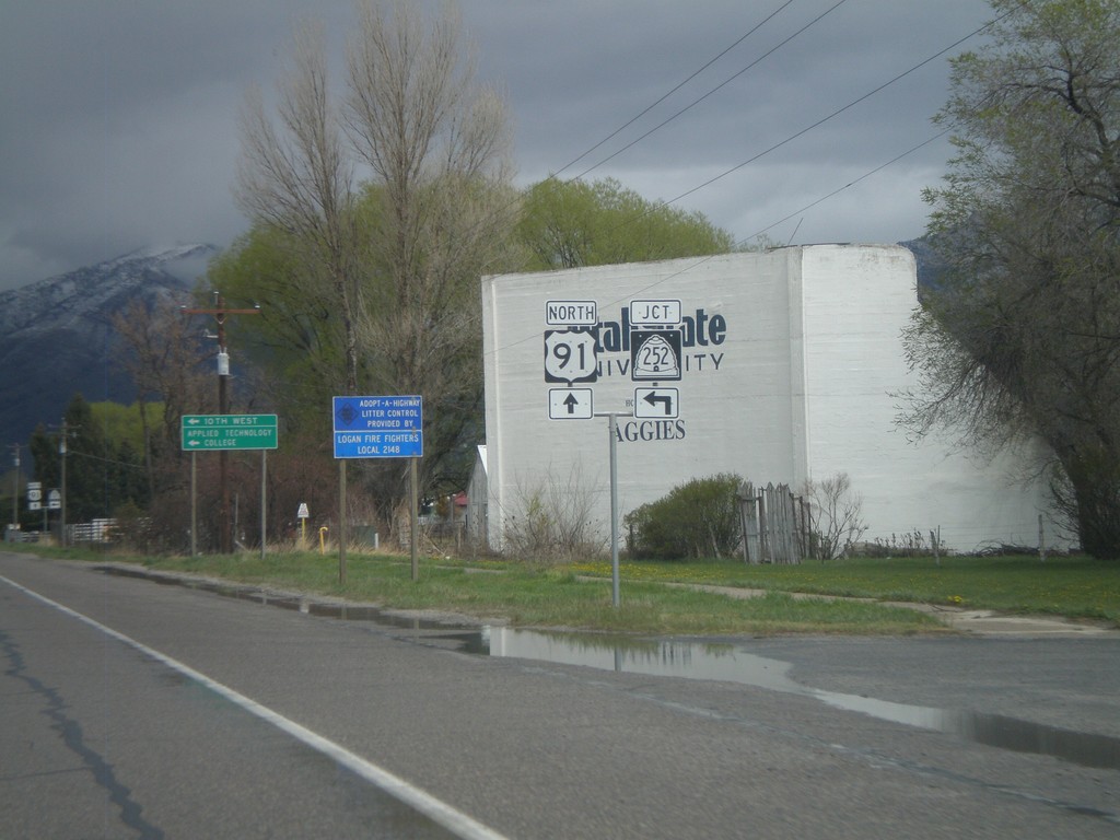
US-91/US-89 North approaching UT-252
US-91/US-89 north approaching UT-252
Taken 05-01-2010
Logan
Cache County
Utah
United States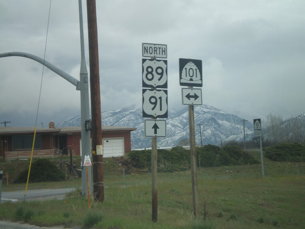
US-89/US-91 North at UT-101
US-89/US-91 North at UT-101
Taken 05-01-2010
 Wellsville
Cache County
Utah
United States
Wellsville
Cache County
Utah
United States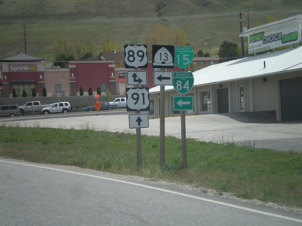
US-91 North at US-89/UT-13/BL-15/BL-84
US-91 north at US-89/UT-13/BL-15/BL-84. US-89 joins US-91 north to Logan.
Taken 05-01-2010


 Brigham City
Box Elder County
Utah
United States
Brigham City
Box Elder County
Utah
United States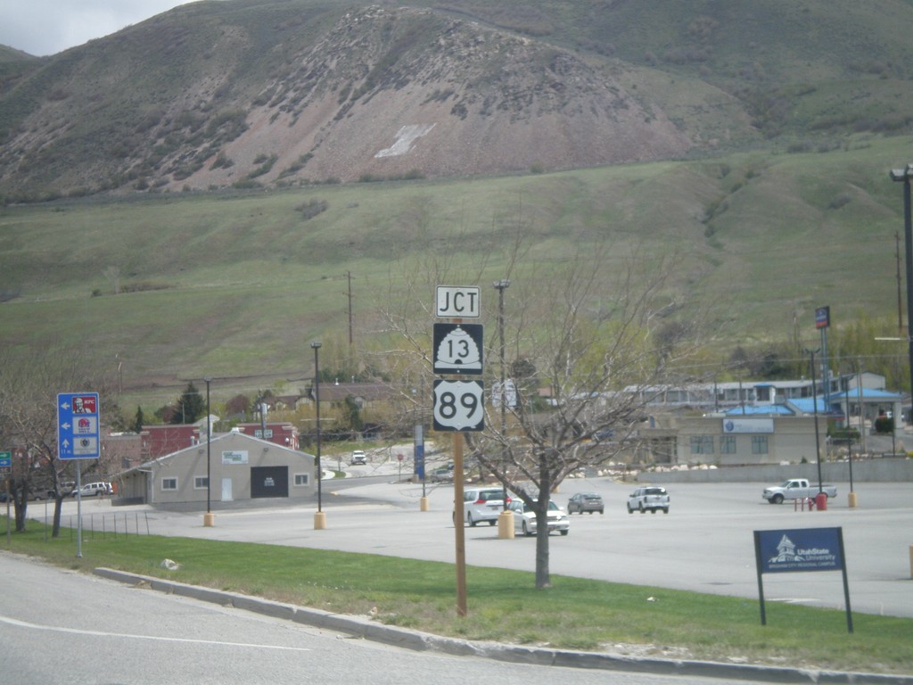
US-91 North Approaching US-89/UT-13
US-91 north approaching US-89 and UT-13.
Taken 05-01-2010
Brigham City
Box Elder County
Utah
United States
ID-55 North at BL-84
ID-55 north at BL-84 (Nampa-Caldwell Blvd.). Continue north on ID-55 for I-84.
Taken 04-20-2010

 Nampa
Canyon County
Idaho
United States
Nampa
Canyon County
Idaho
United States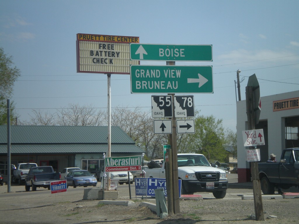
ID-55 North at ID-78
ID-55 north at ID-78 junction to Grand View and Brueau in Marsing.
Taken 04-20-2010
 Marsing
Owyhee County
Idaho
United States
Marsing
Owyhee County
Idaho
United States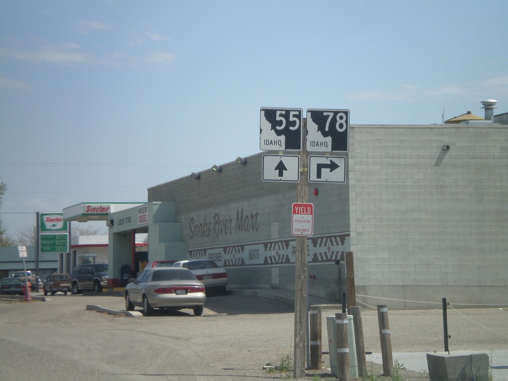
ID-55 North Approaching ID-78
ID-55 north approaching ID-78 junction in Marsing.
Taken 04-20-2010
Marsing
Owyhee County
Idaho
United States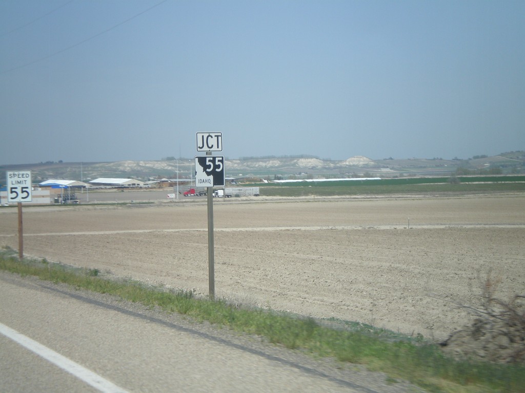
US-95 North Approaching ID-55
US-95 north approaching ID-55.
Taken 04-20-2010
 Marsing
Owyhee County
Idaho
United States
Marsing
Owyhee County
Idaho
United States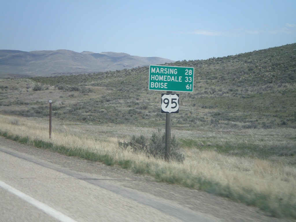
US-95 North - Distance Marker
First distance marker on US-95 north in Idaho. Distance to Marsing, Homedale, and Boise (not on US-95).
Taken 04-20-2010
Rockville
Owyhee County
Idaho
United States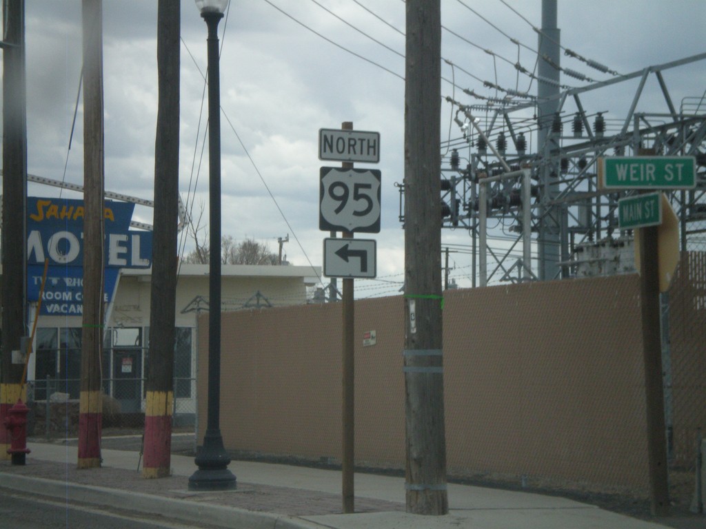
US-95 North in Jordan Valley
US-95 north in Jordan Valley. US-95 north turns off Main St.
Taken 04-20-2010
Jordan Valley
Malheur County
Oregon
United States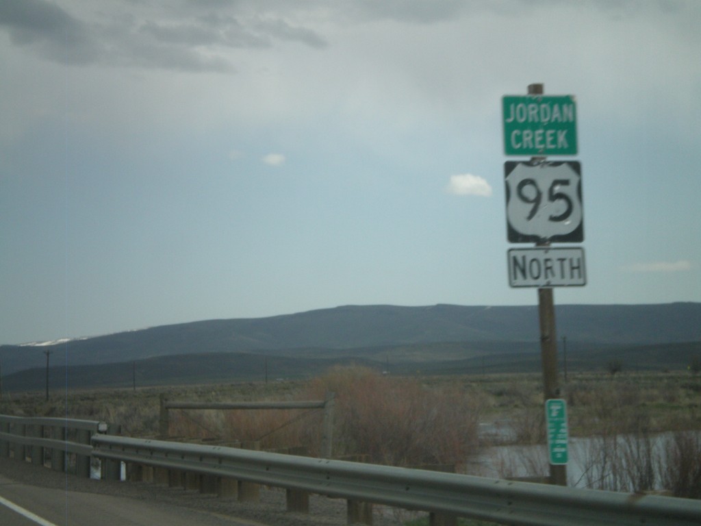
US-95 North - Jordan Creek
US-95 north crossing Jordan Creek. Jordan Creek is overflowing in this picture from spring runoff.
Taken 04-20-2010
Jordan Valley
Malheur County
Oregon
United States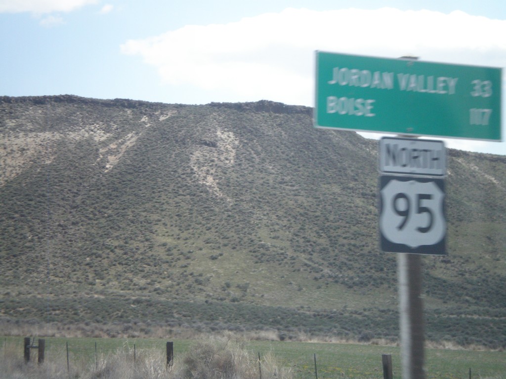
US-95 North - Distance Marker
Distance marker on US-95 north to Jordan Valley and Boise.
Taken 04-20-2010
Jordan Valley
Malheur County
Oregon
United States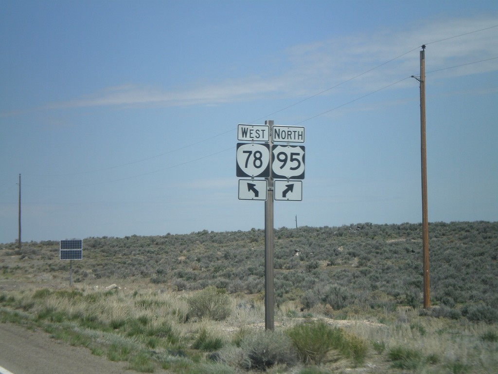
US-95 North At OR-78
US-95 north at OR-78.
Taken 04-20-2010
 Jordan Valley
Malheur County
Oregon
United States
Jordan Valley
Malheur County
Oregon
United States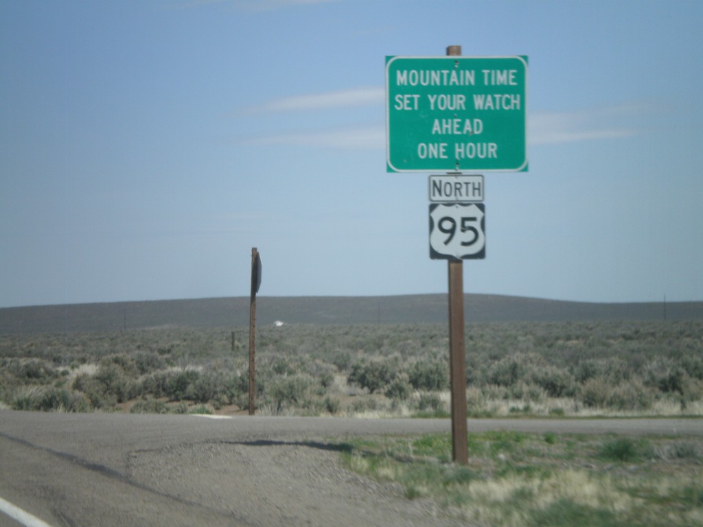
US-95 North - Mountain Time Zone
Entering Mountain Time Zone on US-95 north. US-95 passes in and out of Mountain Time for its duration. The highway enters Pacific Time again just north of Riggins, Idaho.
Taken 04-20-2010
Jordan Valley
Malheur County
Oregon
United States
Exposition Blvd. east at BL-80 Onramp
Exposition Blvd. east at BL-80 west Exit 9A onramp.
Taken 04-16-2010
 Sacramento
 County
California
United States
Sacramento
Sacramento County
California
United States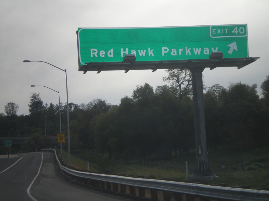
US-50 West - Exit 40
US-50 west at Exit 40 - Red Hawk Parkway.
Taken 04-15-2010
 Placerville
El Dorado County
California
United States
Placerville
El Dorado County
California
United States