Signs Tagged With Shield
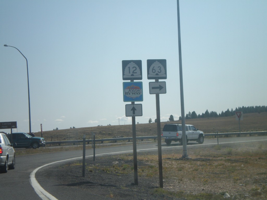
UT-12 East at UT-63 South
UT-12 at approaching UT-63.
Taken 10-12-2008

 Bryce
Garfield County
Utah
United States
Bryce
Garfield County
Utah
United States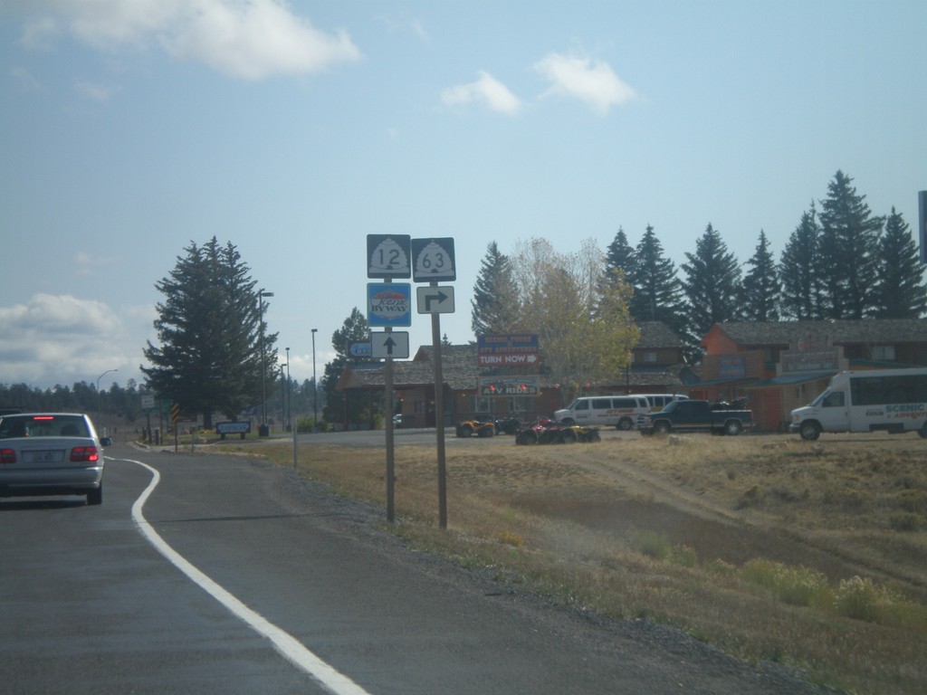
UT-12 East Approaching UT-63
UT-12 east approaching UT-63.
Taken 10-12-2008
Bryce
Garfield County
Utah
United States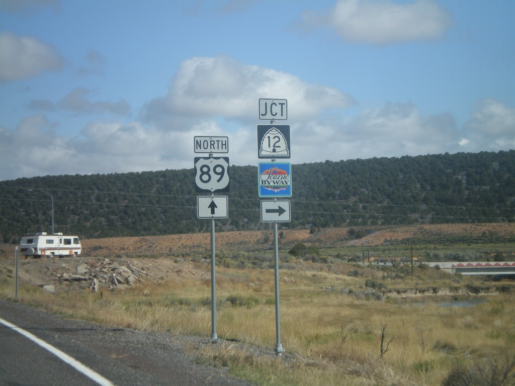
US-89 North at UT-12 East
US-89 north at UT-12 east. UT-12 is marked as a Utah scenic byway.
Taken 10-12-2008
 Panguitch
Garfield County
Utah
United States
Panguitch
Garfield County
Utah
United States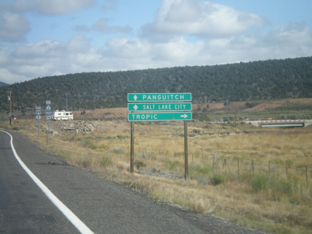
US-89 North Approaching UT-12 East
US-89 north approaching UT-12 east to Tropic. Use US-89 north for Salt Lake and Panguitch.
Taken 10-12-2008
Panguitch
Garfield County
Utah
United States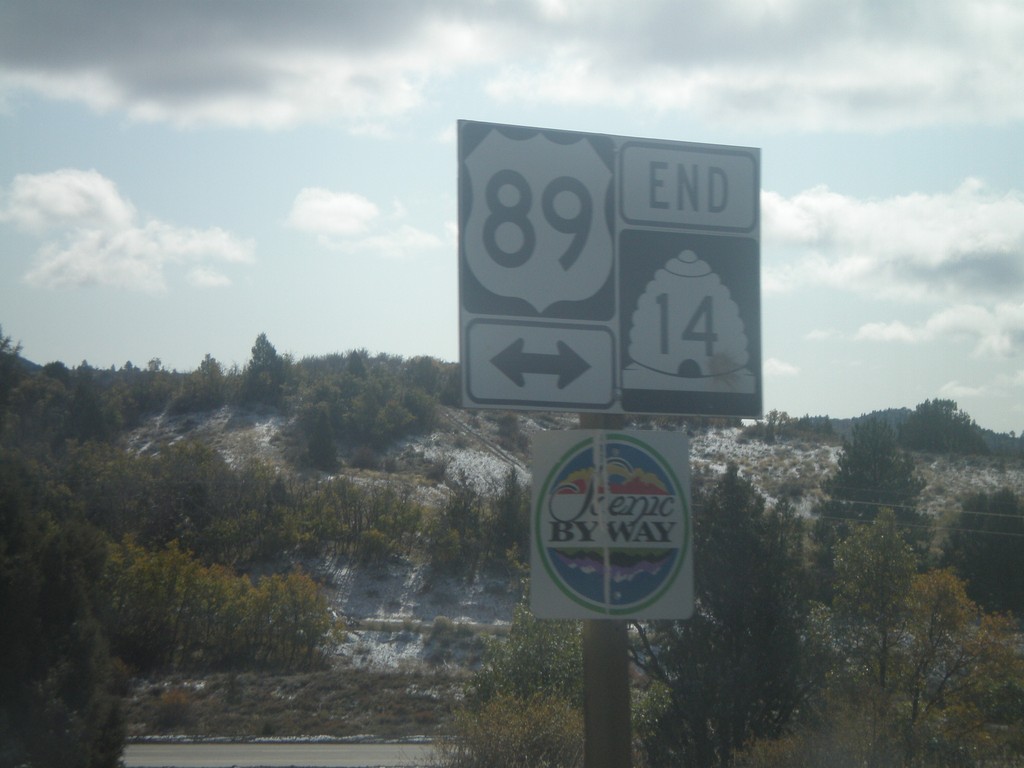
End UT-14 East at US-89
End UT-14 east at US-89. US-89 is marked as a Utah scenic byway.
Taken 10-12-2008
 Alton
Kane County
Utah
United States
Alton
Kane County
Utah
United States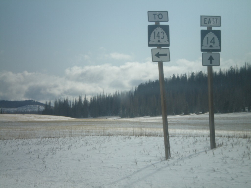
UT-14 East at UT-148
UT-14 east at UT-148 north.
Taken 10-12-2008
 Brian Head
Iron County
Utah
United States
Brian Head
Iron County
Utah
United States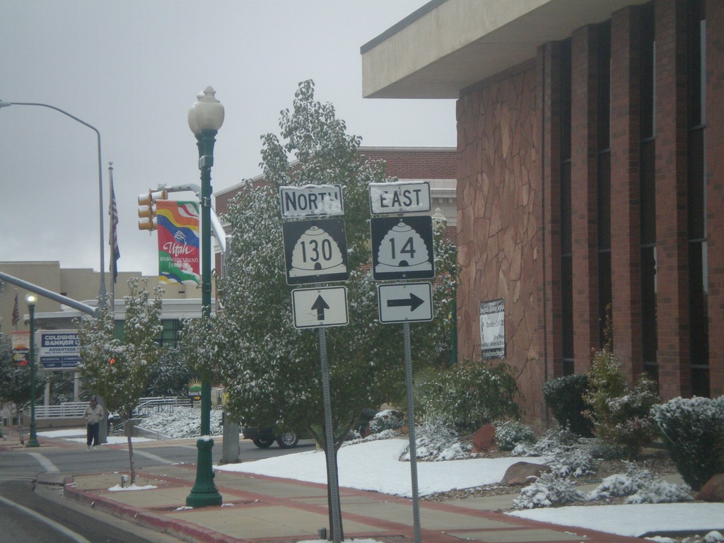
UT-130 North at UT-14
UT-130 north at UT-14 east.
Taken 10-12-2008
 Cedar City
Iron County
Utah
United States
Cedar City
Iron County
Utah
United States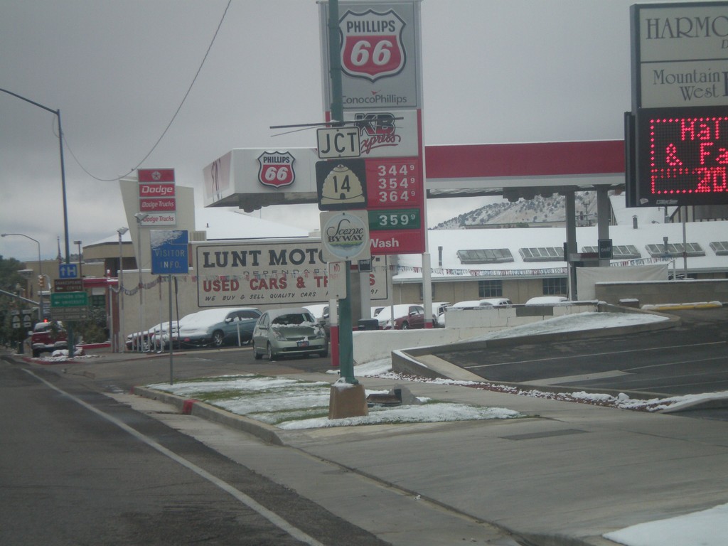
UT-130 North Approaching UT-14
UT-130 north approaching UT-14. UT-14 is marked as a Utah scenic byway.
Taken 10-12-2008
Cedar City
Iron County
Utah
United States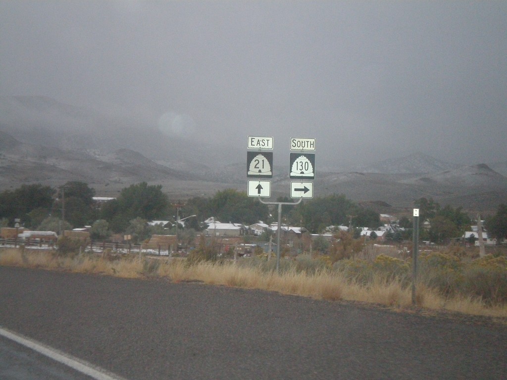
UT-21 East Approaching UT-130
UT-21 east approaching UT-130 south.
Taken 10-11-2008
 Minersville
Beaver County
Utah
United States
Minersville
Beaver County
Utah
United States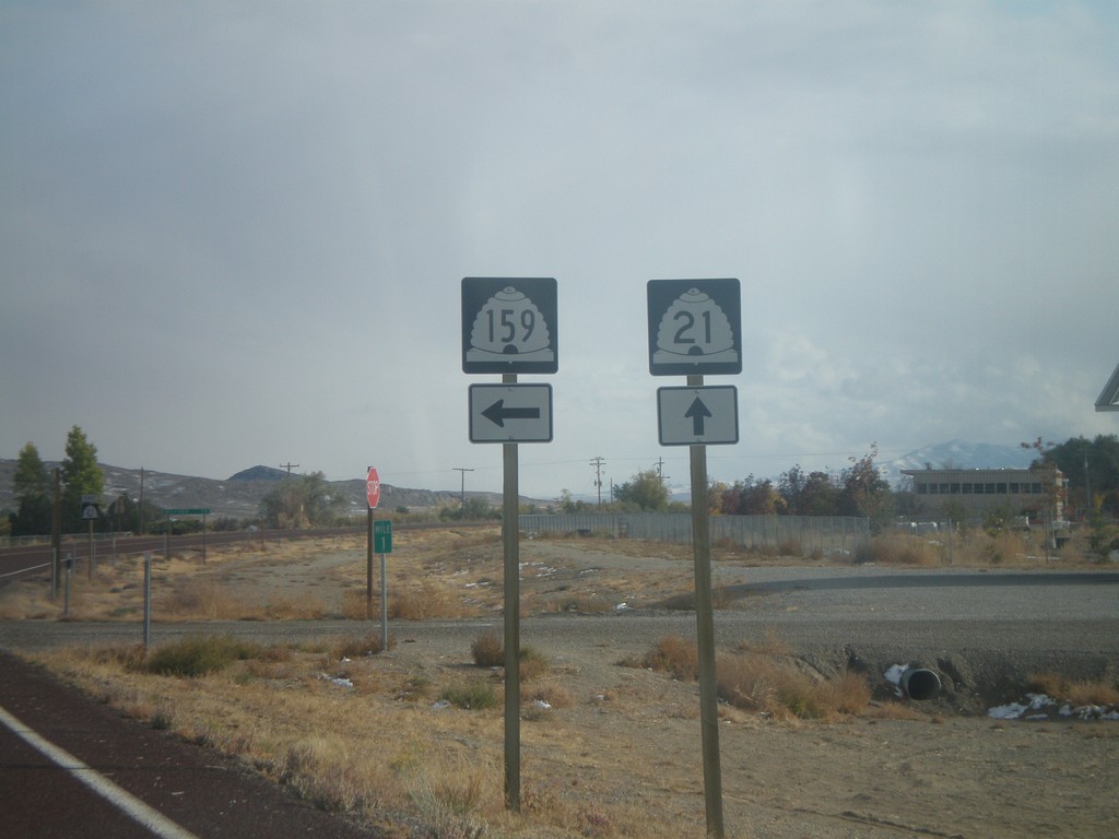
UT-21 East at UT-159
UT-21 east at UT-159 north.
Taken 10-11-2008
 Garrison
Millard County
Utah
United States
Garrison
Millard County
Utah
United States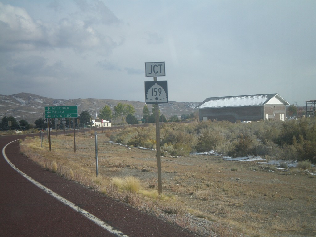
UT-21 East Approaching UT-159
UT-21 east approaching UT-159 north.
Taken 10-11-2008
Garrison
Millard County
Utah
United States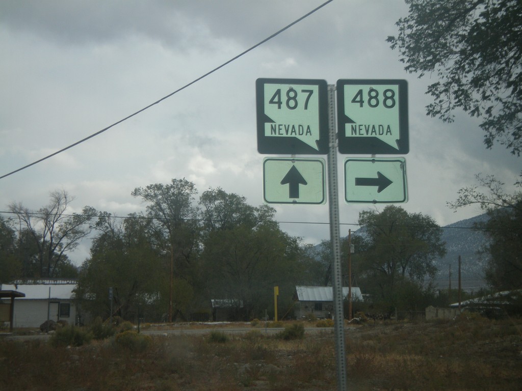
NV-487 South at NV-488
NV-487 south at NV-488.
Taken 10-11-2008

 Baker
White Pine County
Nevada
United States
Baker
White Pine County
Nevada
United States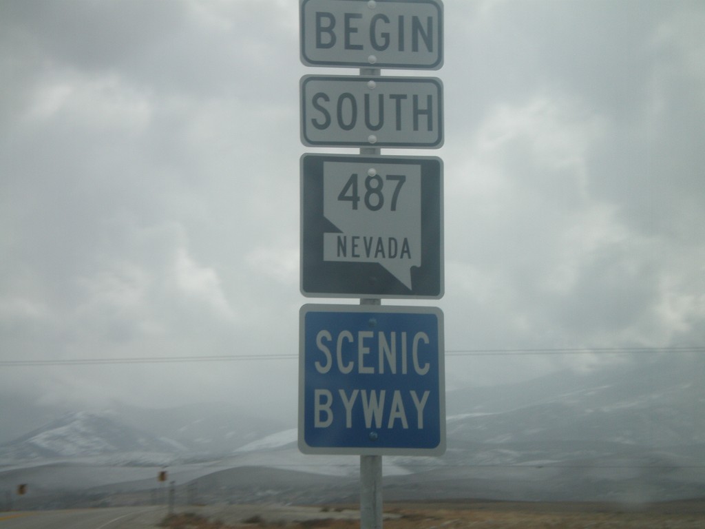
Begin NV-487 South
Begin NV-487 south in White Pine County. NV-487 is designated as a Nevada Scenic Byway for the entire length of the route.
Taken 10-11-2008

 Baker
White Pine County
Nevada
United States
Baker
White Pine County
Nevada
United States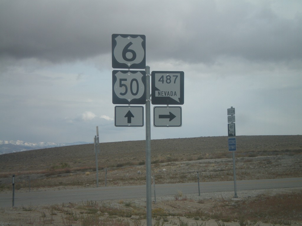
US-6/US-50 East at NV-487
US-6/US-50 East at NV-487.
Taken 10-11-2008
Baker
White Pine County
Nevada
United States
US-93 (Cutout) South of Majors Jct.
US-93 South cutout shield at Majors Junction.
Taken 10-11-2008
 Ely
White Pine County
Nevada
United States
Ely
White Pine County
Nevada
United States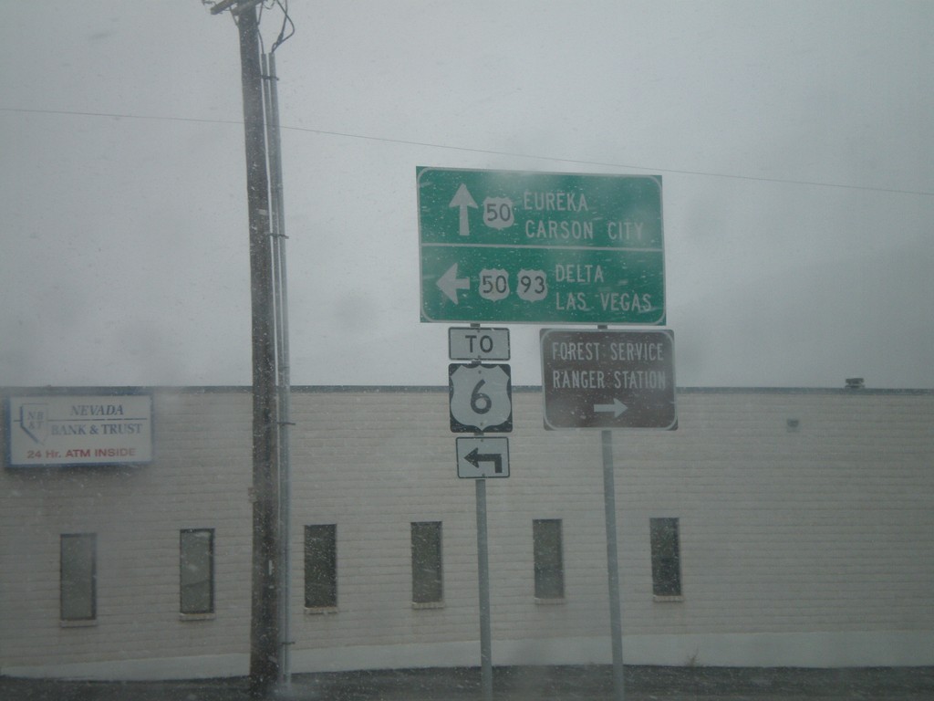
US-93 South at US-50 - Ely
US-93 south at US-50 in Ely. US-50 joins US-93 south to Majors Place. Continue straight for US-50 west to Eureka and Carson City. Turn left for US-93 South/US-50 East to Delta (Utah), Las Vegas, and US-6.
Taken 10-11-2008
Ely
White Pine County
Nevada
United States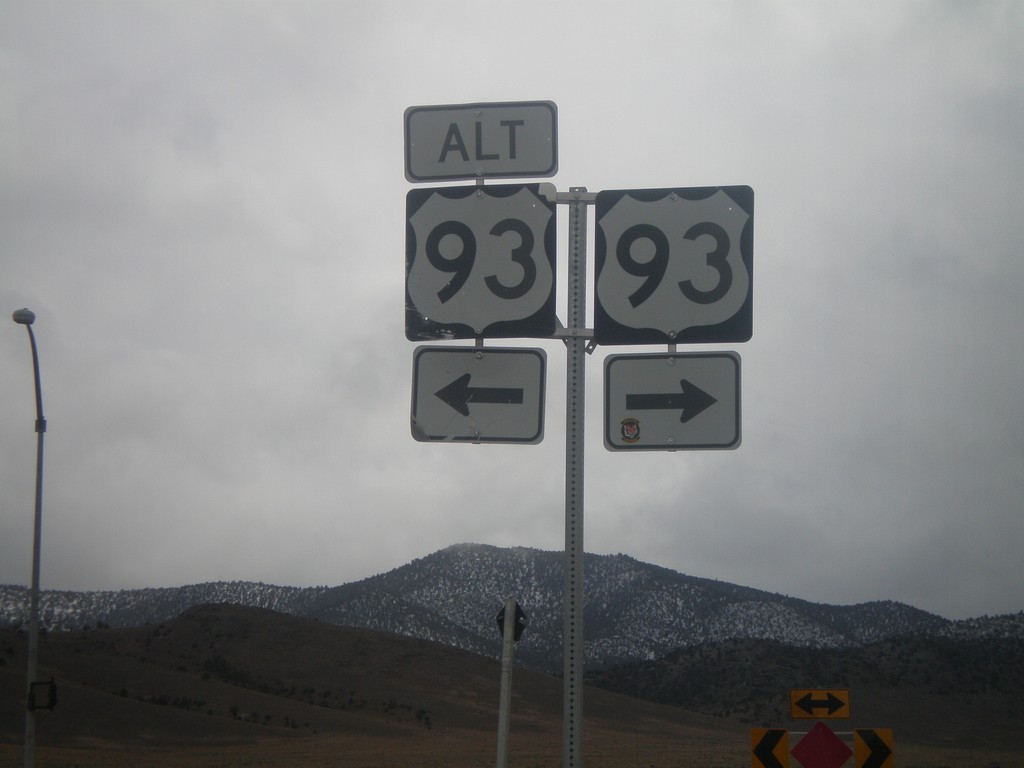
US-93 South At US-93 Alt. (Lages Jct)
US-93 south at Alt. US-93 at Lages Junction. Turn right to continue south on US-93; left for Alt. US-93 North.
Taken 10-11-2008
 Ely
White Pine County
Nevada
United States
Ely
White Pine County
Nevada
United States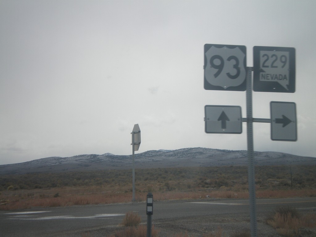
US-93 South at NV-229
US-93 south at NV-229 in Elko County.
Taken 10-11-2008
 Wells
Elko County
Nevada
United States
Wells
Elko County
Nevada
United States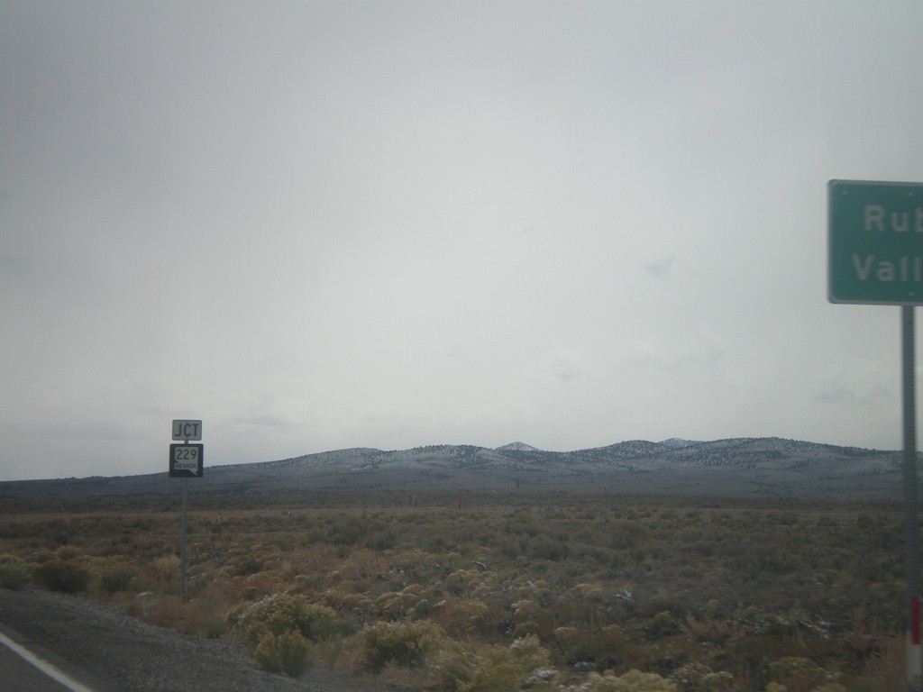
US-93 South Approaching NV-229
US-93 south approaching NV-229 west to Ruby Valley.
Taken 10-11-2008
Wells
Elko County
Nevada
United States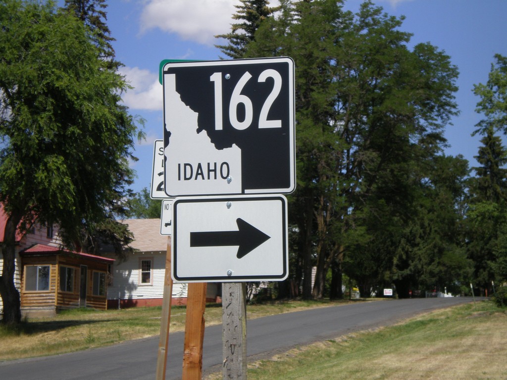
ID-162 - Nezperce
ID-162 at the corner of 8th St. and Walnut St.
Taken 07-27-2008
 Nezperce
Lewis County
Idaho
United States
Nezperce
Lewis County
Idaho
United States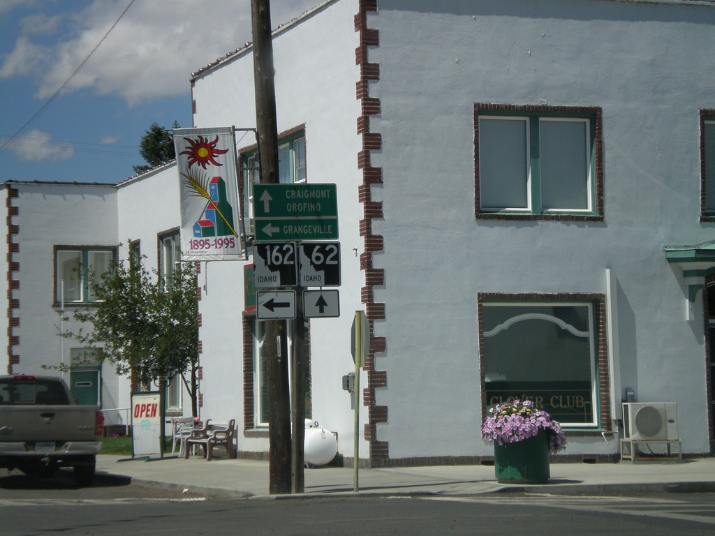
End ID-64 West at ID-62/ID-162
End ID-64 at ID-162 and ID-62. Continue straight for ID-62 towards Craigmont and Orofino. Turn left for ID-162 towards Grangeville.
Taken 07-27-2008

 Nezperce
Lewis County
Idaho
United States
Nezperce
Lewis County
Idaho
United States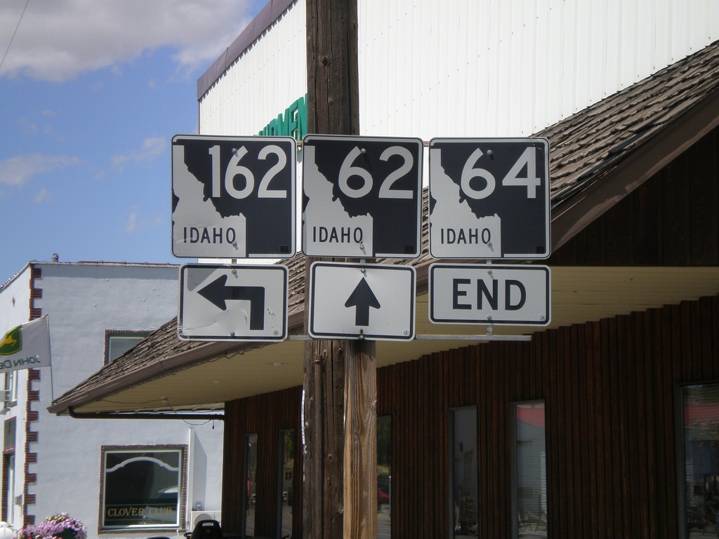
End ID-64 at ID-62 and ID-162
End ID-64 at ID-62 and ID-162. This is the only location in the state where three state highways meet.
Taken 07-27-2008
Nezperce
Lewis County
Idaho
United States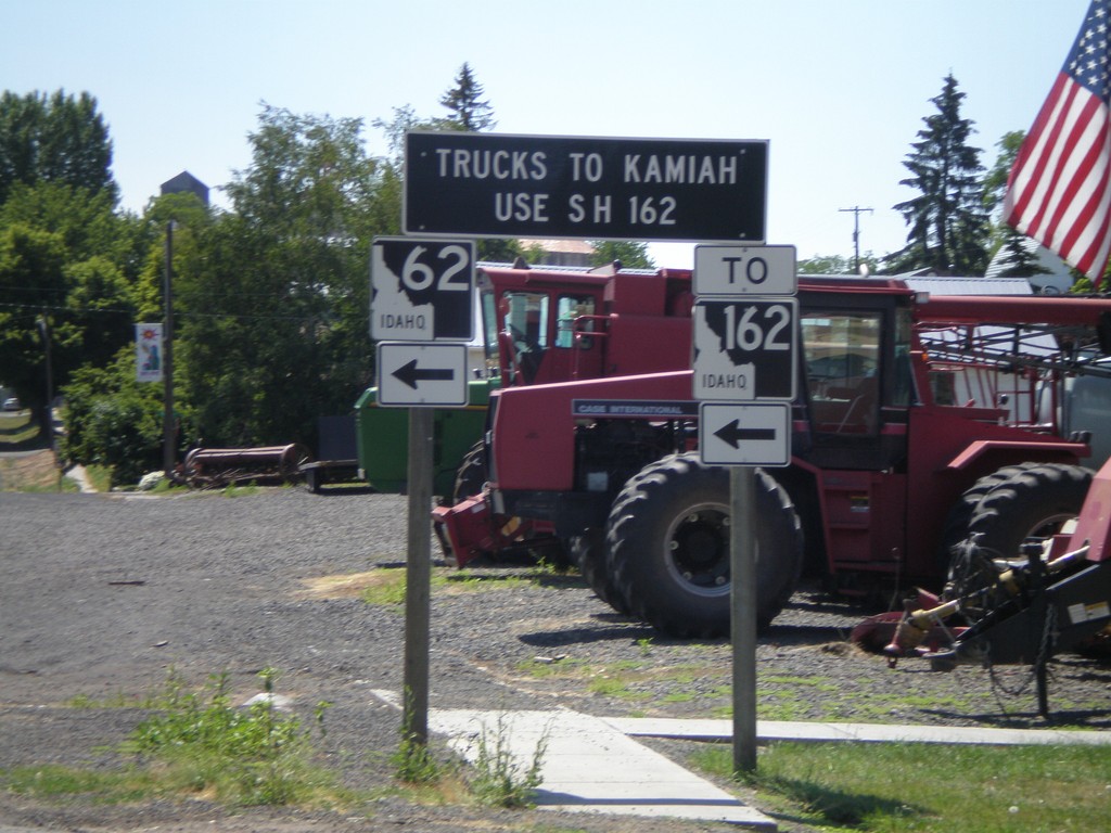
ID-62 East To ID-162 - Truck Information
ID-62 approaching ID-162. All Kamiah truck traffic use ID-162.
Taken 07-27-2008
Nezperce
Lewis County
Idaho
United States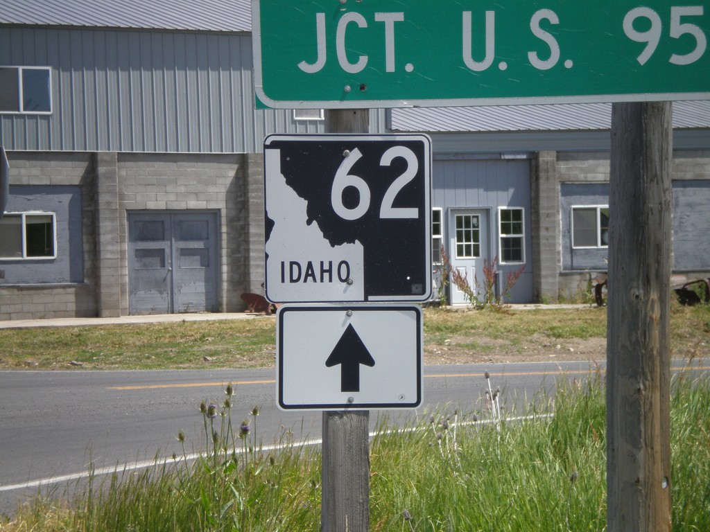
BL-95 South at ID-62 (Closeup)
Closeup of ID-62 shield at ID-62/BL-95 junction.
Taken 07-27-2008
 Craigmont
Lewis County
Idaho
United States
Craigmont
Lewis County
Idaho
United States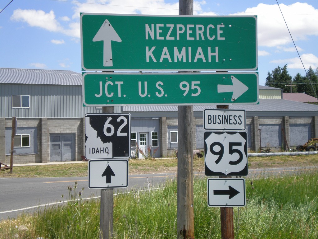
BL-95 South at ID-62
BL-95 south at ID-62 towards Kamiah and Nezperce. Turn left on BL-95 for US-95.
Taken 07-27-2008
Craigmont
Lewis County
Idaho
United States