Signs Tagged With Shield
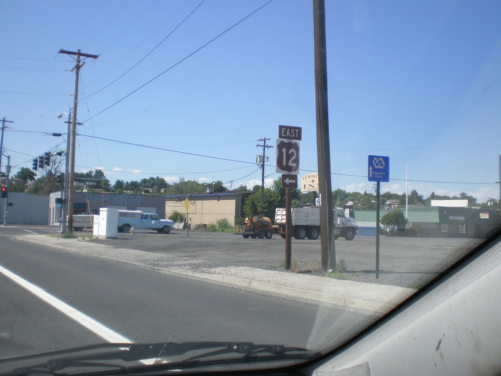
US-12 East - Levee Bypass at Main St.
US-12 East on Levee Bypass approaching Main St. Turn left on Main St. to continue on US-12.
Taken 07-27-2008
 Lewiston
Nez Perce County
Idaho
United States
Lewiston
Nez Perce County
Idaho
United States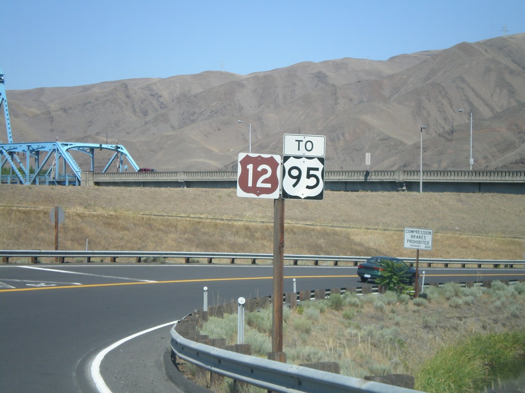
US-12 East To US-95 - Levee Bypass
US-12 East - To US-95 on the Levee Bypass in Lewiston.
Taken 07-27-2008
 Lewiston
Nez Perce County
Idaho
United States
Lewiston
Nez Perce County
Idaho
United States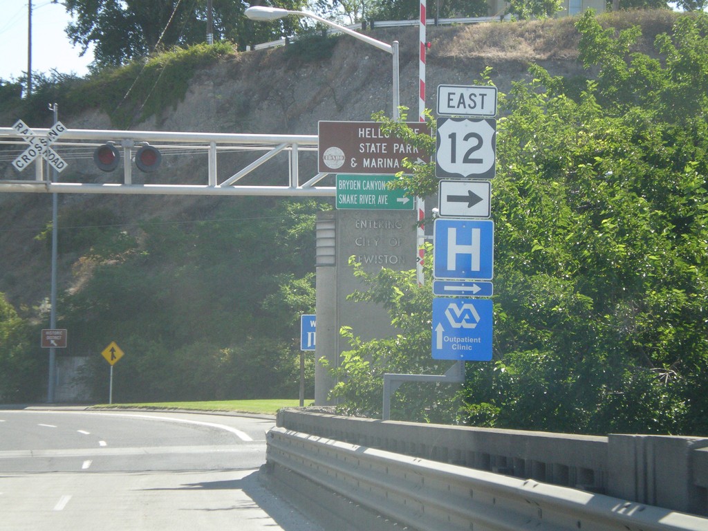
US-12 East - Interstate Bridge
US-12 east on Idaho side of Interstate Bridge over the Snake River. Merge right to continue east on US-12.
Taken 07-27-2008
Lewiston
Nez Perce County
Idaho
United States
ID-128 West - Lewiston
ID-128 west in Lewiston. ID-128 follows the north side of the Clearwater and Snake River, and connects with WA-128.
Taken 07-27-2008
 Lewiston
Nez Perce County
Idaho
United States
Lewiston
Nez Perce County
Idaho
United States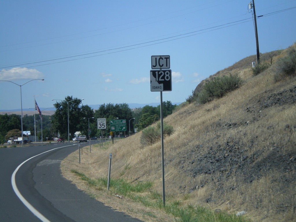
US-12 West Approaching ID-128
US-12 west approaching ID-128 in Lewiston.
Taken 07-27-2008
Lewiston
Nez Perce County
Idaho
United States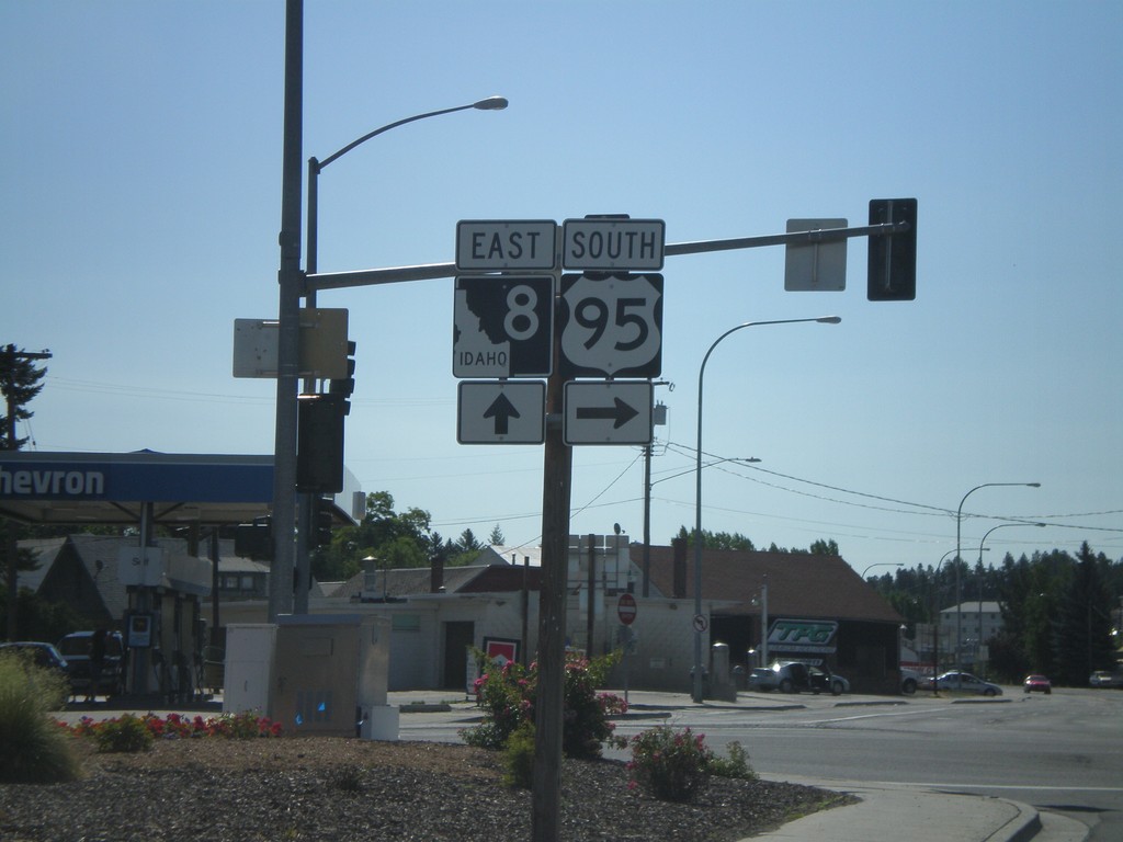
US-95 South/ID-8 At ID-8 East
US-95 South/ID-8 East at ID-8 East junction in Moscow.
Taken 07-27-2008
 Moscow
Latah County
Idaho
United States
Moscow
Latah County
Idaho
United States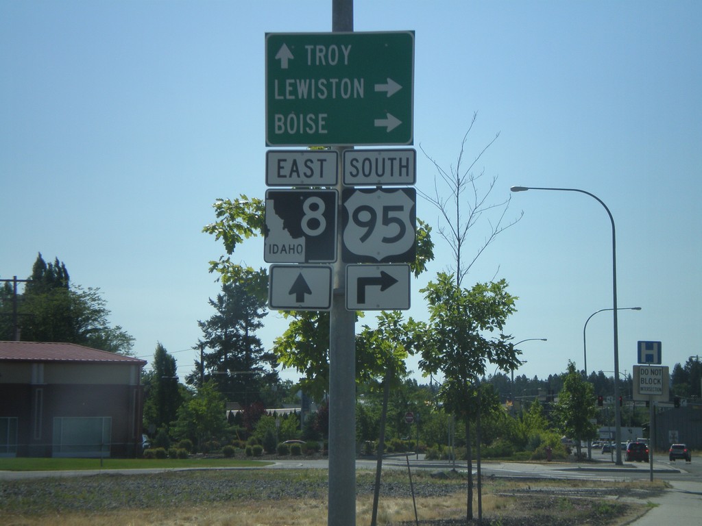
US-95 South/ID-8 Approaching ID-8 East
US-95 South/ID-8 East approaching US-95/ID-8 split. Use ID-8 east for Troy; turn right for US-95 south to Lewiston and Boise.
Taken 07-27-2008
Moscow
Latah County
Idaho
United States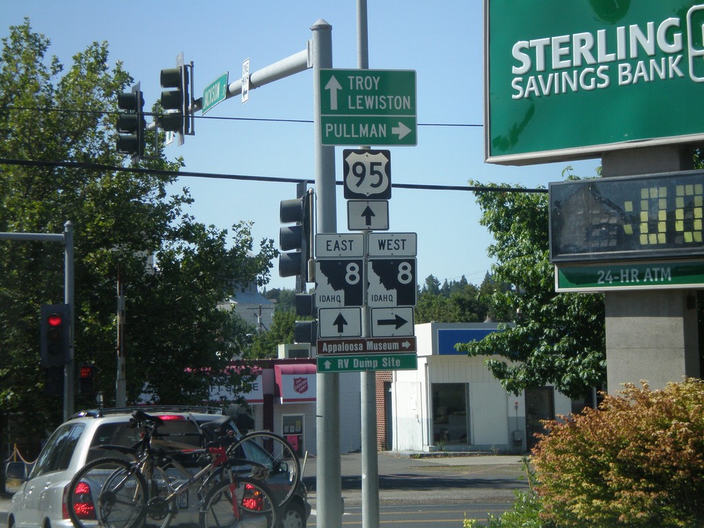
US-95 South at ID-8
US-95 south at ID-8. Turn right for ID-8 west to Pullman (WA). Go straight for US-95 South/ID-8 for Lewiston and Troy (via ID-8). ID-8 joins US-95 through downtown Moscow.
Taken 07-27-2008
Moscow
Latah County
Idaho
United States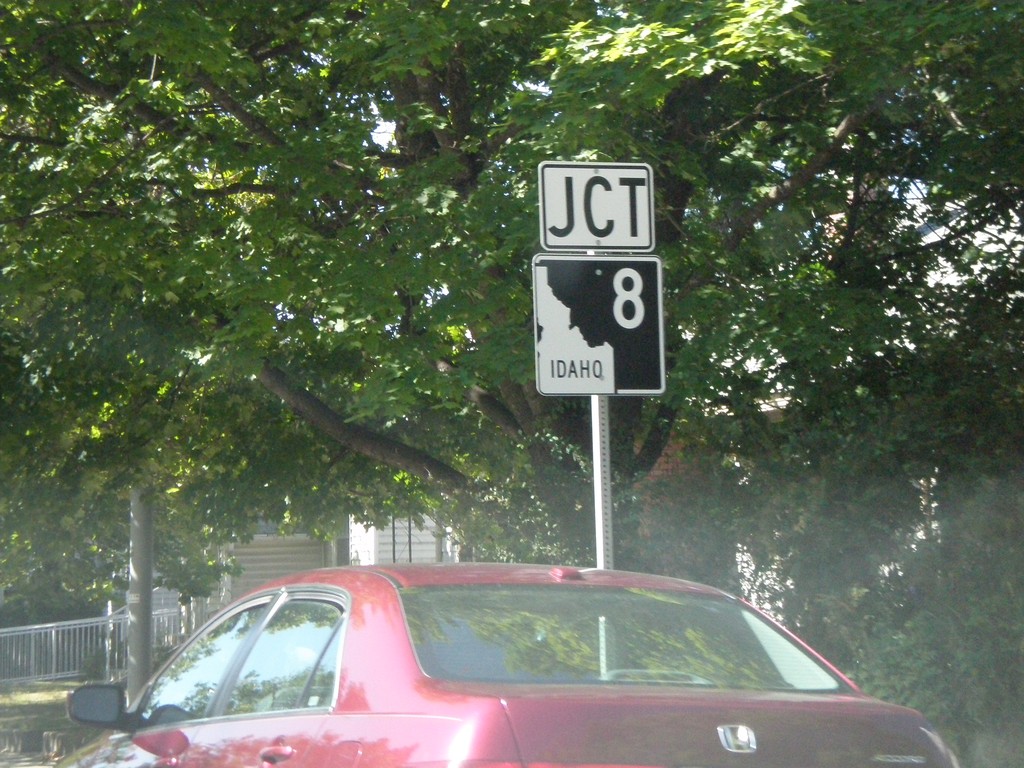
US-95 South Approaching ID-8
US-95 South approaching ID-8 in Moscow.
Taken 07-27-2008
Moscow
Latah County
Idaho
United States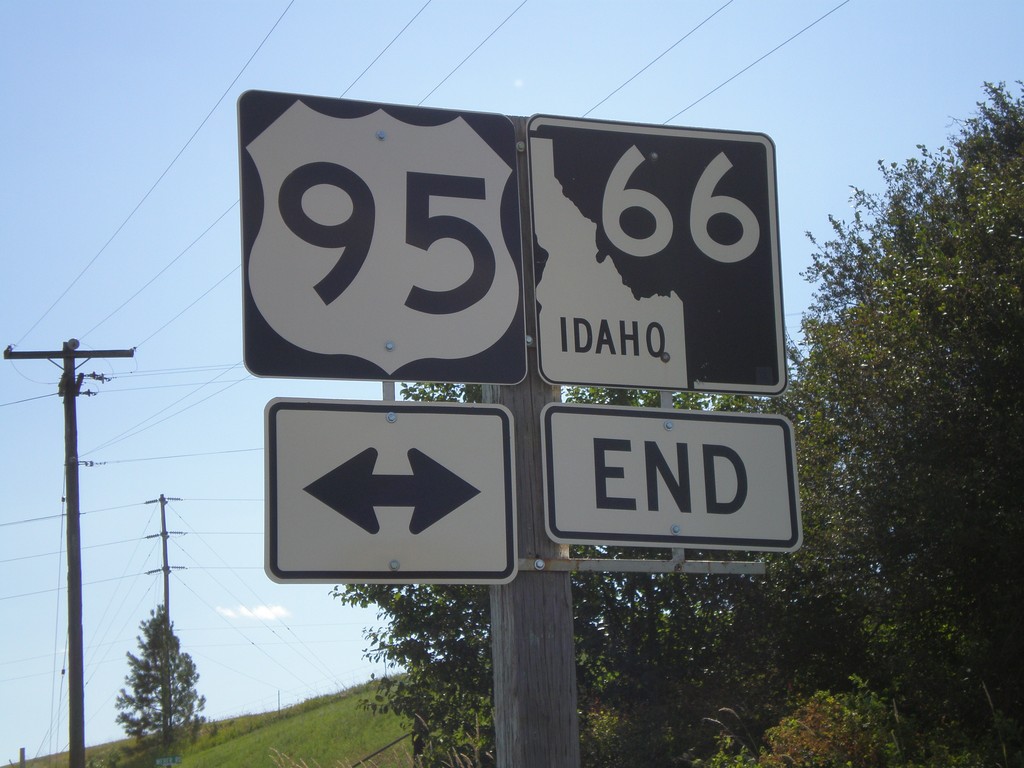
End ID-66 West at US-95
End ID-66 west at US-95 in Latah County.
Taken 07-27-2008
 Viola
Latah County
Idaho
United States
Viola
Latah County
Idaho
United States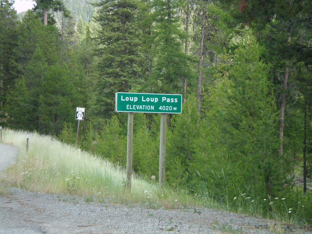
WA-20 East - Loup Loup Pass
WA-20 east at Loup Loup Pass - Elevation 4,020 Feet.
Taken 07-26-2008
 Mowich Illahee
Okanogan County
Washington
United States
Mowich Illahee
Okanogan County
Washington
United States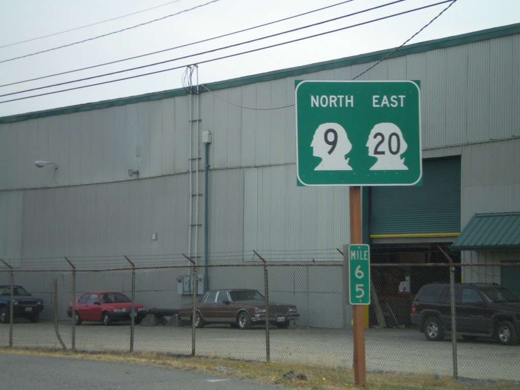
WA-20 East/WA-9 North
WA-20 East/WA-9 North in Sedro-Wooley.
Taken 07-26-2008
 Sedro-Woolley
Skagit County
Washington
United States
Sedro-Woolley
Skagit County
Washington
United States
WA-20 East
First WA-20 shield on WA-20 east.
Taken 07-24-2008
Port Townsend
Jefferson County
Washington
United States
WA-3 North at WA-16 East
WA-3 north at WA-16 east
Taken 07-24-2008

 Bremerton
Kitsap County
Washington
United States
Bremerton
Kitsap County
Washington
United States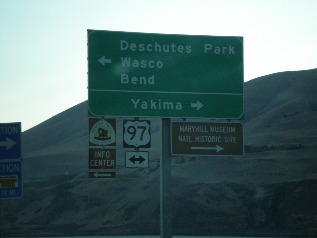
I-84 West Exit 104 Offramp at US-97
I-84 west Exit 104 offramp at US-97. Use US-97 north for Yakima. Use US-97 south for Deschutes Park/Wasco/Bend.
Taken 07-23-2008


 Biggs Junction
Sherman County
Oregon
United States
Biggs Junction
Sherman County
Oregon
United States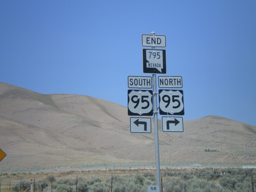
End NV-795 West at US-95
End NV-795 west at US-95.
Taken 07-07-2008
 Winnemucca
Humboldt County
Nevada
United States
Winnemucca
Humboldt County
Nevada
United States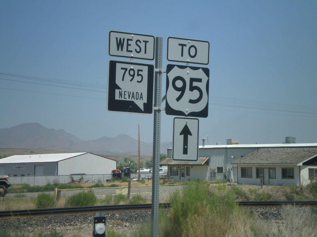
NV-795 West to US-95
NV-795 west to US-95.
Taken 07-07-2008
Winnemucca
Humboldt County
Nevada
United States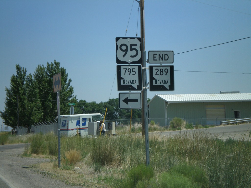
End NV-289 at NV-795 to US-95
End NV-289 east at NV-795 to US-95.
Taken 07-07-2008
 Winnemucca
Humboldt County
Nevada
United States
Winnemucca
Humboldt County
Nevada
United States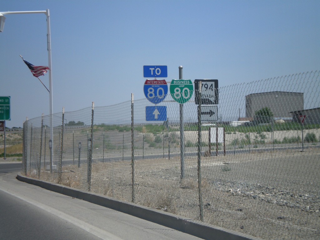
BL-80/NV-289 East at NV-794
BL-80/NV-289 east at NV-794. Continue on BL-80/NV-289 for I-80.
Taken 07-07-2008


 Winnemucca
Humboldt County
Nevada
United States
Winnemucca
Humboldt County
Nevada
United States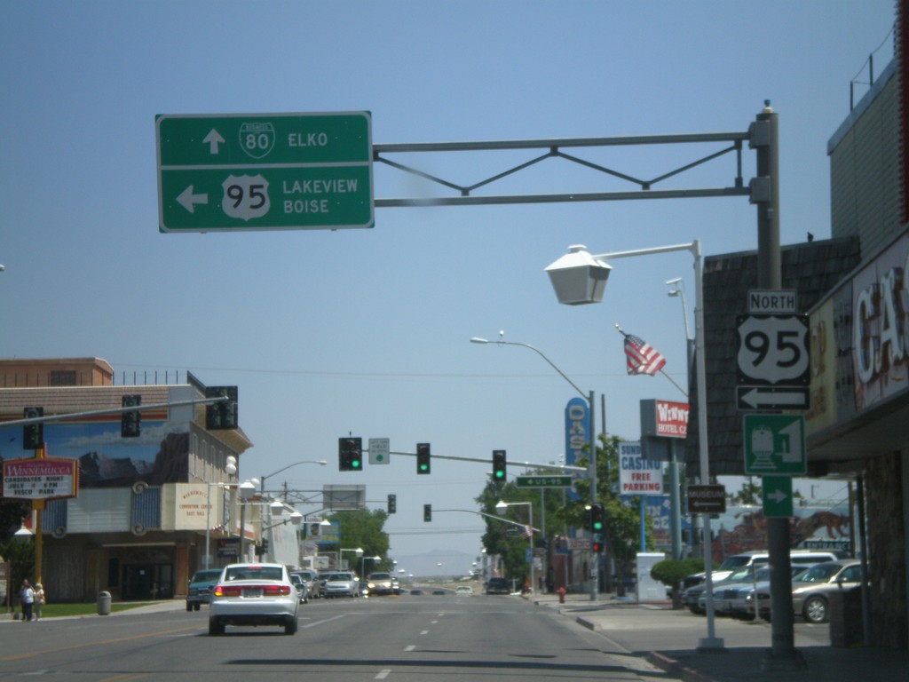
US-95 North/BL-80 in Winnemucca
BL-80 East/US-95 North (Winnemucca Blvd.) at US-95 north Melarkey St. Continue straight for BL-80 to Elko. Turn left for US-95 to Lakeview (OR) and Boise(ID).
Taken 07-07-2008
Winnemucca
Humboldt County
Nevada
United States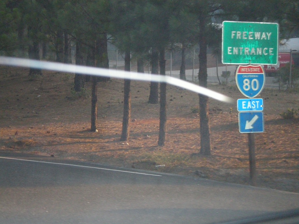
End CA-174 South at I-80 Freeway Entrance
End CA-174 south at I-80 east freeway entrance.
Taken 07-07-2008
 Colfax
Placer County
California
United States
Colfax
Placer County
California
United States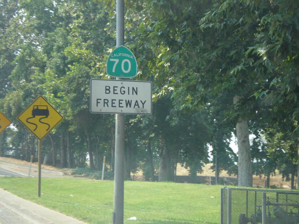
CA-70 South - Begin Freeway
Begin freeway on CA-70 south crossing the Yuba River.
Taken 07-06-2008
 Marysville
Yuba County
California
United States
Marysville
Yuba County
California
United States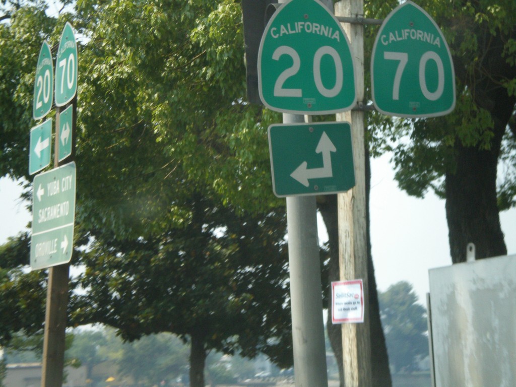
CA-70 South at CA-20 East
CA-70 south at CA-20. CA-20 joins CA-70 south for a few blocks through Marysville.
Taken 07-06-2008
 Marysville
Yuba County
California
United States
Marysville
Yuba County
California
United States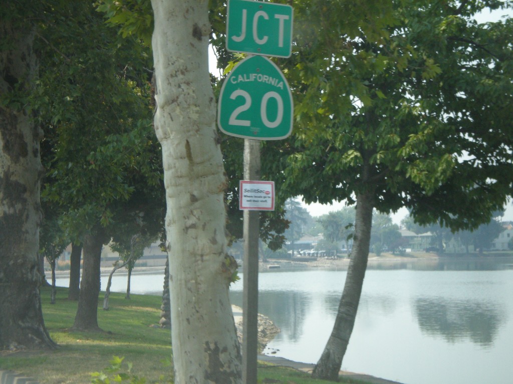
CA-70 South Approaching CA-20 East
CA-70 south approaching CA-20.
Taken 07-06-2008
Marysville
Yuba County
California
United States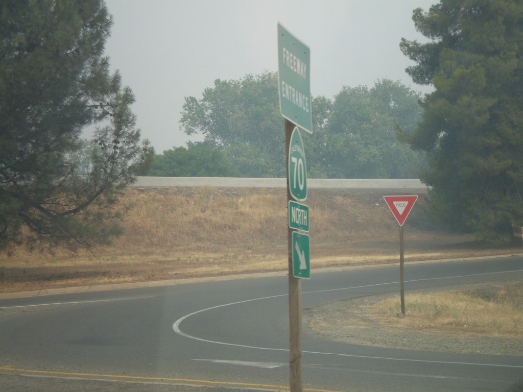
CA-162 West at CA-70 North
CA-162 west at CA-70 north freeway entrance.
Taken 07-06-2008
 Oroville
Butte County
California
United States
Oroville
Butte County
California
United States