Signs Tagged With Shield
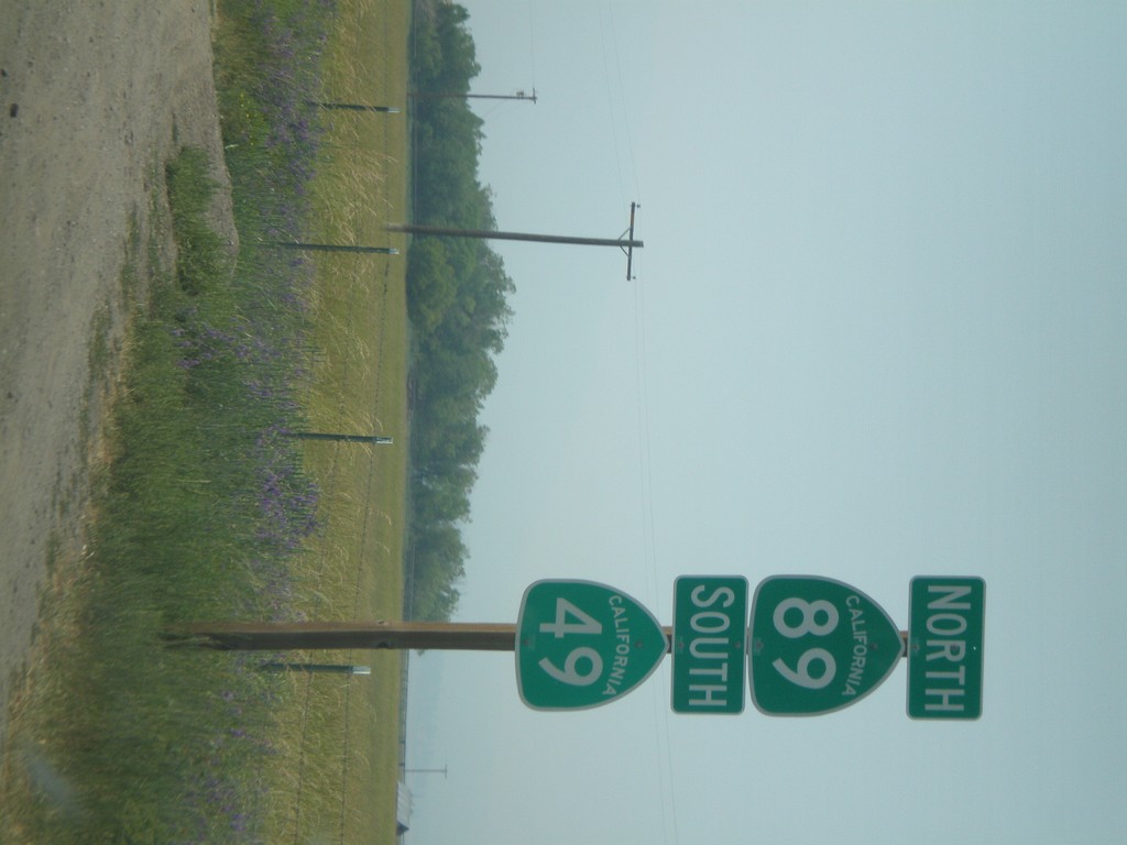
CA-89 North/CA-49 South
CA-49 South/CA-89 North shields north of Sierraville.
Taken 07-03-2008

 Sierraville
Sierra County
California
United States
Sierraville
Sierra County
California
United States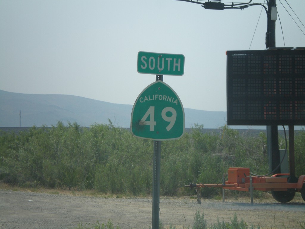
CA-49 South
First CA-49 shield south of CA-70.
Taken 07-03-2008
Chilcoot-Vinton
Plumas County
California
United States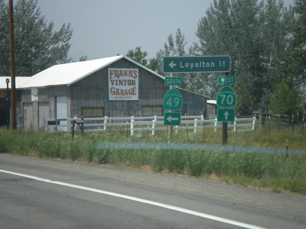
CA-70 West at CA-49 South
CA-70 west at CA-49 south to Loyalton. This is the northern beginning of CA-49 which goes through the California Gold Country.
Taken 07-03-2008
 Chilcoot-Vinton
Plumas County
California
United States
Chilcoot-Vinton
Plumas County
California
United States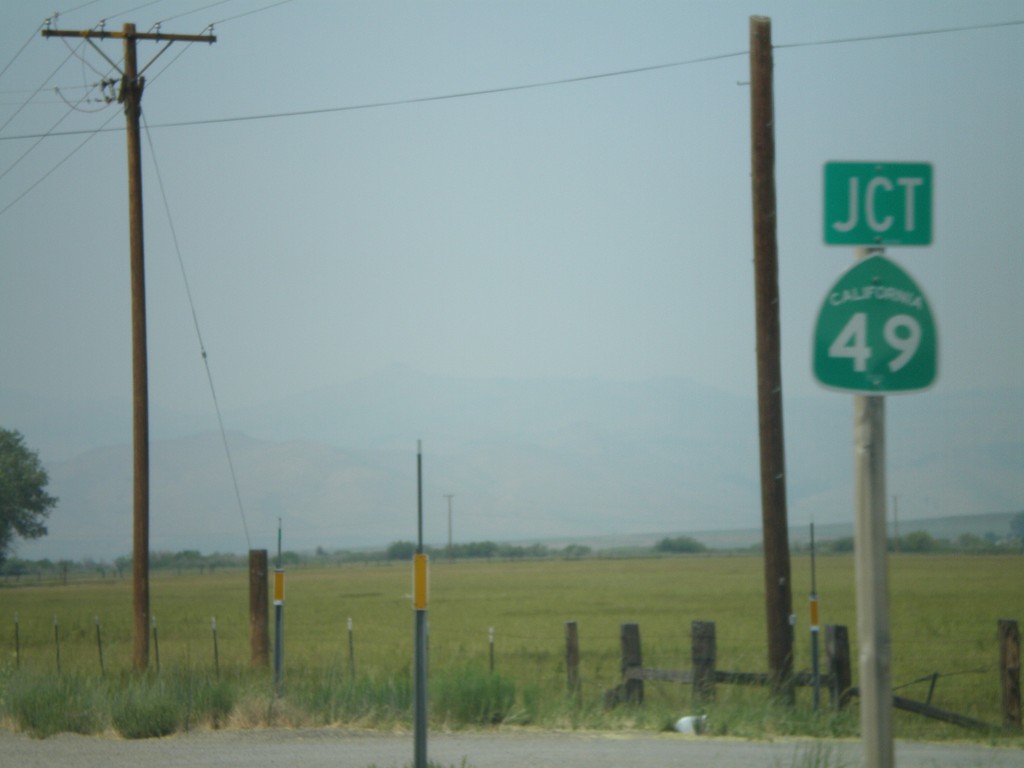
CA-70 West Approaching CA-49
CA-70 west approaching CA-49 south.
Taken 07-03-2008
Chilcoot-Vinton
Plumas County
California
United States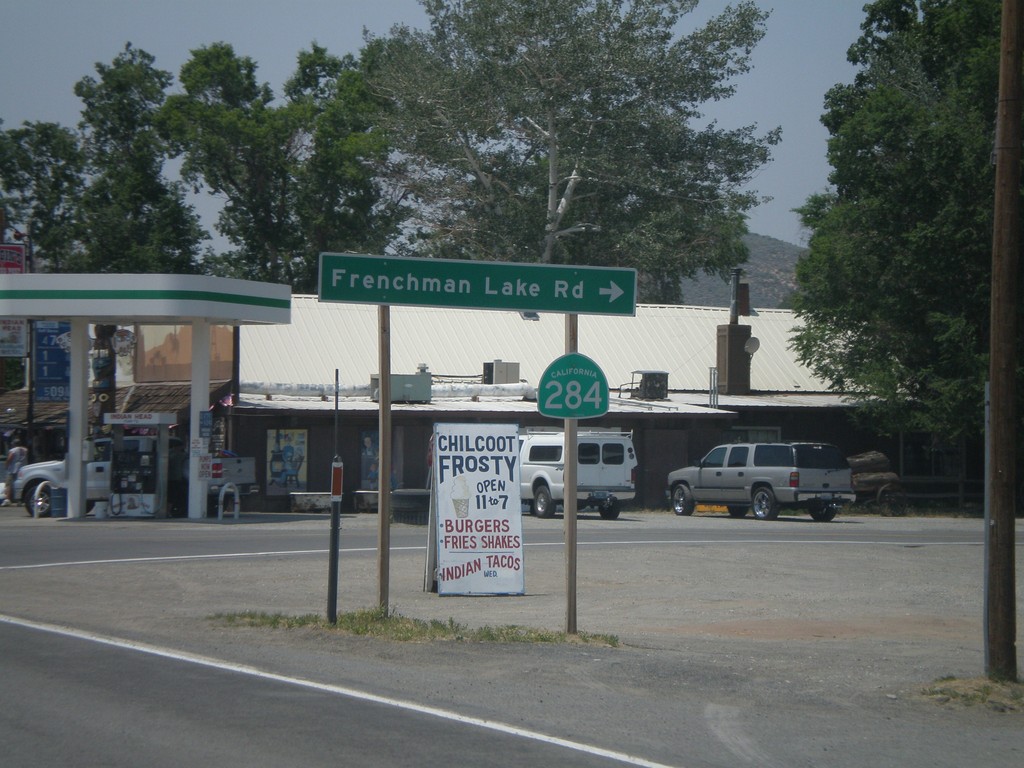
CA-70 West at CA-284 North
CA-70 west at CA-284 north to Frenchman Lake.
Taken 07-03-2008
 Chilcoot-Vinton
Plumas County
California
United States
Chilcoot-Vinton
Plumas County
California
United States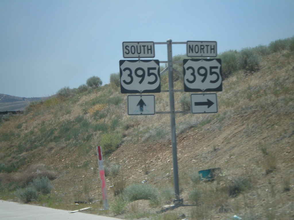
Lemmon Drive at US-395 Exit 74
Lemmon Drive at US-395 Exit 74 freeway entrance.
Taken 07-03-2008
 Reno
Washoe County
Nevada
United States
Reno
Washoe County
Nevada
United States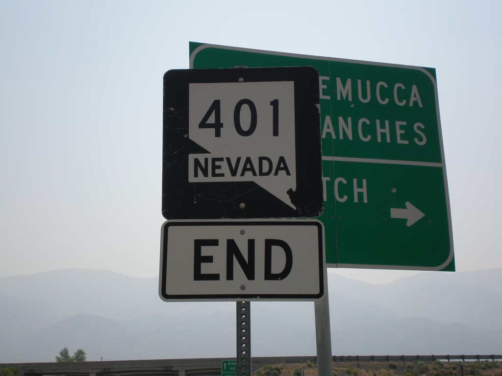
End NV-401 at I-80
End NV-401 approaching I-80.
Taken 07-03-2008


 Lovelock
Pershing County
Nevada
United States
Lovelock
Pershing County
Nevada
United States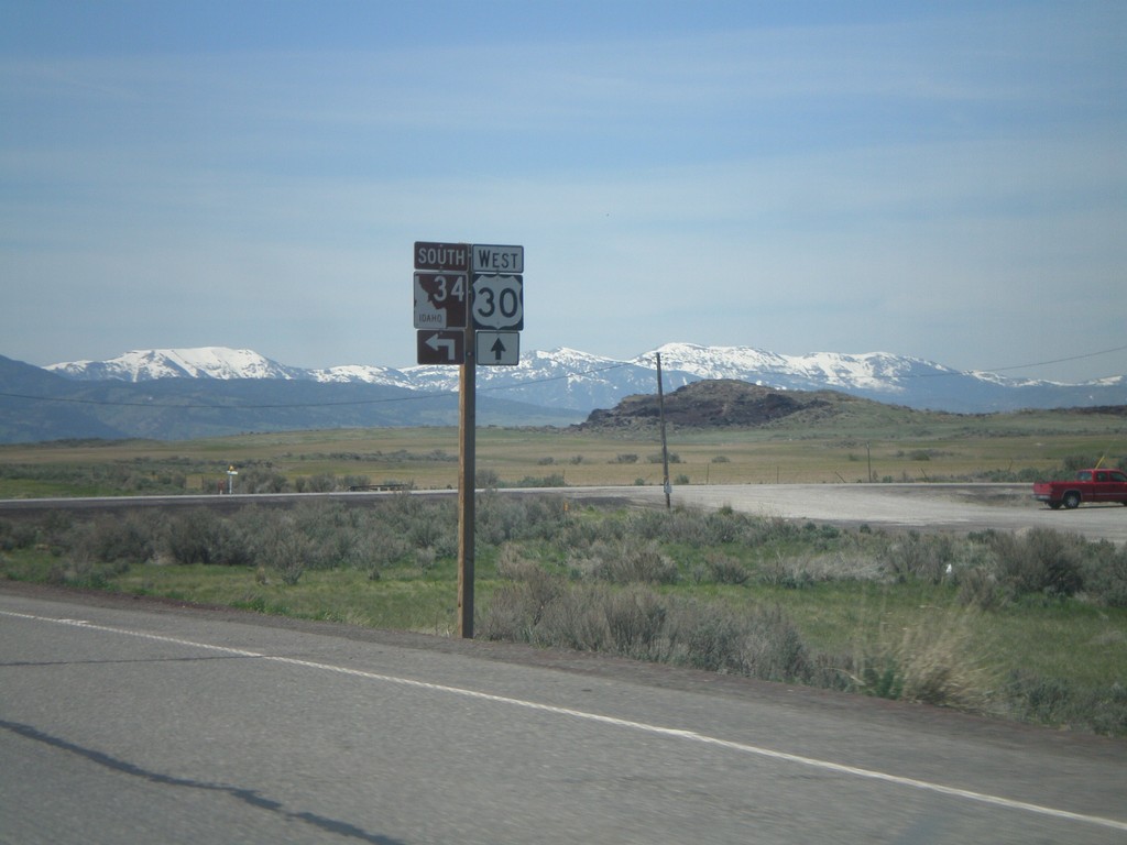
US-30 East/ID-34 South Approaching ID-34
US-30 East/ID-34 South approaching US-30/ID-34 split in Bannock County.
Taken 05-19-2008

 Bancroft
Caribou County
Idaho
United States
Bancroft
Caribou County
Idaho
United States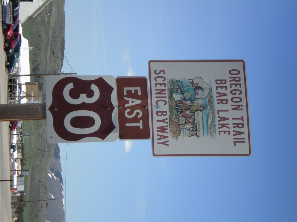
US-30 East - Oregon Trail Bear Lake Scenic Byway
US-30 East in Soda Springs - Oregon Trail - Bear Lake Scenic Byway.
Taken 05-19-2008
Soda Springs
Caribou County
Idaho
United States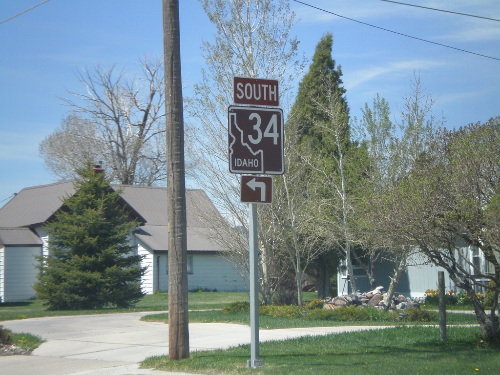
ID-34 South - Soda Springs
ID-34 south (East Hooper Ave.) at North 3rd St. Turn left to continue south on ID-34.
Taken 05-19-2008
Soda Springs
Caribou County
Idaho
United States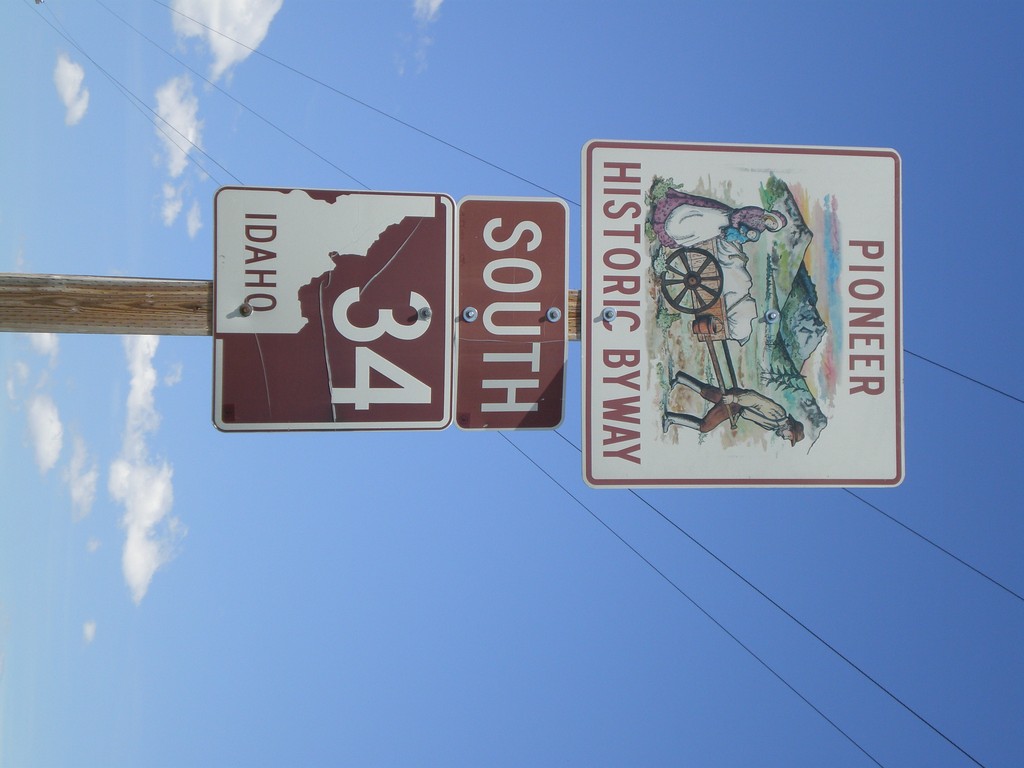
ID-34 South - Pioneer Historic Byway
ID-34 south in Caribou County - Pioneer Historic Byway.
Taken 05-19-2008
Wayan
Caribou County
Idaho
United States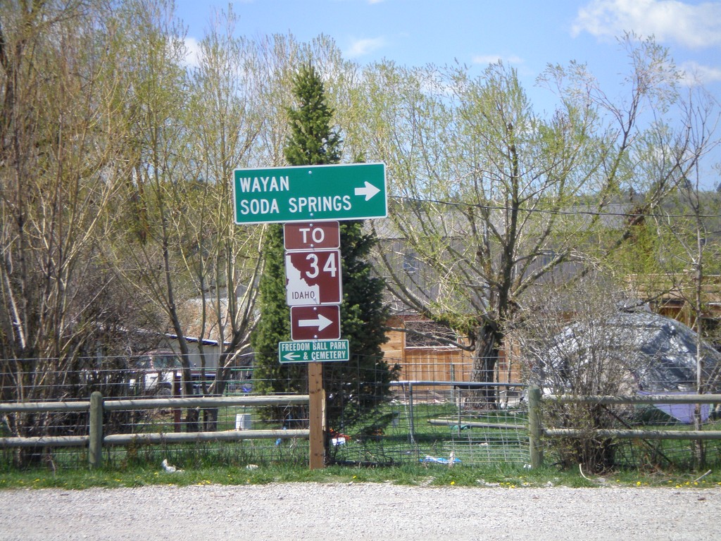
End WY-239 at Stateline Road - To ID-34
End WY-239 at Stateline Road. Turn right on Stateline Road to ID-34, Wayan, and Soda Springs.
Taken 05-19-2008
 Freedom
Lincoln County
Wyoming
United States
Freedom
Lincoln County
Wyoming
United States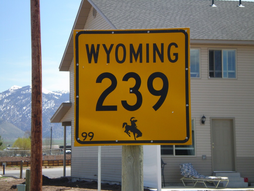
WY-239 East - Freedom
WY-239 east in Freedom. This is the only indication that the road crossed into Wyoming.
Taken 05-19-2008
Freedom
Lincoln County
Wyoming
United States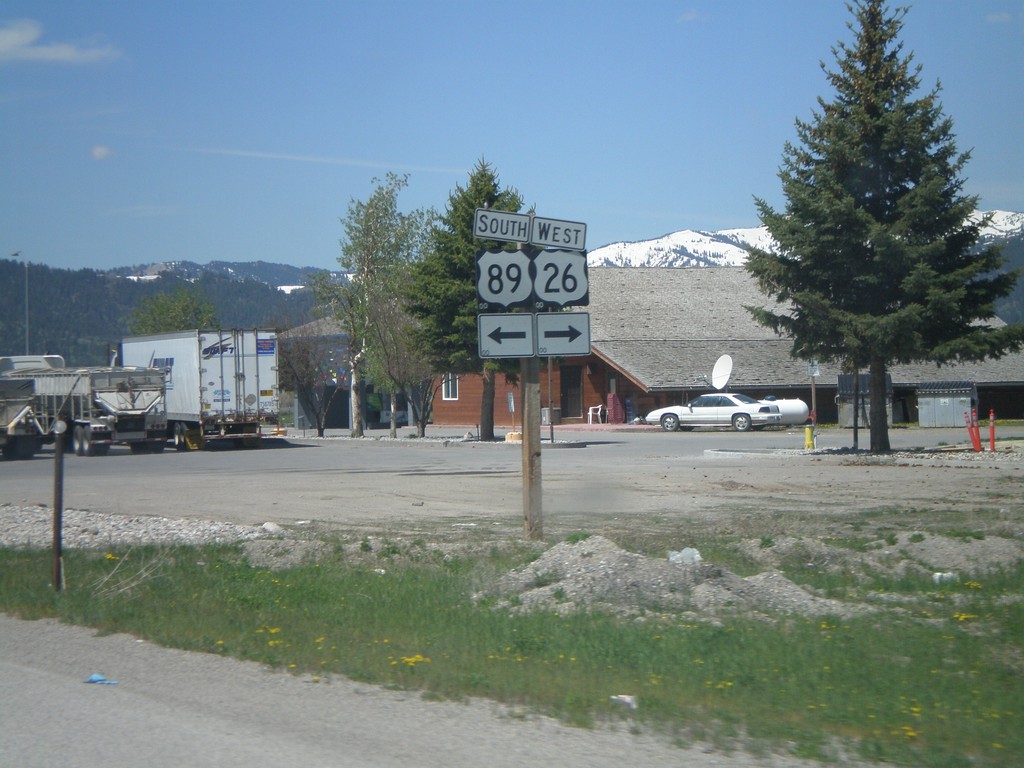
US-89 South/US-26 West at Alpine Junction
US-89 South/US-26 West at US-89/US-26 split in Alpine Junction
Taken 05-19-2008

 Alpine
Lincoln County
Wyoming
United States
Alpine
Lincoln County
Wyoming
United States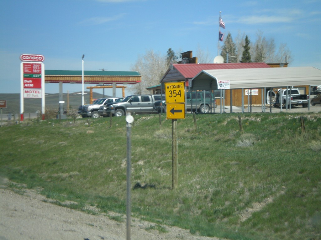
US-191/US-189 North at WY-354
US-189/US-191 North at WY-354 west.
Taken 05-19-2008


 Daniel
Sublette County
Wyoming
United States
Daniel
Sublette County
Wyoming
United States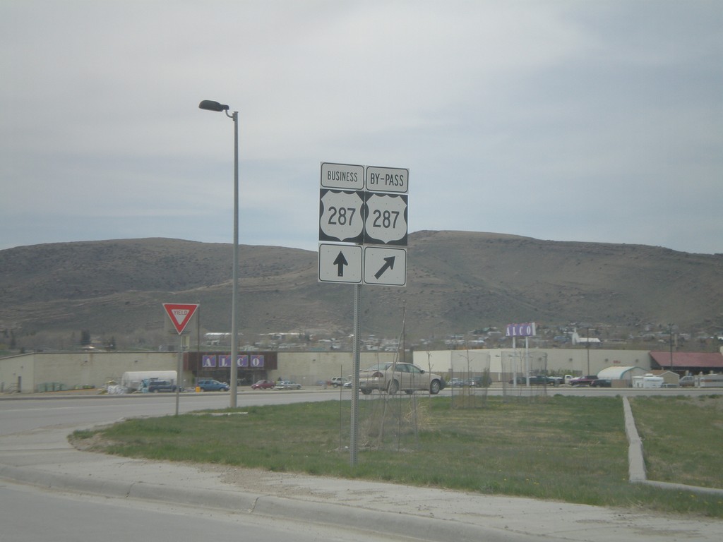
BL-80 West/US-287 North at US-287 By-Pass
BL-80 West/US-287 North at US-287 North Bypass.
Taken 05-18-2008
 Rawlins
Carbon County
Wyoming
United States
Rawlins
Carbon County
Wyoming
United States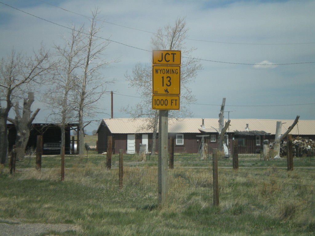
US-30 West/US-287 North approaching WY-13
US-30 West/US-287 North approaching WY-13 in Rock River.
Taken 05-18-2008
 Rock River
Albany County
Wyoming
United States
Rock River
Albany County
Wyoming
United States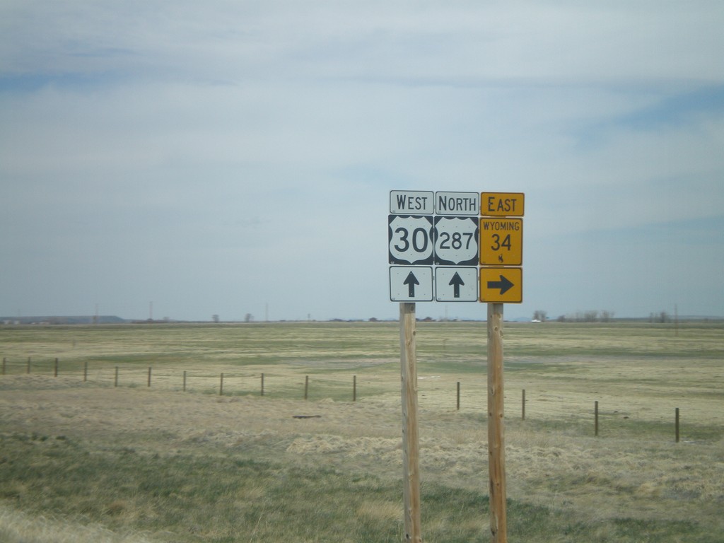
US-30 West/US-287 North Approaching WY-34
US-30 West/US-287 North at WY-34 North in Albany County.
Taken 05-18-2008
 Bosler
Albany County
Wyoming
United States
Bosler
Albany County
Wyoming
United States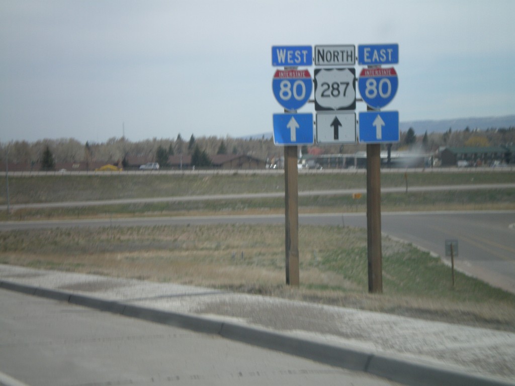
US-287 North at I-80
US-287 north approaching I-80.
Taken 05-18-2008
Laramie
Albany County
Wyoming
United States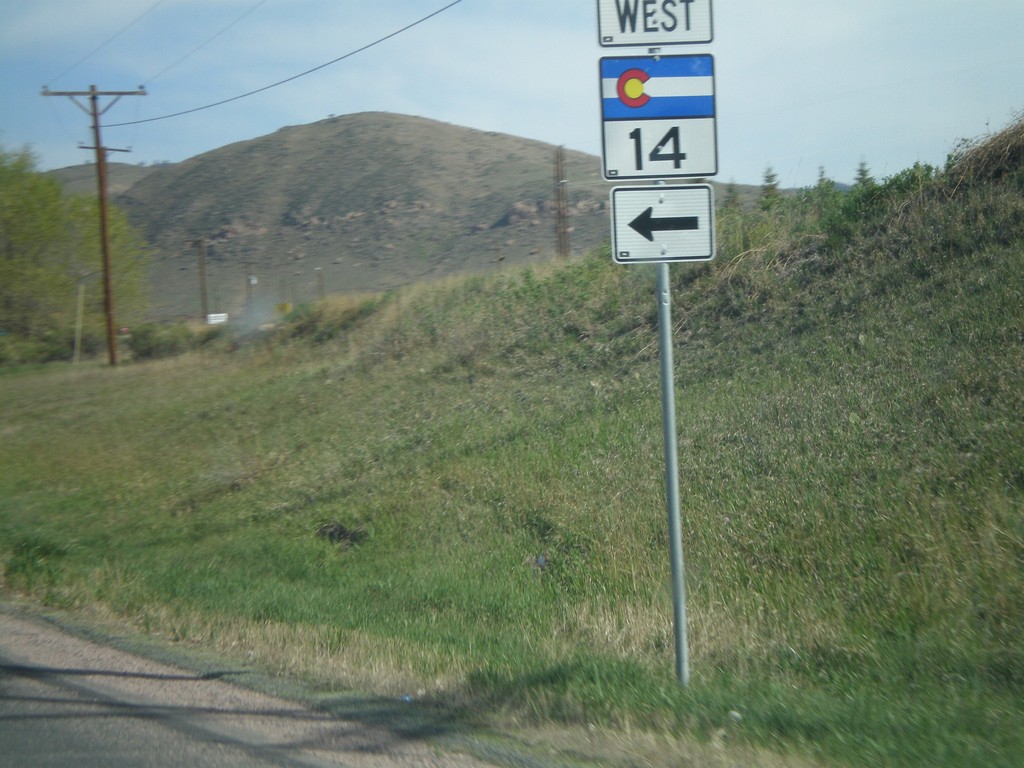
US-287 North at CO-14 West
US-287 north at CO-14 west.
Taken 05-18-2008
 Bellvue
Larimer County
Colorado
United States
Bellvue
Larimer County
Colorado
United States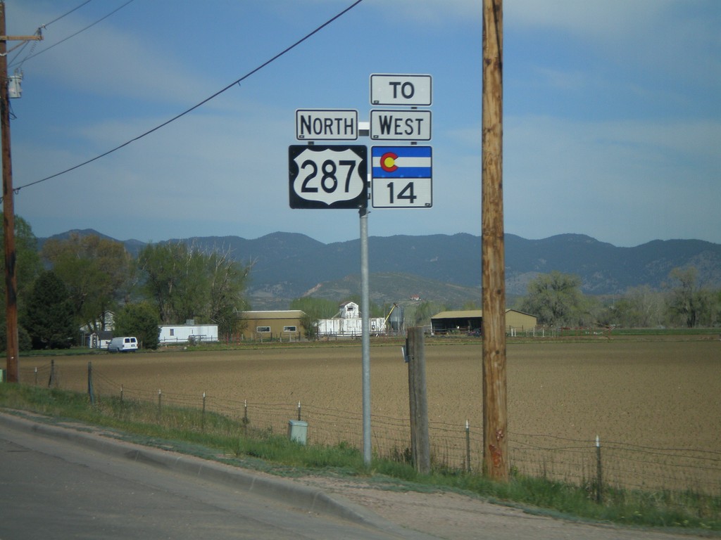
US-287 North/To CO-14 West
US-287 North/To CO-14 west north of Fort Collins.
Taken 05-18-2008
Fort Collins
Larimer County
Colorado
United States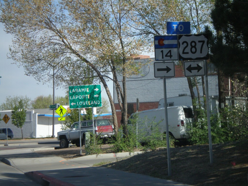
CO-14 West at US-287
CO-14 west at US-287 in Fort Collins. Use US-287 north for Laramie (WY) and Laporte, and US-287 south for Loveland.
Taken 05-18-2008
Fort Collins
Larimer County
Colorado
United States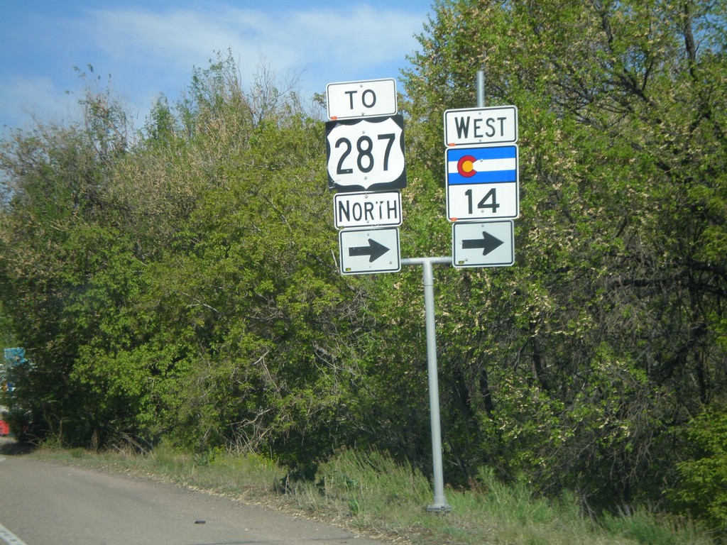
CO-14 West/To US-287 North
CO-14 west to US-287 at the corner of E. Mulberry St. and Riverside Ave.
Taken 05-18-2008
Fort Collins
Larimer County
Colorado
United States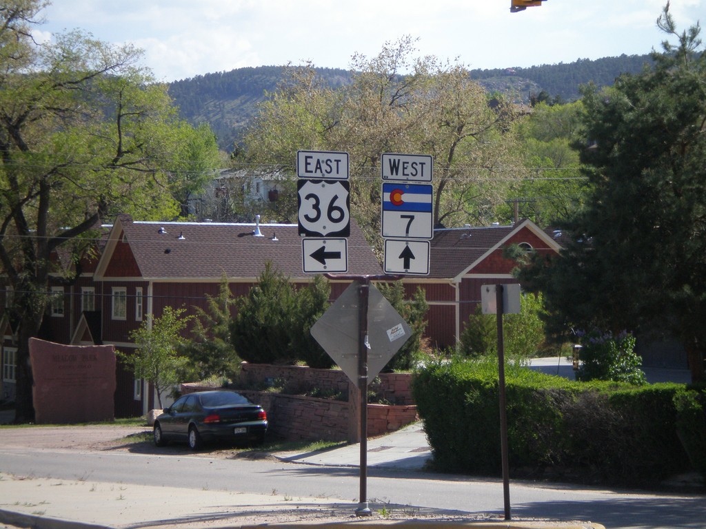
US-36 East at CO-7 West
US-36 east at CO-7 west
Taken 05-17-2008

 Lyons
Boulder County
Colorado
United States
Lyons
Boulder County
Colorado
United States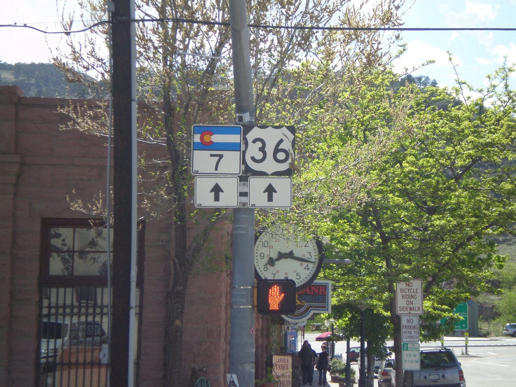
US-36 East/CO-7 South - Lyons
US-36/CO-7 on Main St.
Taken 05-17-2008
Lyons
Boulder County
Colorado
United States