Signs Tagged With Shield
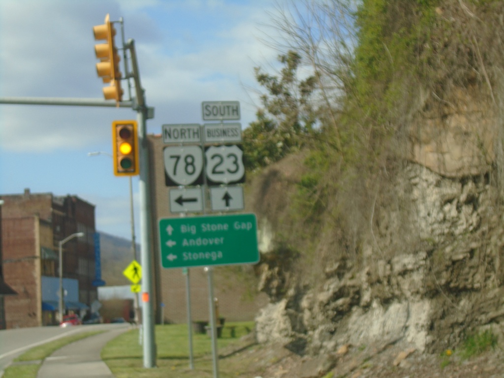
Bus. US-23 South at VA-78 North
Bus. US-23 South at VA-78 North in Norton. Use VA-78 North to Andover and Stonega. Continue south on Bus. US-23 for Big Stone Gap.
Taken 03-31-2024
 Appalachia
Wise County
Virginia
United States
Appalachia
Wise County
Virginia
United States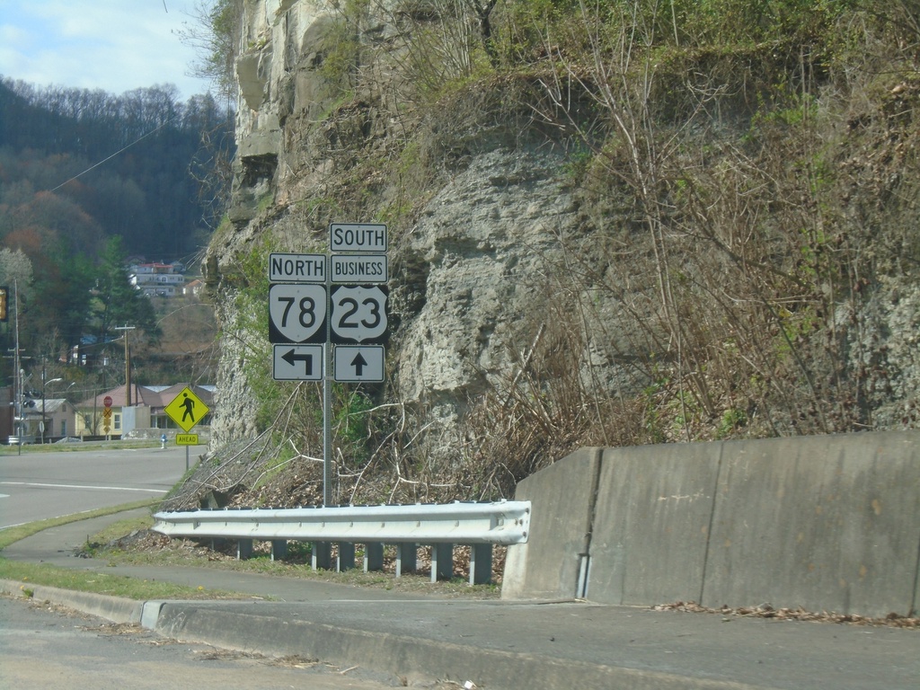
Bus. US-23 South at VA-78
Bus. US-23 South at VA-78 North in Appalachia
Taken 03-31-2024
 Appalachia
Wise County
Virginia
United States
Appalachia
Wise County
Virginia
United States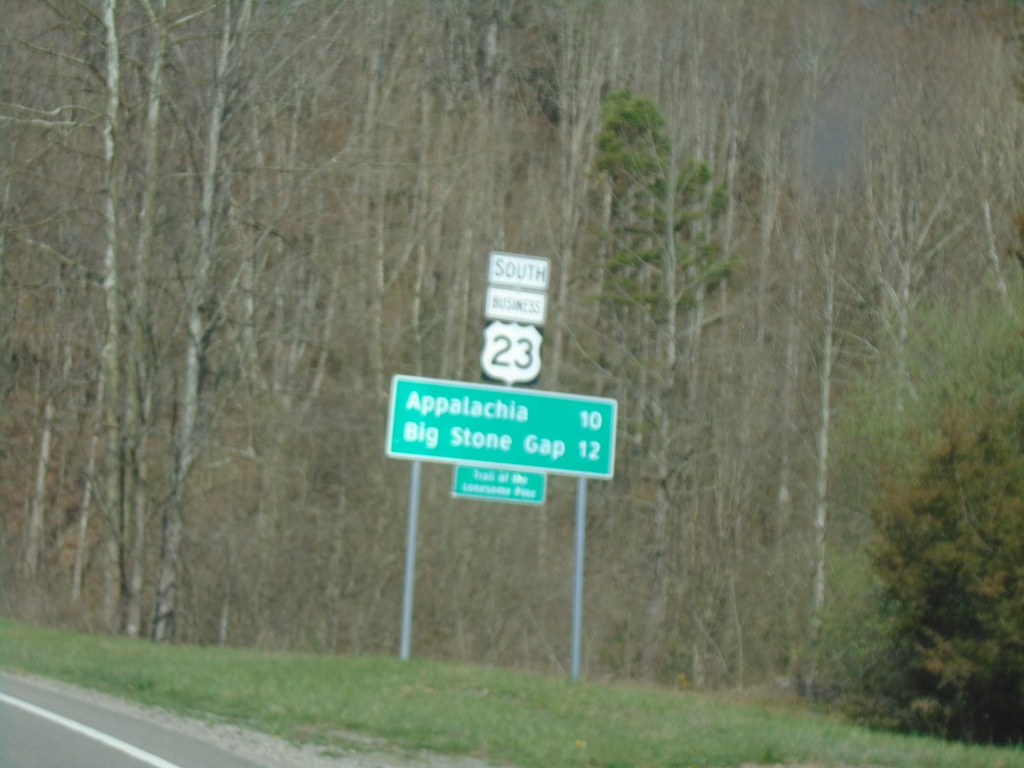
Bus. US-23 South - Distance Marker
Distance Marker on Bus. US-23 South. Distance to Appalachia and Big Stone Gap.
Taken 03-31-2024
Norton
Wise County
Virginia
United States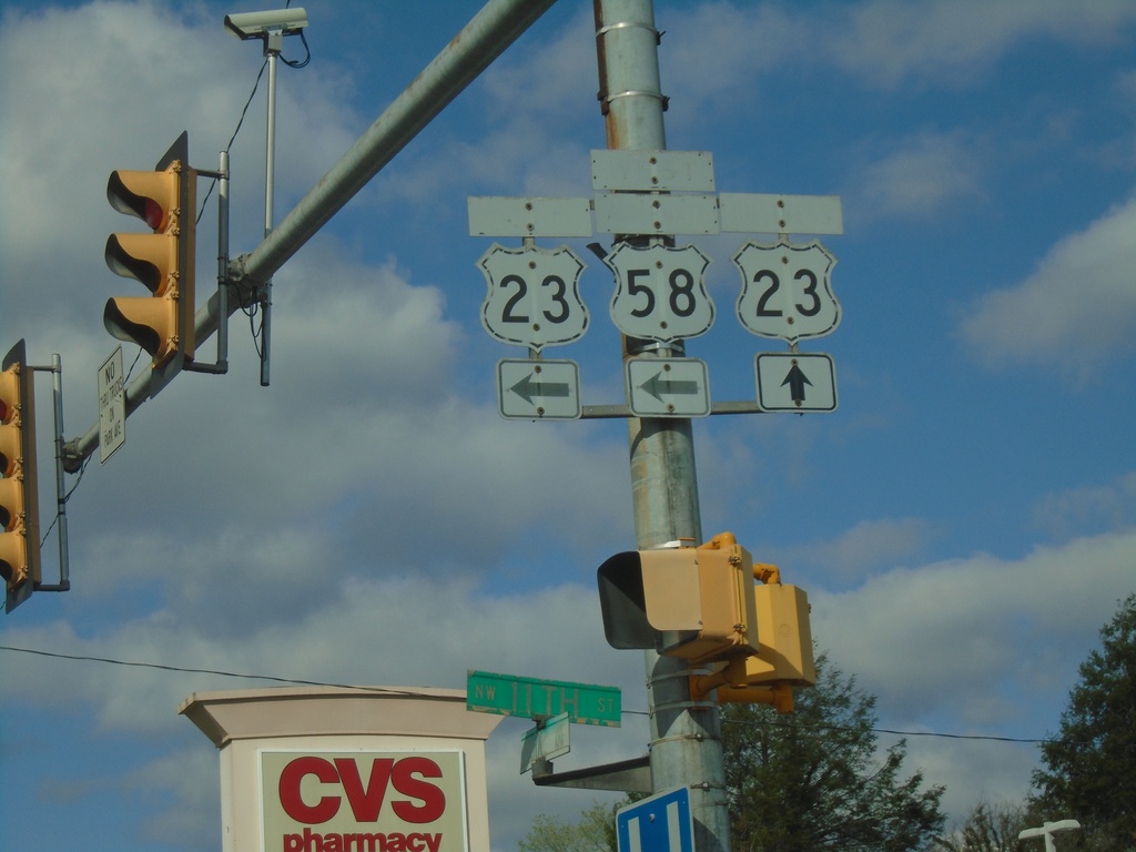
Bus. US-23 South (Park Ave) at 11th St.
Bus. US-23 South (Park Ave) at 11th St in Norton. Sign assembly contains old cut-out style shields for Bus. US-23, US-23, and Alt. US-58. The banners on the signs are faded. Turn left on 11th St. for access to US-23 and Alt. US-58. Continue straight on Park Ave. for Bus. US-23 South
Taken 03-31-2024

 Norton
Virginia
United States
Norton
Virginia
United States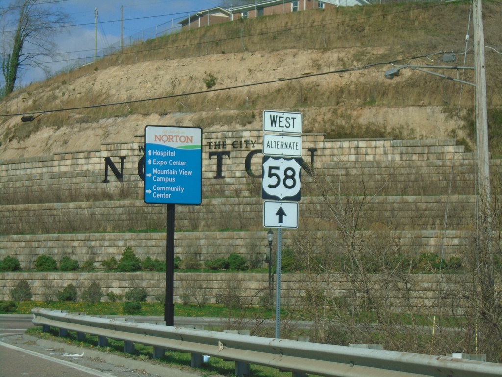
Bus. US-23 South to Alt. US-58 - Norton
Bus. US-23 South to Alt. US-58 in Norton.
Taken 03-31-2024
Norton
Virginia
United States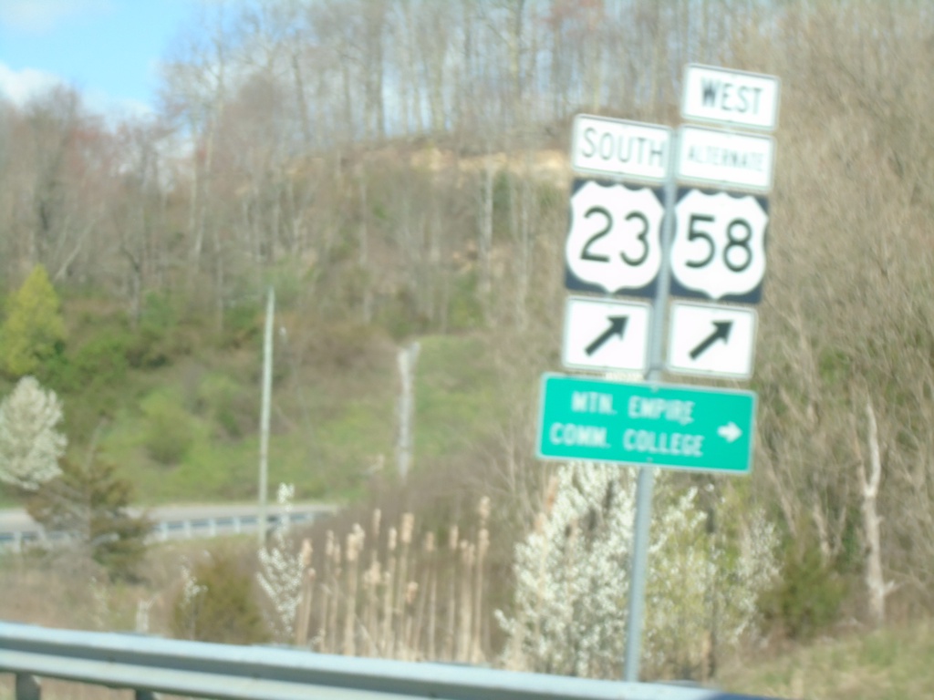
Alt. US-58 West at US-23 South
Alt. US-58 West at US-23 South to Mountain Empire Community College.
Taken 03-31-2024
Norton
Virginia
United States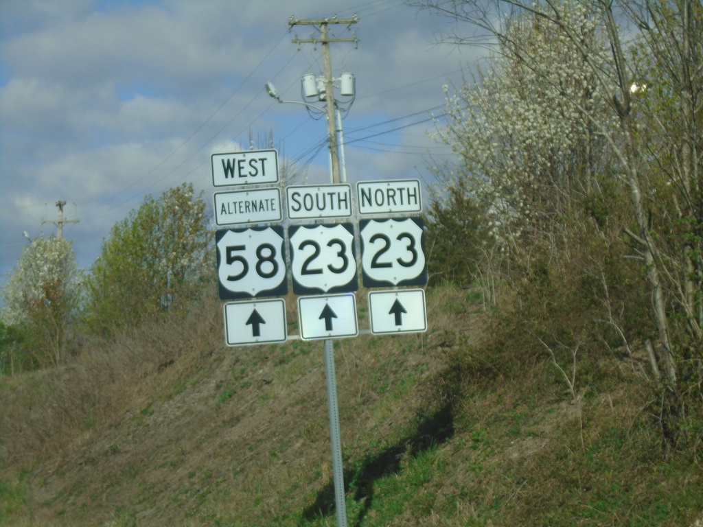
Alt. US-58 West Approaching US-23
Alt. US-58 West approaching US-23 in Norton.
Taken 03-31-2024
Norton
Virginia
United States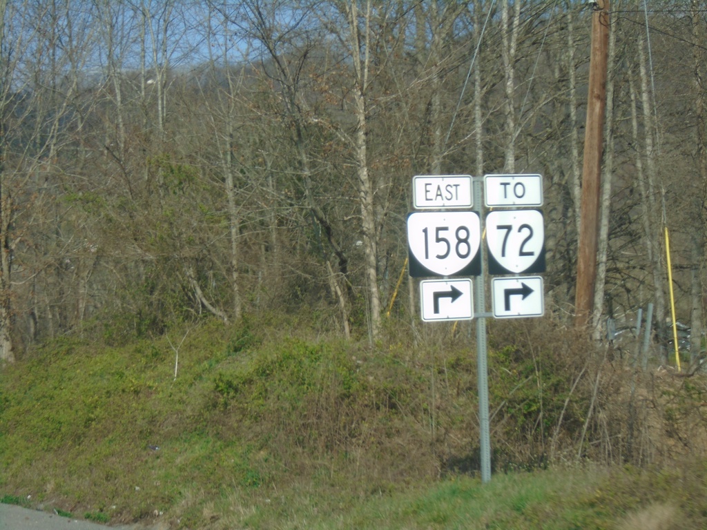
Alt. US-58 West - Exit 1
Alt. US-58 West at Exit 1 - To VA-72/VA-158 East.
Taken 03-31-2024

 Coeburn
Wise County
Virginia
United States
Coeburn
Wise County
Virginia
United States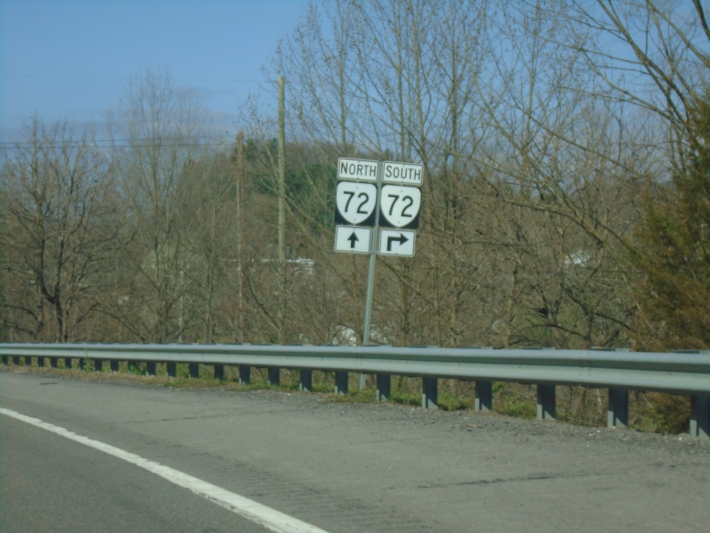
Alt. US-58 West Approaching Exit 2
Alt. US-58 West approaching Exit 2. Use Exit 2 for VA-72 South. Continue on freeway for access to VA-72 North, although confusingly VA-72 shares no concurrency with Alt. US-58 West.
Taken 03-31-2024
Coeburn
Wise County
Virginia
United States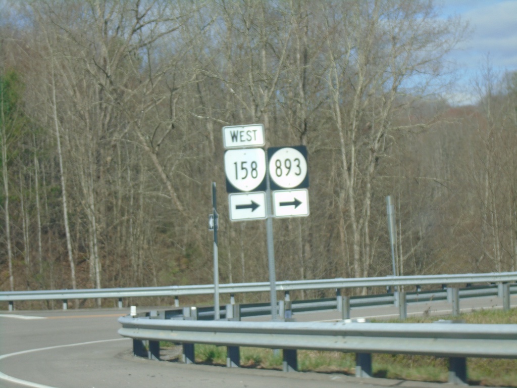
US-58 Alt. West at VA-158/VAS-893
US-58 Alt. West at VA-158 West/VAS-893 in Wise County.
Taken 03-31-2024
 Coeburn
Wise County
Virginia
United States
Coeburn
Wise County
Virginia
United States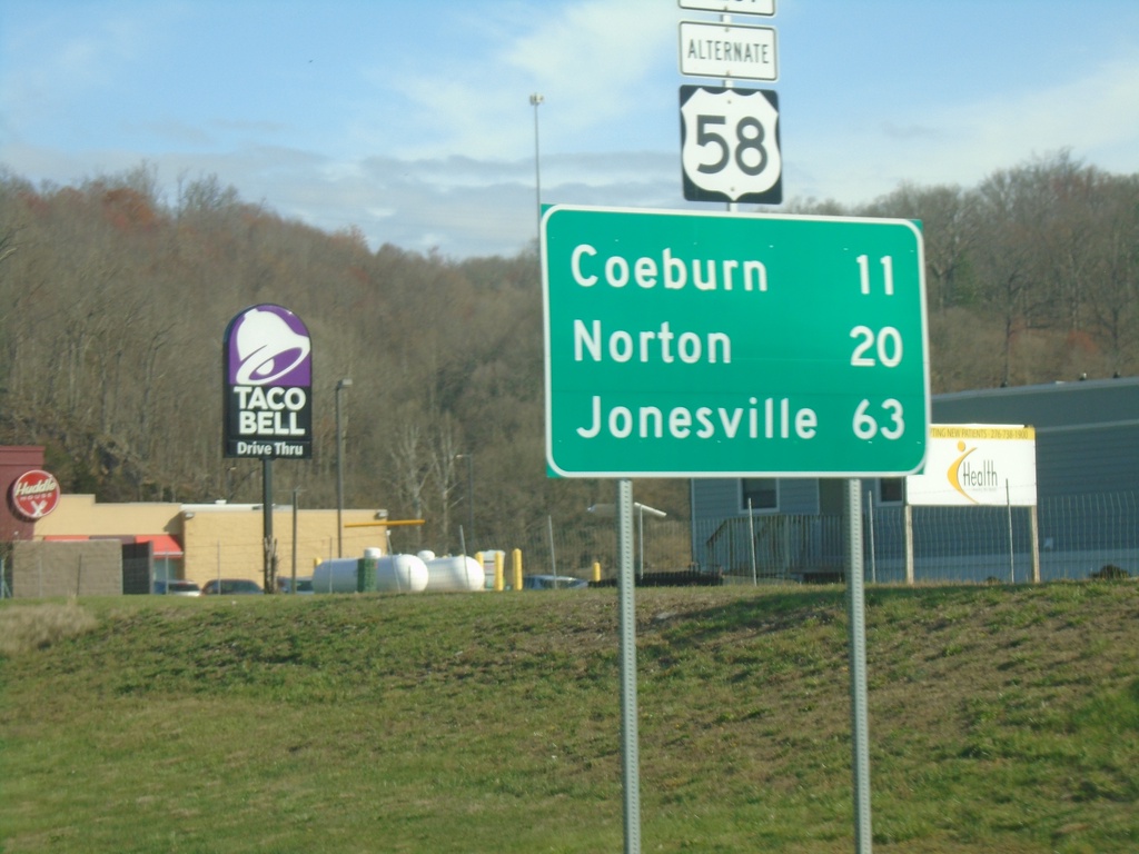
US-58 Alt. West - Distance Marker
Distance marker on US-58 Alt. West. Distance to Coeburn, Norton, and Jonesville.
Taken 03-31-2024
Saint Paul
Russell County
Virginia
United States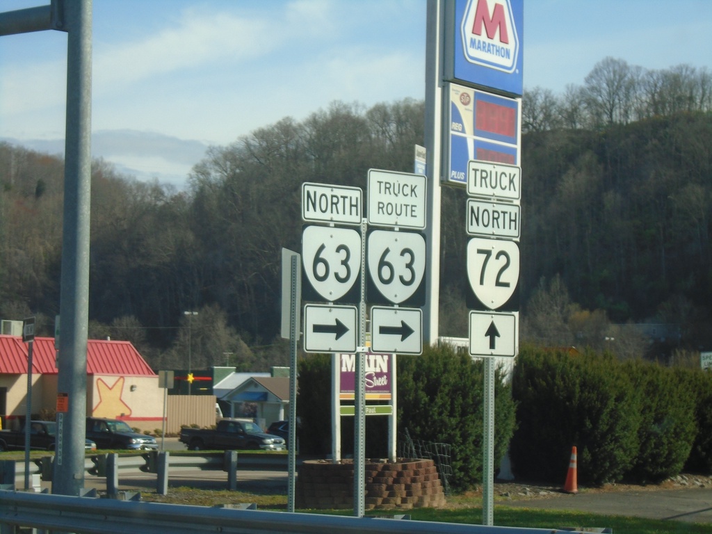
Alt. US-58 West at VA-63 - St. Paul
Alt. US-58 West at VA-63 in St. Paul. Turn right on Wise St. for VA-63/Truck Route VA-63. For truck route to VA-72, continue west on Alt. US-58.
Taken 03-31-2024
 Saint Paul
Wise County
Virginia
United States
Saint Paul
Wise County
Virginia
United States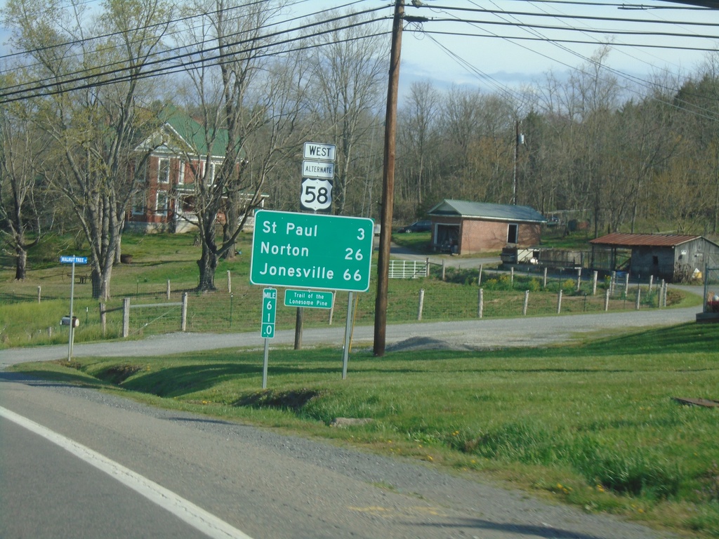
Alt. US-58 West - Distance Marker
Distance marker on Alt. US-58 West. Distance to St Paul, Norton, and Jonesville.
Taken 03-31-2024
Castlewood
Russell County
Virginia
United States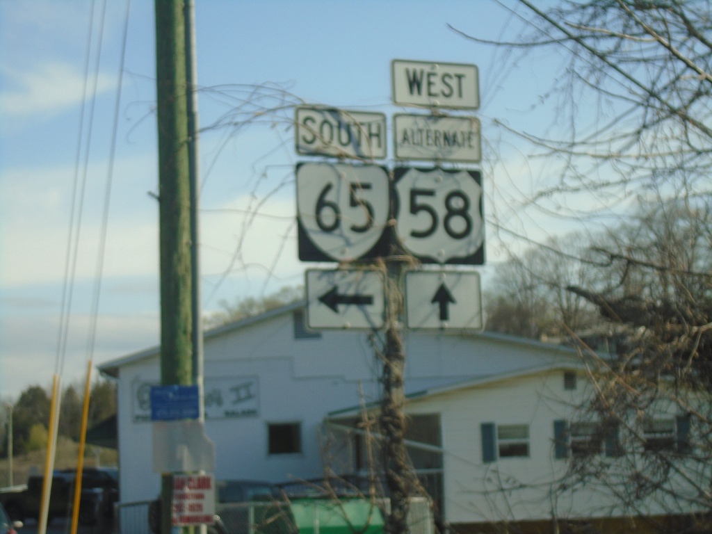
Alt. US-58 West at VA-65 South
Alt. US-58 West at VA-65 South in Castlewood.
Taken 03-31-2024
 Castlewood
Russell County
Virginia
United States
Castlewood
Russell County
Virginia
United States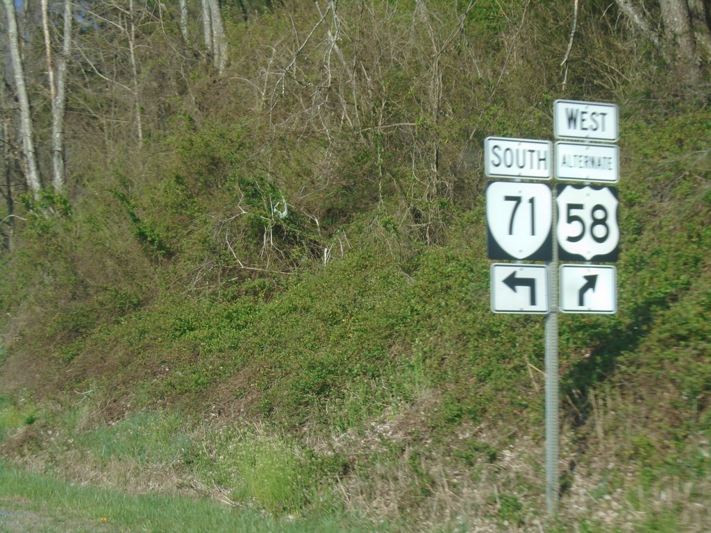
Alt. US-58 West/VA-71 South at Split
Alt. US-58 West/VA-71 South at Alt. US-58/VA-71 split
Taken 03-31-2024
 Castlewood
Russell County
Virginia
United States
Castlewood
Russell County
Virginia
United States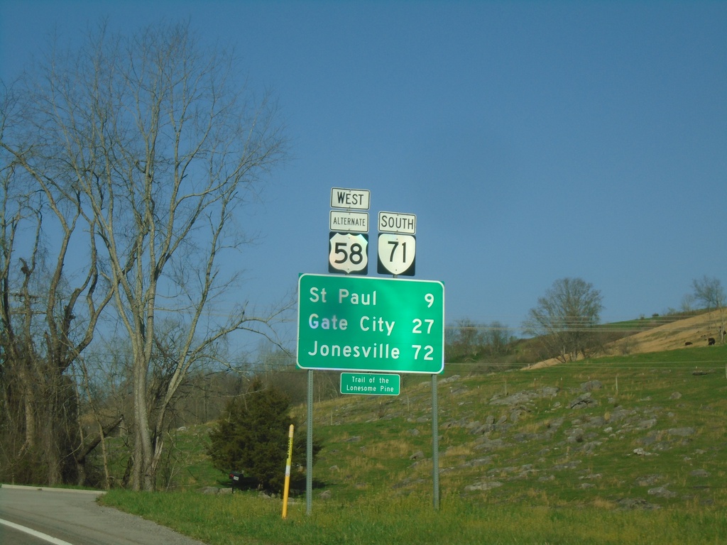
Alt. US-58 West/VA-71 South - Distance Marker
Distance Marker on Alt. US-58 West/VA-71 South. Distance to St. Paul, Gate City, and Jonesville.
Taken 03-31-2024
Castlewood
Russell County
Virginia
United States
Alt. US-58 West Approaching VA-71
Alt. US-58 West approaching VA-71. VA-71 South joins Alt. US-58 westbound.
Taken 03-31-2024
Castlewood
Russell County
Virginia
United States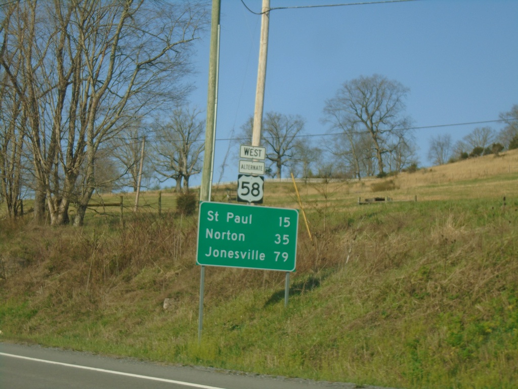
Alt. US-58 West - Distance Marker
Distance marker on Alt. US-58 West. Distance to St. Paul, Norton, and Jonesville.
Taken 03-31-2024
Lebanon
Russell County
Virginia
United States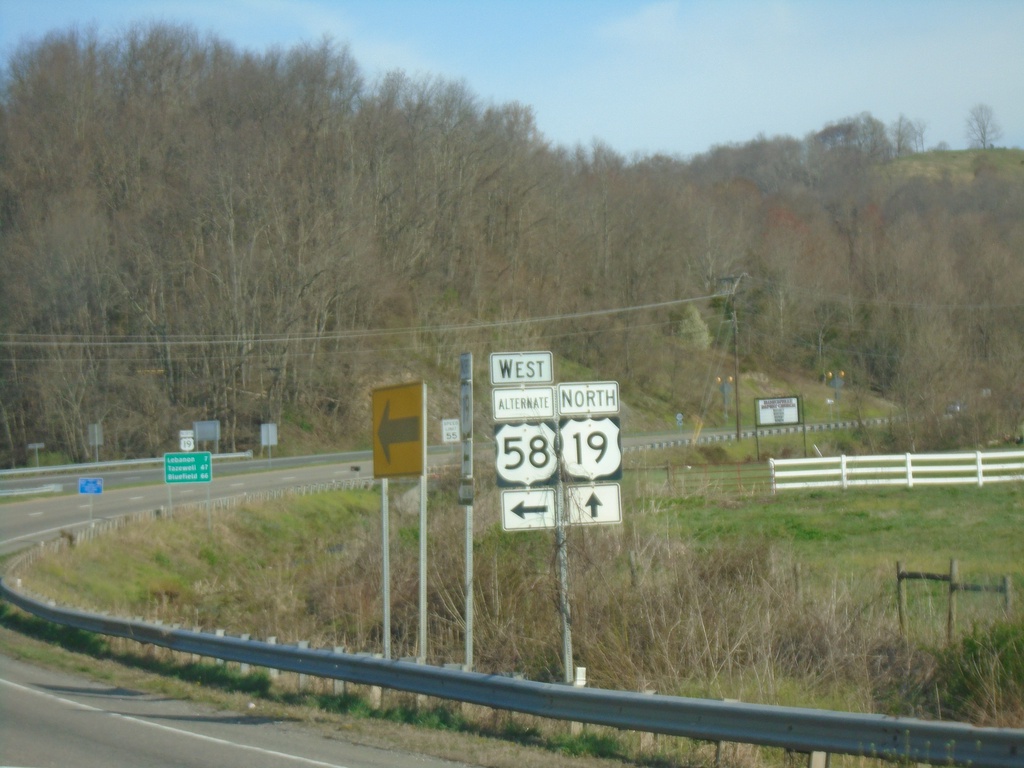
US-19 North/Alt. US-58 West at Split
US-19 North/Alt. US-58 West at US-19/Alt. US-58 split.
Taken 03-31-2024
 Lebanon
Russell County
Virginia
United States
Lebanon
Russell County
Virginia
United States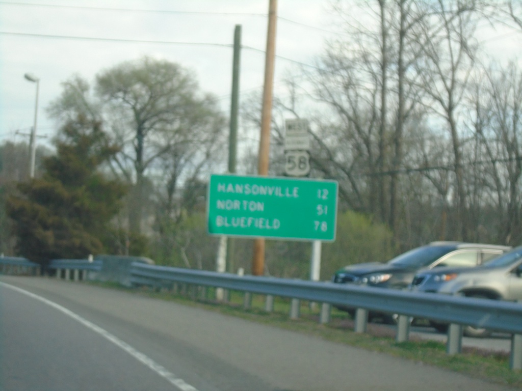
US-19 North/Alt. US-58 West - Distance Marker
Distance Marker on US-19 North/Alt. US-58 West. Distance to Hansonville, Norton, and Bluefield.
Taken 03-31-2024
Abingdon
Washington County
Virginia
United States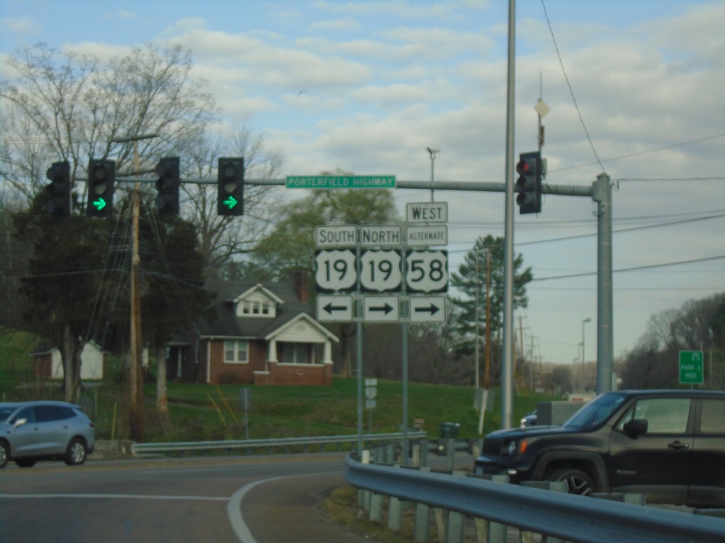
Alt. US-58 West at US-19
Alt. US-58 West at US-19 (Porterfield Highway).
Taken 03-31-2024
Abingdon
Washington County
Virginia
United States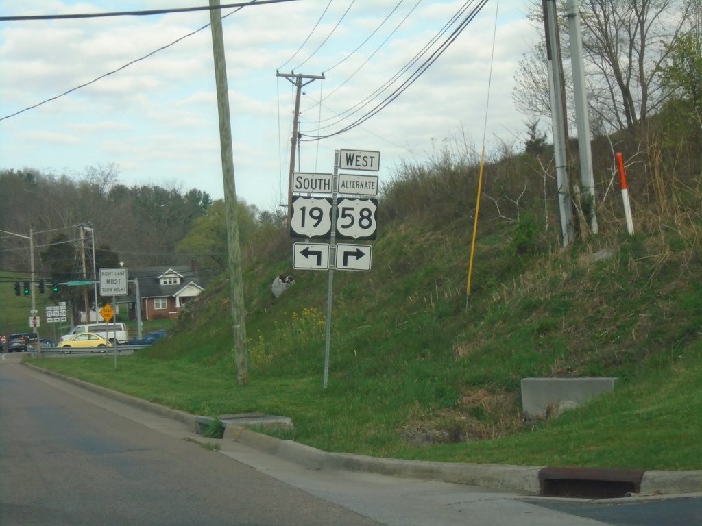
Alt. US-58 West at US-19
Alt. US-58 West (Russell Road NW) at US-19 in Abingdon.
Taken 03-31-2024
Abingdon
Washington County
Virginia
United States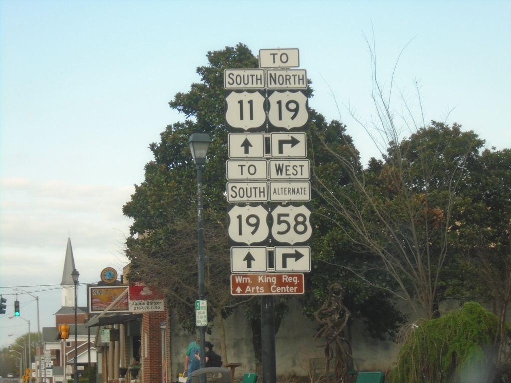
US-11 South/Alt. US-58 West (Main St.) at Alt. US-58/To US-19
US-11 South/Alt. US-58 West (Main St.) at Alt. US-58/To US-19 (Russell Road NW)
Taken 03-31-2024
 Abingdon
Washington County
Virginia
United States
Abingdon
Washington County
Virginia
United States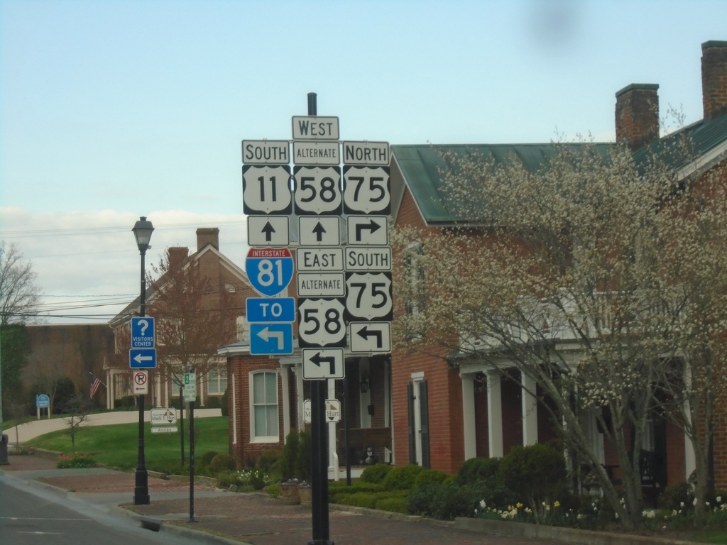
US-11/Alt. US-58 at VA-75
US-11/Alt. US-58 at VA-75 in Abingdon. Turn left for Alt. US-58 East/VA-75 South to I-81. Continue straight for US-11 South/Alt. US-58 West.
Taken 03-31-2024

 Abingdon
Washington County
Virginia
United States
Abingdon
Washington County
Virginia
United States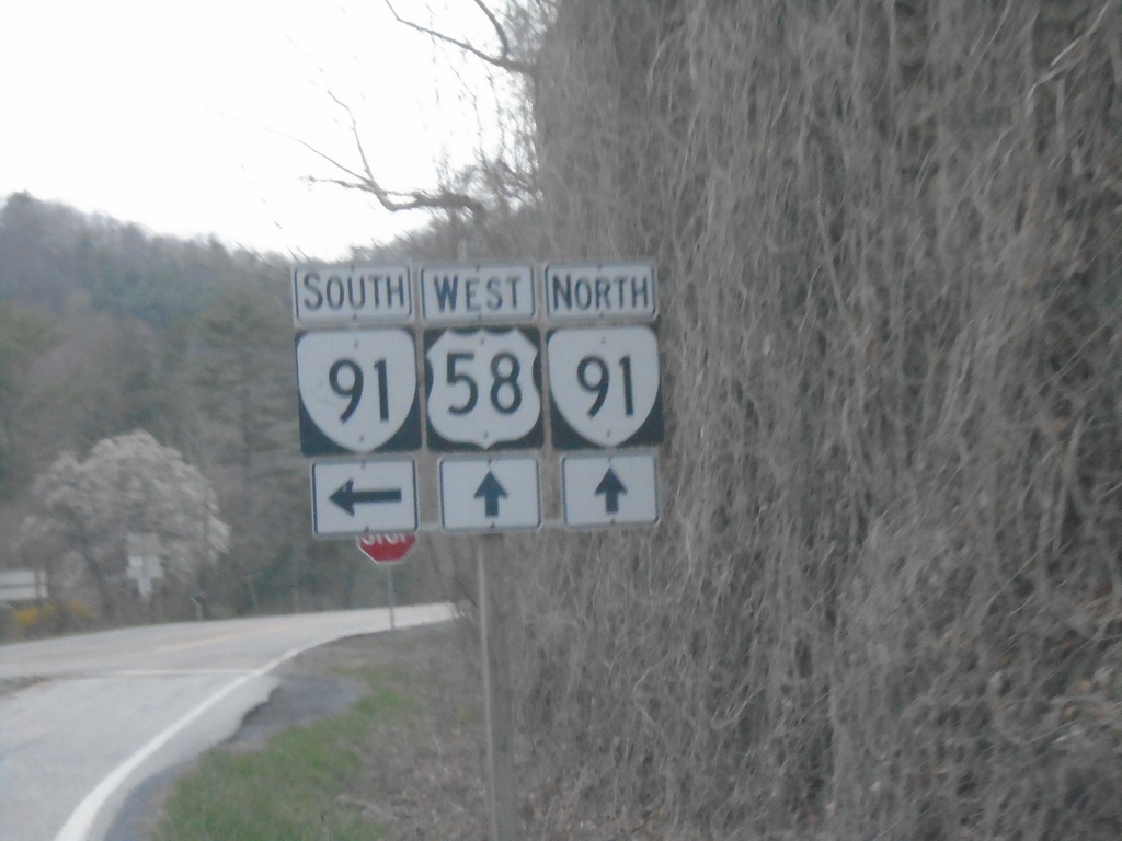
US-58 West at VA-91
US-58 West at VA-91. VA-91 North joins US-58 West into Damascus.
Taken 03-31-2024
 Damascus
Washington County
Virginia
United States
Damascus
Washington County
Virginia
United States