Signs Tagged With Shield
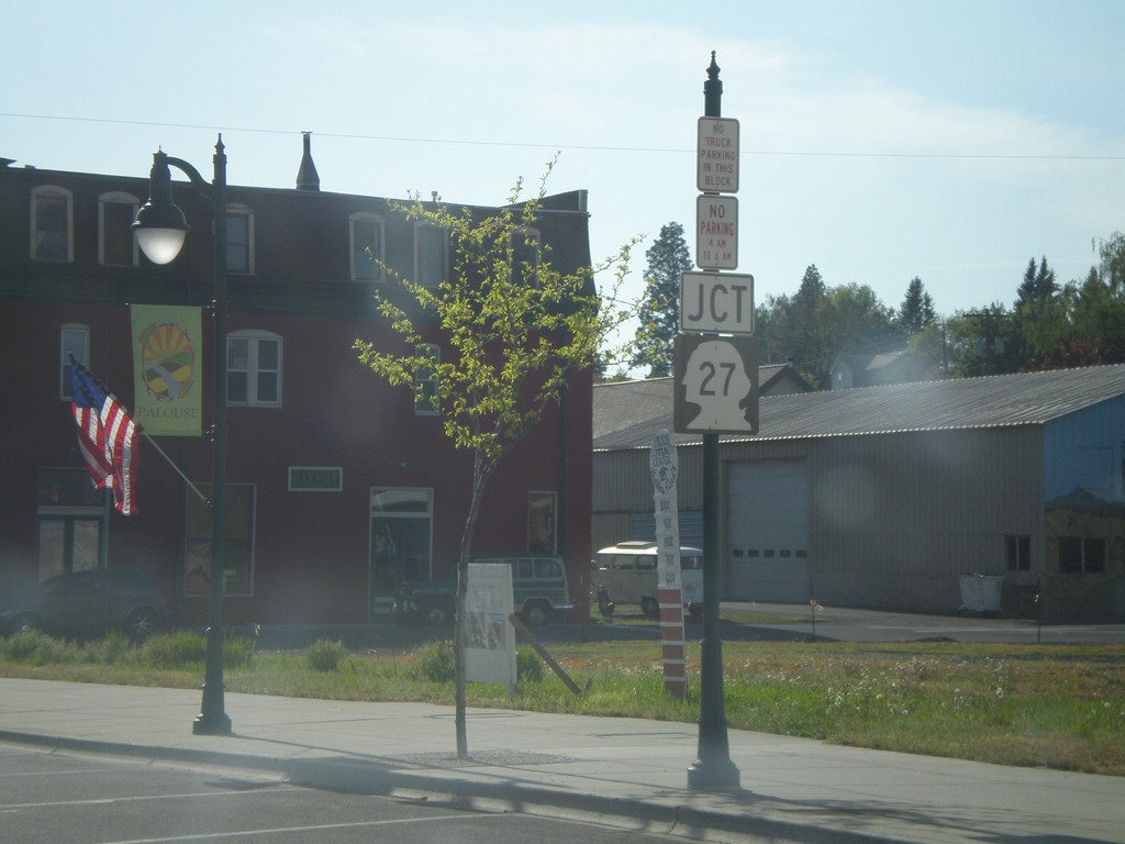
WA-272 West Approaching WA-27
WA-272 west approaching WA-27.
Taken 05-25-2009

 Palouse
Whitman County
Washington
United States
Palouse
Whitman County
Washington
United States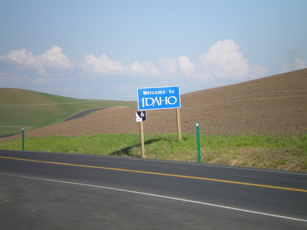
Welcome To Idaho - ID-6 East
Welcome to Idaho on ID-6 east.
Taken 05-25-2009
 Potlatch
Latah County
Idaho
United States
Potlatch
Latah County
Idaho
United States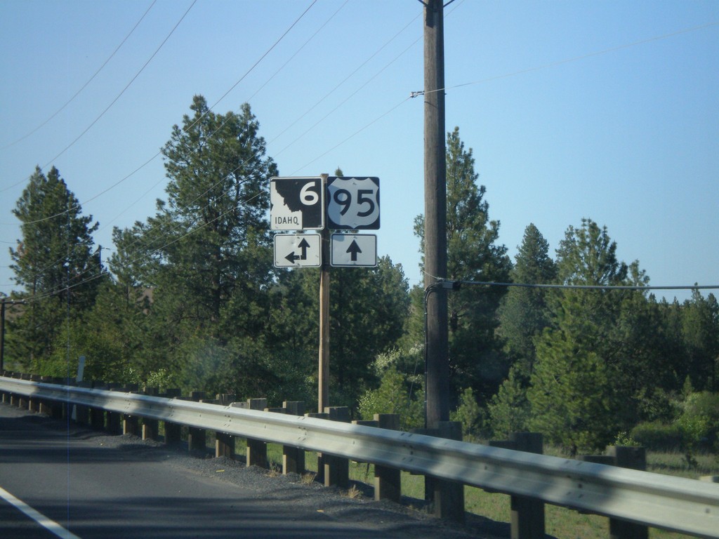
UD-95 north at ID-6 West
US-95 north at ID-6 west.
Taken 05-25-2009
Potlatch Latah County Idaho United States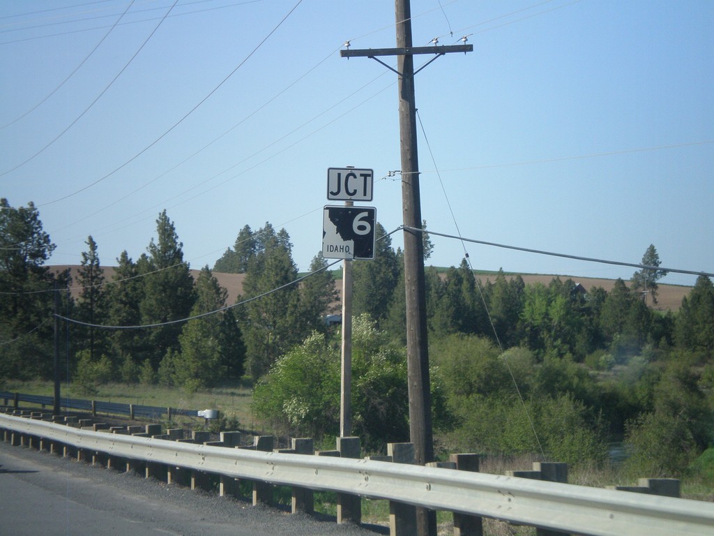
US-95 North Approaching ID-6
US-95 north approaching ID-6 west.
Taken 05-25-2009
 Potlatch
Latah County
Idaho
United States
Potlatch
Latah County
Idaho
United States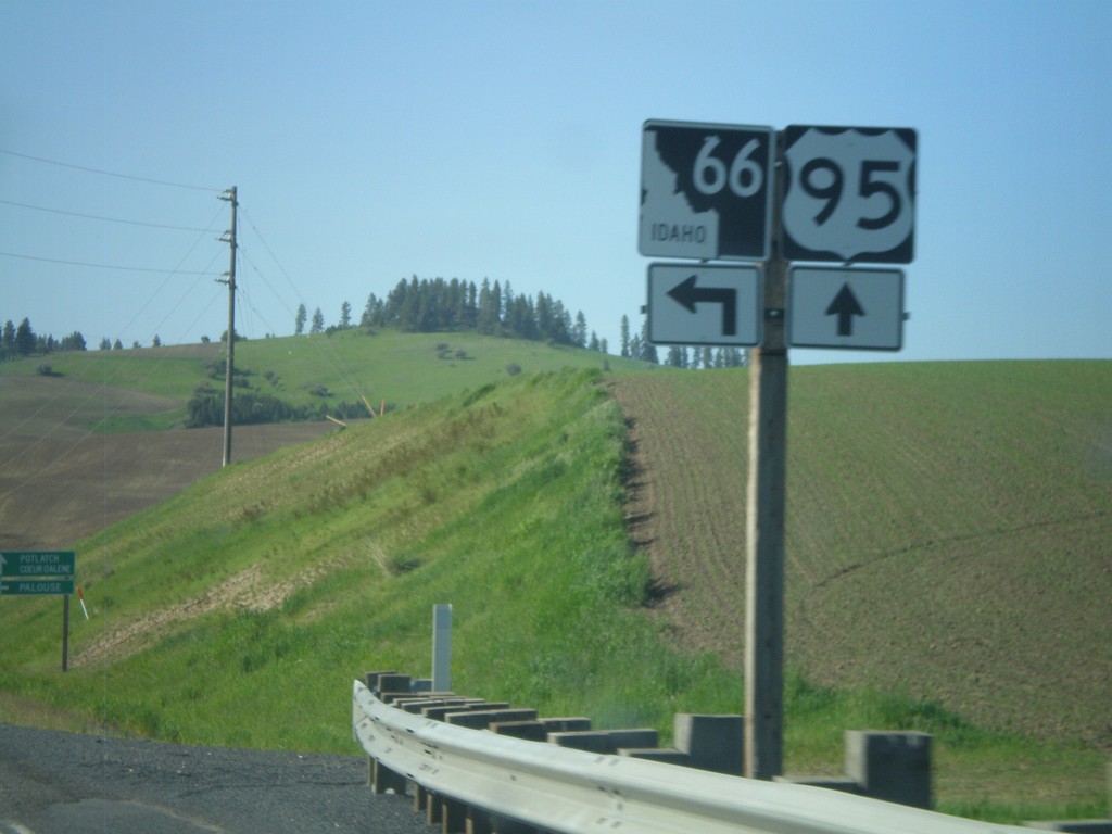
US-95 North at ID-66
US-95 north at ID-66 west.
Taken 05-25-2009
 Viola
Latah County
Idaho
United States
Viola
Latah County
Idaho
United States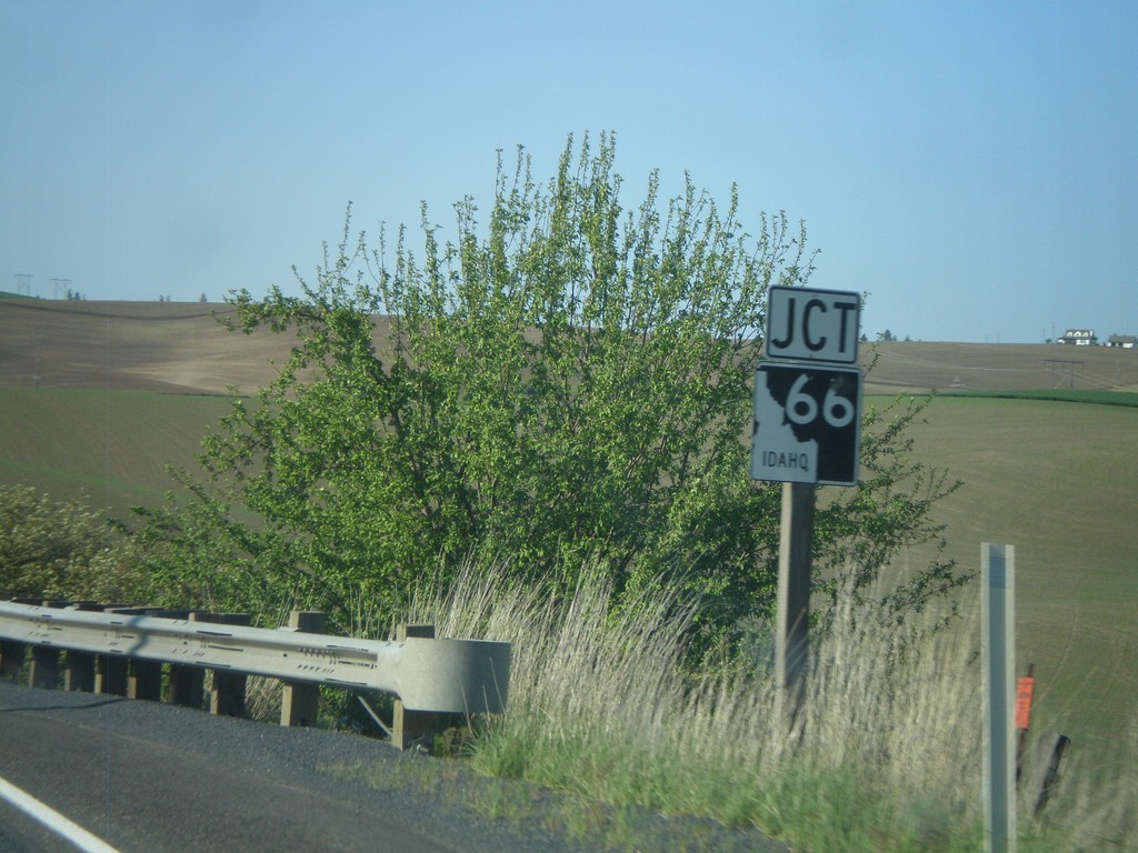
US-95 North Approaching ID-66
US-95 north at ID-66 west.
Taken 05-25-2009
Viola
Latah County
Idaho
United States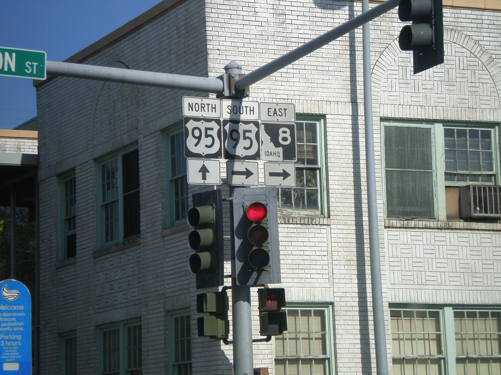
ID-8 East at US-95
ID-8 east at US-95. ID-8 joins US-95 south through Moscow.
Taken 05-25-2009
 Moscow
Latah County
Idaho
United States
Moscow
Latah County
Idaho
United States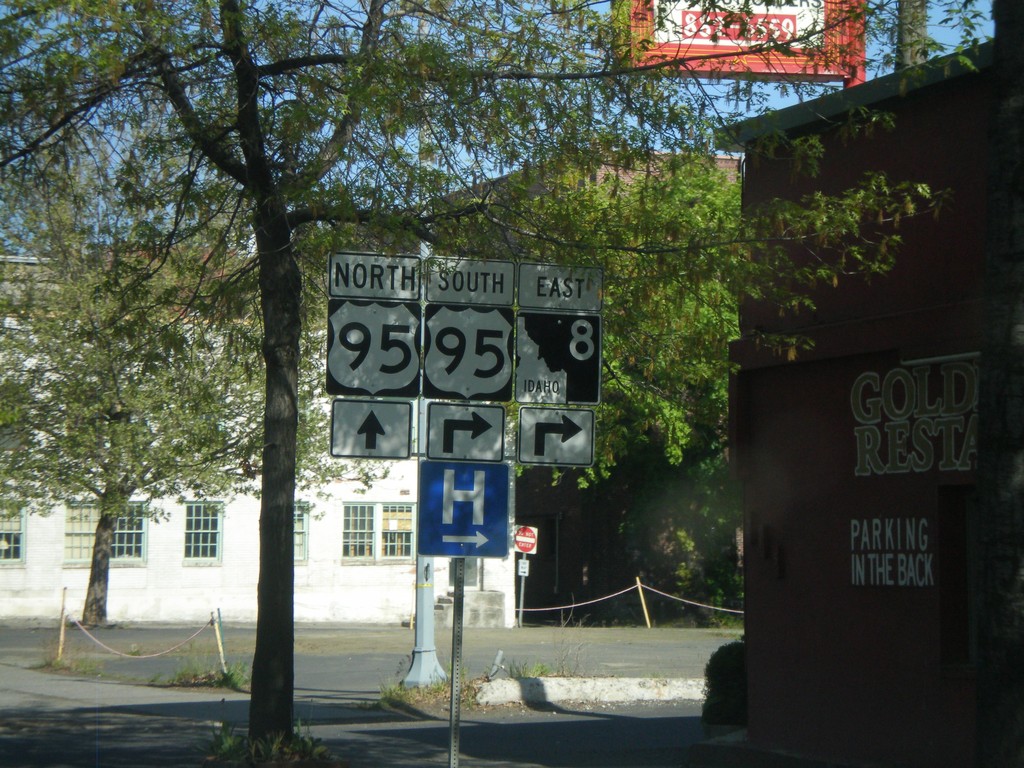
ID-8 East Approaching US-95
ID-8 east approaching US-95.
Taken 05-25-2009
Moscow
Latah County
Idaho
United States
Jct. US-95 on ID-8 East
Jct. US-95 on ID-8 East
Taken 05-25-2009
Moscow
Latah County
Idaho
United States
End ID-60
End ID-60 West at Washington State Line
Taken 05-22-2009
 Plummer
Benewah County
Idaho
United States
Plummer
Benewah County
Idaho
United States
US-95 South at ID-60 West
US-95 south at ID-60 West
Taken 05-22-2009
Plummer
Benewah County
Idaho
United States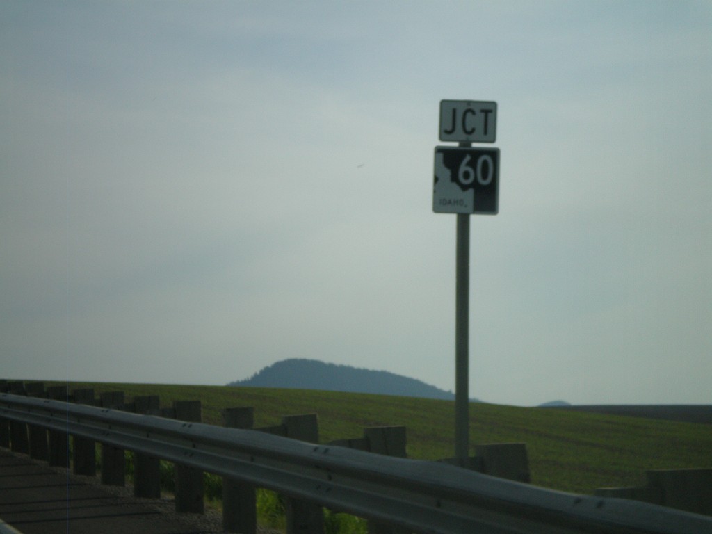
US-95 South Approaching ID-60
US-95 south approaching ID-60
Taken 05-22-2009
Plummer
Benewah County
Idaho
United States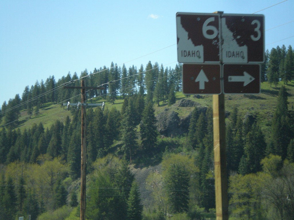
ID-3 north at ID-6
ID-3 north at ID-6. The White Pine Scenic Byway follows ID-3 north from here to Rose Lake.
Taken 05-21-2009
 Saint Maries
Benewah County
Idaho
United States
Saint Maries
Benewah County
Idaho
United States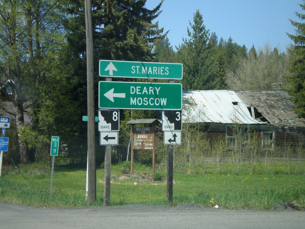
ID-8 West at ID-3
ID-8 west at ID-3. ID-8 west joins ID-3 south to Deary. Use ID-8/ID-3 for Deary and Moscow. Use ID-3 north for St. Maries.
Taken 05-21-2009
Bovill
Latah County
Idaho
United States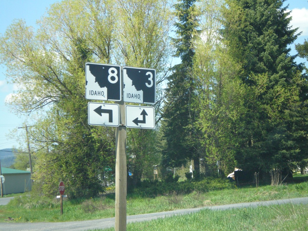
ID-8 West Approaching ID-3
ID-8 west approaching ID-3.
Taken 05-21-2009
Bovill
Latah County
Idaho
United States
Michigan Ave. at ID-7
Michigan Ave. south at ID-7. Use ID-7 east for US-12.
Taken 05-21-2009

 Orofino
Clearwater County
Idaho
United States
Orofino
Clearwater County
Idaho
United States
ID-7 in Orofino
ID-7 (Michigan Ave.) at Riverside Ave. Turn left to continue on ID-7
Taken 05-21-2009
Orofino
Clearwater County
Idaho
United States

End ID-11 at US-12
End ID-11 west at US-12.
Taken 05-21-2009
 Orofino
Clearwater County
Idaho
United States
Orofino
Clearwater County
Idaho
United States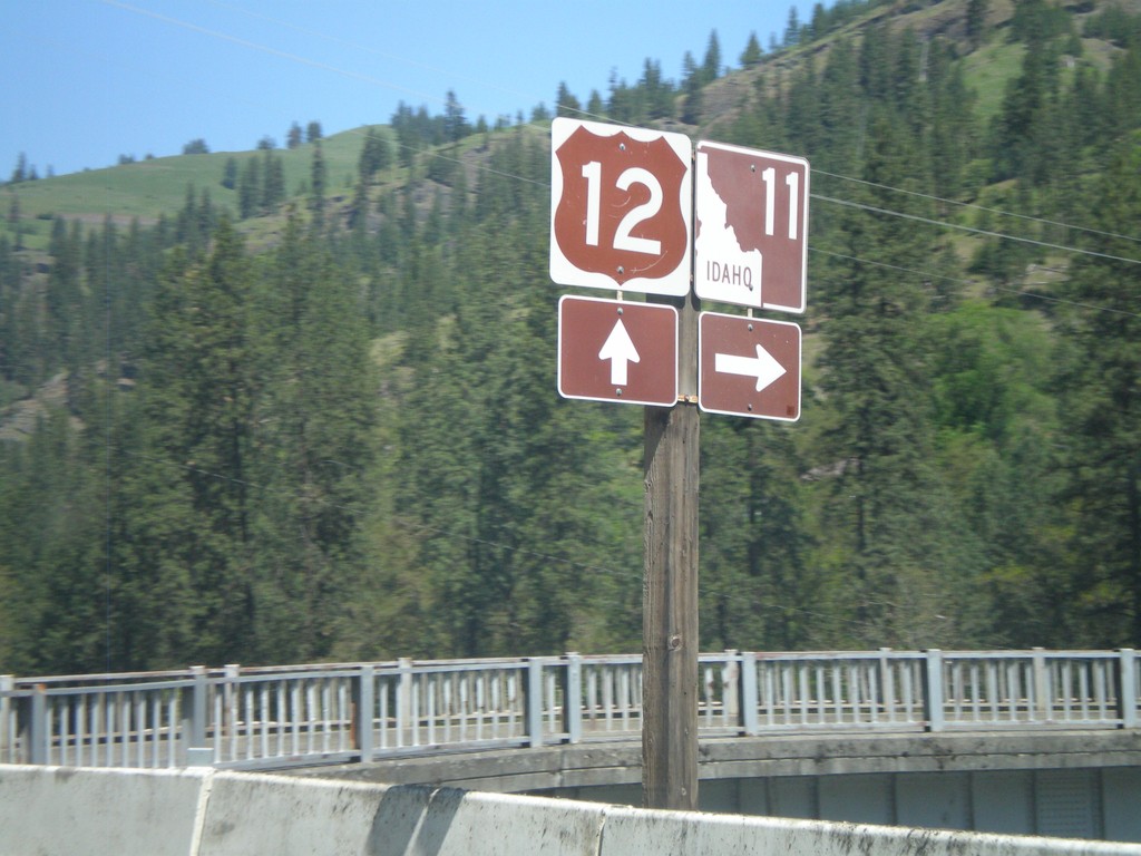
US-12 west at ID-11
US-12 west at ID-11
Taken 05-21-2009
Orofino
Clearwater County
Idaho
United States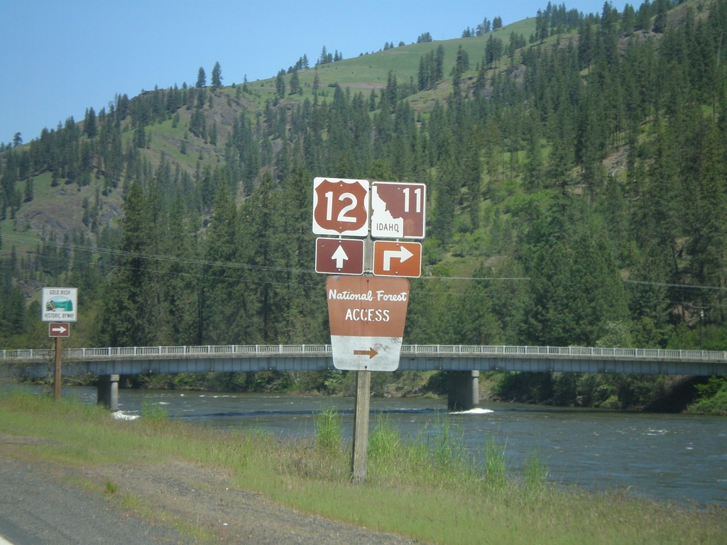
ID-11 Junction on US-12 West
US-12 west approaching ID-11
Taken 05-21-2009
Nezperce
Clearwater County
Idaho
United States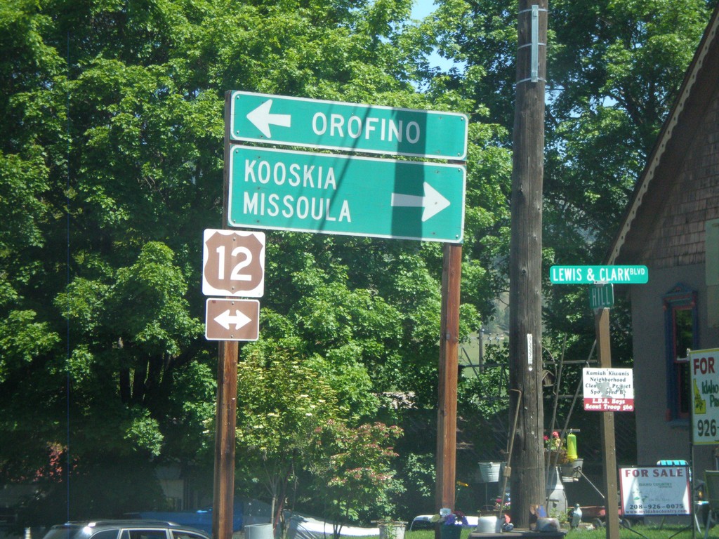
End ID-64/ID-162 at US-12
End ID-64/ID-162 at US-12. Use US-12 west for Orofino. Use US-12 east for Kooskia and Missoula (Montana).
Taken 05-21-2009

 Kamiah
Lewis County
Idaho
United States
Kamiah
Lewis County
Idaho
United States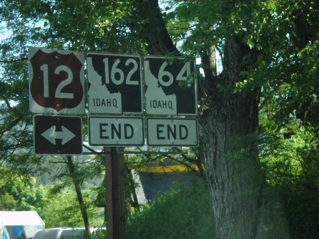
End ID-162 and ID-64 at US-12
End ID-162/ID-64 at US-12.
Taken 05-21-2009
Kamiah
Lewis County
Idaho
United States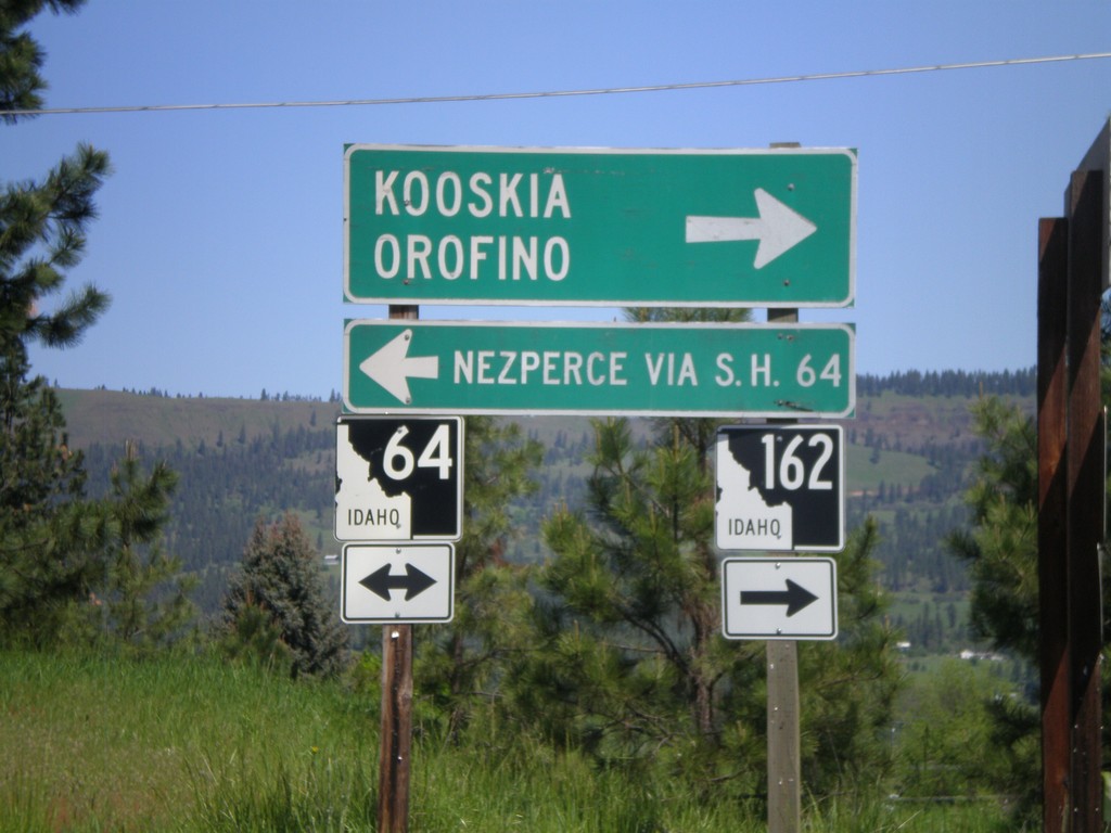
ID-162 South at ID-64
ID-162 south at ID-64. Use ID-64 west for Nezperce (via SH-64). Use ID-64/ID-162 east for Kooskia and Orofino.
Taken 05-21-2009
Kamiah
Lewis County
Idaho
United States