Signs Tagged With Shield
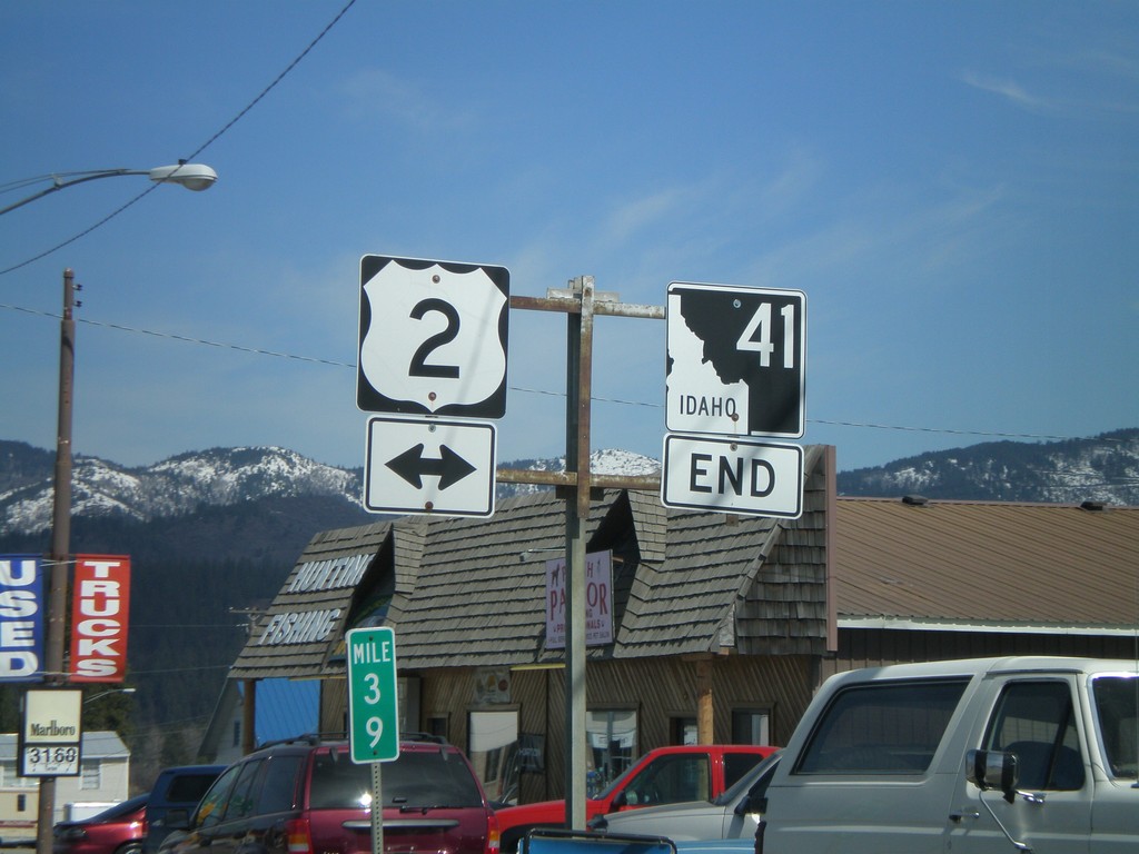
End ID-41 North at US-2
End ID-41 north at US-2. ID-41 through Oldtown is on the state line. The east side of the street is in Idaho; the west side in Washington.
Taken 04-13-2008

 Oldtown
Bonner County
Idaho
United States
Oldtown
Bonner County
Idaho
United States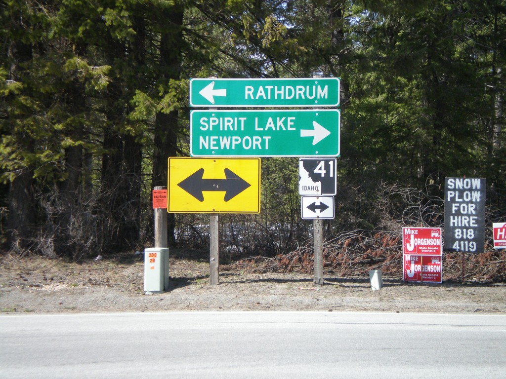
End ID-54 West at ID-41
End ID-54 west at ID-41. Use ID-41 north for Spirit Lake and Newport (WA). Use ID-41 south for Rathdrum.
Taken 04-13-2008
 Spirit Lake
Kootenai County
Idaho
United States
Spirit Lake
Kootenai County
Idaho
United States
ID-41 North at ID-54
ID-41 north at ID-54.
Taken 04-13-2008
Spirit Lake
Kootenai County
Idaho
United States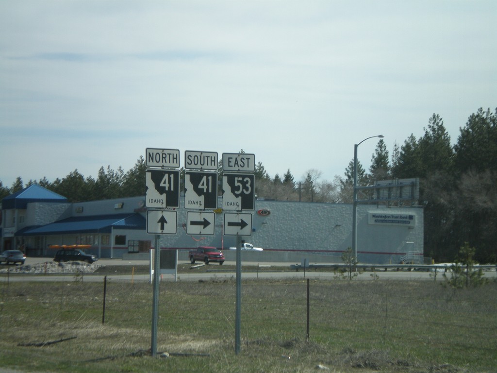
ID-53 East at ID-41
ID-53 east at ID-41 junction. ID-53 east traffic turns right here. ID-41 north traffic continue straight.
Taken 04-13-2008
 Rathdrum
Kootenai County
Idaho
United States
Rathdrum
Kootenai County
Idaho
United States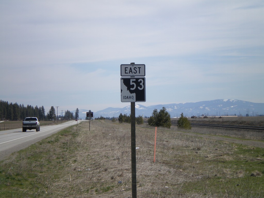
Begin ID-53 - Idaho/Washington Border
Begin ID-53 west at the Washington-Idaho border.
Taken 04-13-2008
Hauser
Kootenai County
Idaho
United States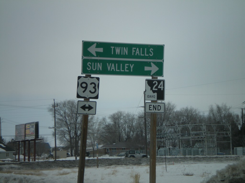
End ID-24 at US-93
End ID-24 West at US-93 Junction north to Sun Valley and south to Twin Falls.
Taken 02-17-2008

 Shoshone
Lincoln County
Idaho
United States
Shoshone
Lincoln County
Idaho
United States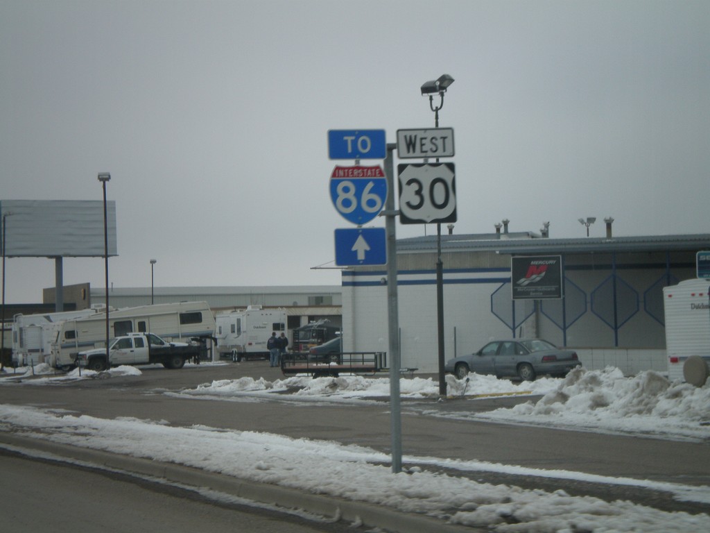
US-30 West/To I-86
US-30 West/To I-86 on Garrett Way.
Taken 02-17-2008

 Pocatello
Bannock County
Idaho
United States
Pocatello
Bannock County
Idaho
United States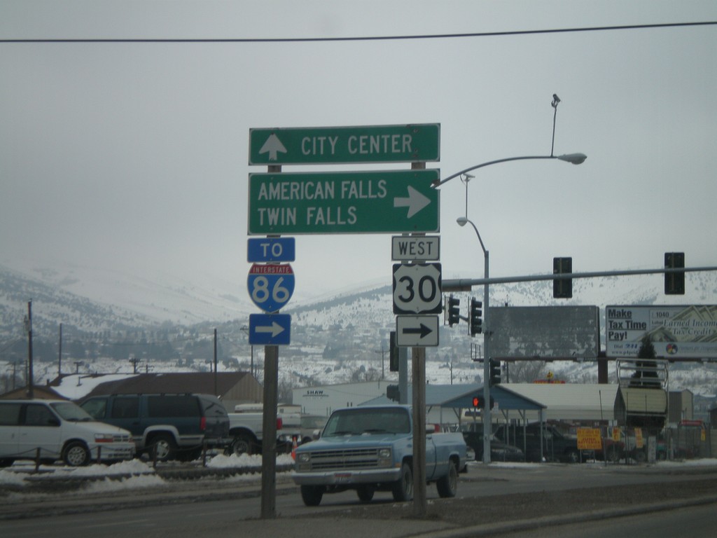
US-30 West - Oak St./Garrett Way Jct.
US-30 west (Oak St.) at Garrett Way to American Falls and Twin Falls.
Taken 02-17-2008
Pocatello
Bannock County
Idaho
United States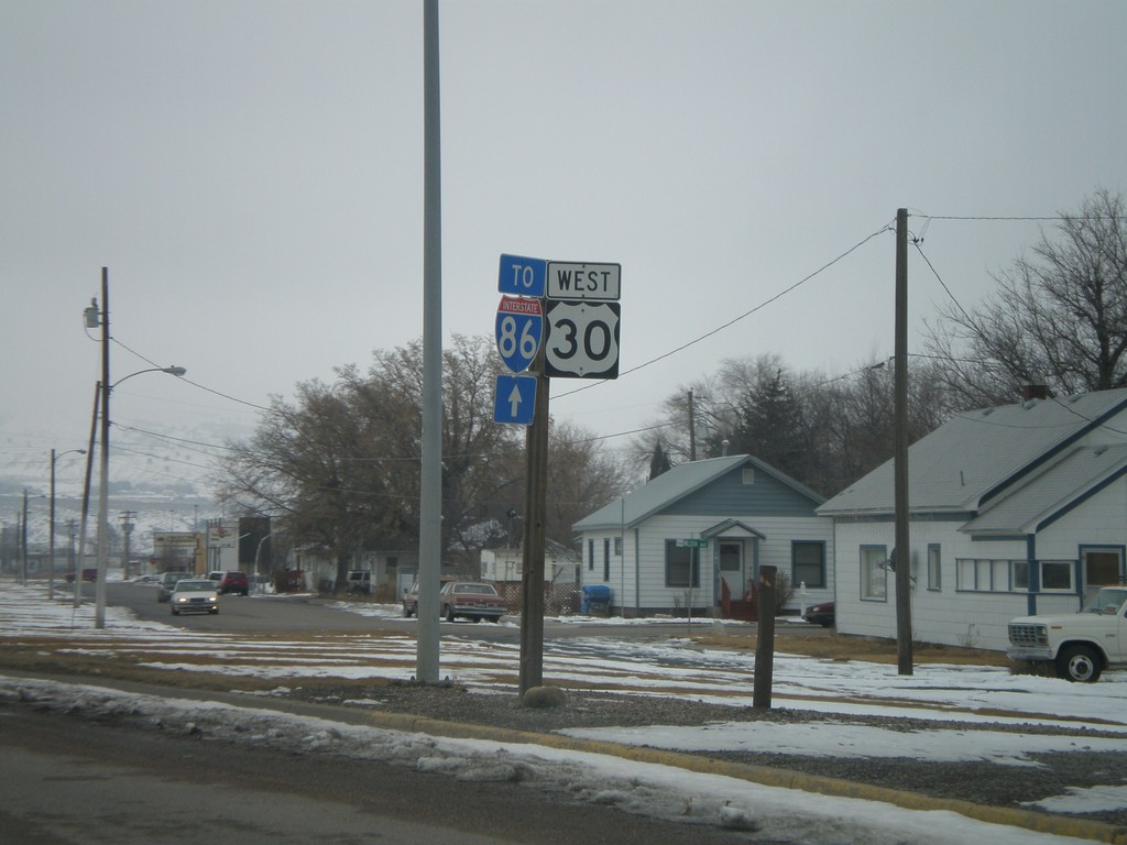
US-30 West To I-86 - Oak St.
US-30 West/To I-86 on Oak St. West.
Taken 02-17-2008
Pocatello
Bannock County
Idaho
United States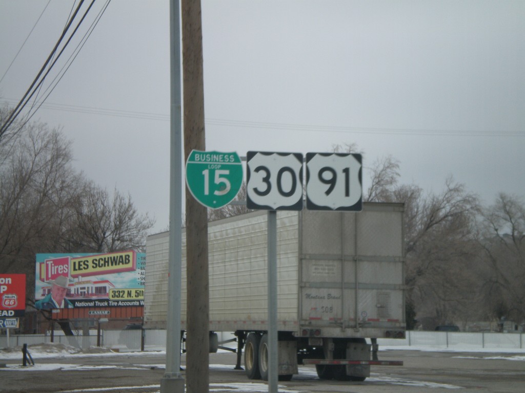
BL-15/US-30/US-91 Shields - Pocatello
BL-15/US-30/US-91 shields on S. 5th Ave. north.
Taken 02-17-2008

 Pocatello
Bannock County
Idaho
United States
Pocatello
Bannock County
Idaho
United States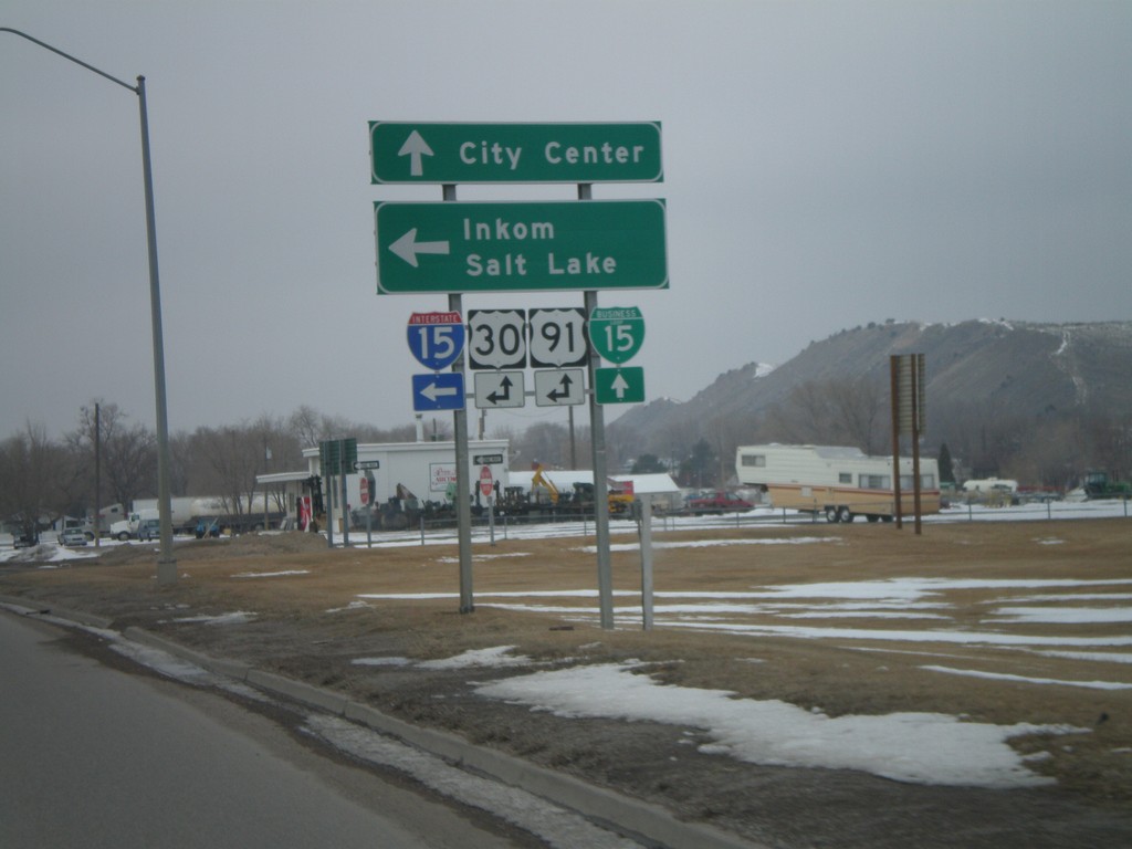
US-91/US-30/BL-15 North at I-15 South
US-91/US-30/BL-15 north at I-15/US-30/US-91 south to Inkom and Salt Lake. US-91 joins I-15 south to Virginia. US-30 joins I-15 south to McCammon.
Taken 02-17-2008
 Pocatello
Bannock County
Idaho
United States
Pocatello
Bannock County
Idaho
United States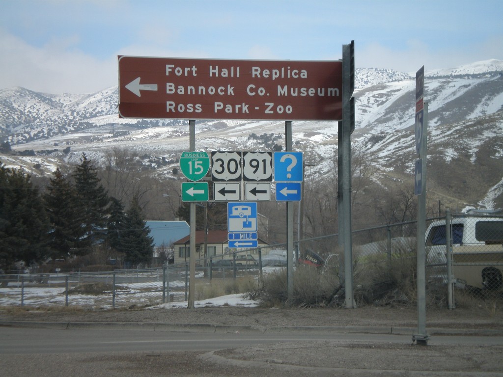
I-15 North at US-91/US-30/BL-15
I-15 offramp at US-91/US-30/BL-15. US-91 and US-30 leave I-15 here. Turn left for Fort Hall Replica, Bannock County Museum, and Ross Park - Zoo.
Taken 02-17-2008
Pocatello
Bannock County
Idaho
United States
US-91 North at I-15 Ramp
US-91 north at I-15 onramp. Merge right for I-15 north - continue straight for I-15 south.
Taken 02-17-2008
Downey
Bannock County
Idaho
United States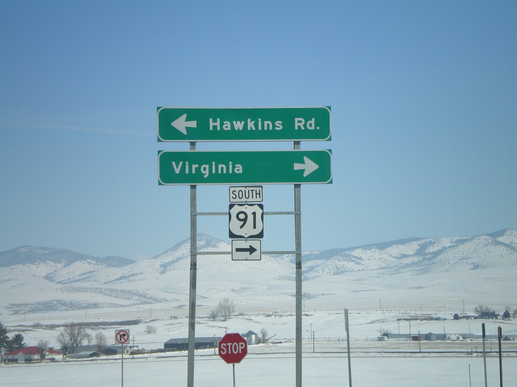
I-15 North Offramp at US-91
I-15 north offramp at US-91 to Virginia. Turn left for Hawkins Road. US-91 joins I-15 north here to Pocatello.
Taken 02-17-2008
Virginia
Bannock County
Idaho
United States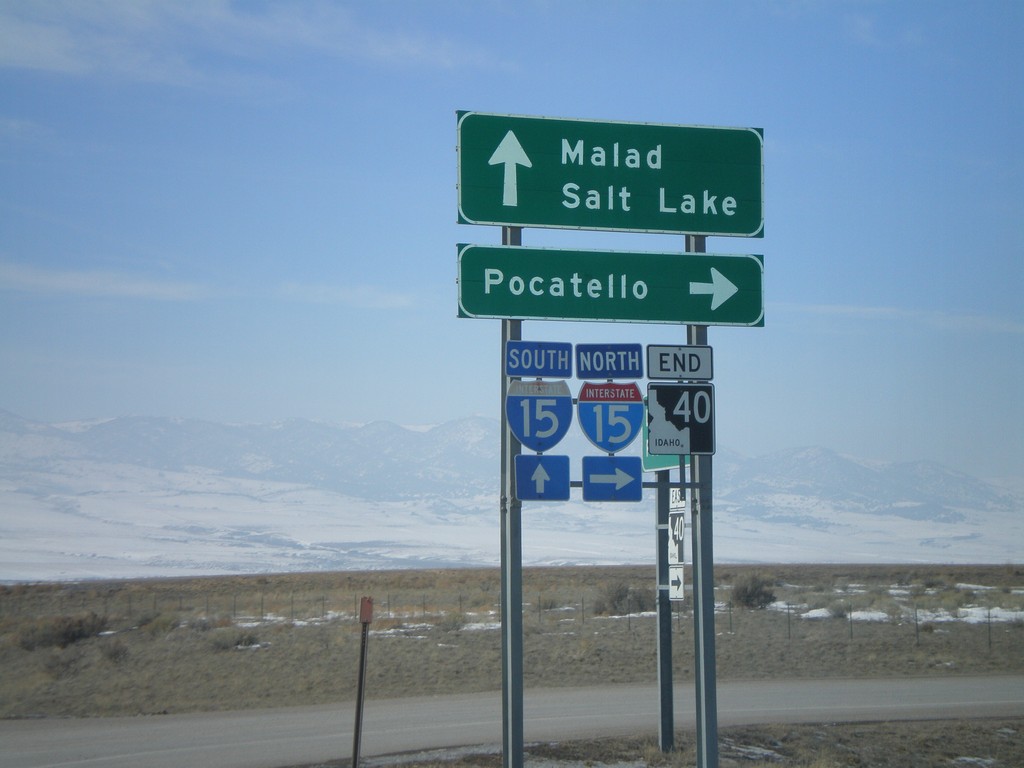
End ID-40 West at I-15
End ID-40 west at I-15 - north to Pocatello, south to Malad and Salt Lake.
Taken 02-17-2008
 Downey
Bannock County
Idaho
United States
Downey
Bannock County
Idaho
United States
Jct. I-15 on ID-40 West
ID-40 west approaching I-15.
Taken 02-17-2008
Downey
Bannock County
Idaho
United States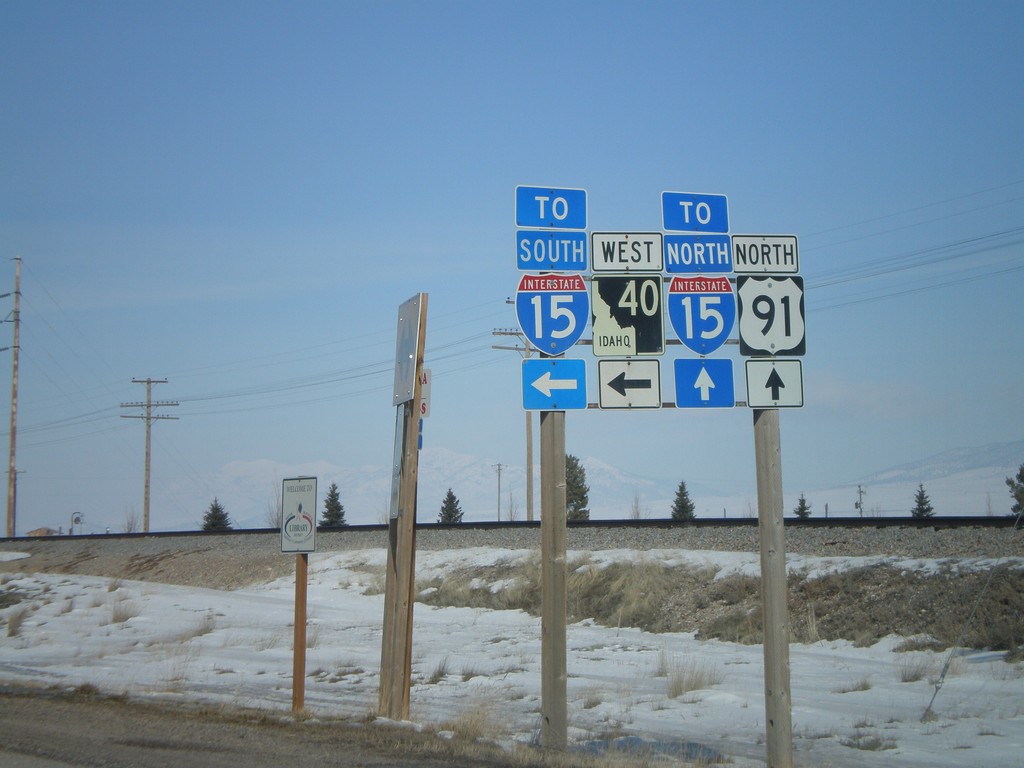
US-91 North at ID-40 West
US-91 north at ID-40 west. Use ID-40 west for I-15 south. Use US-91 north for I-15 north.
Taken 02-17-2008
Downey
Bannock County
Idaho
United States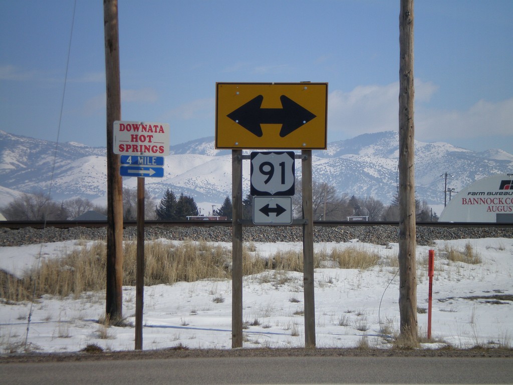
End ID-40 East at US-91
End ID-40 east at US-91.
Taken 02-17-2008
Downey
Bannock County
Idaho
United States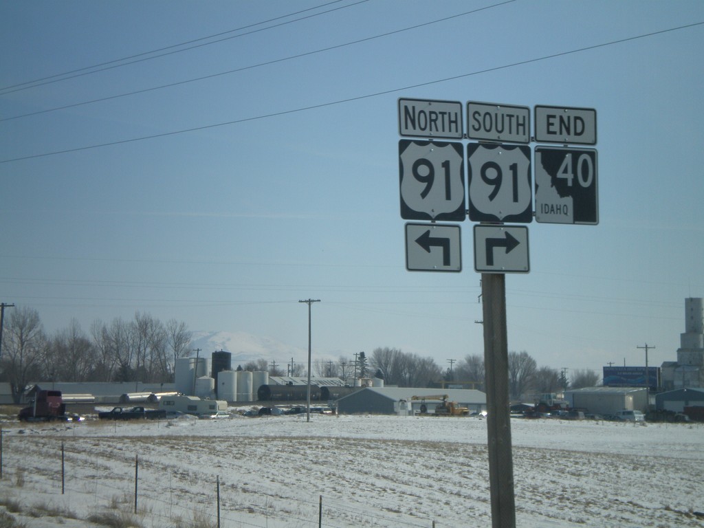
End ID-40 at US-91
End ID-40 east at US-91.
Taken 02-17-2008
Downey
Bannock County
Idaho
United States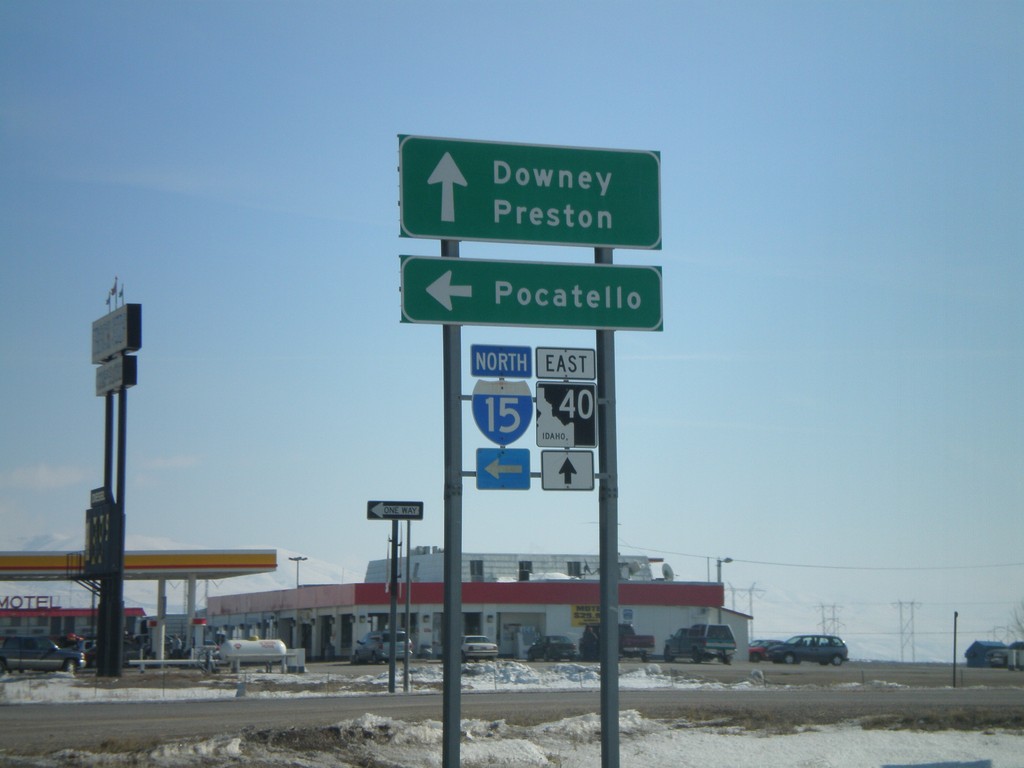
ID-40 East at I-15 North
ID-40 east to Downey and Preston at I-15 north to Pocatello.
Taken 02-17-2008
Downey
Bannock County
Idaho
United States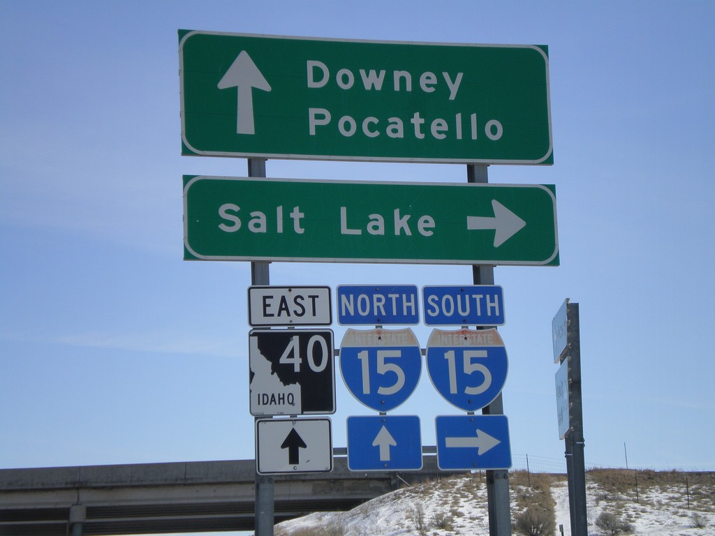
Begin ID-40 East at I-15
Begin ID-40 east at I-15 south to Salt Lake.
Taken 02-17-2008
Downey
Bannock County
Idaho
United States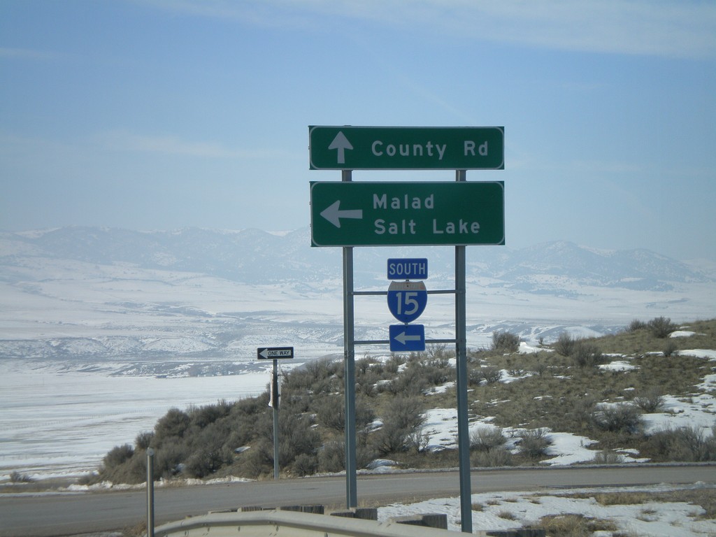
End ID-40 West at I-15 South
End ID-40 west at I-15 south to Malad and Salt Lake.
Taken 02-17-2008
Downey
Bannock County
Idaho
United States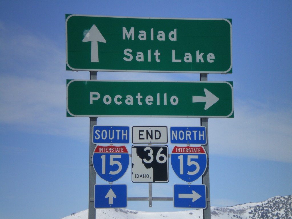
End ID-36 West at I-15
End ID-36 west at I-15 north to Pocatello, and south to Malad and Salt Lake.
Taken 02-17-2008
 Malad City
Oneida County
Idaho
United States
Malad City
Oneida County
Idaho
United States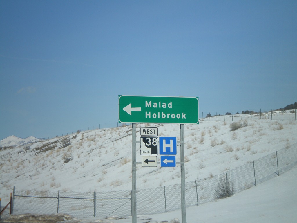
I-15 North Offramp at ID-38
I-15 north Exit 13 at ID-38 to Malad and Holbrook.
Taken 02-17-2008
 Malad City
Oneida County
Idaho
United States
Malad City
Oneida County
Idaho
United States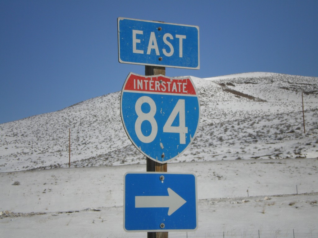
UT-83 North at I-84 East
End UT-83 north at I-84.
Taken 02-17-2008

 Howell
Box Elder County
Utah
United States
Howell
Box Elder County
Utah
United States