Signs Tagged With Shield
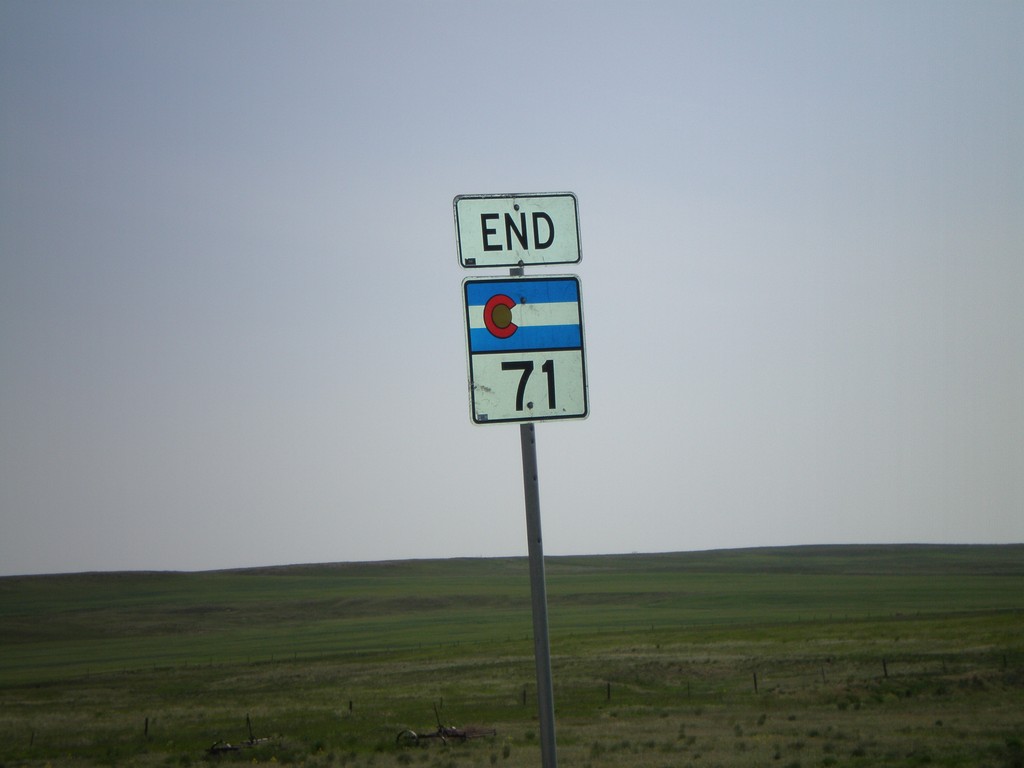
End CO-71 North - CO/NE Line
End CO-71 north at the Nebraska-Colorado Border.
Taken 05-27-2007
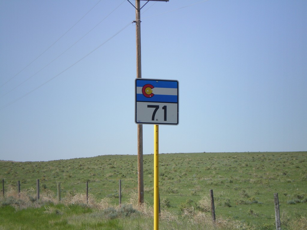
 Raymer
Weld County
Colorado
United States
Raymer
Weld County
Colorado
United States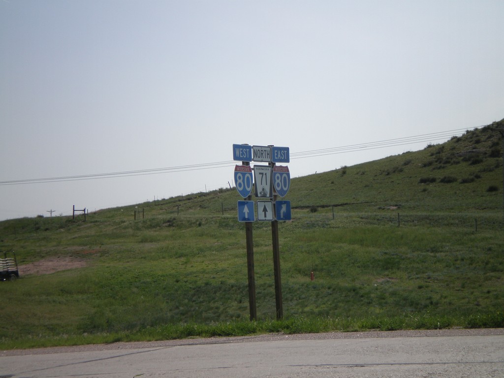
NE-71 North at I-80
NE-71 north at I-80.
Taken 05-27-2007

 Kimball
 County
Nebraska
United States
Kimball
Kimball County
Nebraska
United States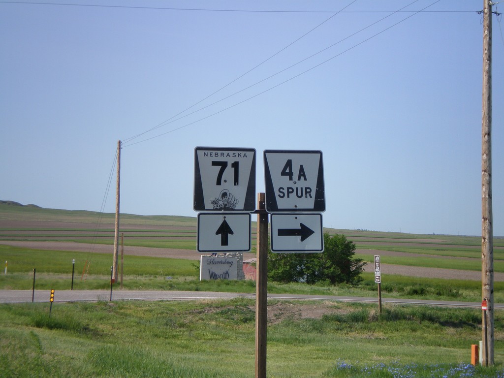
NE-71 South at NE-4A Spur
NE-71 south at NE-4ASpur west to Harrisburg.
Taken 05-27-2007
 Harrisburg
Banner County
Nebraska
United States
Harrisburg
Banner County
Nebraska
United States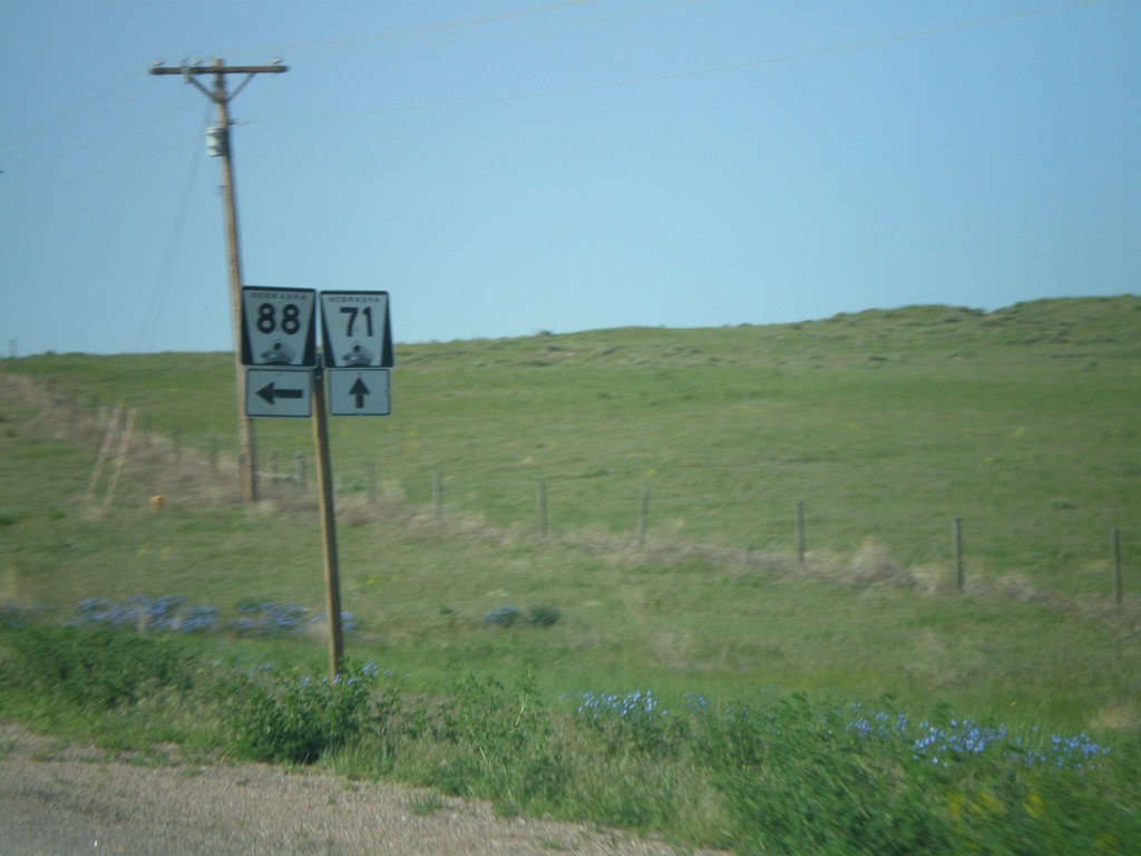
NE-71 South/NE-88 East Split
NE-71 South/NE-88 East at NE-88.
Taken 05-27-2007
 Harrisburg
Banner County
Nebraska
United States
Harrisburg
Banner County
Nebraska
United States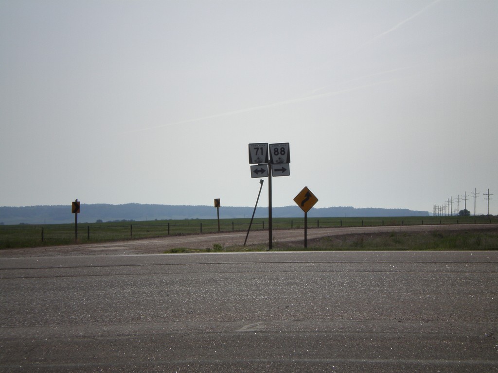
NE-88 East at NE-71
NE-88 east at NE-71.
Taken 05-27-2007
Harrisburg
Banner County
Nebraska
United States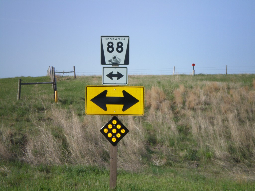
CR-213 South at NE-88
End CR-213 south at NE-88.
Taken 05-27-2007
Lyman
Banner County
Nebraska
United States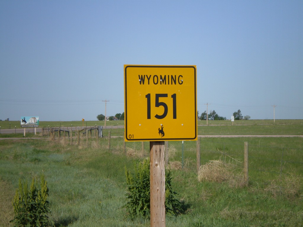
Begin WY-151 West at the Wyoming Stateline
Begin WY-151 west at the Wyoming-Nebraska border.
Taken 05-27-2007
 La Grange
Goshen County
Wyoming
United States
La Grange
Goshen County
Wyoming
United States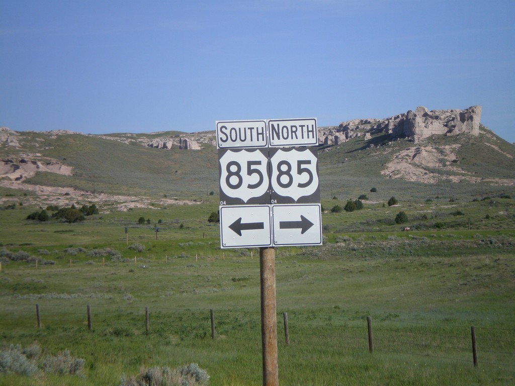
End WY-151 at US-85
End WY-151 west at US-85.
Taken 05-27-2007
La Grange
Goshen County
Wyoming
United States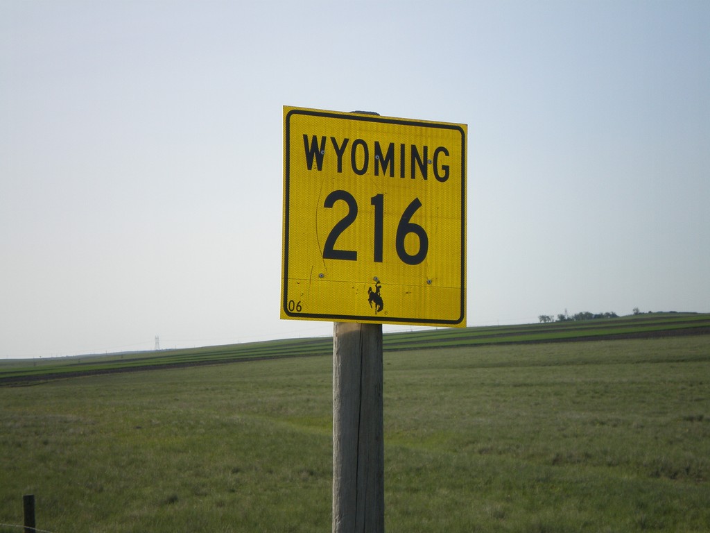
WY-216 East - Laramie County
WY-216 east, just east of US-85.
Taken 05-27-2007
 Cheyenne
Laramie County
Wyoming
United States
Cheyenne
Laramie County
Wyoming
United States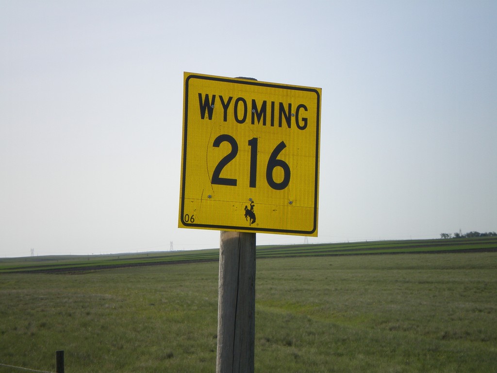
WY-216 East - Laramie County
WY-216 east, just east of US-85.
Taken 05-27-2007
Cheyenne
Laramie County
Wyoming
United States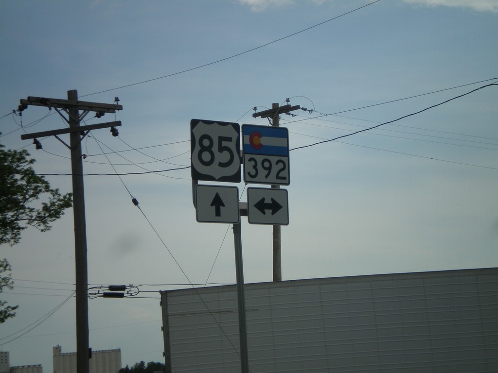
US-85 South at CO-392
US-85 south at CO-392.
Taken 05-26-2007

 Greeley
Weld County
Colorado
United States
Greeley
Weld County
Colorado
United States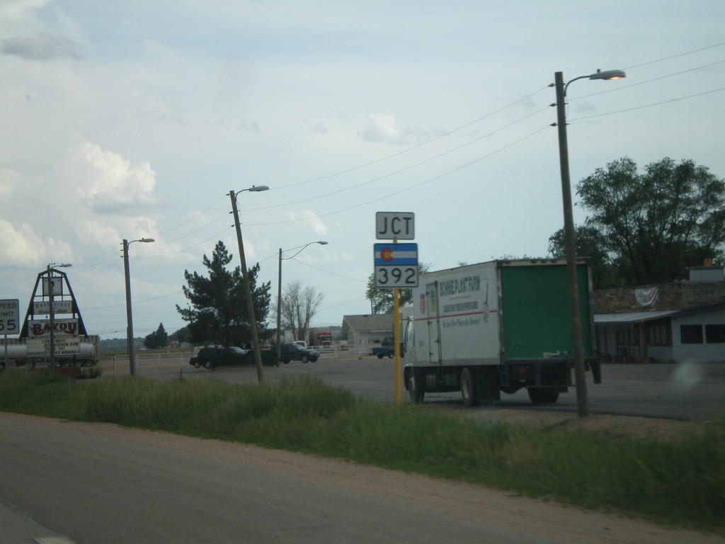
US-85 South Approaching CO-392
US-85 south approaching CO-392.
Taken 05-26-2007
Lucerne
Weld County
Colorado
United States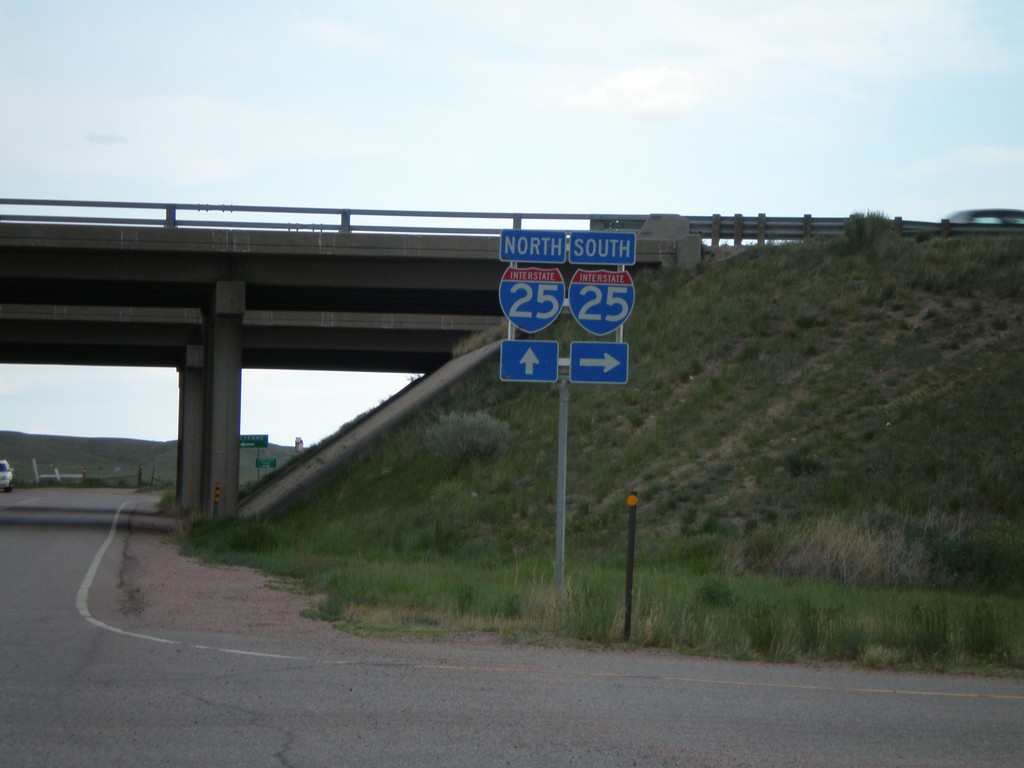
Buckeye Road at I-25
Buckeye Road east at I-25 freeway entrance.
Taken 05-26-2007

 Carr
Larimer County
Colorado
United States
Carr
Larimer County
Colorado
United States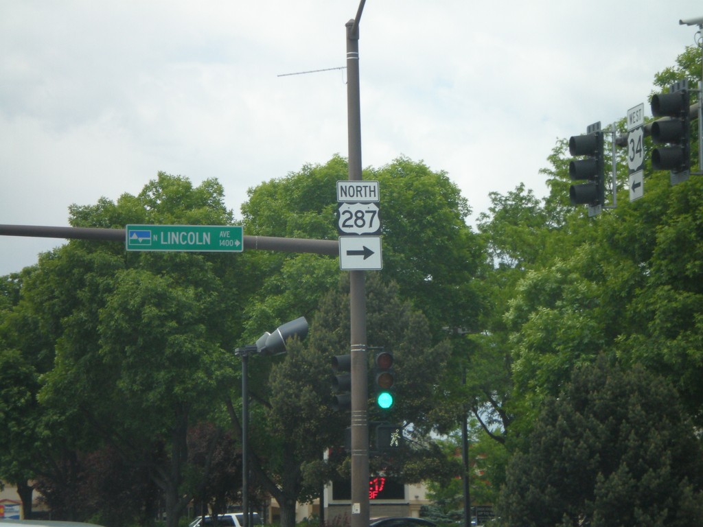
US-34 West at US-287 North - Loveland
US-34 west at US-287 north.
Taken 05-26-2007

 Loveland
Larimer County
Colorado
United States
Loveland
Larimer County
Colorado
United States
US-34 West Approaching US-287
US-34 east approaching US-287.
Taken 05-26-2007
Loveland
Larimer County
Colorado
United States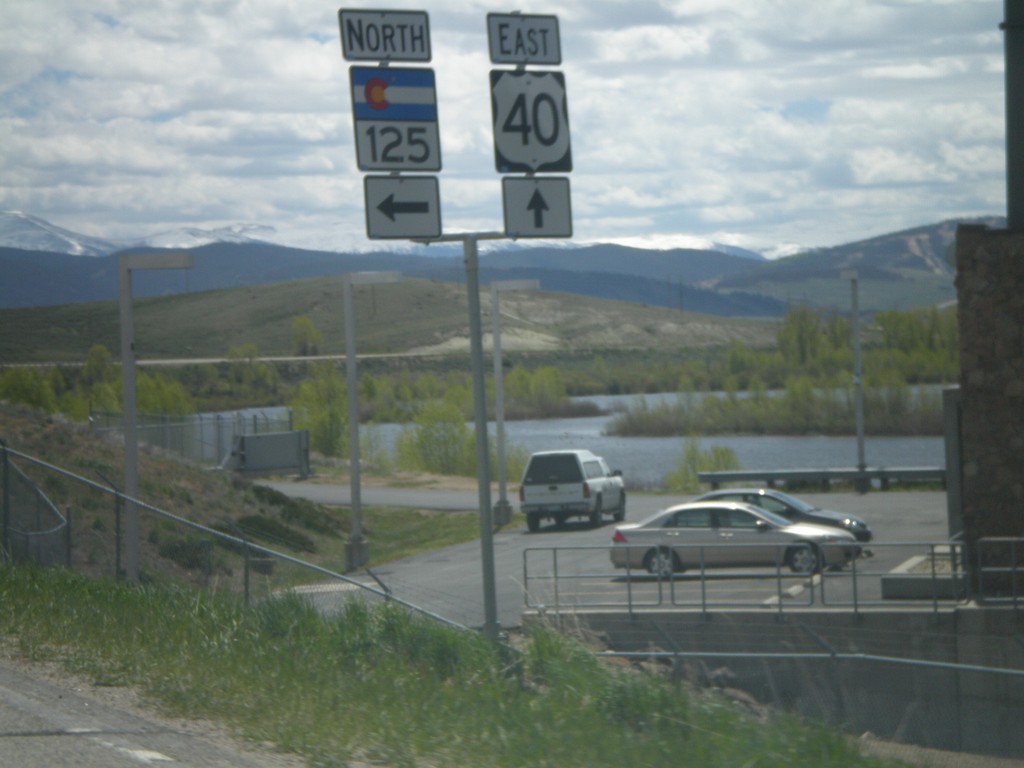
US-40 East at CO-125 North
US-40 east at CO-125 north.
Taken 05-25-2007

 Granby
Grand County
Colorado
United States
Granby
Grand County
Colorado
United States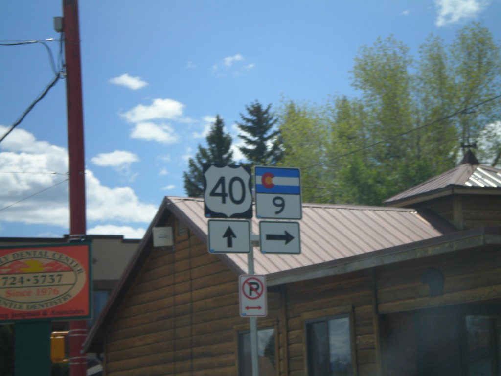
US-40 East at CO-9 South
US-40 east at CO-9 south.
Taken 05-25-2007
 Kremmling
Grand County
Colorado
United States
Kremmling
Grand County
Colorado
United States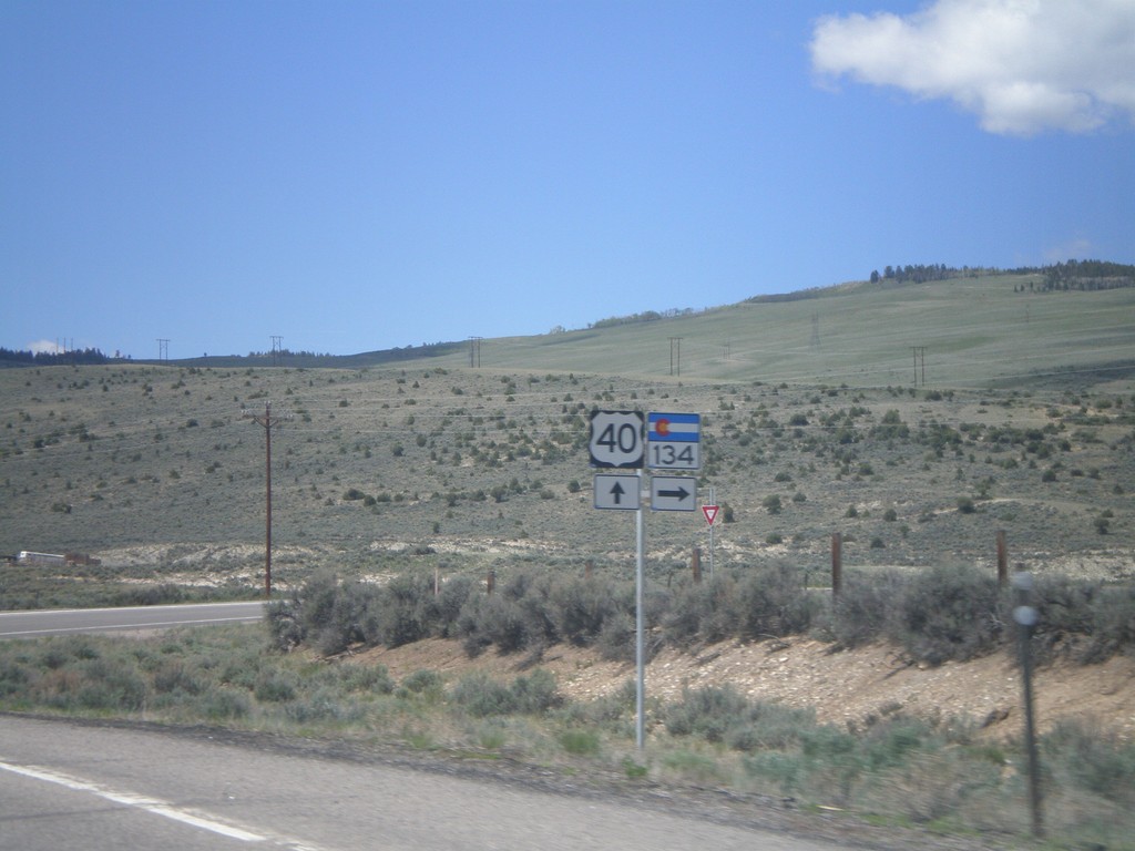
US-40 East at CO-134
US-40 east at CO-134.
Taken 05-25-2007
 Kremmling
Grand County
Colorado
United States
Kremmling
Grand County
Colorado
United States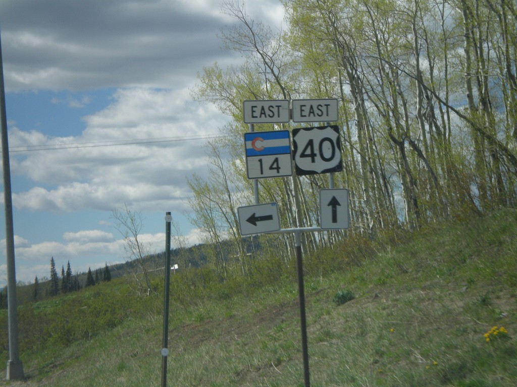
US-40 East at CO-14 East
US-40 east at CO-14 east on Muddy Pass.
Taken 05-25-2007
 Kremmling
Jackson County
Colorado
United States
Kremmling
Jackson County
Colorado
United States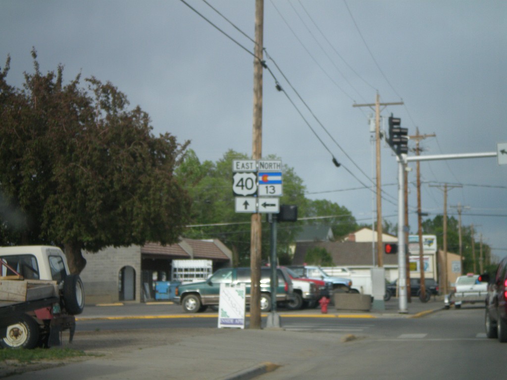
US-40 East/CO-13 North at CO-13 Split
US-40 east at CO-13 north.
Taken 05-24-2007
 Craig
Moffat County
Colorado
United States
Craig
Moffat County
Colorado
United States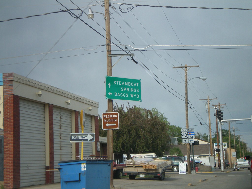
US-40 East at CO-13 North
US-40 east to Steamboat Springs at CO-13 north to Baggs, Wyo.
Taken 05-24-2007
Craig
Moffat County
Colorado
United States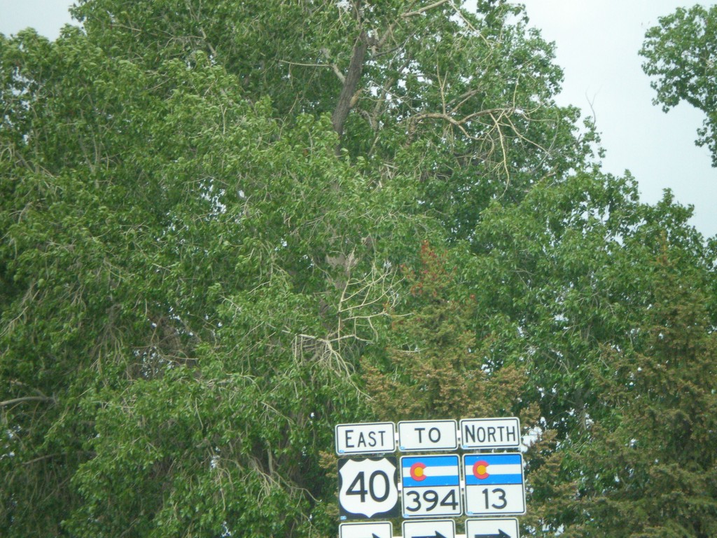
US-40 East/CO-13 North/To CO-394 - Craig
US-40 East/To CO-394/CO-13 north on the one-way couplet in Craig.
Taken 05-24-2007
 Craig
Moffat County
Colorado
United States
Craig
Moffat County
Colorado
United States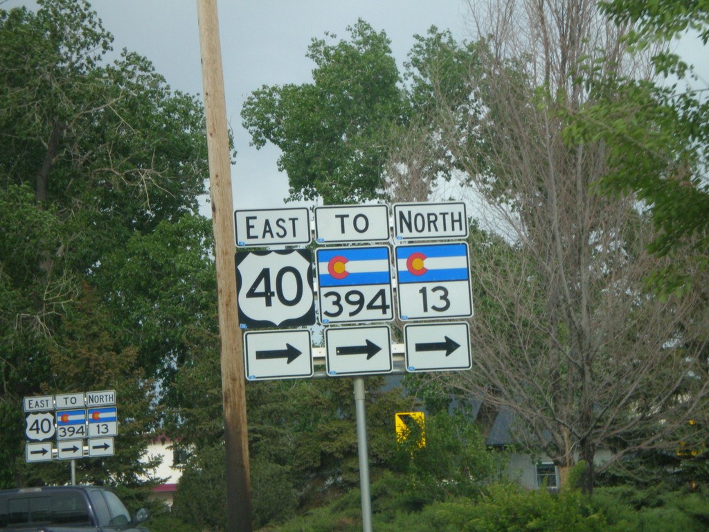
US-40 East/CO-13 North/To CO-394
US-40 East/To CO-394/CO-13 north on the one-way couplet in Craig.
Taken 05-24-2007
Craig
Moffat County
Colorado
United States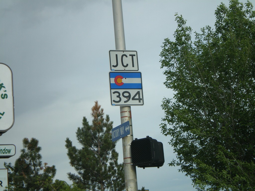
US-40 East at CO-394
US-40 east at CO-394 south.
Taken 05-24-2007
Craig
Moffat County
Colorado
United States