Signs Tagged With Shield
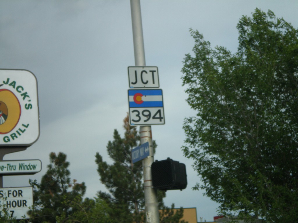
US-40 East at CO-394 South
US-40 east at CO-394 south.
Taken 05-24-2007

 Craig
Moffat County
Colorado
United States
Craig
Moffat County
Colorado
United States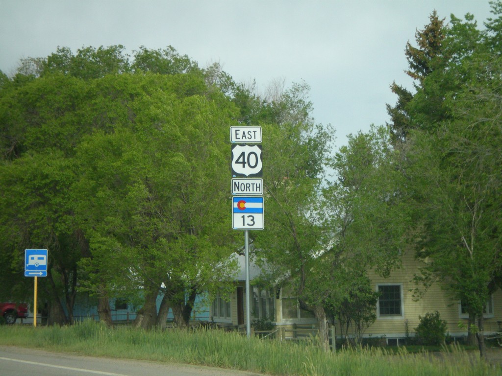
US-40 East/CO-13 North - Craig
US-40 East/CO-13 north.
Taken 05-24-2007
 Craig
Moffat County
Colorado
United States
Craig
Moffat County
Colorado
United States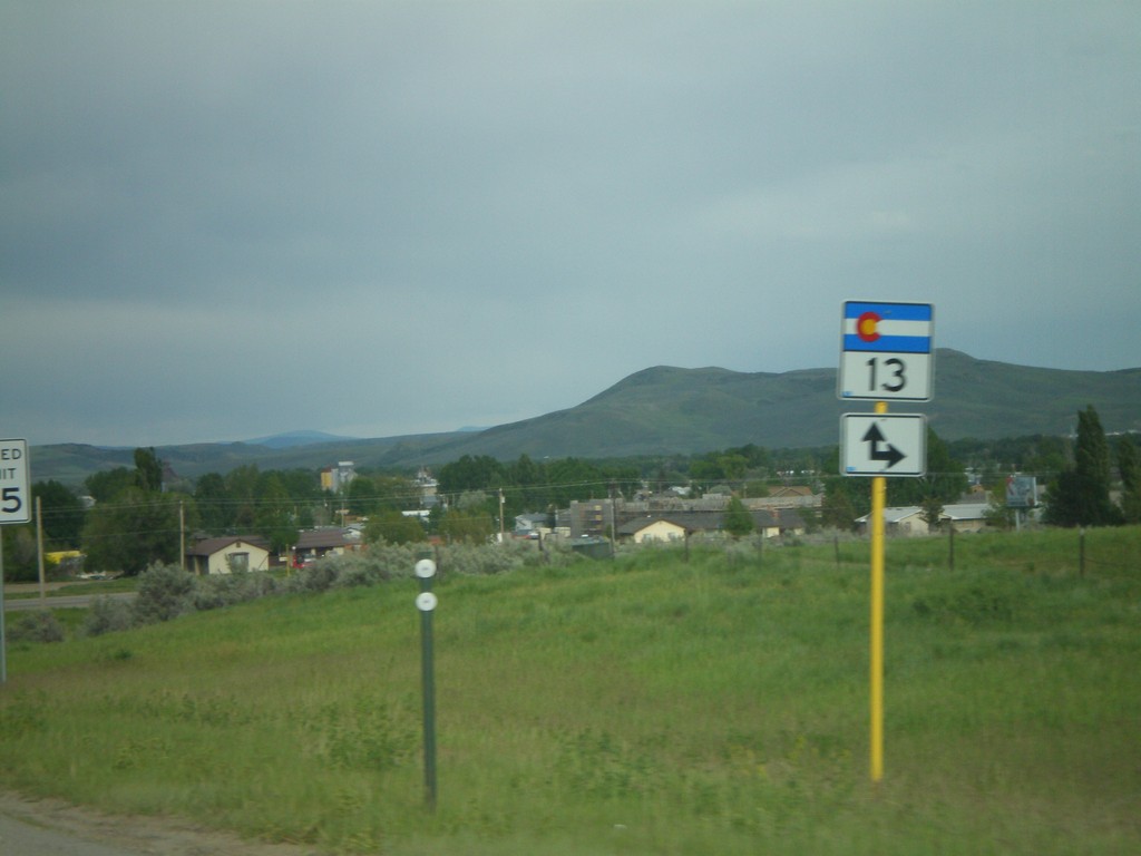
US-40 East at CO-13 South Jct.
US-40 east approaching CO-13 south.
Taken 05-24-2007
Craig
Moffat County
Colorado
United States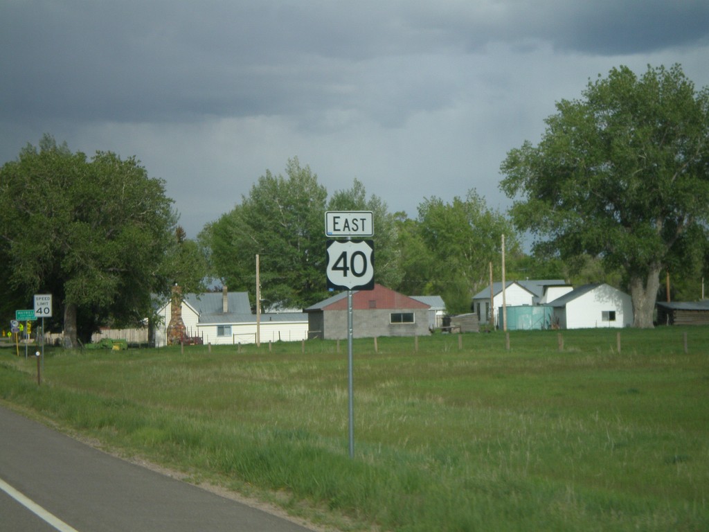
US-40 East at CO-138 West
US-40 east at CO-138 west.
Taken 05-24-2007
 Craig
Moffat County
Colorado
United States
Craig
Moffat County
Colorado
United States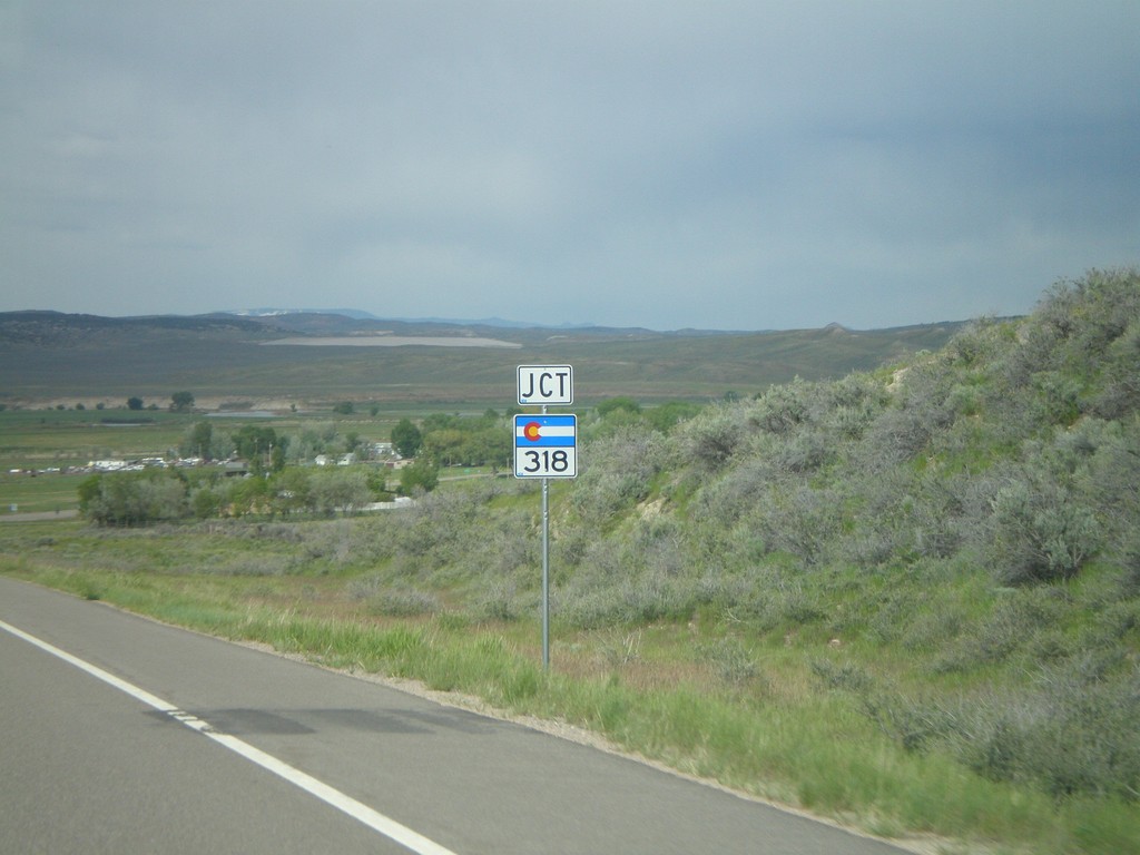
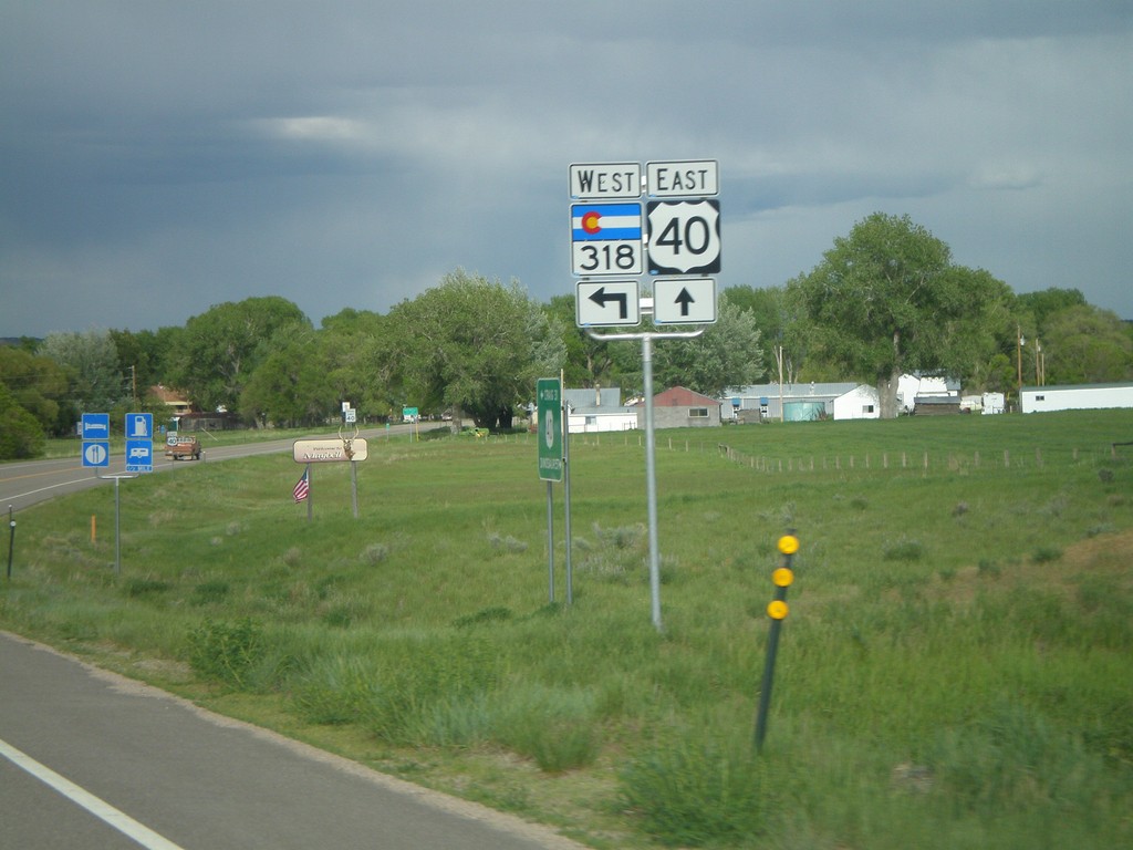
US-40 East Approaching CO-318
US-40 east approaching CO-318 west.
Taken 05-24-2007
Craig
Moffat County
Colorado
United States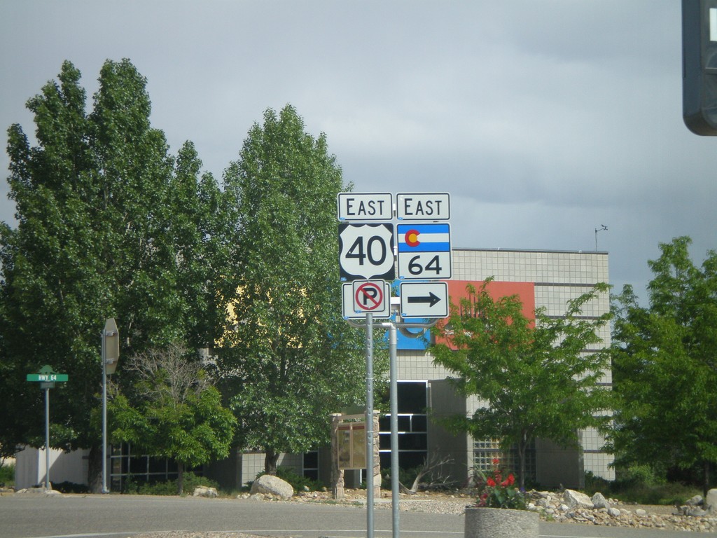
US-40 East at CO-64 East
US-40 east at CO-64 east.
Taken 05-24-2007
 Dinosaur
Moffat County
Colorado
United States
Dinosaur
Moffat County
Colorado
United States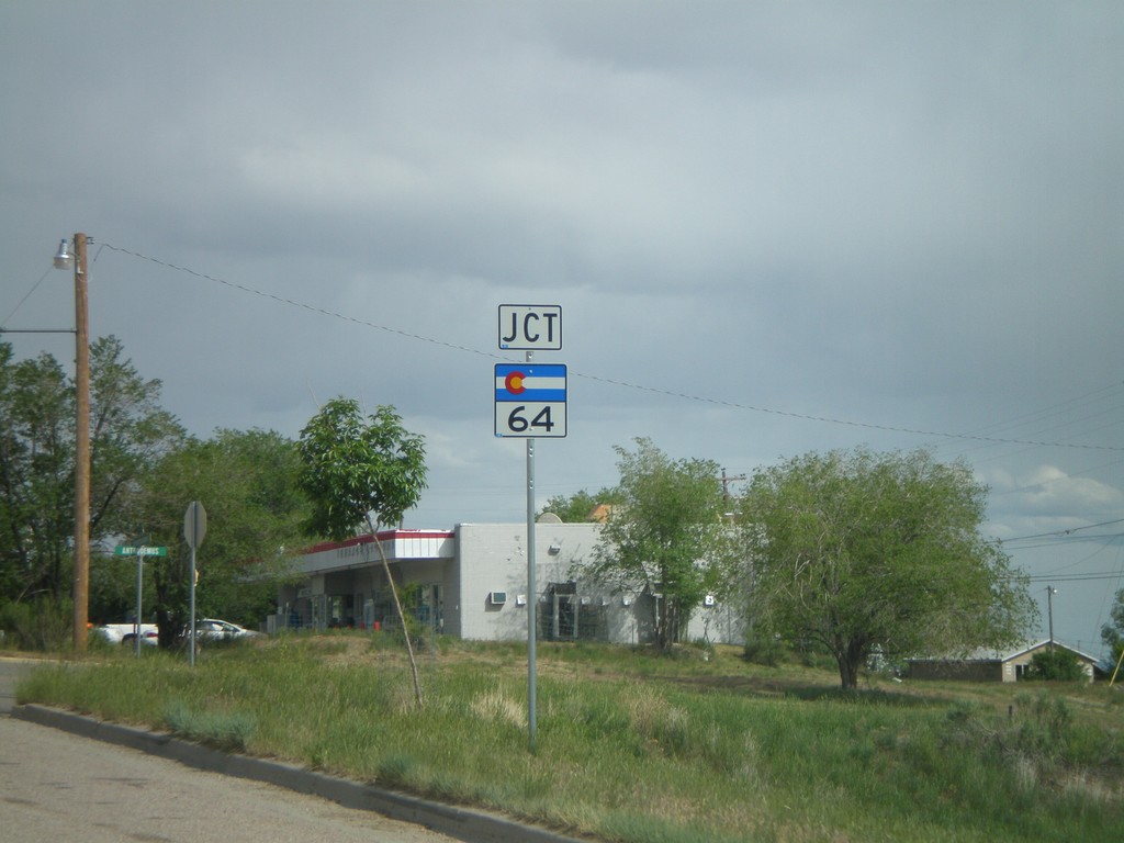
US-40 East Approaching CO-64
US-40 east approaching CO-64.
Taken 05-24-2007
Dinosaur
Moffat County
Colorado
United States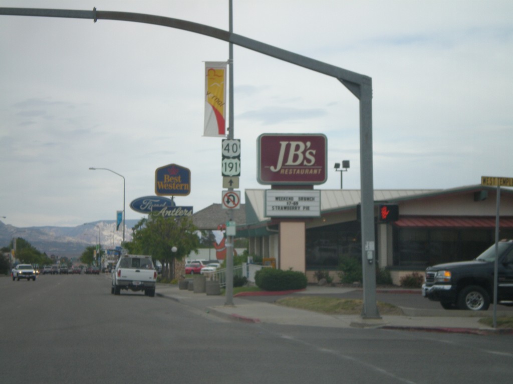
US-40 East/US-191 North - Vernal
US-40 East/US-191 North in Vernal.
Taken 05-24-2007
 Vernal
Uintah County
Utah
United States
Vernal
Uintah County
Utah
United States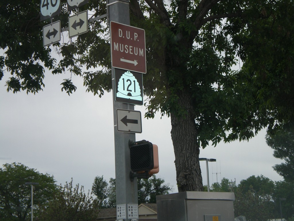
US-40 East at UT-121 West
US-40 east at UT-121 west.
Taken 05-24-2007
Vernal
Uintah County
Utah
United States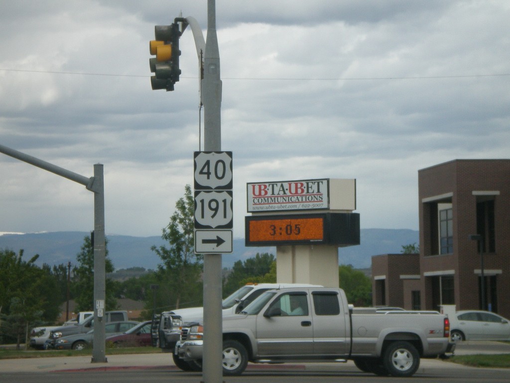
US-40 East/US-191 North - Roosevelt
US-40/US-191 at UT-121.
Taken 05-24-2007
Roosevelt
Duchesne County
Utah
United States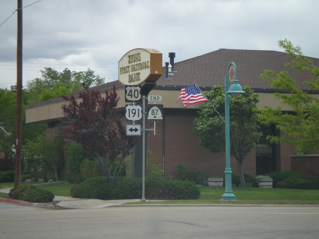
End UT-87 South At US-40/US-191
End UT-87 south at US-40/US-191.
Taken 05-24-2007
 Duchesne
 County
Utah
United States
Duchesne
Duchesne County
Utah
United States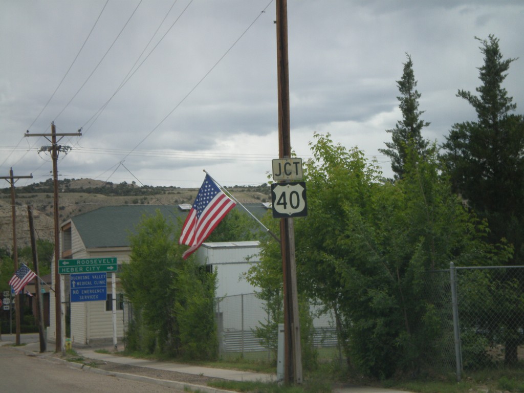
UT-87 South Approaching US-40/US-191
UT-87 south approaching US-40.
Taken 05-24-2007
Duchesne
Duchesne County
Utah
United States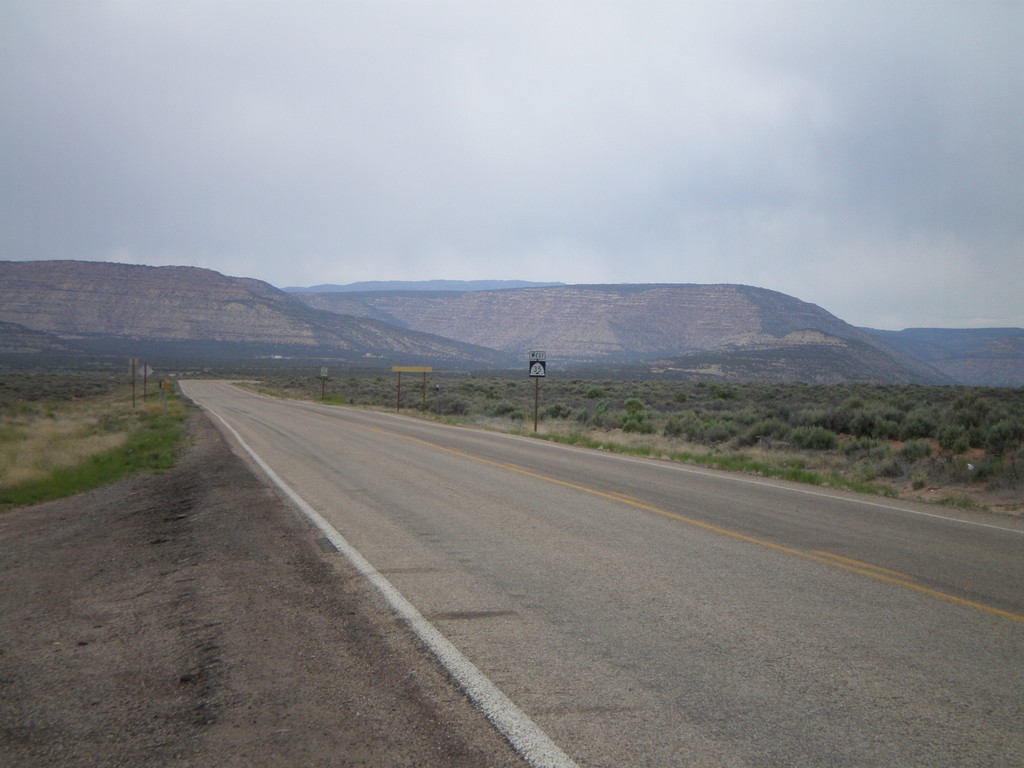
Begin UT-35 West
Begin UT-35 west at UT-87.
Taken 05-24-2007
 Duchesne
 County
Utah
United States
Duchesne
Duchesne County
Utah
United States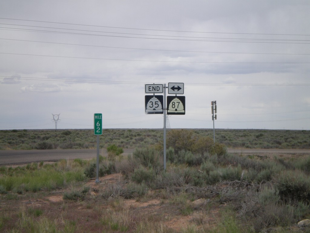
End UT-35 at UT-87
End UT-35 east at UT-87.
Taken 05-24-2007
Duchesne
Duchesne County
Utah
United States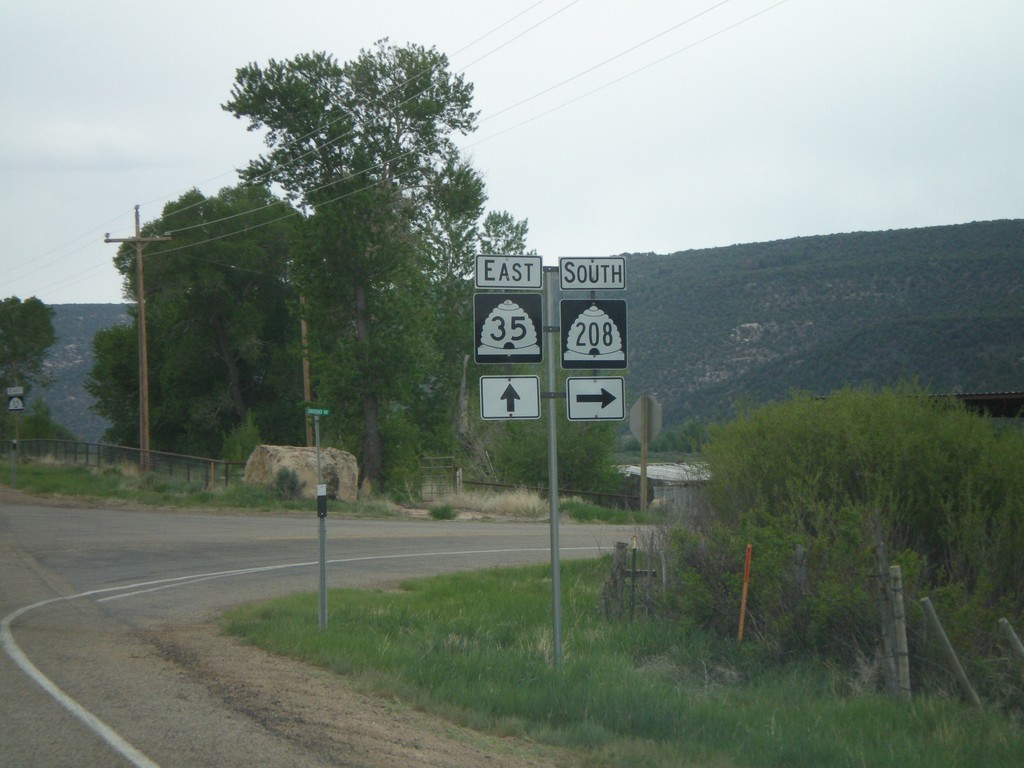
UT-35 East at UT-208 South
UT-35 east approaching UT-208 south.
Taken 05-24-2007
 Tabiona
Duchesne County
Utah
United States
Tabiona
Duchesne County
Utah
United States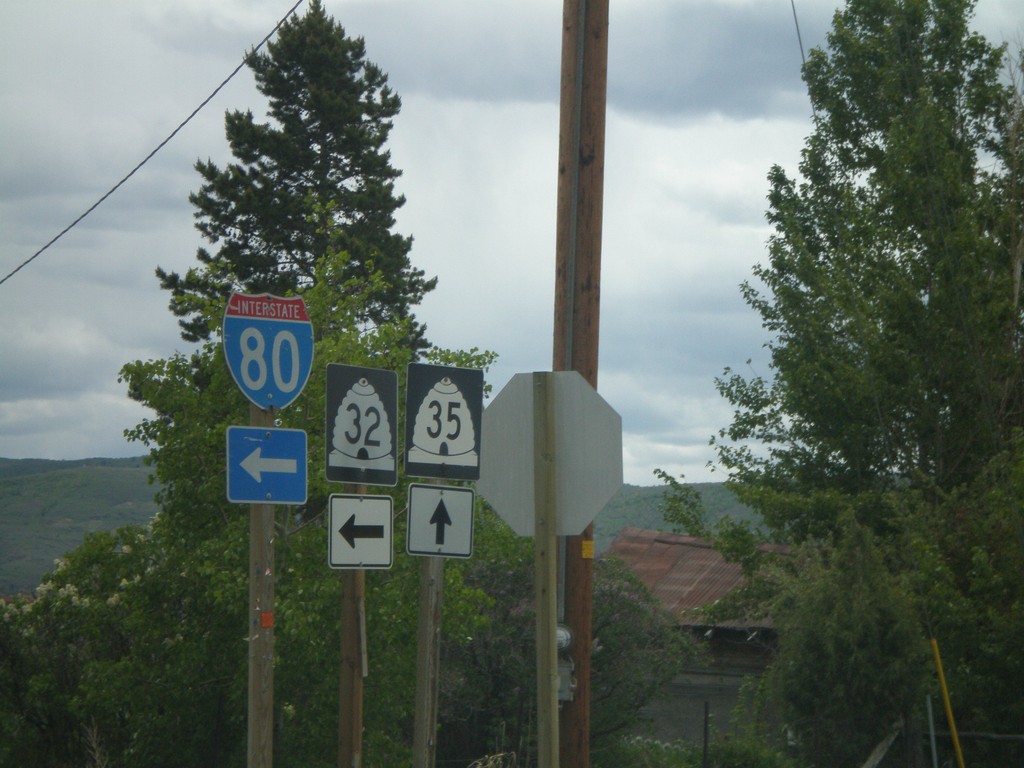
UT-32 East at UT-35 East
UT-32 east at UT-35 east in Francis. Turn left to continue east on UT-32 to I-80.
Taken 05-24-2007

 Francis
Summit County
Utah
United States
Francis
Summit County
Utah
United States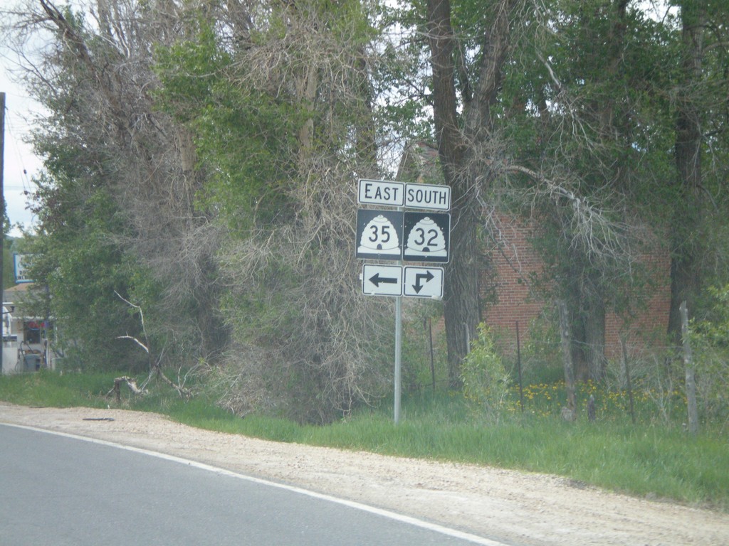
UT-32 East at UT-35 East
UT-32 south at UT-35 east.
Taken 05-24-2007
Francis
Summit County
Utah
United States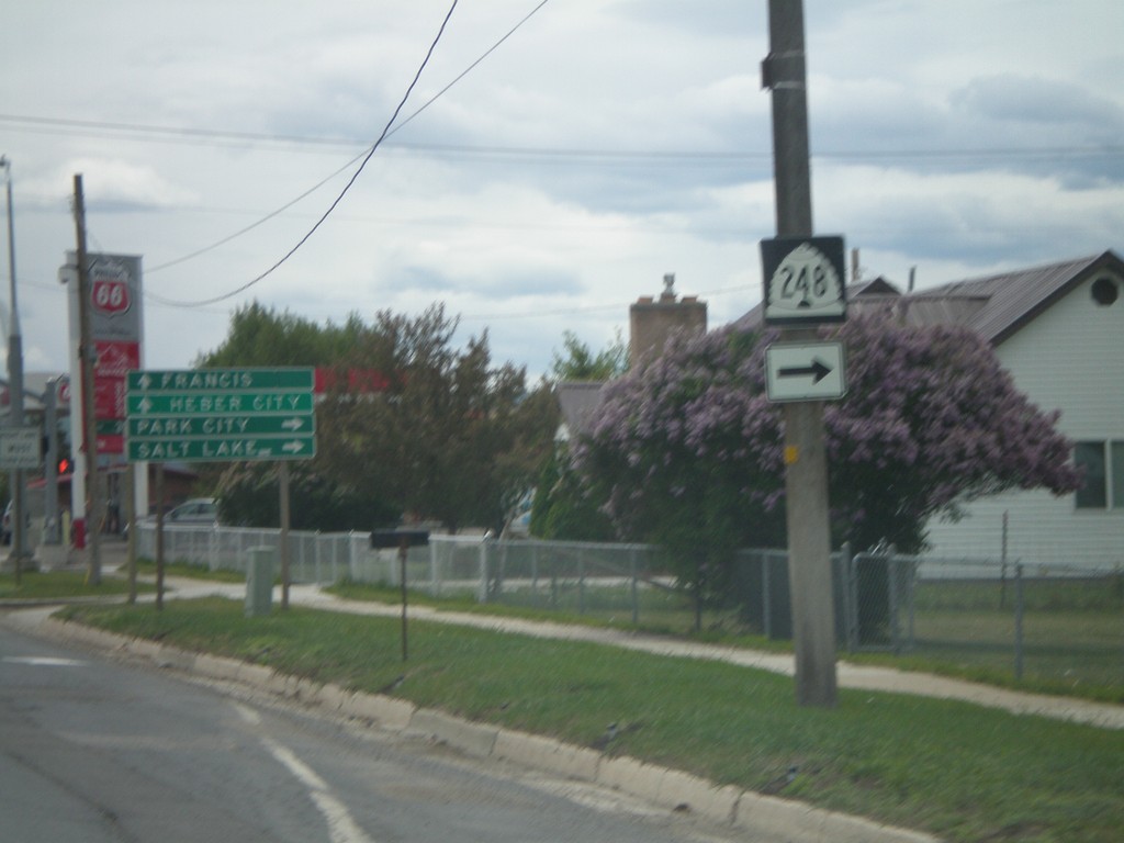
UT-32 East at UT-248 South
UT-32 south approaching UT-248.
Taken 05-24-2007
 Kamas
Summit County
Utah
United States
Kamas
Summit County
Utah
United States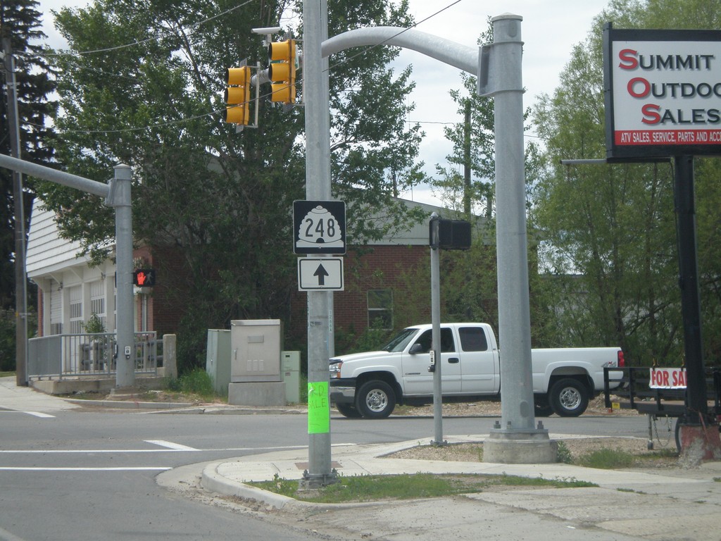
To UT-248 on UT-32 South
UT-32 south To UT-248 south of UT-150.
Taken 05-24-2007
Kamas
Summit County
Utah
United States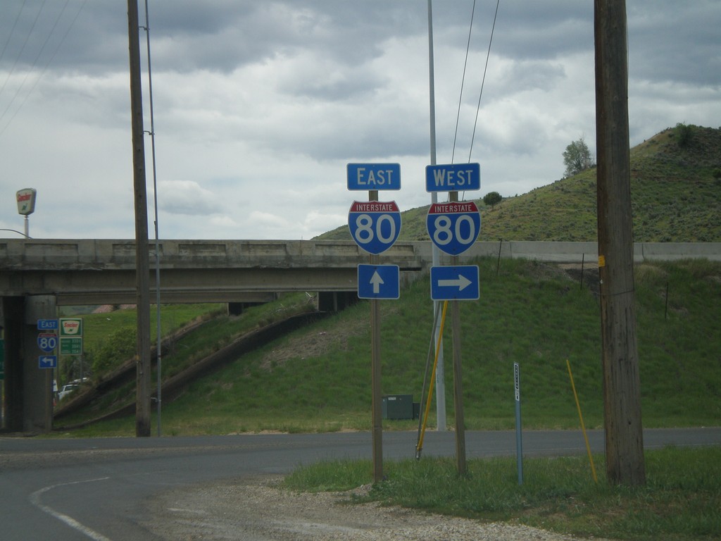
UT-32 South at I-80
US-32 south at I-80 freeway entrance.
Taken 05-24-2007
Coalville
Summit County
Utah
United States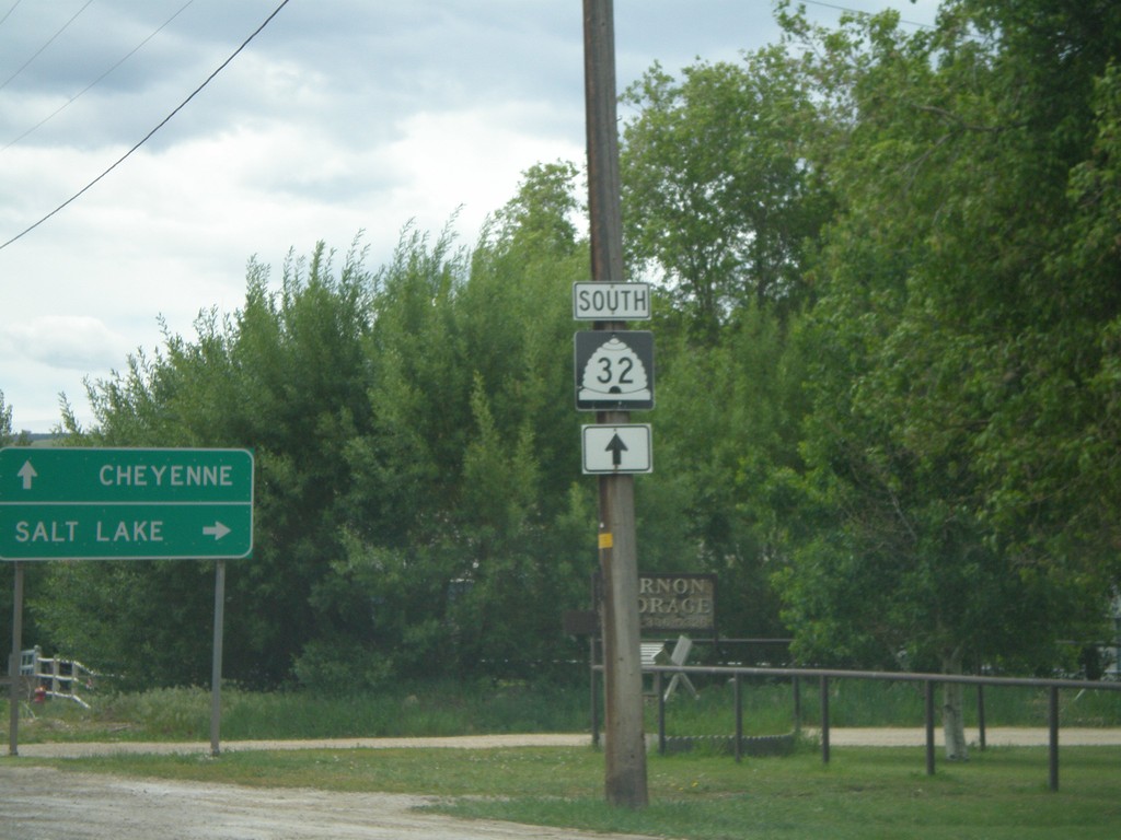
UT-32 South at I-80 Jct.
US-32 south approaching I-80 to Salt Lake and Cheyenne (WY).
Taken 05-24-2007
Coalville
Summit County
Utah
United States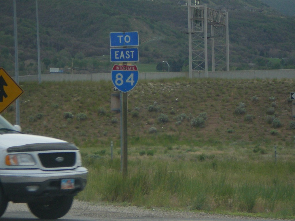
US-89 South at I-84 East
US-89 south approaching I-84 east.
Taken 05-24-2007

 Ogden
Weber County
Utah
United States
Ogden
Weber County
Utah
United States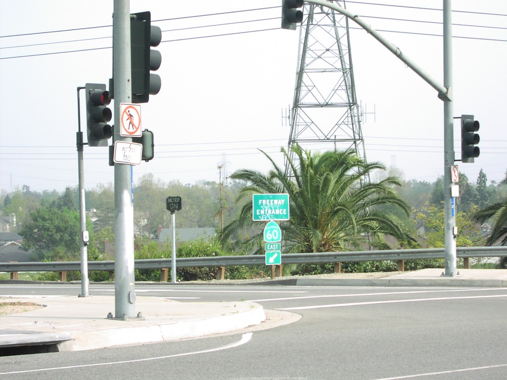
S Haven Ave. at CA-60 Exit 39 Onramp
S. Haven Ave. at CA-60 east freeway entrance.
Taken 03-01-2007
 Ontario
San Bernardino County
California
United States
Ontario
San Bernardino County
California
United States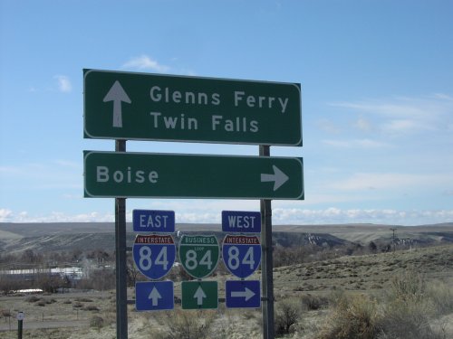
Old US-30 at I-84/BL-84
Old US-30 at I-84/BL-84 junction. Turn right on I-84 west towards Boise. Continue ahead for I-84/BL-84 towards Glenns Ferry and Twin Falls.
Taken 03-01-2007


 Glenns Ferry
Elmore County
Idaho
United States
Glenns Ferry
Elmore County
Idaho
United States