Signs Tagged With Shield
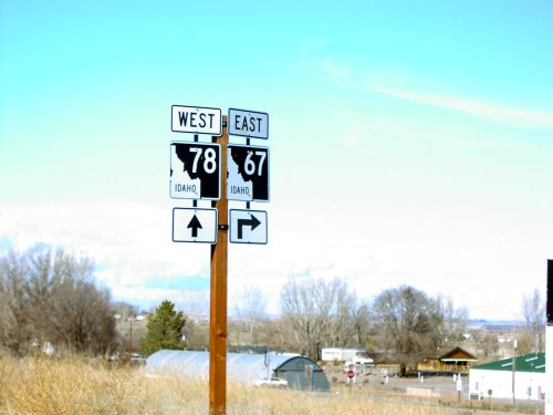
ID-78 West at ID-67 East
ID-78 west at ID-67 east to Mountain Home.
Taken 03-01-2007

 Grand View
Owyhee County
Idaho
United States
Grand View
Owyhee County
Idaho
United States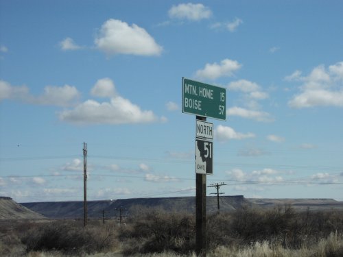
ID-51 North - Distance Marker
Distance marker on ID-51 north to Mountain Home and Boise.
Taken 03-01-2007
 Bruneau
Owyhee County
Idaho
United States
Bruneau
Owyhee County
Idaho
United States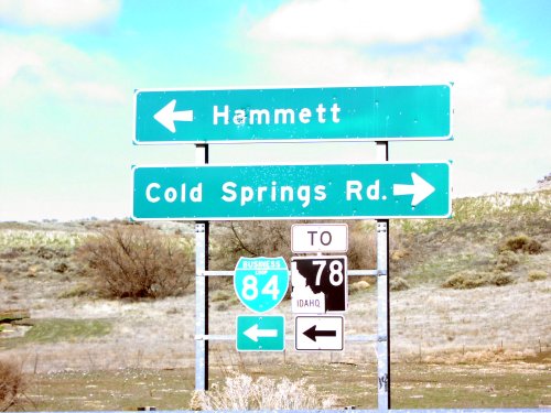
I-84 West at BL-84/To ID-78
I-84 west at Exit 114 offramp. Turn left for BL-84 West/To ID-78 to Hammett. Turn right for Cold Springs Road.
Taken 03-01-2007


 Hammett
Elmore County
Idaho
United States
Hammett
Elmore County
Idaho
United States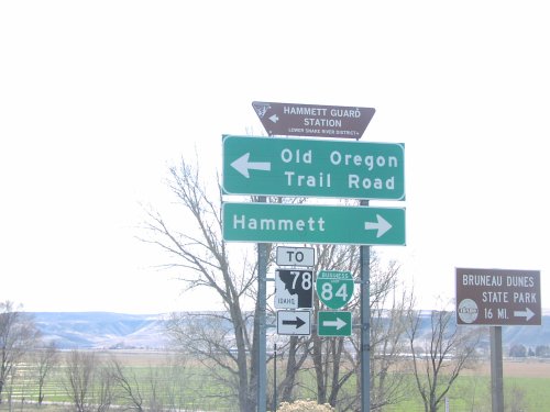
I-84 East at BL-84/To ID-78 East
I-84 East Exit 112 offramp at BL-84. Turn right on BL-84/To ID-78 for Hammett and Bruneau Dunes State Park. Turn left for Old Oregon Trail Road.
Taken 03-01-2007
Hammett
Elmore County
Idaho
United States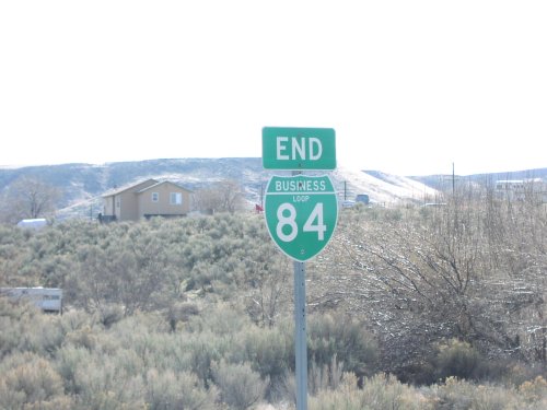
End Hammet Business Loop
End BL-84 at I-84 in Hammett.
Taken 03-01-2007
Hammett
Elmore County
Idaho
United States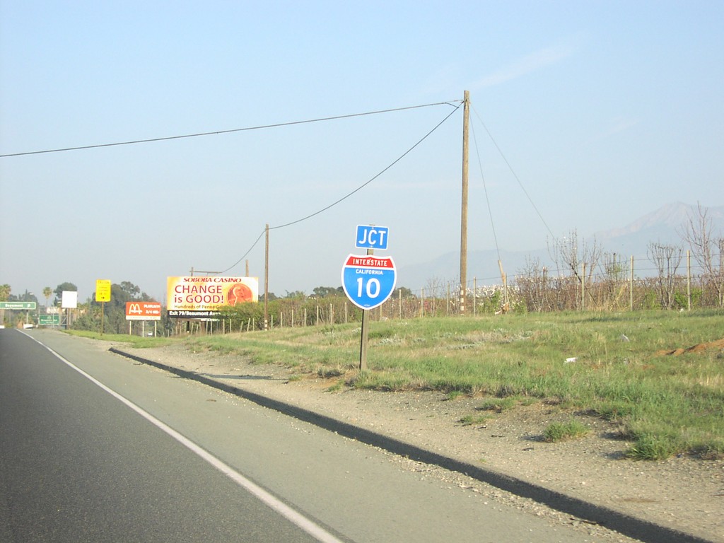
End CA-60 East at I-10
End CA-60 at I-10 east in Beaumont.
Taken 03-01-2007

 Beaumont
Riverside County
California
United States
Beaumont
Riverside County
California
United States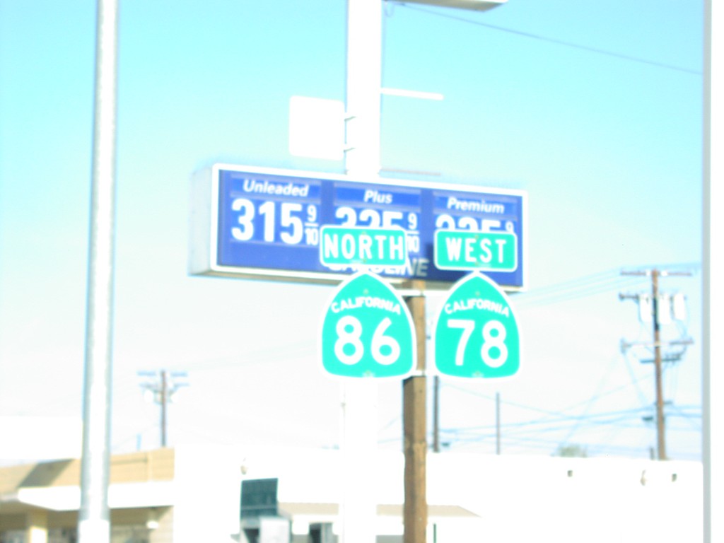
CA-78 West/CA-86 North - Brawley
CA-86 North/CA-78 West in Brawley, just north of CA-86 jct.
Taken 03-01-2007

 Brawley
Imperial County
California
United States
Brawley
Imperial County
California
United States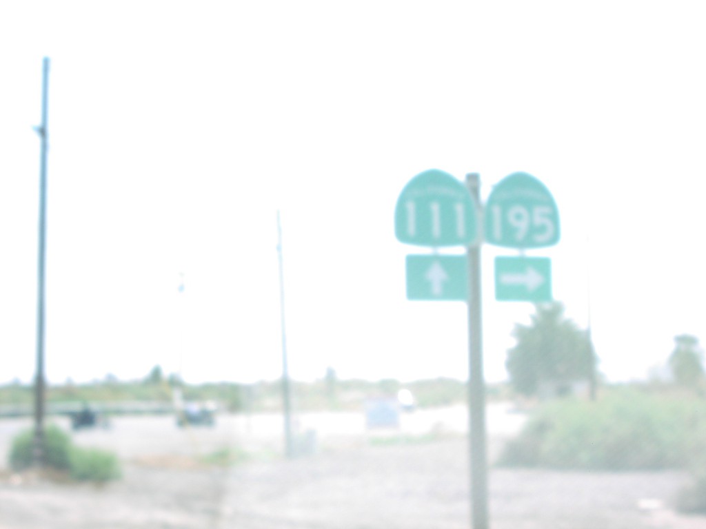
CA-111 South at CA-195
CA-111 south at CA-195.
Taken 03-01-2007

 Mecca
Riverside County
California
United States
Mecca
Riverside County
California
United States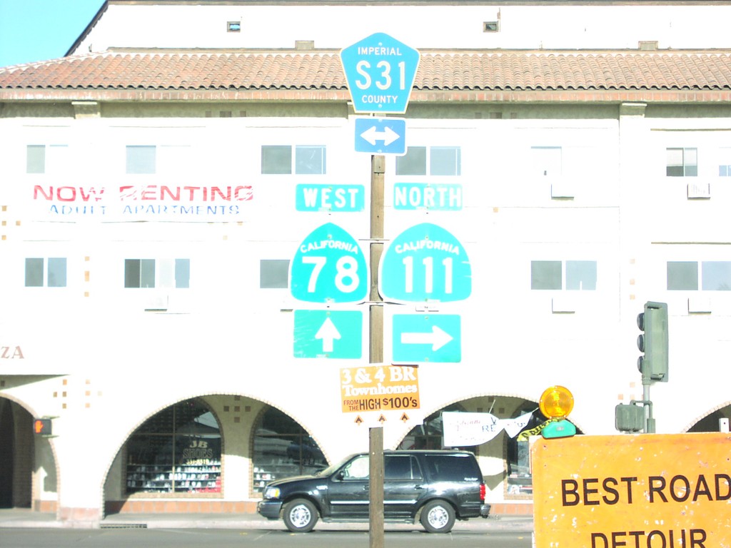
CA-111 North/CA-78 West at Split
CA-111 North/CA-78 West at CA-111/CA-78 split. CR-S31 follows CA-111 north.
Taken 03-01-2007
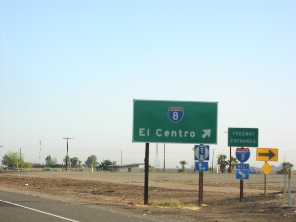
CA-111 North at I-8 West to El Centro
CA-111 north at I-8 west to El Centro.
Taken 03-01-2007
 El Centro
Imperial County
California
United States
El Centro
Imperial County
California
United States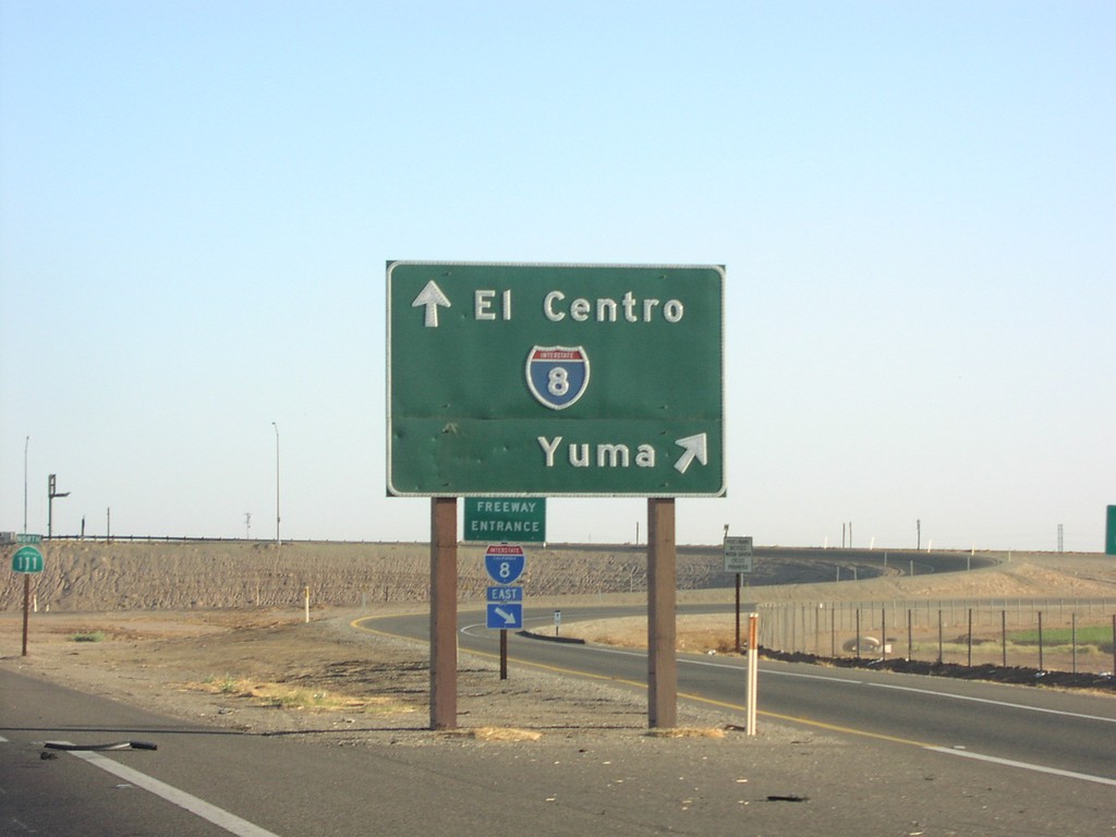
CA-111 North at I-8 East to Yuma
CA-111 north at I-8 east to Yuma.
Taken 03-01-2007
El Centro
Imperial County
California
United States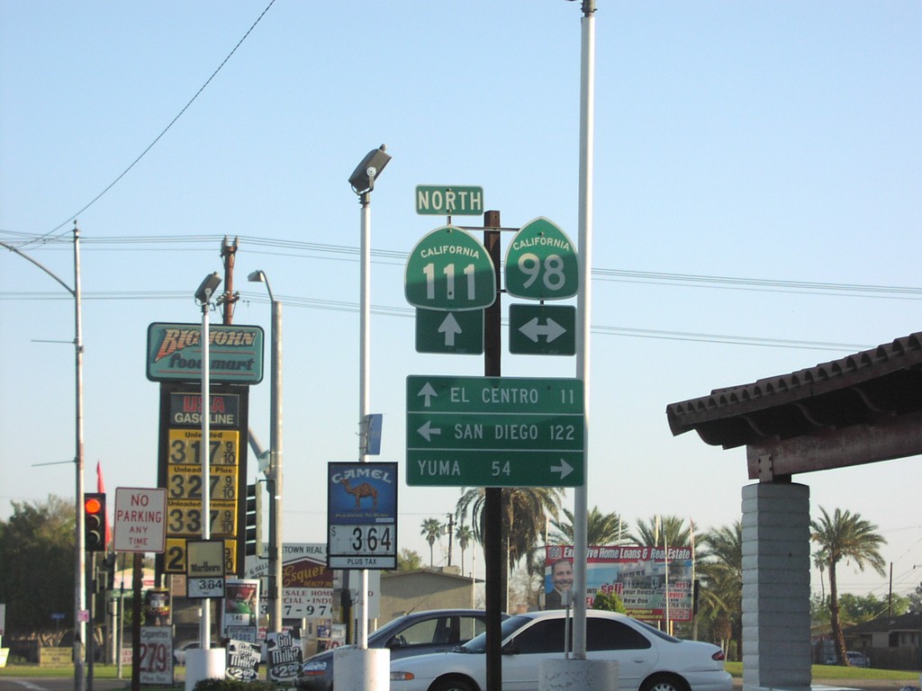
CA-111 North at CA-98
CA-111 north to El Centro, at CA-98 east Yuma, and west to San Diego. CA-98 parallels the southern border of California.
Taken 03-01-2007
 Calexico
Imperial County
California
United States
Calexico
Imperial County
California
United States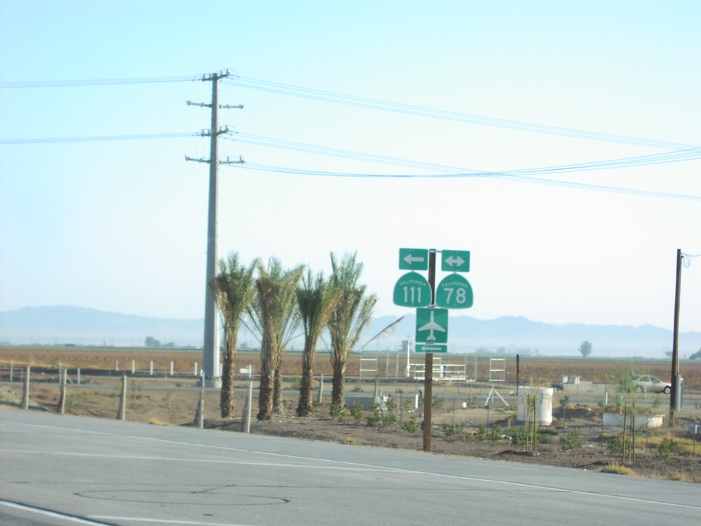
CA-111 North at CA-78
CA-111 north at CA-78. CA-111 north follows CA-78 west through Brawley.
Taken 03-01-2007
Brawley
Imperial County
California
United States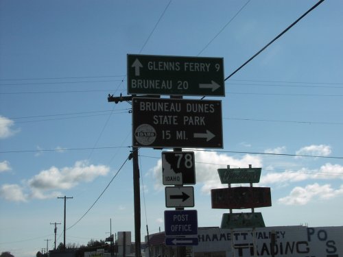
BL-84 East at ID-78
BL-84 east at ID-78 south to Bruneau, and Bruneau Dunes State Park. ID-78 follows the south side of the Snake River to Marsing.
Taken 03-01-2007
Hammett
Elmore County
Idaho
United States
BL-84 - Glenns Ferry
Bannock St. north at Oregon Trail. Continue north on Bannock St. for BL-84 west (to I-84 west). Turn right on Oregon Trail for I-84 east (via BL-84 east).
Taken 03-01-2007
Glenns Ferry
Elmore County
Idaho
United States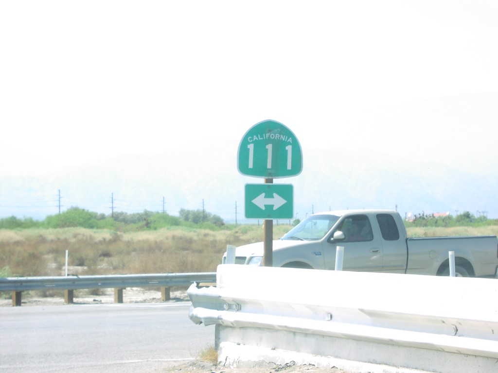
4th St. at CA-111
4th St. in Mecca at CA-111.
Taken 03-01-2007
Mecca
Riverside County
California
United States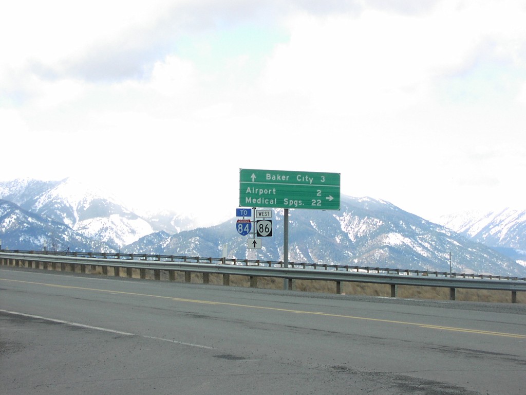
OR-86 West at I-84
OR-86 west at OR-203 (not signed) to Medical Springs and Airport.
Taken 02-01-2007
 Baker City
Baker County
Oregon
United States
Baker City
Baker County
Oregon
United States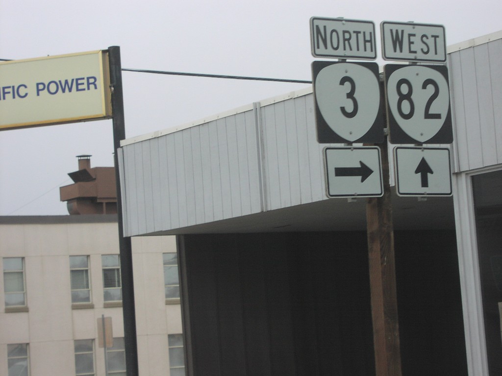
OR-82 West at OR-3 North
OR-82 west at OR-3 north.
Taken 02-01-2007

 Enterprise
Wallowa County
Oregon
United States
Enterprise
Wallowa County
Oregon
United States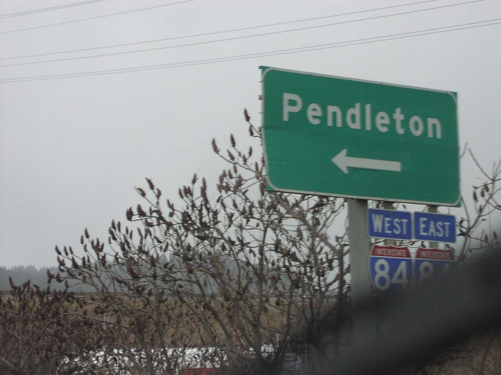
OR-82 West at I-84 West
OR-82 west I-84 west to Pendleton.
Taken 02-01-2007
La Grande
Union County
Oregon
United States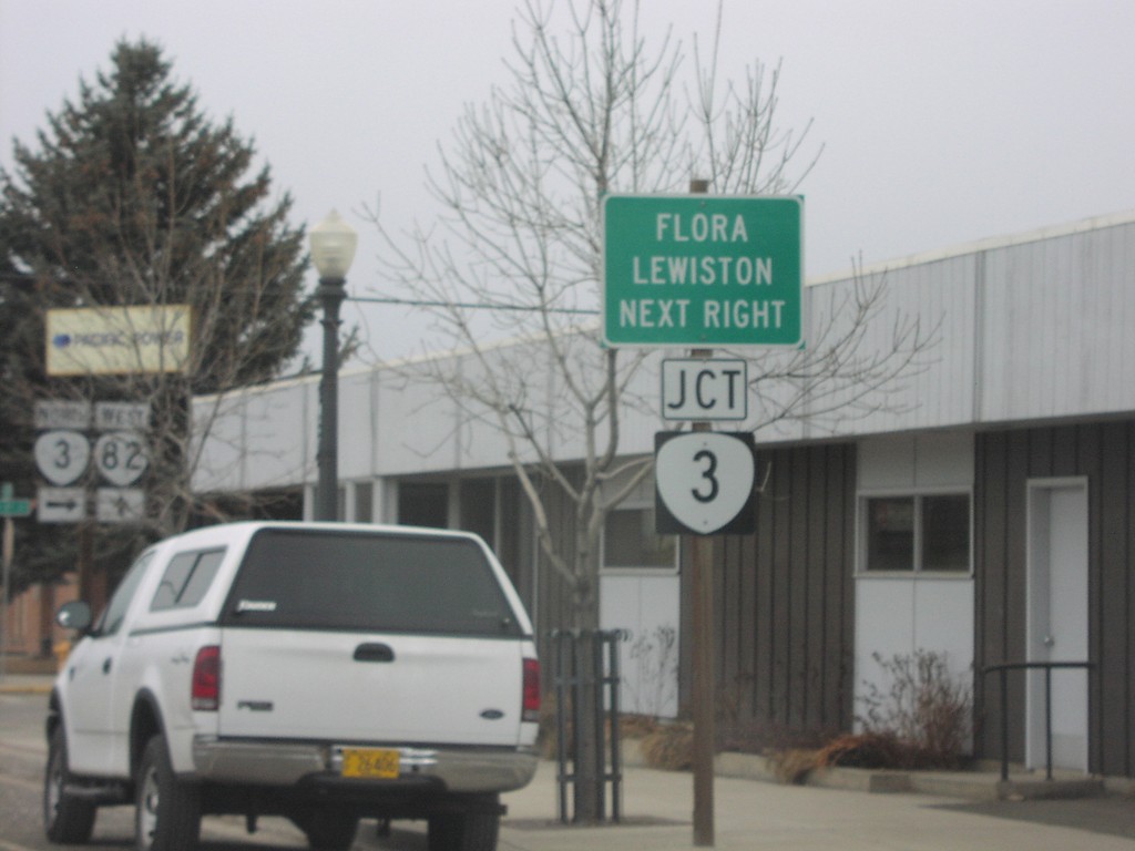
OR-82 West Approaching OR-3 North
OR-82 west approaching OR-3 north to Flora and Lewiston.
Taken 02-01-2007
Enterprise
Wallowa County
Oregon
United States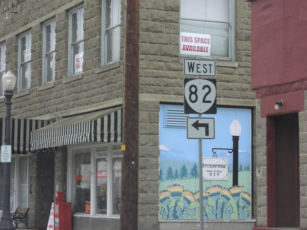
OR-82 West - Enterprise
OR-82 west in Enterprise at the corner of North and River St.
Taken 02-01-2007
Enterprise
Wallowa County
Oregon
United States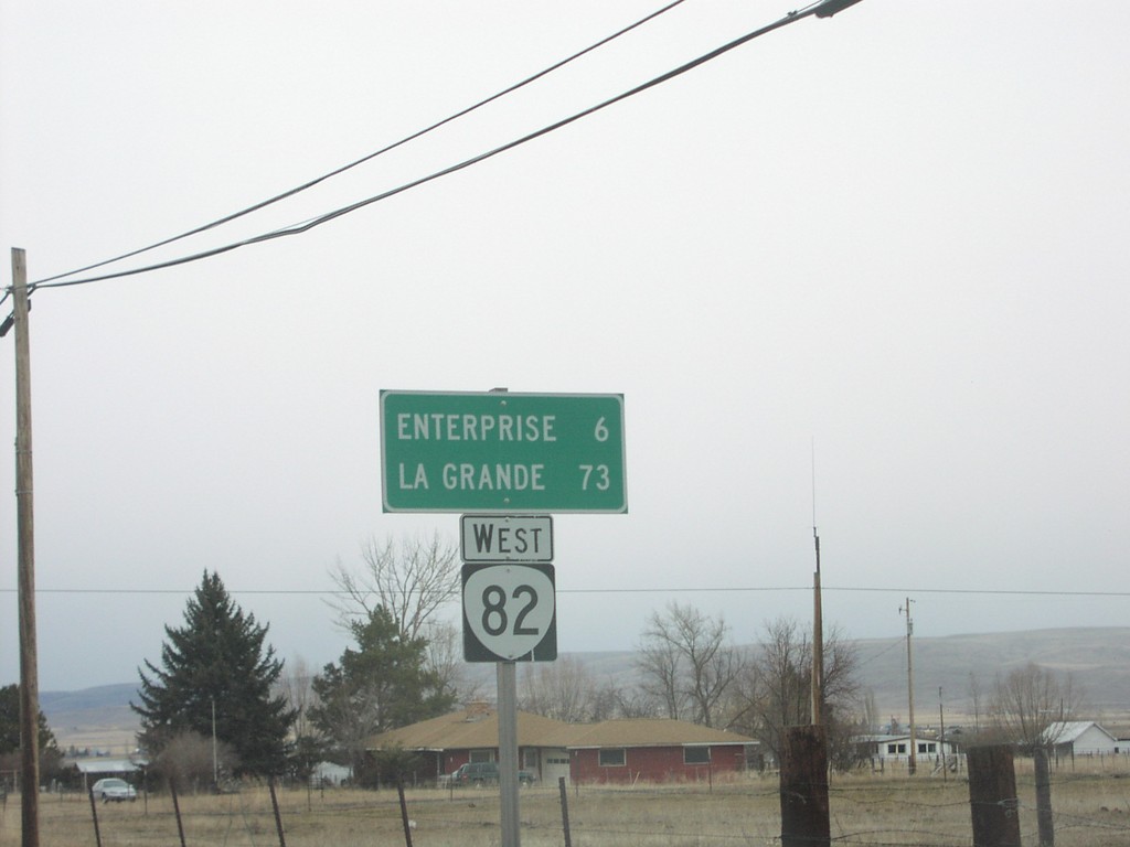
OR-82 West - Distance Marker
Distance marker on OR-82 west to Enterprise and La Grande.
Taken 02-01-2007
Joseph
Wallowa County
Oregon
United States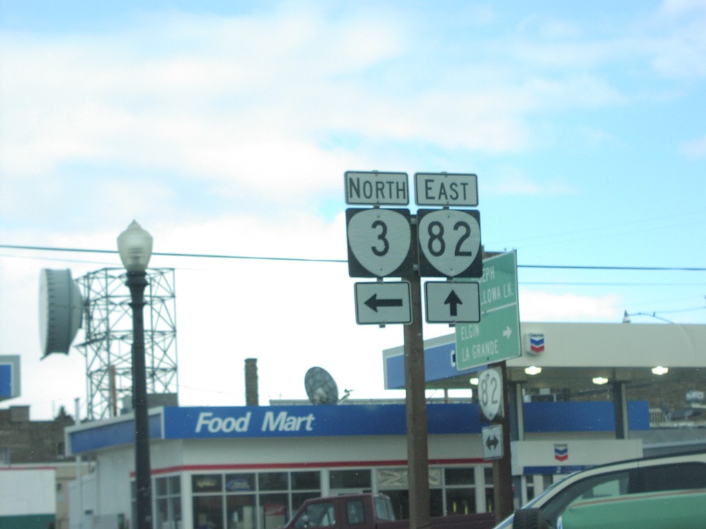
OR-82 East at OR-3 North
OR-82 east at OR-3 north.
Taken 02-01-2007
Enterprise
Wallowa County
Oregon
United States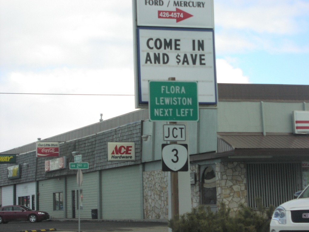
OR-82 East Approaching OR-3 North
OR-82 east approaching OR-3 north to Flora and Lewiston.
Taken 02-01-2007
Enterprise
Wallowa County
Oregon
United States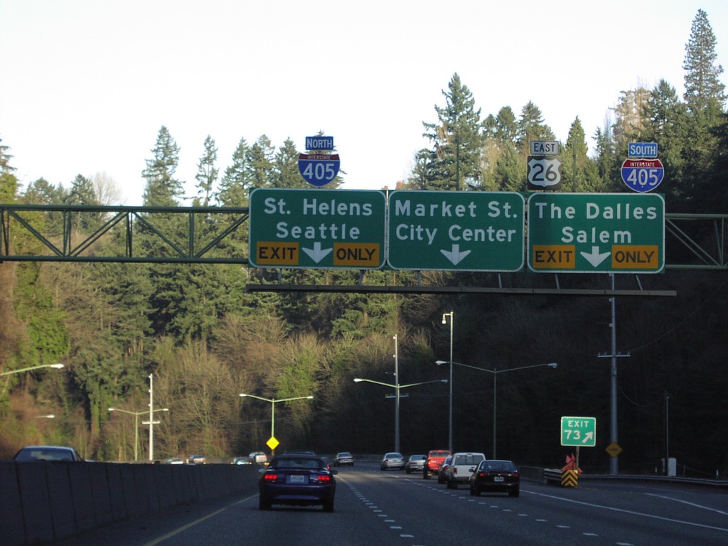
US-26 East at I-405
US-26 east approaching I-405 and Market St. into Downtown Portland.
Taken 01-01-2007
 Portland
Multnomah County
Oregon
United States
Portland
Multnomah County
Oregon
United States