Signs Tagged With Shield
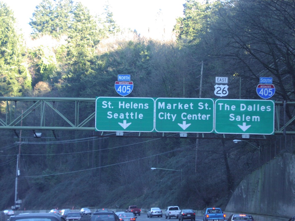
US-26 East Approaching I-405
US-26 east approaching I-405. US-26 east follows I-405 south towards The Dalles and Salem.
Taken 01-01-2007

 Portland
Multnomah County
Oregon
United States
Portland
Multnomah County
Oregon
United States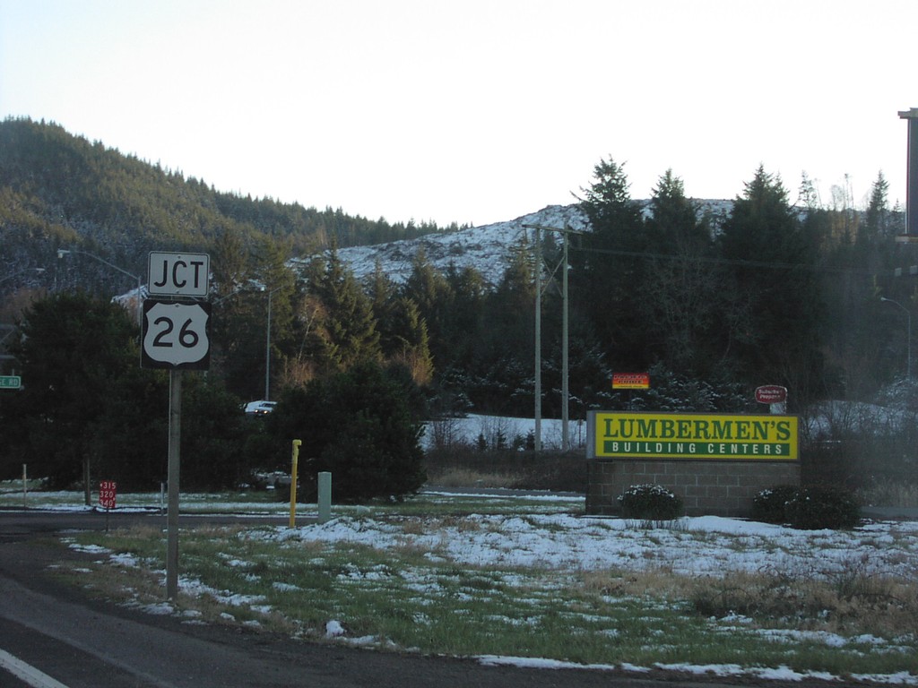
US-101 South at US-26
US-101 south approaching western end of US-26.
Taken 01-01-2007
 Seaside
Clatsop County
Oregon
United States
Seaside
Clatsop County
Oregon
United States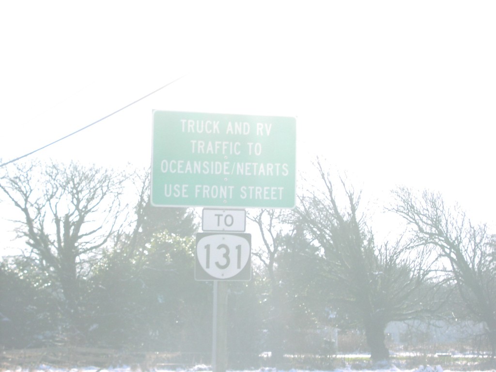
US-101 South at OR-131
US-101 south approaching OR-131. OR-131 bound truck and RV Traffic, use Front St.
Taken 01-01-2007
 Tillamook
 County
Oregon
United States
Tillamook
Tillamook County
Oregon
United States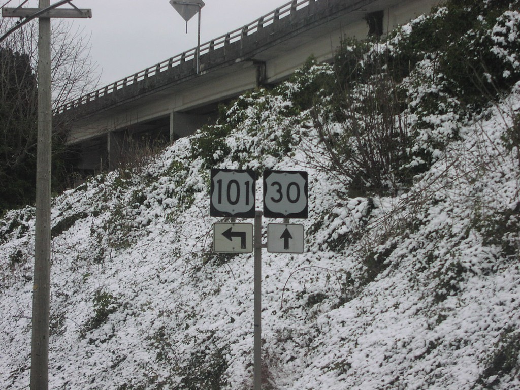
US-101 North at US-30
US-101 north approaching beginning of US-30.
Taken 01-01-2007
 Astoria
Clatsop County
Oregon
United States
Astoria
Clatsop County
Oregon
United States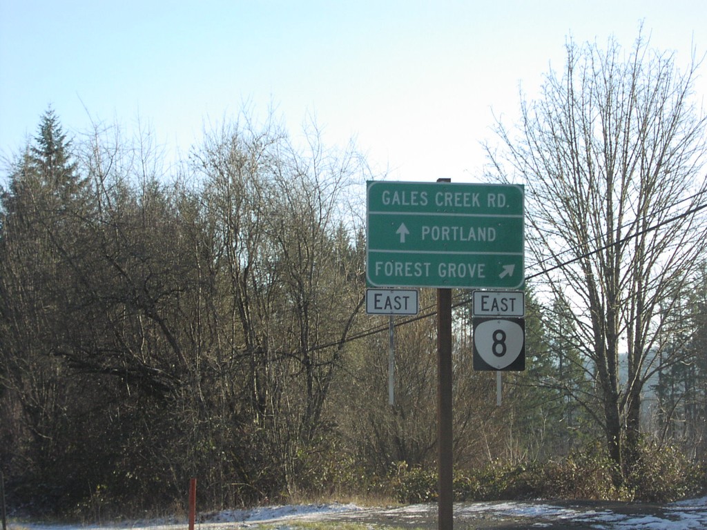
OR-6 East at OR-8
OR-6 east at OR-8 east to Forest Grove.
Taken 01-01-2007

 Gales Creek
Washington County
Oregon
United States
Gales Creek
Washington County
Oregon
United States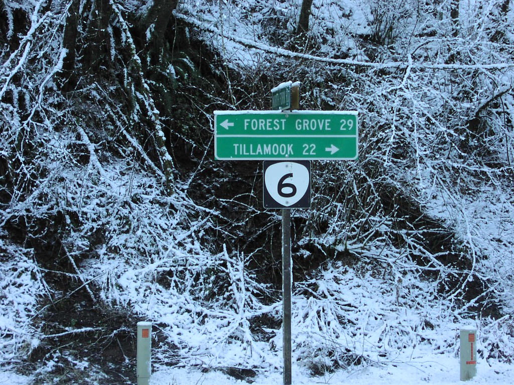
OR-6 - Tillamook State Forest
OR-6 to Tillamook and Forest Grove in the Tillamook State Forest.
Taken 01-01-2007
Tillamook
Tillamook County
Oregon
United States
Loop WA-100 - Cape Disappointment SP
WA-100 Loop just east of Cape Disappointment State Park Interpretive Center.
Taken 01-01-2007
 Ilwaco
Pacific County
Washington
United States
Ilwaco
Pacific County
Washington
United States
Loop WA-100 - Cape Disappointment SP
WA-100 Loop just east of Cape Disappointment State Park Interpretive Center.
Taken 01-01-2007
Ilwaco
Pacific County
Washington
United States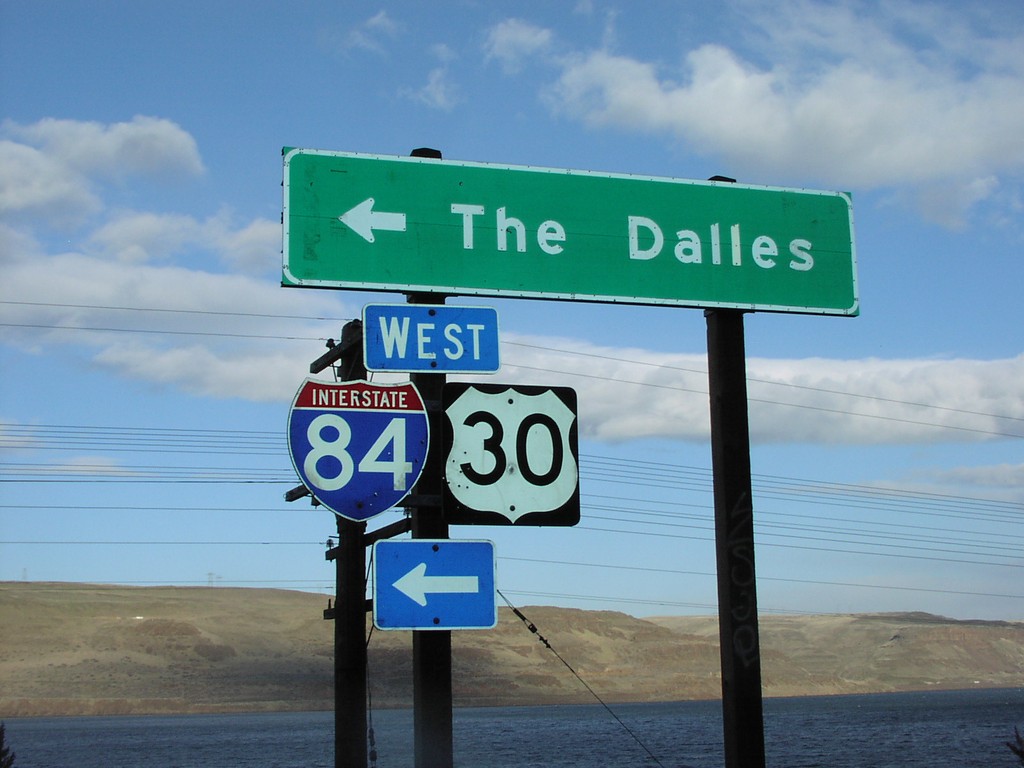
I-84/US-30 West Onramp Exit 123
I-84/US-30 West freeway entrance to The Dalles, at Exit 123.
Taken 01-01-2007
 Arlington
Gilliam County
Oregon
United States
Arlington
Gilliam County
Oregon
United States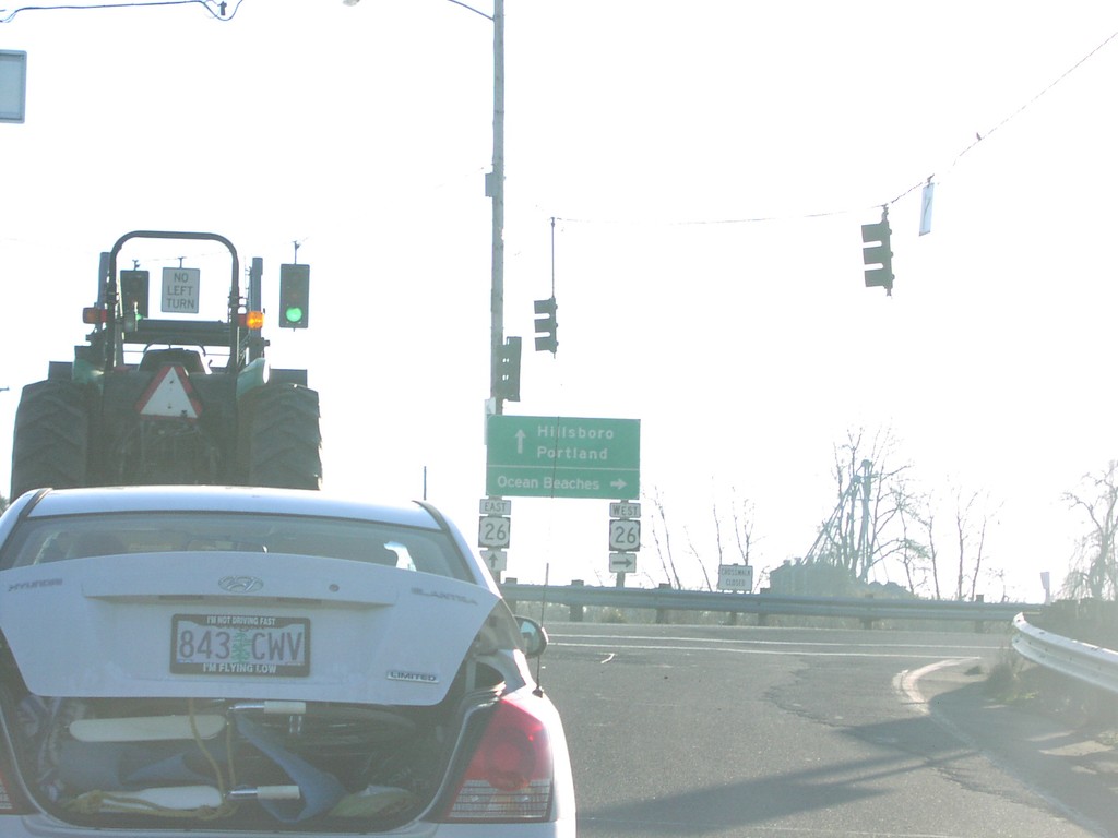
Glencoe Rd. S. at US-26 Exit 57 Onramp
Glencoe Road south at US-26 (Exit 57) West to Ocean Beaches and east to Portland.
Taken 01-01-2007
North Plains
Washington County
Oregon
United States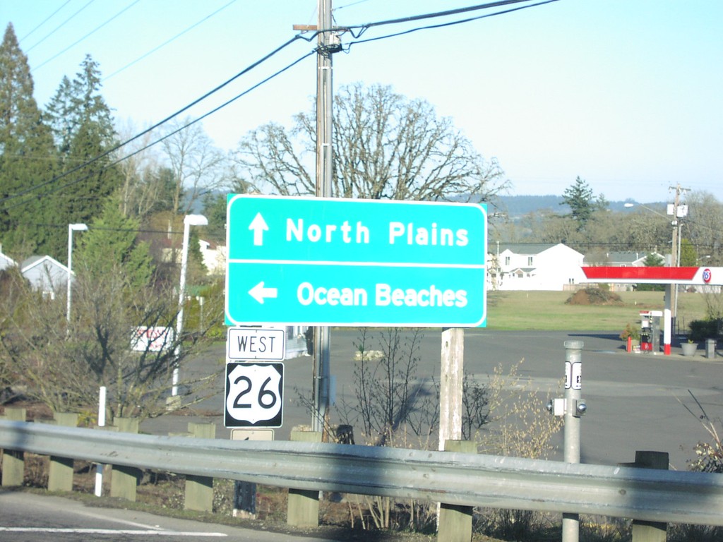
Glencoe Rd. N. at US-26 Exit 57 Onramp
Glencoe Road north at US-26 (Exit 57) West to Ocean Beaches.
Taken 01-01-2007
North Plains
Washington County
Oregon
United States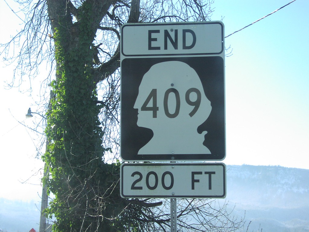
End WA-409 200 Feet
End WA-409 in 200 feet at the Puget Island Ferry dock.
Taken 01-01-2007
 Cathlamet
Wahkiakum County
Washington
United States
Cathlamet
Wahkiakum County
Washington
United States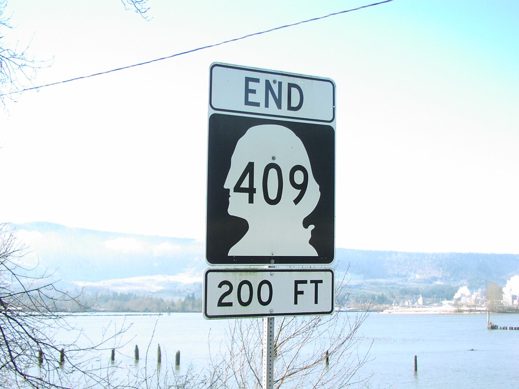
End WA-409 - 200 Feet
End WA-409 in 200 feet at the Puget Island Ferry dock.
Taken 01-01-2007
Cathlamet
Wahkiakum County
Washington
United States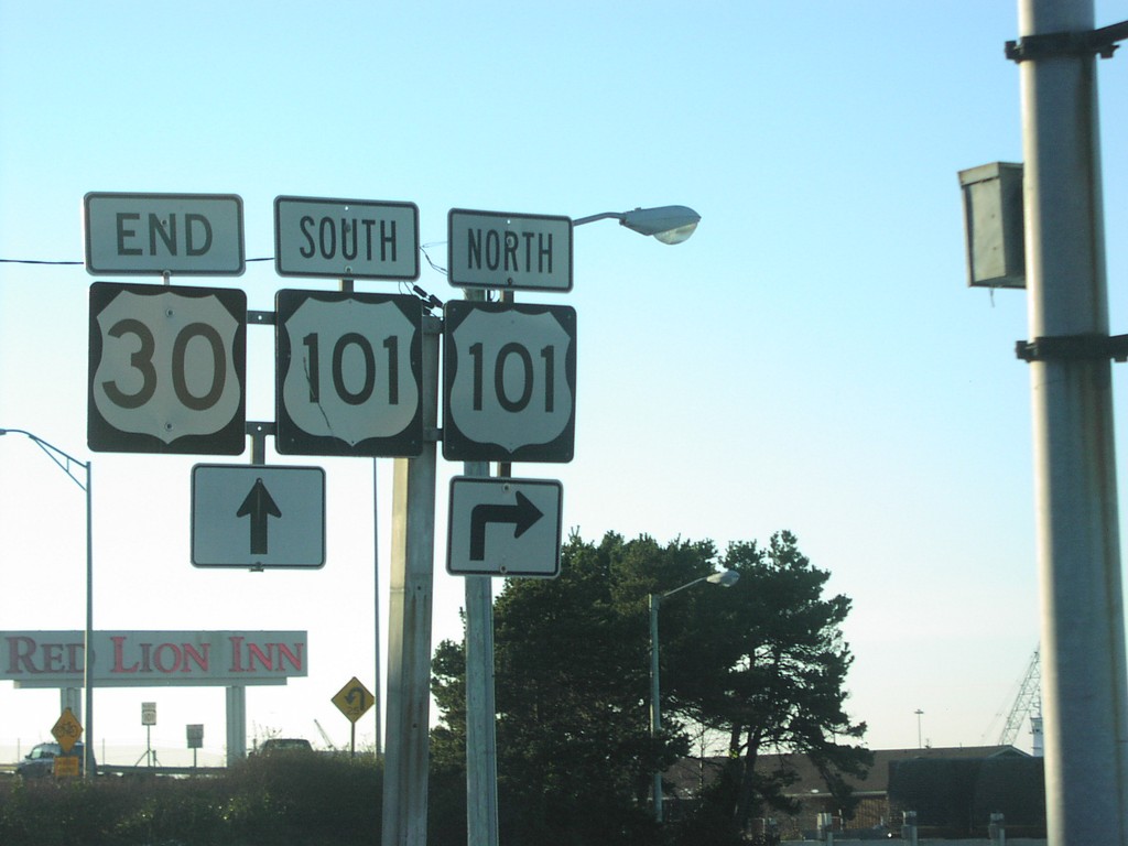
End US-30 West at US-101
End US-30 west at US-101.
Taken 01-01-2007
Astoria
Clatsop County
Oregon
United States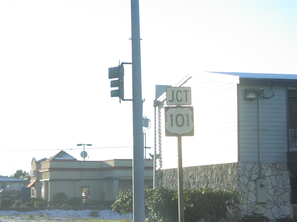
End US-30 West at US-101
Junction US-101 nearing western end of US-30.
Taken 01-01-2007
Astoria
Clatsop County
Oregon
United States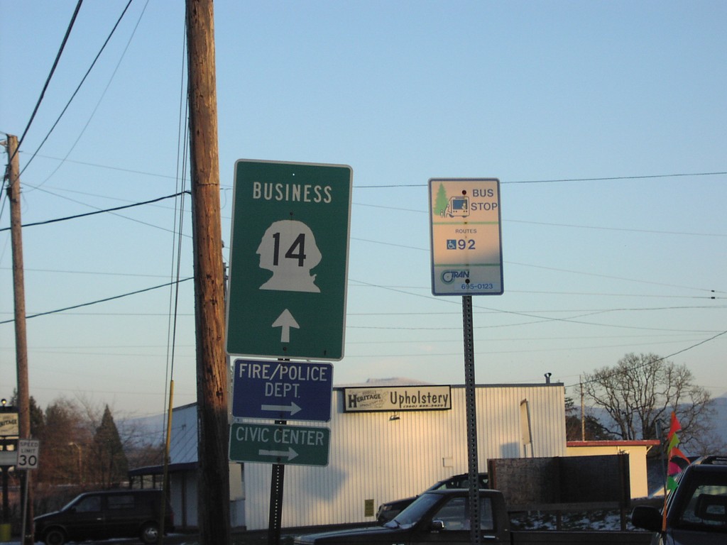
Bus. WA-14 East - Camas
Business WA-14 east.
Taken 01-01-2007
 Camas
Clark County
Washington
United States
Camas
Clark County
Washington
United States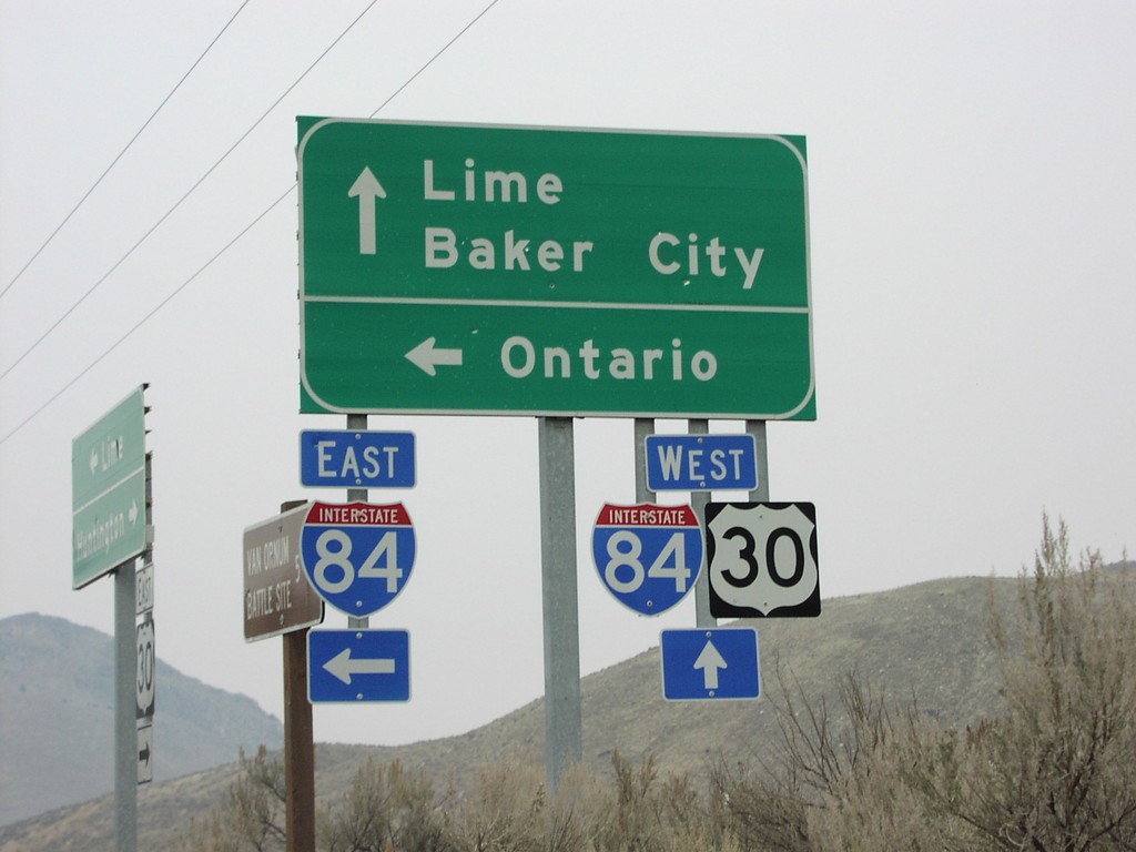
US-30 West at I-84 in Lime
US-30 west at I-84 to Baker City and Ontario.
Taken 12-01-2006
Huntington
Baker County
Oregon
United States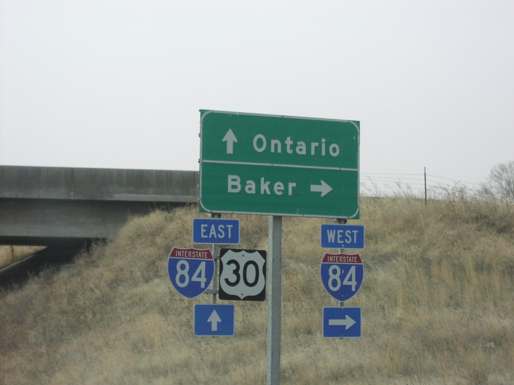
US-30 East at I-84 Exit 352 Onramp
US-30 east at I-84 west freeway entrance to Baker City.
Taken 12-01-2006
Huntington
Baker County
Oregon
United States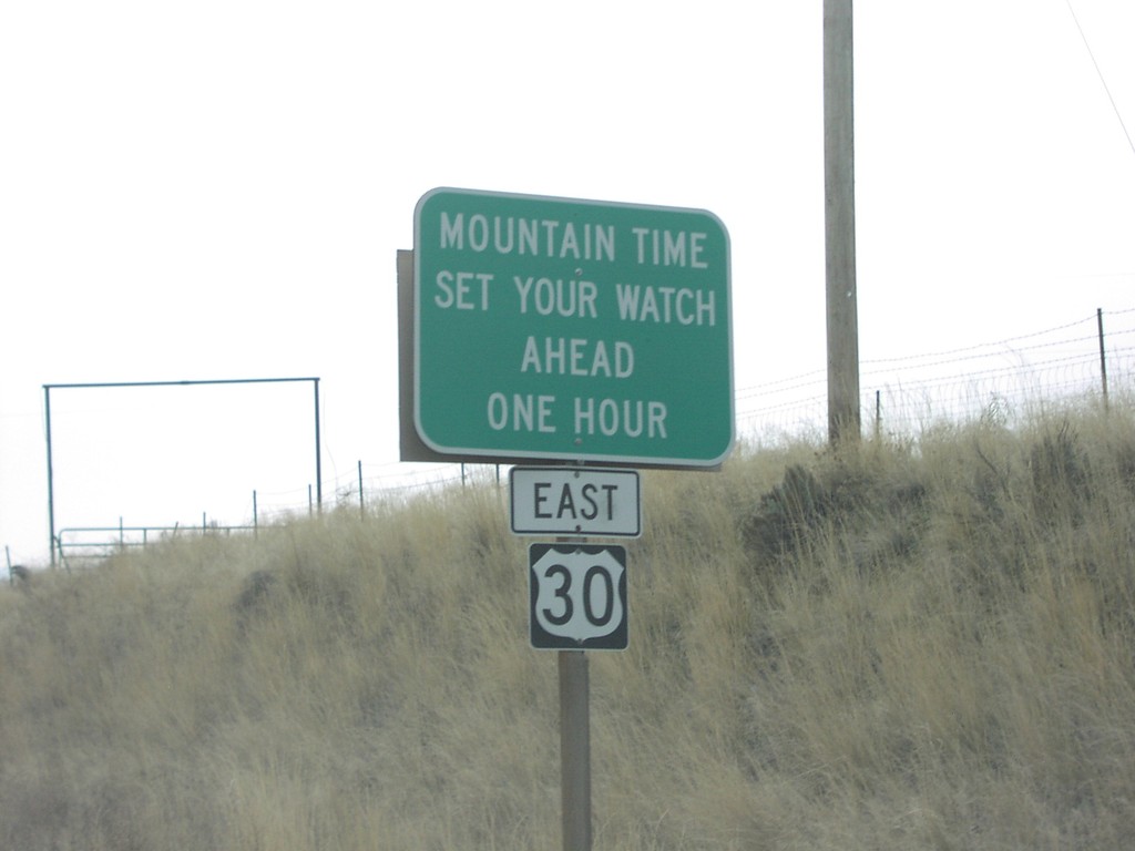
US-30 East - Mountain Time Zone
Mountain Time - Set Your Watch Ahead One Hour, on US-30 east.
Taken 12-01-2006
Huntington
Baker County
Oregon
United States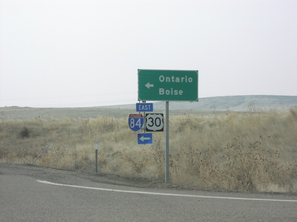
US-30 at I-84 Exit 352 Onramp
US-30 east at I-84/US-30 east to Ontario and Boise.
Taken 12-01-2006
Huntington
Baker County
Oregon
United States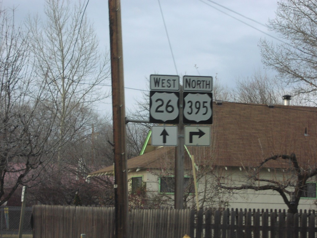
US-26 West at US-395 North
US-26 West/US-395 North approaching US-395 north.
Taken 12-01-2006
 Mount Vernon
Grant County
Oregon
United States
Mount Vernon
Grant County
Oregon
United States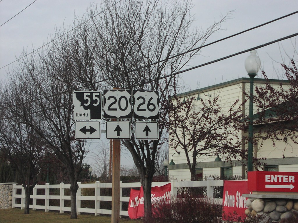
US-20/US-26 West at ID-55
US-20/US-26 west at ID-55.
Taken 12-01-2006

 Eagle
Ada County
Idaho
United States
Eagle
Ada County
Idaho
United States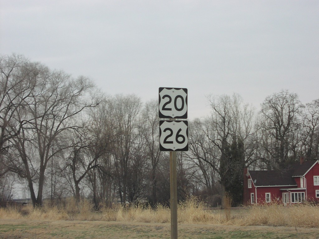
US-20/US-26 West - West of Star Road
US-20/US-26 shields just west of Star Road
Taken 12-01-2006
Meridian
Ada County
Idaho
United States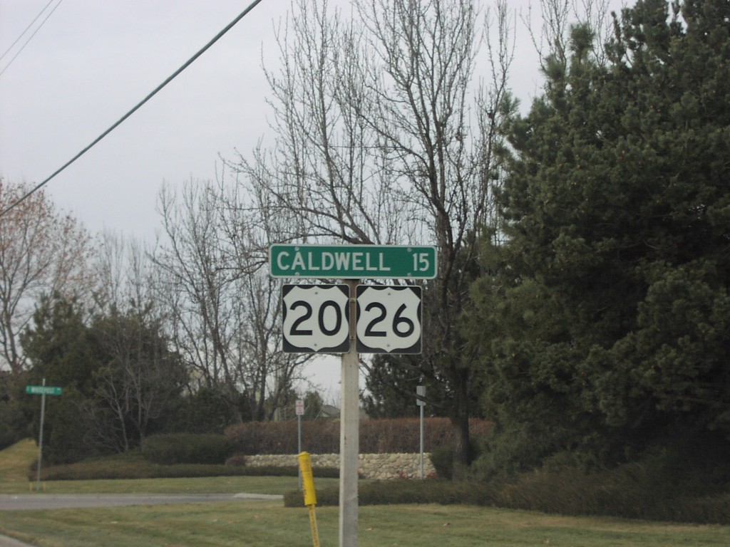
US-20/US-26 West - Distance Marker
Distance marker to Caldwell on US-20/US-26 west after ID-55 junction.
Taken 12-01-2006
Boise
Ada County
Idaho
United States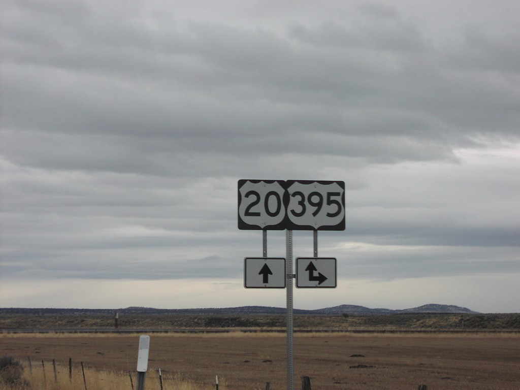
US-20 West at US-395 South
US-20 East at US-395 South. US-395 North follows US-20 east into Burns.
Taken 12-01-2006
Riley
Harney County
Oregon
United States