Signs Tagged With Shield
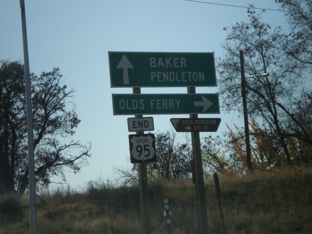
End US-95 Spur at Olds Ferry Jct.
US-95 Spur south at Olds Ferry Highway. US-95 Spur crosses the Snake River just south of here and enters Oregon. Sign reads End US-95 Spur - but it is still signed as US-95 Spur on the Oregon side of the Snake River.
Taken 11-04-2007
 Weiser
Washington County
Idaho
United States
Weiser
Washington County
Idaho
United States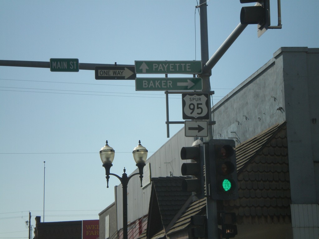
US-95 Spur - Weiser
US-95 Spur south (State St.) to Payette at Main St. to Baker (Oregon).
Taken 11-04-2007
Weiser
Washington County
Idaho
United States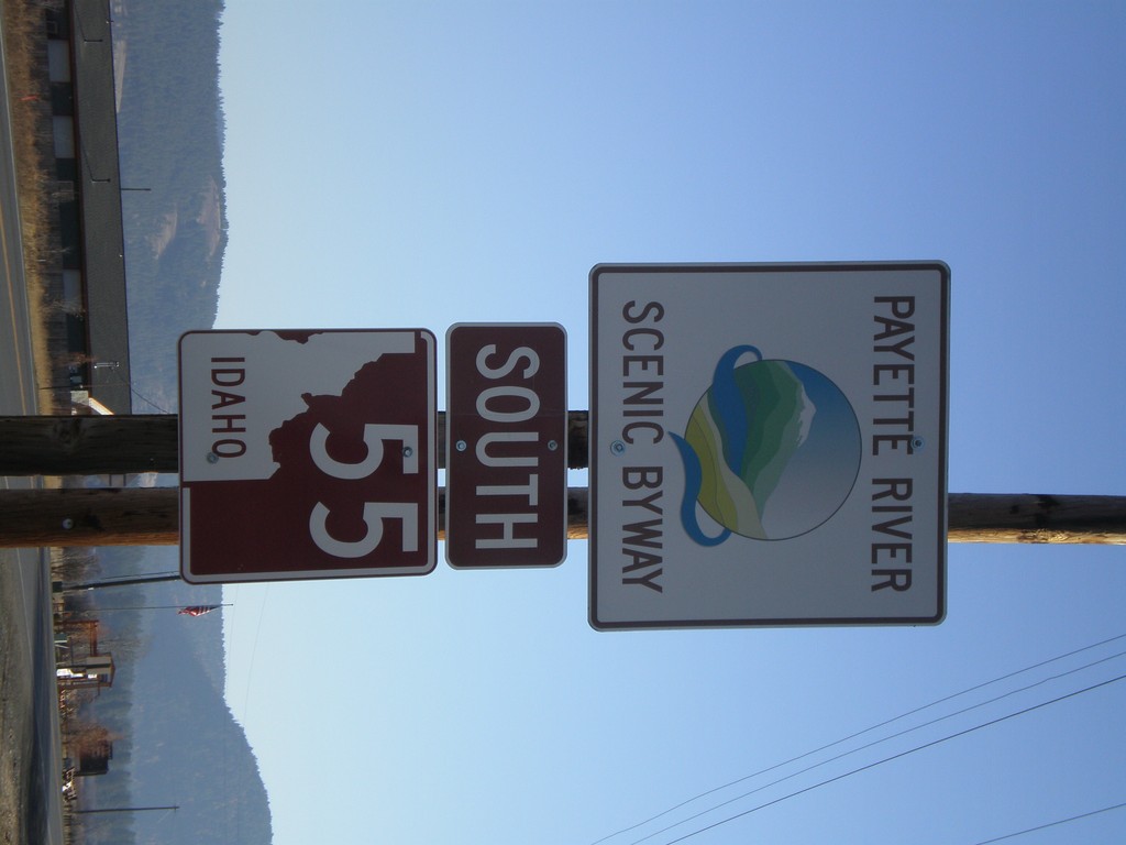
ID-55 South - Payette River Scenic Byway
Payette River Scenic Byway/ID-55 on ID-55 South. This sign is the newer style of scenic byway signs.
Taken 11-04-2007
 New Meadows
Adams County
Idaho
United States
New Meadows
Adams County
Idaho
United States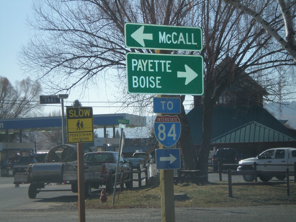
US-95 South at ID-55
US-95 South at ID-55. Although fastest way to Boise is via ID-55 - sign directs Boise traffic on US-95. US-95 south is the fastest way to I-84.
Taken 11-04-2007

 New Meadows
Adams County
Idaho
United States
New Meadows
Adams County
Idaho
United States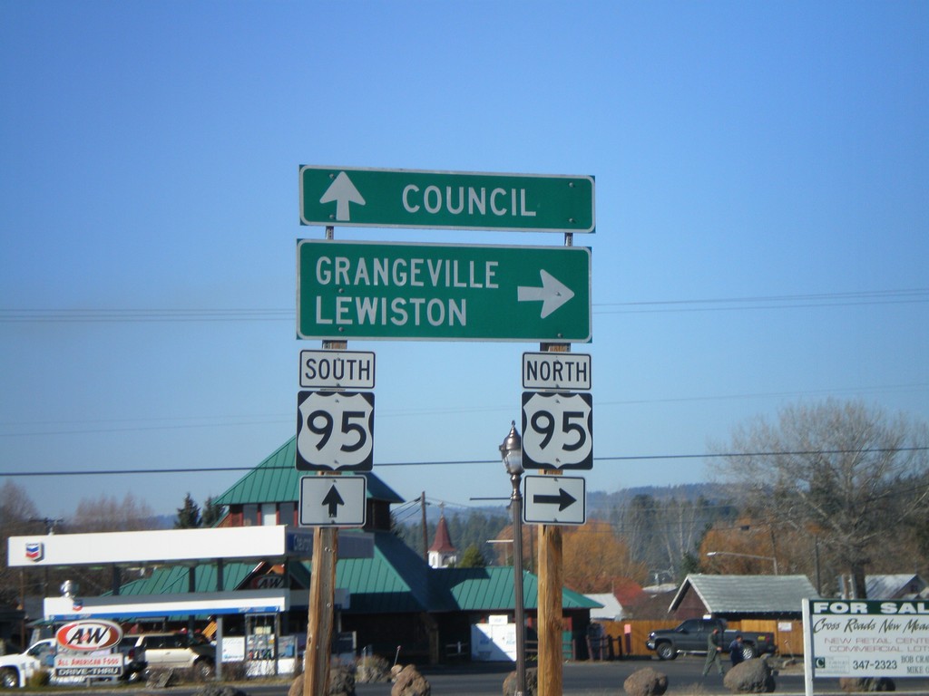
End ID-55 North at US-95
End ID-55 at US-95 south to Council, and north to Grangeville and Lewiston.
Taken 11-04-2007
New Meadows
Adams County
Idaho
United States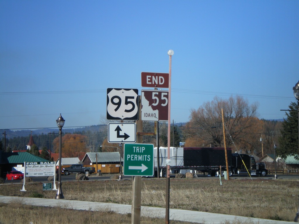
End ID-55 North at US-95
End ID-55 north at US-95. US-95 between New Meadows and Grangeville is the only highway connecting north and south Idaho.
Taken 11-04-2007
New Meadows
Adams County
Idaho
United States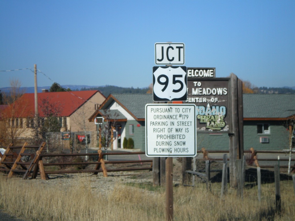
ID-55 North At US-95
ID-55 north approaching US-95.
Taken 11-04-2007
New Meadows
Adams County
Idaho
United States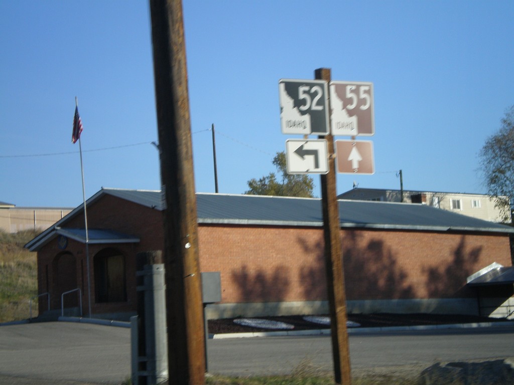
ID-55 North Approaching ID-52
ID-55 north approaching ID-52.
Taken 11-04-2007
 Horseshoe Bend
Boise County
Idaho
United States
Horseshoe Bend
Boise County
Idaho
United States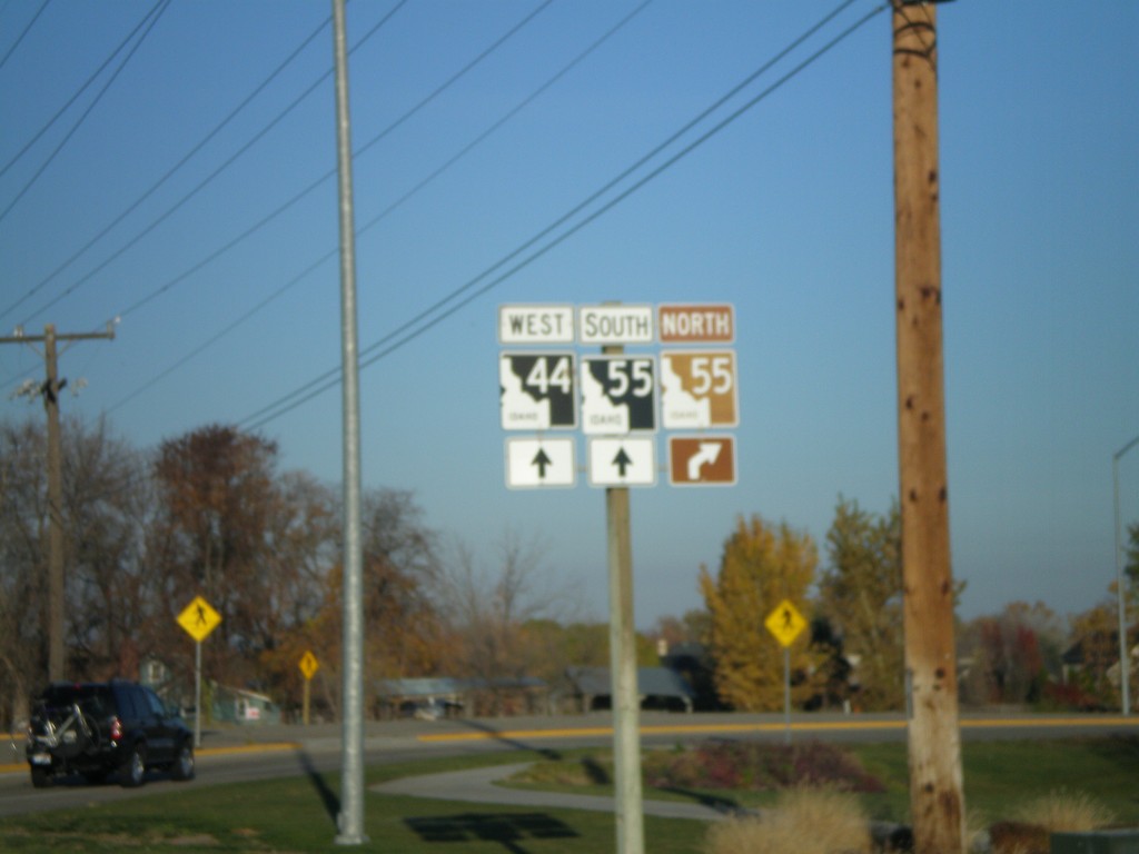
ID-44 West Approaching ID-55
ID-44 west at ID-55 north junction. ID-55 follows ID-44 west through Eagle. ID-55 northward is the Payette River Scenic Byway.
Taken 11-04-2007
 Eagle
Ada County
Idaho
United States
Eagle
Ada County
Idaho
United States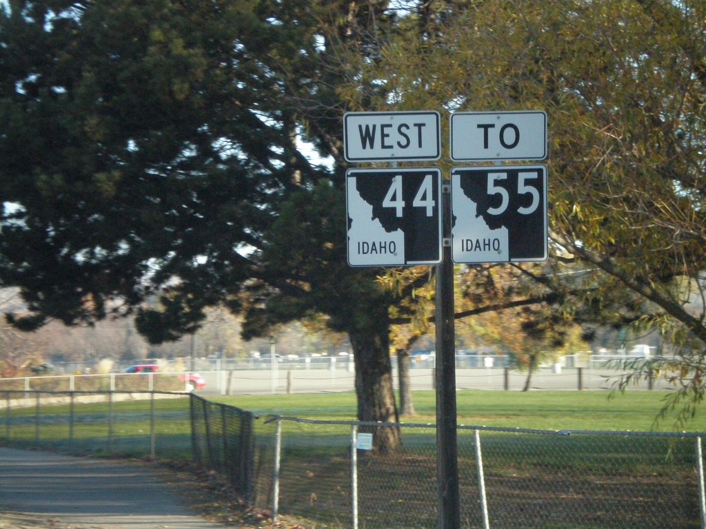
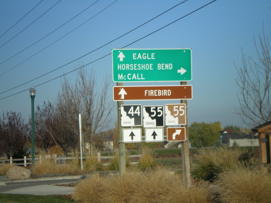
ID-44 West - To ID-55
ID-44 west to ID-55.
Taken 11-04-2007
Garden City
Ada County
Idaho
United States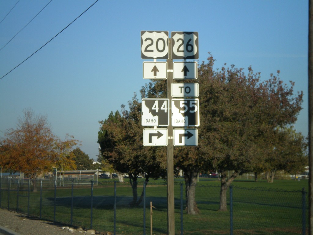
US-20/US-26 West at ID-44
US-20/US-26 west at ID-44 west - to ID-55.
Taken 11-04-2007

 Garden City
Ada County
Idaho
United States
Garden City
Ada County
Idaho
United States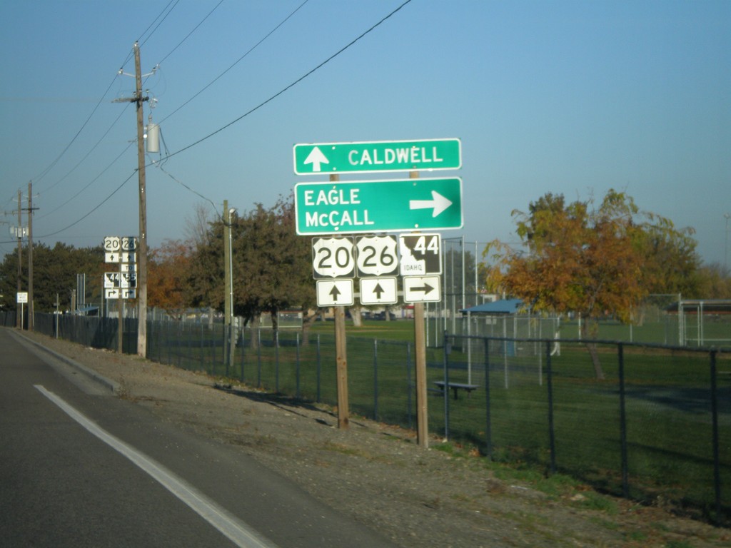
US-20/US-26 West Approaching ID-44
US-20/US-26 west approaching ID-44 east to Eagle and McCall.
Taken 11-04-2007
Garden City
Ada County
Idaho
United States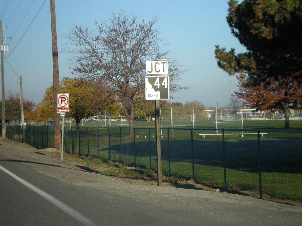
Jct. ID-44 on US-20/US-26 West
US-20/US-26 west approaching ID-44.
Taken 11-04-2007
Garden City
Ada County
Idaho
United States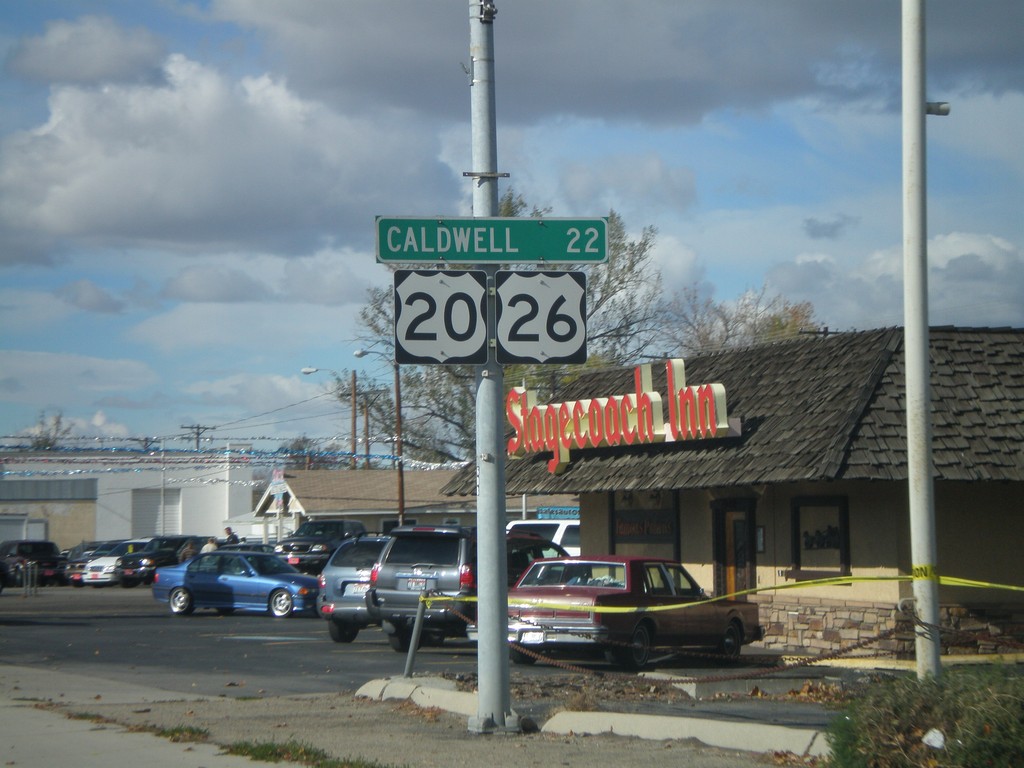
US-20/US-26 West - Distance Marker
Distance marker on US-20/US-26 West (Chinden Blvd.) to Caldwell.
Taken 10-20-2007
Garden City
Ada County
Idaho
United States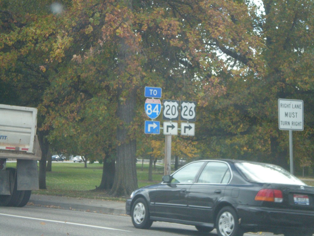
US-20/US-26 East at Broadway
US-20/US-26 east To I-84 on Myrtle St., at Broadway. US-20/US-26 east follows Broadway to I-84 about 2 miles south.
Taken 10-20-2007
Boise
Ada County
Idaho
United States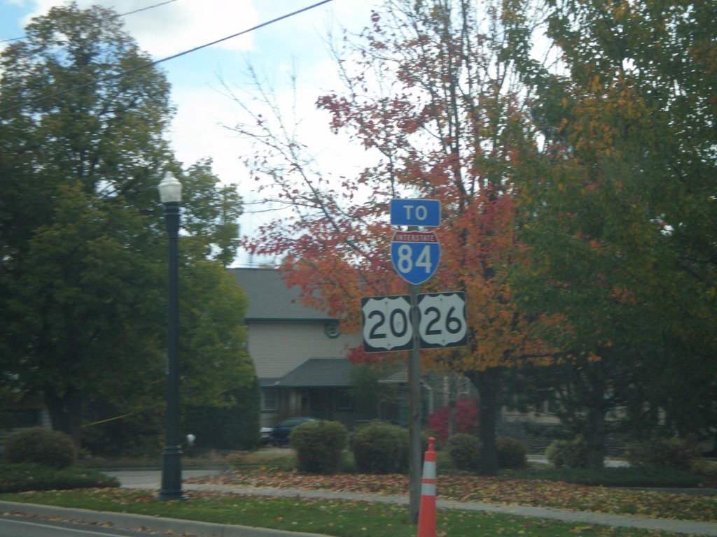
US-20/US-26 East - Boise
US-20/US-26 East (Myrtle St.)/To I-84 in Boise.
Taken 10-20-2007
Boise
Ada County
Idaho
United States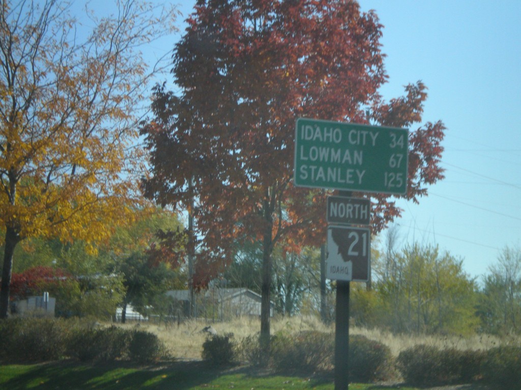
ID-21 North - Distance Marker
First distance marker on ID-21 North to Idaho City, Lowman, and Stanley.
Taken 10-13-2007
 Boise
Ada County
Idaho
United States
Boise
Ada County
Idaho
United States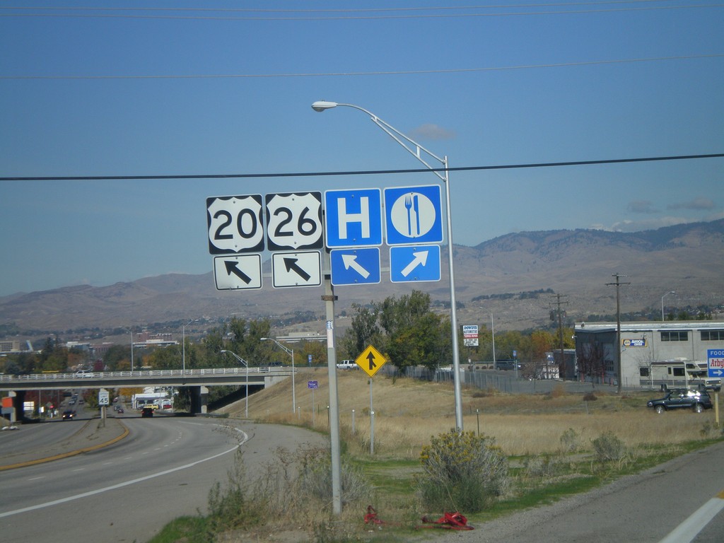
US-20/US-26 West - Federal Way
US-20/US-26 West (Broadway Ave. North) at Federal Way interchange.
Taken 10-13-2007
Boise
Ada County
Idaho
United States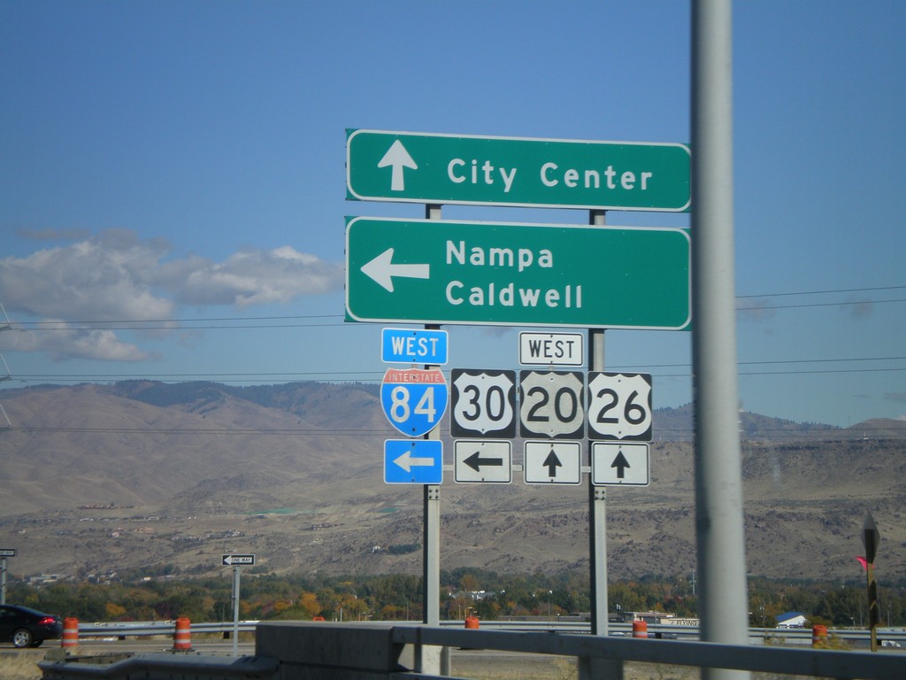
Broadway Ave. South at I-84 West Onramp
Broadway Ave. South at I-84 west offramp. US-20/US-26 leave I-84 here and follow Broadway Ave. north into Boise.
Taken 10-13-2007
 Boise
Ada County
Idaho
United States
Boise
Ada County
Idaho
United States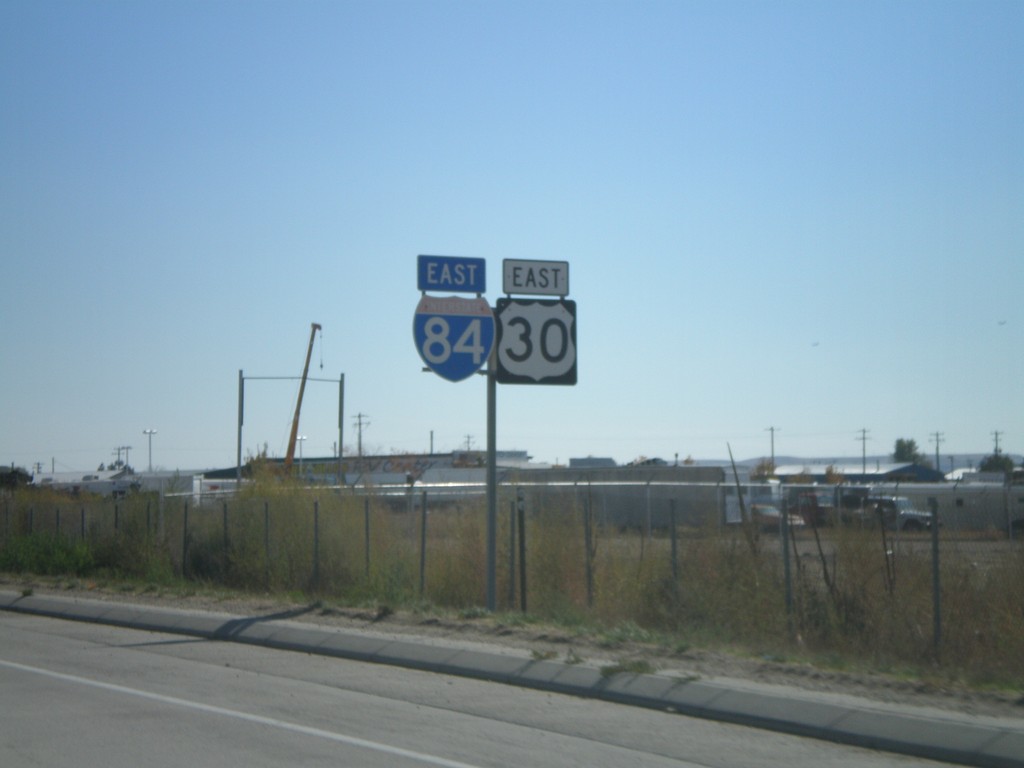
I-84/US-30 East - Boise
I-84 and US-30 east shields in south Boise. Idaho is good at signing multiplexed highways.
Taken 10-13-2007
Boise
Ada County
Idaho
United States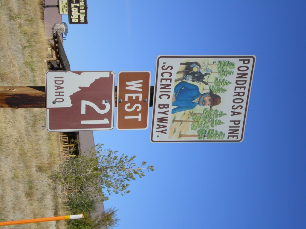
Begin ID-21 West - Ponderosa Pine Scenic Byway
Begin ID-21 West - Ponderosa Pine Scenic Byway
Taken 10-08-2007
Stanley
Custer County
Idaho
United States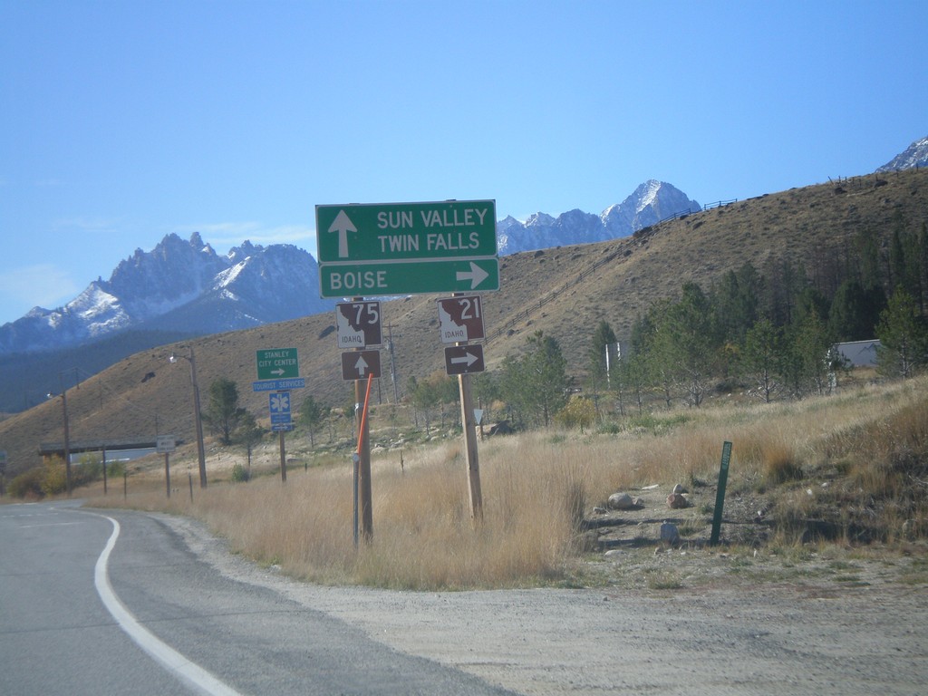
ID-75 South at ID-21 North
ID-75 south at ID-21 west to Boise.
Taken 10-08-2007
 Stanley
Custer County
Idaho
United States
Stanley
Custer County
Idaho
United States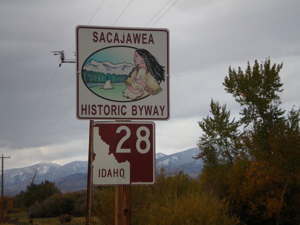
ID-28 North - Sacajawea Historic Byway
Sacajawea Scenic Byway on ID-28 north.
Taken 10-06-2007
 Tendoy
Lemhi County
Idaho
United States
Tendoy
Lemhi County
Idaho
United States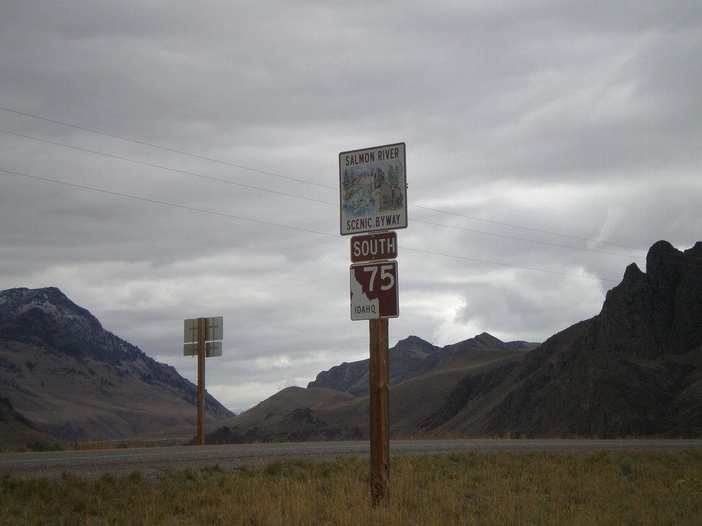
ID-75 South - Salmon River Scenic Byway
Begin ID-75 South/Salmon River Scenic Byway, just south of US-93.
Taken 10-06-2007
Challis
Custer County
Idaho
United States