Signs Tagged With Shield
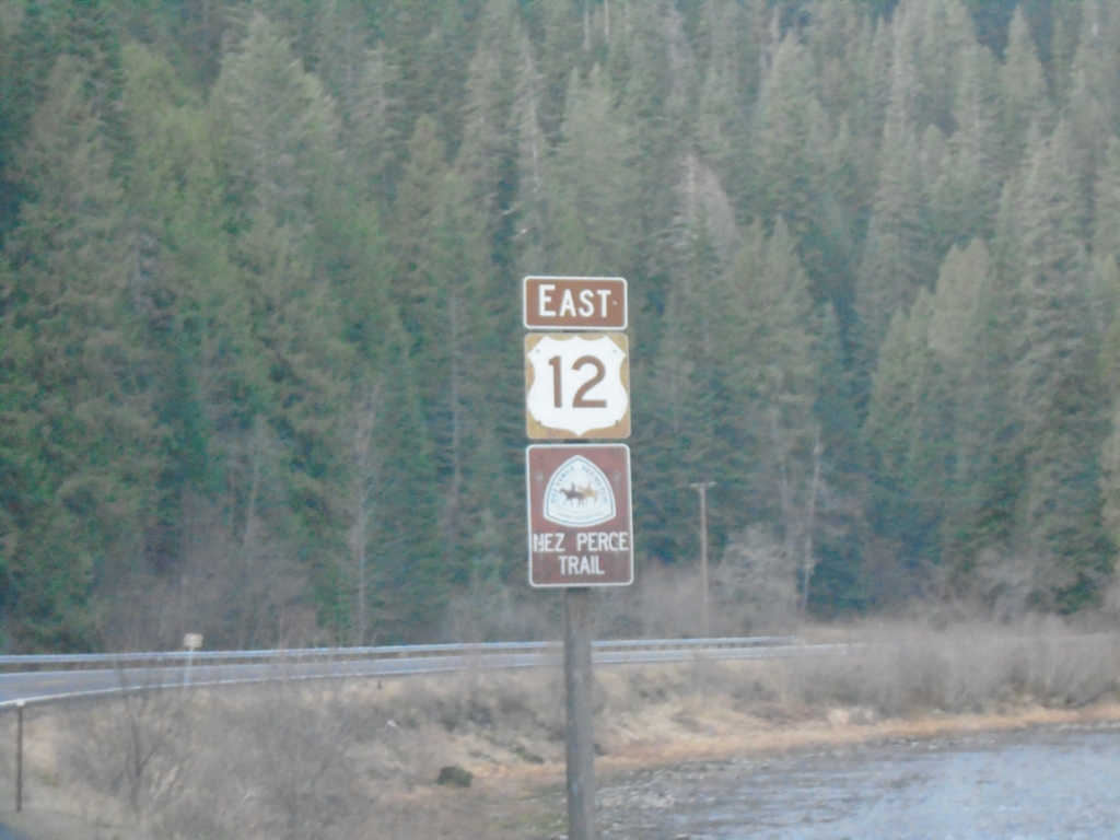
US-12 East - Nez Perce Trail
US-12 East - Nez Perce Trail. The Lochsa River is in the background. The US-12 shield is the old style Idaho scenic byway shield, which was brown instead of black.
Taken 11-30-2024
 Kooskia
Idaho County
Idaho
United States
Kooskia
Idaho County
Idaho
United States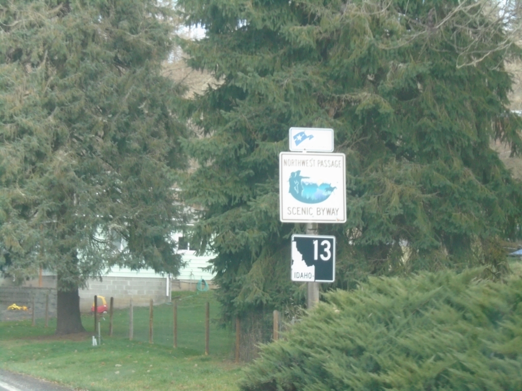
ID-13 - Northwest Passage Scenic Byway
ID-13 - Northwest Passage Scenic Byway in Harpster.
Taken 11-30-2024
 Harpster
Idaho County
Idaho
United States
Harpster
Idaho County
Idaho
United States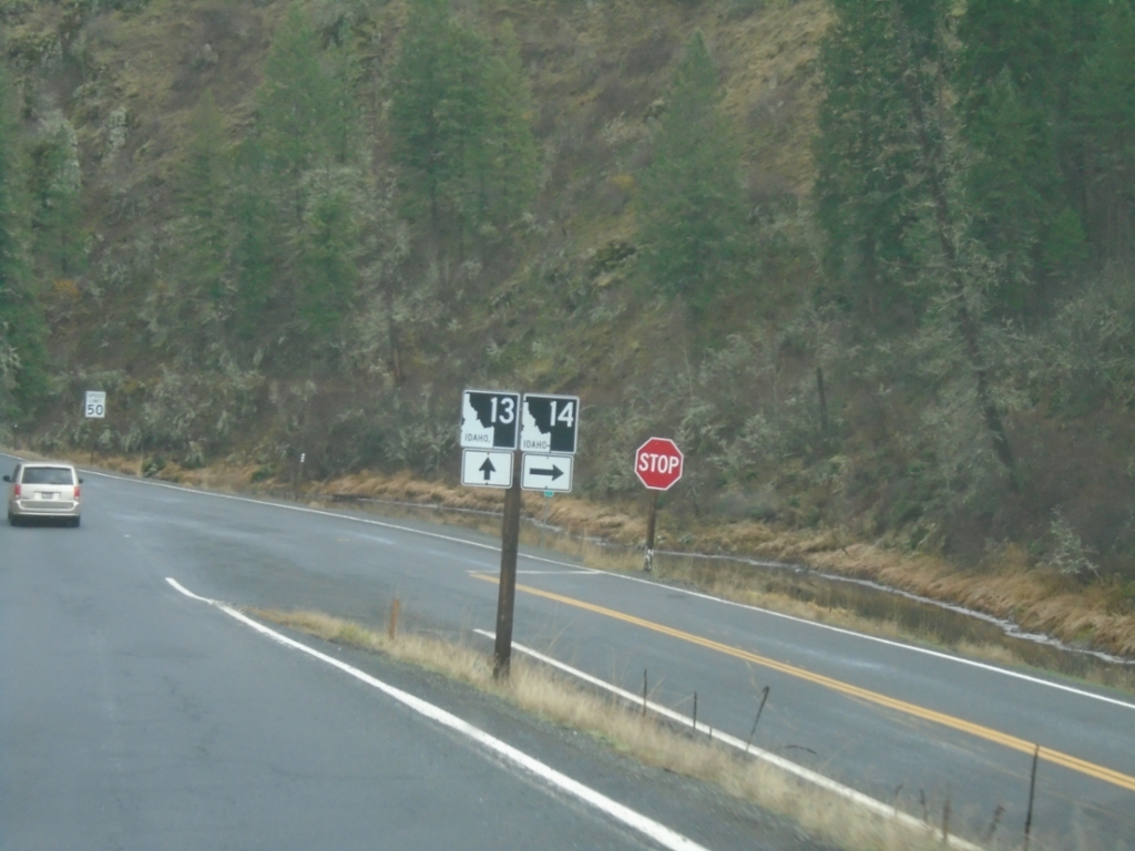
ID-13 North at ID-14
ID-13 North at ID-14 in Idaho County.
Taken 11-30-2024
 Harpster
Idaho County
Idaho
United States
Harpster
Idaho County
Idaho
United States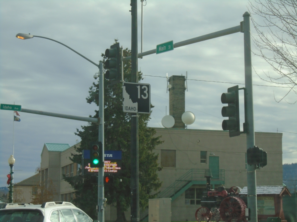
ID-13 - Grangeville
ID-13 North in Grangeville.
Taken 11-30-2024
Grangeville
Idaho County
Idaho
United States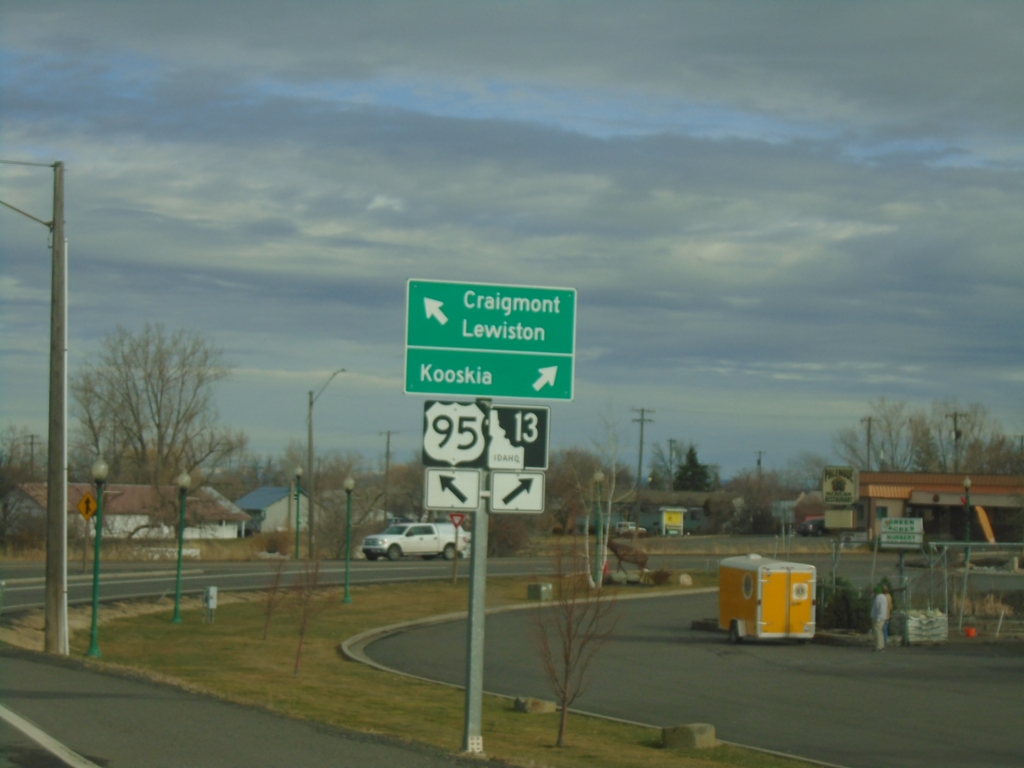
US-95 North at ID-13
US-95 North at ID-13 in Grangeville. Use ID-13 to Kooskia; continue north on US-95 to Craigmont and Lewiston.
Taken 11-30-2024
 Grangeville
Idaho County
Idaho
United States
Grangeville
Idaho County
Idaho
United States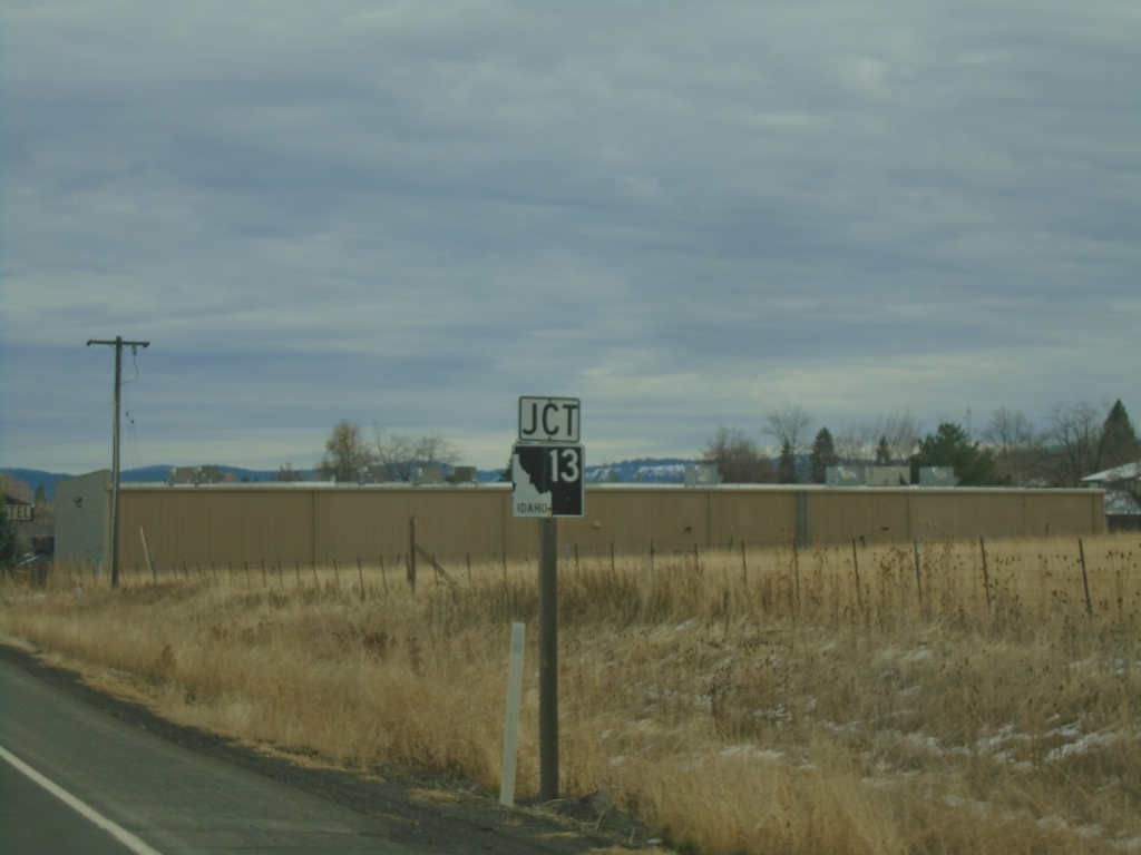
US-95 North Approaching ID-13
US-95 North approaching ID-13 in Grangeville.
Taken 11-30-2024
Grangeville
Idaho County
Idaho
United States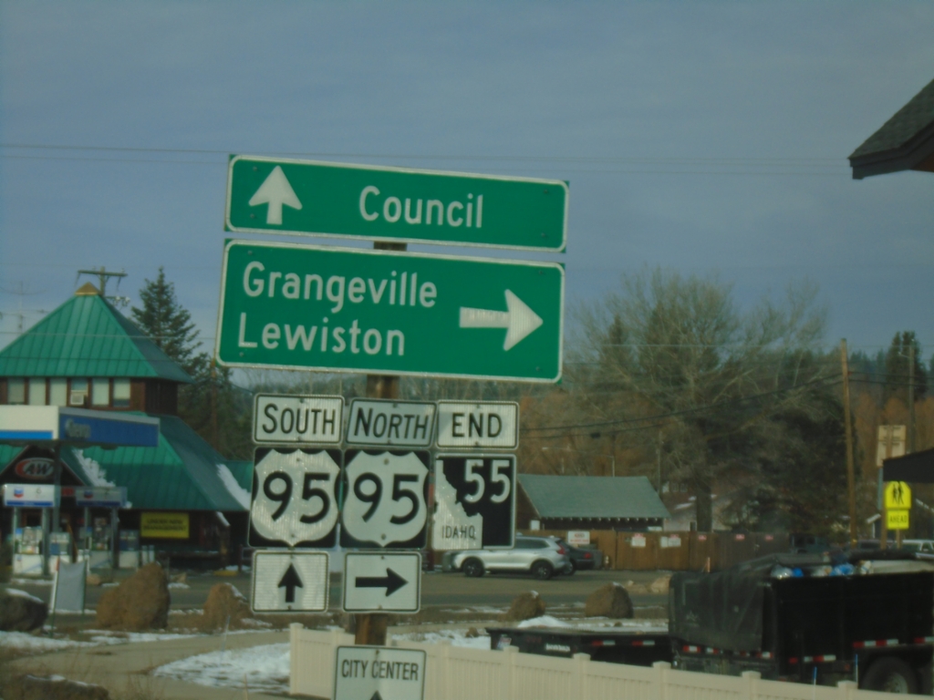
End ID-55 North at US-95
End ID-55 at US-95 south to Council, and north to Grangeville and Lewiston.
Taken 11-30-2024
 New Meadows
Adams County
Idaho
United States
New Meadows
Adams County
Idaho
United States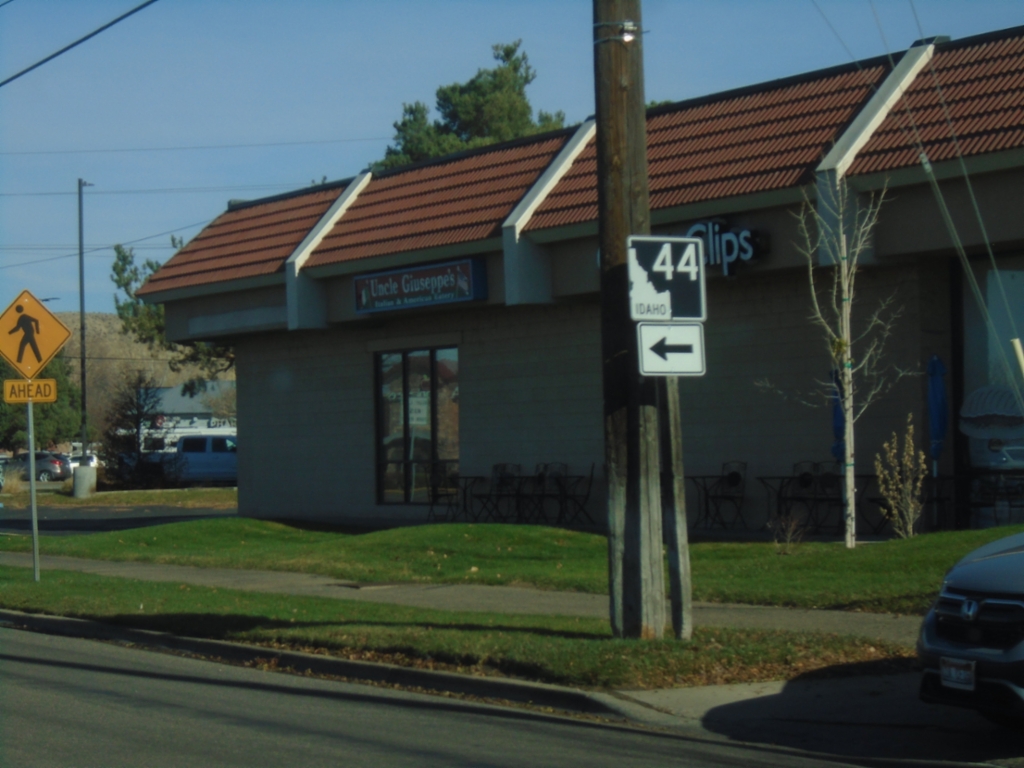
ID-44 West - Glenwood St. at State St.
ID-44 West - Glenwood St. at State Street in Garden City . Turn left on State St. to continue west on ID-44.
Taken 11-29-2024
 Garden City
Ada County
Idaho
United States
Garden City
Ada County
Idaho
United States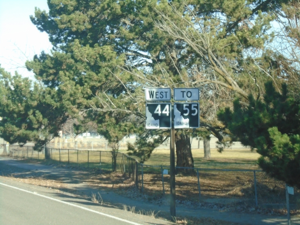
ID-44 West - To ID-55
ID-44 west to ID-55 on Glenwood St. North
Taken 11-29-2024
Garden City
Ada County
Idaho
United States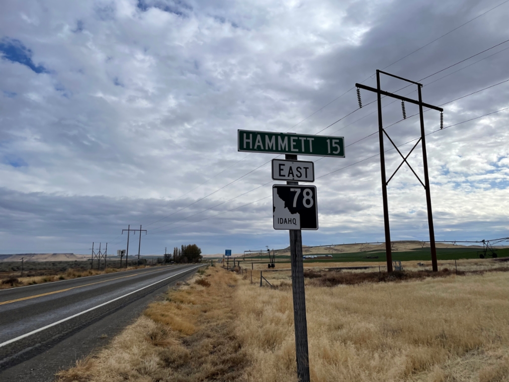
ID-78 East - Distance Marker
Distance marker on ID-78 East. Distance to Hammett.
Taken 11-02-2024
 Mountain Home
Owyhee County
Idaho
United States
Mountain Home
Owyhee County
Idaho
United States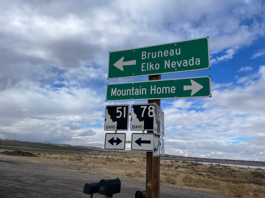
ID-78 West at ID-51
ID-78 west at ID-51. Use ID-51 north for Mountain Home. Use ID-51 South/ID-78 West for Bruneau and Elko, Nevada.
Taken 11-02-2024
 Bruneau
Owyhee County
Idaho
United States
Bruneau
Owyhee County
Idaho
United States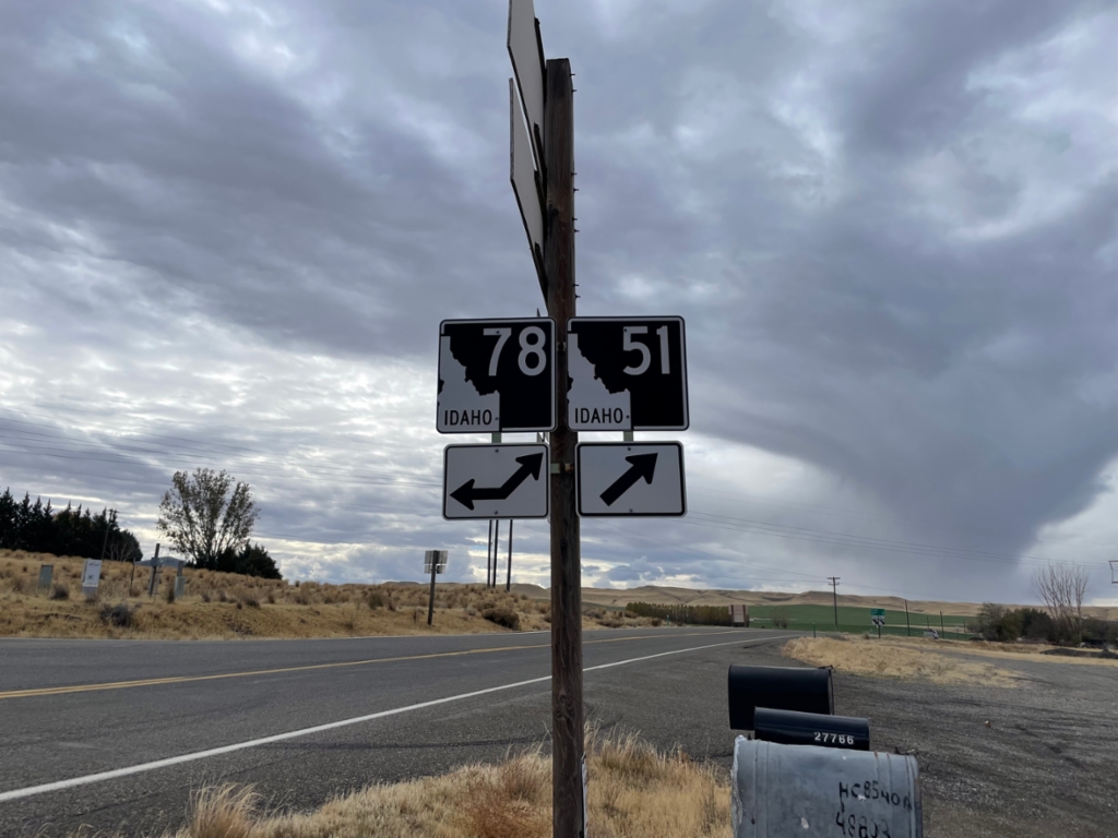
ID-51 South at ID-78
ID-51 south at ID-78. ID-78 joins ID-51 southbound through Bruneau.
Taken 11-02-2024
Mountain Home
Owyhee County
Idaho
United States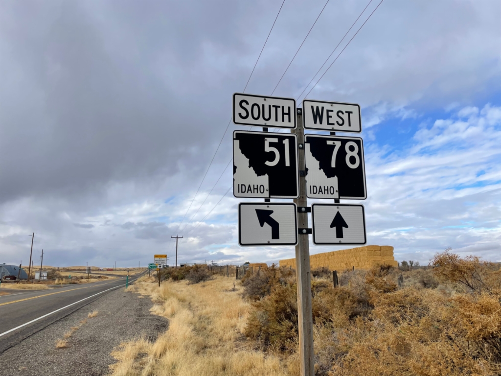
ID-78 West/ID-51 South Split
ID-78 West/ID-51 South split in Owyhee County.
Taken 11-02-2024
Bruneau
Owyhee County
Idaho
United States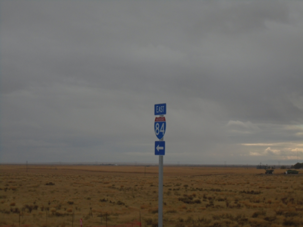
Simco Road South at I-84 East
Simco Road South at I-84 east (Exit 74)
Taken 11-02-2024


 Mountain Home
Elmore County
Idaho
United States
Mountain Home
Elmore County
Idaho
United States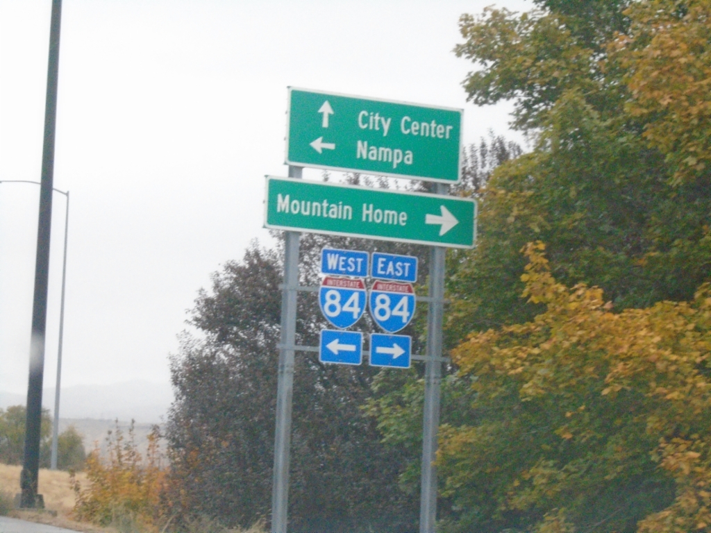
Vista Ave. North at I-84
Vista Ave. North at I-84 (Exit 53). Use I-84 East to Mountain Home; I-84 West to Nampa. Continue north on Vista Ave. to (Boise) City Center.
Taken 11-02-2024
Boise
Ada County
Idaho
United States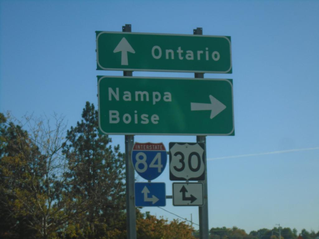
ID-19 West at I-84 Onramp
End BL-84 West at I-84/US-30/(US-20/US-26) in Caldwell. Use I-84/US-30 east for Nampa and Boise; I-84/US-30 west for Ontario (Oregon).
Taken 10-19-2024

 Caldwell
Canyon County
Idaho
United States
Caldwell
Canyon County
Idaho
United States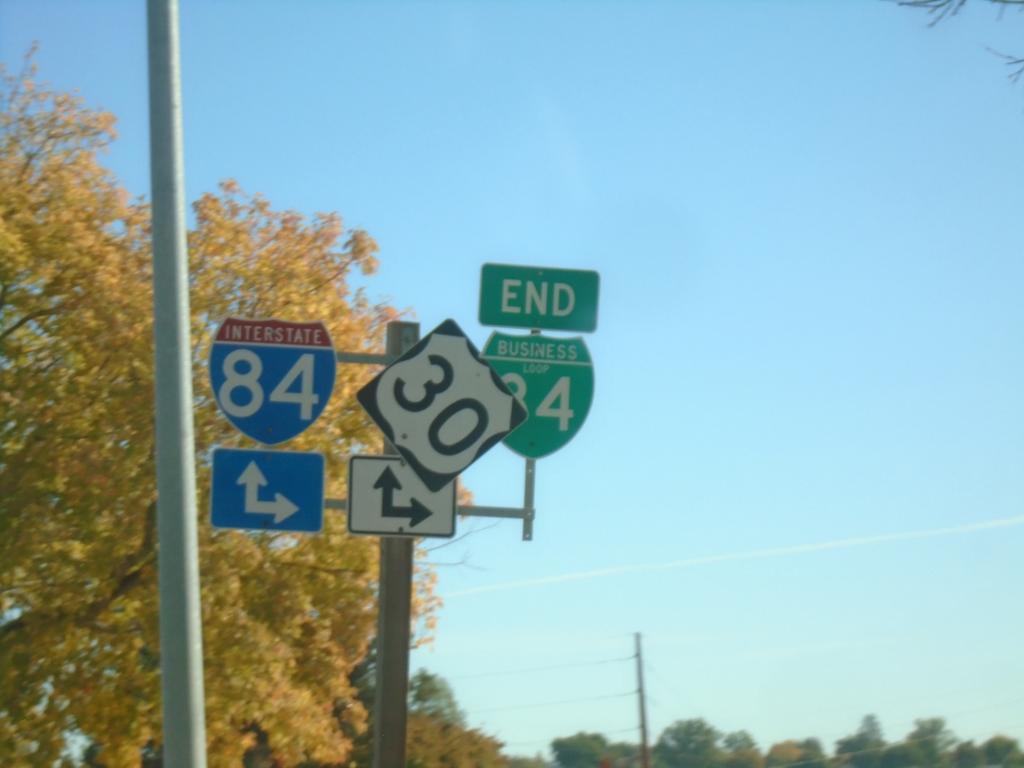
End BL-84 West at I-84/US-30
End BL-84 West at I-84/US-30 in Caldwell.
Taken 10-19-2024
Caldwell
Canyon County
Idaho
United States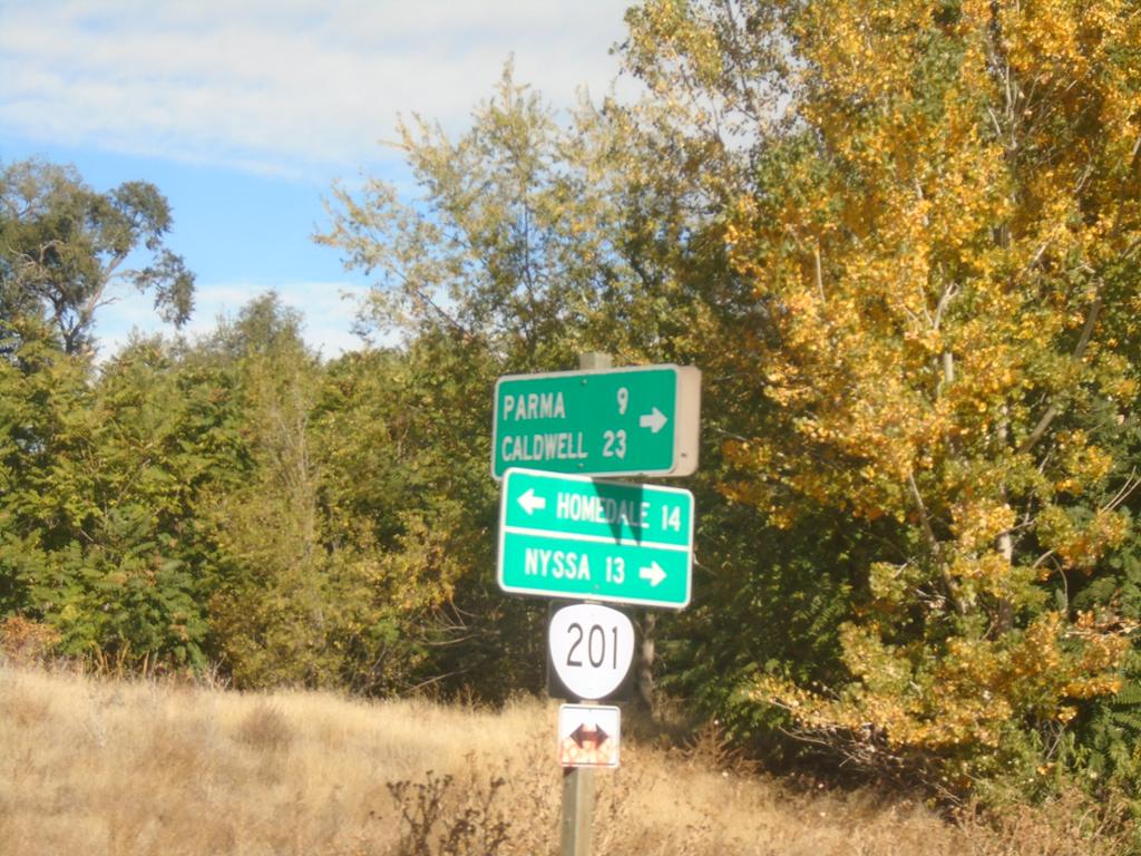
OR-201 North at OR-452
OR-201 North at OR-452 (unsigned) in Adrian. Turn right for OR-452 east to Parma (Idaho) and Caldwell (Idaho). Use OR-201 North to Nyssa; OR-201 South to Homedale (Idaho).
Taken 10-19-2024

 Adrian
Malheur County
Oregon
United States
Adrian
Malheur County
Oregon
United States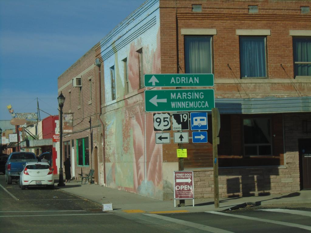
ID-19 West at Main Street - Homedale
ID-19 West at Main St. in Homedale. This intersection was formerly along the route of US-95, until a bypass was constructed along the southeast side of town. Turn left on Main Street. for US-95, Marsing, and Winnemucca (Nevada). Continue straight on Idaho Ave. for ID-19 to Adrian (Oregon).
Taken 10-19-2024
Homedale
Owyhee County
Idaho
United States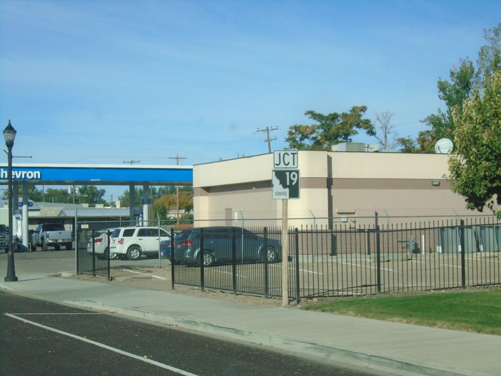
ID-19 West - Homedale
ID-19 west (Idaho Ave.) approaching Main Street in Homedale. The junction sign approaching this intersection suggests that ID-19 actually runs along Main Street.
Taken 10-19-2024
Homedale
Owyhee County
Idaho
United States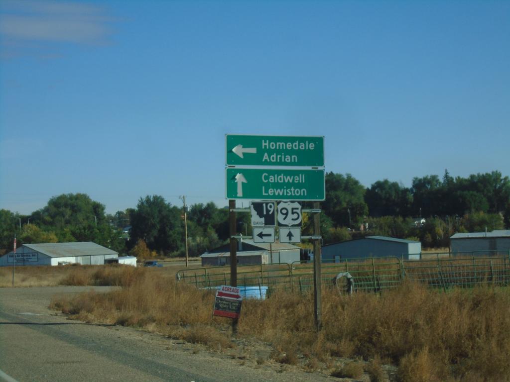
US-95 North at ID-19
US-95 North at ID-19 in Homedale. Use ID-19 west to Homedale and Adrian (Oregon). Continue on US-95 North/ID-19 East to Caldwell and Lewiston.
Taken 10-19-2024
Homedale
Owyhee County
Idaho
United States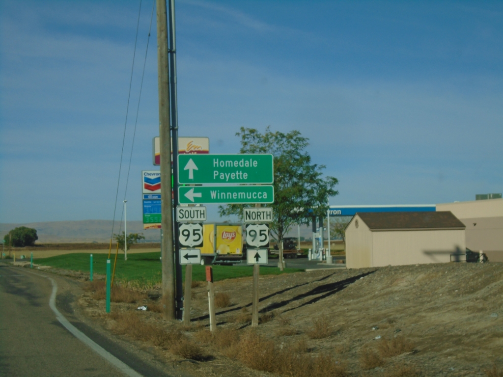
End ID-55 South at US-95
End ID-55 South at US-95. Use US-95 north to Homedale and Payette. Use US-95 south to Winnemucca (Nevada).
Taken 10-19-2024
Marsing
Owyhee County
Idaho
United States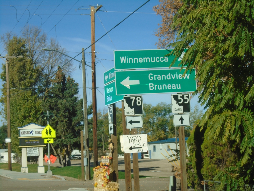
ID-55 South at ID-78
ID-55 south at ID-78 east to Grandview and Bruneau. Continue south on ID-55 for Winnemuuca (Nevada), via US-95 south.
Taken 10-19-2024
Marsing
Owyhee County
Idaho
United States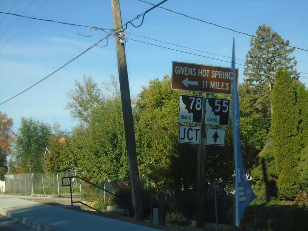
ID-55 South Approaching ID-78
ID-55 South approaching ID-78 east to Givens Hot Springs.
Taken 10-19-2024
Marsing
Owyhee County
Idaho
United States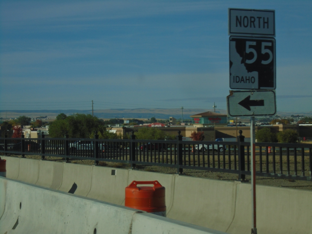
Karcher Road West at I-84/US-30 East
Karcher Road West at I-84/US-30 East/ID-55 North (Exit 33). Turn left for ID-55 North.
Taken 10-19-2024
Nampa
Canyon County
Idaho
United States