Signs Tagged With Shield
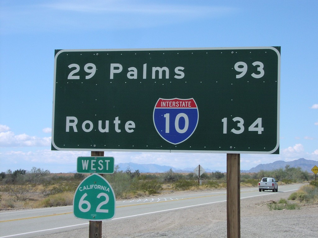
CA-62 West - Distance Marker
Distance marker on CA-62 west to 29 Palms and I-10. Taken just west of US-95 junction.
Taken 03-01-2006

 Vidal Junction
San Bernardino County
California
United States
Vidal Junction
San Bernardino County
California
United States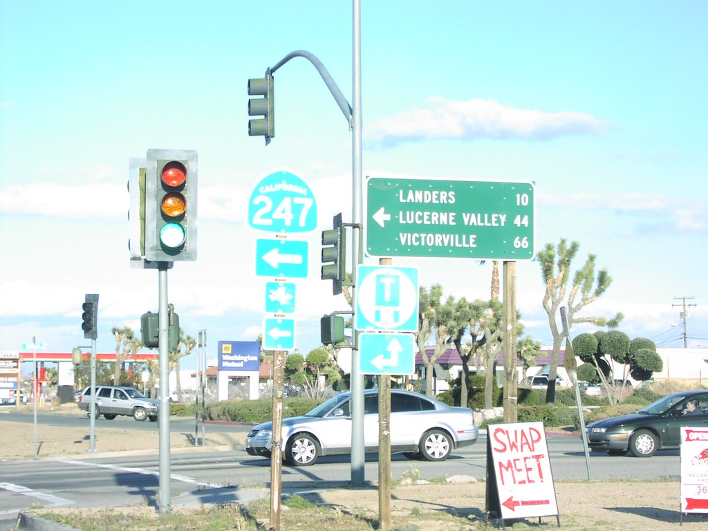
CA-62 East at CA-247 North
CA-62 east at CA-247 north to Landers, Lucerne Valley, and Victorville
Taken 03-01-2006
 Yucca Valley
San Bernardino County
California
United States
Yucca Valley
San Bernardino County
California
United States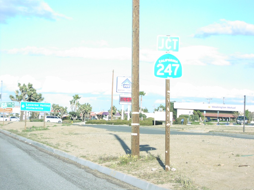
CA-62 East Approaching CA-247 North
Junction CA-247 on CA-62 east
Taken 03-01-2006
Yucca Valley
San Bernardino County
California
United States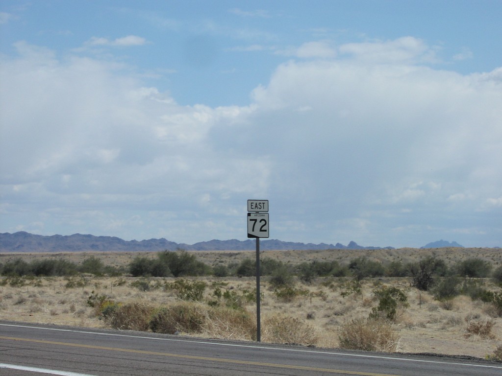
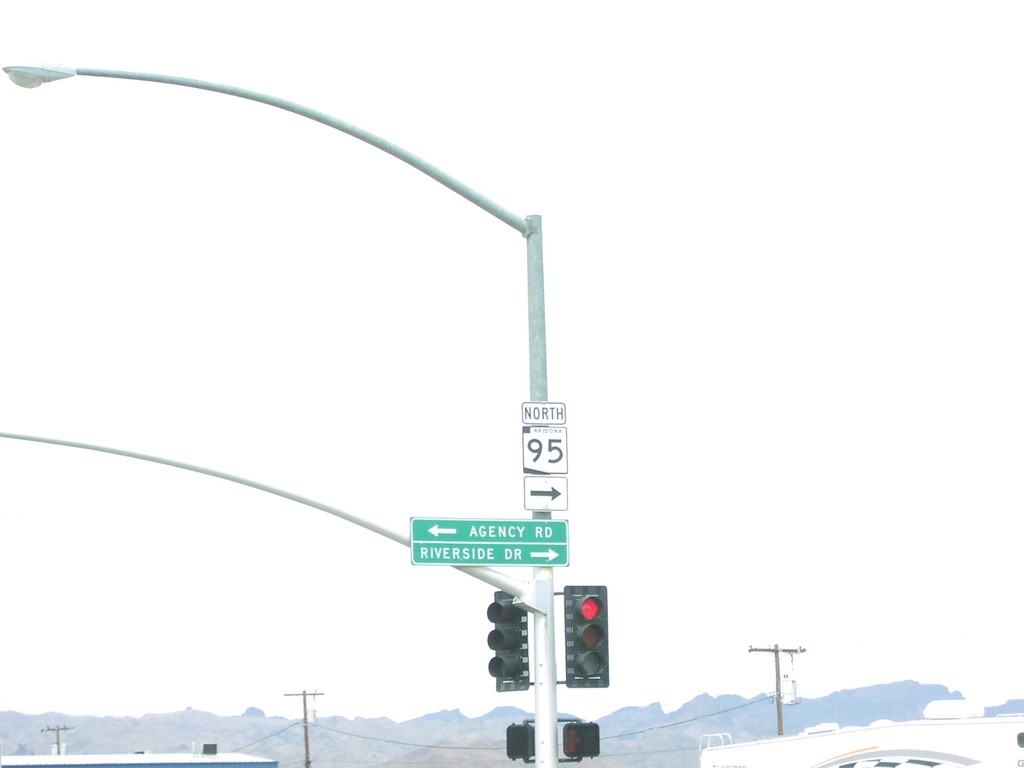
AZ-95 North at Truck AZ-95
AZ-95 north at Truck AZ-95
Taken 03-01-2006
 Parker
La Paz County
Arizona
United States
Parker
La Paz County
Arizona
United States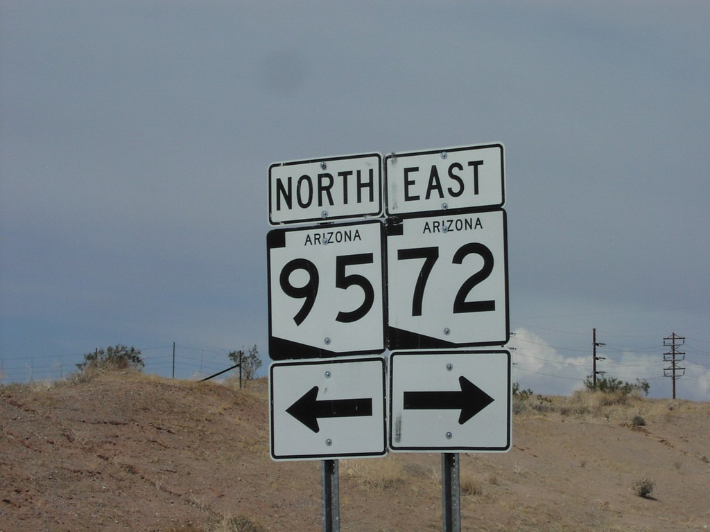
AZ-95 North at AZ-72 East
AZ-95 north at AZ-72 junction.
Taken 03-01-2006
 Parker
La Paz County
Arizona
United States
Parker
La Paz County
Arizona
United States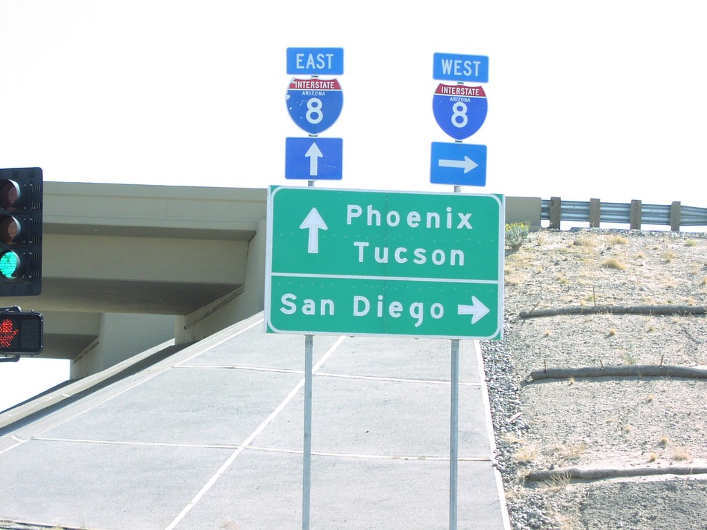
AZ-280 South at I-8 Exit 3 Onramp
Begin of AZ-280 south at I-8 to San Diego, Phoenix, and Tuscon.
Taken 03-01-2006

 Yuma
Yuma County
Arizona
United States
Yuma
Yuma County
Arizona
United States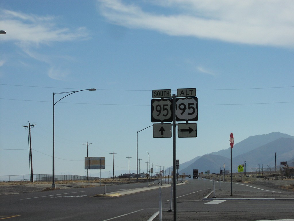
US-95 South/US-95 Alt.
US-95 south at Alt US-95 north to Yerrington
Taken 02-01-2006

 Schurz
Mineral County
Nevada
United States
Schurz
Mineral County
Nevada
United States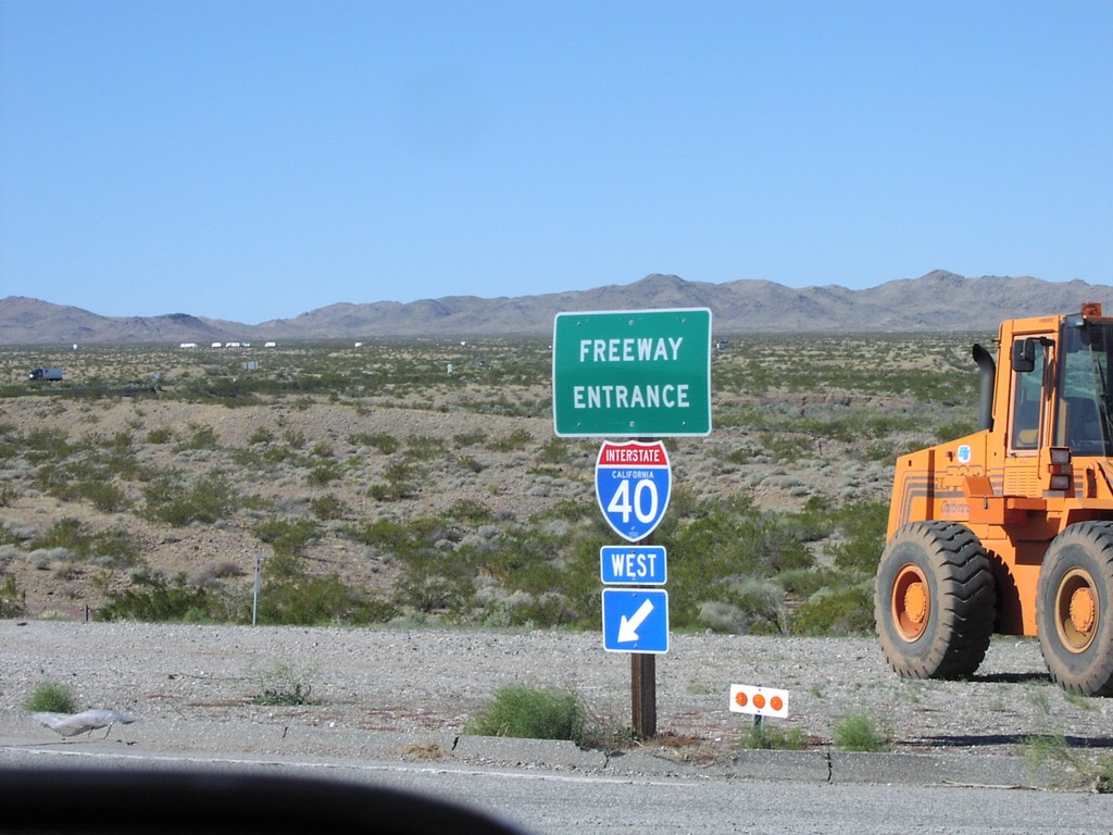
US-95 South at I-40
US-95 north at I-40 onramp
Taken 02-01-2006
 Needles
San Bernardino County
California
United States
Needles
San Bernardino County
California
United States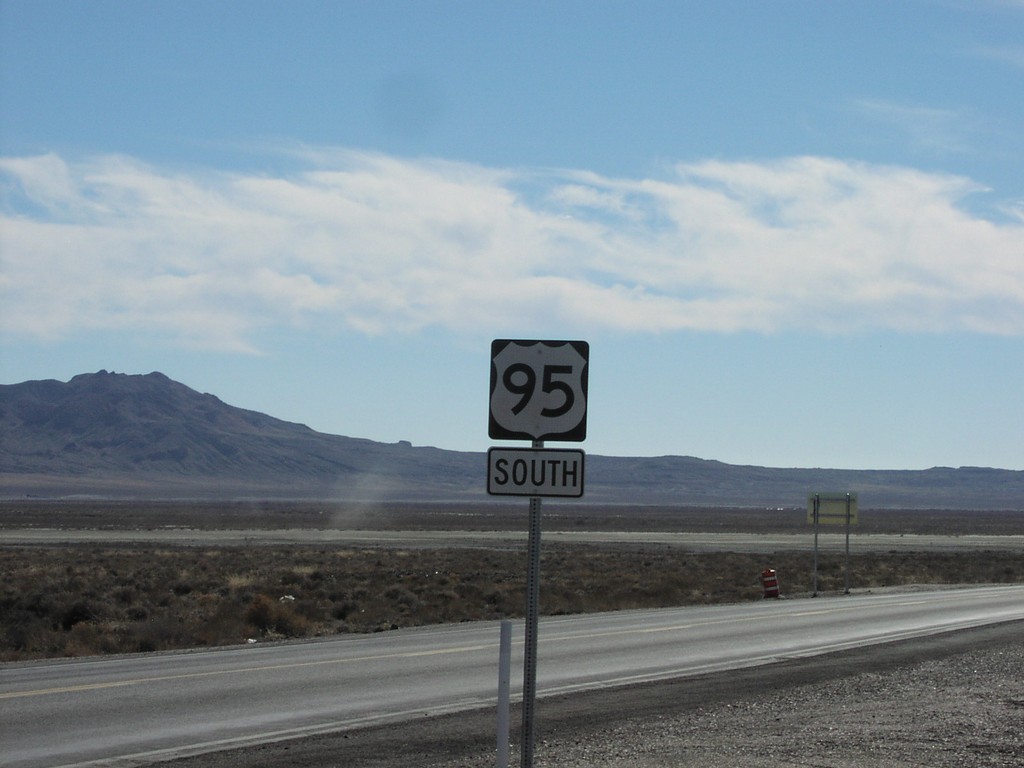
US-95 South
First US-95 south reassurance marker after leaving I-80
Taken 02-01-2006
Churchill County
Nevada
United States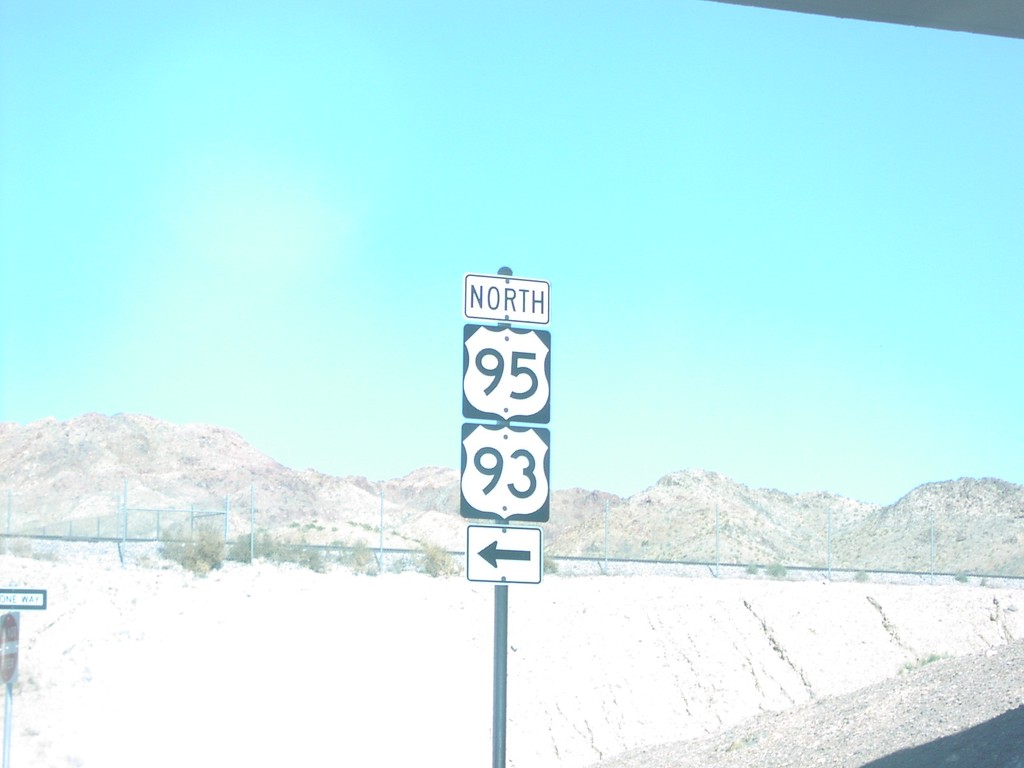
US-95 North at US-93 Jct.
US-95/US-93 north shields at onramp to Las Vegas.
Taken 02-01-2006

 Boulder City
Clark County
Nevada
United States
Boulder City
Clark County
Nevada
United States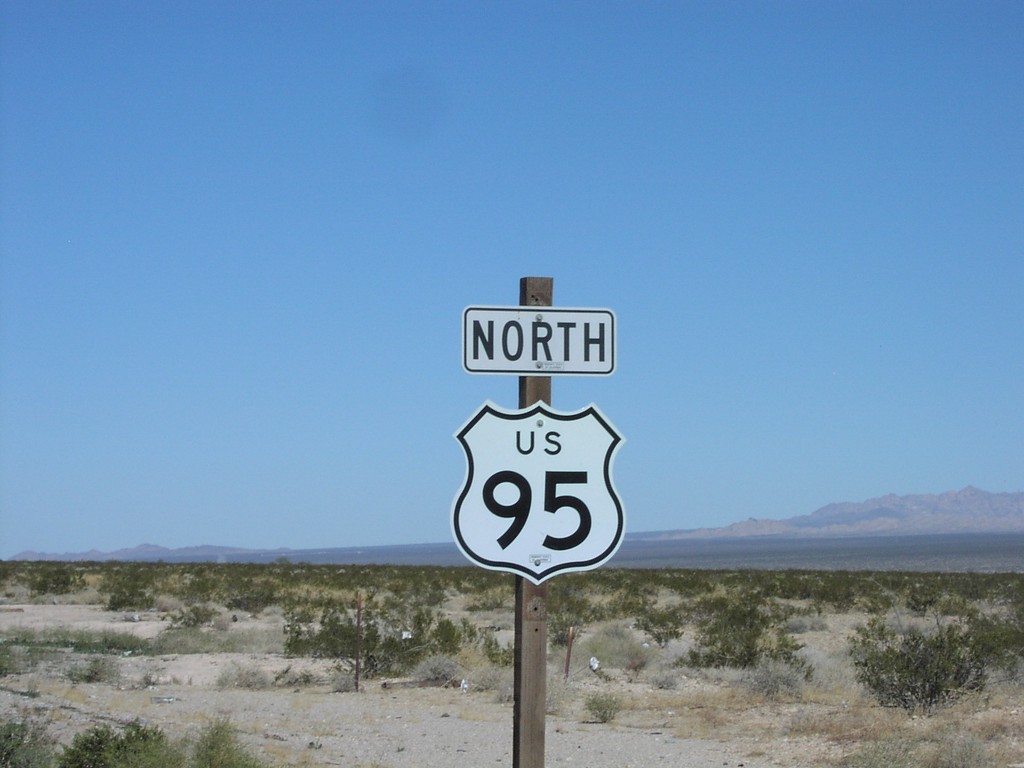
US-95 North
US-95 north reassurance marker
Taken 02-01-2006
Arrowhead Junction
San Bernardino County
California
United States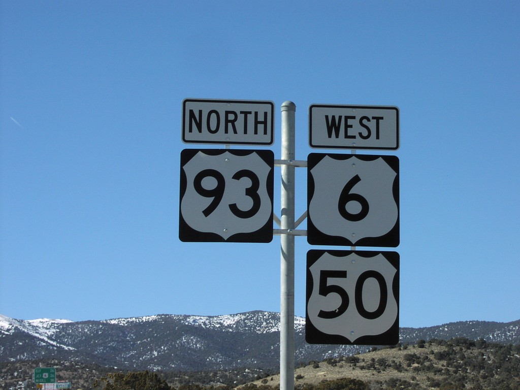
US-93 North/US-6 West/US-50 West
US-93 North/US-6 West/US-50 West north of Majors Junction
Taken 02-01-2006

 Majors Place
White Pine County
Nevada
United States
Majors Place
White Pine County
Nevada
United States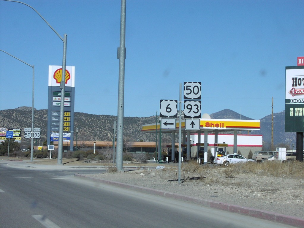
US-93 North/US-50 West at US-6 West
US-93 North/US-50 West at US-6 west
Taken 02-01-2006
Ely
White Pine County
Nevada
United States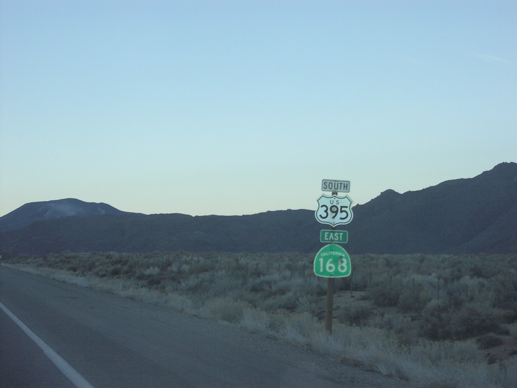
US-395 South/CA-168 East
US-395 south/CA-168 east
Taken 02-01-2006

 West Bishop
Inyo County
California
United States
West Bishop
Inyo County
California
United States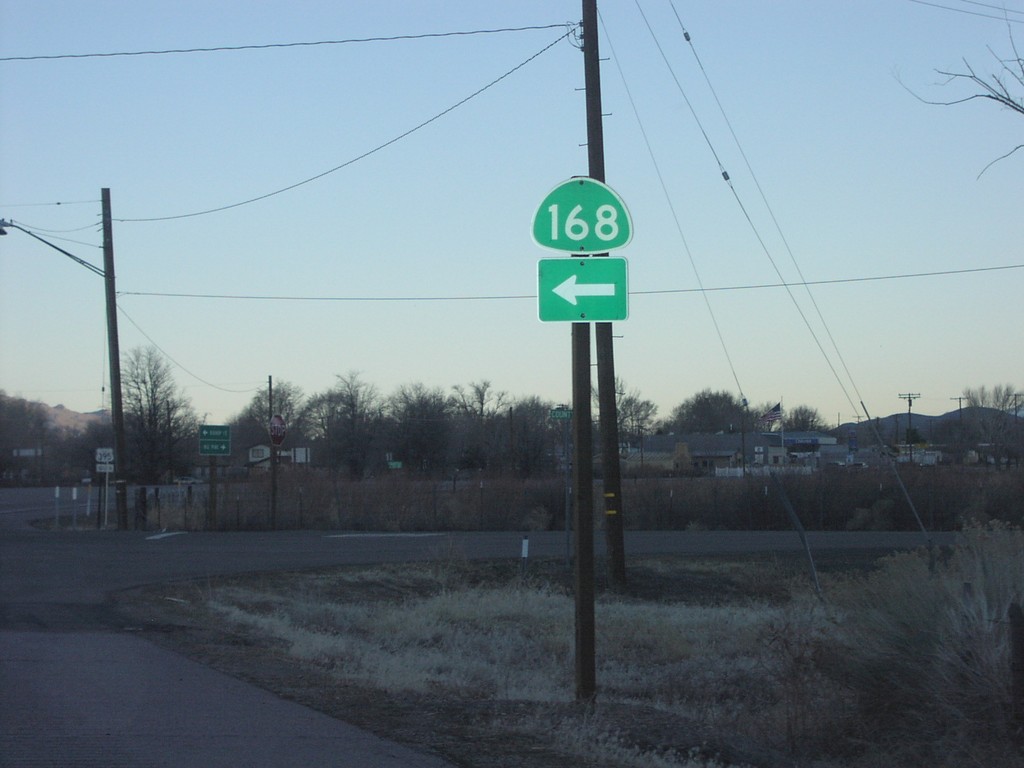
US-395 South at CA-168 East
CA-168 left turn on US-395 south. CA-168 shield does not have California text.
Taken 02-01-2006
Big Pine
Inyo County
California
United States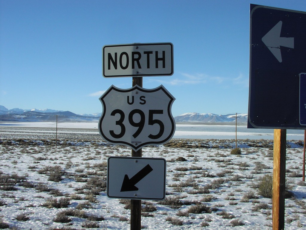
US-395 Entrance at Crowley Lake
US-395 freeway entrance at Crowley Lake IC
Taken 02-01-2006
South Landing
Mono County
California
United States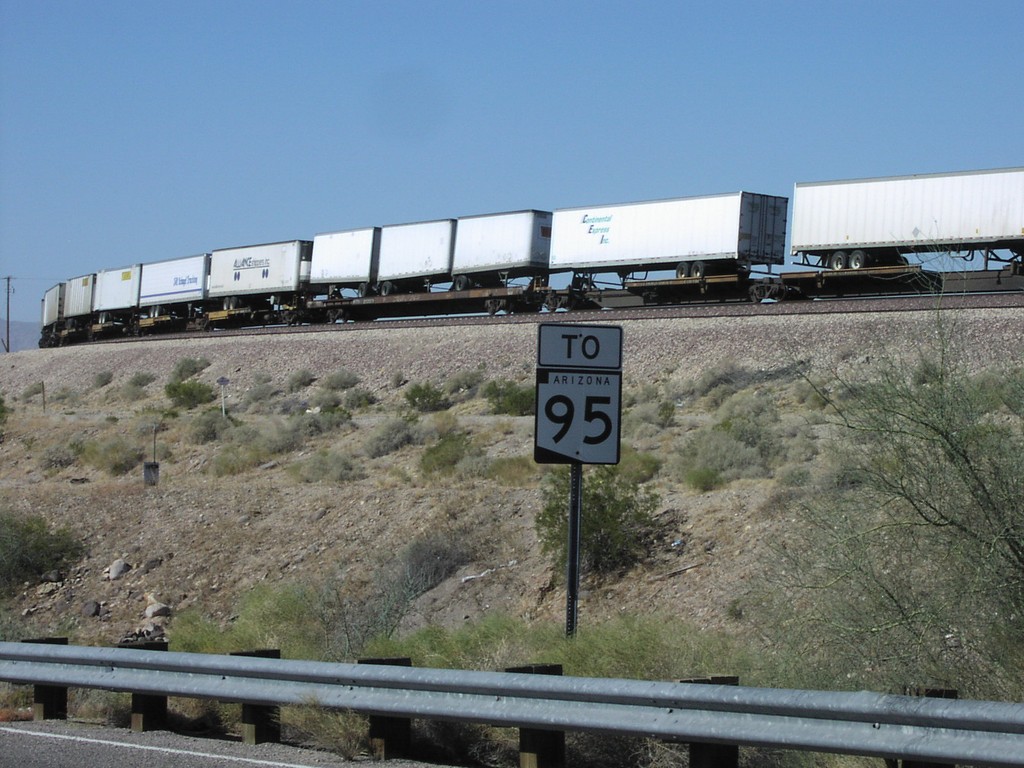
To AZ-95 Oatman Topock Hwy
To AZ-95 on north Oatman-Topock Highway, north of I-40
Taken 02-01-2006
Catfish Paradise
Mohave County
Arizona
United States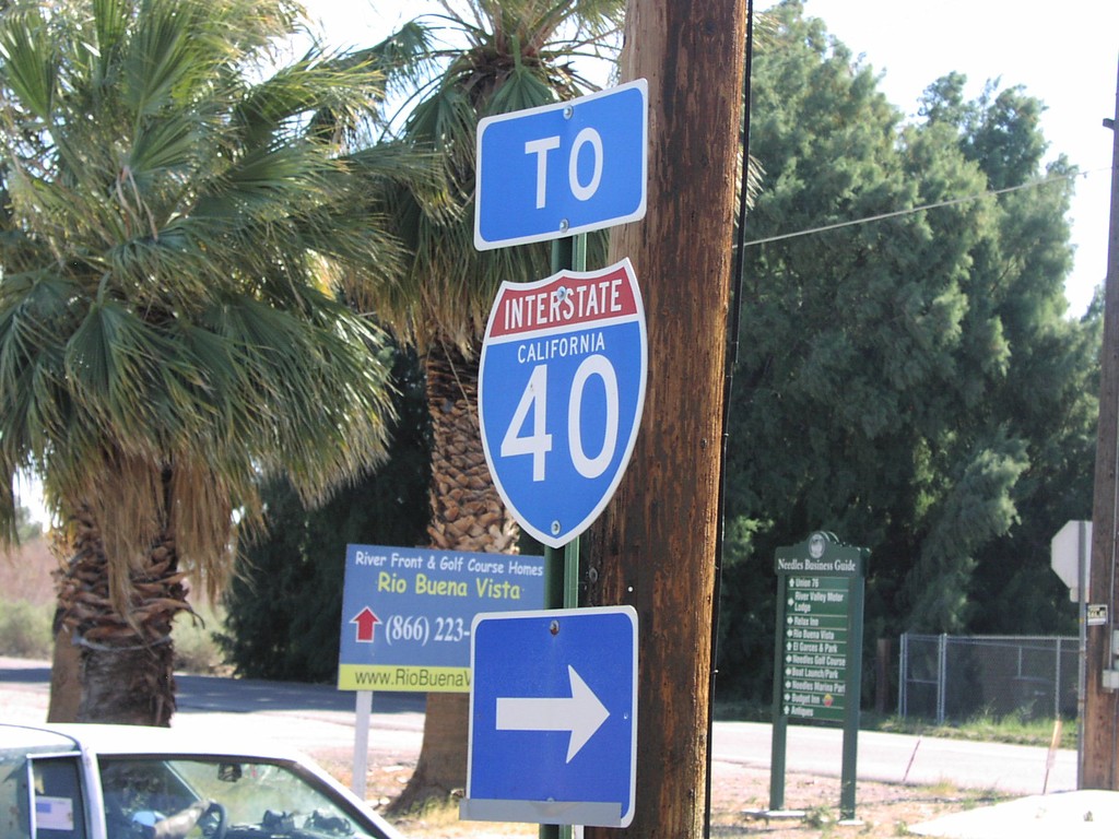
River Rd@HarborAve To I-40
To I-40 on River Drive/Harbor Blvd
Taken 02-01-2006
Needles
San Bernardino County
California
United States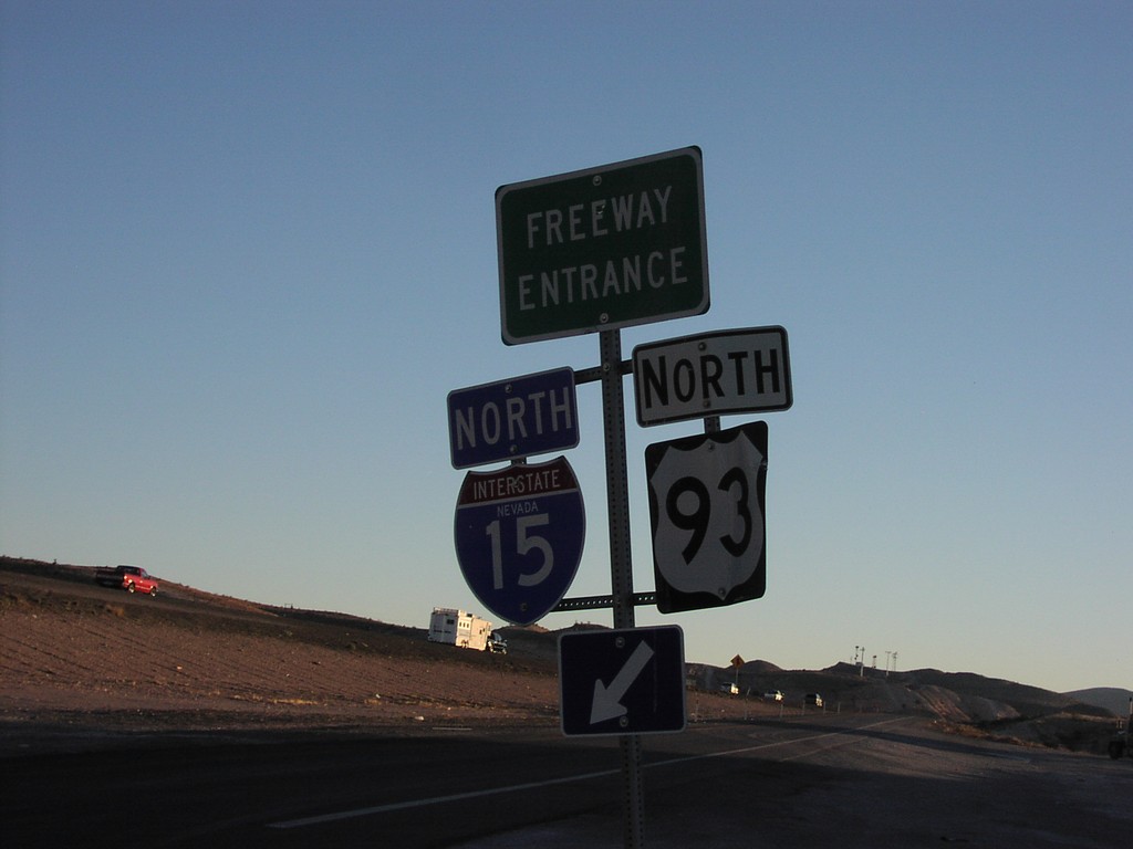
NV-604 at I-15 Onramp
NV-604 north at I-15/US-93 North onramp
Taken 02-01-2006

 North Las Vegas
Clark County
Nevada
United States
North Las Vegas
Clark County
Nevada
United States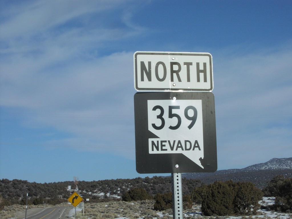
NV-359 North at NV/CA Stateline
NV-359 north at California border
Taken 02-01-2006
 Mina
Mineral County
Nevada
United States
Mina
Mineral County
Nevada
United States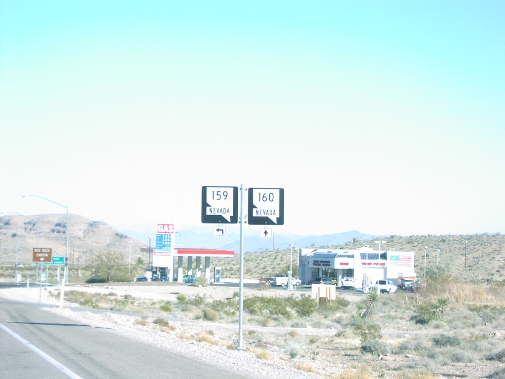
NV-160 East at NV-159
NV-160/NV-159 junction on NV-160 east
Taken 02-01-2006
 Las Vegas
Clark County
Nevada
United States
Las Vegas
Clark County
Nevada
United States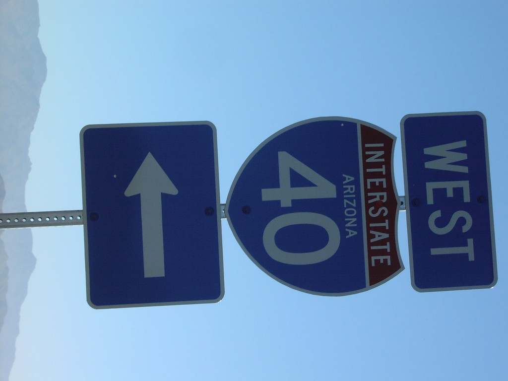
I-40 Santa Fe Ranch Rd Entrance
I-40 west shield on Santa Fe Ranch Road
Taken 02-01-2006
Golden Valley
Mohave County
Arizona
United States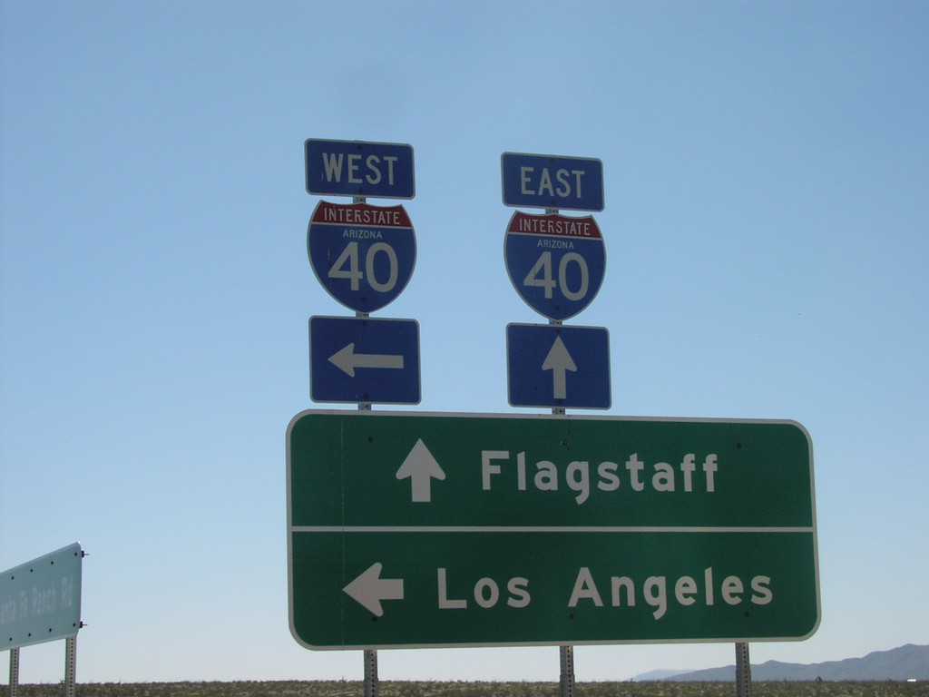
I-40 Santa Fe Ranch Rd Entrance
Santa Fe Ranch Road at I-40 to Flagstaff and Los Angeles
Taken 02-01-2006
Golden Valley
Mohave County
Arizona
United States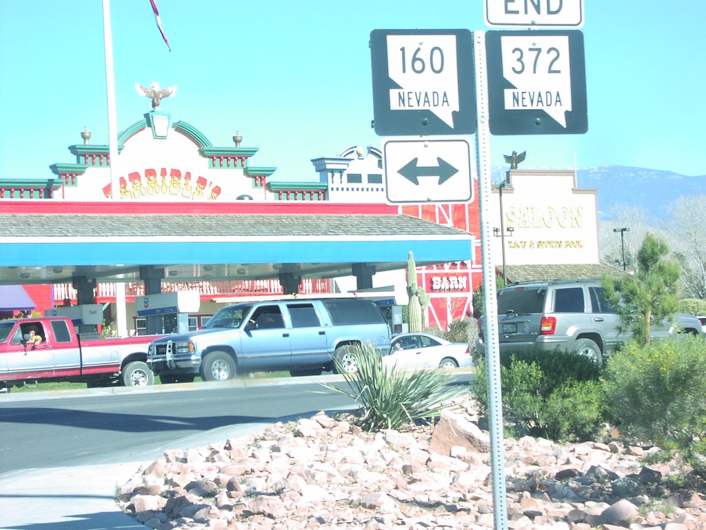
End NV-372 at NV-160
End NV-372 east at NV-160
Taken 02-01-2006
 Pahrump
Nye County
Nevada
United States
Pahrump
Nye County
Nevada
United States