Signs Tagged With Shield
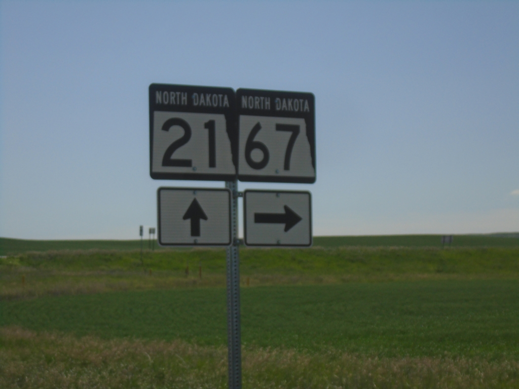
ND-21 East at ND-67
ND-21 East at ND-67 in Slope County
Taken 06-29-2025

 Amidon
Slope County
North Dakota
United States
Amidon
Slope County
North Dakota
United States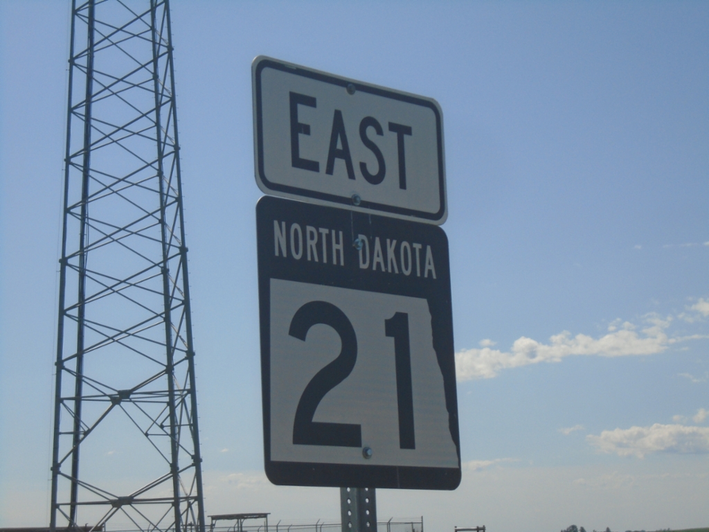
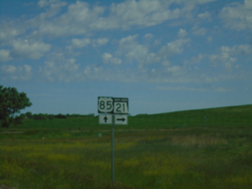
US-85 North at ND-21
US-85 North at ND-21 in Slope County.
Taken 06-29-2025
 Amidon
Slope County
North Dakota
United States
Amidon
Slope County
North Dakota
United States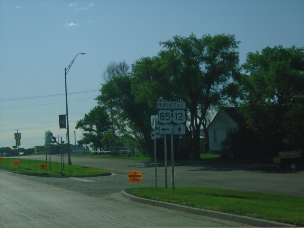
US-12 East/US-85 North at US-12/US-85 Split
US-12 East/US-85 North at US-12/US-85 split in Bowman.
Taken 06-29-2025
 Bowman
 County
North Dakota
United States
Bowman
Bowman County
North Dakota
United States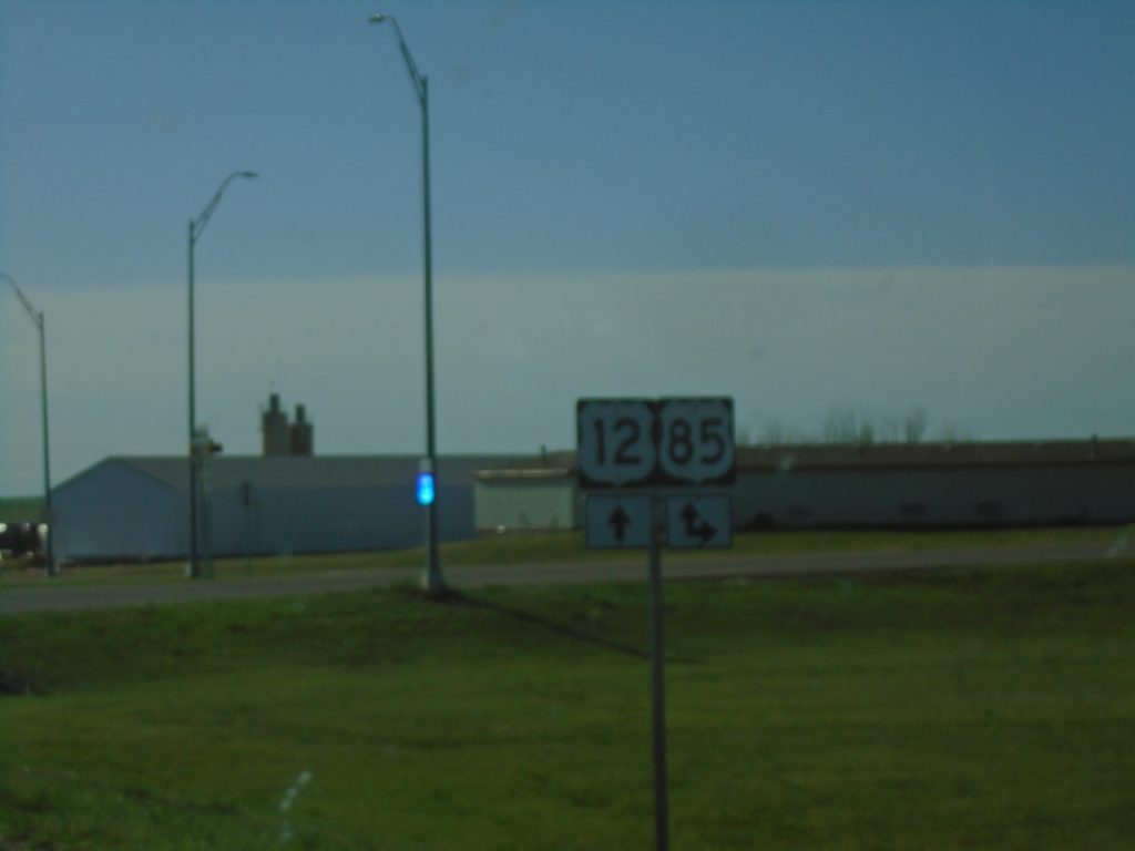
US-12 East at US-85 South - Bowman
US-12 East at US-85 South in Bowman. US-85 North joins US-12 east through Bowman.
Taken 06-29-2025
Bowman
Bowman County
North Dakota
United States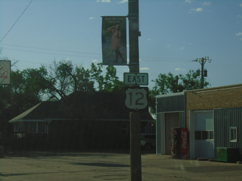
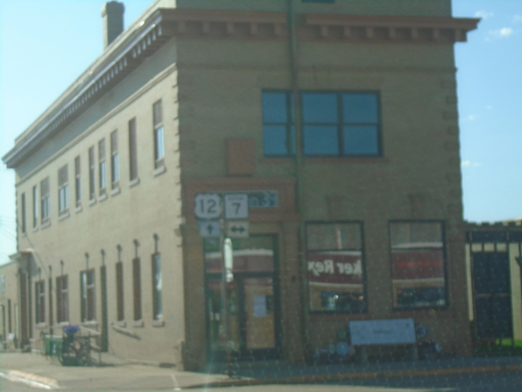
US-12 East at MT-7
US-12 East at MT-7 in Baker.
Taken 06-29-2025
 Baker
Fallon County
Montana
United States
Baker
Fallon County
Montana
United States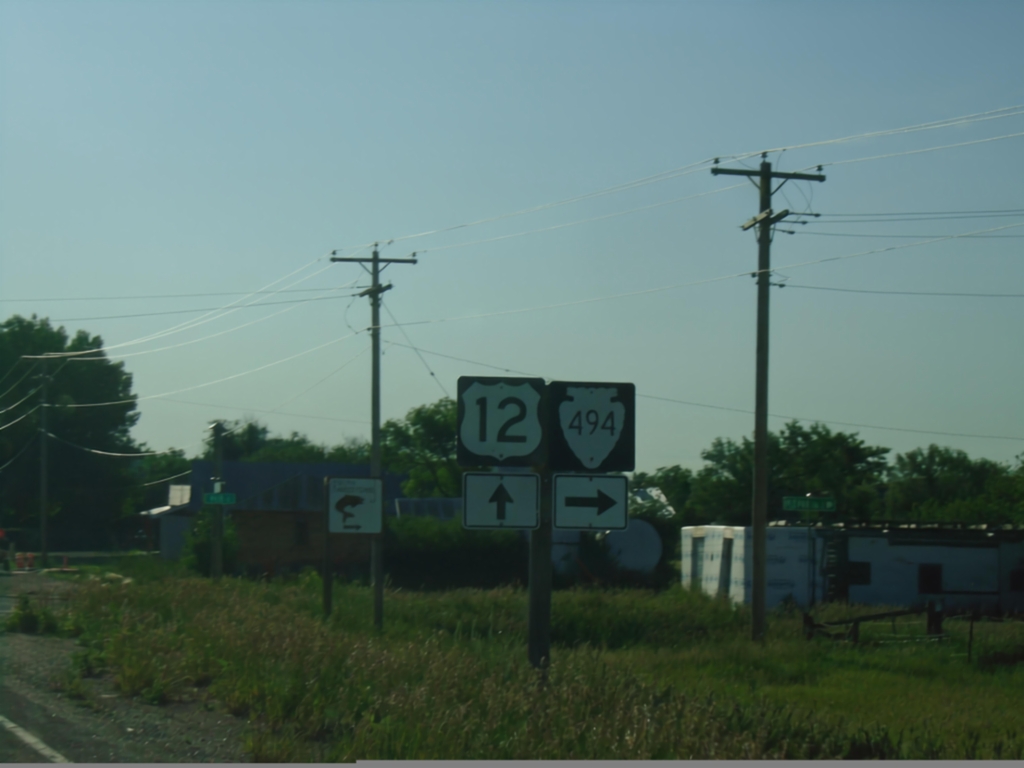
US-12 East at MTS-494
US-12 East at MTS-494 in Plevna.
Taken 06-29-2025
 Plevna
Fallon County
Montana
United States
Plevna
Fallon County
Montana
United States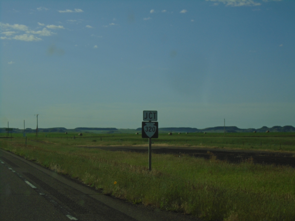
US-12 East Approaching MTS-320
US-12 East approaching MTS-320 in Fallon County.
Taken 06-29-2025
 Ismay
Fallon County
Montana
United States
Ismay
Fallon County
Montana
United States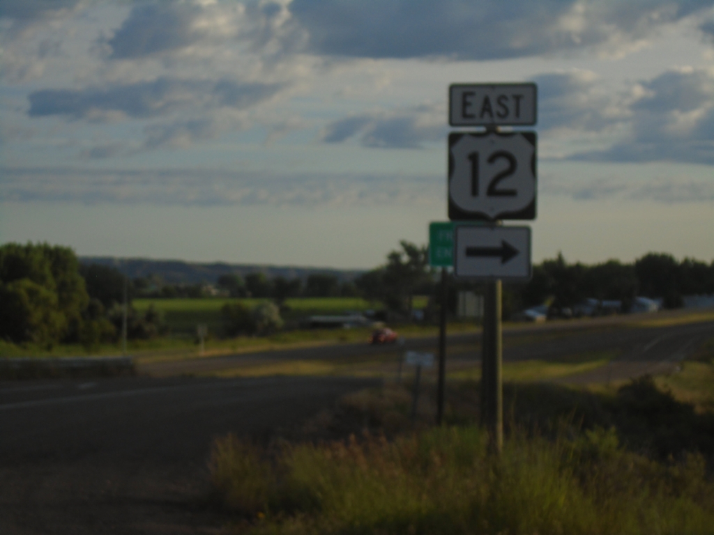
I-94 East - Exit 141 Offramp at US-12
I-94 East - Exit 141 Offramp at US-12. Turn right to continue east on US-12.
Taken 06-29-2025

 Miles City
Custer County
Montana
United States
Miles City
Custer County
Montana
United States
MT-59 North at I-94 West
MT-59 North at I-94 West. Use I-94 West for the MT-59 truck route through Miles City.
Taken 06-29-2025
 Miles City
Custer County
Montana
United States
Miles City
Custer County
Montana
United States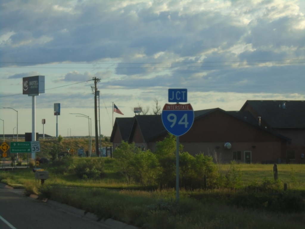
MT-59 North Approaching I-94
MT-59 North approaching I-94 in Miles City.
Taken 06-29-2025
Miles City
Custer County
Montana
United States
I-94 Freeway Entrance - East Forsyth Interchange
I-94 Freeway Entrance at East Forsyth interchange (Exit 95).
Taken 06-29-2025
Forsyth
Rosebud County
Montana
United States
I-94 East - Exit 93 Interchange at US-12
I-94 East - Exit 93 Interchange at US-12 West.
Taken 06-28-2025
Forsyth
Rosebud County
Montana
United States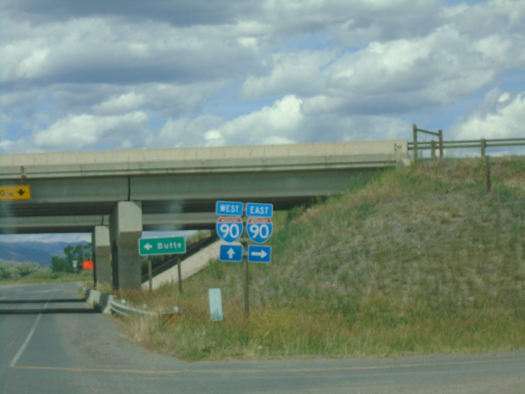
End MT-55 North at I-90
End MT-55 North at I-90 in Whitehall.
Taken 06-28-2025

 Whitehall
Jefferson County
Montana
United States
Whitehall
Jefferson County
Montana
United States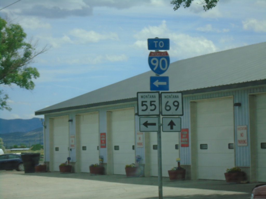
MT-2 East/MT-55 North at MT-69 and MT-55/To I-90
MT-2 East/MT-55 North at MT-69 and MT-55/To I-90 in Whitehall. Turn left for MT-55 North to I-90; continue straight for MT-2 East/MT-69 North.
Taken 06-28-2025

 Whitehall
Jefferson County
Montana
United States
Whitehall
Jefferson County
Montana
United States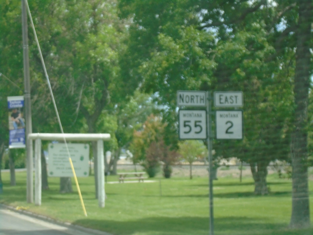
MT-2 East/MT-55 North - Whitehall
MT-2 East/MT-55 North in Whitehall
Taken 06-28-2025
Whitehall
Jefferson County
Montana
United States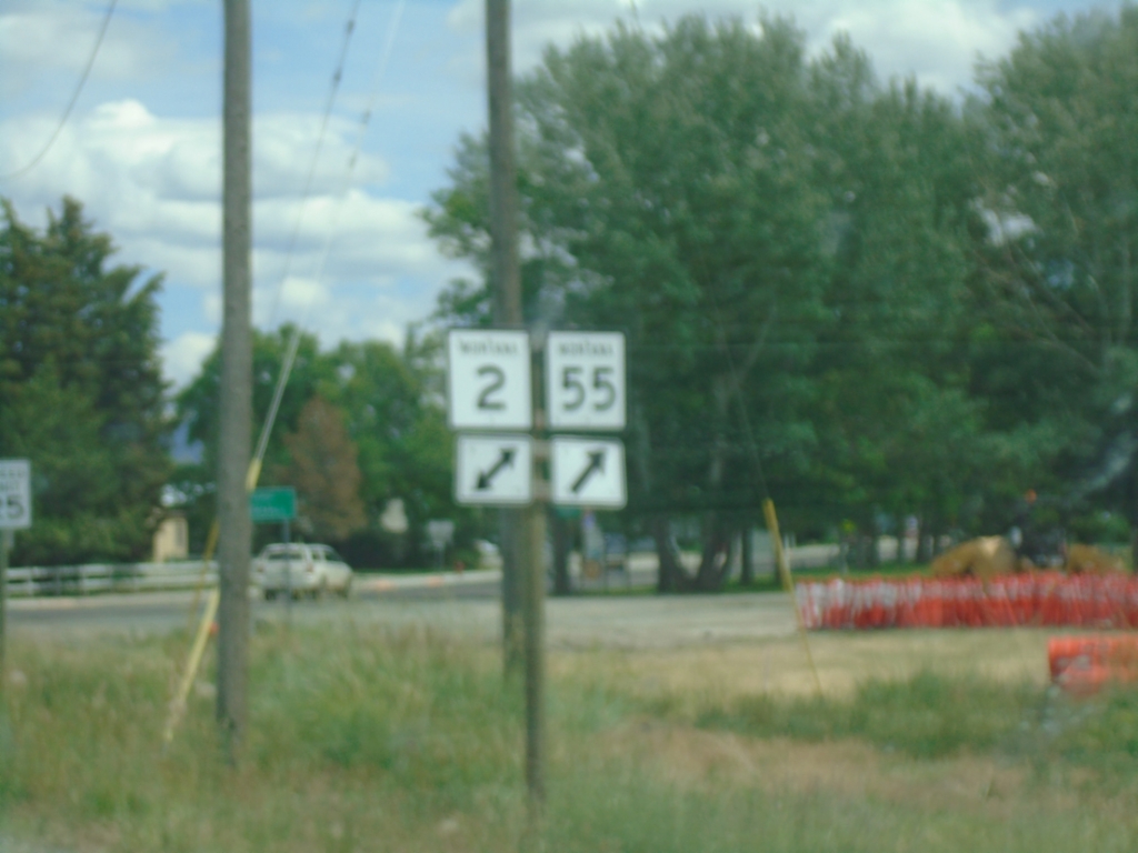
MT-55 North at MT-2
MT-55 North at MT-2 in Whitehall.
Taken 06-28-2025
Whitehall
Jefferson County
Montana
United States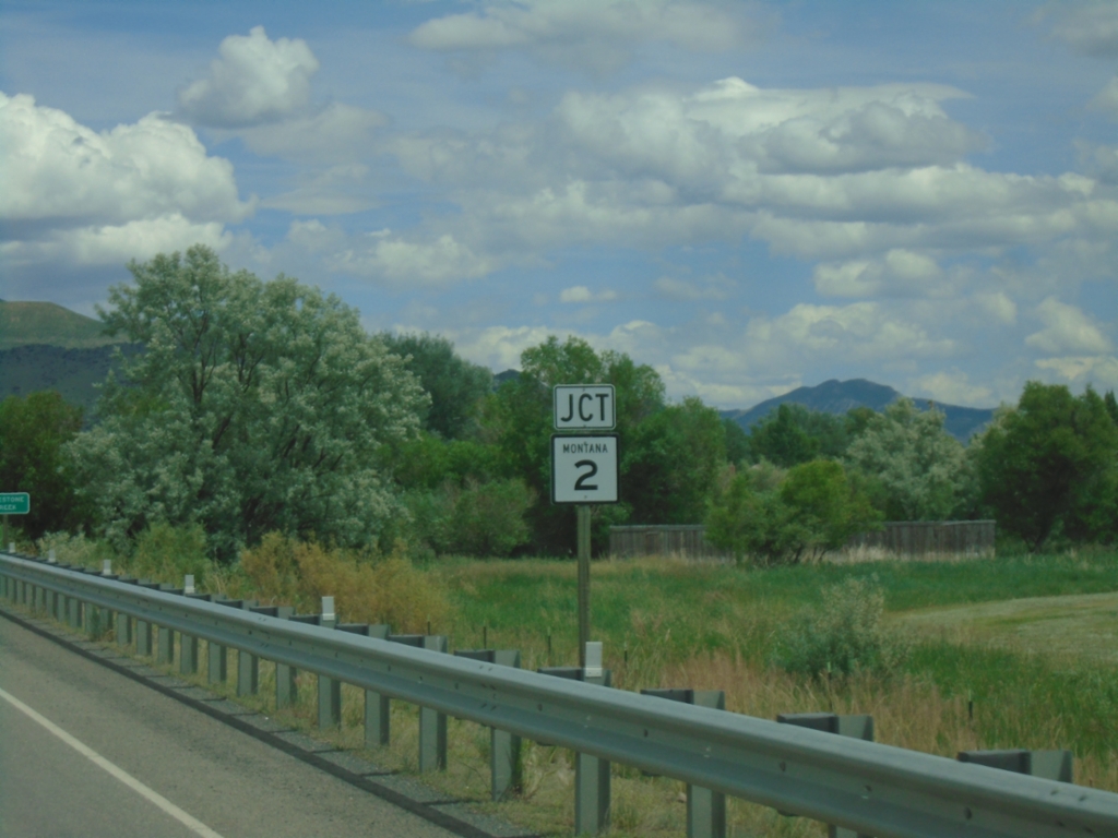
MT-55 North Approaching MT-2
MT-55 North approaching MT-2 in Whitehall.
Taken 06-28-2025
Whitehall
Jefferson County
Montana
United States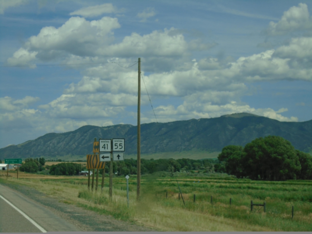
MT-41 North at MT-55
MT-41 North at MT-55 in Madison County.
Taken 06-28-2025
 Silver Star
Madison County
Montana
United States
Silver Star
Madison County
Montana
United States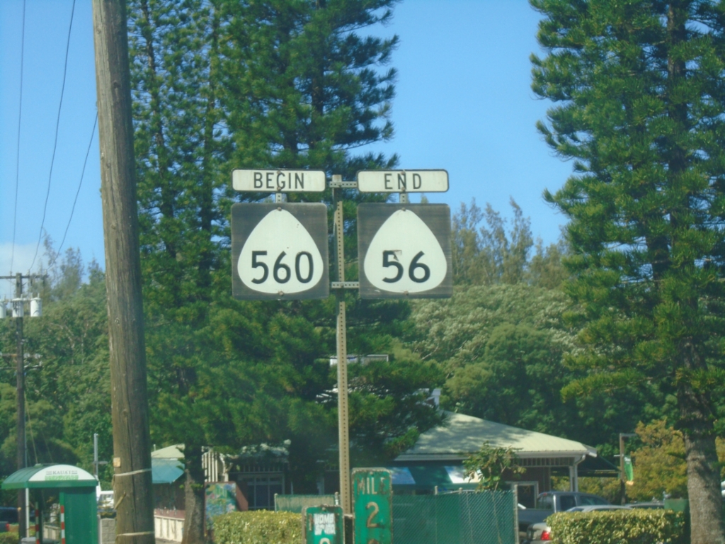
End HI-56/Begin HI-560 - Princeville
End HI-56/Begin HI-560 in Princeville. Both routes are part of the Kūhiō Highway.
Taken 02-20-2025

 Princeville
Kauai County
Hawaii
United States
Princeville
Kauai County
Hawaii
United States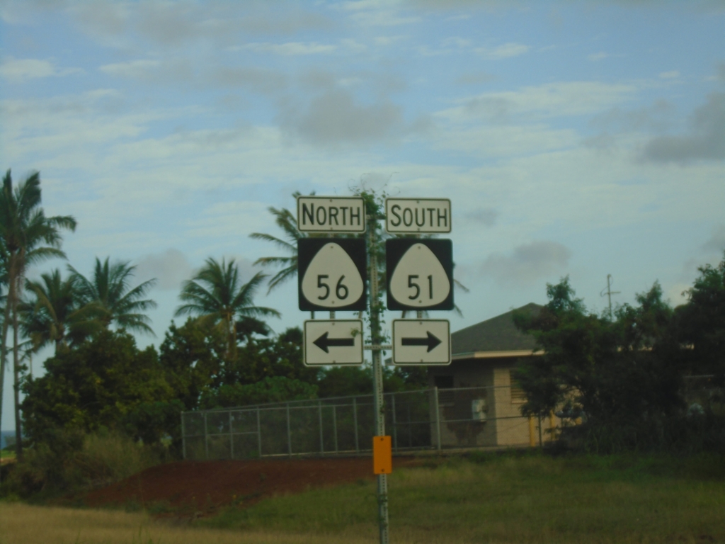
HI-56 North At HI-51 (Kapule Highway)
HI-56 North (Kūhiō Highway) at HI-51 (Kapule Highway).
Taken 02-18-2025
 Lihue
Kauai County
Hawaii
United States
Lihue
Kauai County
Hawaii
United States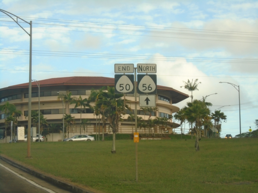
End HI-50 East at HI-56 and Rice St.
End HI-50 East (Kaumualiʻi Highway) at HI-56 North (Kūhiō Highway) and Rice St.
Taken 02-18-2025
 Lihue
Kauai County
Hawaii
United States
Lihue
Kauai County
Hawaii
United States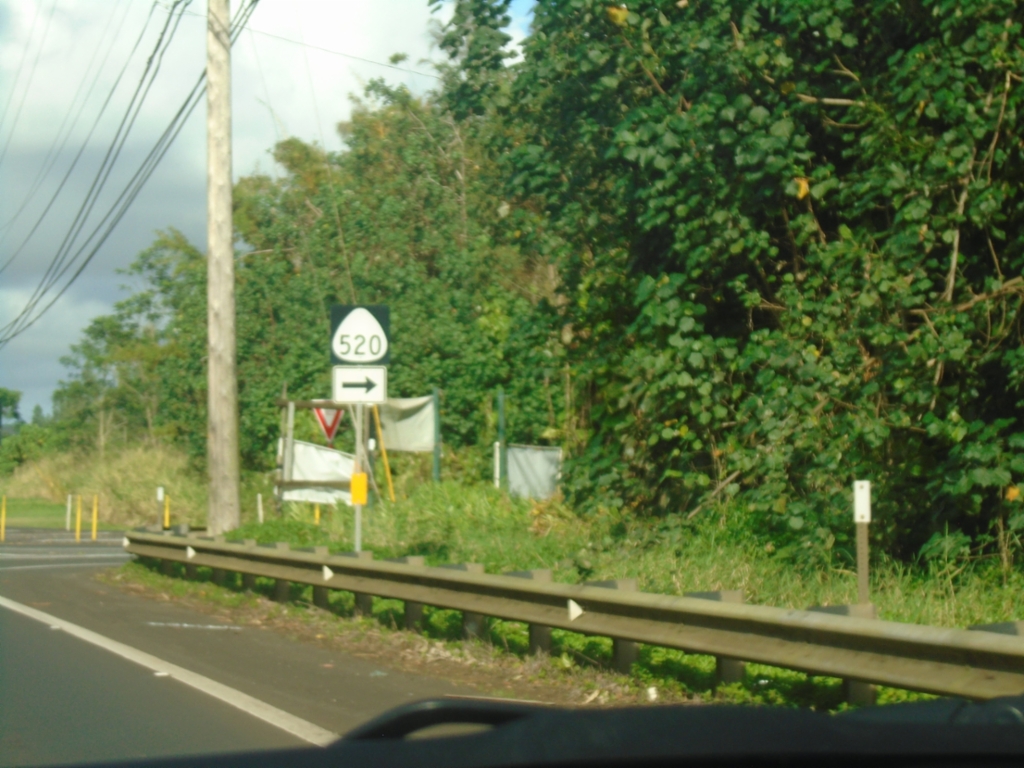
HI-50 East at HI-520 South (Kaumualiʻi Highway)
HI-50 East (Kaumualiʻi Highway) at HI-520 South (Maluhia Road).
Taken 02-18-2025
 Kalaheo
Kauai County
Hawaii
United States
Kalaheo
Kauai County
Hawaii
United States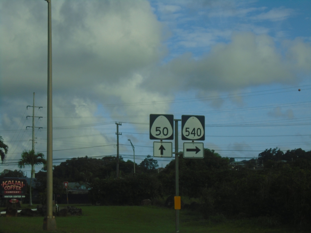
HI-50 East at HI-540 (Halewili Road)
HI-50 East (Kaumualiʻi Highway) at HI-540 (Halewili Road) in Kalāheo
Taken 02-18-2025
 Kalaheo
Kauai County
Hawaii
United States
Kalaheo
Kauai County
Hawaii
United States