Signs Tagged With Shield
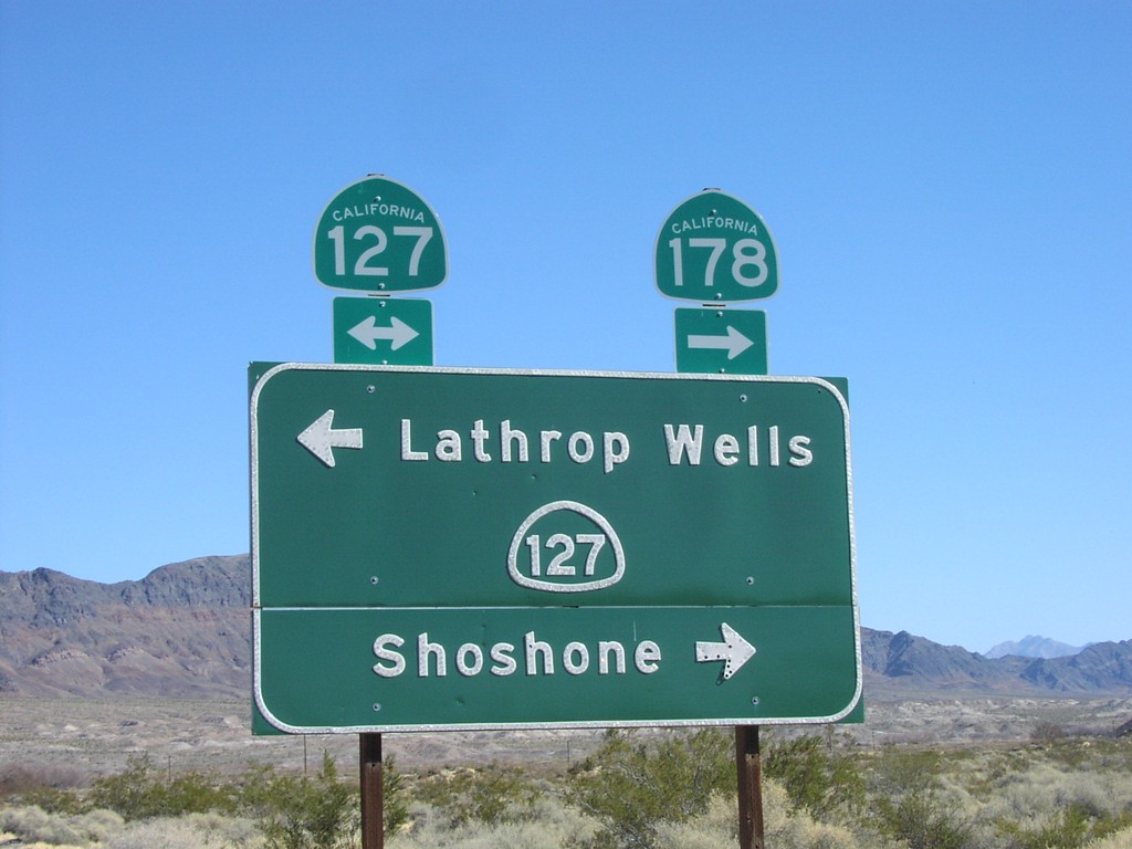
CA-178 East at CA-127/CA-178
CA-178 east at CA-127/CA-178 to Lathrop Wells and Shoshone
Taken 02-01-2006

 Shoshone
Inyo County
California
United States
Shoshone
Inyo County
California
United States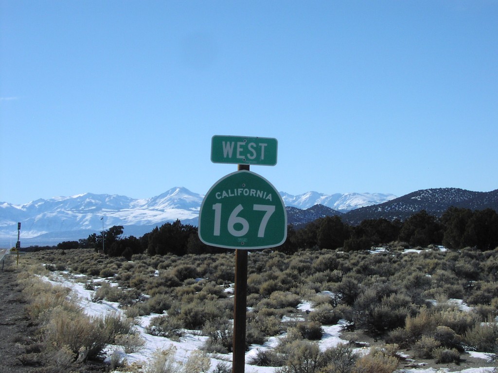
CA-167 West at NV/CA Stateline
First SR-167 assurance marker after Nevada border
Taken 02-01-2006
 Mina
Mono County
California
United States
Mina
Mono County
California
United States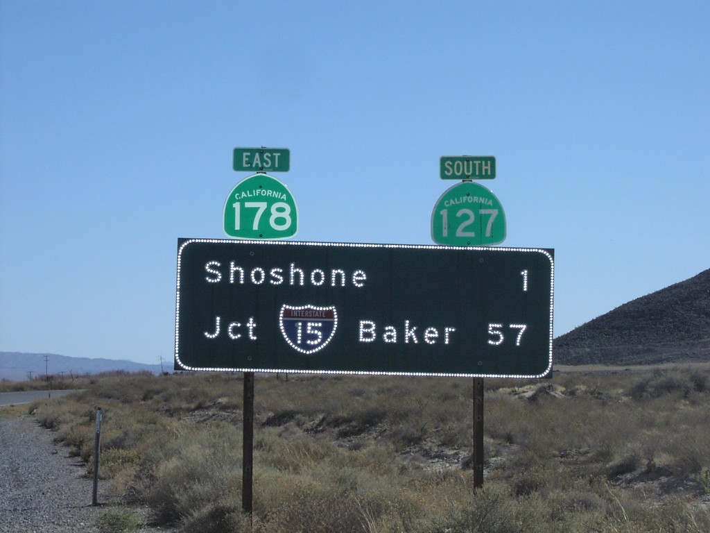
CA-127 South - Distance Marker
CA-127 South/CA-178 east to I-15 (Baker) and Shoshone.
Taken 02-01-2006
Shoshone
Inyo County
California
United States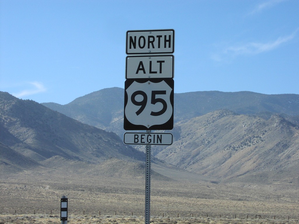
Begin US-95 Alt. North
Begin Alt. US-95 north
Taken 02-01-2006
 Schurz
Mineral County
Nevada
United States
Schurz
Mineral County
Nevada
United States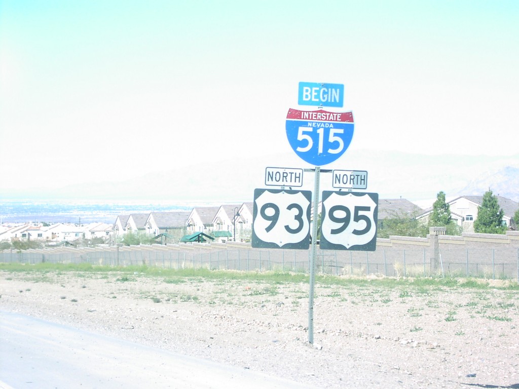
Begin I-515 North
Begin I-515 North on I-515/US-93/US-95 North
Taken 02-01-2006


 Henderson
Clark County
Nevada
United States
Henderson
Clark County
Nevada
United States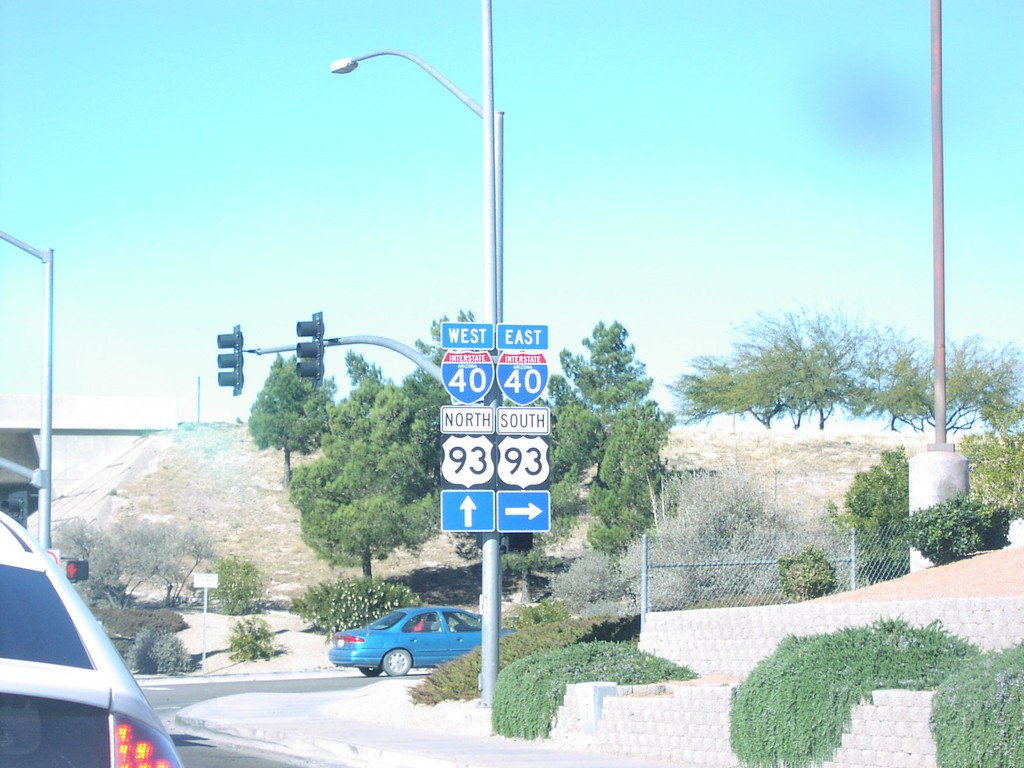
Beale St. at I-40/US-93 Jct.
US-93/I-40 junction on Beale St. northbound.
Taken 02-01-2006
 Kingman
Mohave County
Arizona
United States
Kingman
Mohave County
Arizona
United States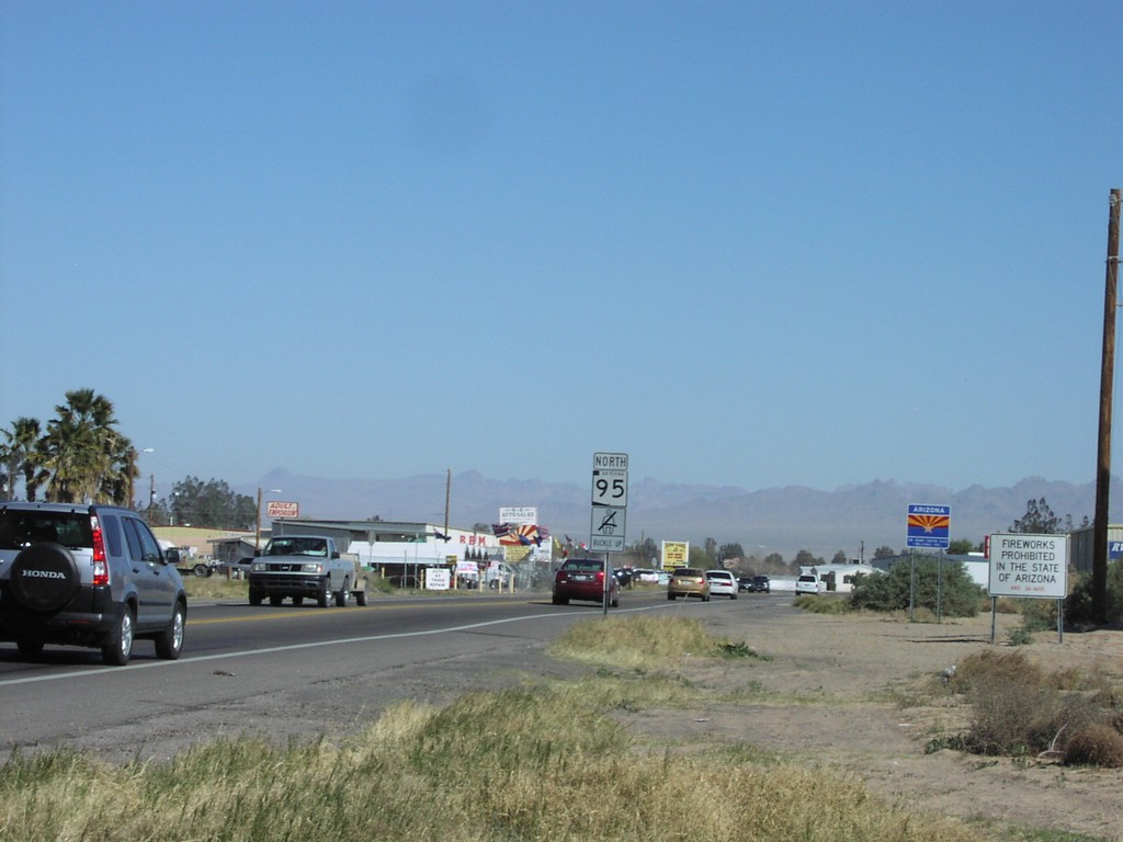
AZ-95 North CA/AZ StateLine
AZ-95 north and Arizona Welcome Sign at California border
Taken 02-01-2006
 Mohave Valley
Mohave County
Arizona
United States
Mohave Valley
Mohave County
Arizona
United States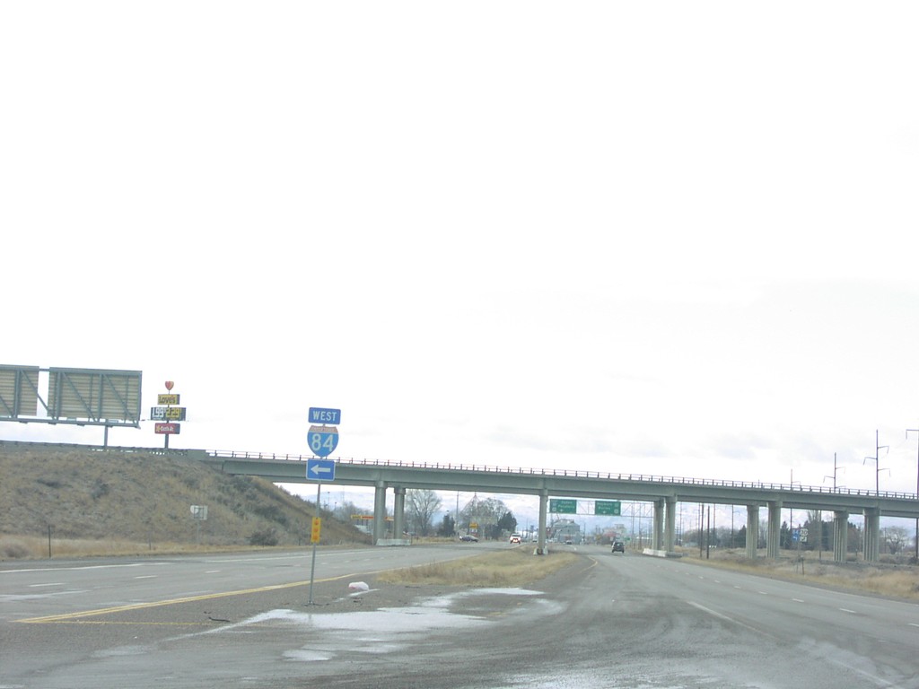
ID-24 West at I-84 and US-30
I-84 west onramp at the eastern terminus of ID-24
Taken 01-15-2006


 Heyburn
Minidoka County
Idaho
United States
Heyburn
Minidoka County
Idaho
United States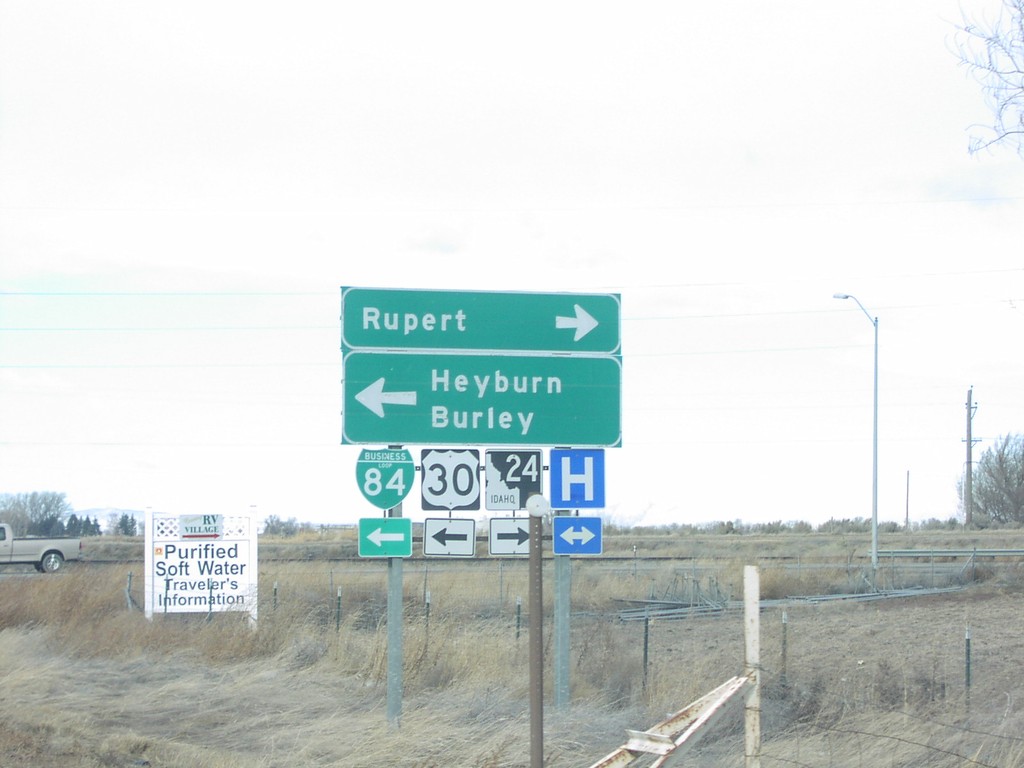
I-84 West Exit 211 Offramp at US-30/ID-24
US-30/ID-24/BL-84 at I-84 interchange
Taken 01-15-2006
Heyburn
Minidoka County
Idaho
United States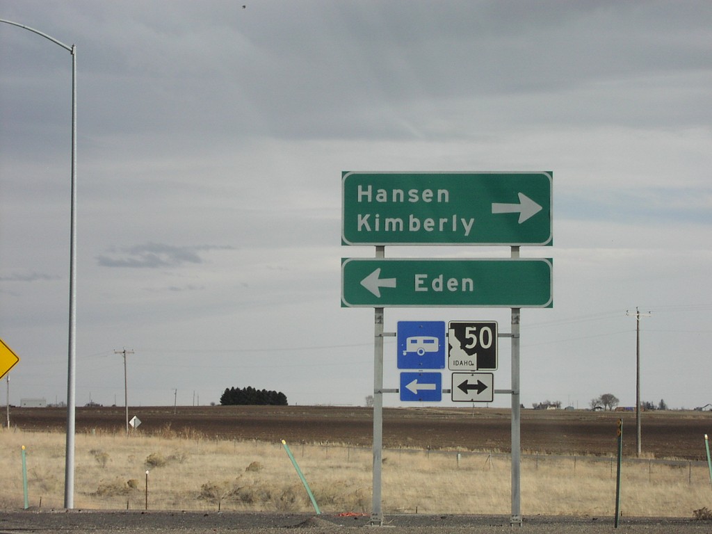
I-84 East Exit 182 Offramp
I-84 at ID-50 interchange to Eden and Hansen
Taken 01-14-2006
 Eden
Jerome County
Idaho
United States
Eden
Jerome County
Idaho
United States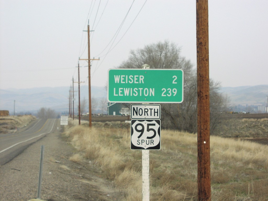
US-95 Spur North - Distance Marker
US-95 Spur North to Lewiston and Weiser. US-95 Spur connects the Oregon side of the Snake River, with the Idaho side at Weiser.
Taken 01-01-2006
 Ontario
Malheur County
Oregon
United States
Ontario
Malheur County
Oregon
United States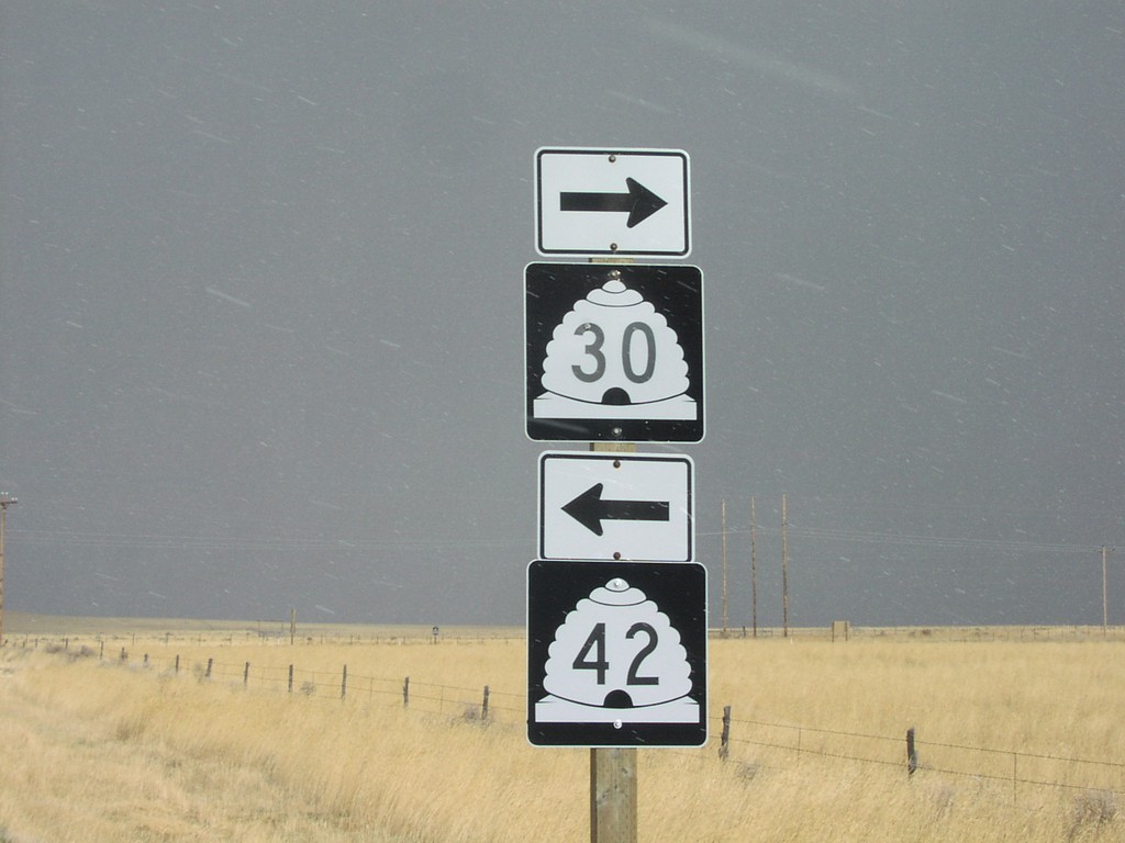
UT-30 East at UT-41
UT-30/UT-42 shields on UT-30 east
Taken 11-12-2005

 Cedar Creek
Box Elder County
Utah
United States
Cedar Creek
Box Elder County
Utah
United States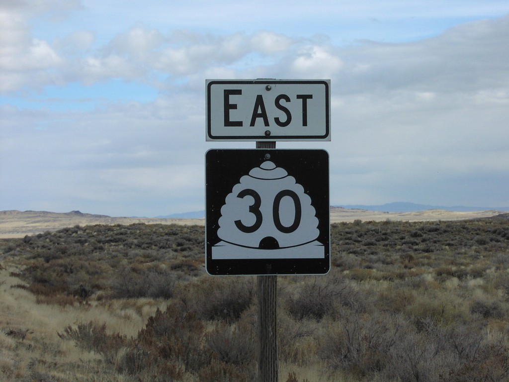
UT-30 East At Nevada-Utah Border
UT-30 East shield at Nevada border
Taken 11-12-2005
Lucin
Box Elder County
Utah
United States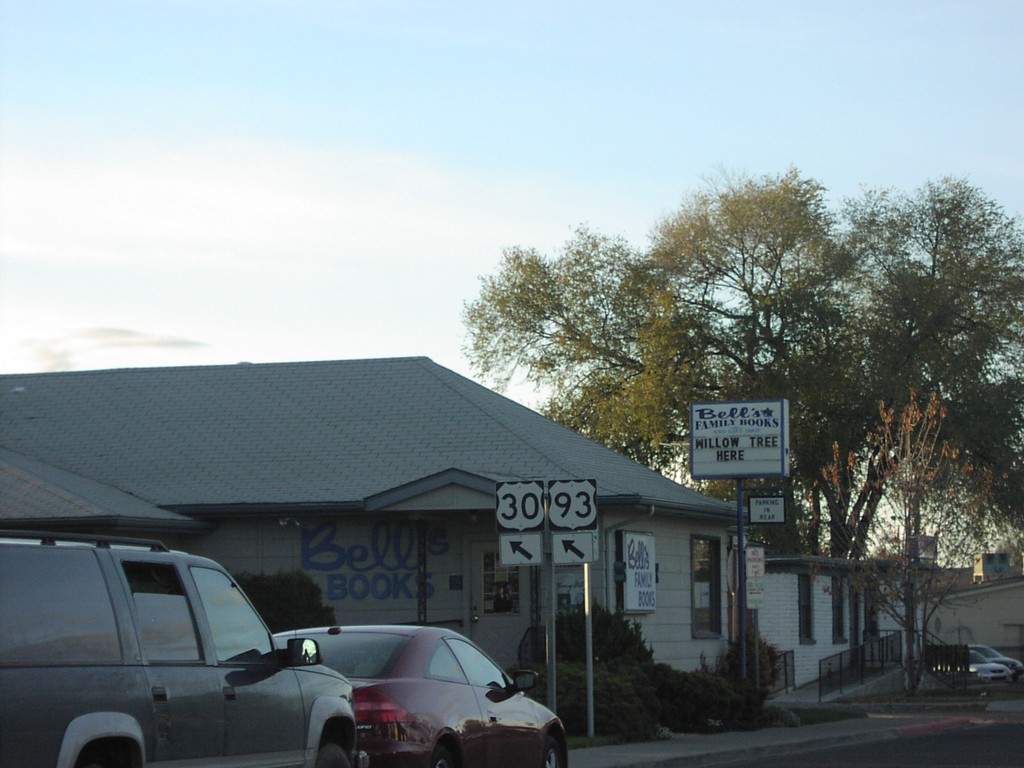
US-30 West/US-93 South - Twin Falls
US-30/US-93 left turn on US-30 west
Taken 11-12-2005
Twin Falls
Twin Falls County
Idaho
United States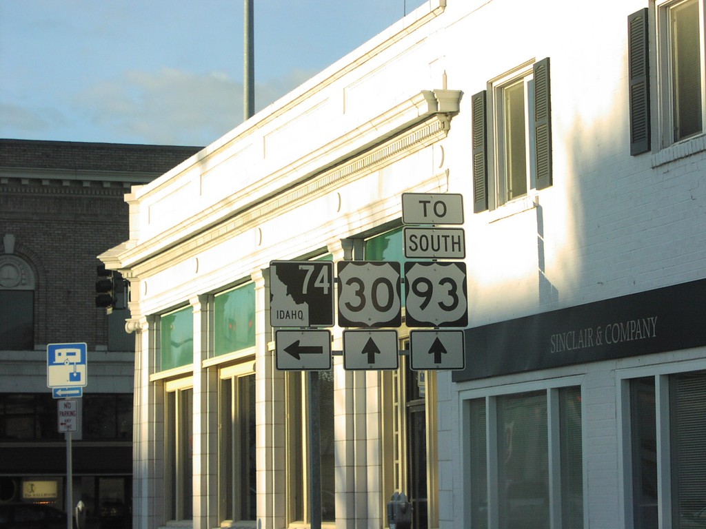
US-30 West at ID-74
US-30 west at ID-74/To US-93 junctio
Taken 11-12-2005
 Twin Falls
 County
Idaho
United States
Twin Falls
Twin Falls County
Idaho
United States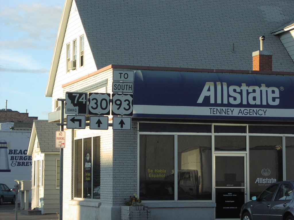
US-30 West at ID-74
US-30 west at ID-74 junctio
Taken 11-12-2005
Twin Falls
Twin Falls County
Idaho
United States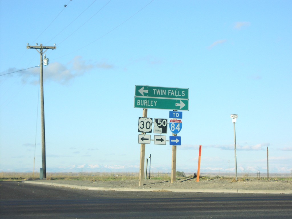
US-30 West at ID-50
US-30 west at ID-50/To I-84 junction to Twin Falls and Bu
Taken 11-12-2005
Kimberly
Twin Falls County
Idaho
United States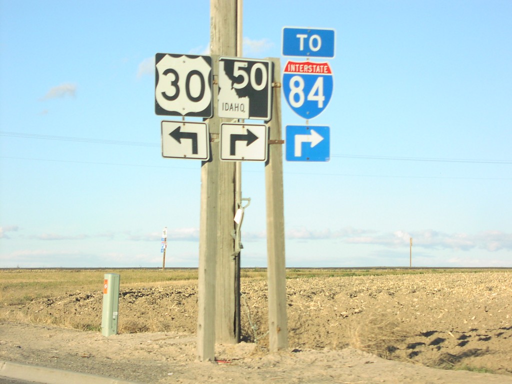
US-30 West at ID-50
US-30 west at ID-50/To I-84 junction
Taken 11-12-2005
Kimberly
Twin Falls County
Idaho
United States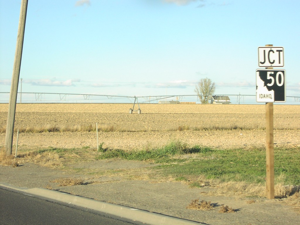
US-30 West at ID-50
Junction ID-50 on US-30 west
Taken 11-12-2005
Kimberly
Twin Falls County
Idaho
United States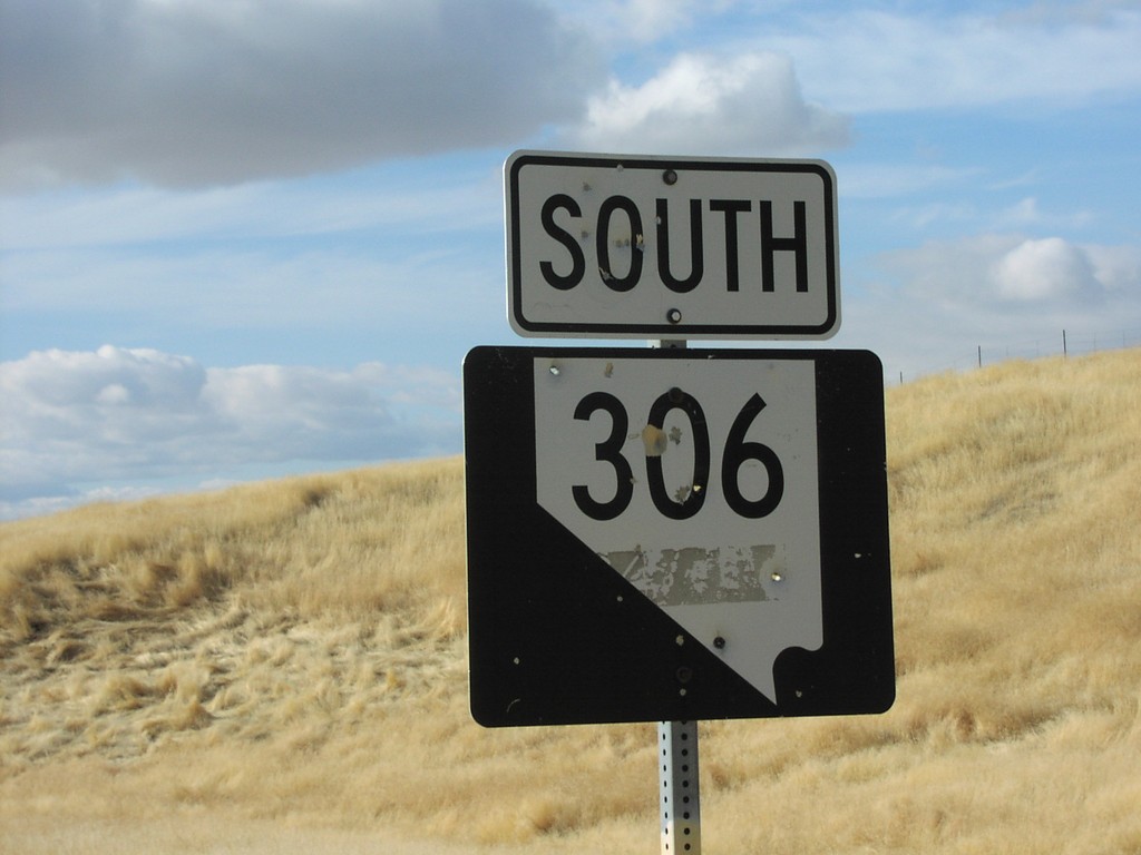
NV-306 South
NV-306 shield south of I-80 junction
Taken 11-12-2005
 Beowawe
Eureka County
Nevada
United States
Beowawe
Eureka County
Nevada
United States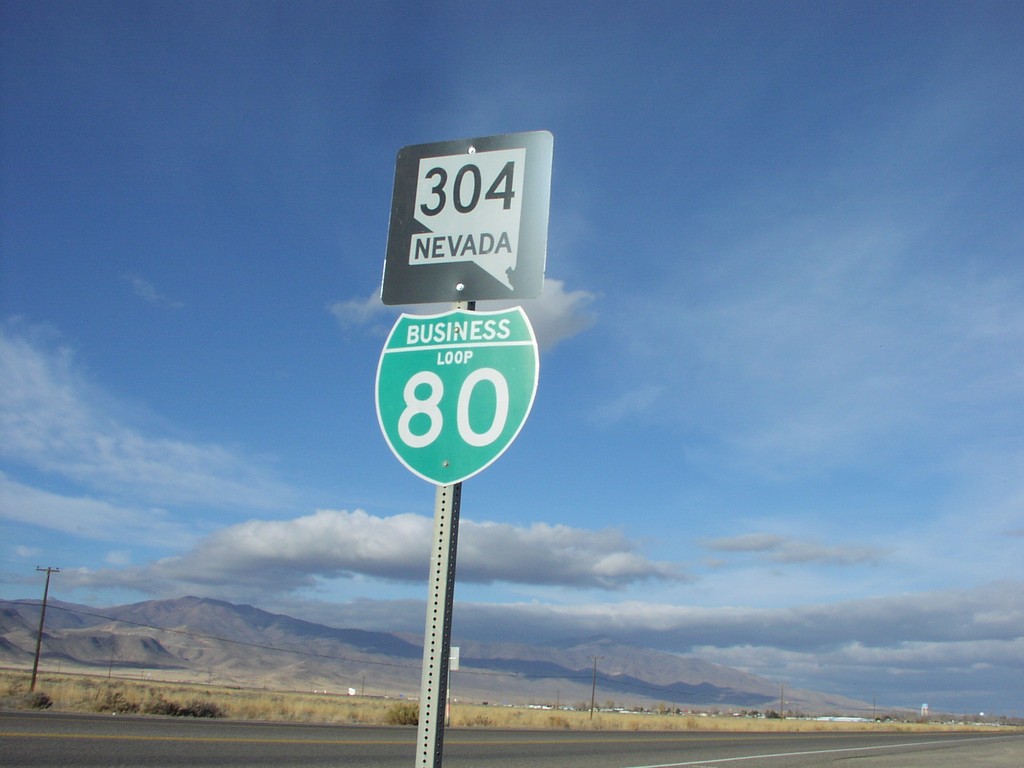
NV-304/BL-80 West
BL-80/NV-304 west shield
Taken 11-12-2005

 Battle Mountain
Lander County
Nevada
United States
Battle Mountain
Lander County
Nevada
United States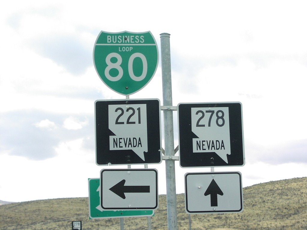
NV-278 South at NV-221/BL-80
NV-278 south at BL-80/NV-221 junction. Turn left for BL-80 East/NV-221 and Carlin.
Taken 11-12-2005
 Carlin
Elko County
Nevada
United States
Carlin
Elko County
Nevada
United States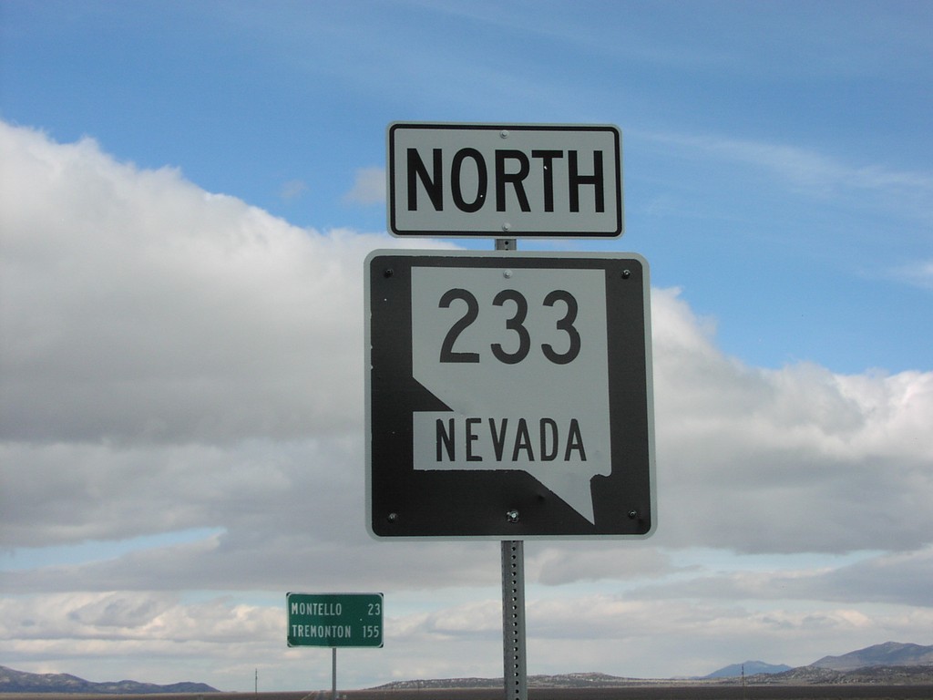
NV-233 North
NV-233 north at beginning of NV-233
Taken 11-12-2005
 Oasis
Elko County
Nevada
United States
Oasis
Elko County
Nevada
United States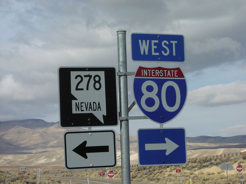
NV-221/BL-80 West at NV-278/To I-80
Western end of NV-221 west at NV-278
Taken 11-12-2005
 Carlin
Elko County
Nevada
United States
Carlin
Elko County
Nevada
United States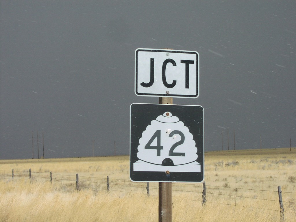
Jct. UT-42 on UT-30 East
UT-30 east approaching junction UT-42
Taken 11-12-2005
Cedar Creek
Box Elder County
Utah
United States