Signs Tagged With Shield
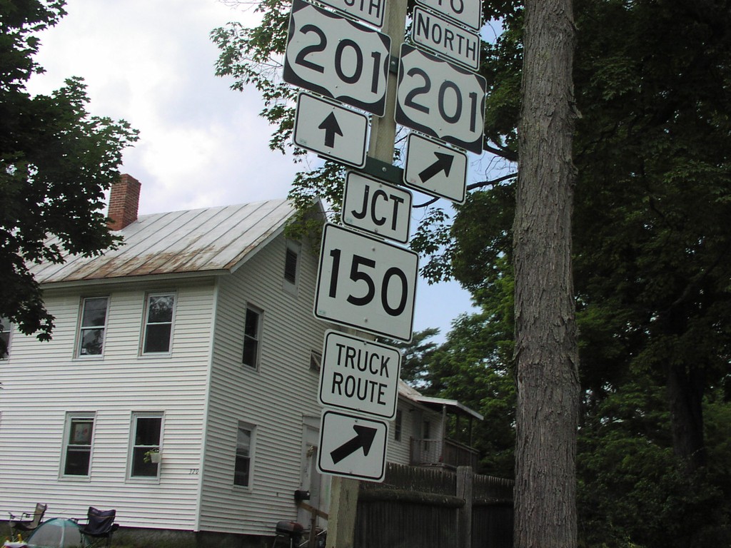
US-2 West at US-201/ME-150
US-2 West at To US-201/ME-150 Junction in Skowhegan
Taken 07-01-2004


 Skowhegan
Somerset County
Maine
United States
Skowhegan
Somerset County
Maine
United States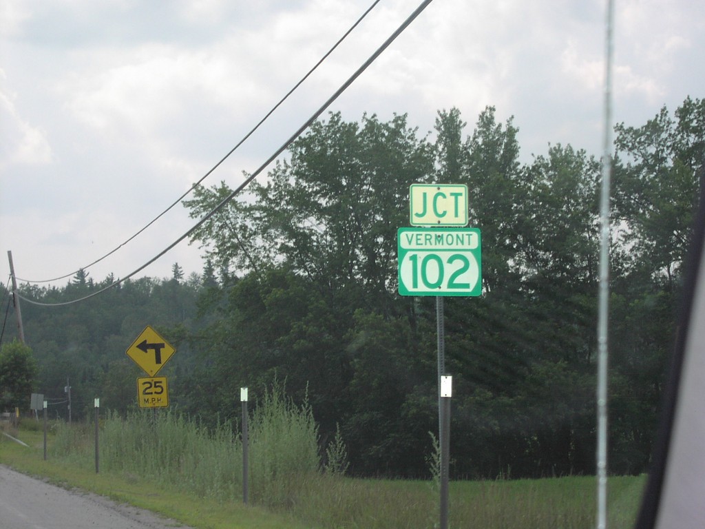
US-2 West Approaching VT-102
Junction VT-102 on US-2 West near the New Hampshire-Vermont Line on the Connecticut River.
Taken 07-01-2004
 Lancaster
Coos County
New Hampshire
United States
Lancaster
Coos County
New Hampshire
United States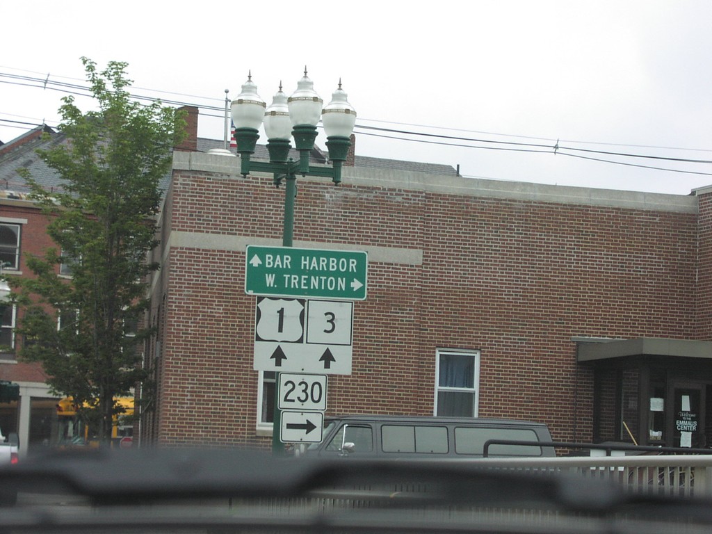
US-1 North/ME-3 South at MT-230
US-1 North/ME-3 South at ME-230 Junction
Taken 07-01-2004


 Ellsworth
Hancock County
Maine
United States
Ellsworth
Hancock County
Maine
United States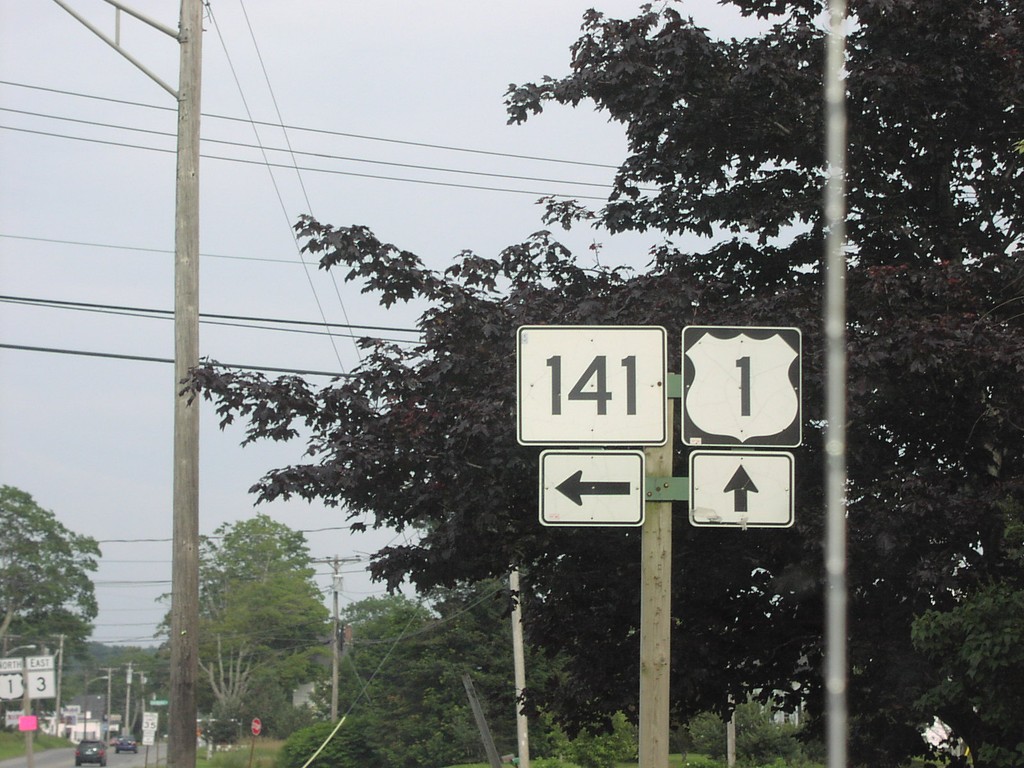
US-1 North at MT-141
US-1 North/ME-3 South at ME-141 Junction
Taken 07-01-2004
 Belfast
Waldo County
Maine
United States
Belfast
Waldo County
Maine
United States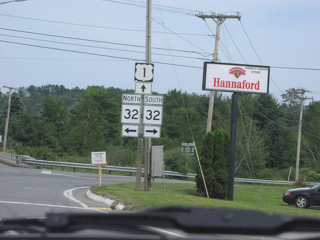
US-1 North at ME-32
US-1 North at ME-32 Junction
Taken 07-01-2004
 Waldoboro
Lincoln County
Maine
United States
Waldoboro
Lincoln County
Maine
United States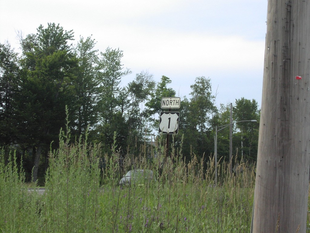
US-1 North - Belfast
US-1 North Shield in Belfast
Taken 07-01-2004
Belfast
Waldo County
Maine
United States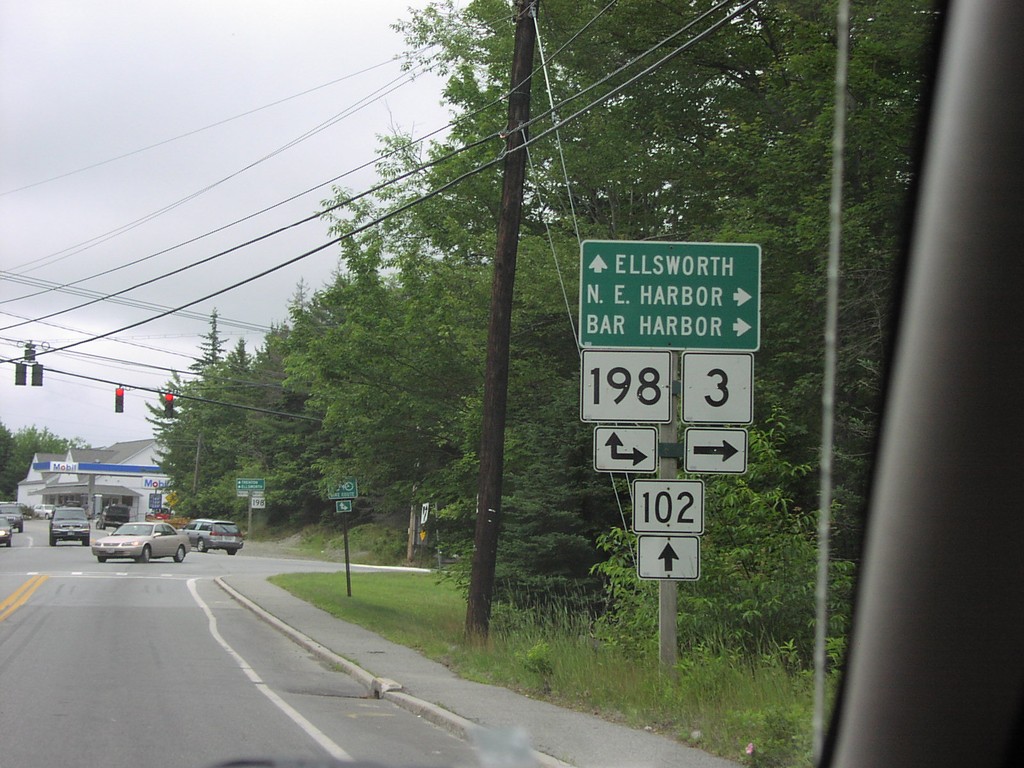
MT-102 at ME-198/ME-3
ME-102 at ME-198/ME-3 Junction in Somesville
Taken 07-01-2004

 Mount Desert
Hancock County
Maine
United States
Mount Desert
Hancock County
Maine
United States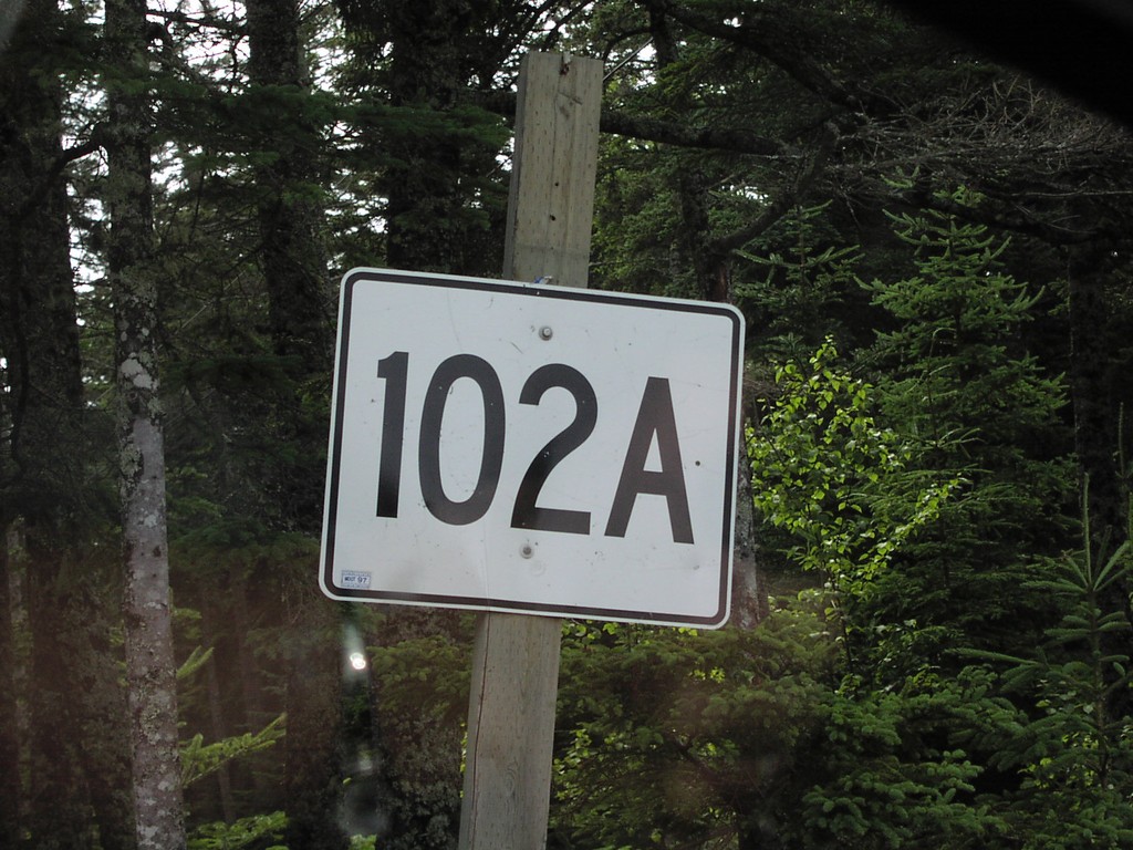
ME-102A - Seawall
ME-102A Shield on Mt. Desert Island
Taken 07-01-2004
 Southwest Harbor
Hancock County
Maine
United States
Southwest Harbor
Hancock County
Maine
United States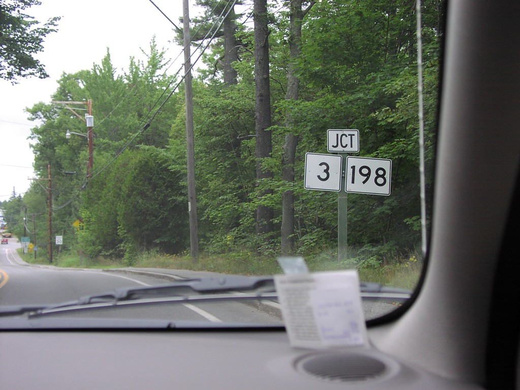
ME-102 North at ME-3/ME-198
ME-102 North Approaching ME-3/ME-198
Taken 07-01-2004
Mount Desert
Hancock County
Maine
United States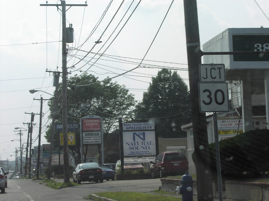
MA-9 West approaching MA-30
MA-9 West at MA-30 Junction
Taken 07-01-2004

 Framingham
Middlesex County
Massachusetts
United States
Framingham
Middlesex County
Massachusetts
United States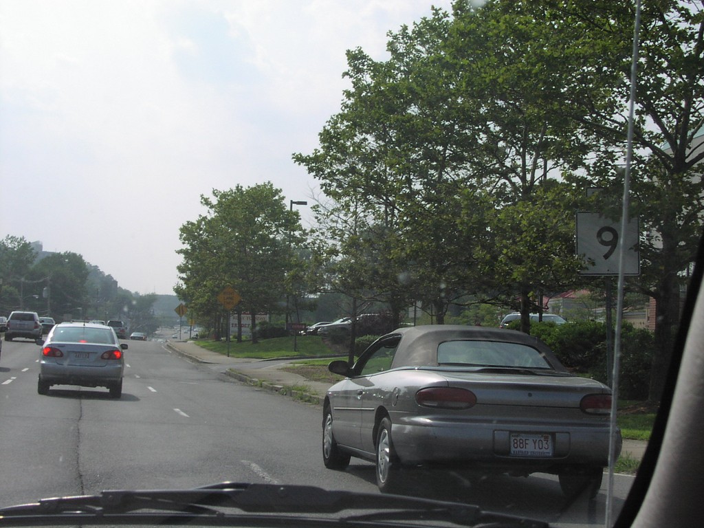
MA-9 West - Framingham
MA-9 West
Taken 07-01-2004
Framingham
Middlesex County
Massachusetts
United States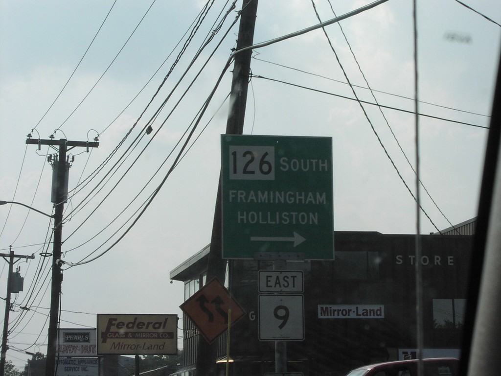
MA-9 East at MA-126 South
MA-9 East at MA-126 South Junction to Framingham and Holliston
Taken 07-01-2004
 Framingham
Middlesex County
Massachusetts
United States
Framingham
Middlesex County
Massachusetts
United States
MA-2A West - Lexington
MA-2A West Shield in
Taken 07-01-2004
 Lexington
Middlesex County
Massachusetts
United States
Lexington
Middlesex County
Massachusetts
United States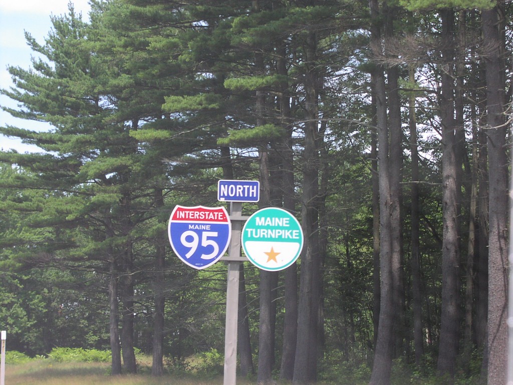
I-95 North Maine Turnpike
I-95 Maine/Maine Turnpike Shields
Taken 07-01-2004
 Saco
York County
Maine
United States
Saco
York County
Maine
United States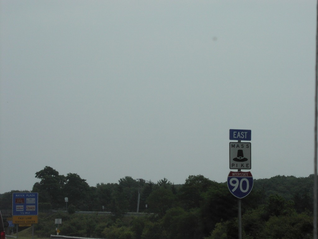
I-90 East/MassPike
I-90 East/MassPike Shields
Taken 07-01-2004
 Natick
Middlesex County
Massachusetts
United States
Natick
Middlesex County
Massachusetts
United States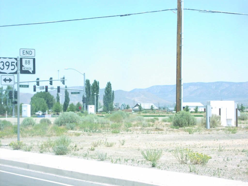
End NV-88 North at US-395
End NV-88 at US-395 in Minden.
Taken 07-01-2004

 Minden
Douglas County
Nevada
United States
Minden
Douglas County
Nevada
United States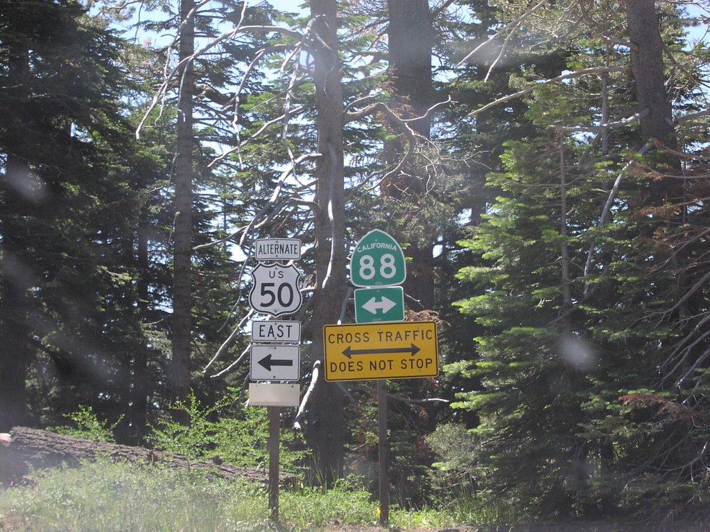
End Mormon Emigrant Trail at CA-88 (US-50 Alt)
End Mormon Emigrant Trail (US-50 ALT) at CA-88 near Kirkwood
Taken 07-01-2004

 Tragedy Spring
Amador County
California
United States
Tragedy Spring
Amador County
California
United States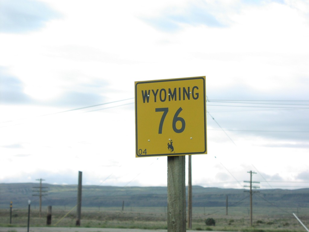
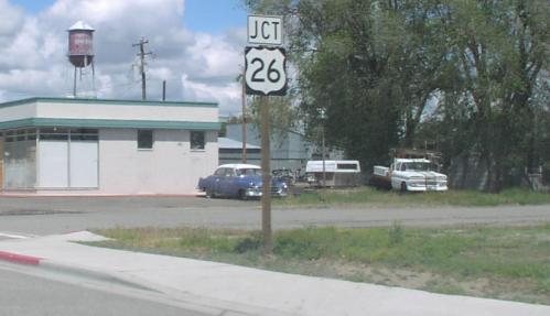
US-93 North Approaching US-26
US-26 Junction on US-93 North
Taken 05-01-2004

 Shoshone
Lincoln County
Idaho
United States
Shoshone
Lincoln County
Idaho
United States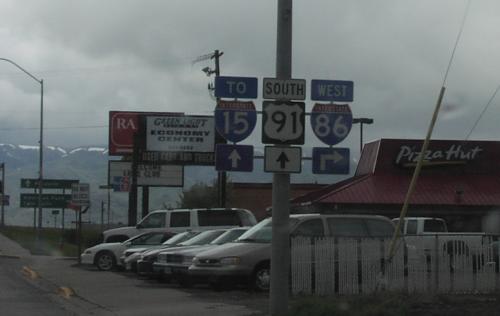
US-91 South Approaching I-86
US-91 south approaching I-86. Use I-86 east for I-15.
Taken 05-01-2004


 Chubbuck
Bannock County
Idaho
United States
Chubbuck
Bannock County
Idaho
United States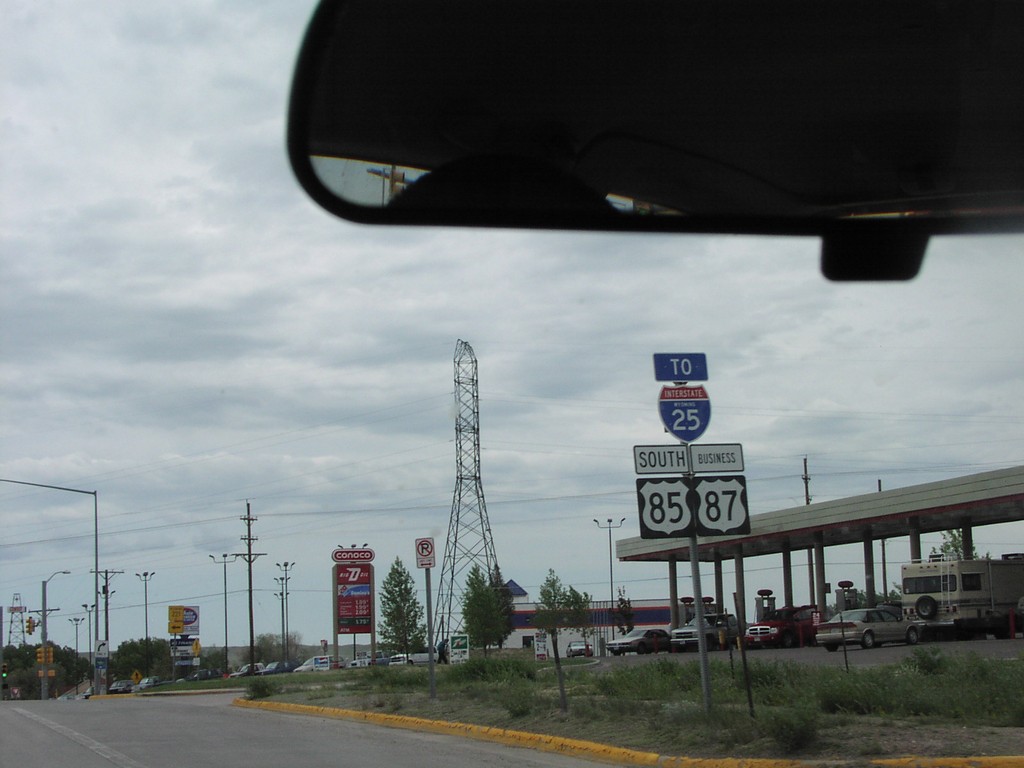
US-85 South To I-25
US-85 South/US-87 Business/To I-25
Taken 05-01-2004
 Cheyenne
Laramie County
Wyoming
United States
Cheyenne
Laramie County
Wyoming
United States
US-36 East/KS-27 South
US-36 East/KS-27 South
Taken 05-01-2004
 Saint Francis
Cheyenne County
Kansas
United States
Saint Francis
Cheyenne County
Kansas
United States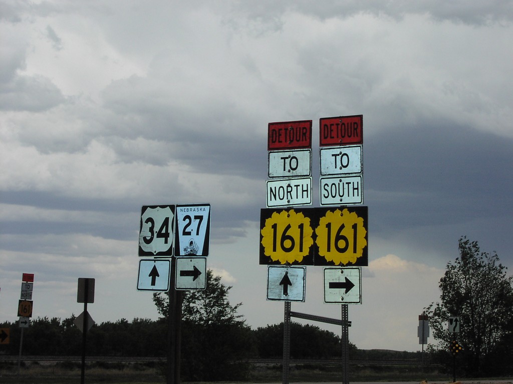
US-34 East at NE-27 South
US-34 East at NE-27 South. Use NE-27 south for detour to KS-161 South. Use US-34 east for detour to KS-161 North.
Taken 05-01-2004


 Haigler
Dundy County
Nebraska
United States
Haigler
Dundy County
Nebraska
United States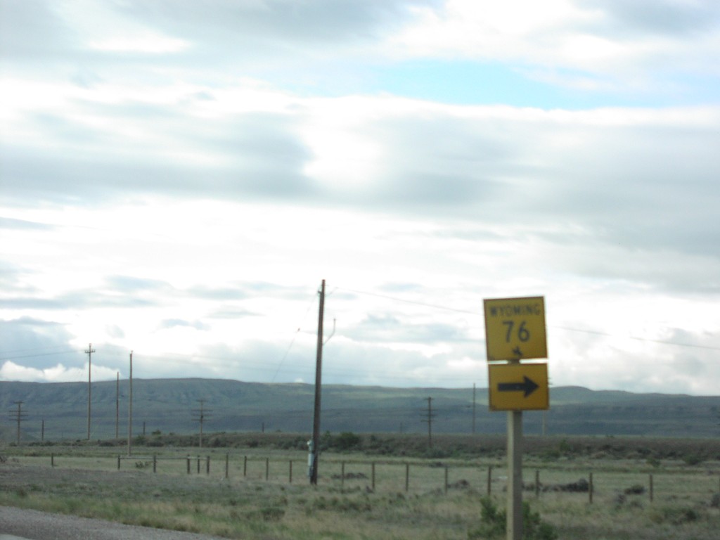
US-287 South at WY-76
US-287 South at WY-76 Junction
Taken 05-01-2004

 Rawlins
Carbon County
Wyoming
United States
Rawlins
Carbon County
Wyoming
United States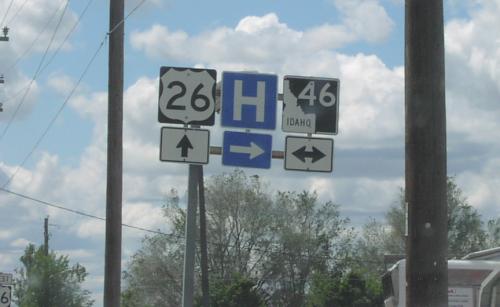
US-26 West at ID-46
US-26/ID-46 Junction on US-26 West
Taken 05-01-2004
 Gooding
 County
Idaho
United States
Gooding
Gooding County
Idaho
United States