Signs Tagged With Shield
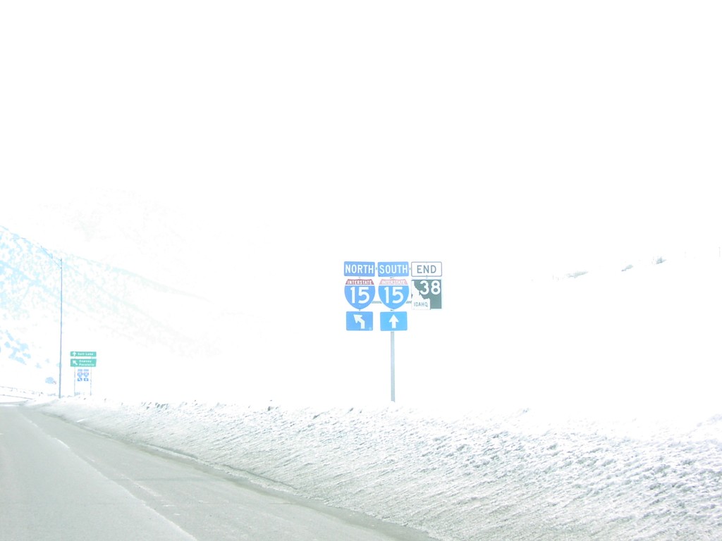
End ID-38 at I-15 Exit 13
End ID-38 at I-15 (Exit 13) in Malad.
Taken 02-01-2004

 Malad City
Oneida County
Idaho
United States
Malad City
Oneida County
Idaho
United States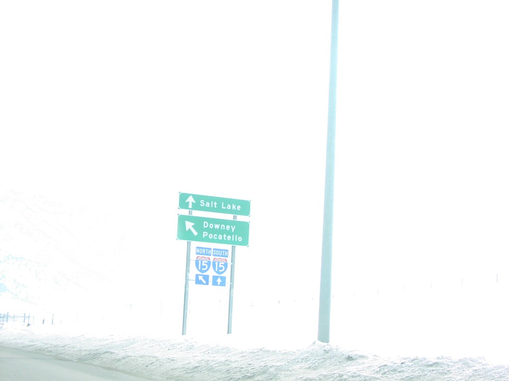
End ID-38 at I-15
End ID-38 west at I-15 in Malad. Use I-15 south for Salt Lake; I-15 north for Downey and Pocatello.
Taken 02-01-2004
Malad City
Oneida County
Idaho
United States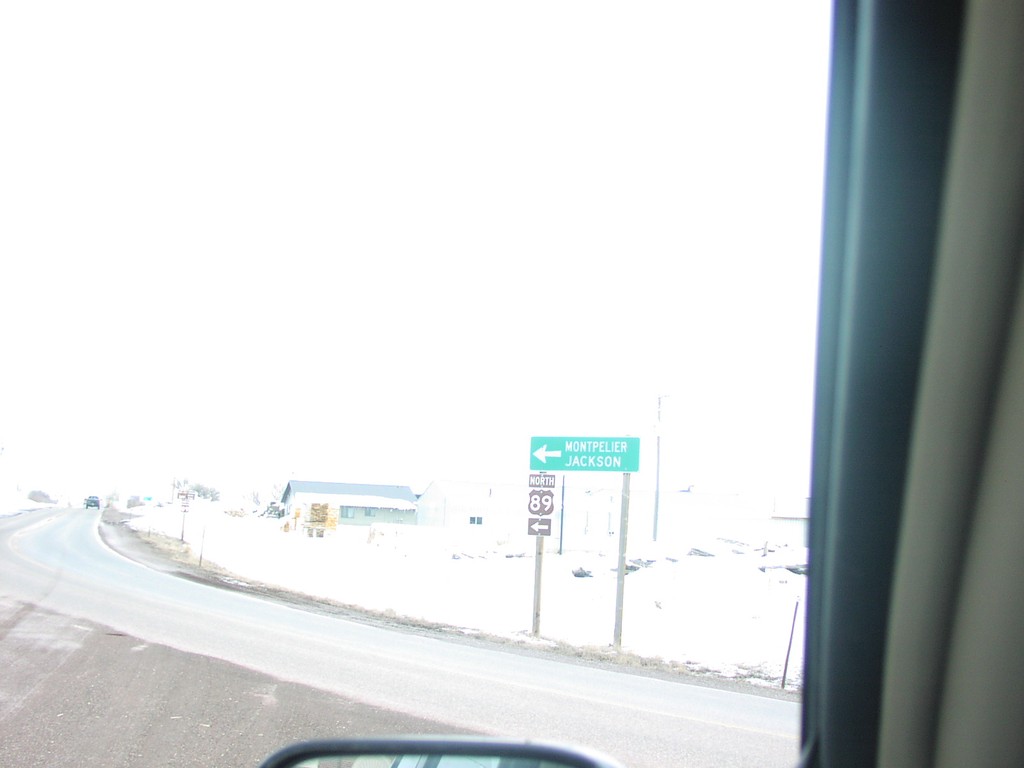
End ID-36 at US-89
End ID-36 at US-89 Junction, north of Paris
Taken 02-01-2004

 Ovid
Bear Lake County
Idaho
United States
Ovid
Bear Lake County
Idaho
United States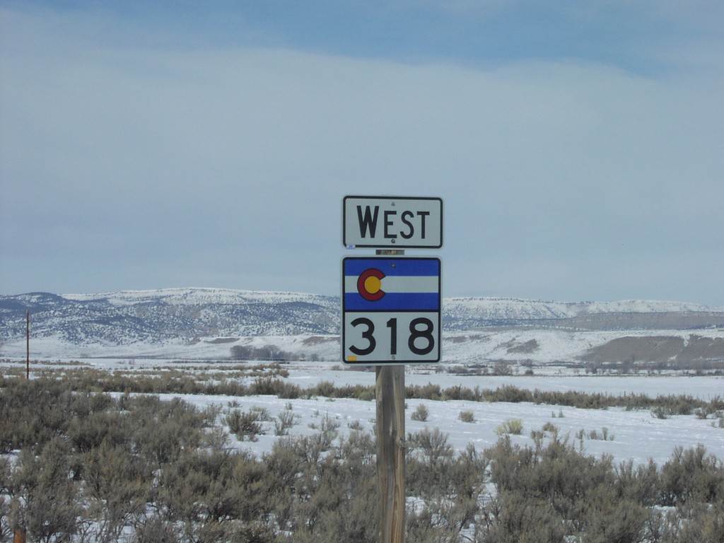
CO-318 West
CO-318 west shield, just west of US-40
Taken 02-01-2004
 Moffat County
Colorado
United States
Moffat County
Colorado
United States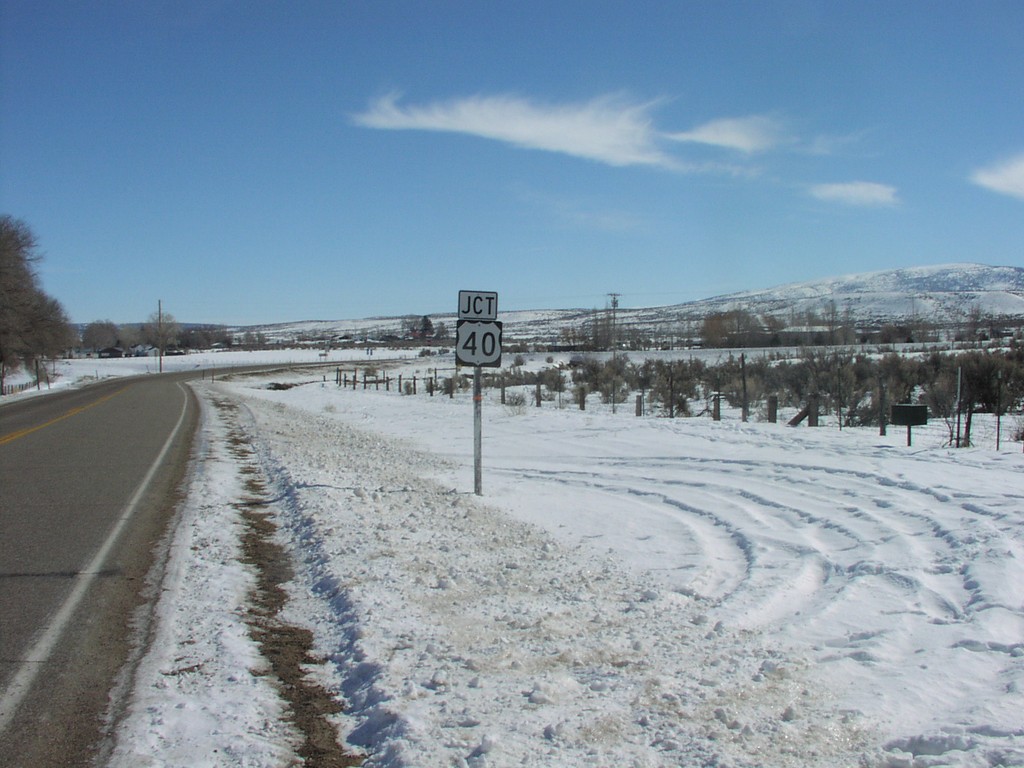
CO-318 East at US-40
Junction US-40 on CO-318 East
Taken 02-01-2004
 Moffat County
Colorado
United States
Moffat County
Colorado
United States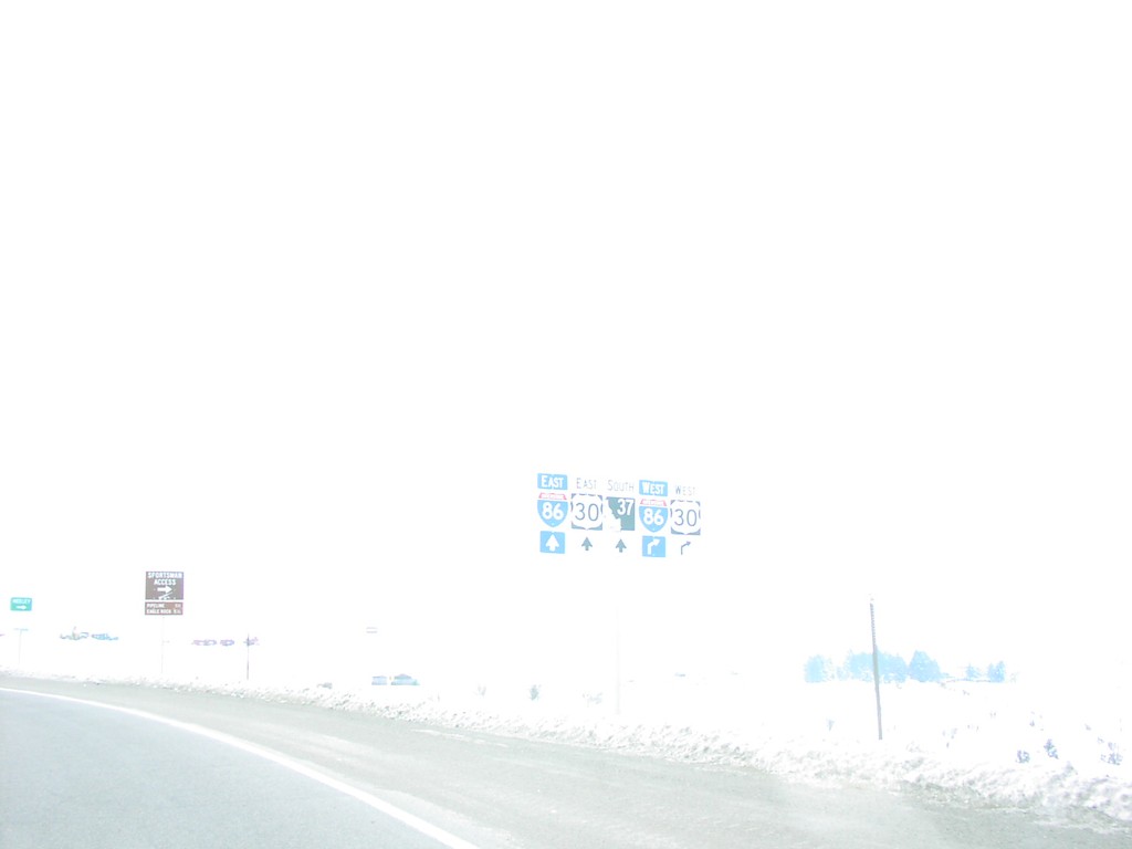
BL-86 West at I-86/US-30/ID-37
BL-86 west approaching I-86/US-30. Continue over freeway for ID-37 south.
Taken 02-01-2004


 American Falls
Power County
Idaho
United States
American Falls
Power County
Idaho
United States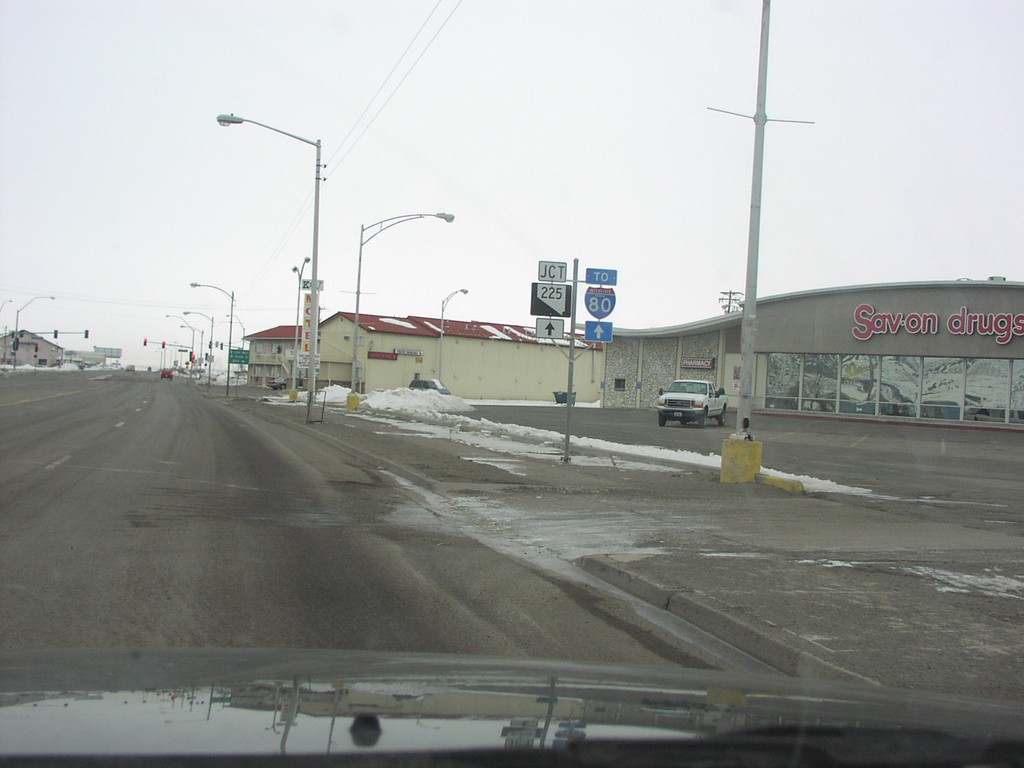
BL-80 West To NV-225/I-80
NV-225 North, To I-80
Taken 02-01-2004


 Elko
Elko County
Nevada
United States
Elko
Elko County
Nevada
United States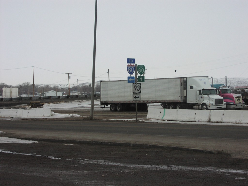
BL-80 West at US-93 (To I-80)
BL-80, I-80, and US-93 Shields at BL-80/US-93 Junction
Taken 02-01-2004
Wells
Elko County
Nevada
United States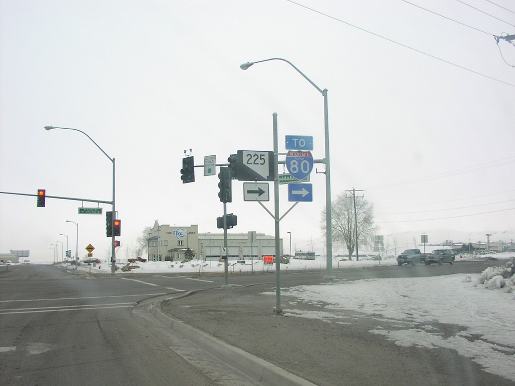
BL-80 West at NV-225 (To I-80)
BL-80 West at NV-225 North. Continue west on BL-80 to access I-80.
Taken 02-01-2004
Elko
Elko County
Nevada
United States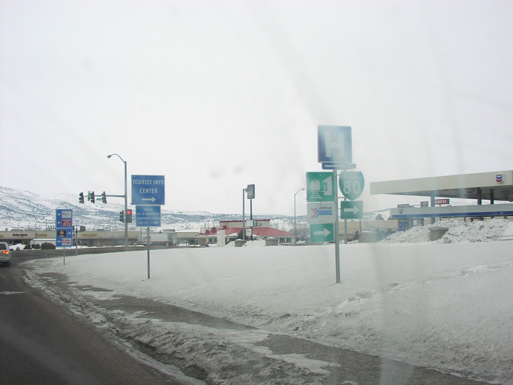
BL-80 West at Idaho St. - Elko
BL-80 Shield at approaching Idaho Street
Taken 02-01-2004
Elko
Elko County
Nevada
United States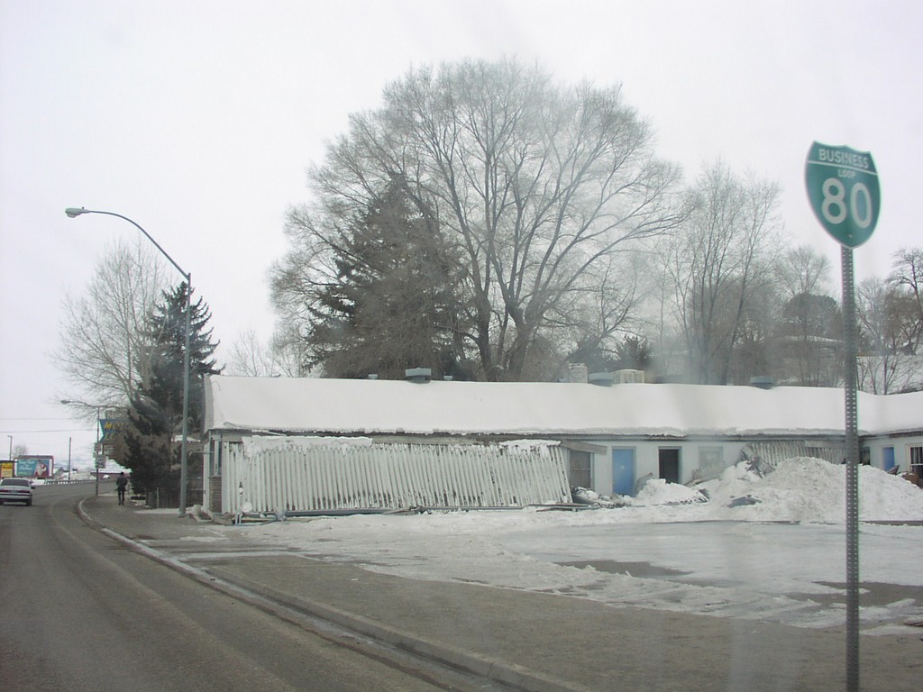
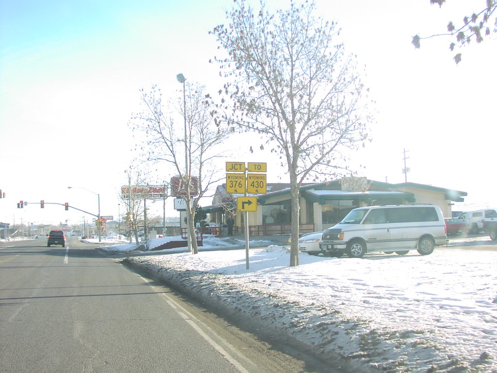
BL-80 East at WY-372/To WY-430
WY-372/To WY-430 on BL-80 East
Taken 02-01-2004

 Rock Springs
Sweetwater County
Wyoming
United States
Rock Springs
Sweetwater County
Wyoming
United States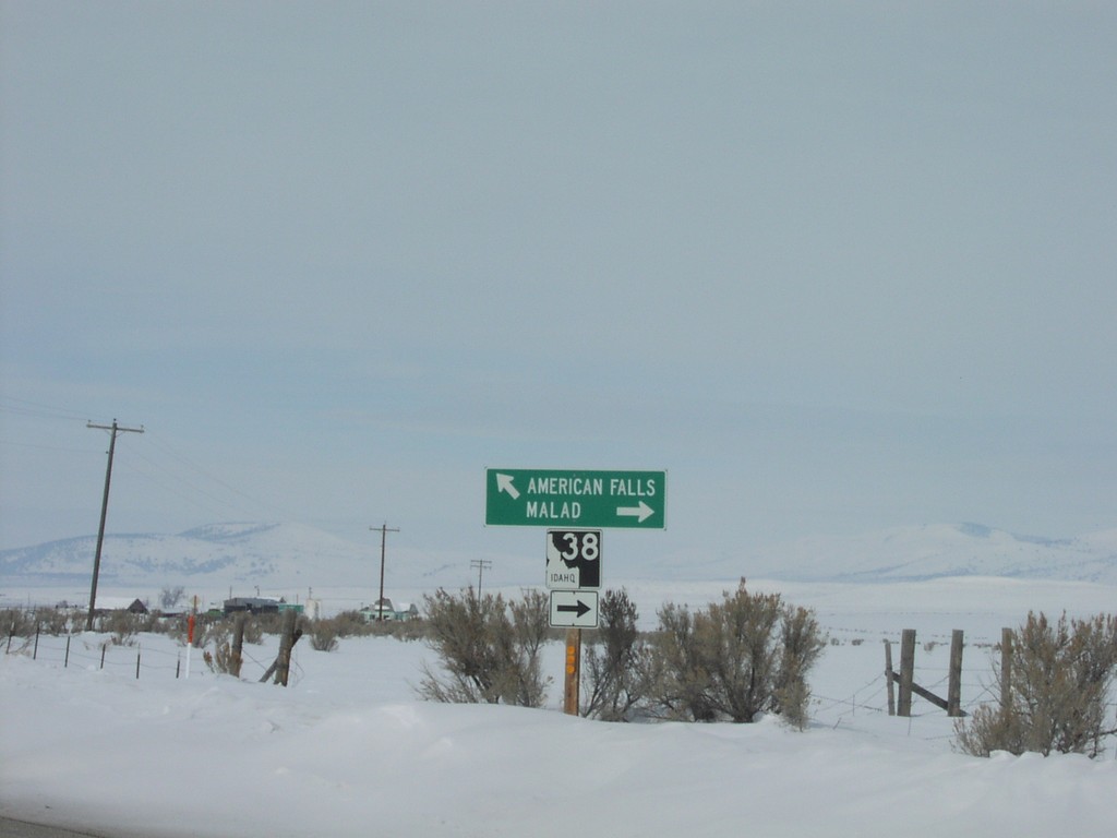
Begin ID-38 in Holbrook
ID-38 to Malad and Oneida County Road to American Falls
Taken 02-01-2004
Holbrook
Oneida County
Idaho
United States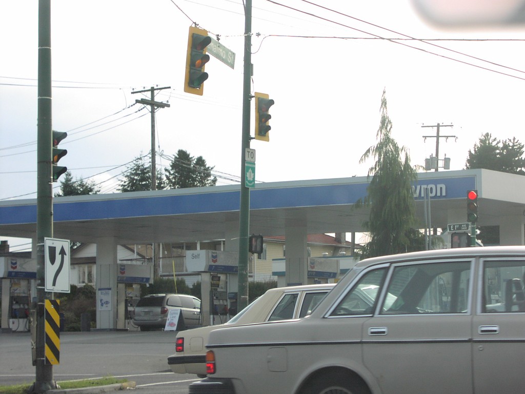
To TC-1 on BC-7 East
To TC-1 Shield on BC-7 (First St.) East.
Taken 01-01-2004

 Vancouver
Metro Vancouver
British Columbia
Canada
Vancouver
Metro Vancouver
British Columbia
Canada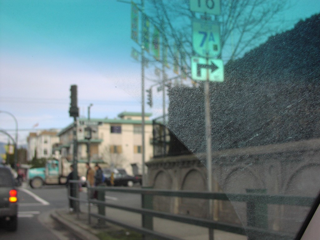
To BC-7A - Vancouver
To BC-7A Shields.
Taken 01-01-2004
 Vancouver
Metro Vancouver
British Columbia
Canada
Vancouver
Metro Vancouver
British Columbia
Canada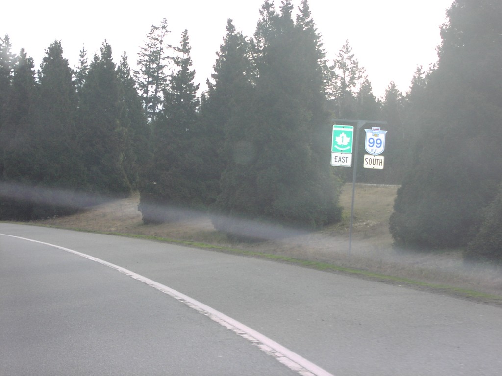
TC-1 East/BC-99 South
BC-99 South/TC-1 East Shields.
Taken 01-01-2004
 West Vancouver
Metro Vancouver
British Columbia
Canada
West Vancouver
Metro Vancouver
British Columbia
Canada
BC-99A South/BC-1A East - Vancouver
BC-1A/BC-99A South, Main St.
Taken 01-01-2004

 Vancouver
Metro Vancouver
British Columbia
Canada
Vancouver
Metro Vancouver
British Columbia
Canada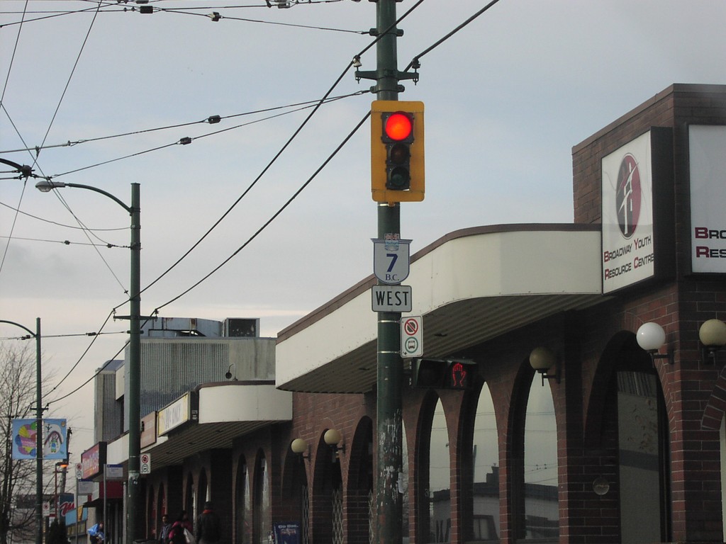
BC-7 West - Vancouver
BC-7 West Shield on Broadway
Taken 01-01-2004
Vancouver
Metro Vancouver
British Columbia
Canada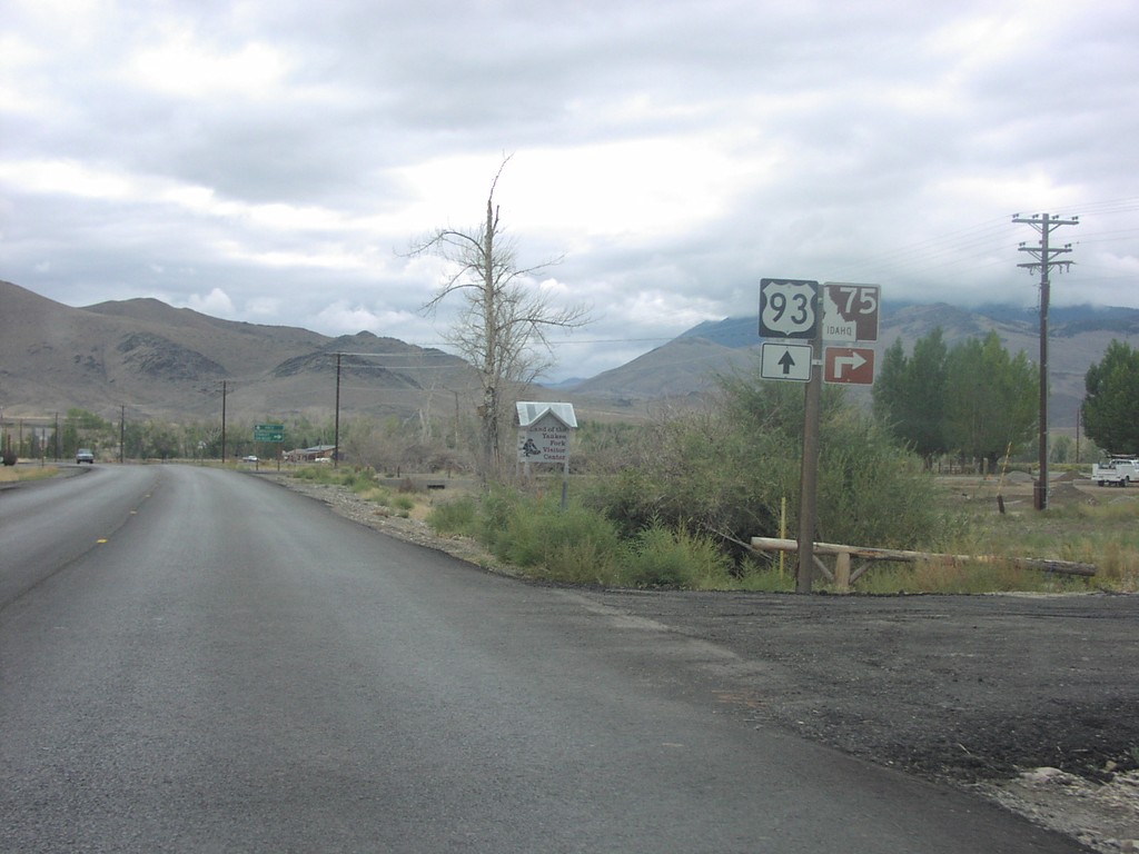
US-93 South at ID-75
Junction ID-75/US-93 on US-93 South
Taken 09-01-2003

 Challis
Custer County
Idaho
United States
Challis
Custer County
Idaho
United States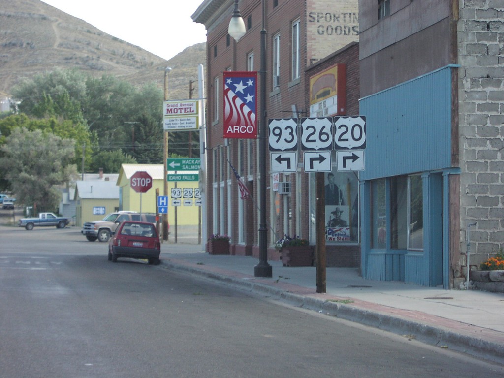
US-20/US-26/US-93 at Split in Arco
US-20/US-26/US-93 Junction on US-20 East
Taken 09-01-2003

 Arco
Butte County
Idaho
United States
Arco
Butte County
Idaho
United States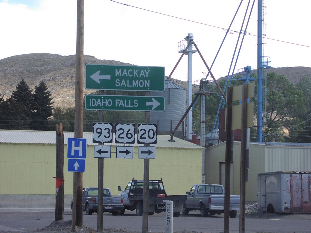
US-20/US-26 East/US-93 North Split
US-20/US-26/US-93 Junction to Mackay and Idaho Falls on US-20 East
Taken 09-01-2003
Arco
Butte County
Idaho
United States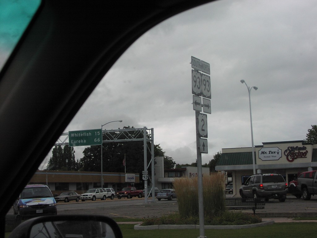
US-2 West at US-93
US-2/US-93 Junction on US-2 East
Taken 09-01-2003
 Kalispell
Flathead County
Montana
United States
Kalispell
Flathead County
Montana
United States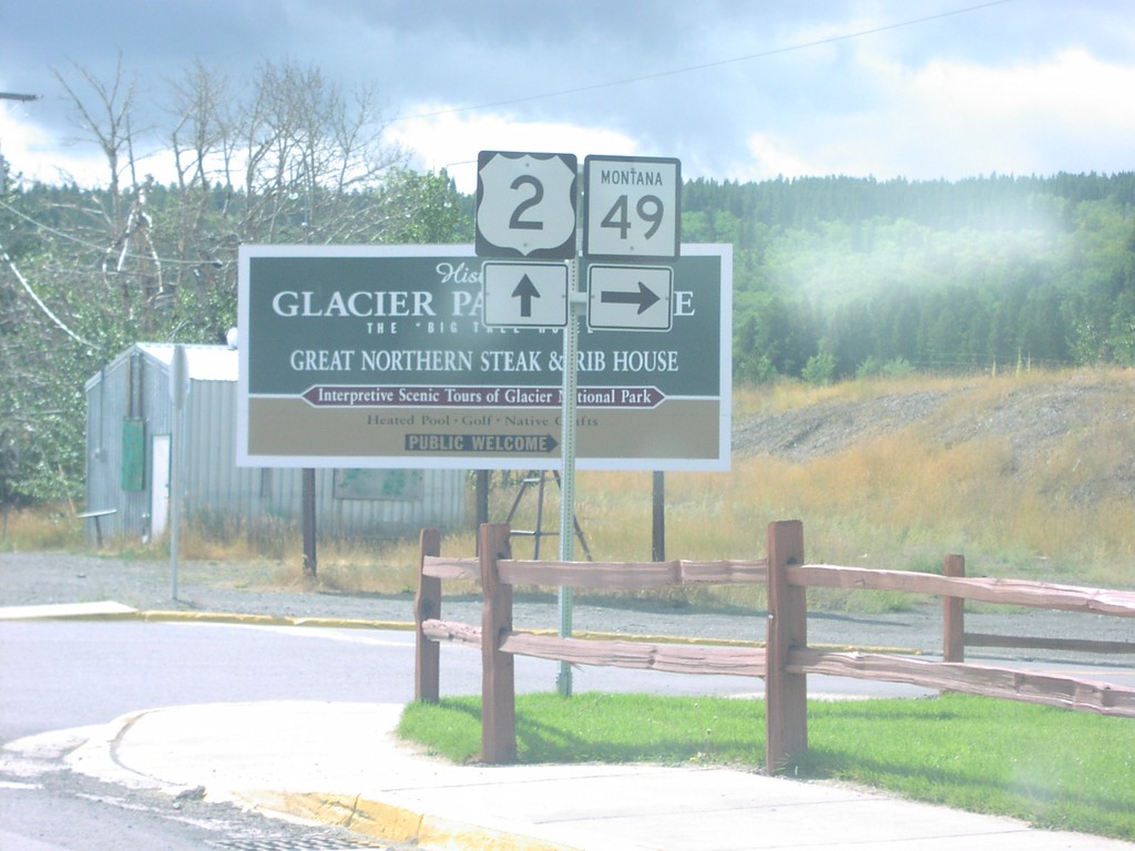
US-2 West at MT-49
US-2/MT-49 Junction on US-2 East, Saint Marys.
Taken 09-01-2003
 East Glacier Park
Glacier County
Montana
United States
East Glacier Park
Glacier County
Montana
United States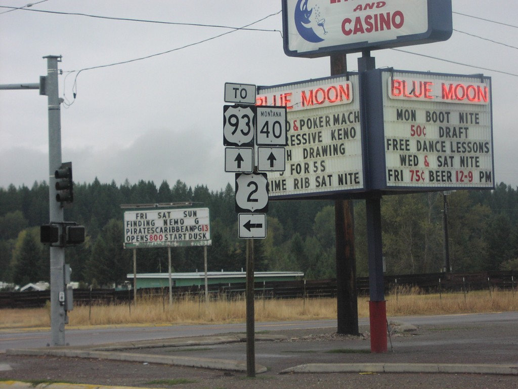
US-2 West at MT-40 West
US-2/To US-93/MT-40 Shields at MT-40/US-2 Junction
Taken 09-01-2003
 Columbia Falls
Flathead County
Montana
United States
Columbia Falls
Flathead County
Montana
United States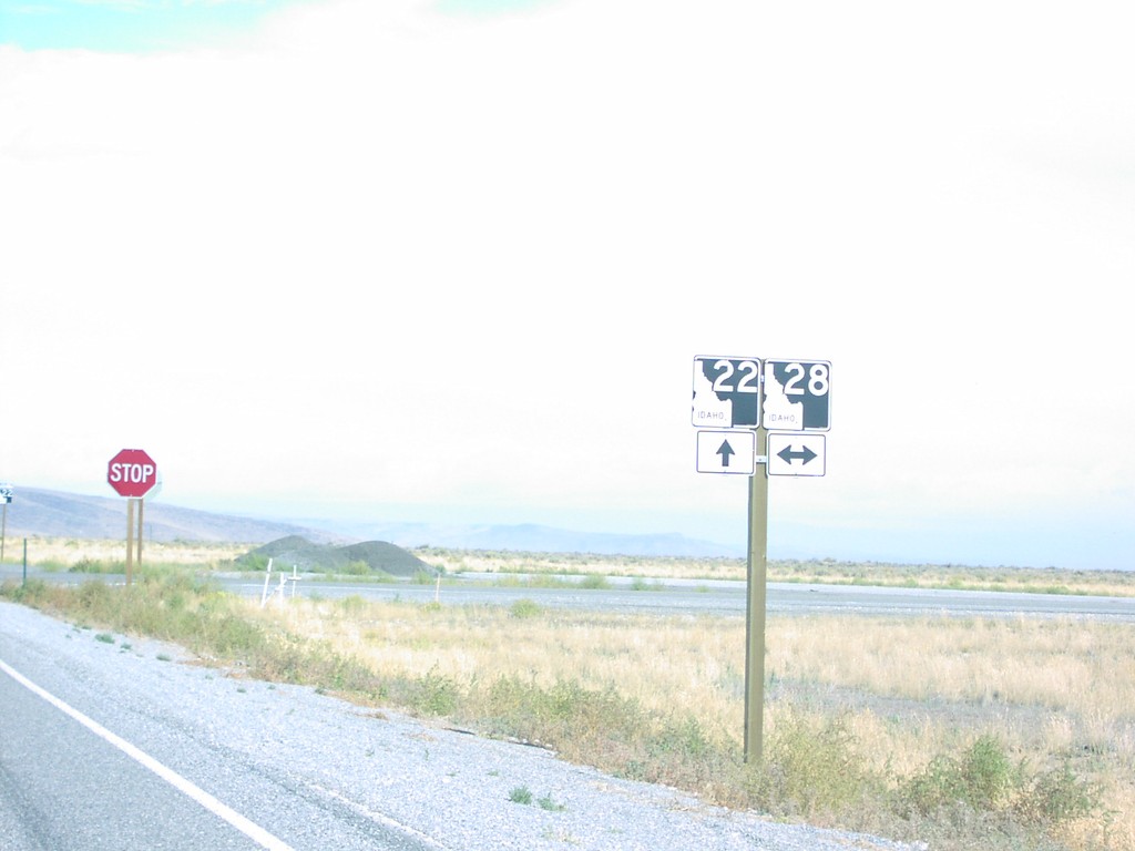
ID-22 North at ID-28
ID-22/ID-28 Junction on ID-22 East
Taken 09-01-2003

 Monteview
Clark County
Idaho
United States
Monteview
Clark County
Idaho
United States