Signs Tagged With Shield
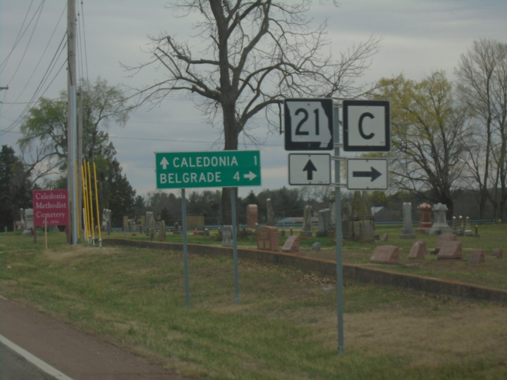
MO-21 South at MO-C
MO-21 South at MO-C in Washington County. Use MO-C West to Belgrade. Continue south on MO-21 for Caledonia.
Taken 03-27-2026

 Caledonia
Washington County
Missouri
United States
Caledonia
Washington County
Missouri
United States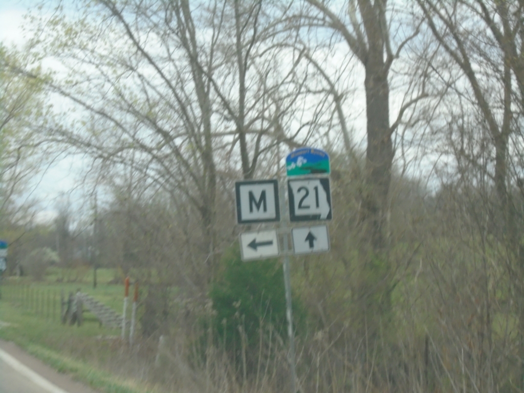
MO-21 South at MO-M
MO-21 South at MO-M. MO-21 is designated as the Ozark Run Scenic Byway.
Taken 03-27-2026
 Caledonia
Washington County
Missouri
United States
Caledonia
Washington County
Missouri
United States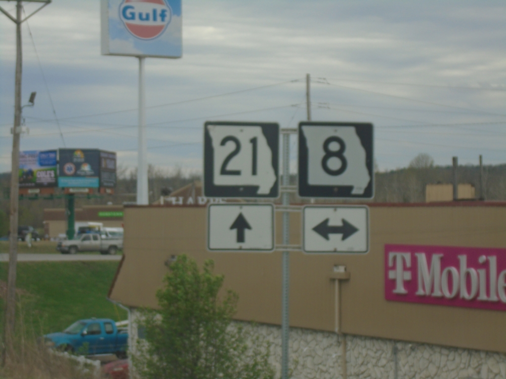
MO-21 South at MO-8
MO-21 South at MO-8 junction in Potosi.
Taken 03-27-2026
 Potosi
Washington County
Missouri
United States
Potosi
Washington County
Missouri
United States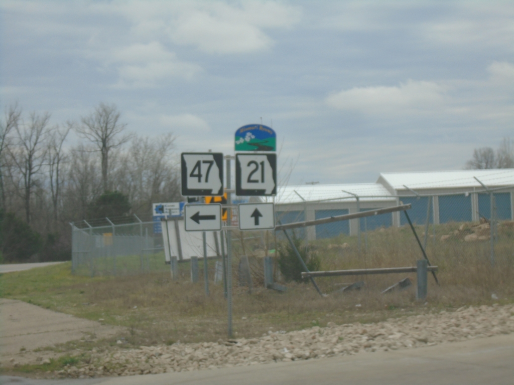
MO-21/MO-47 South - Old Mines
MO-21/MO-47 South at MO-21/MO-47 split in Old Mines. MO-21 is designated as the Ozark Run Scenic Byway
Taken 03-27-2026
 Cadet
Washington County
Missouri
United States
Cadet
Washington County
Missouri
United States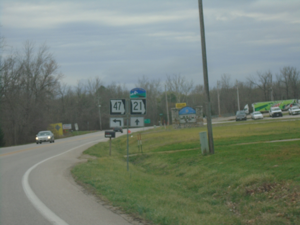
MO-21/MO-47 South at MO-21/MO-47 Split
MO-21/MO-47 South at MO-21/MO-47 split in Old Mines. MO-21 is designated the Ozark Run Scenic Byway
Taken 03-27-2026
Cadet
Washington County
Missouri
United States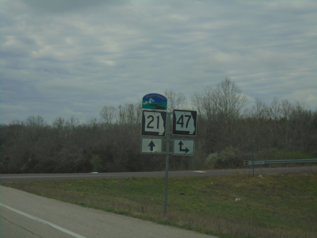
MO-21 South at MO-47 Junction
MO-21 South at MO-47 junction. MO-47 South joins MO-21 South to Old Mines. MO-21 is designated as the Ozark Run Scenic Byway.
Taken 03-27-2026
Cadet
Washington County
Missouri
United States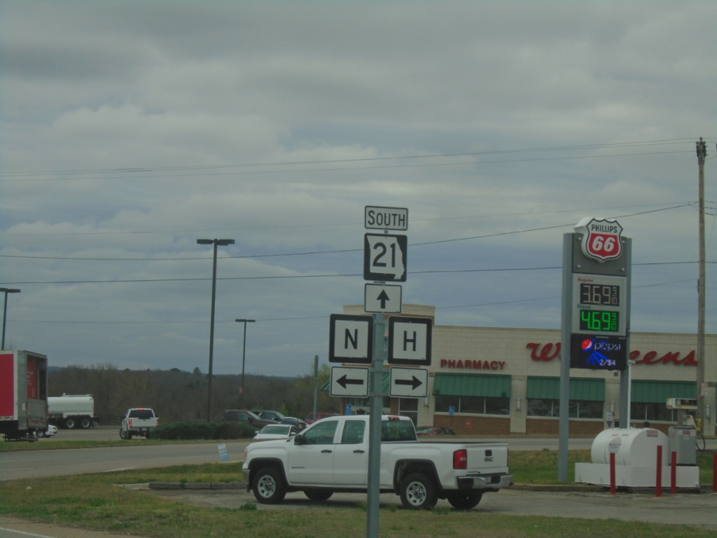
MO-21 South at MO-H and MO-N
MO-21 South at MO-H and MO-N in De Soto.
Taken 03-27-2026

 De Soto
Jefferson County
Missouri
United States
De Soto
Jefferson County
Missouri
United States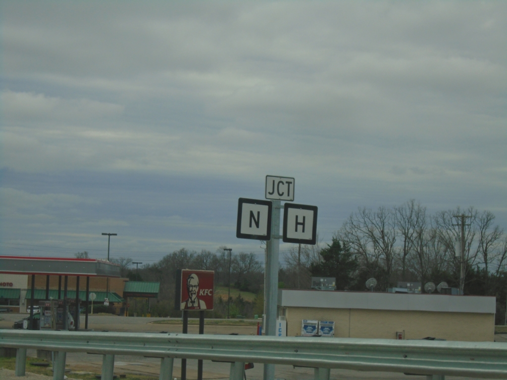
MO-21 South Approaching MO-H and MO-N
MO-21 South approaching MO-H and MO-N in De Soto.
Taken 03-27-2026
De Soto
Jefferson County
Missouri
United States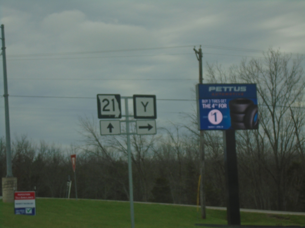
MO-21 South at MO-Y
MO-21 South at MO-Y in De Soto.
Taken 03-27-2026
 De Soto
Jefferson County
Missouri
United States
De Soto
Jefferson County
Missouri
United States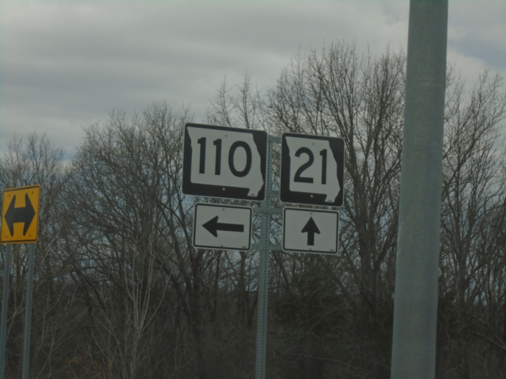
MO-21 South at MO-110
MO-21 South at MO-110 in Jefferson County
Taken 03-27-2026
 De Soto
Jefferson County
Missouri
United States
De Soto
Jefferson County
Missouri
United States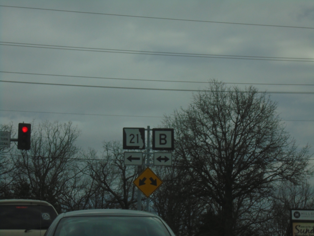
MO-21 South at MO-B
MO-21 South at MO-B. This is the southern end of the MO-21 freeway. Turn left to continue on MO-21 south.
Taken 03-27-2026
 Central Township
Jefferson County
Missouri
United States
Central Township
Jefferson County
Missouri
United States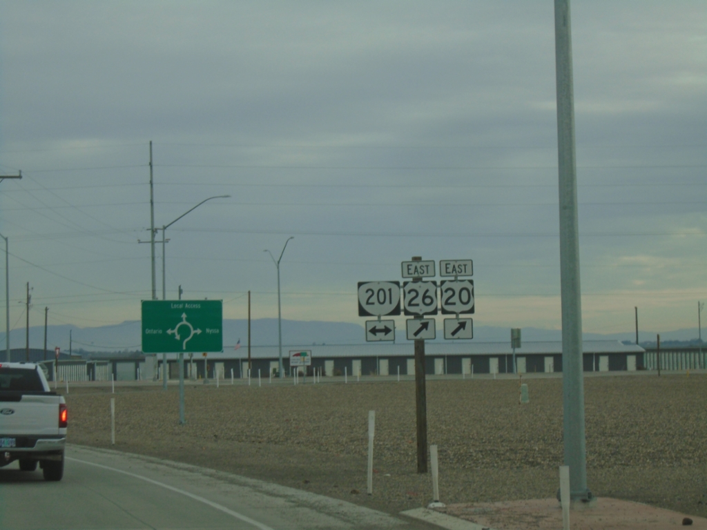
US-20/US-26 East at OR-201
US-20/US-26 east at OR-201. This intersection was converted to a roundabout in 2024.
Taken 02-16-2026


 Ontario
Malheur County
Oregon
United States
Ontario
Malheur County
Oregon
United States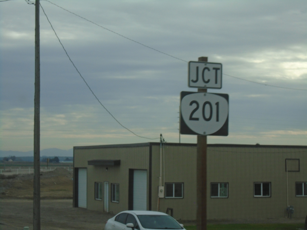
US-20/US-26 East Approaching OR-201
US-20/US-26 east approaching OR-201.
Taken 02-16-2026
Ontario
Malheur County
Oregon
United States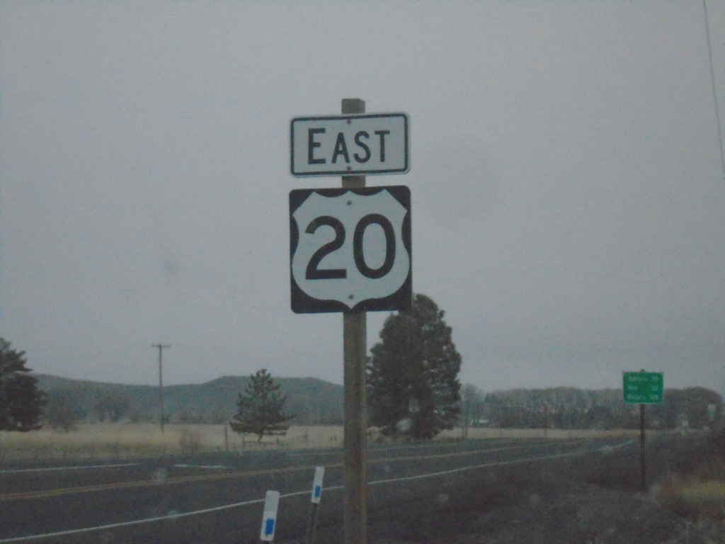
US-20 East - Harney County
US-20 east in Harney County.
Taken 02-16-2026
Burns
Harney County
Oregon
United States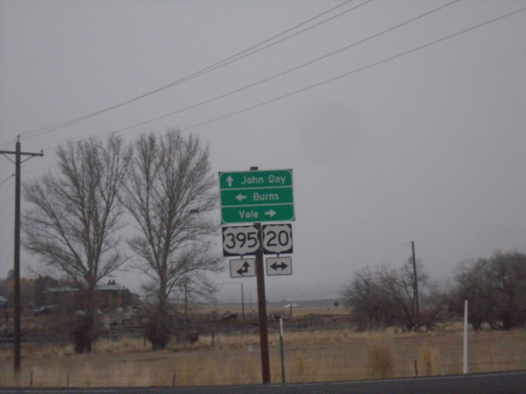
Fry Road North at US-20/US-395 Junction
Fry Road North at US-20/US-395 Junction. Turn right for US-20 East to Vale; left for US-20 West/US-395 South to Burns; continue straight for US-395 North to John Day.
Taken 02-16-2026
 Burns
Harney County
Oregon
United States
Burns
Harney County
Oregon
United States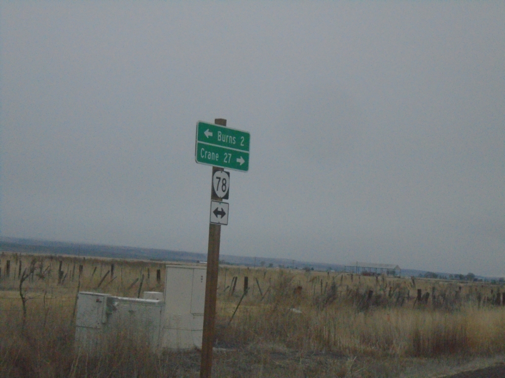
End OR-205 North at OR-78
End OR-205 North at OR-78 in Harney County. Turn right for OR-78 East to Crane; left for OR-78 West to Burns.
Taken 02-16-2026

 Burns
Harney County
Oregon
United States
Burns
Harney County
Oregon
United States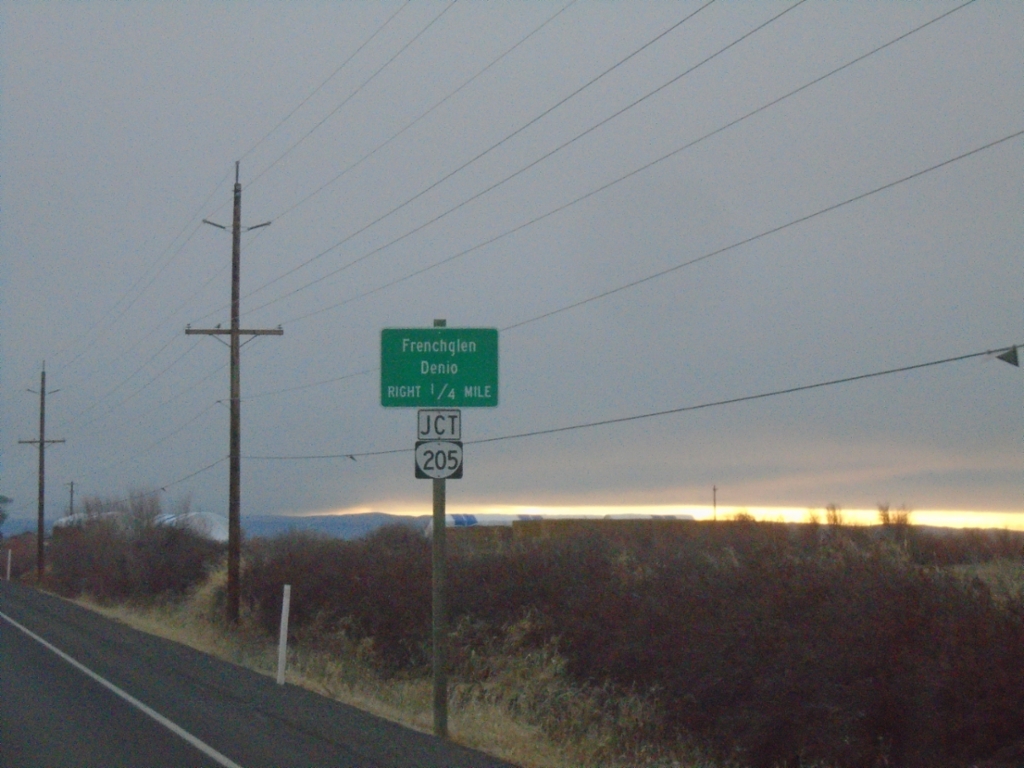
OR-78 East Approaching OR-205
OR-78 East approaching OR-205. Use OR-205 south to Frenchglen and Denio (Nevada).
Taken 02-16-2026
Burns
Harney County
Oregon
United States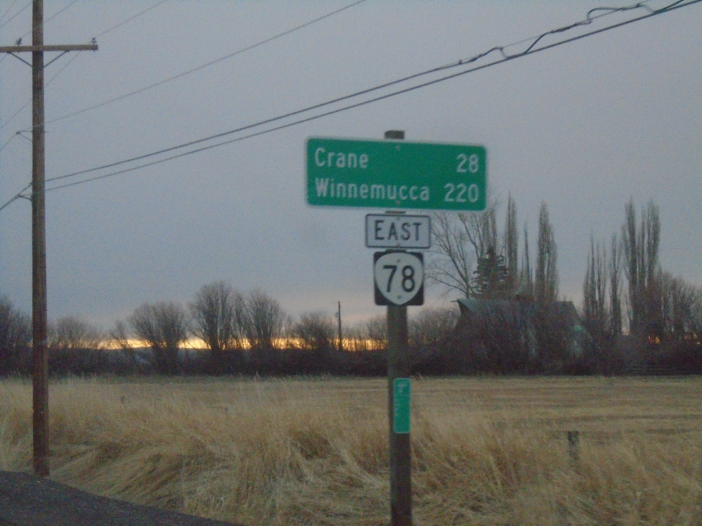
OR-78 East - Distance Marker
Distance marker on OR-78 east. Distance to Crane and Winnemucca (Nevada).
Taken 02-16-2026
Burns
Harney County
Oregon
United States
US-20 West/US-395 South - Burns
US-20 West/US-395 South in Burns
Taken 02-16-2026
Burns
Harney County
Oregon
United States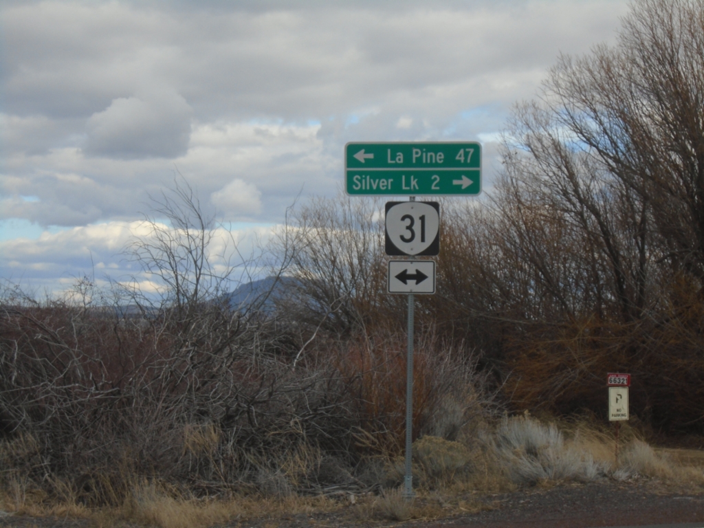
End Silver Creek Marsh Road at OR-31
End Silver Creek Marsh Road at OR-31. Turn right on OR-31 for Silver Lake. Turn left on OR-31 for La Pine.
Taken 02-15-2026
 Silver Lake
Lake County
Oregon
United States
Silver Lake
Lake County
Oregon
United States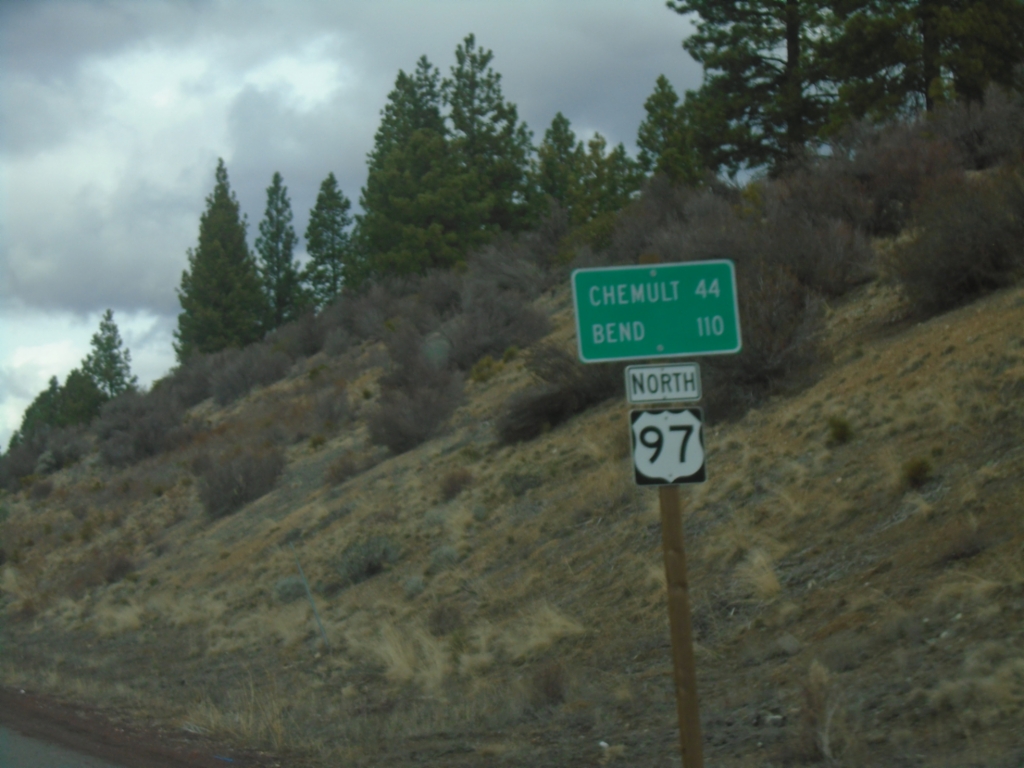
US-97 North - Distance Marker
Distance marker on US-97 north. Distance to Chemult and Bend.
Taken 02-15-2026
 Chiloquin
Klamath County
Oregon
United States
Chiloquin
Klamath County
Oregon
United States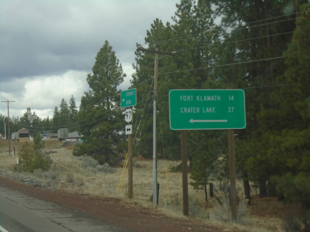
US-97 North at OR-62
US-97 North at OR-62 in Klamath County. Use OR-62 for Fort Klamath and Crater Lake.
Taken 02-15-2026
 Chiloquin
Klamath County
Oregon
United States
Chiloquin
Klamath County
Oregon
United States
US-97 North at OR-62
US-97 North at OR-62 in Klamath County.
Taken 02-15-2026
Chiloquin
Klamath County
Oregon
United States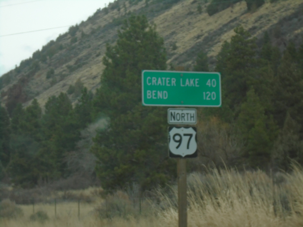
US-97 North - Distance Marker
Distance marker on US-97 north. Distance to Crater Lake and Bend.
Taken 02-15-2026
Modoc Point
Klamath County
Oregon
United States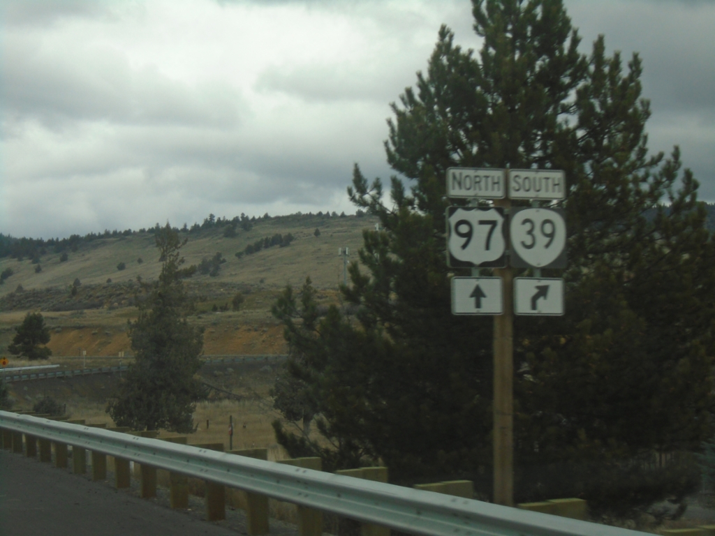
US-97 North - Exit 272
US-97 North approaching Exit 272. Use Exit 272 for OR-39 south.
Taken 02-15-2026

 Klamath Falls
Klamath County
Oregon
United States
Klamath Falls
Klamath County
Oregon
United States