Signs Tagged With Shield
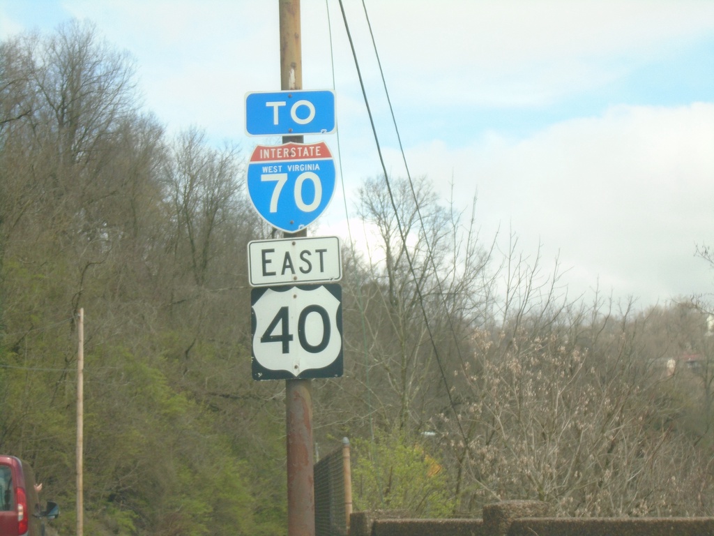
US-40 East/To I-70 - Wheeling
US-40 East/To I-70 on the National Road in Wheeling
Taken 04-01-2024

 Wheeling
Ohio County
West Virginia
United States
Wheeling
Ohio County
West Virginia
United States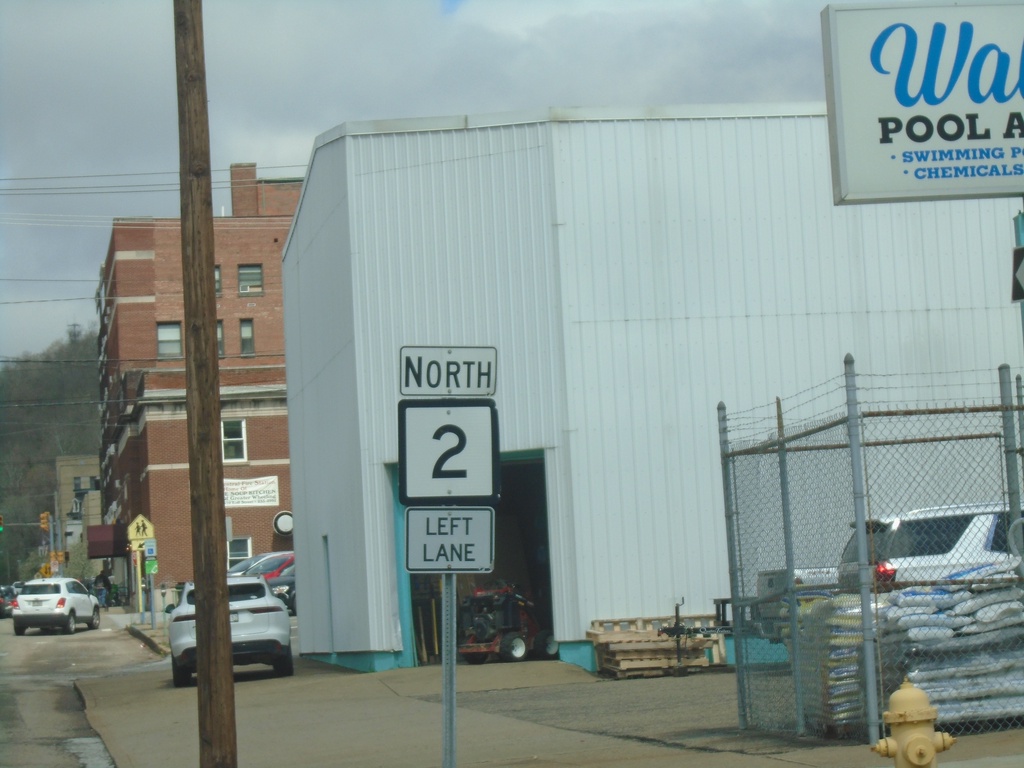
WV-2 North - Wheeling
WV-2 north in Wheeling. Use left lane to continue on WV-2 north.
Taken 04-01-2024
 Wheeling
Ohio County
West Virginia
United States
Wheeling
Ohio County
West Virginia
United States
US-250 West/WV-2 North at WV-86
US-250 West/WV-2 North at WV-86 in Glendale.
Taken 04-01-2024

 Glen Dale
Marshall County
West Virginia
United States
Glen Dale
Marshall County
West Virginia
United States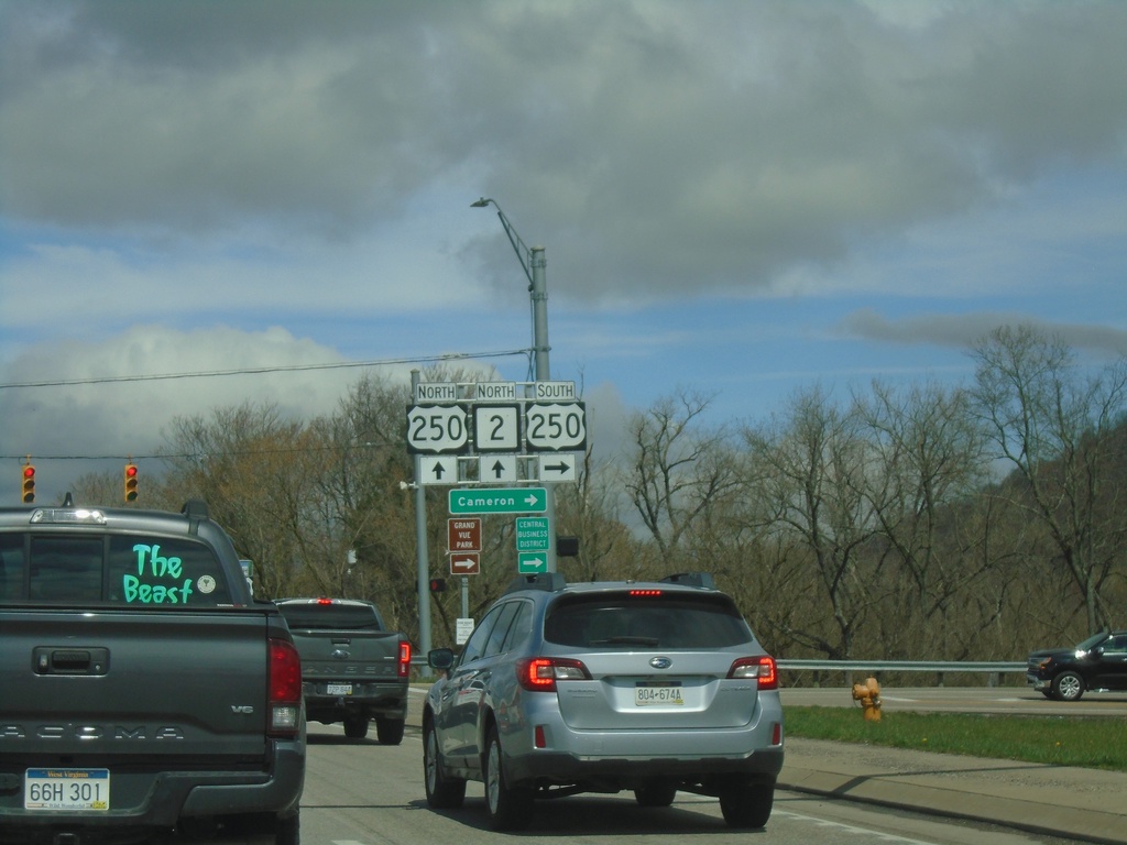
WV-2 North at US-250
WV-2 North at US-250 in Moundsville. US-250 east to Cameron. US-250 West joins WV-2 Northbound.
Taken 04-01-2024
Moundsville
Marshall County
West Virginia
United States
WV-2 North at (Truck)US-250
WV-2 North at (Truck)US-250. This is the truck route to US-250 (7th St. to Jefferson Ave.), the actual US-250 junction is further north along WV-2.
Taken 04-01-2024
Moundsville
Marshall County
West Virginia
United States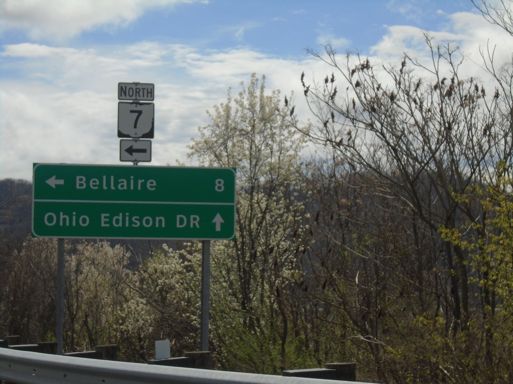
OH-872 East at OH-7 North Onramp
OH-872 East at OH-7 North onramp to Bellaire. Continue straight for (OH-872)/Ohio Edison Drive.
Taken 04-01-2024

 Shadyside
Belmont County
Ohio
United States
Shadyside
Belmont County
Ohio
United States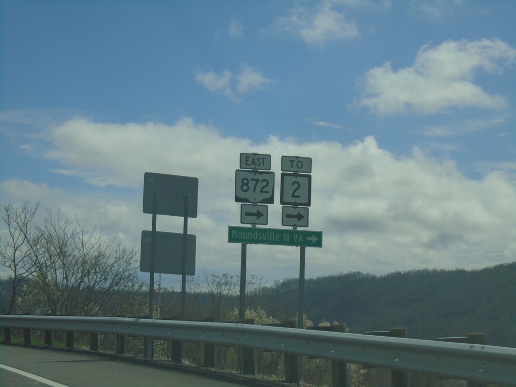
OH-7 North Offramp at OH-872
OH-7 North Offramp at OH-872. Turn right for OH-872 to WV-2 and Moundville, WV.
Taken 04-01-2024
Dilles Bottom
Belmont County
Ohio
United States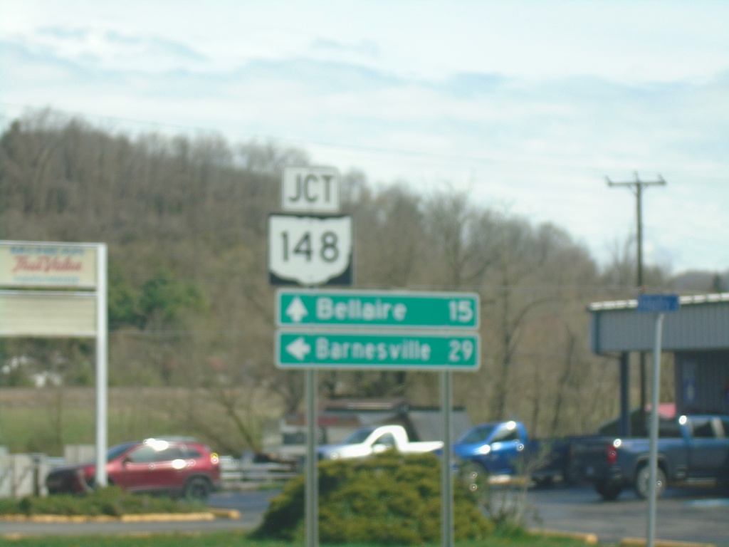
OH-7 North Approaching OH-148
OH-7 North approaching OH-148 in Powhatan Point. Use OH-148 West to Barnesville; OH-7 North to Bellaire.
Taken 04-01-2024
 Powhatan Point
Belmont County
Ohio
United States
Powhatan Point
Belmont County
Ohio
United States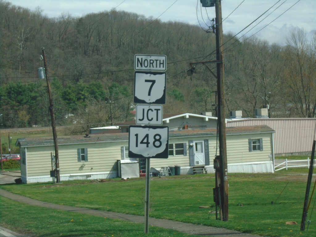
OH-7 North Approaching OH-148
OH-7 North approaching OH-148 in Powhatan Point
Taken 04-01-2024
Powhatan Point
Belmont County
Ohio
United States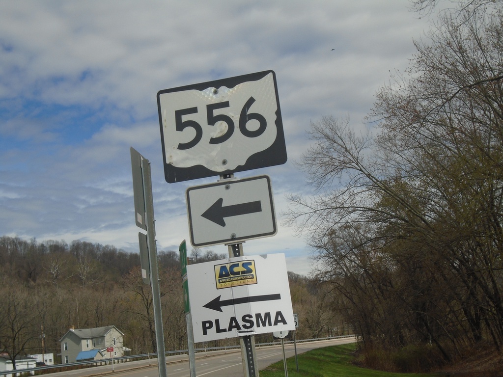
OH-7 North at OH-556
OH-7 North at OH-556 in Clarington.
Taken 04-01-2024
 Clarington
Monroe County
Ohio
United States
Clarington
Monroe County
Ohio
United States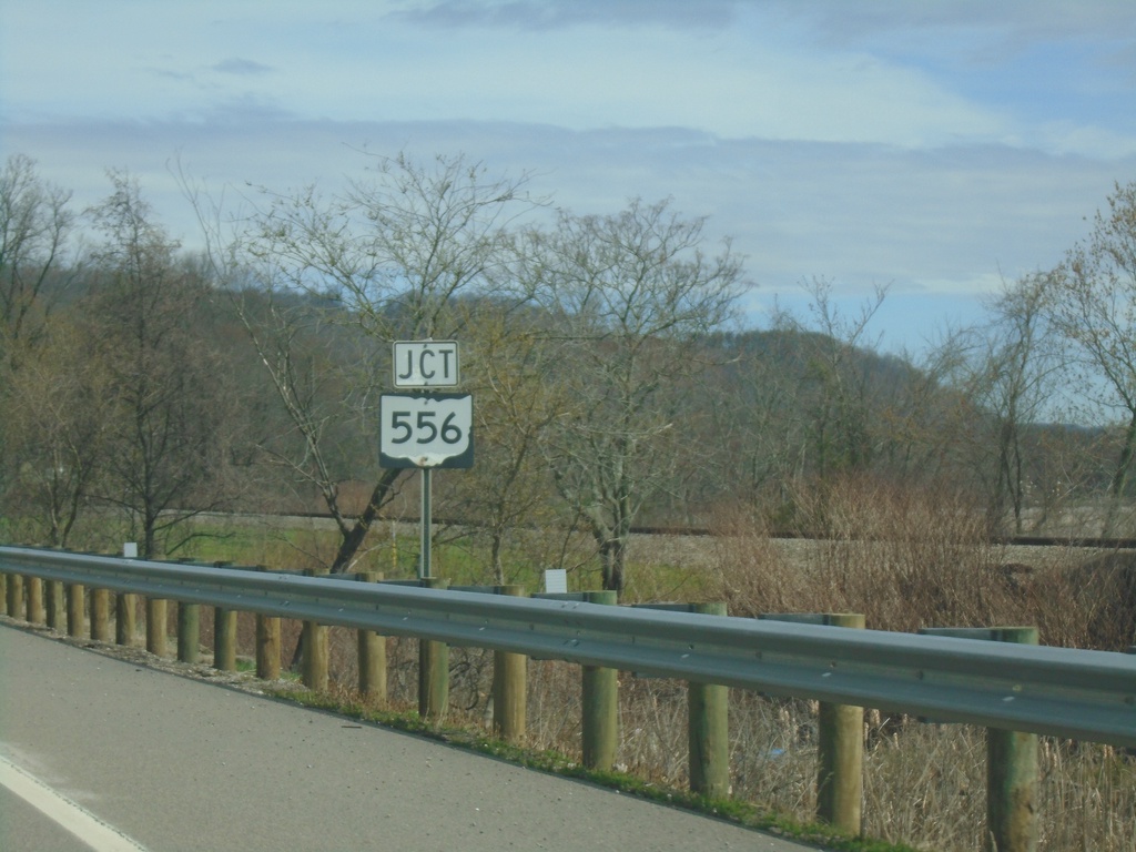
OH-7 North Approaching OH-556
OH-7 North approaching OH-556 in Clarington.
Taken 04-01-2024
Clarington
Monroe County
Ohio
United States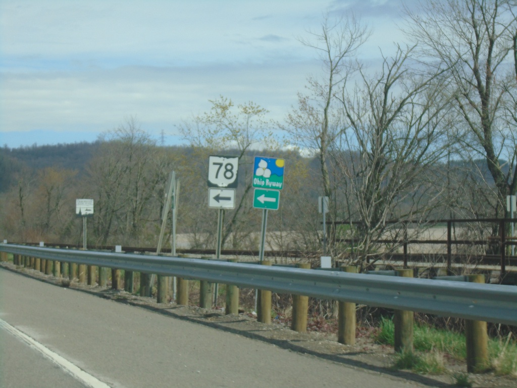
OH-7 North at OH-78 West
OH-7 North at OH-78 West in Clarington. OH-78 is part of the Ohio Appalachian Byway.
Taken 04-01-2024
 Clarington
Monroe County
Ohio
United States
Clarington
Monroe County
Ohio
United States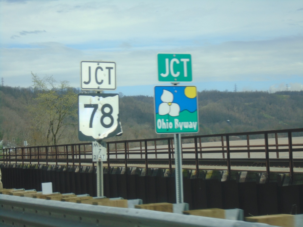
OH-7 North Approaching OH-78
OH-7 North approaching OH-78 in Clarington. OH-78 is part of the Ohio Appalachian Byway.
Taken 04-01-2024
Clarington
Monroe County
Ohio
United States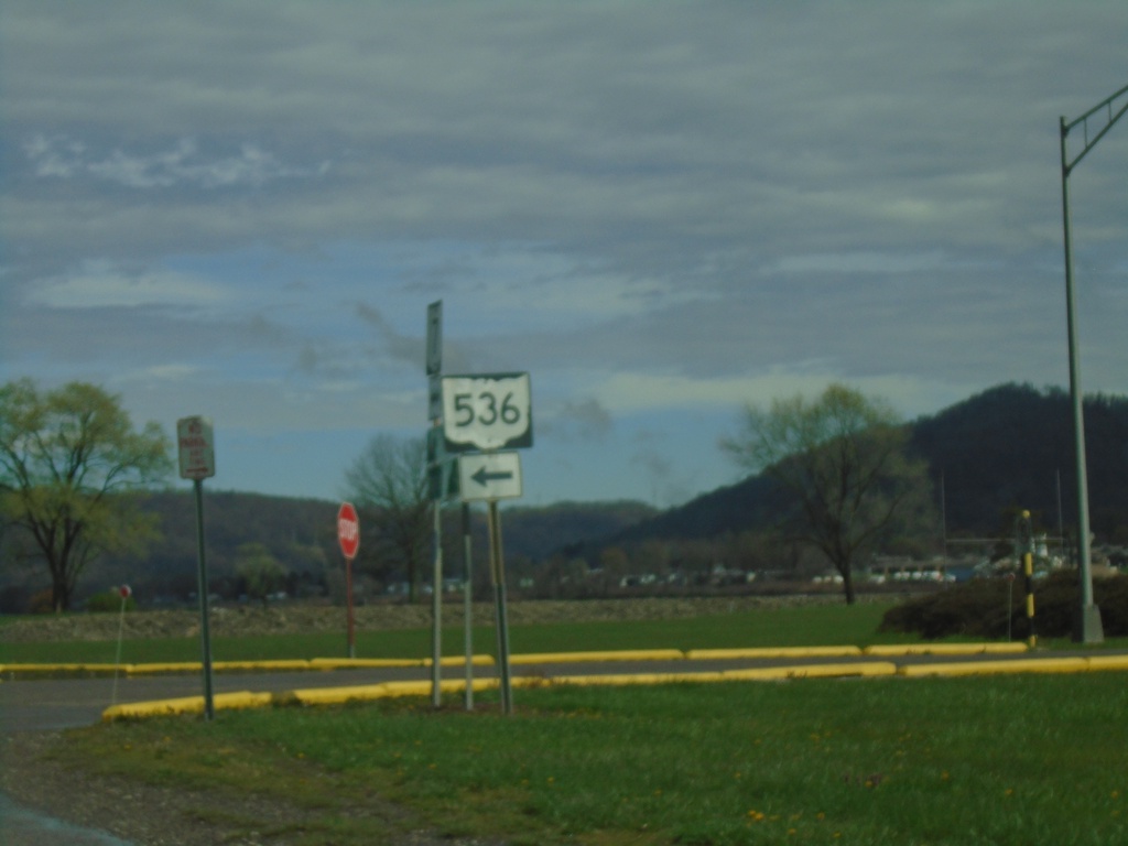
OH-7 North at OH-536
OH-7 North at OH-536 in Hannibal.
Taken 04-01-2024
 Hannibal
Monroe County
Ohio
United States
Hannibal
Monroe County
Ohio
United States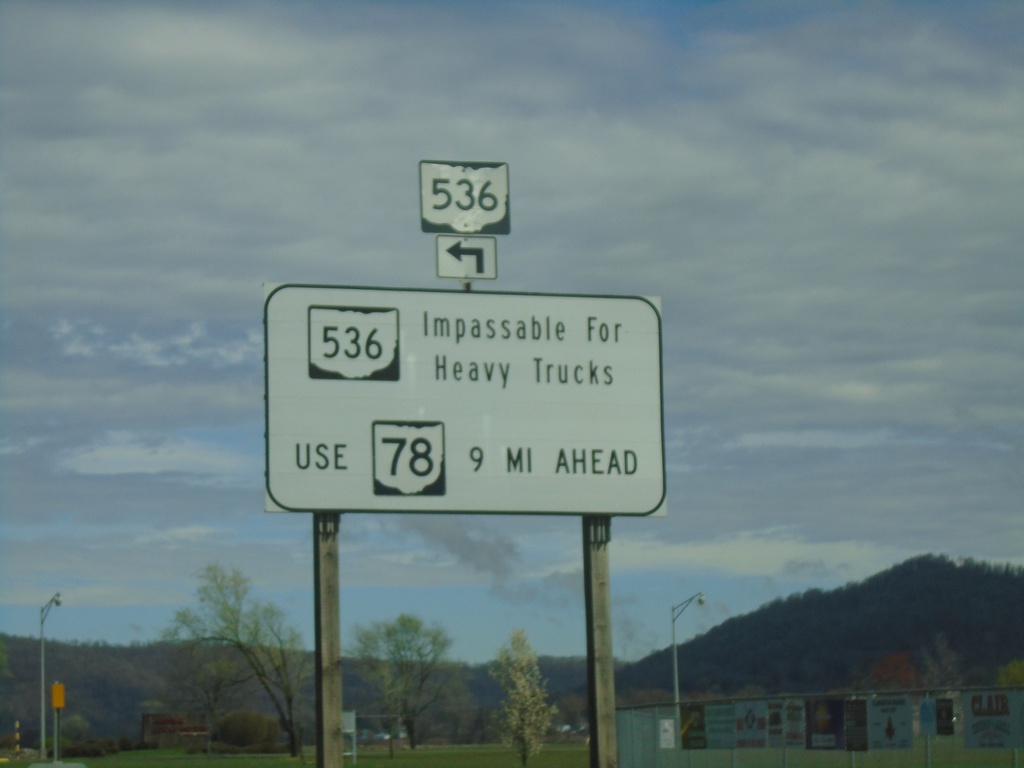
OH-7 North Approaching OH-536
OH-7 North approaching OH-536 in Hannibal. OH-536 is impassable for heavy trucks. Use OH-78 as an alternate route.
Taken 04-01-2024
Hannibal
Monroe County
Ohio
United States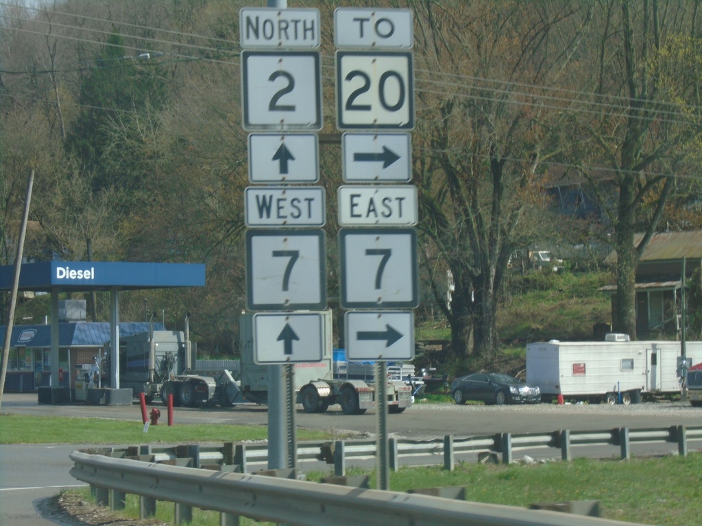
WV-2 North at WV-7
WV-2 North at WV-7 to WV-20. WV-7 West joins WV-2 northbound through New Martinsville.
Taken 04-01-2024

 New Martinsville
Wetzel County
West Virginia
United States
New Martinsville
Wetzel County
West Virginia
United States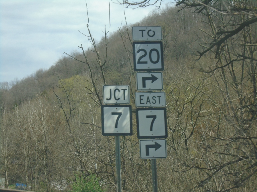
WV-2 North at WV-7 East/To WV-20
WV-2 North at WV-7 East/To WV-20 in New Martinsville.
Taken 04-01-2024
New Martinsville
Wetzel County
West Virginia
United States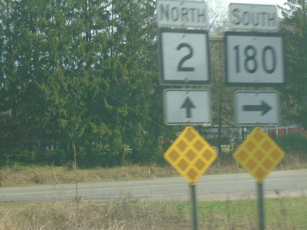
WV-2 North at WV-180 South
WV-2 North at WV-180 South in Wetzel County.
Taken 04-01-2024
 New Martinsville
Wetzel County
West Virginia
United States
New Martinsville
Wetzel County
West Virginia
United States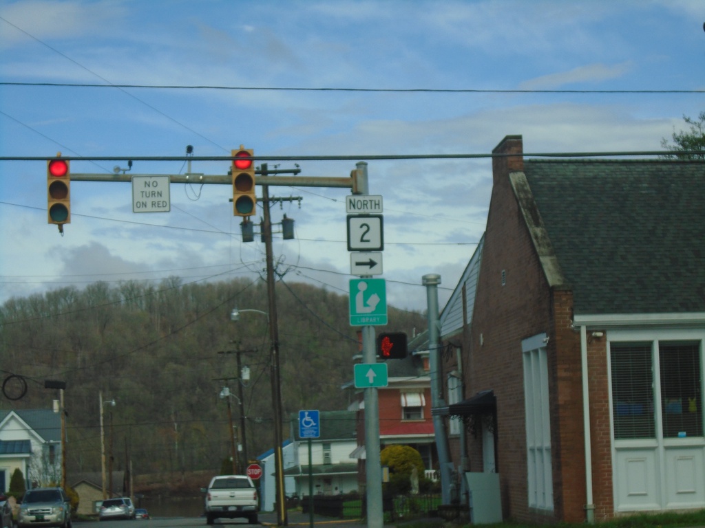
WV-2 - Sistersville
WV-2 at the corner of Elizabeth St. and Wells St. in Sistersville.
Taken 04-01-2024
Sistersville
Tyler County
West Virginia
United States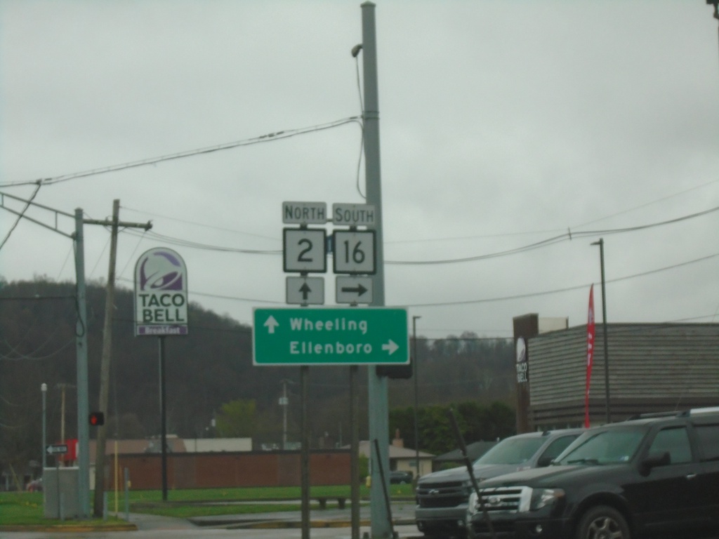
WV-2 North at WV-16
WV-2 North at WV-16 South to Ellenboro. Continue north on WV-2 for Wheeling.
Taken 04-01-2024
 Saint Marys
Pleasants County
West Virginia
United States
Saint Marys
Pleasants County
West Virginia
United States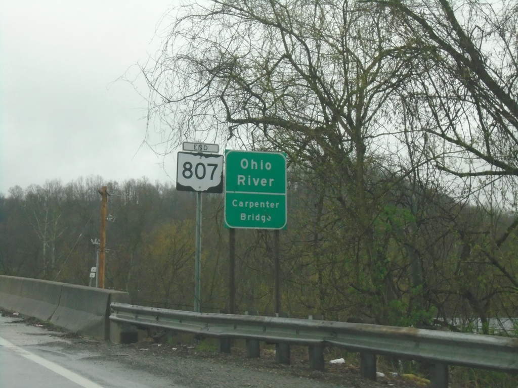
End OH-807 - Ohio River
End OH-807 at the Ohio River/Carpenter Bridge.
Taken 04-01-2024
 Newport
Washington County
Ohio
United States
Newport
Washington County
Ohio
United States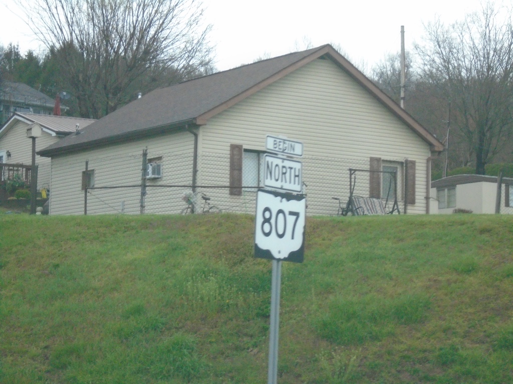
Begin North OH-807
Begin North OH-807 on approach to Carpenter Bridge over Ohio River.
Taken 04-01-2024
Newport
Washington County
Ohio
United States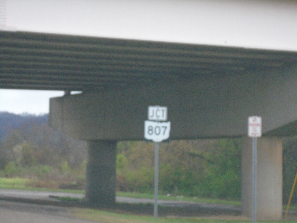
OH-7 North Approaching OH-807
OH-7 North approaching OH-807 in Newport.
Taken 04-01-2024
Newport
Washington County
Ohio
United States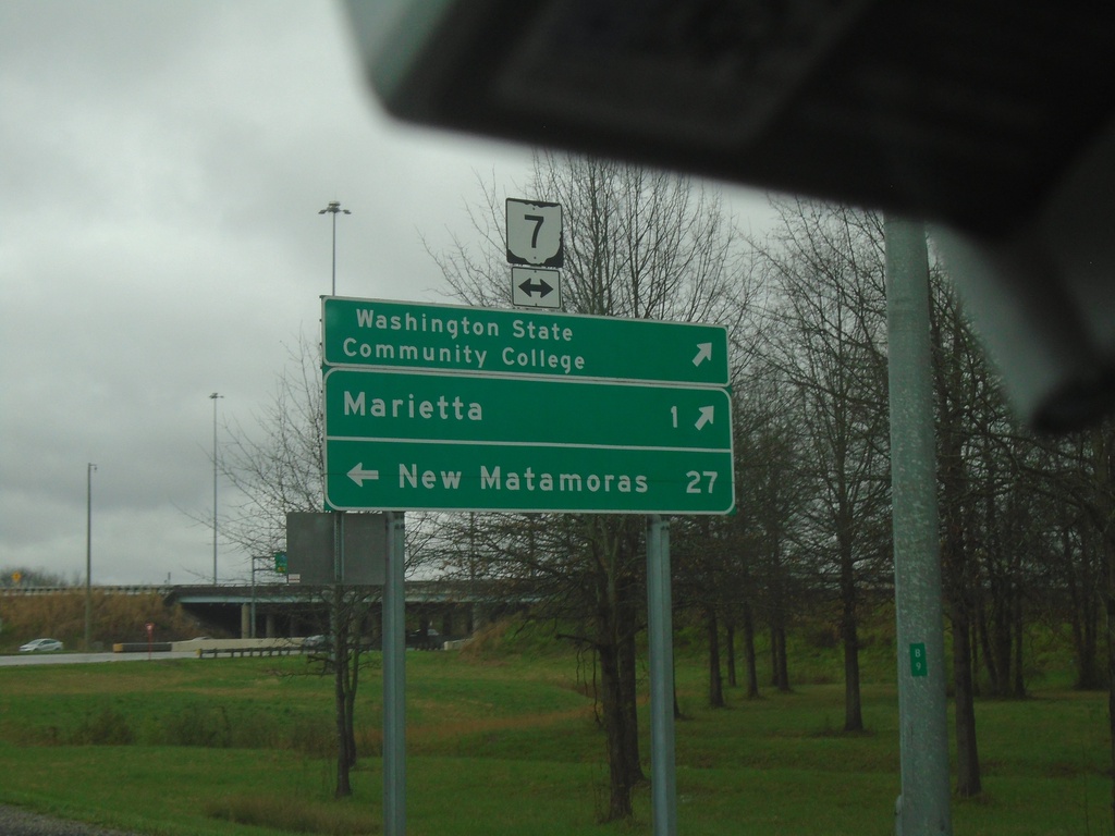
I-77 North - Exit 1 Offramp at OH-7
I-77 North - Exit 1 Offramp at OH-7. Use OH-7 South to Washington State Community College and Marietta. Use OH-7 North to New Matamoras.
Taken 04-01-2024
 Marietta
Washington County
Ohio
United States
Marietta
Washington County
Ohio
United States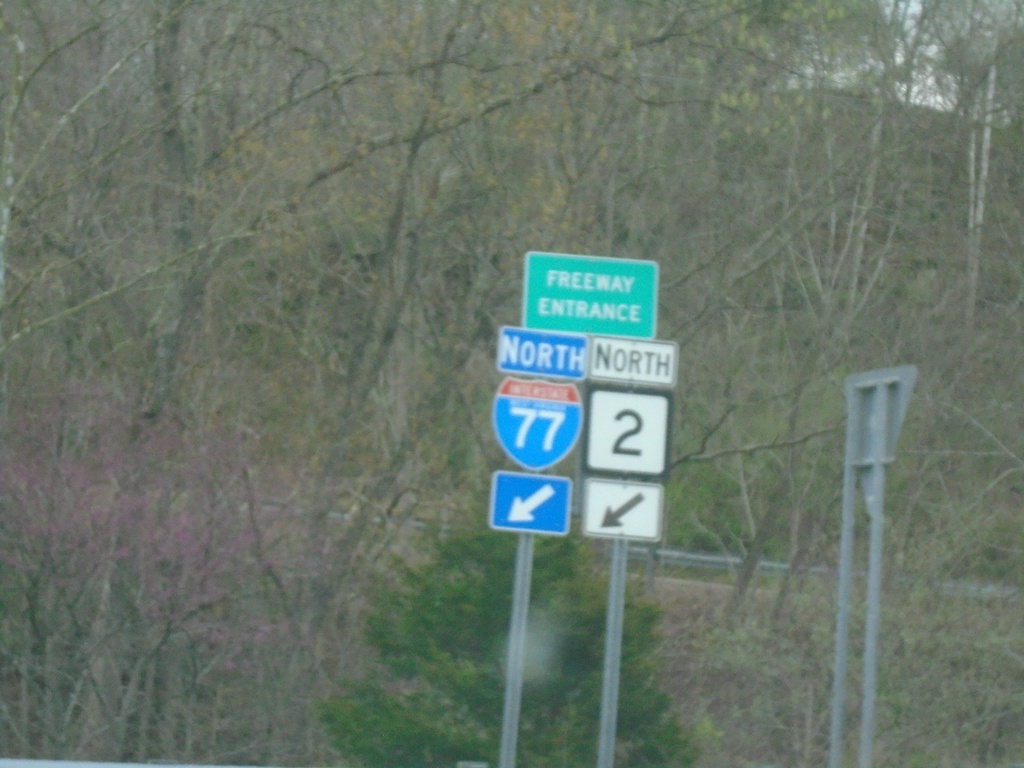
US-33 East/WV-2 North at I-77
I-77/WV-2 North Freeway Entrance.
Taken 04-01-2024
 Ravenswood
Jackson County
West Virginia
United States
Ravenswood
Jackson County
West Virginia
United States