Signs Tagged With Shield
I-90 East Exit 452 Offramp
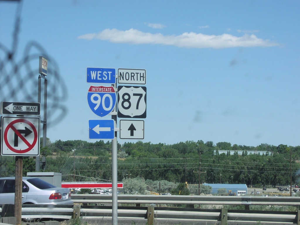
US-87 North at I-90 Freeway Entrance
Taken 07-01-2003
 Billings
Yellowstone County
Montana
United States
Billings
Yellowstone County
Montana
United States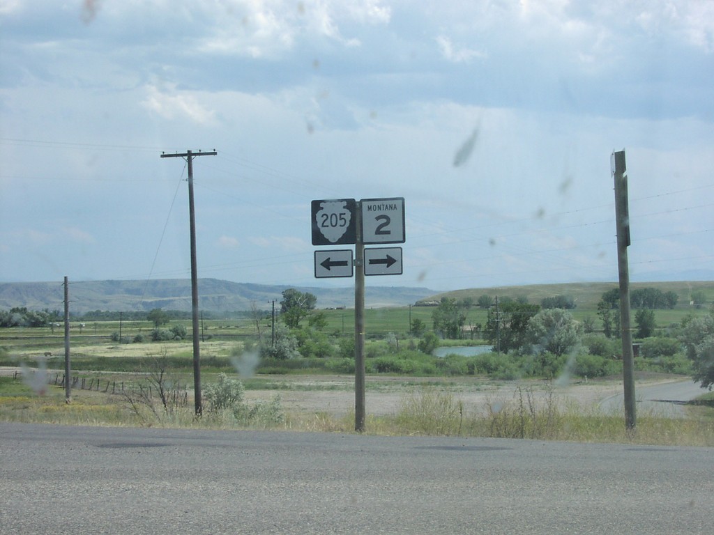
I-90 at Exit 278 Offramp at MT-2/MTS-205
MT-2/MTS-205 at I-90 Junction
Taken 07-01-2003

 Three Forks
Gallatin County
Montana
United States
Three Forks
Gallatin County
Montana
United States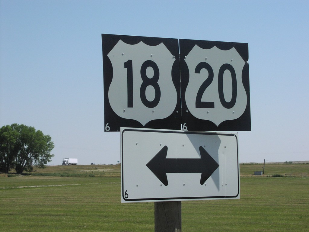
End WY-319 at US-18/US-20
US-18/US-20 Shields at End of WY-319
Taken 07-01-2003


 Orin
Converse County
Wyoming
United States
Orin
Converse County
Wyoming
United States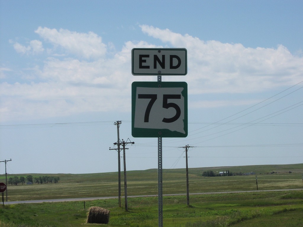
End SD-75 at SD-20
End SD-75 South at SD-20
Taken 07-01-2003

 Bison
Perkins County
South Dakota
United States
Bison
Perkins County
South Dakota
United States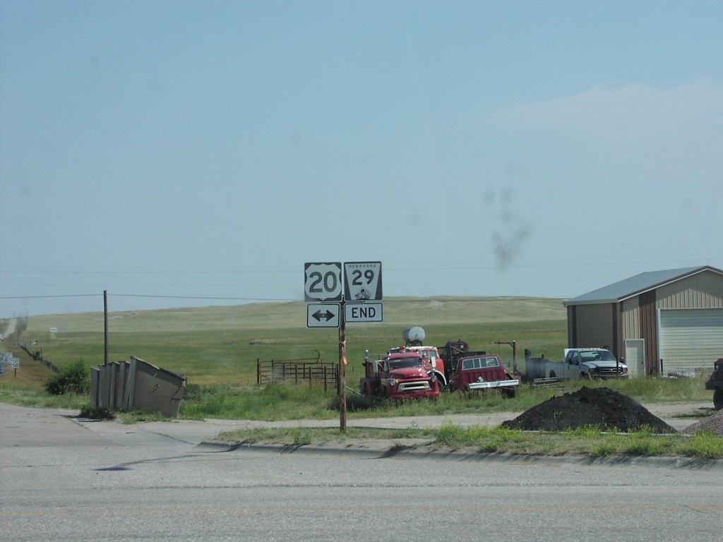
End NE-29 North at US-20
End NE-29 at US-20
Taken 07-01-2003
 Harrison
Sioux County
Nebraska
United States
Harrison
Sioux County
Nebraska
United States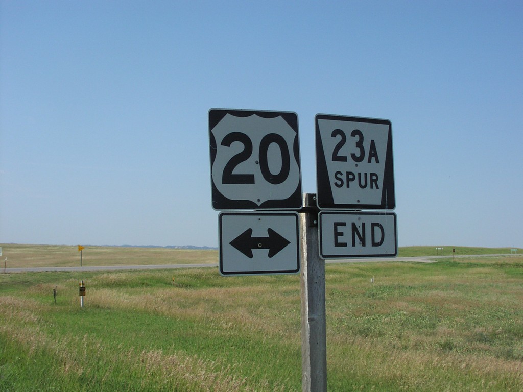
End NE-23A Spur at US-20
End NE-23A Spur at US-20
Taken 07-01-2003
 Whitney
Dawes County
Nebraska
United States
Whitney
Dawes County
Nebraska
United States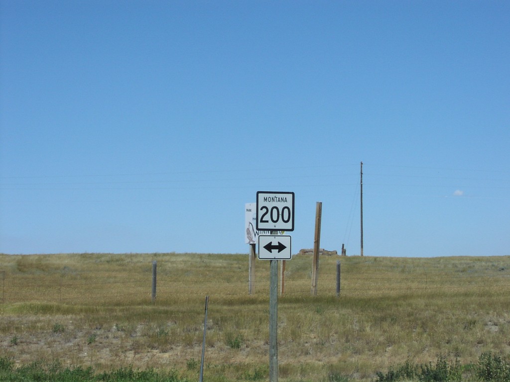
End MTS-244 North at MT-200
MT-200 Shield At Northern Terminus of MTS-244
Taken 07-01-2003

 Winnett
Petroleum County
Montana
United States
Winnett
Petroleum County
Montana
United States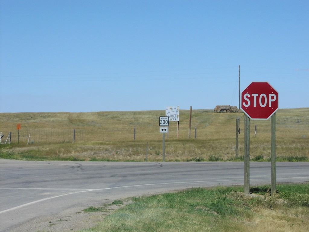
End MTS-244 North at MT-200
MT-200 Shield At Northern Terminus of MTS-244
Taken 07-01-2003
Winnett
Petroleum County
Montana
United States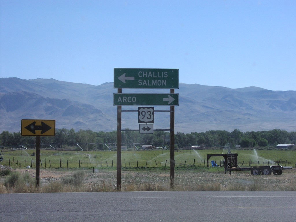
End ID-75 North at US-93
End ID-75 at US-93 to Arco and Salmon
Taken 07-01-2003

 Challis
Custer County
Idaho
United States
Challis
Custer County
Idaho
United States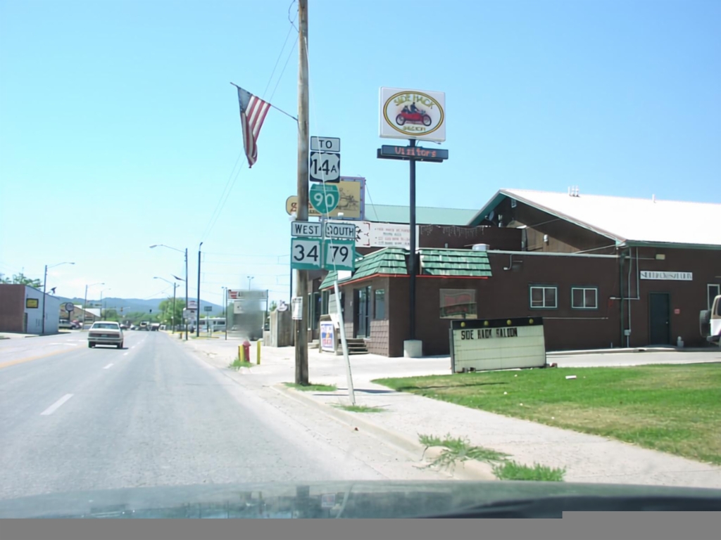
BL-90/SD-34/SD-79 in Sturgis
BL-90, SD-34, SD-79, To US-14A Shields
Taken 07-01-2003


 Sturgis
Meade County
South Dakota
United States
Sturgis
Meade County
South Dakota
United States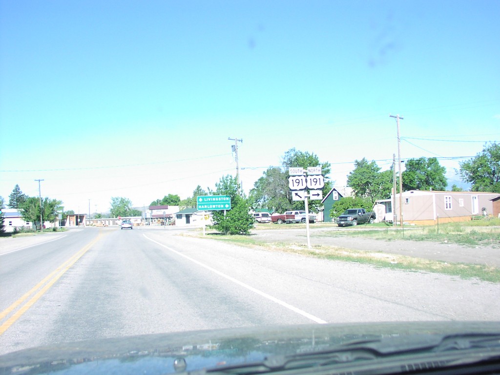
BL-90 West at US-191
US-191 at BL-90 West
Taken 07-01-2003
 Big Timber
Sweet Grass County
Montana
United States
Big Timber
Sweet Grass County
Montana
United States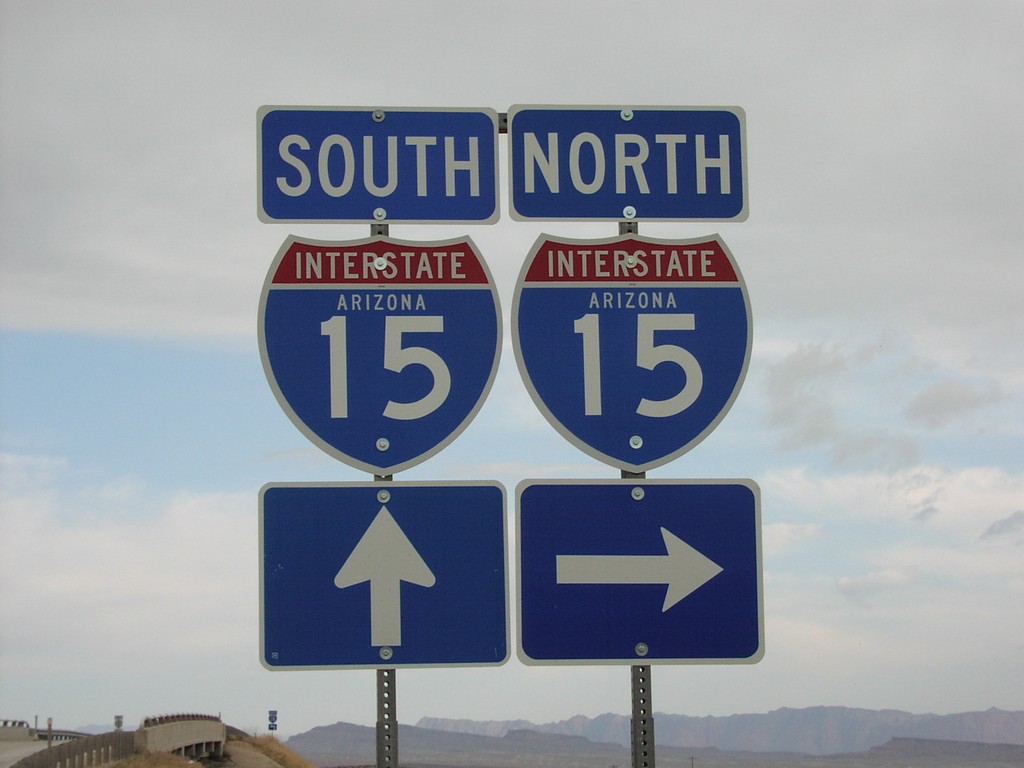
Black Rock Road at I-15
Black Rock Road at I-15 freeway entrance.
Taken 05-01-2003
 Littlefield
Mohave County
Arizona
United States
Littlefield
Mohave County
Arizona
United States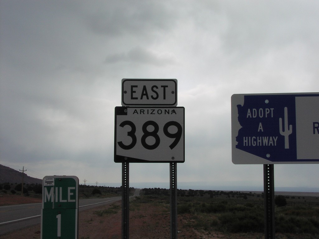
AZ-398 East - Mohave County
AZ-389 shield in rural Mohave County between Colorado City and Fredonia.
Taken 05-01-2003
 Kaibab
Mohave County
Arizona
United States
Kaibab
Mohave County
Arizona
United States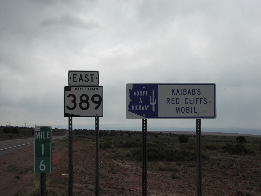
AZ-389 East - Adopt A Highway and Milemarker
Adopt a Highway, state highway shield, and milemarker along AZ-398 east between Colorado City and Freedonia.
Taken 05-01-2003
Kaibab
Mohave County
Arizona
United States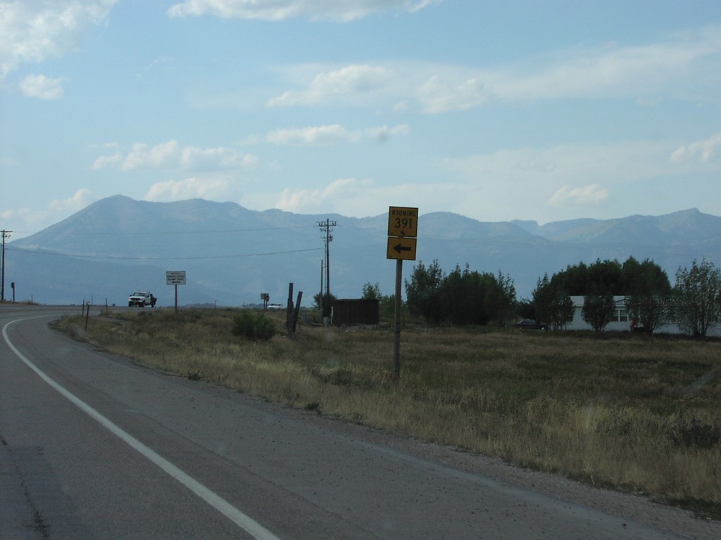
US-89/US-26/US-191/US-189 North at WY-391
US-89/US-26/US-191/US-189 North at WY-391 in Teton County.
Taken 08-01-2002


 Jackson
Teton County
Wyoming
United States
Jackson
Teton County
Wyoming
United States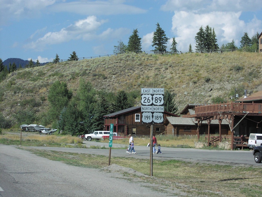
US-26/US-89/US-191/US-189 - Hoback Jct.
US-26 East/US-89/US-191/US-189 North shields, just north of Hoback Junction.
Taken 08-01-2002
Jackson
Teton County
Wyoming
United States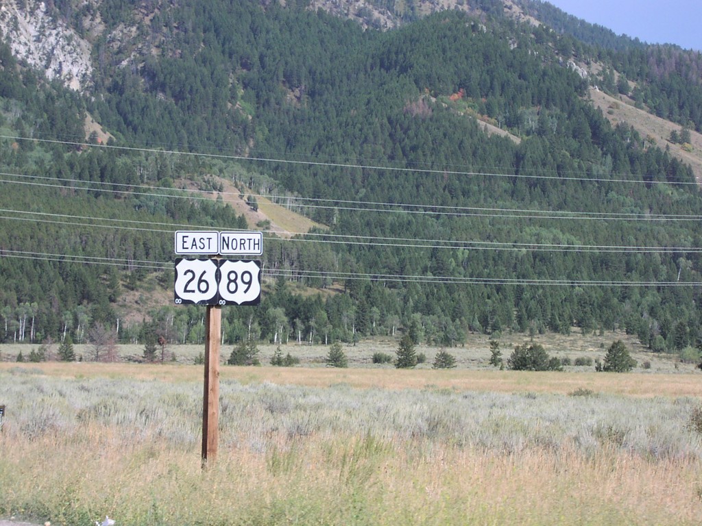
US-26 East/US-89 North - Alpine Jct.
US-26 East/US-89 North shields just north of Alpine Jct.
Taken 08-01-2002
Alpine
Lincoln County
Wyoming
United States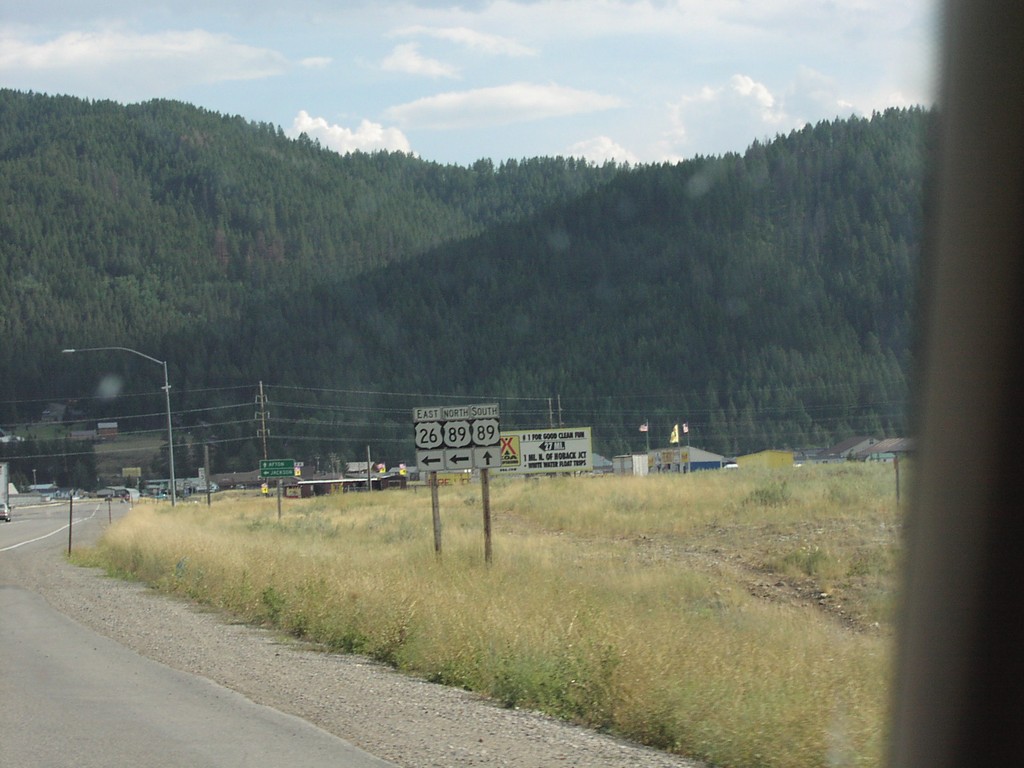
US-26 East Approaching US-89
US-26 East approaching US-89 - Alpine Junction.
Taken 08-01-2002
Alpine
Lincoln County
Wyoming
United States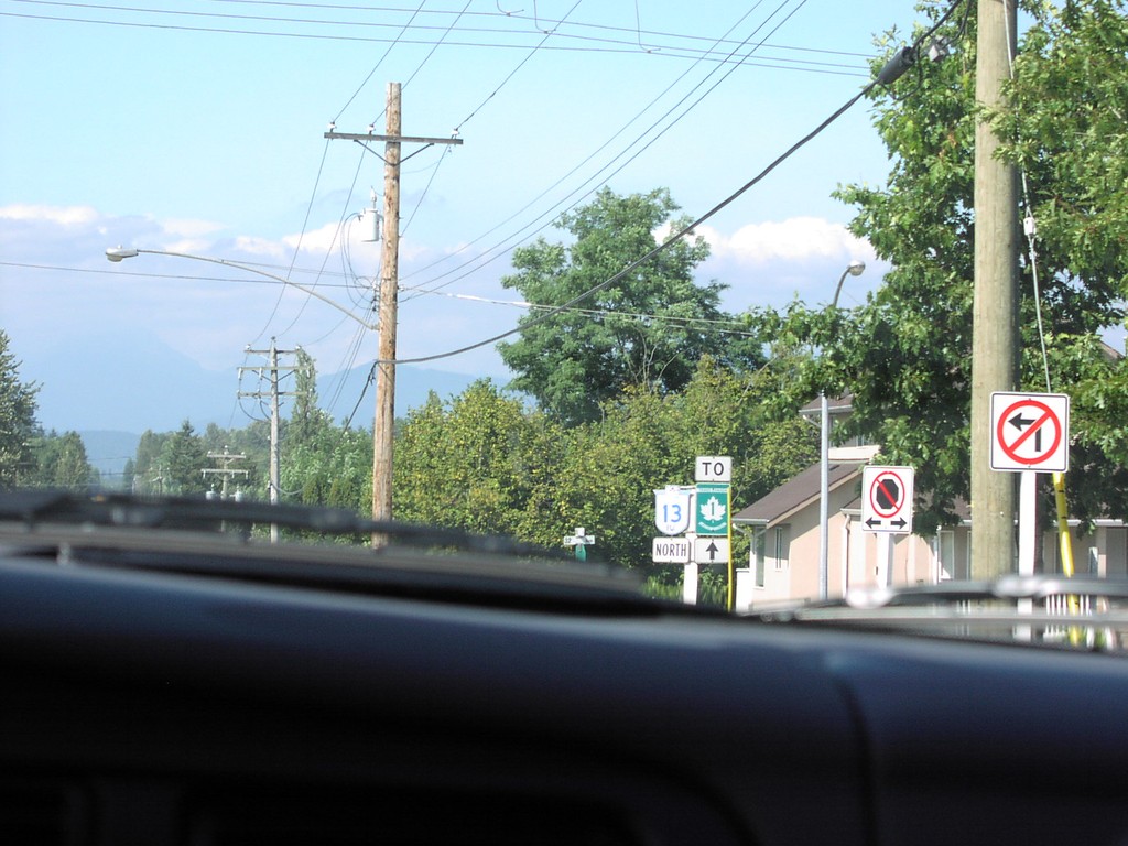
BC-13 North to TC-1 - Langley
BC-13 North To TC-1
Taken 08-01-2002

 Langley Township
Metro Vancouver
British Columbia
Canada
Langley Township
Metro Vancouver
British Columbia
Canada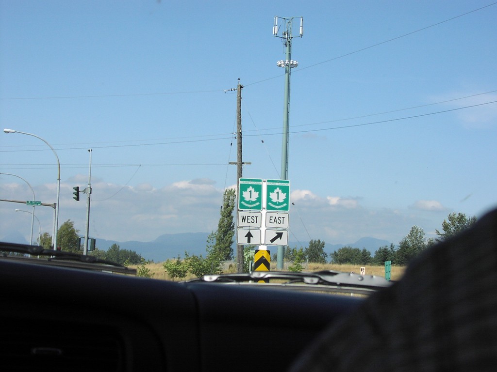
BC-13 North at TC-1
TC-1 Shields at BC-13/TC-1 Junction.
Taken 08-01-2002
Langley Township
Metro Vancouver
British Columbia
Canada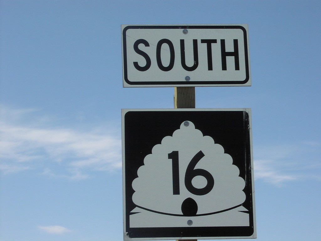
UT-16 South - Rich County
Begin of UT-16 south, at UT-30.
Taken 04-01-2002

 Sage Creek Junction
Rich County
Utah
United States
Sage Creek Junction
Rich County
Utah
United States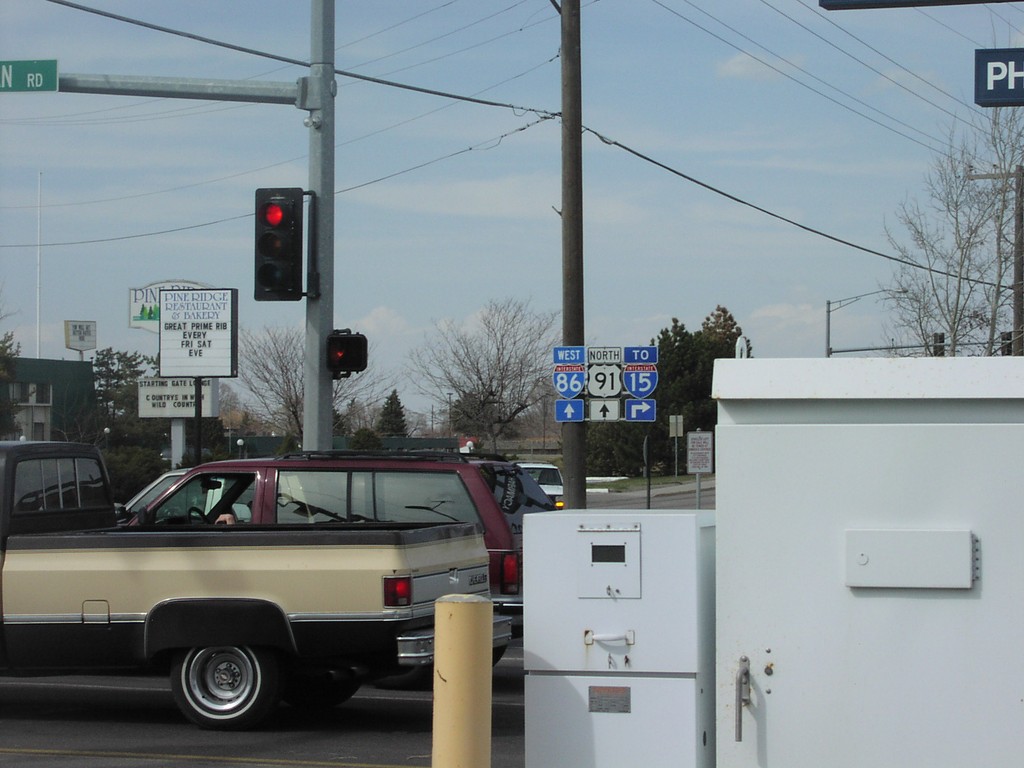
US-91 North at I-86
I-15/I-86/US-91 Shields on Yellowstone Ave. North
Taken 04-01-2002

 Pocatello
Bannock County
Idaho
United States
Pocatello
Bannock County
Idaho
United States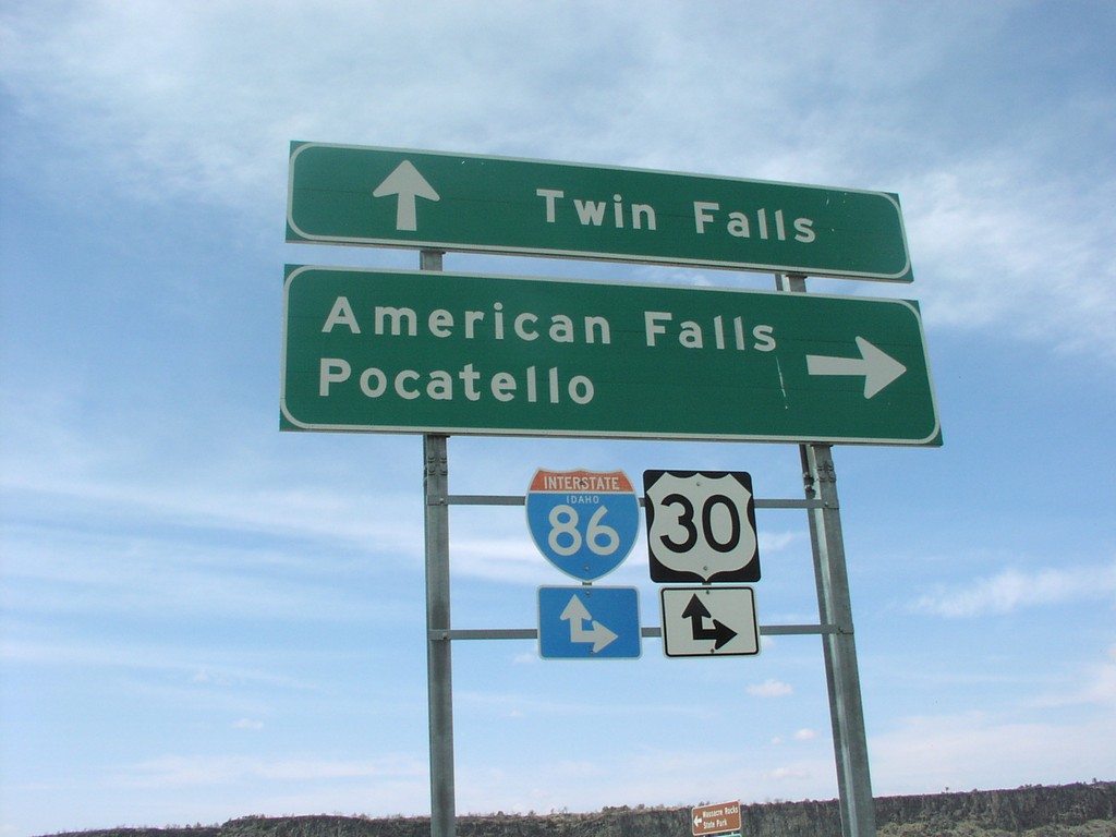
I-86 Onramp at Exit 28
I-86 Freeway Entrance at Massacre Rocks State Park
Taken 04-01-2002
 Neeley
Power County
Idaho
United States
Neeley
Power County
Idaho
United States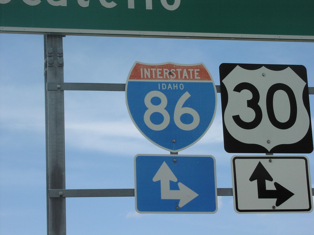
I-86 Idaho - Closeup - Exit 28
I-86 Idaho Shield at Exit 28 Onramp
Taken 04-01-2002
American Falls
Power County
Idaho
United States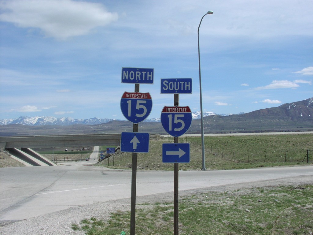
I-15 Exit 387 Onramp on Begin UT-30 East.
I-15 Shields at UT-30/I-15 Junction, Box Elder County.
Taken 04-01-2002
Riverside
Box Elder County
Utah
United States