Signs Tagged With Shield
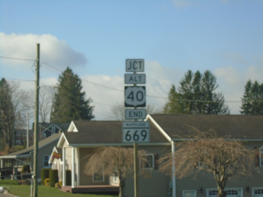
End MD-669 South at US-40 Alt
End MD-669 South at US-40 Alt (Main St.) in Grantsville.
Taken 03-29-2024

 Grantsville
Garrett County
Maryland
United States
Grantsville
Garrett County
Maryland
United States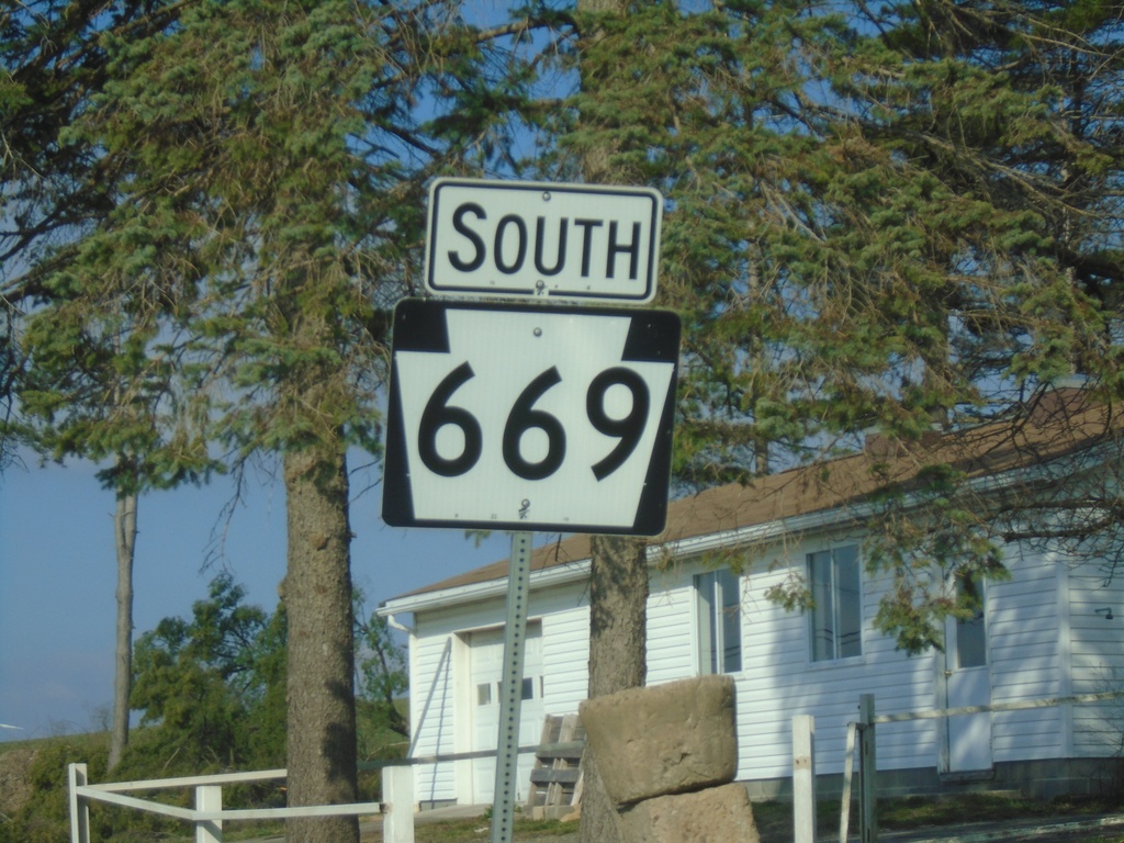
PA-669 South - Somerset County
PA-669 South in Somerset County
Taken 03-29-2024
 Springs
Somerset County
Pennsylvania
United States
Springs
Somerset County
Pennsylvania
United States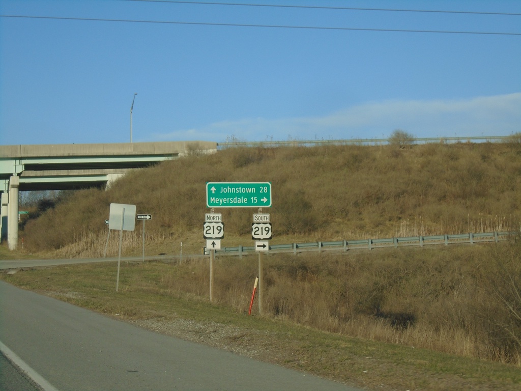
PA-281 North at US-219 Interchange
PA-281 North at US-219 interchange. Use US-219 South to Meyersdale; US-219 North to Johnstown.
Taken 03-28-2024

 Somerset
 County
Pennsylvania
United States
Somerset
Somerset County
Pennsylvania
United States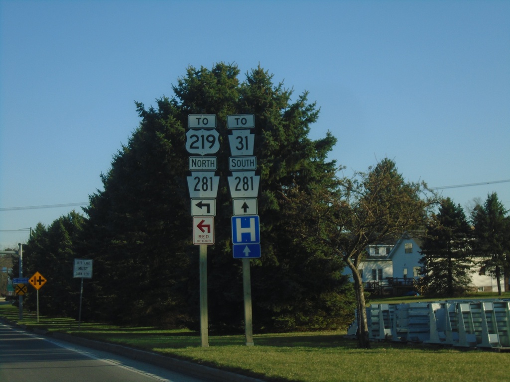
Pleasant Ave. at PA-281 - Somerset
Pleasant Ave. at PA-281 in Somerset. Use PA-281 south to PA-31; use PA-281 north to US-219.
Taken 03-28-2024
 Somerset
 County
Pennsylvania
United States
Somerset
Somerset County
Pennsylvania
United States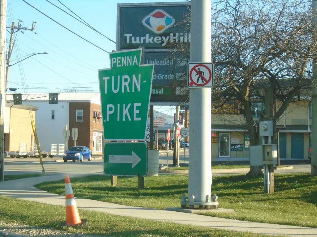
Pennsylvania Turnpike Entrance - Somerset Interchange
PA-601 at Pennsylvania Turnpike Entrance - Somerset Interchange (Exit 110).
Taken 03-28-2024


 Somerset
 County
Pennsylvania
United States
Somerset
Somerset County
Pennsylvania
United States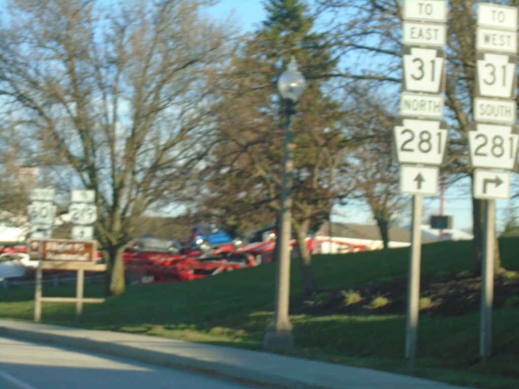
Pennsylvania Turnpike (Exit 110) Ramp Approaching PA-601
Pennsylvania Turnpike (Somerset Interchange / Exit 110) ramp approaching PA-601. Use PA-601 south to PA-31 West/PA-281 South. Continue straight for PA-31 East/PA-281 North.
Taken 03-28-2024
Somerset
Somerset County
Pennsylvania
United States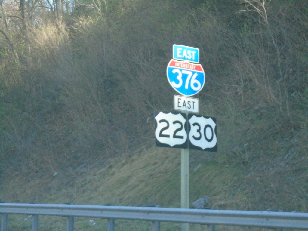
I-376/US-22/US-30 East - Carnegie
I-376/US-22/US-30 East in Carnegie
Taken 03-28-2024


 Carnegie
Allegheny County
Pennsylvania
United States
Carnegie
Allegheny County
Pennsylvania
United States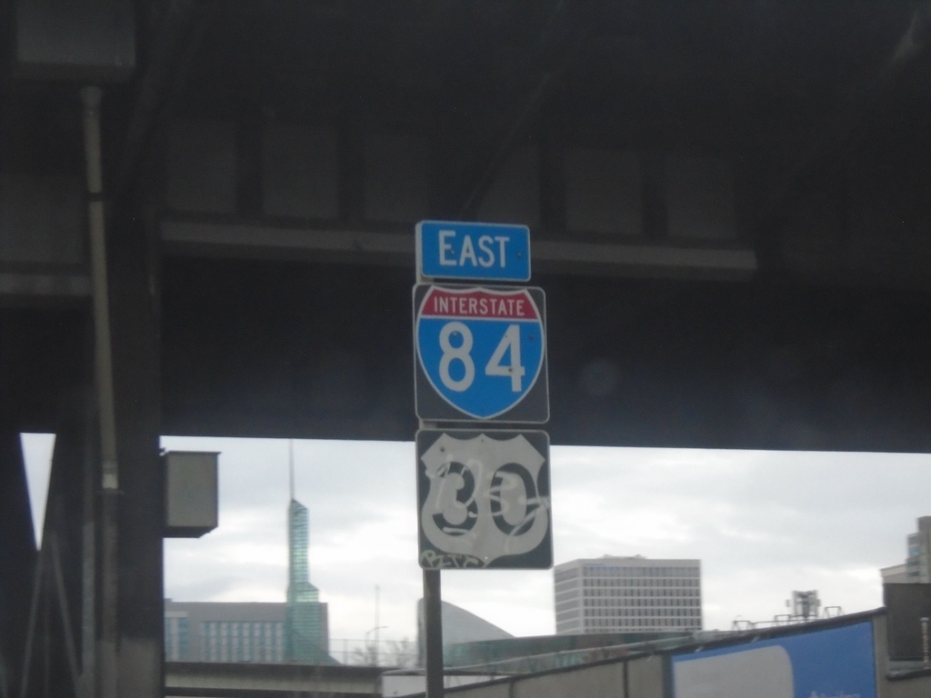
I-84 East/US-30 East - Portland
I-84 East/US-30 East in Portland. This is the first I-84 shield eastbound.
Taken 01-06-2024
 Portland
Multnomah County
Oregon
United States
Portland
Multnomah County
Oregon
United States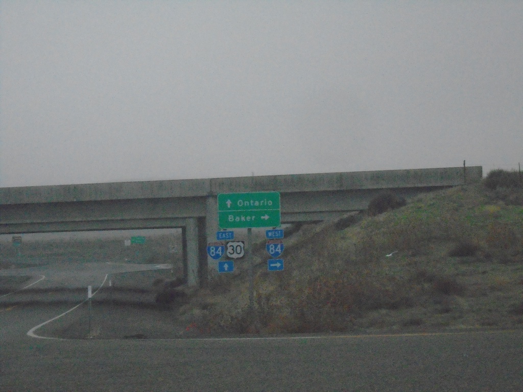
US-30 East at I-84 Exit 352
US-30 East at I-84. Use I-84 west to Baker; I-84/US-30 East to Ontario.
Taken 01-02-2024
Huntington
Baker County
Oregon
United States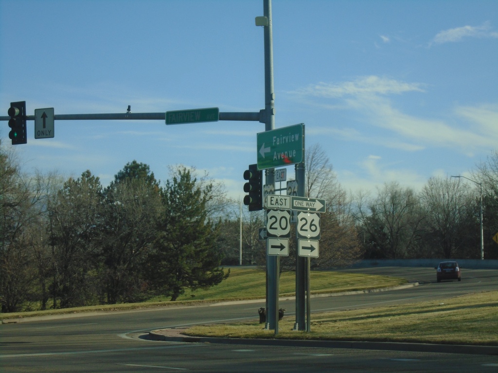
I-184 East Offramp at US-20/US-26
I-184 East (Exit 3) offramp at US-20/US-26. Turn right to continue eastbound on US-20/US-26.
Taken 01-01-2024


 Boise
Ada County
Idaho
United States
Boise
Ada County
Idaho
United States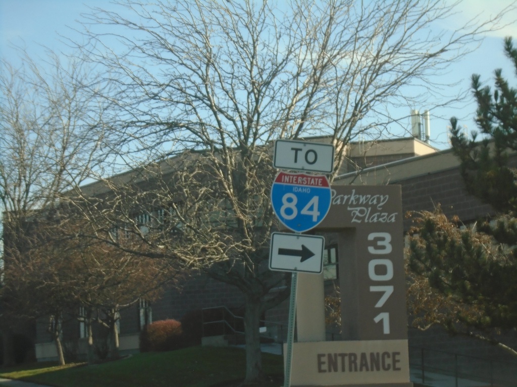
Franklin Road East at Eagle Road - To I-84
To I-84 on Franklin Road East at Eagle Road (ID-55). The I-84 shield is a rare occurrence of an interstate shield with the text IDAHO.
Taken 01-01-2024
 Meridian
Ada County
Idaho
United States
Meridian
Ada County
Idaho
United States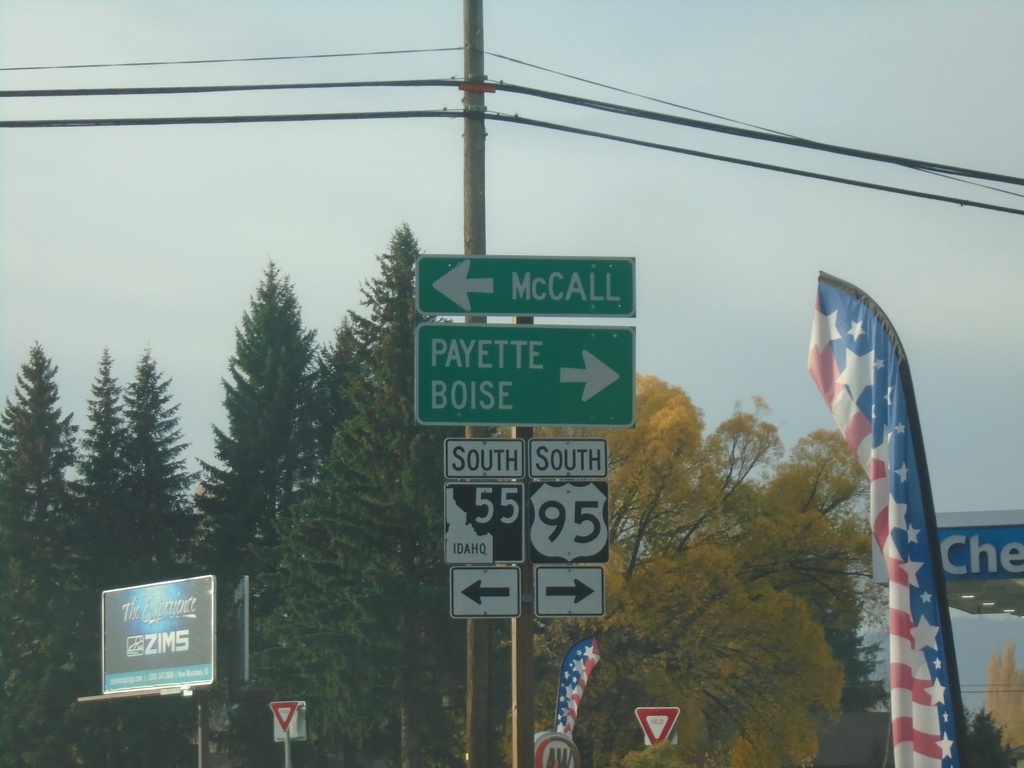
US-95 South at ID-55
US-95 South at ID-55 in New Meadows. Turn right for US-95 South to Weiser and Boise; turn left for ID-55 south to McCall.
Taken 10-22-2023
 New Meadows
Adams County
Idaho
United States
New Meadows
Adams County
Idaho
United States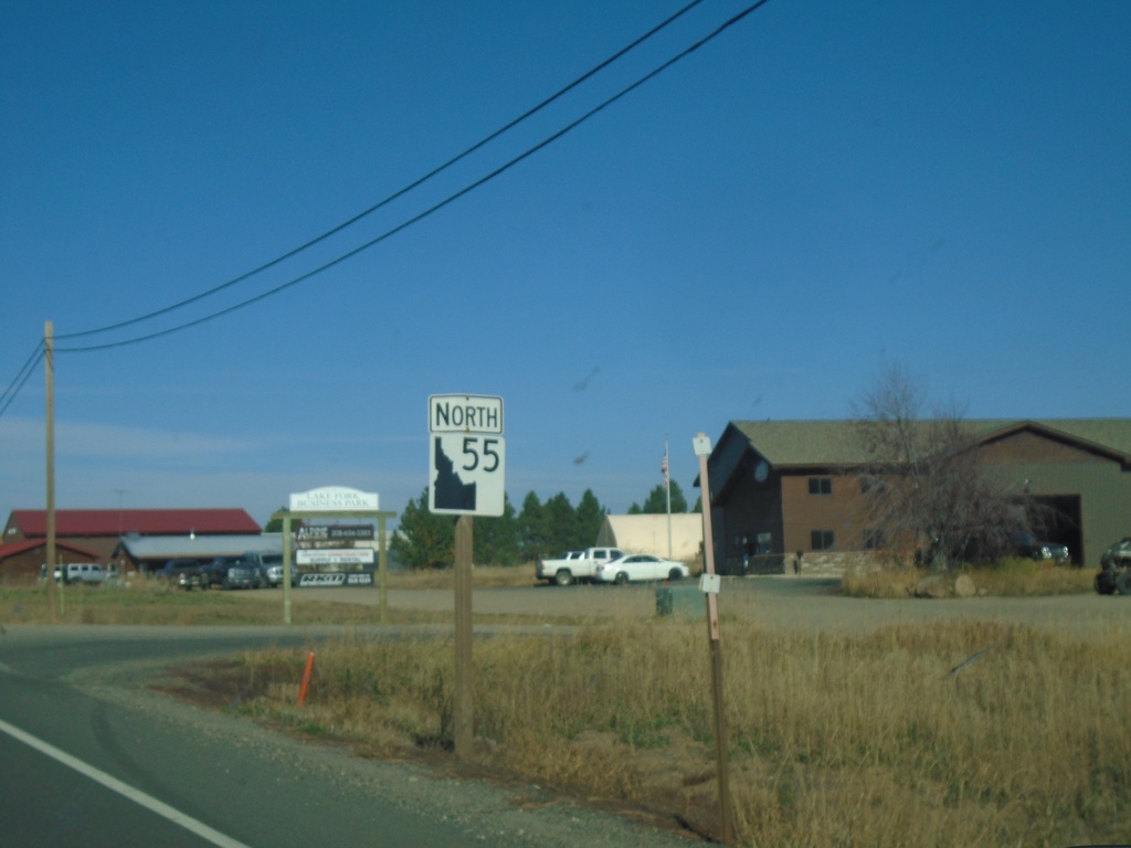
ID-55 North - Lake Fork
ID-55 north in Lake Fork.
Taken 10-20-2023
McCall
Valley County
Idaho
United States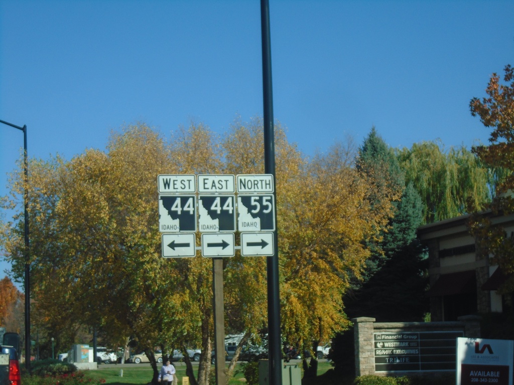
ID-55 North at ID-44
ID-55 north at ID-44 in Eagle. ID-55 north joins ID-44 east through Eagle.
Taken 10-20-2023
 Eagle
Ada County
Idaho
United States
Eagle
Ada County
Idaho
United States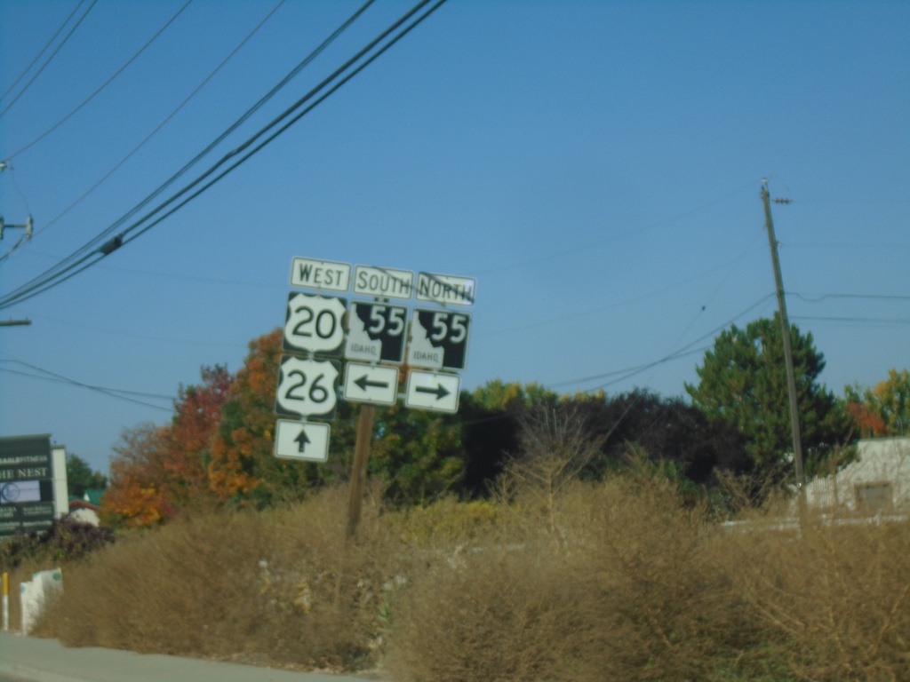
US-20/US-26 West at ID-55
US-20/US-26 west at ID-55 in Boise.
Taken 10-20-2023
Eagle
Ada County
Idaho
United States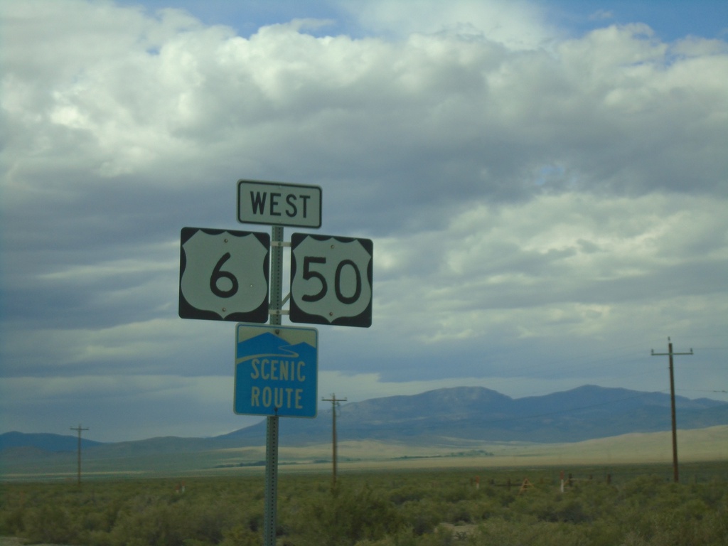
US-6/US-50 West - White Pine County
First US-6/US-50 west shields in Nevada. US-6/US-50 is part of a Nevada scenic route between the Utah-Nevada state line to Ely.
Taken 09-09-2023

 Baker
White Pine County
Nevada
United States
Baker
White Pine County
Nevada
United States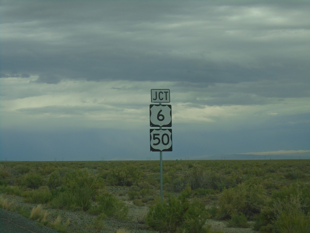
UT-159 North Approaching US-6/US-50
UT-159 North approaching US-6/US-50 in Millard County.
Taken 09-09-2023
 Garrison
Millard County
Utah
United States
Garrison
Millard County
Utah
United States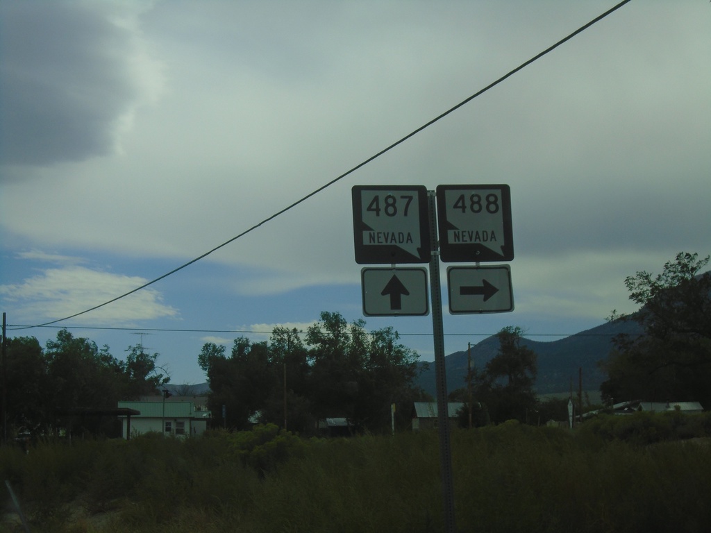
NV-487 South at NV-488
NV-487 south at NV-488 in Baker. NV-488 connects Baker with Great Basin National Park.
Taken 09-09-2023

 Baker
White Pine County
Nevada
United States
Baker
White Pine County
Nevada
United States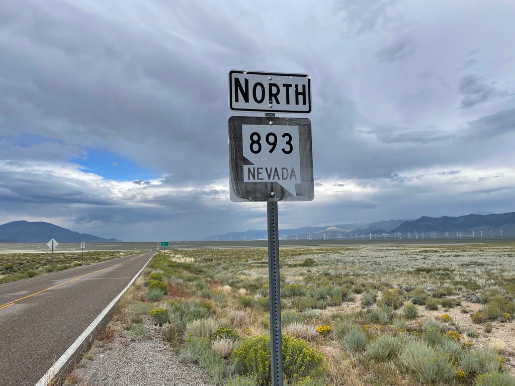
NV-893 North - White Pine County
A very weathered NV-893 shield in White Pine County.
Taken 09-09-2023
 Ely
White Pine County
Nevada
United States
Ely
White Pine County
Nevada
United States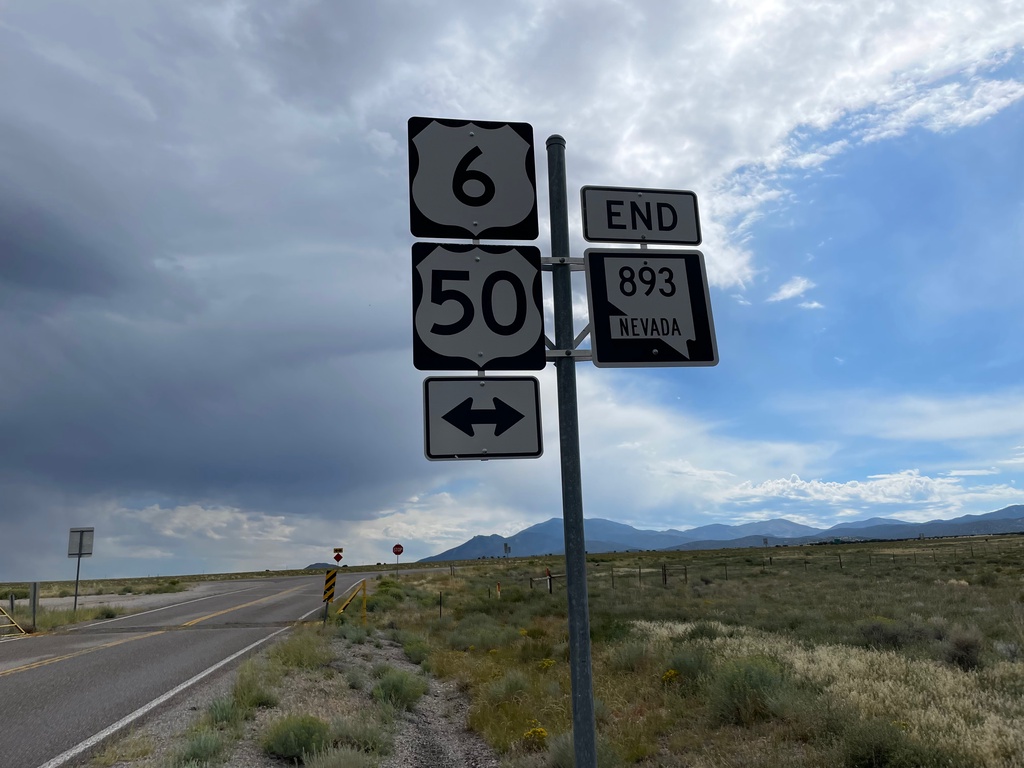
End NV-893 South at US-6/US-50
End NV-893 South at US-6/US-50 in White Pine County.
Taken 09-09-2023
Ely
White Pine County
Nevada
United States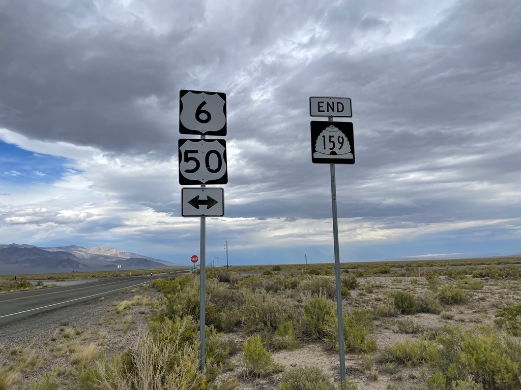
End UT-159 North at US-6/US-50
End UT-159 North at US-6/US-50 in Millard County.
Taken 09-09-2023
Garrison
Millard County
Utah
United States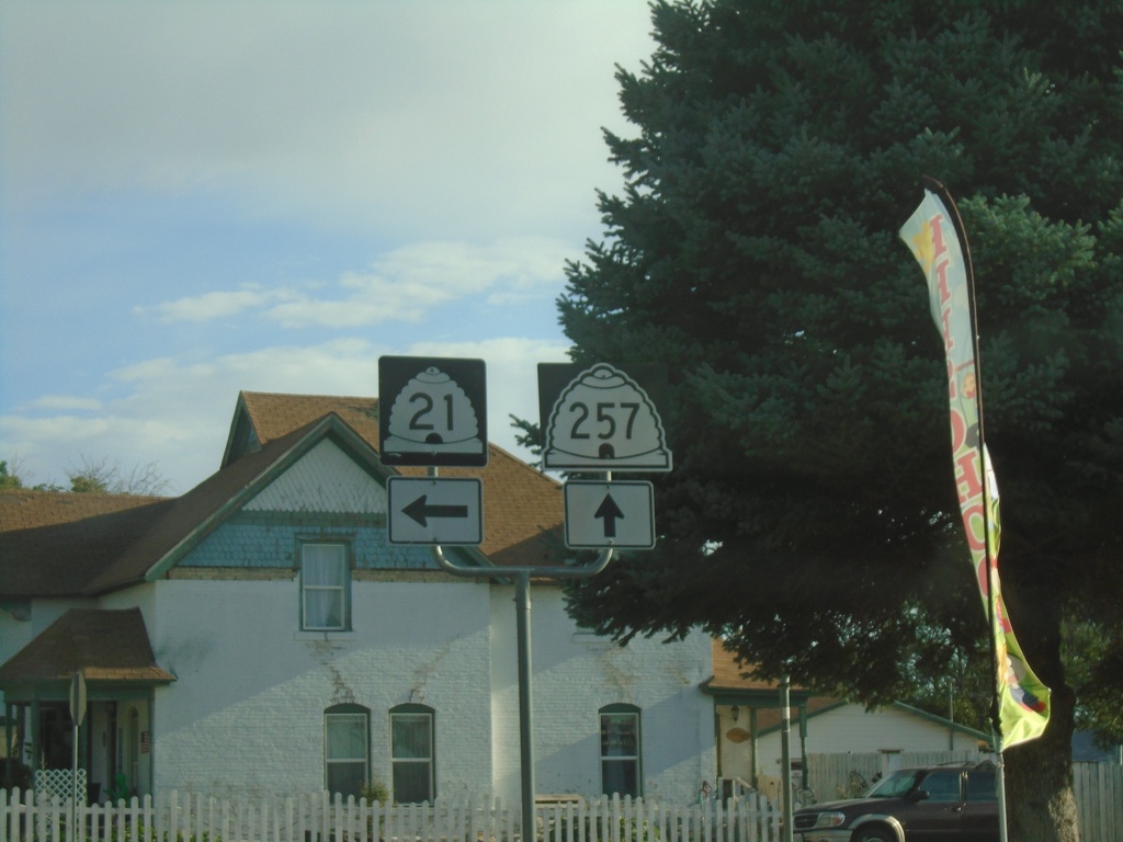
UT-21 West at UT-257
UT-21 West at UT-257 in Milford.
Taken 09-09-2023

 Milford
Beaver County
Utah
United States
Milford
Beaver County
Utah
United States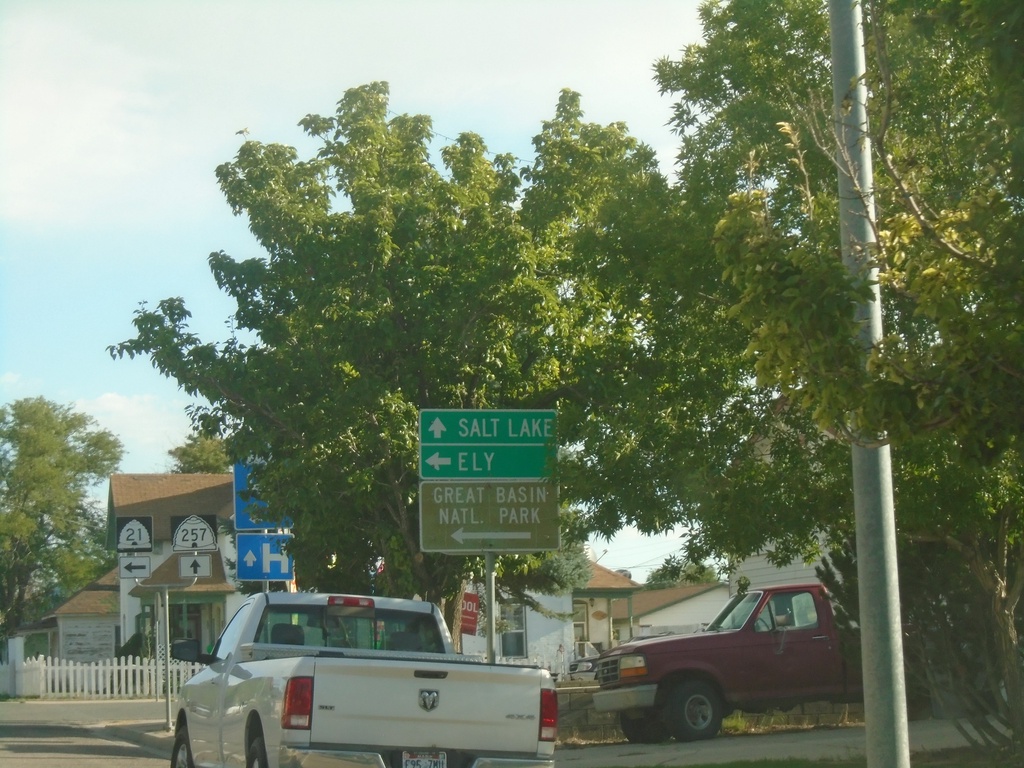
UT-21 West at UT-257
UT-21 West at UT-257 in Milford. Turn left to continue on UT-21 west to Ely (Nevada) and Great Basin National Park. Continue north on UT-257 for Salt Lake.
Taken 09-09-2023
Milford
Beaver County
Utah
United States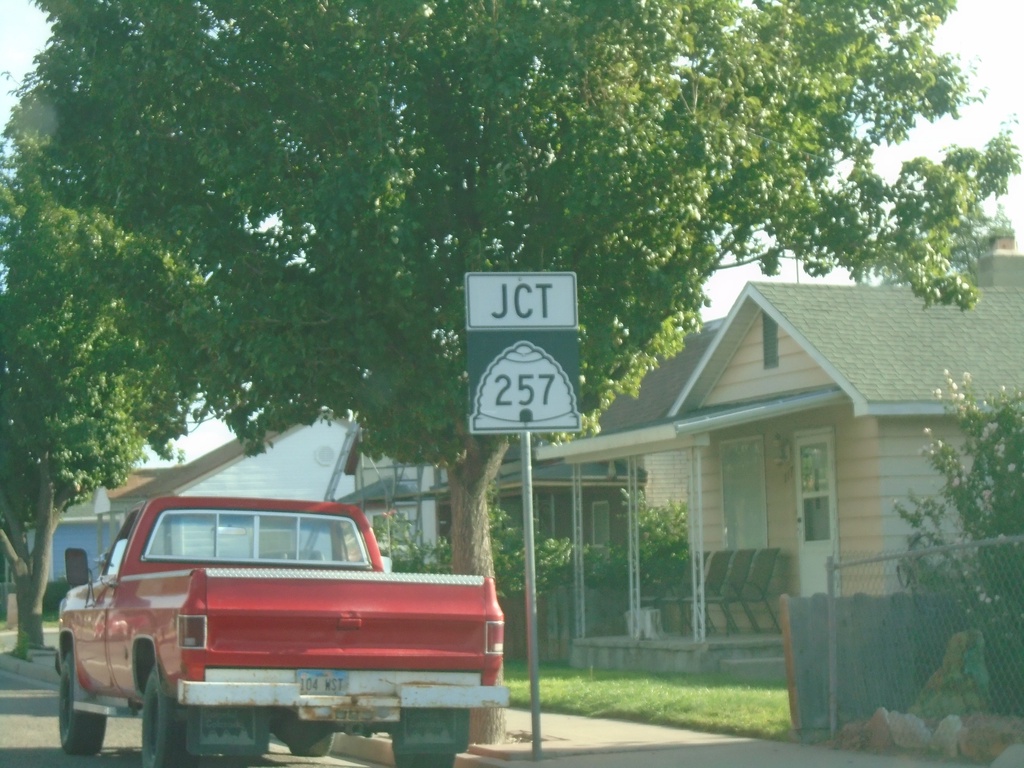
UT-21 West Approaching UT-257
UT-21 West approaching UT-257 in Milford.
Taken 09-09-2023
Milford
Beaver County
Utah
United States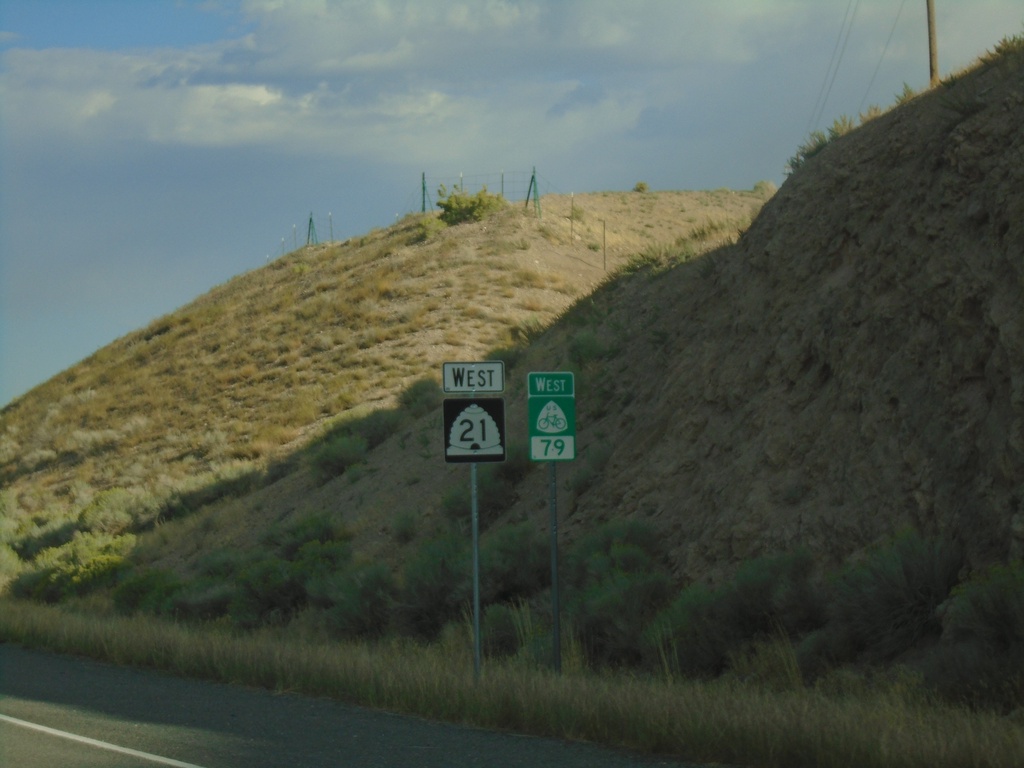
UT-21 West/US Bicycle Route 79
UT-21 West/US Bicycle Route 79 West - Minersville.
Taken 09-09-2023
Minersville
Beaver County
Utah
United States