Signs Tagged With Shield
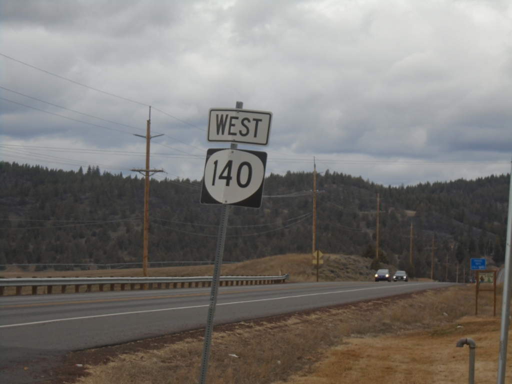
OR-140 West - Klamath County
OR-140 West in Klamath County
Taken 02-15-2026
 Klamath Falls
Klamath County
Oregon
United States
Klamath Falls
Klamath County
Oregon
United States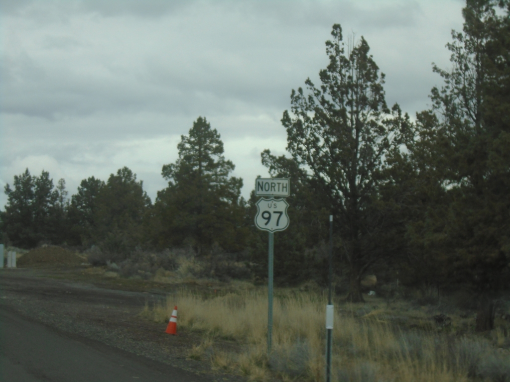
US-97 North - Siskiyou County
US-97 North in Siskiyou County. This is the last US-97 shield in California northbound.
Taken 02-15-2026
 Dorris
Siskiyou County
California
United States
Dorris
Siskiyou County
California
United States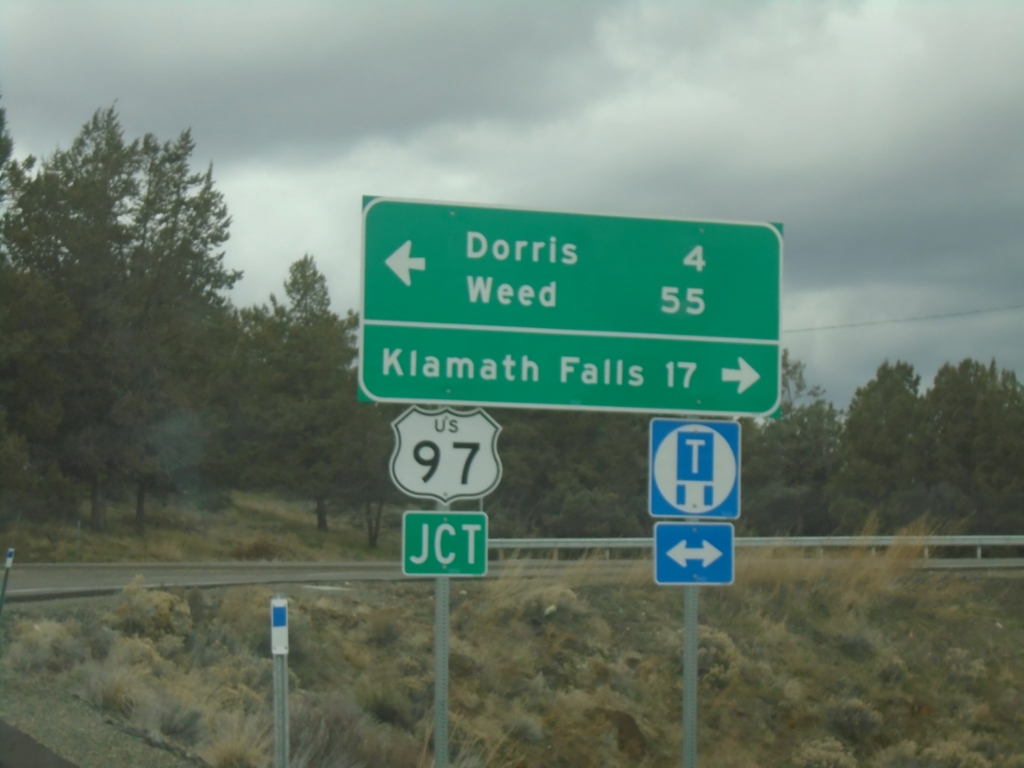
End CA-161 West at US-97
End CA-161 West at US-97 in Siskiyou County. Turn left for US-97 South to Dorris and Weed; right for US-97 North to Klamath Falls (Oregon).
Taken 02-15-2026
 Dorris
Siskiyou County
California
United States
Dorris
Siskiyou County
California
United States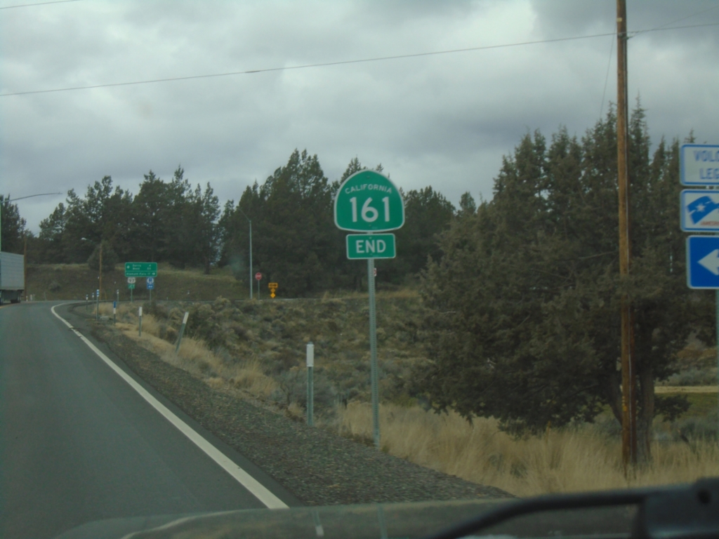
End CA-161 West Approaching US-97
End CA-161 West approaching US-97 in Siskiyou County.
Taken 02-15-2026
Dorris
Siskiyou County
California
United States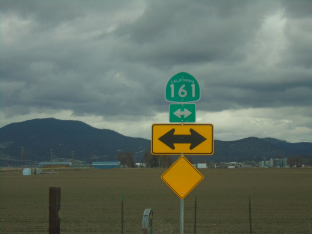
End Hill Road North at CA-161
End Hill Road North at CA-161 on the stateline with California and Oregon.
Taken 02-15-2026
Tulelake
Klamath County
Oregon
United States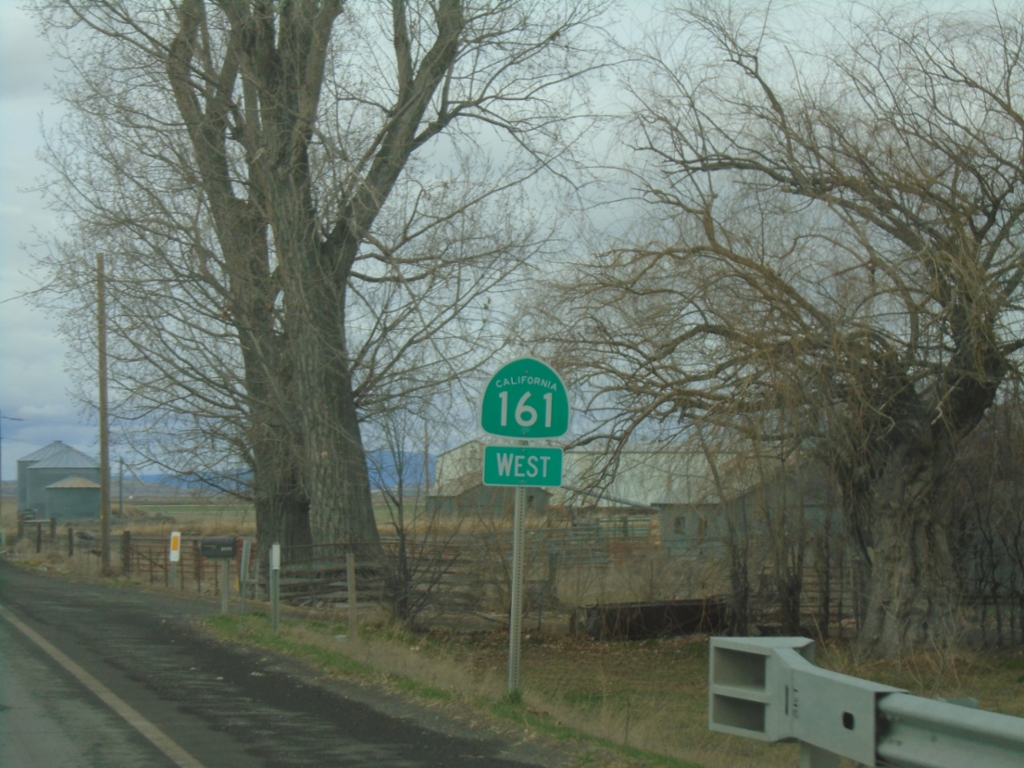
CA-161 West - Siskiyou County
CA-161 West in Siskiyou County.
Taken 02-15-2026
Tulelake
Klamath County
Oregon
United States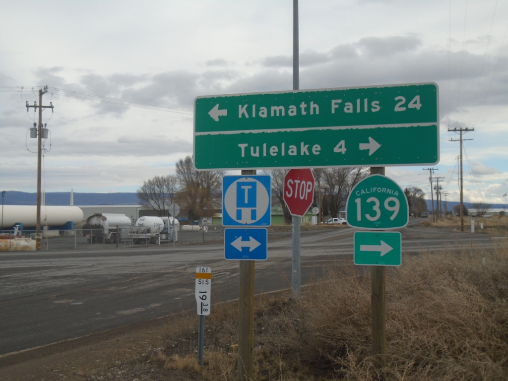
End CA-161 East at CA-139
End CA-161 East at CA-139. Turn right for CA-139 South to Tulelake; left for OR-39 North to Klamath Falls (Oregon). CA-161 runs along the stateline of Oregon and California.
Taken 02-15-2026
 Merrill
Klamath County
Oregon
United States
Merrill
Klamath County
Oregon
United States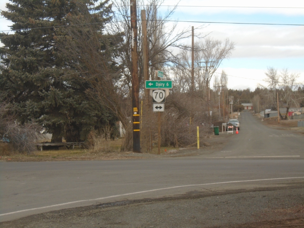
Harpold Road North at OR-70
Harpold Road North at OR-70 in Bonanza. Use OR-70 west to Dairy.
Taken 02-15-2026
 Bonanza
Klamath County
Oregon
United States
Bonanza
Klamath County
Oregon
United States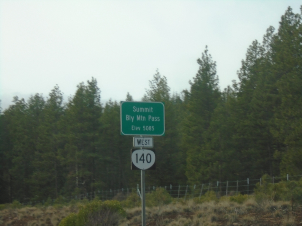
OR-140 West - Bly Mountain Pass
OR-140 west at Bly Mountain Pass. Elevation 5085 Feet.
Taken 02-15-2026
Beatty
Klamath County
Oregon
United States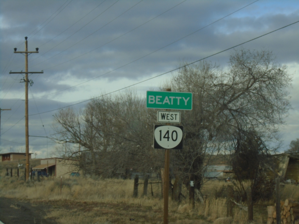
OR-140 West - Beatty
Entering Beatty on OR-140 west.
Taken 02-15-2026
Beatty
Klamath County
Oregon
United States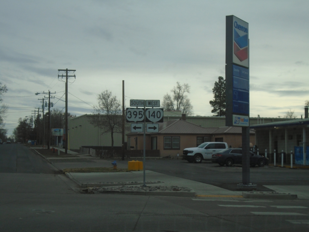
US-395 South/OR-140 West Split
US-395 South/OR-140 West split in Lakeview. Turn right for OR-140 west; left for US-395 south.
Taken 02-14-2026
 Lakeview
Lake County
Oregon
United States
Lakeview
Lake County
Oregon
United States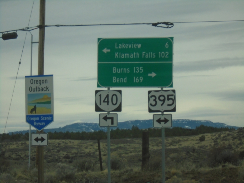
OR-140 West at US-395
OR-140 west at US-395. OR-140 west joins US-395 south into Lakeview. Use US-395 north for Burns and Bend. Use US-395 South/OR-140 West for Lakeview and Klamath Falls. US-395 is part of the Oregon Outback Scenic Byway.
Taken 02-14-2026
Lakeview
Lake County
Oregon
United States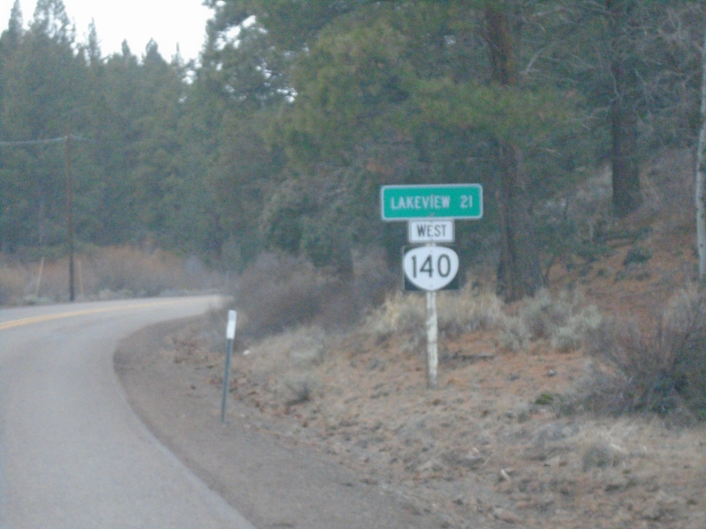
OR-140 West - Distance Marker
Distance marker on OR-140 west. Distance to Lakeview.
Taken 02-14-2026
Lake County
Oregon
United States
OR-140 West - Distance Marker
Distance marker on OR-140 west. Distance to Lakeview.
Taken 02-14-2026
Adel
Lake County
Oregon
United States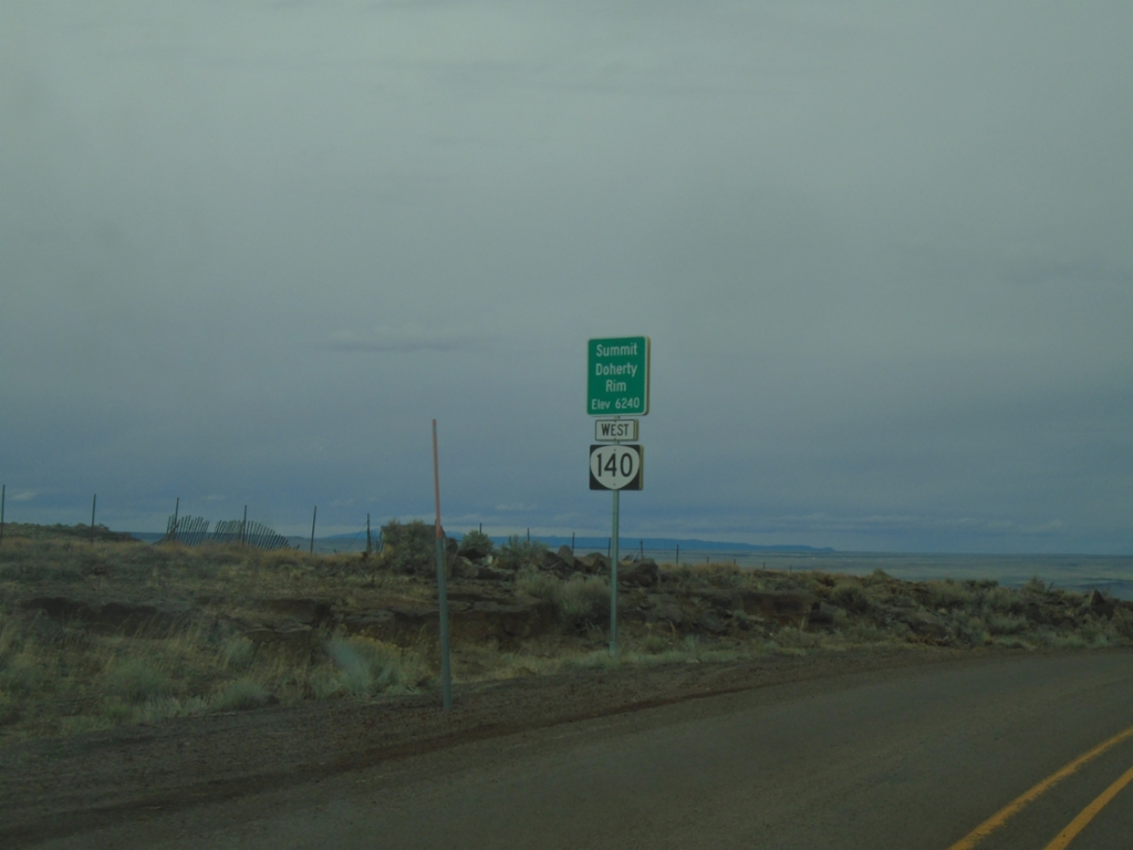
OR-140 West - Summit - Doherty Rim
Doherty Rim Summit, Elevation 6,240 Feet on OR-140 west in rural Lake County.
Taken 02-14-2026
Adel
Lake County
Oregon
United States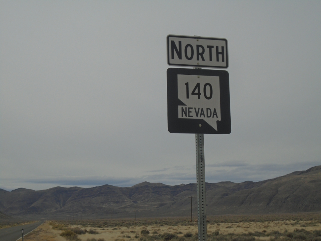
NV-140 North - Denio Junction
NV-140 North at Denio Junction
Taken 02-14-2026
 Humboldt County
Nevada
United States
Humboldt County
Nevada
United States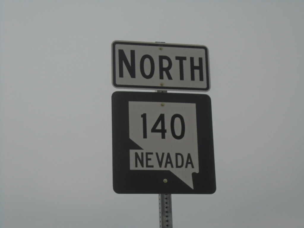
NV-140 North - Denio Junction
NV-140 North at Denio Junction
Taken 02-14-2026
Humboldt County
Nevada
United States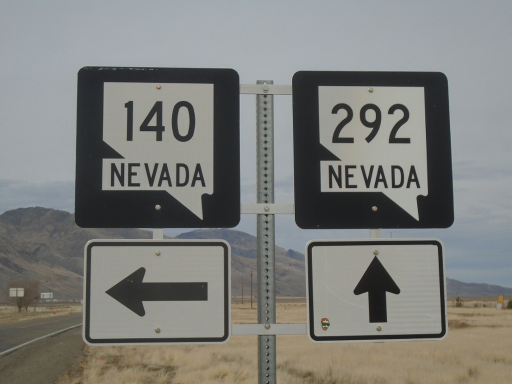
NV-140 North at NV-292
NV-140 North at NV-292 - Denio Junction. Turn left to continue north on NV-140; continue straight for NV-292.
Taken 02-14-2026
 Denio
Humboldt County
Nevada
United States
Denio
Humboldt County
Nevada
United States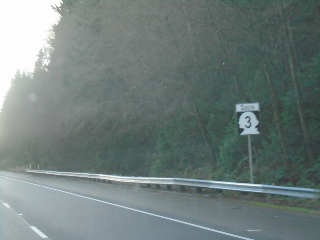
WA-3 South - Silverdale
WA-3 south shield in Silverdale.
Taken 12-26-2025
 Silverdale
Kitsap County
Washington
United States
Silverdale
Kitsap County
Washington
United States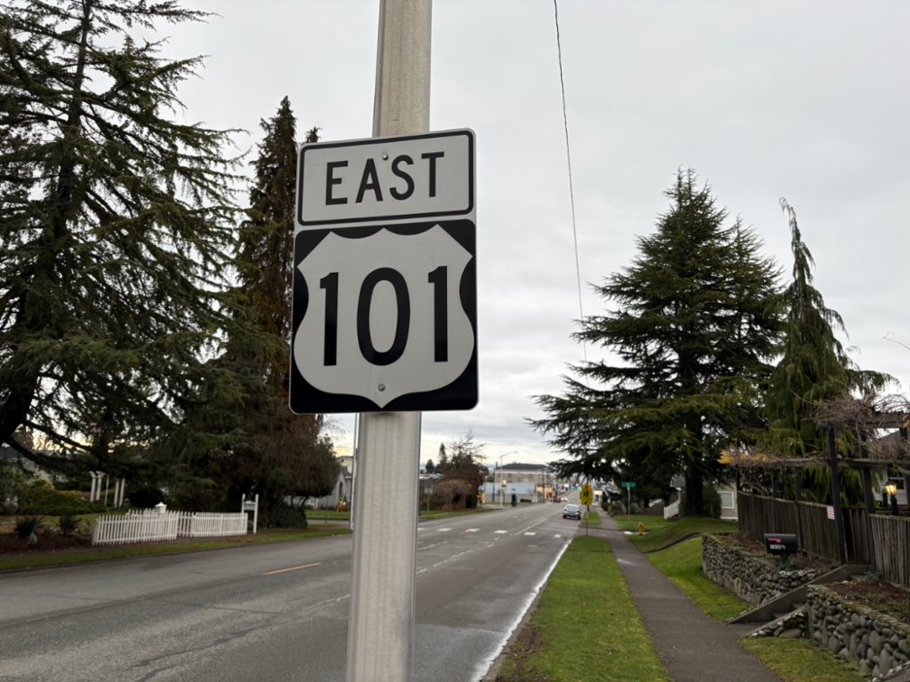
US-101 East - Port Angeles
US-101 East (Lincoln St.) in Port Angeles.
Taken 12-25-2025
 Port Angeles
Clallam County
Washington
United States
Port Angeles
Clallam County
Washington
United States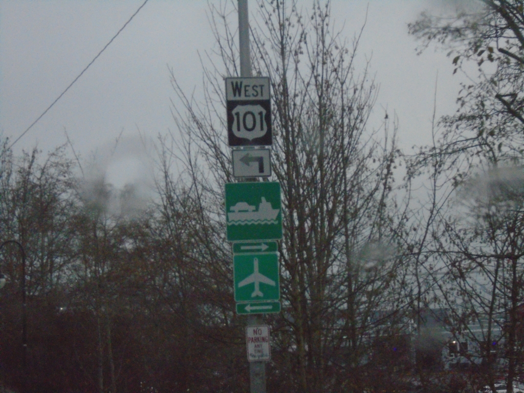
US-101 West at Lincoln St. - Port Angeles
US-101 west at Lincoln St. in Port Angeles. Turn left to continue west on US-101. Turn right for Ferry to Victoria, BC.
Taken 12-22-2025
Port Angeles
Clallam County
Washington
United States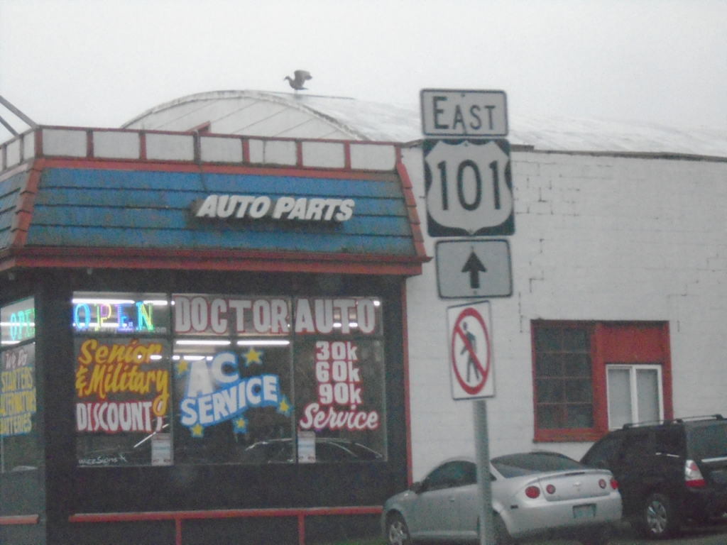
US-101 East - Port Angeles
US-101 east in Port Angeles.
Taken 12-22-2025
Port Angeles
Clallam County
Washington
United States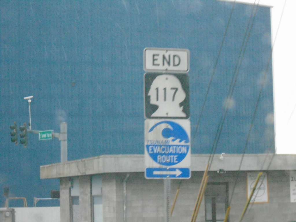
End WA-117 North at Marine Drive
End WA-117 North (Tumwater Truck Route) at Marine Drive in Port Angeles. Turn right on Marine Drive for the Tsunami Evacuation Route.
Taken 12-22-2025
 Port Angeles
Clallam County
Washington
United States
Port Angeles
Clallam County
Washington
United States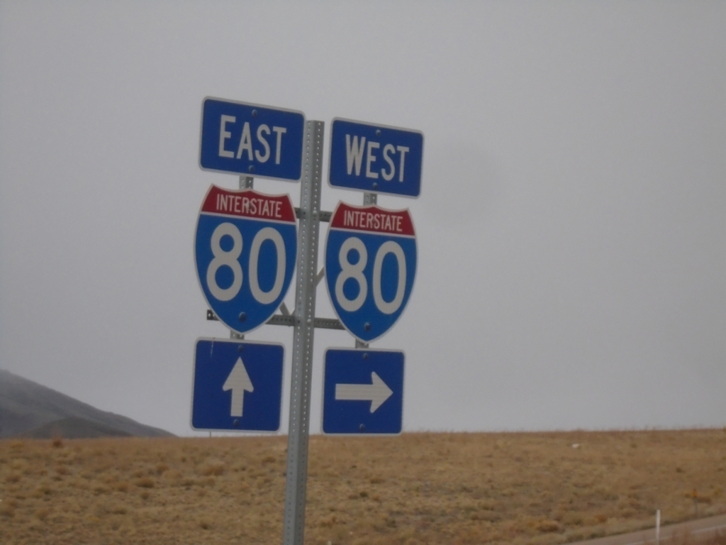
I-80 Junction at Exit 348 Interchange
I-80 junction at Exit 348 (Beverly Hills) interchange
Taken 10-26-2025
 Elko County
Nevada
United States
Elko County
Nevada
United States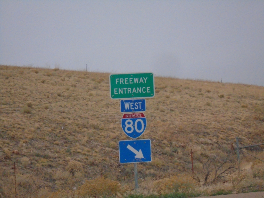
I-80 West - Exit 351 Onramp
I-80 West - Exit 351 Onramp in Elko County.
Taken 10-26-2025
Elko County
Nevada
United States