Signs Tagged With Shield
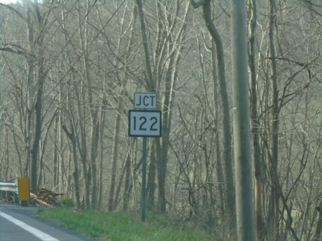
US-219 South Approaching WV-122
US-219 South approaching WV-122 in Monroe County.
Taken 03-30-2024

 Union
Monroe County
West Virginia
United States
Union
Monroe County
West Virginia
United States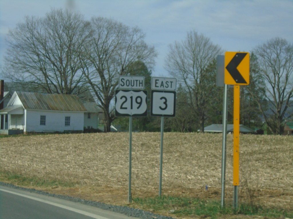
US-219 South/WV-3 East
US-219 South/WV-3 East in Monroe County.
Taken 03-30-2024
 Union
Monroe County
West Virginia
United States
Union
Monroe County
West Virginia
United States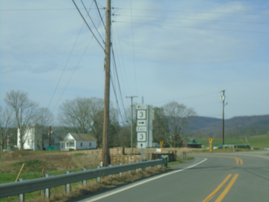
US-219 South at WV-3
US-219 South at WV-3. WV-3 east joins US-219 southbound.
Taken 03-30-2024
Sinks Grove
Monroe County
West Virginia
United States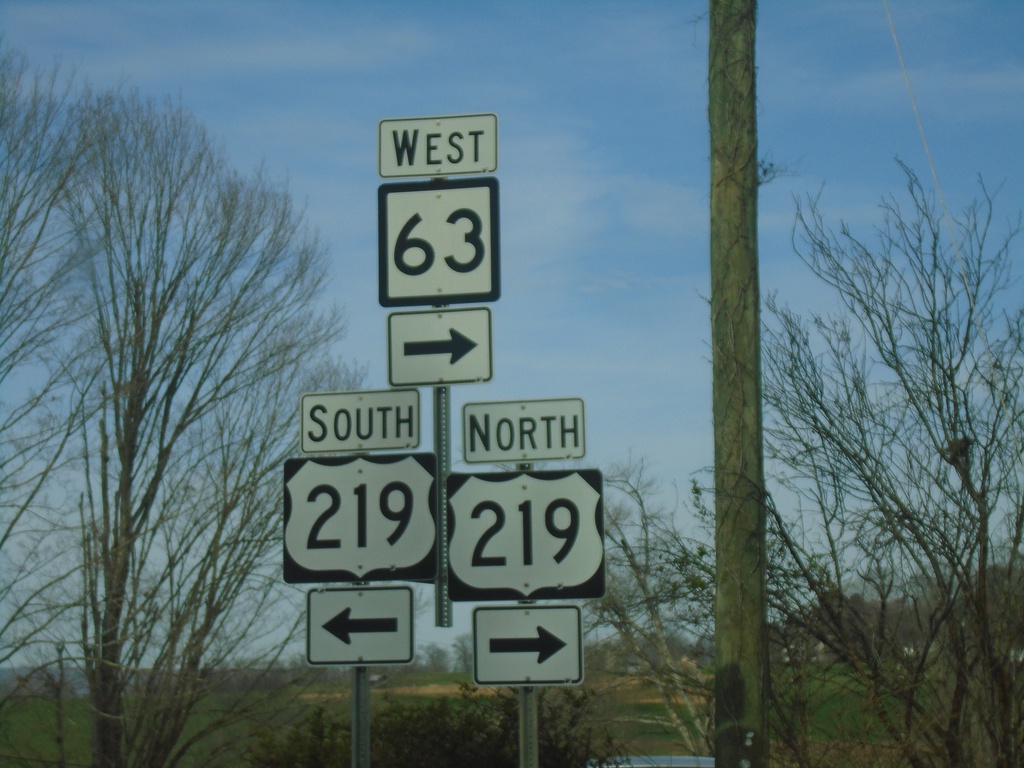
WV-63 West at US-219
WV-63 West at US-219 in Organ Cave. WV-63 West joins US-219 northbound.
Taken 03-30-2024
 Ronceverte
Greenbrier County
West Virginia
United States
Ronceverte
Greenbrier County
West Virginia
United States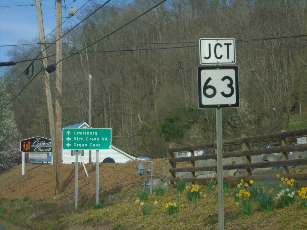
US-60 West Approaching WV-63
US-60 West approaching WV-63 in Caldwell.
Taken 03-30-2024
 Caldwell
Greenbrier County
West Virginia
United States
Caldwell
Greenbrier County
West Virginia
United States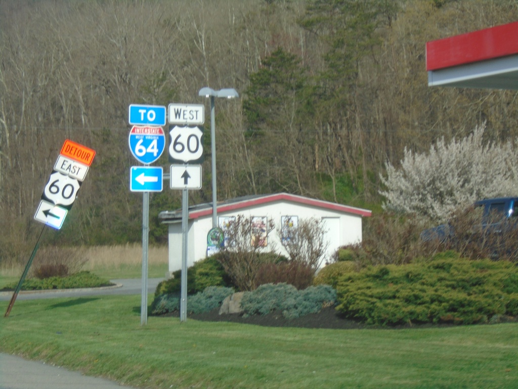
US-60 West at I-64 (Exit 175) Interchange
US-60 West at I-64 (Exit 175) Interchange
Taken 03-30-2024
 Caldwell
Greenbrier County
West Virginia
United States
Caldwell
Greenbrier County
West Virginia
United States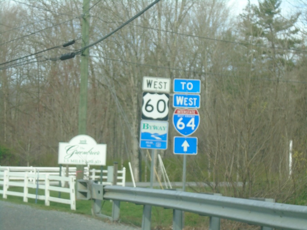
US-60 West/To I-64 West
US-60 West/To I-64 West in White Sulphur Springs
Taken 03-30-2024
White Sulphur Springs
Greenbrier County
West Virginia
United States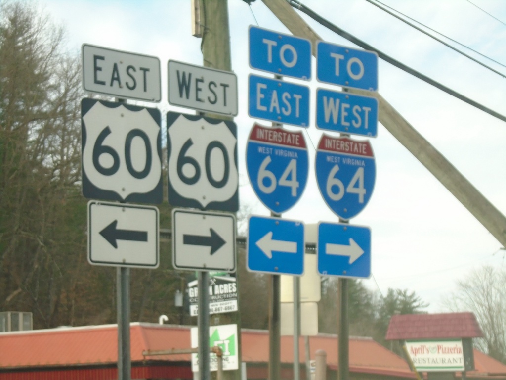
End WV-92 South at US-60/To I-64
End WV-92 South at US-60/To I-64 in White Sulphur Springs.
Taken 03-30-2024
 White Sulphur Springs
Greenbrier County
West Virginia
United States
White Sulphur Springs
Greenbrier County
West Virginia
United States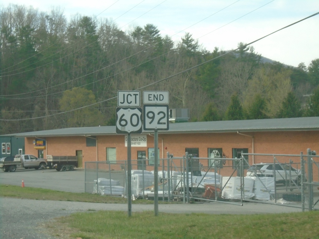
End WV-92 South at US-60
End WV-92 South at US-60 in White Sulphur Springs
Taken 03-30-2024
White Sulphur Springs
Greenbrier County
West Virginia
United States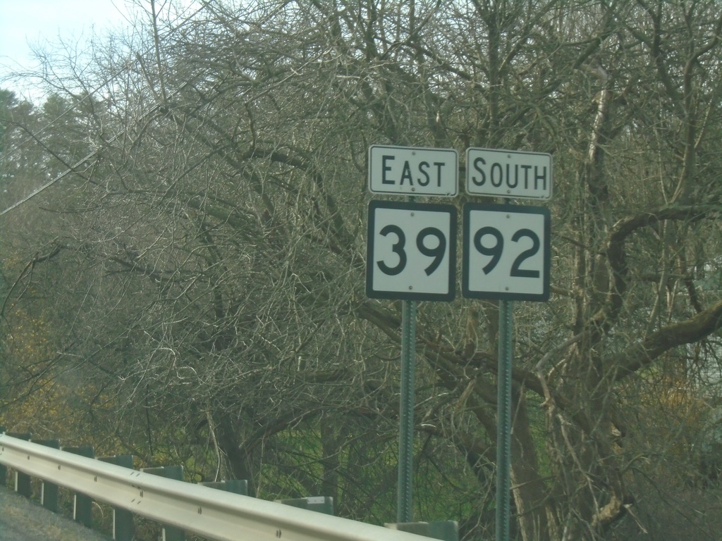
WV-39 East/WV-92 South - Minnehaha Springs
WV-39 East/WV-92 South in Minnehaha Springs
Taken 03-30-2024
 Marlinton
Pocahontas County
West Virginia
United States
Marlinton
Pocahontas County
West Virginia
United States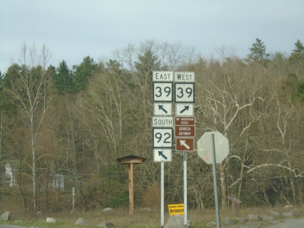
WV-92 South at WV-39 - Minnehaha Springs
WV-92 South at WV-39 in Minnehaha Springs. WV-39 East joins WV-92 southbound.
Taken 03-30-2024
Marlinton
Pocahontas County
West Virginia
United States
End WV-84 West at WV-92
End WV-84 West at WV-92 in Frost.
Taken 03-30-2024
 Marlinton
Pocahontas County
West Virginia
United States
Marlinton
Pocahontas County
West Virginia
United States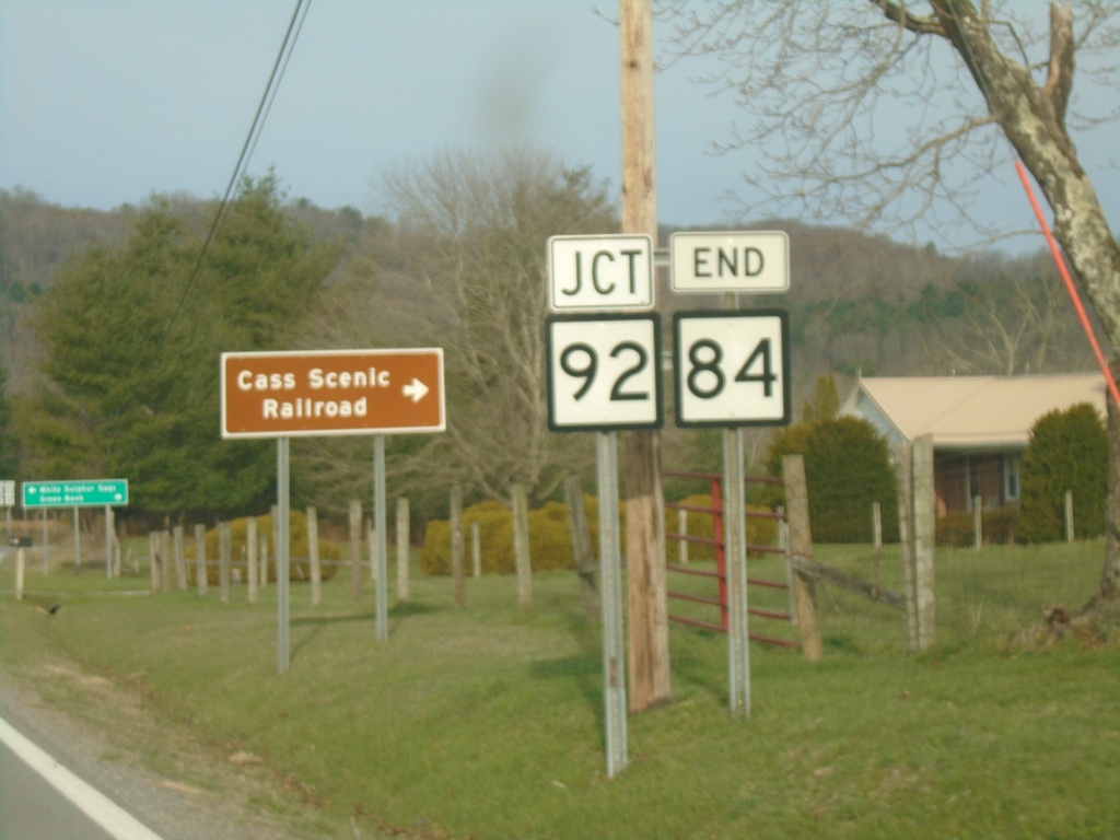
End WV-84 West at WV-92
End WV-84 West at WV-92 in Frost. Use WV-92 north to Cass Scenic Railroad.
Taken 03-30-2024
Marlinton
Pocahontas County
West Virginia
United States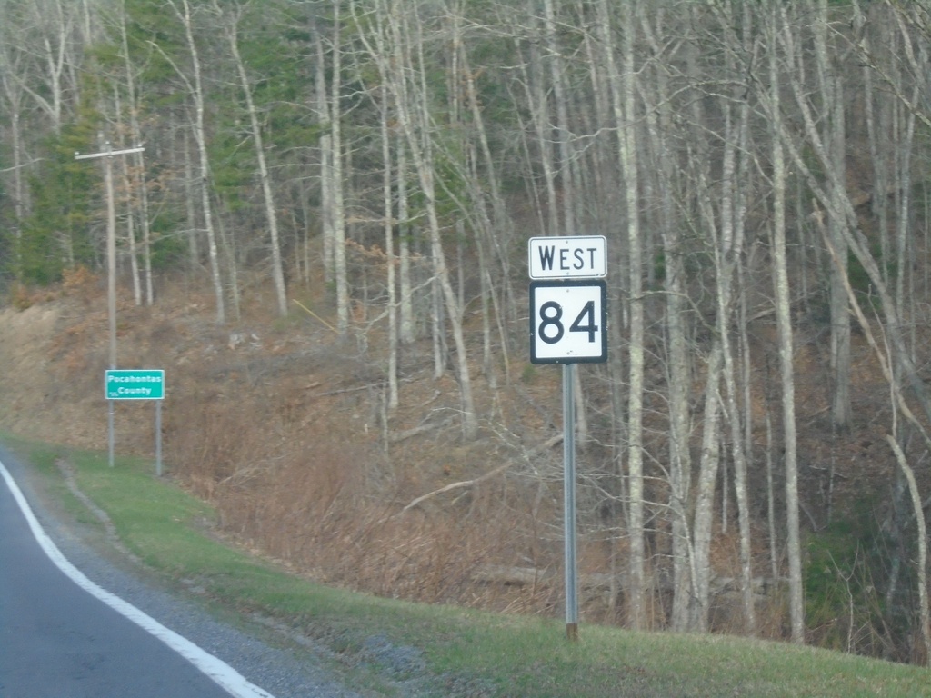
WV-84 West - Pocahontas County
WV-84 West in Pocahontas County
Taken 03-30-2024
Marlinton
Pocahontas County
West Virginia
United States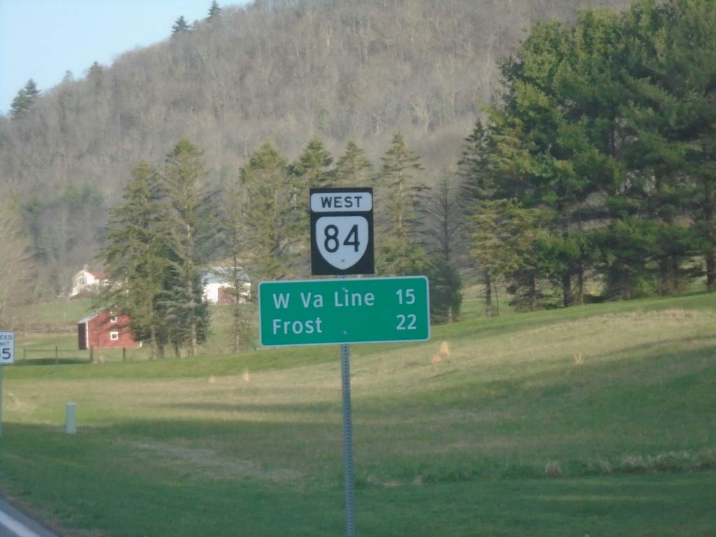
VA-84 West - Distance Marker
Distance marker on VA-84 west. Distance to West Virginia Line and Frost, WV.
Taken 03-30-2024
 Monterey
Highland County
Virginia
United States
Monterey
Highland County
Virginia
United States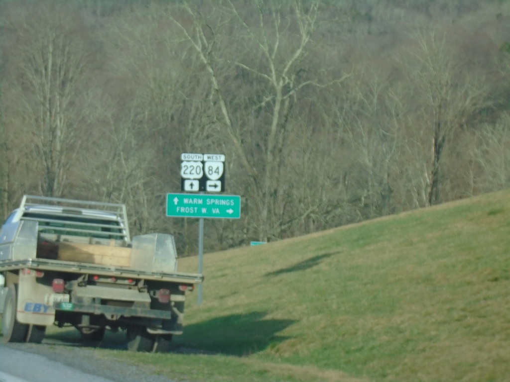
US-220 South at VA-84 West
US-220 South at VA-84 West to Frost, WV. Continue south on US-220 for Warm Springs.
Taken 03-30-2024
 Monterey
Highland County
Virginia
United States
Monterey
Highland County
Virginia
United States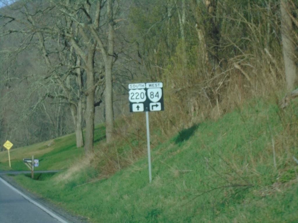
US-220 South at VA-84
US-220 South at VA-84 in Vanderpool.
Taken 03-30-2024
Monterey
Highland County
Virginia
United States
US-220 South at US-250
US-220 South at US-250 in Monterey.
Taken 03-30-2024
 Monterey
Highland County
Virginia
United States
Monterey
Highland County
Virginia
United States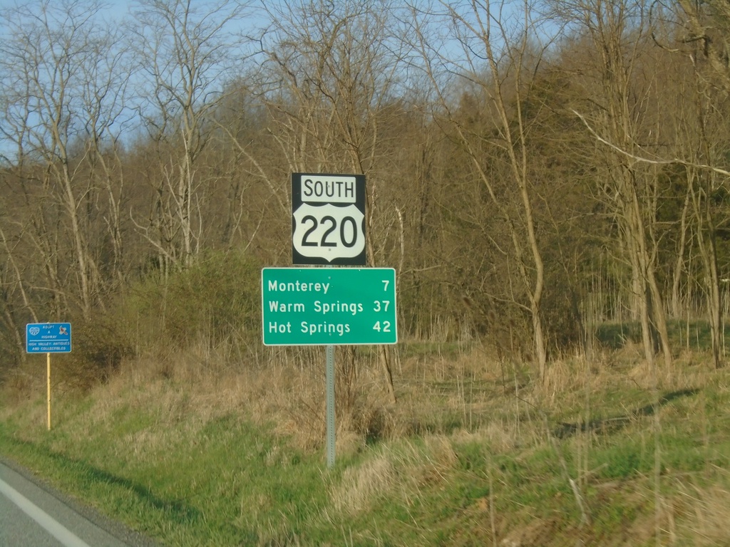
US-220 South - Distance Marker
Distance marker on US-220 south. Distance to Monterey, Warm Springs, and Hot Springs. This is the first distance marker southbound in Virginia. Most of the highway shields in Highland County seem to have a combined shield and banner into one assembly.
Taken 03-30-2024
Monterey
Highland County
Virginia
United States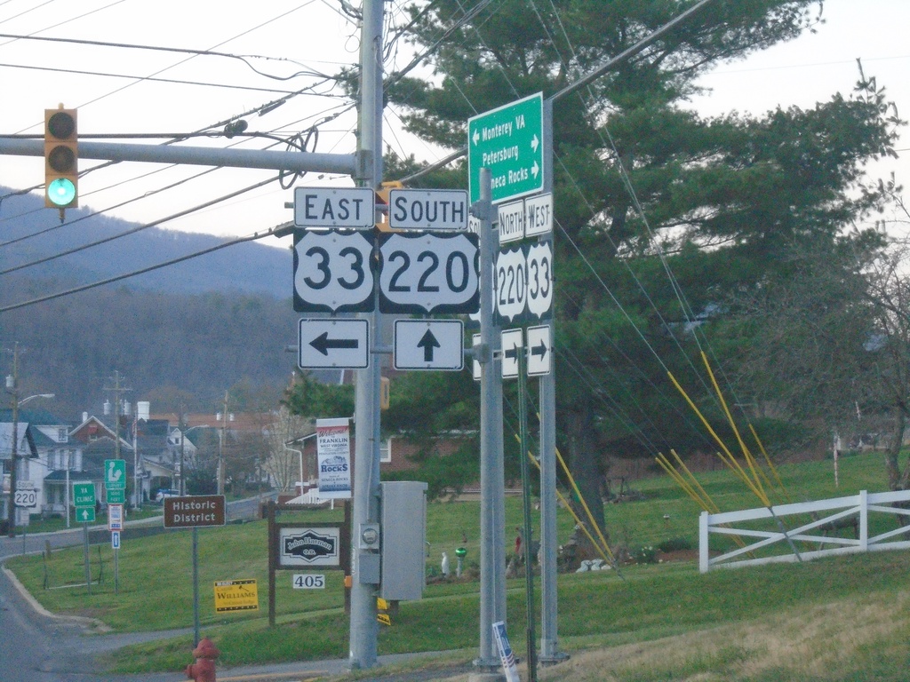
US-33 East/US-220 South at Split
US-33 East/US-220 South at US-33/US-220 split in Franklin.
Taken 03-30-2024
 Franklin
Pendleton County
West Virginia
United States
Franklin
Pendleton County
West Virginia
United States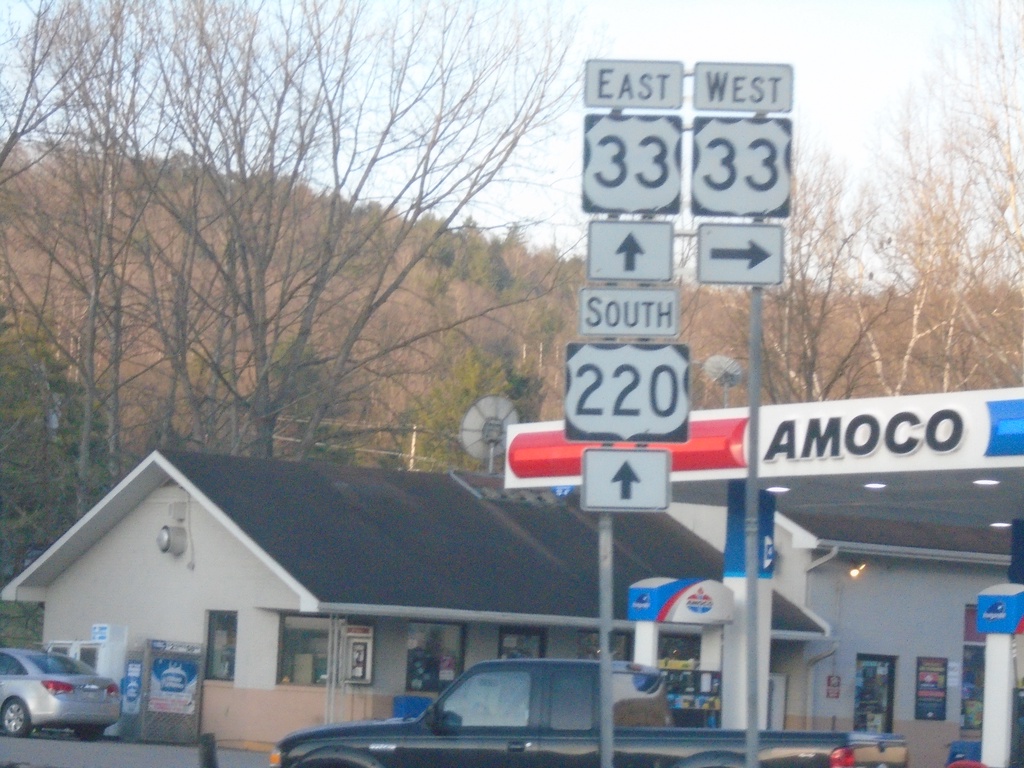
US-220 South at US-33
US-220 South at US-33 in Franklin. US-33 East joins US-220 South through Franklin.
Taken 03-30-2024
Franklin
Pendleton County
West Virginia
United States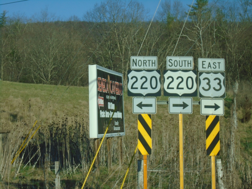
US-33 East at US-220
US-33 East at US-220 in Franklin. US-33 East joins US-220 South through Franklin.
Taken 03-29-2024
Franklin
Pendleton County
West Virginia
United States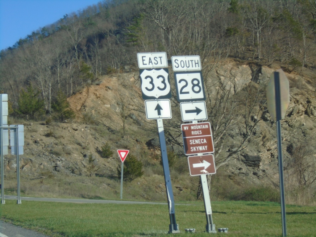
US-33 East/WV-28 South at US-33/WV-28 Split
US-33 East/WV-28 South at US-33/WV-28 split at Judy Gap. Use WV-28 south for the Scenic Skyway Mountain Rides route.
Taken 03-29-2024
 Riverton
Pendleton County
West Virginia
United States
Riverton
Pendleton County
West Virginia
United States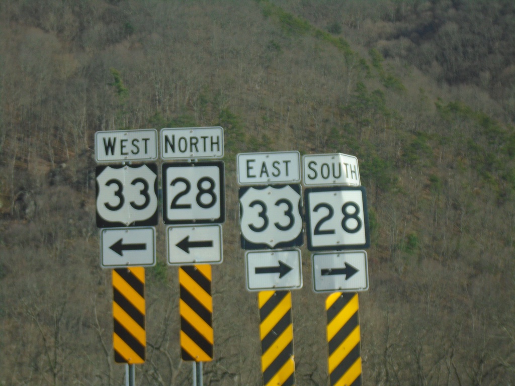
End Briery Gap Road (WVCR-33/4) at US-33/WV-28
End Briery Gap Road (WVCR-33/4) at US-33/WV-28 near Judy Gap.
Taken 03-29-2024
 Riverton
Pendleton County
West Virginia
United States
Riverton
Pendleton County
West Virginia
United States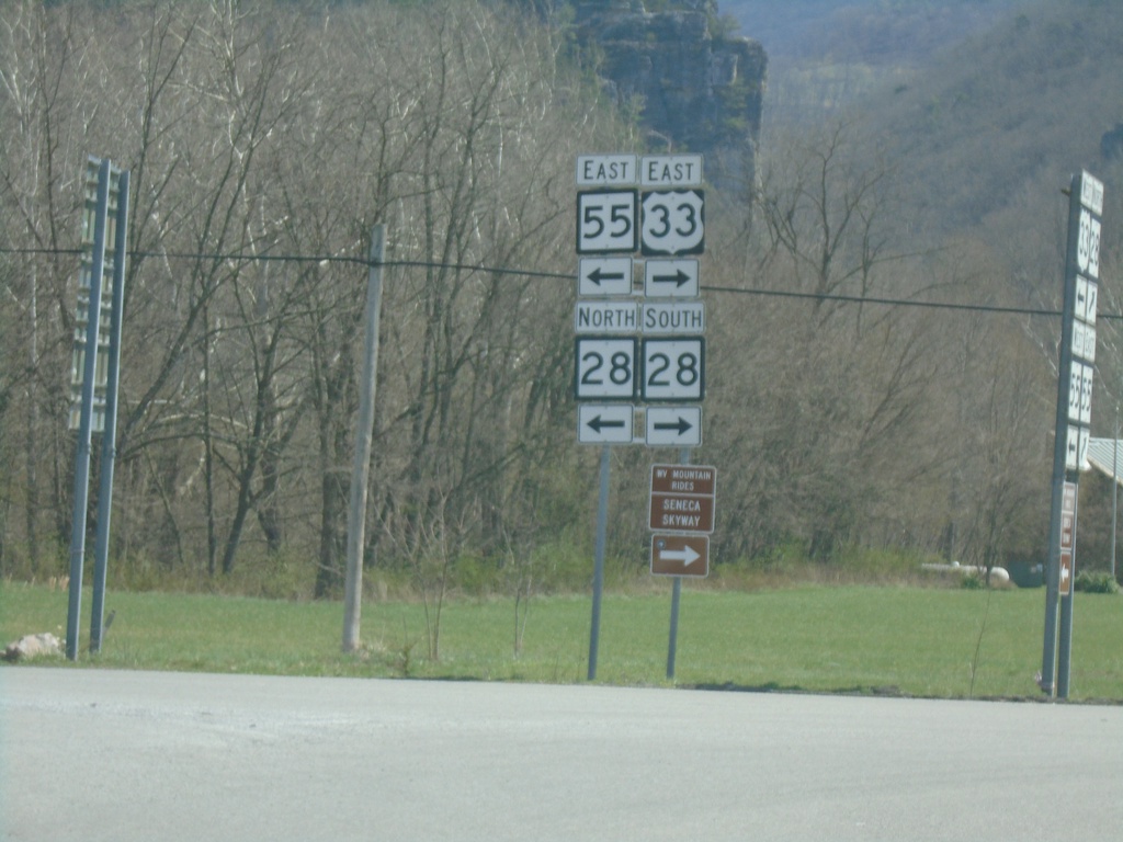
US-33/WV-55 East at WV-28 - Seneca Rocks
US-33/WV-55 East at WV-28 in Seneca Rocks. Turn left for WV-55 East/WV-28 North; turn right for US-33 East/WV-28 South.
Taken 03-29-2024
 Seneca Rocks
Pendleton County
West Virginia
United States
Seneca Rocks
Pendleton County
West Virginia
United States