Signs Tagged With Shield
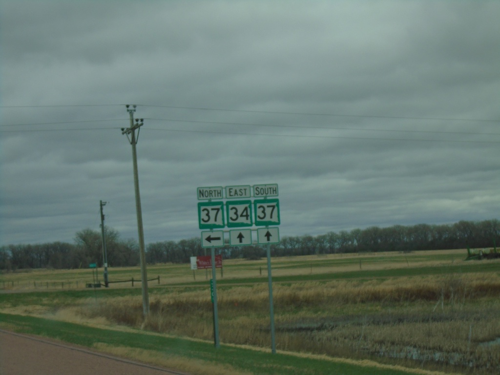
SD-34 East At SD-37
SD-34 East At SD-37 in Sanborn County. SD-37 South joins SD-34 eastbound.
Taken 05-01-2022

 Woonsocket
Sanborn County
South Dakota
United States
Woonsocket
Sanborn County
South Dakota
United States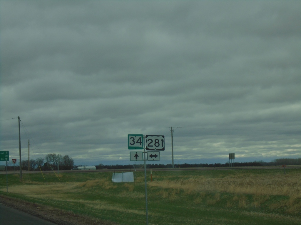
SD-34 East Approaching US-281
SD-34 East approaching US-281 in Jerauld County
Taken 05-01-2022
 Wessington Springs
Jerauld County
South Dakota
United States
Wessington Springs
Jerauld County
South Dakota
United States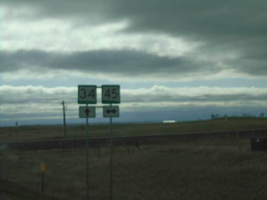
SD-34 East at SD-45
SD-34 East at SD-45 in Buffalo County.
Taken 05-01-2022
 Wessington Springs
Buffalo County
South Dakota
United States
Wessington Springs
Buffalo County
South Dakota
United States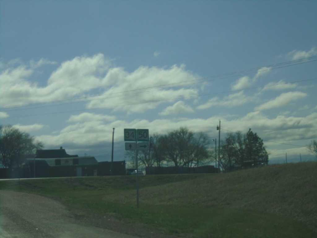
SD-34 East at SD-50 South - Lees Corner
SD-34 East at SD-50 South - Lees Corner.
Taken 05-01-2022
 Chamberlain
Buffalo County
South Dakota
United States
Chamberlain
Buffalo County
South Dakota
United States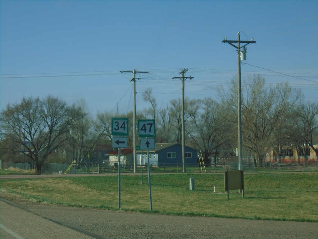
SD-34 East/SD-47 South Split - Fort Thompson
SD-34 East/SD-47 South split in Fort Thompson.
Taken 05-01-2022
 Fort Thompson
Buffalo County
South Dakota
United States
Fort Thompson
Buffalo County
South Dakota
United States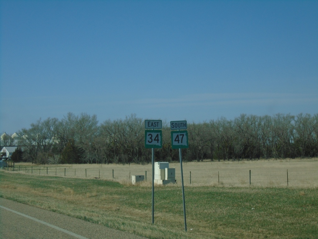
SD-34 East/SD-47 South - Hyde County
SD-34 East/SD-47 South in Hyde County
Taken 05-01-2022
Highmore
Hyde County
South Dakota
United States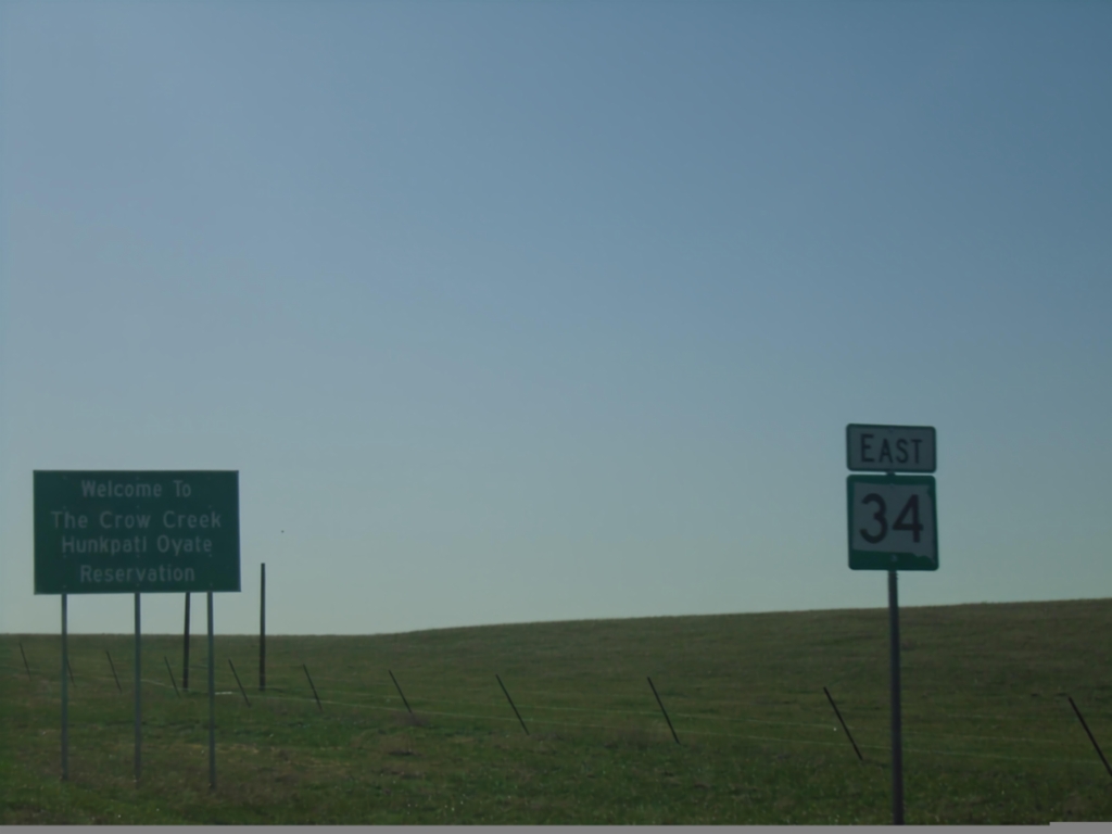
SD-34 East - Crow Creek Reservation
Entering Crow Creek/Hunkpati Oyate Reservation on SD-34 north. The Crow Creek Reservation is home to the Crow Creek Sioux Tribe.
Taken 05-01-2022
Harrold
Hughes County
South Dakota
United States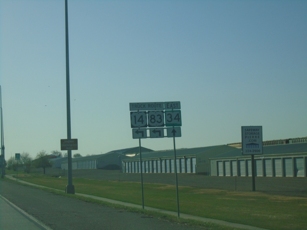
SD-34 East/US-83 Truck North/US-14 Truck East - Pierre.
SD-34 East/US-83 Truck North/US-14 Truck East in Pierre. Turn left to continue on US-83 Truck North/US-14 Truck East. Continue straight for SD-34 east.
Taken 05-01-2022

 Pierre
Hughes County
South Dakota
United States
Pierre
Hughes County
South Dakota
United States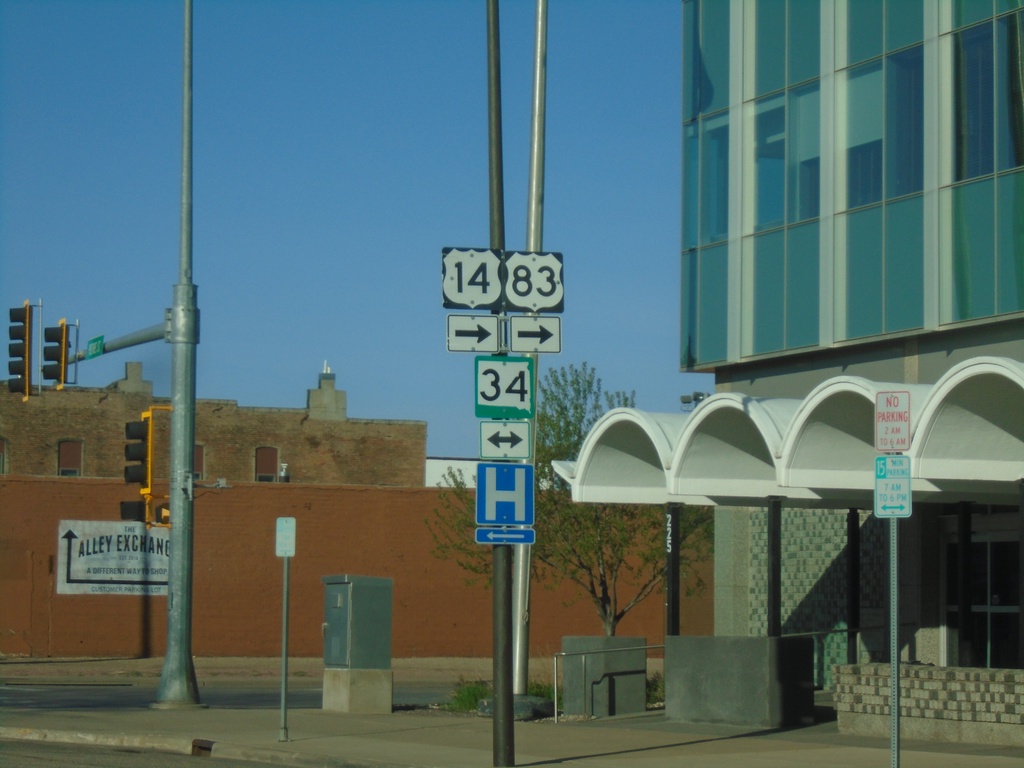
US-83 South/US-14 West at SD-34/US-14 Truck/US-83 Truck
US-83 South/US-14 West (Pierre St.) at SD-34/US-14 Truck/US-83 Truck (Sioux Ave.). Turn right on Sioux Ave for US-83 South/US-14 West/SD-34 West. Turn left on Sioux Ave. for SD-34 East/US-14 Truck/US-83 Truck.
Taken 05-01-2022

 Pierre
Hughes County
South Dakota
United States
Pierre
Hughes County
South Dakota
United States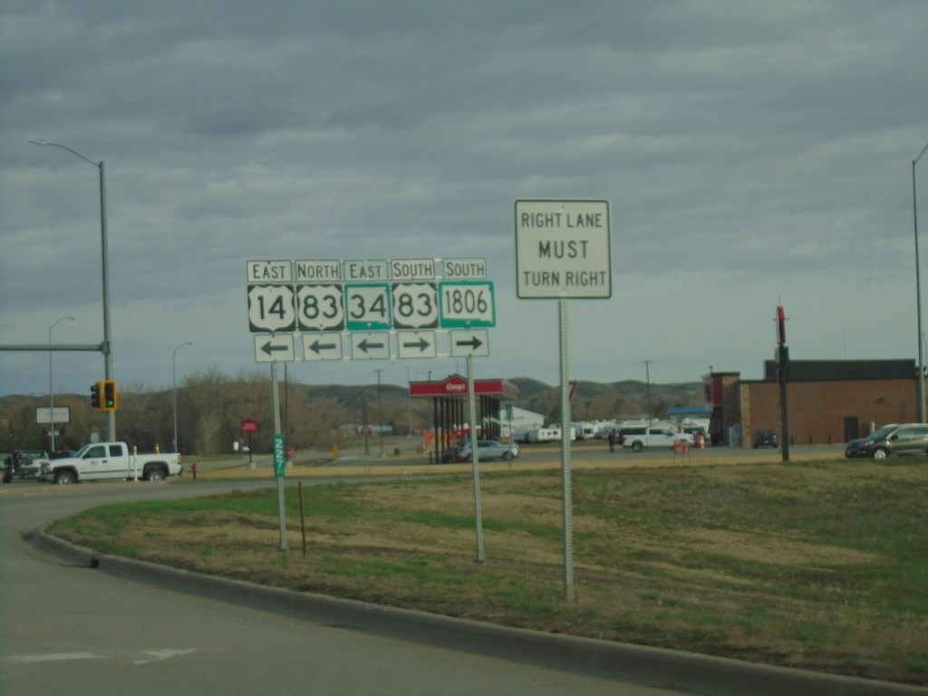
US-14/SD-34 East at US-83/SD-1806
US-14/SD-34 East at US-83/SD-1806 in Fort Pierre. Turn right for US-83 South/SD-1806 South. Turn left for US-83 North/US-14 East/SD-34 East. US-83 joins US-14/SD-34 East across the river into Pierre.
Taken 04-30-2022
 Fort Pierre
Stanley County
South Dakota
United States
Fort Pierre
Stanley County
South Dakota
United States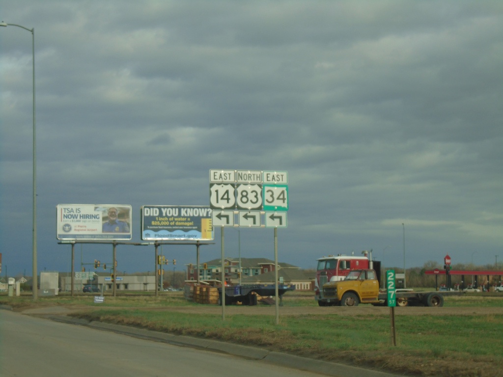
US-14/SD-34 East Approaching US-83
US-14/SD-34 East approaching US-83 in Fort Pierre. Turn left to continue east on US-14/SD-34 and for US-83 north. US-83 joins US-14/SD-34 across the Missouri River into Pierre.
Taken 04-30-2022
Fort Pierre
Stanley County
South Dakota
United States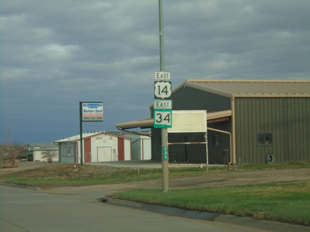
US-14/SD-34 East - Fort Pierre
US-14/SD-34 East in Fort Pierre.
Taken 04-30-2022
Fort Pierre
Stanley County
South Dakota
United States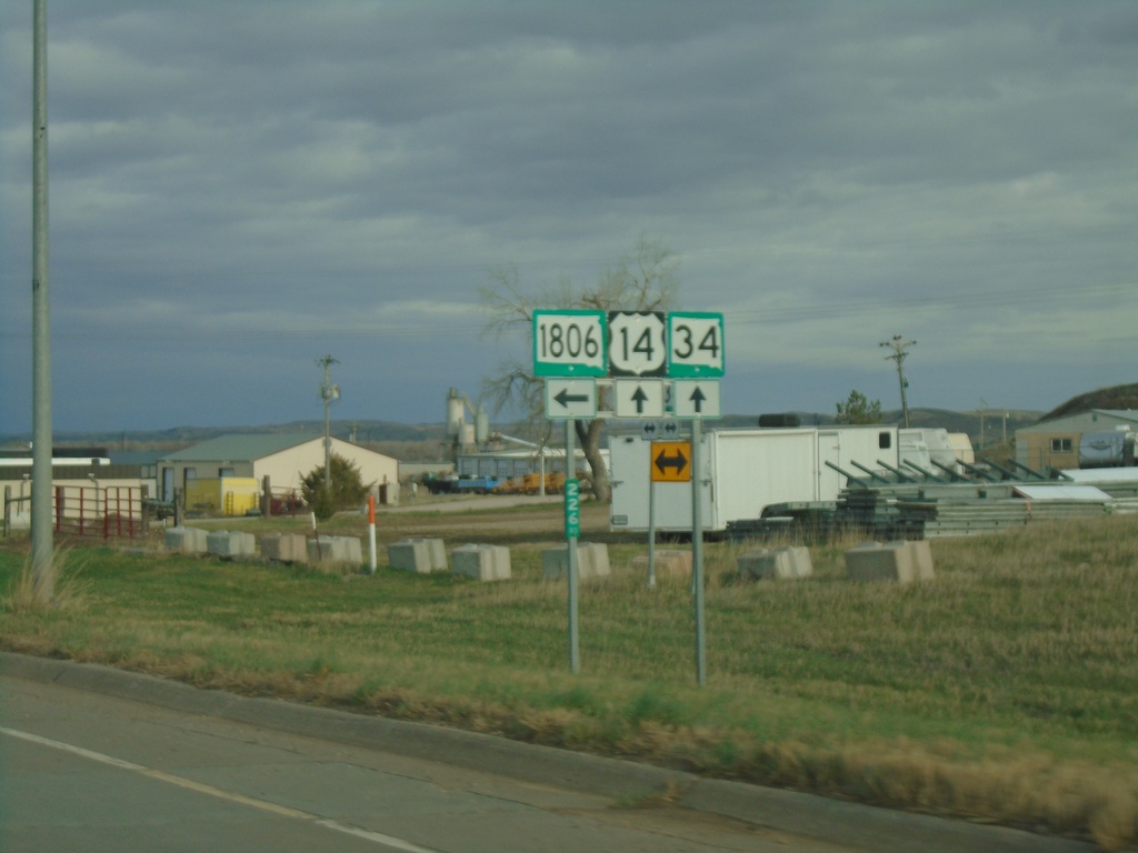
US-14/SD-34 East at SD-1806
US-14/SD-34 East at SD-1806 in Fort Pierre.
Taken 04-30-2022
Fort Pierre
Stanley County
South Dakota
United States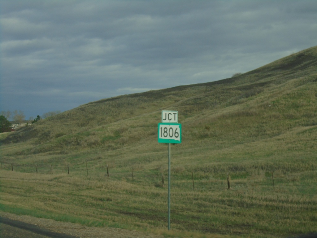
US-14/SD-34 East Approaching SD-1806
US-14/SD-34 East approaching SD-1806. SD-1806 is named for the year Lewis and Clark made their return journey through North and South Dakota.
Taken 04-30-2022
Fort Pierre
Stanley County
South Dakota
United States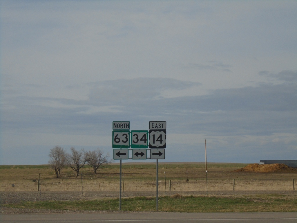
US-14 East/SD-63 North at SD-34
US-14 East/SD-63 North at SD-34 in Stanley County. Turn left for SD-34 West/SD-63 North; right for US-14/SD-34 East.
Taken 04-30-2022
 Hayes
Stanley County
South Dakota
United States
Hayes
Stanley County
South Dakota
United States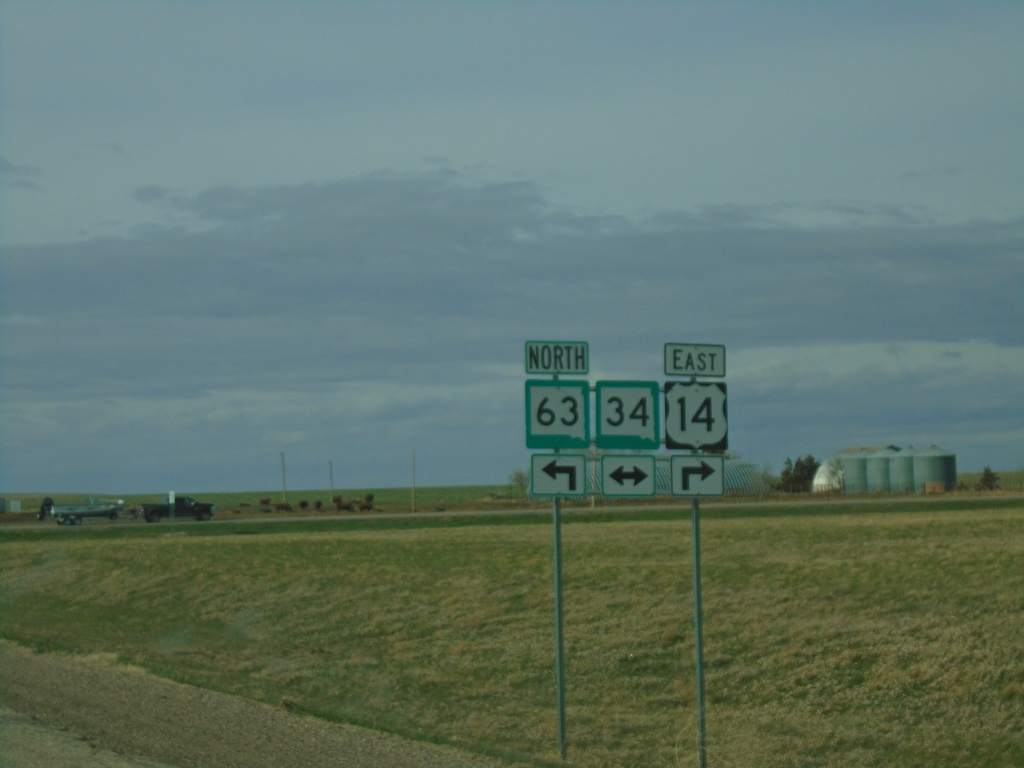
US-14 East/SD-63 North at SD-34
US-14 East/SD-63 North at SD-34 in Stanley County. SD-63 North joins SD-34 westbound; SD-34 east joins US-14 eastbound.
Taken 04-30-2022
 Hayes
Stanley County
South Dakota
United States
Hayes
Stanley County
South Dakota
United States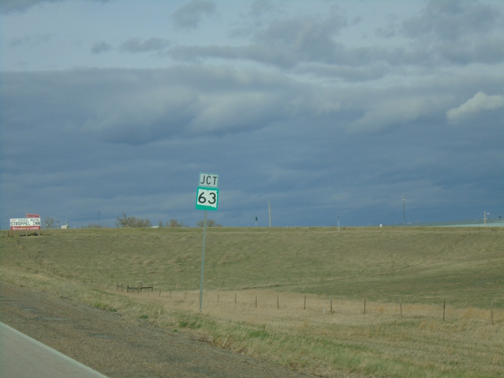
US-14 East Approaching SD-63
US-14 East approaching SD-63 in Midland.
Taken 04-30-2022
Midland
Haakon County
South Dakota
United States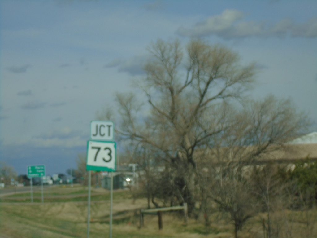
US-14 East Approaching SD-73
US-14 East approaching SD-73 in Phillip.
Taken 04-30-2022
Philip
Haakon County
South Dakota
United States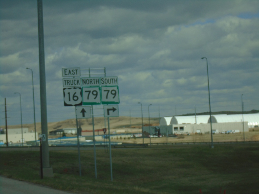
US-16 Truck East at SD-79
US-16 Truck East at SD-79 in Rapid City. SD-79 North joins US-16 Truck East to I-90.
Taken 04-30-2022

 Rapid City
Pennington County
South Dakota
United States
Rapid City
Pennington County
South Dakota
United States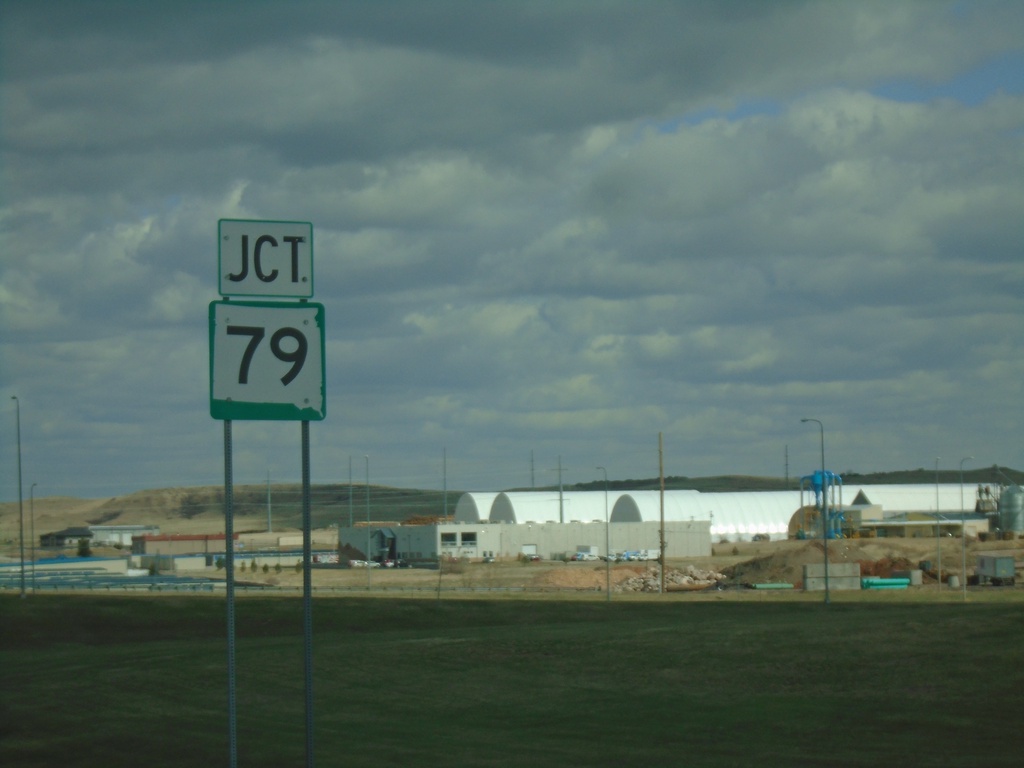
US-16 Truck East Approaching SD-79
US-16 Truck East approaching SD-79 in Rapid City.
Taken 04-30-2022
Rapid City
Pennington County
South Dakota
United States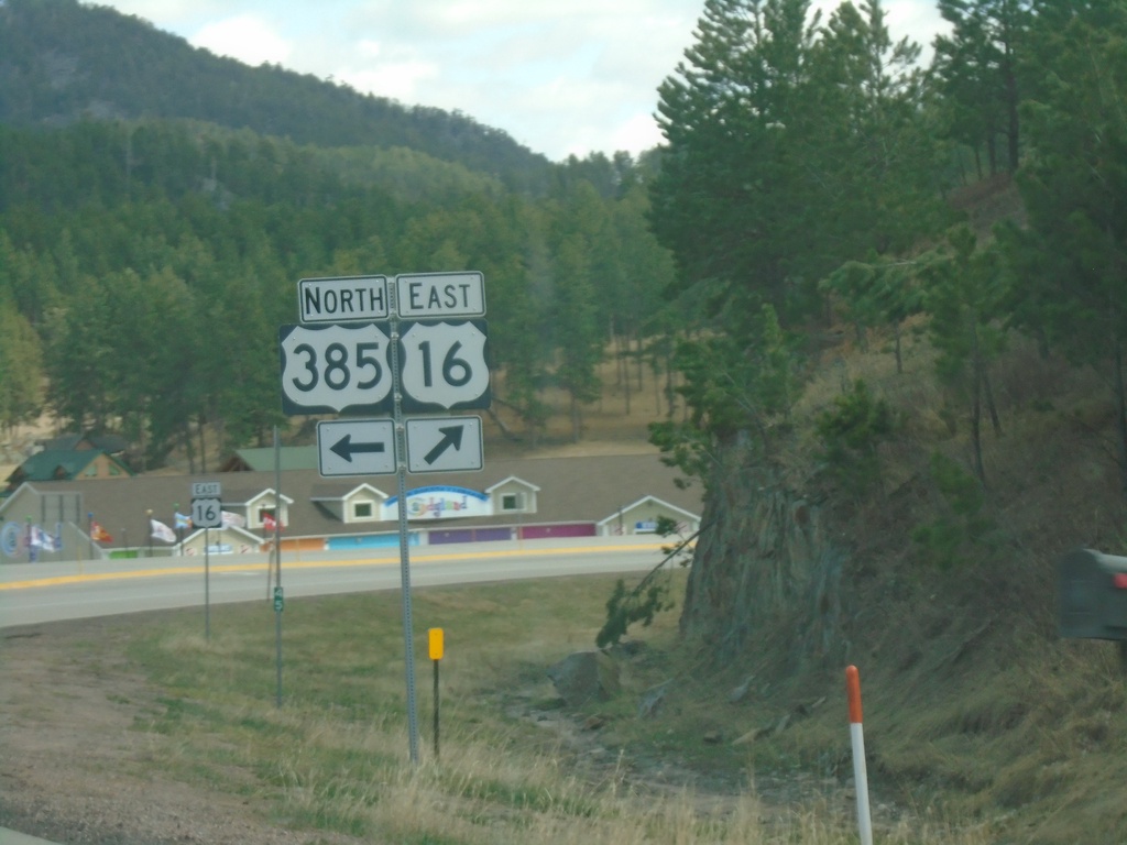
US-385 North/US-16 East at US-385/US-16 Split
US-385 North/US-16 East at US-385/US-16 split in Pennington County.
Taken 04-30-2022

 Hill City
Pennington County
South Dakota
United States
Hill City
Pennington County
South Dakota
United States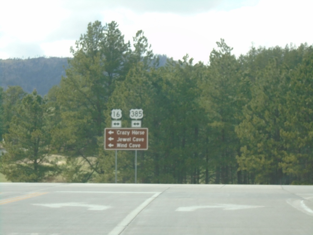
End SD-87 North at US-16/US-385
End SD-87 North at US-16/US-385. Use US-16 West/US-385 South to Crazy Horse, Jewel Cave, and Wind Cave.
Taken 04-30-2022
 Custer
Pennington County
South Dakota
United States
Custer
Pennington County
South Dakota
United States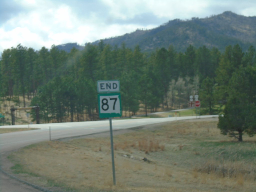
End SD-87 North at US-385/US-16
End SD-87 North at US-385/US-16 in Pennington County.
Taken 04-30-2022
Custer
Pennington County
South Dakota
United States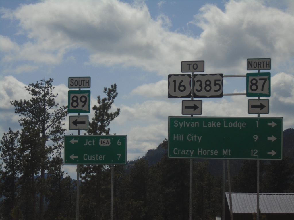
SD-87 North at SD-89
SD-87 North at SD-89 in Custer County. Use SD-89 South to Jct. US-16A and Custer. Use SD-87 North for US-16/US-385, Sylvan Lake Lodge, Hill City, and Crazy Horse Mountain.
Taken 04-30-2022

 Custer
 County
South Dakota
United States
Custer
Custer County
South Dakota
United States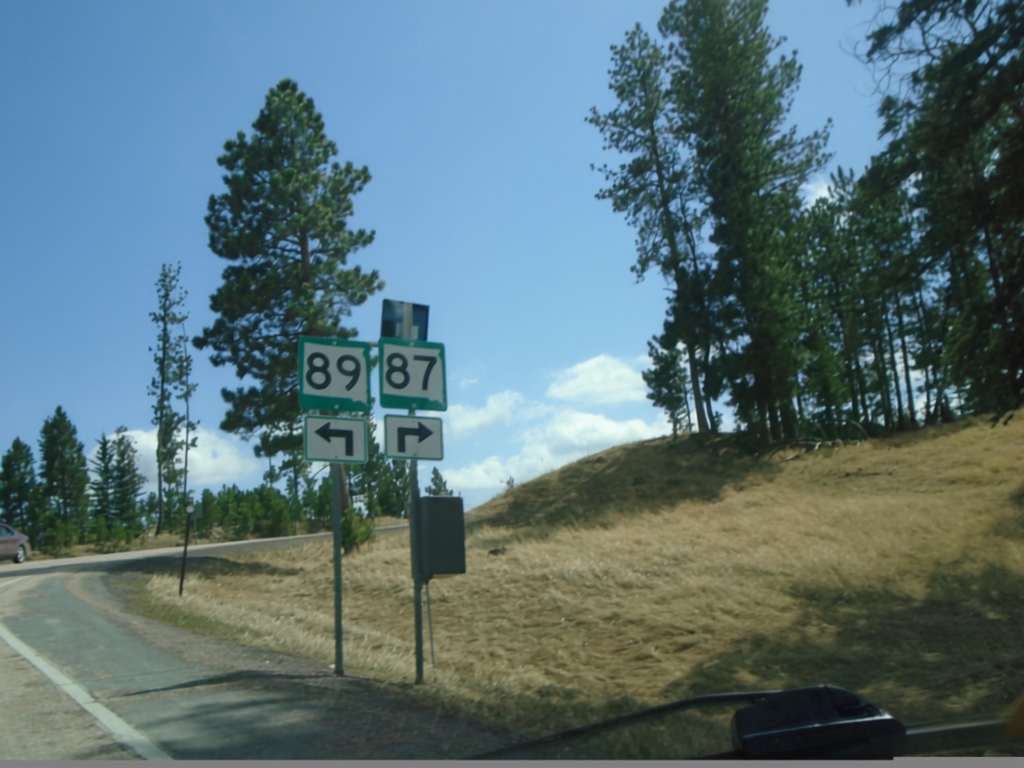
SD-87 North at SD-89
SD-87 North at SD-89 in Custer County.
Taken 04-30-2022
Custer
Custer County
South Dakota
United States