Signs Tagged With Shield
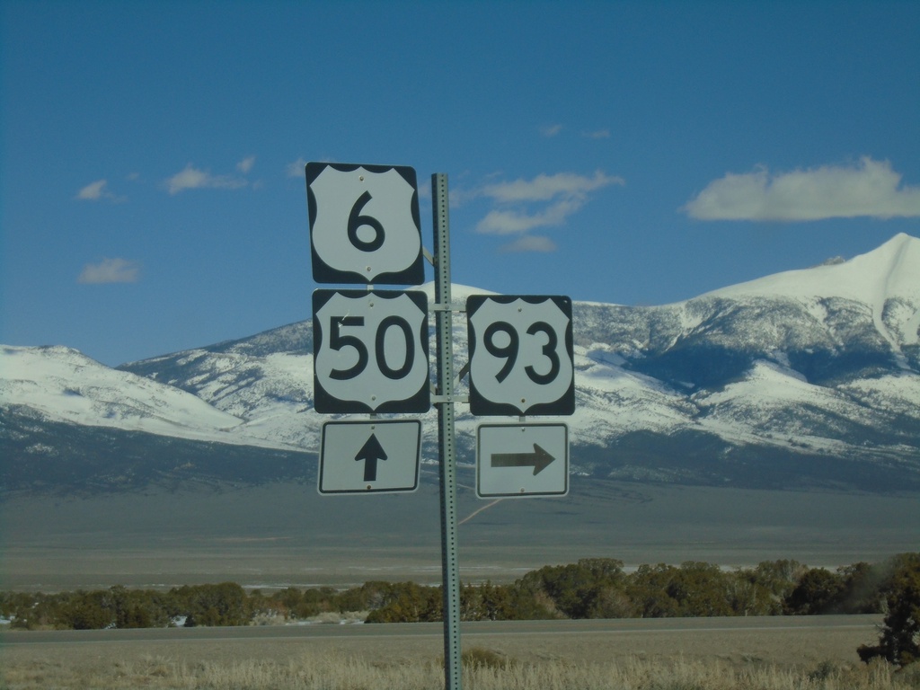
US-50 East/US-6 East/US-93 South at US-93 Junction
US-50 East/US-6 East/US-93 South at US-93 - Majors Junction.
Taken 03-31-2023


 Majors Place
White Pine County
Nevada
United States
Majors Place
White Pine County
Nevada
United States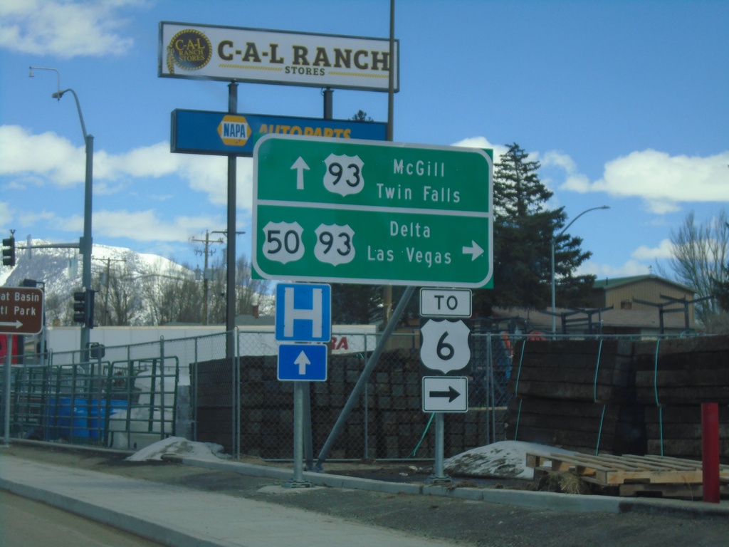
US-50 East at US-93
US-50 east at US-93. Continue ahead for US-93 north to McGill and Twin Falls (Idaho). Turn right for US-93 and US-50 for Delta (Utah, Las Vegas and US-6. US-50 joins US-93 south to Majors Junction.
Taken 03-31-2023
Ely
White Pine County
Nevada
United States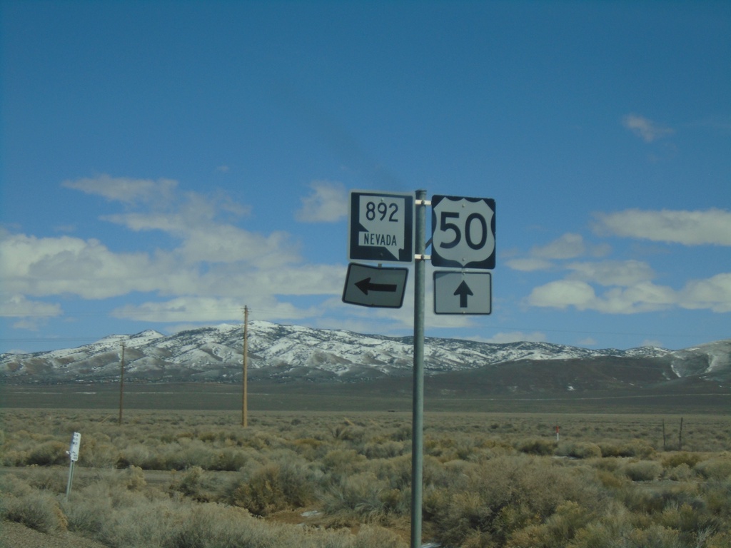
US-50 East at NV-892
US-50 East at NV-892 Junction in White Pine County.
Taken 03-31-2023
 Ely
White Pine County
Nevada
United States
Ely
White Pine County
Nevada
United States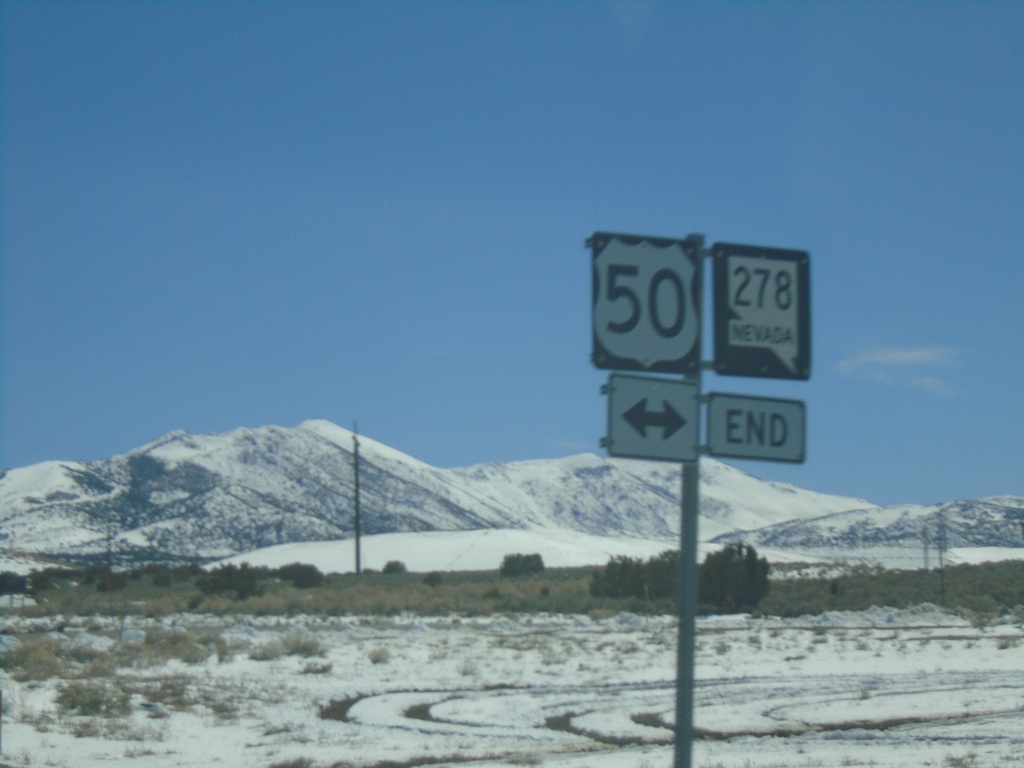
End NV-278 South at US-50
End NV-278 South at US-50 in Eureka.
Taken 03-31-2023
 Eureka
 County
Nevada
United States
Eureka
Eureka County
Nevada
United States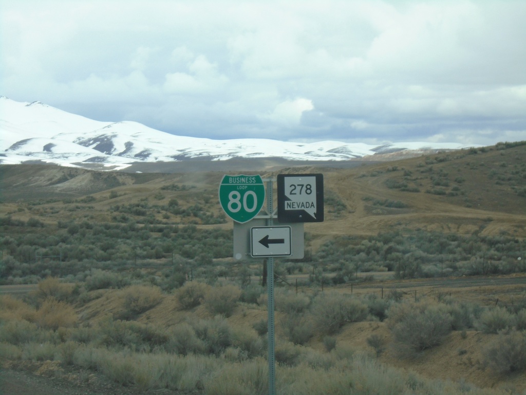
I-80 West - Exit 279 Offramp
I-80 West - Exit 279 Offramp. Turn left for NV-278 South/BL-80 East.
Taken 03-31-2023

 Carlin
Elko County
Nevada
United States
Carlin
Elko County
Nevada
United States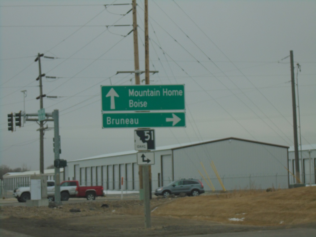
End ID-67 East At ID-51
End ID-67 east at at ID-51. Use ID-51 south for Bruneau. Use ID-51 north for Mountain Home and Boise.
Taken 03-04-2023

 Mountain Home
Elmore County
Idaho
United States
Mountain Home
Elmore County
Idaho
United States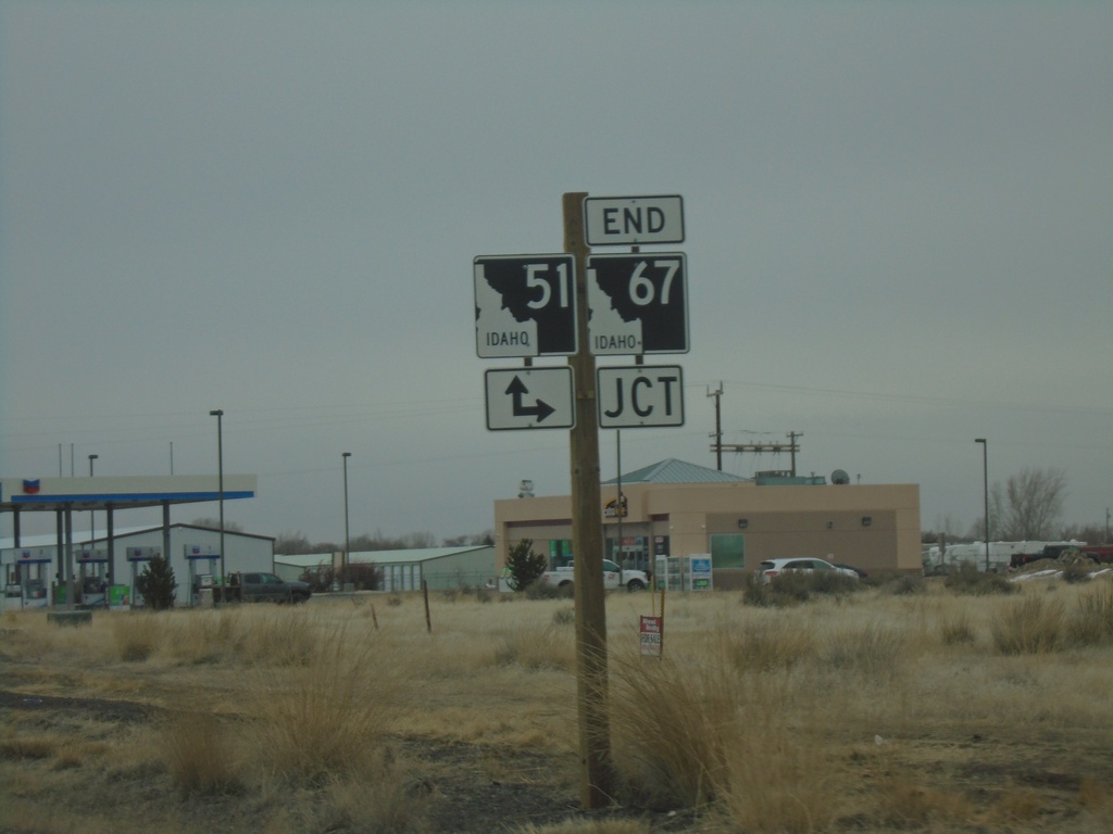
End ID-67 East at ID-51
End ID-67 east at ID-51. Turn right for ID-51 south; continue ahead for ID-51 north.
Taken 03-04-2023
Mountain Home
Elmore County
Idaho
United States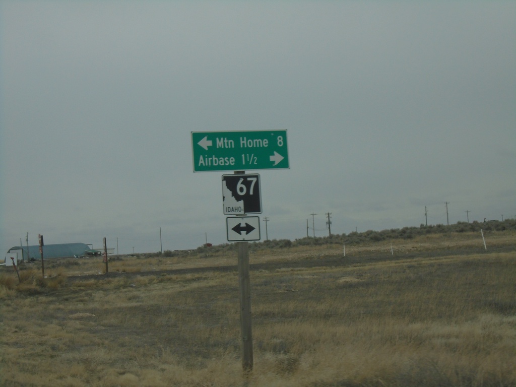
End ID-167 East at ID-67
End ID-167 east at ID-67. Use ID-67 west for the Airbase (Mountain Home AFB). Use ID-67 east for Mountain Home.
Taken 03-04-2023
 Mountain Home Air Force Base
Elmore County
Idaho
United States
Mountain Home Air Force Base
Elmore County
Idaho
United States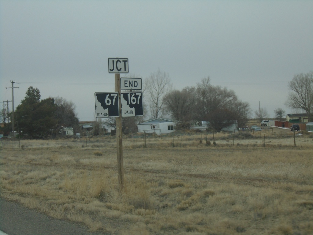
ID-167 East Approaching ID-67
ID-167 east approaching ID-67. ID-167 ends at ID-67.
Taken 03-04-2023
Mountain Home
Elmore County
Idaho
United States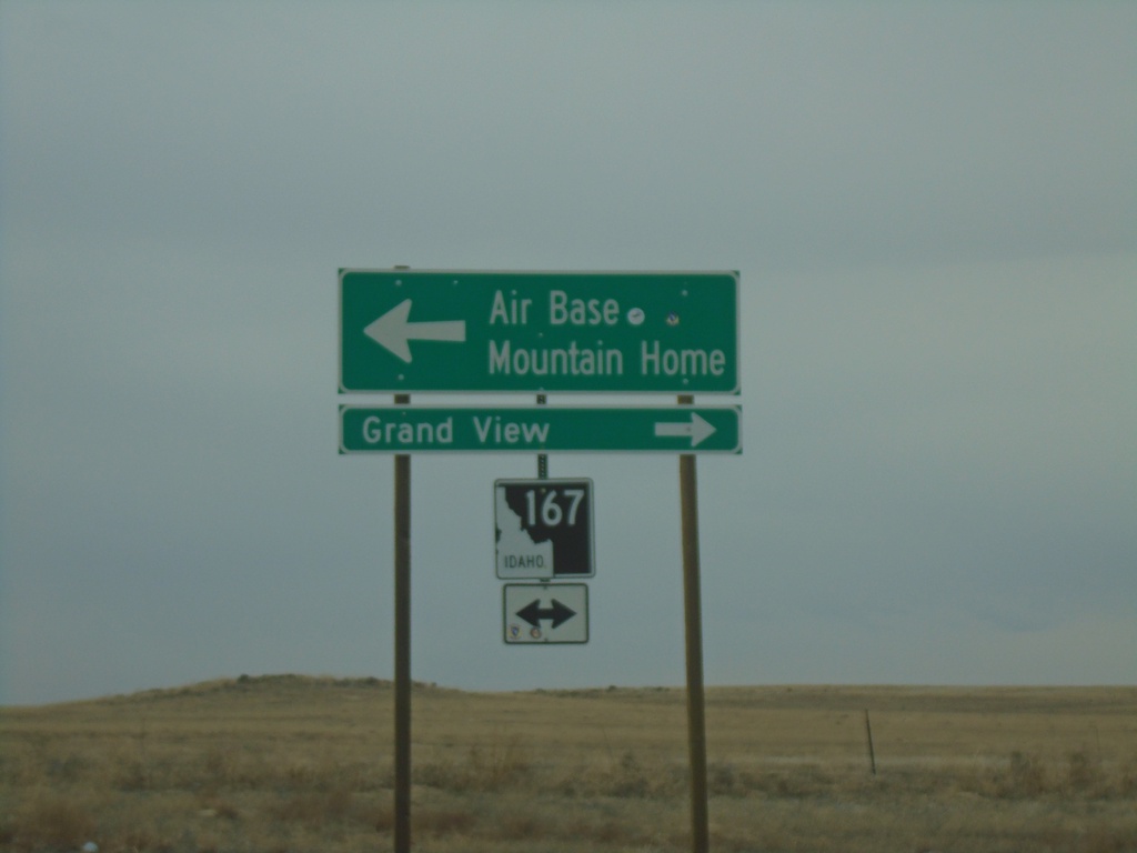
Simco Road South at ID-167
Simco Road South at ID-167. Use ID-167 West to Grand View; ID-167 East to Air Base and Mountain Home.
Taken 03-04-2023
Mountain Home
Elmore County
Idaho
United States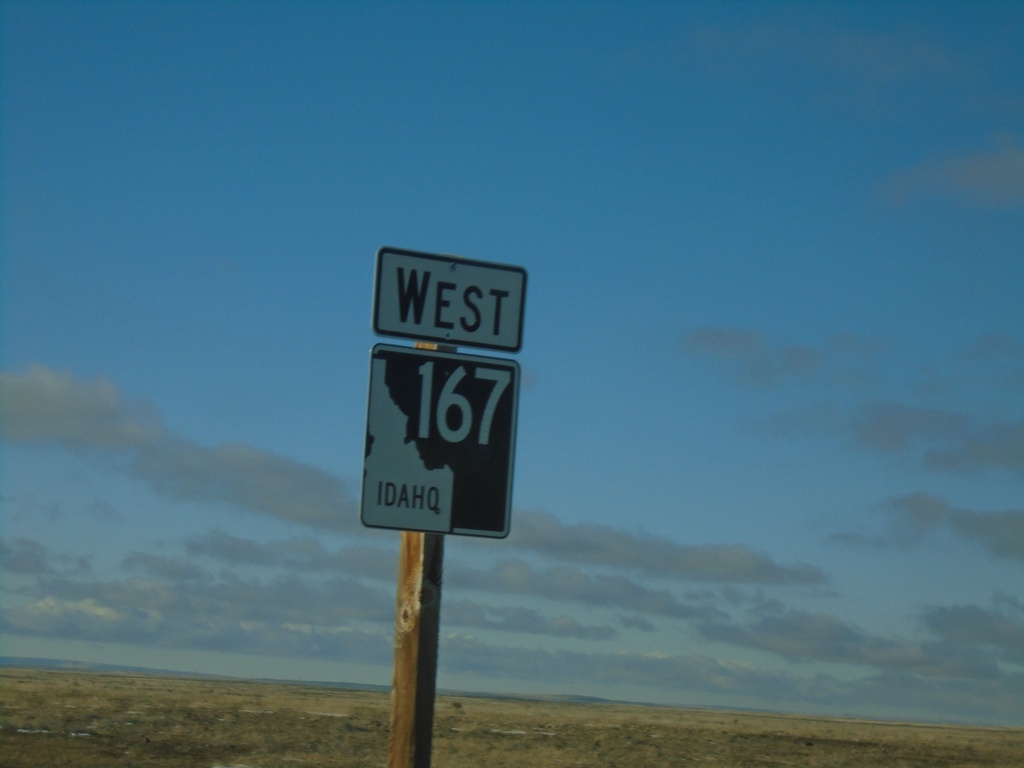
ID-167 West - Elmore County
ID-167 West in Elmore County
Taken 01-01-2023
Mountain Home
Elmore County
Idaho
United States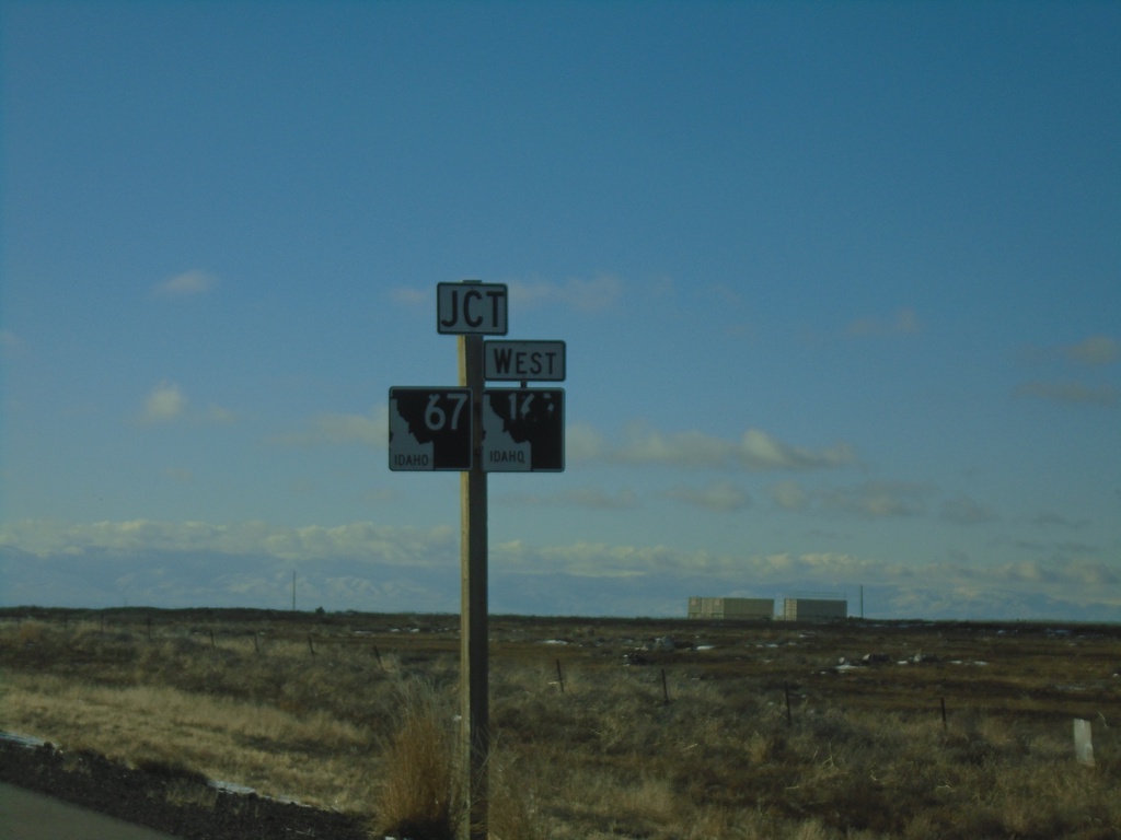
ID-67 West Approaching ID-167
ID-67 West approaching ID-167 West in Elmore County.
Taken 01-01-2023
Mountain Home
Elmore County
Idaho
United States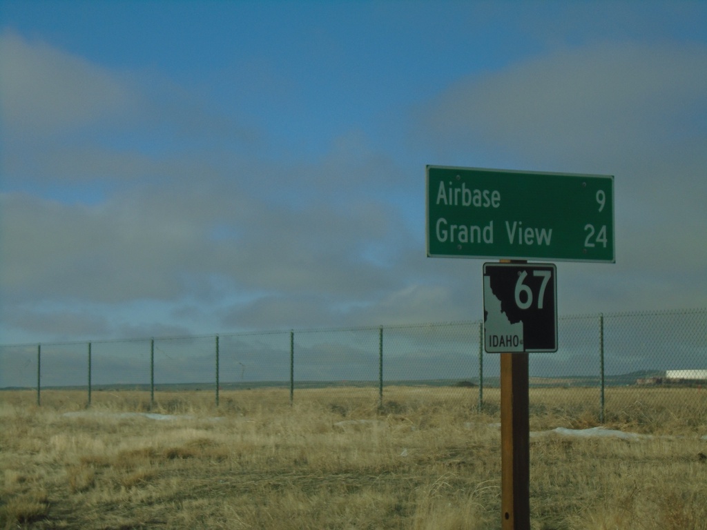
ID-67 West - Distance Marker
Distance marker on ID-67 west. Distance to Airbase (Mountain Home) and Grand View.
Taken 01-01-2023
Mountain Home
Elmore County
Idaho
United States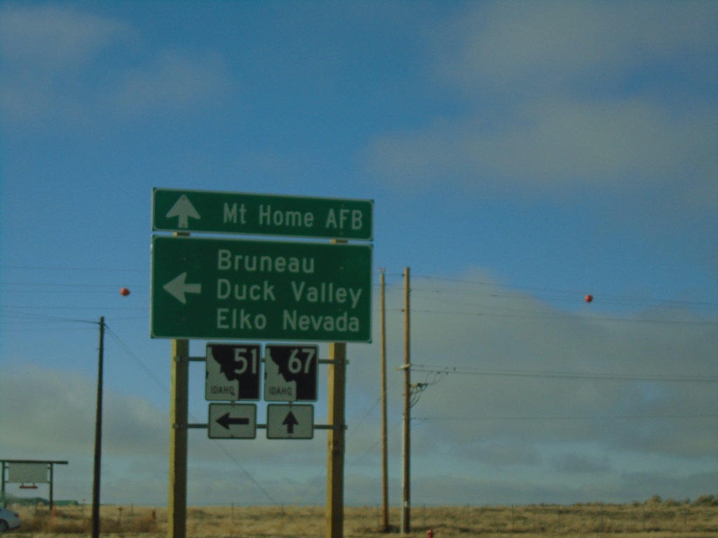
ID-51 South at ID-67 - Mountain Home
ID-51 South at ID-67 in Mountain Home. Turn left to continue on ID-51 South to Bruneau, Duck Valley, and Elko (Nevada). Continue straight for ID-67 to Mountain Home AFB.
Taken 01-01-2023
Mountain Home
Elmore County
Idaho
United States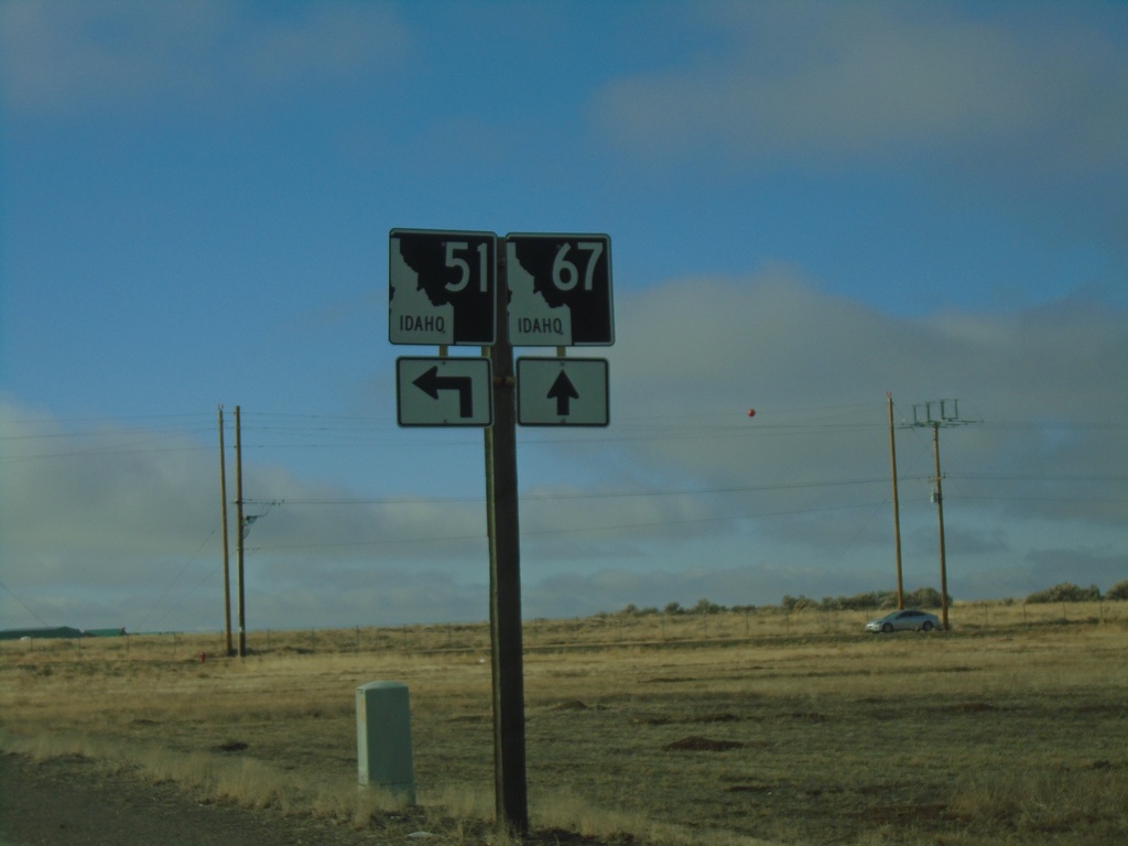
ID-51 South Approaching ID-67
ID-51 South approaching ID-67 in Mountain Home.
Taken 01-01-2023
Mountain Home
Elmore County
Idaho
United States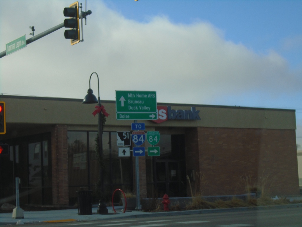
BL-84 West at ID-51 - Mountain Home
BL-84 west at ID-51 in Mountain Home (American Legion Blvd. at N 2nd E). Turn right on N 2nd E to continue west on BL-84 and for I-84 and Boise. Continue straight for ID-51 south to Mountain Home AFB, Bruneau, and Duck Valley (Indian Reservation).
Taken 01-01-2023

 Mountain Home
Elmore County
Idaho
United States
Mountain Home
Elmore County
Idaho
United States
BL-84 West - Mountain Home
BL-84 West in Mountain Home
Taken 01-01-2023
Mountain Home
Elmore County
Idaho
United States
BL-84 West - Mountain Home
BL-84 West in Mountain Home
Taken 01-01-2023
Mountain Home
Elmore County
Idaho
United States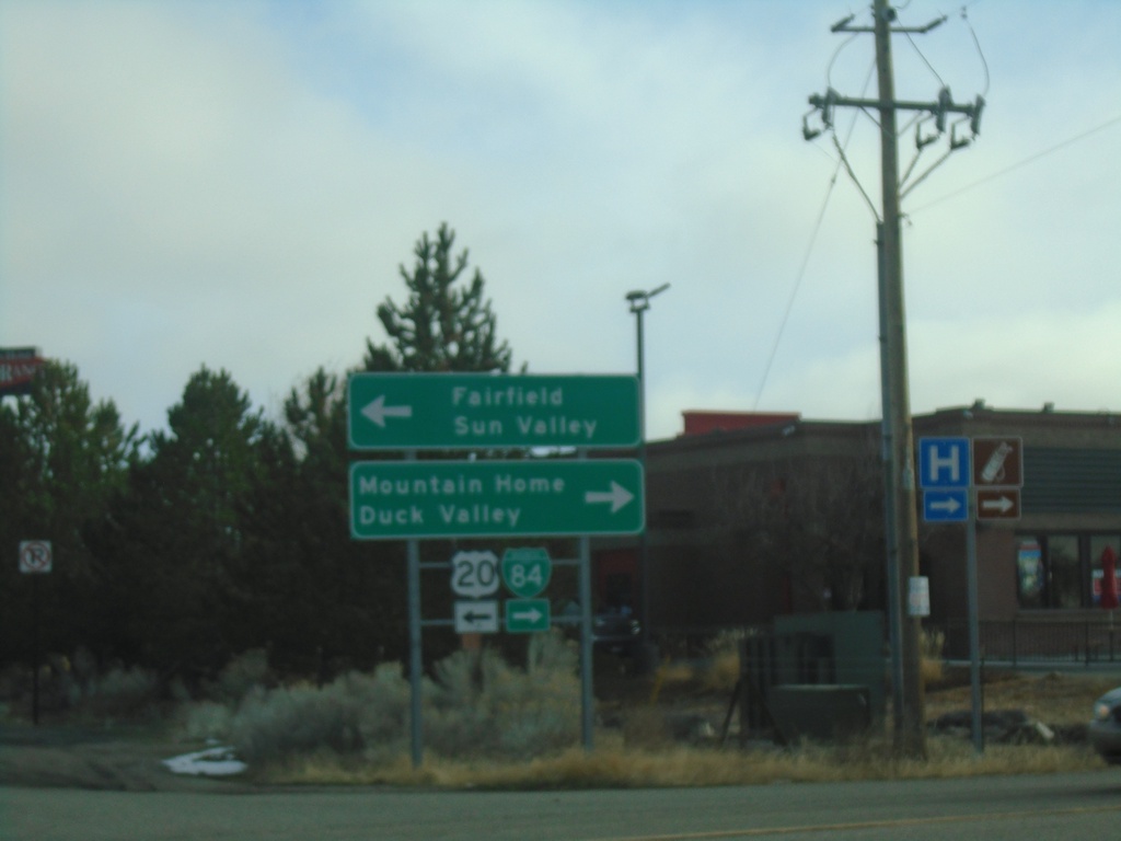
I-84 East - Exit 95 Offramp at US-20/BL-84/ID-51
I-84 East - Exit 95 Offramp at US-20/BL-84/ID-51 in Mountain Home. Turn left for US-20 East to Fairfield and Sun Valley. Turn right for BL-84/(ID-51) to Mountain Home and Duck Valley. US-20 east leaves I-84 eastbound here.
Taken 01-01-2023


 Mountain Home
Elmore County
Idaho
United States
Mountain Home
Elmore County
Idaho
United States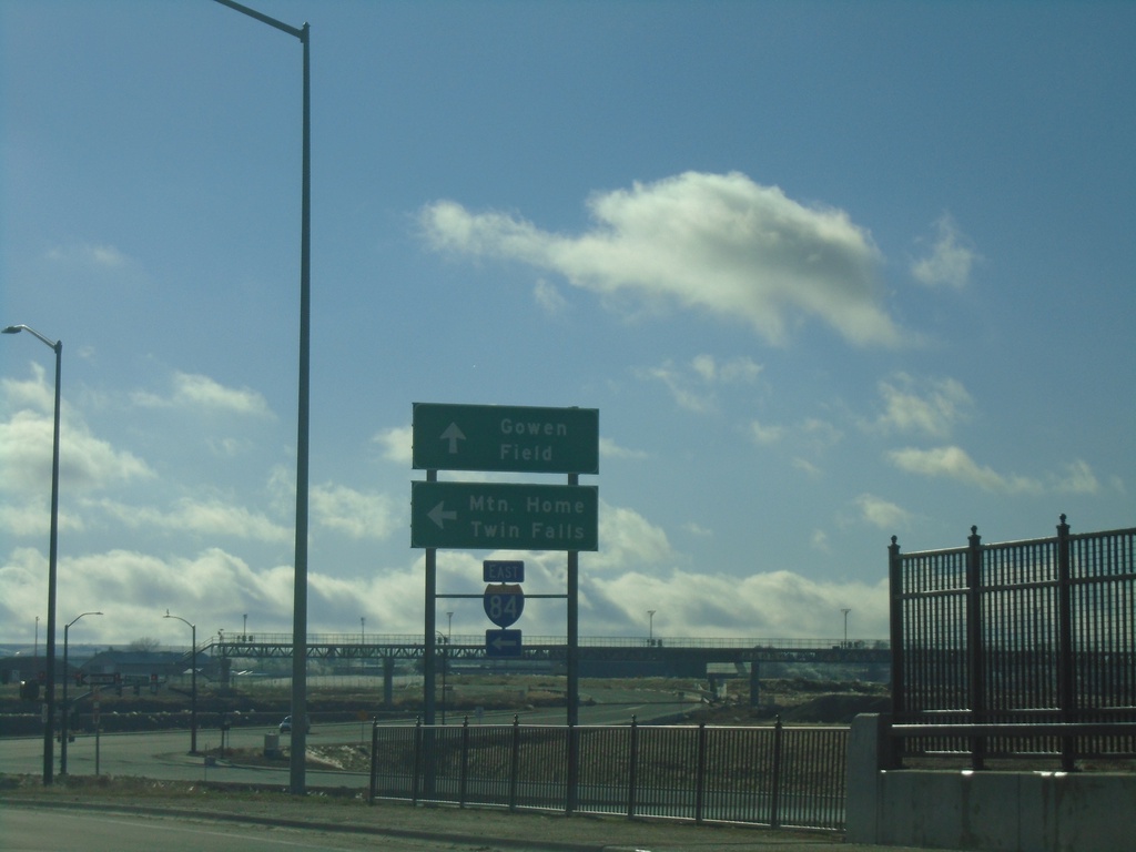
Orchard St. South at I-84 East
Orchard St. South at I-84 East (Exit 52). Use I-84 East to Mountain Home and Twin Falls. Continue south on Orchard St. for Gowen Field.
Taken 01-01-2023
Boise
Ada County
Idaho
United States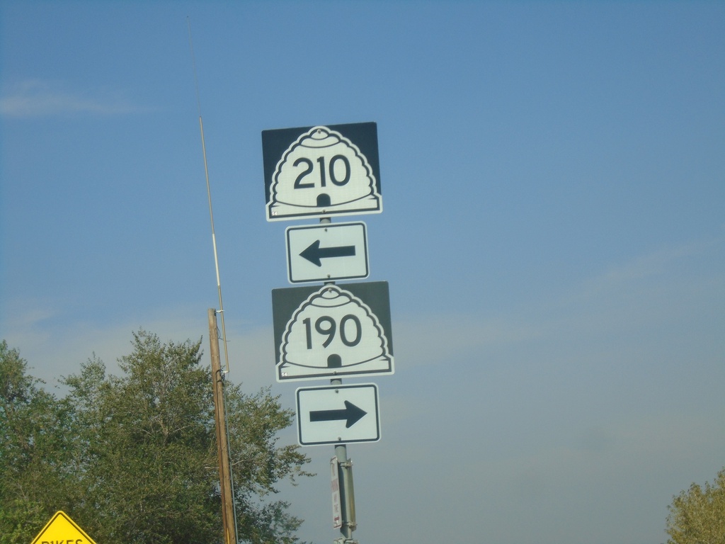
UT-190 West at UT-210 - Cottonwood Heights
UT-190 West at UT-210 in Cottonwood Heights. Turn right on Wasatch Blvd. to continue west on UT-190; turn left on Wasatch Blvd. for UT-210 East.
Taken 09-12-2022

 Salt Lake City
Salt Lake County
Utah
United States
Salt Lake City
Salt Lake County
Utah
United States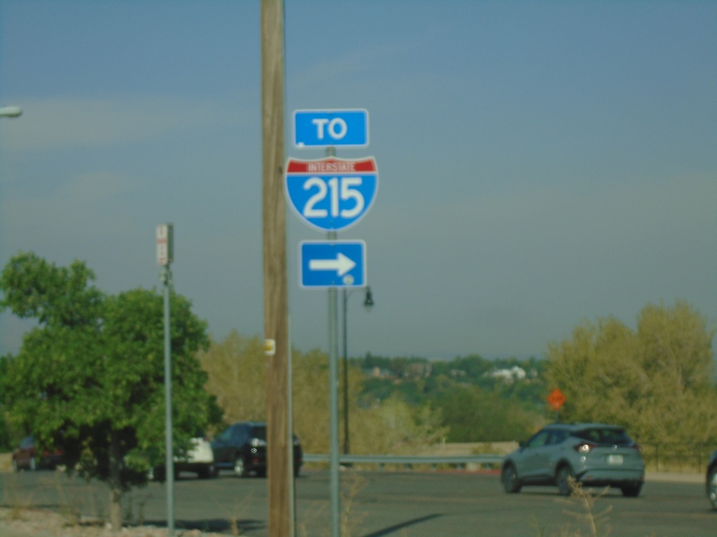
UT-190 West at UT-210 - Cottonwood Heights
UT-190 West at UT-210 in Cottonwood Heights. Turn left to continue west on UT-190 (Wasatch Blvd.) to I-215.
Taken 09-12-2022
 Cottonwood Heights
Salt Lake County
Utah
United States
Cottonwood Heights
Salt Lake County
Utah
United States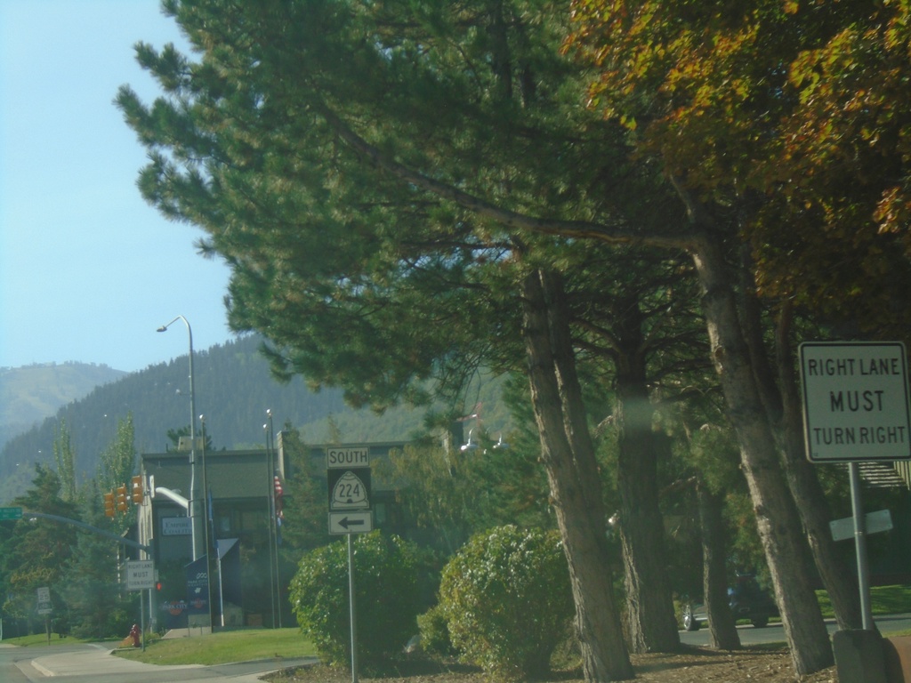
UT-224 South - Park City
UT-224 South - Park Ave. at Deer Valley Drive in Park City. Turn left on Deer Valley Drive to continue south on UT-224.
Taken 09-12-2022
 Park City
Summit County
Utah
United States
Park City
Summit County
Utah
United States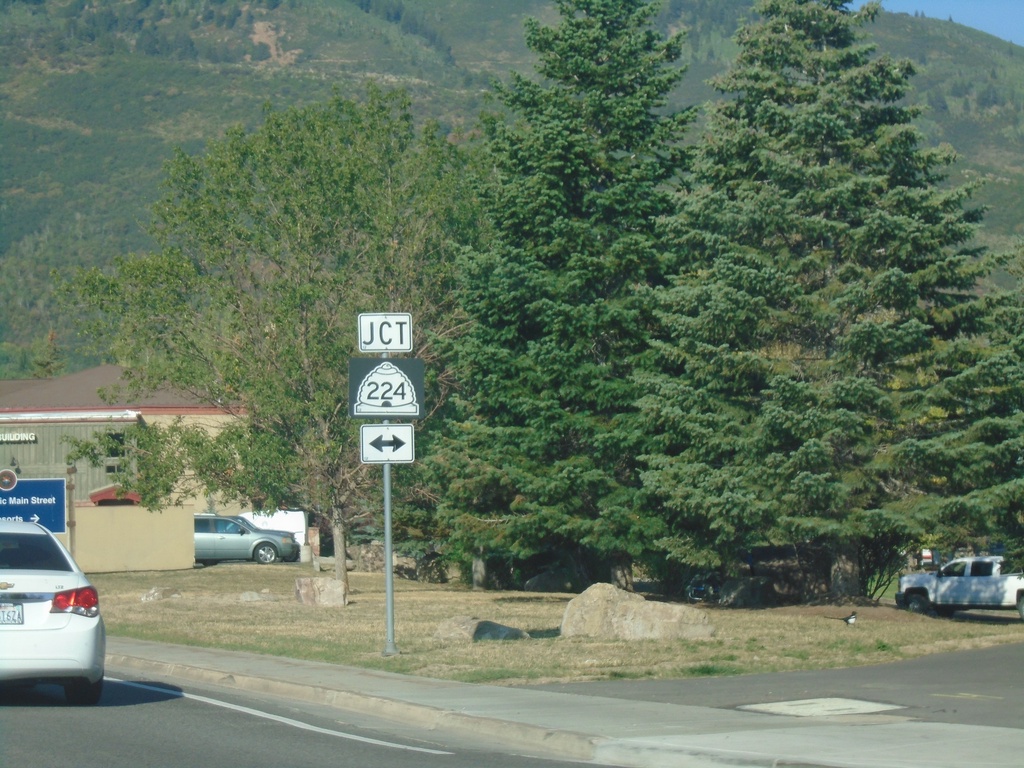
UT-248 West at UT-224 - Park City
UT-248 West (Kearns Blvd.) at UT-224 (Park Ave.) in Park City.
Taken 09-12-2022
 Park City
Summit County
Utah
United States
Park City
Summit County
Utah
United States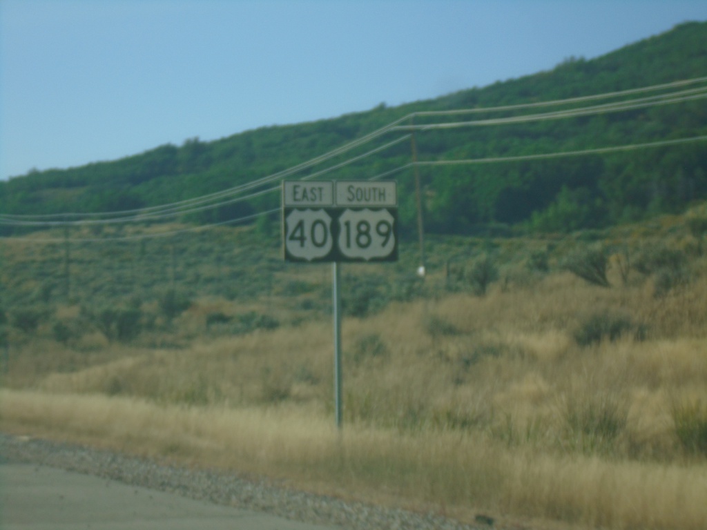
US-40 East/US-189 South - Summit County
US-40 East/US-189 South in Summit County
Taken 09-12-2022

 Park City
Summit County
Utah
United States
Park City
Summit County
Utah
United States