Signs Tagged With Shield
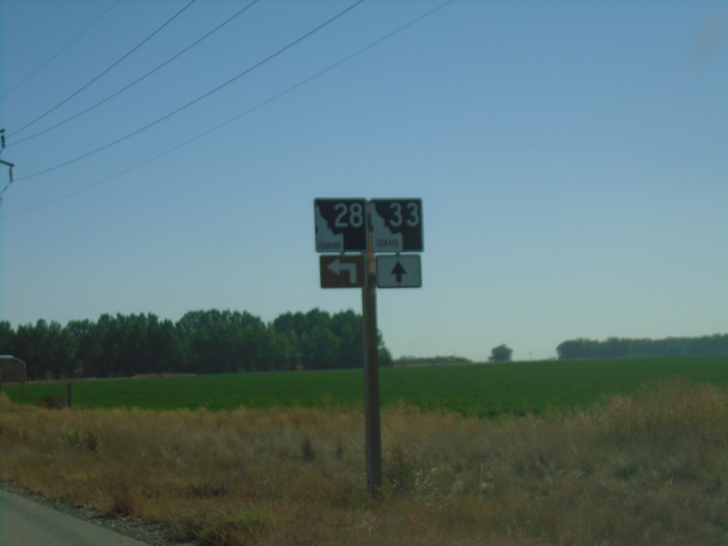
ID-33 East Approaching ID-28
ID-33 East approaching ID-28 in Jefferson County.
Taken 09-24-2021

 Mud Lake
Jefferson County
Idaho
United States
Mud Lake
Jefferson County
Idaho
United States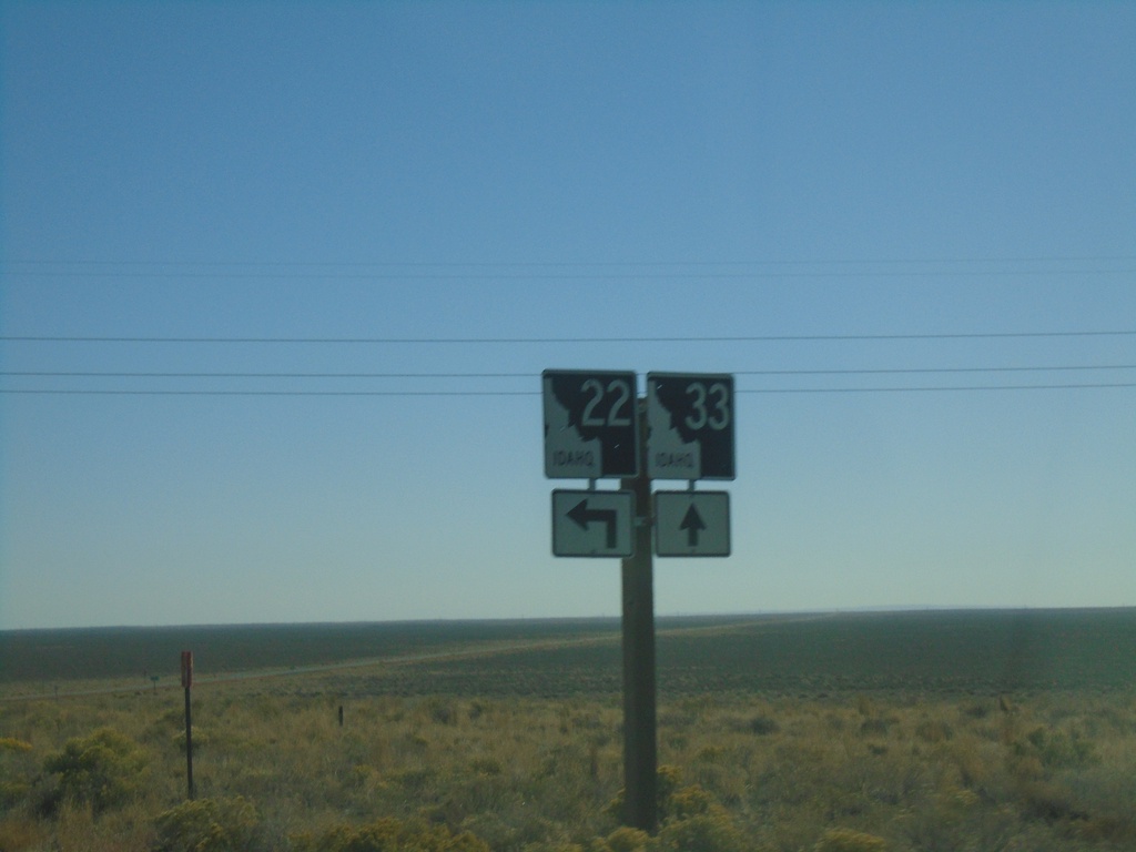
ID-33 East Approaching ID-22
ID-33 east approaching ID-22. Turn left for ID-22 east.
Taken 09-24-2021
 Berenice
Butte County
Idaho
United States
Berenice
Butte County
Idaho
United States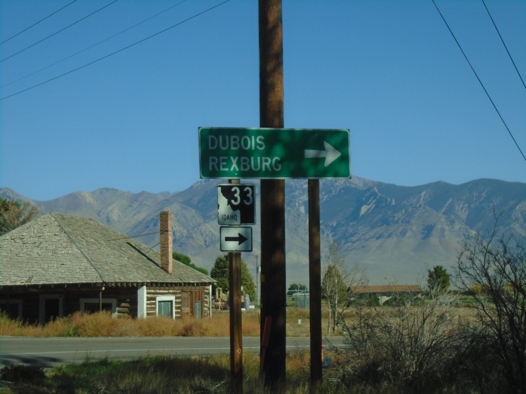
ID-33 East at Little Lost River Highway
ID-33 East at Little Lost River Highway in Howe. Turn right to continue east on ID-33 towards Dubois and Rexburg.
Taken 09-24-2021
Howe
Butte County
Idaho
United States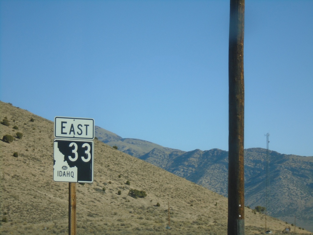
ID-33 East - Butte County
ID-33 east in Butte County. First route marker on ID-33 eastbound.
Taken 09-24-2021
Howe
Butte County
Idaho
United States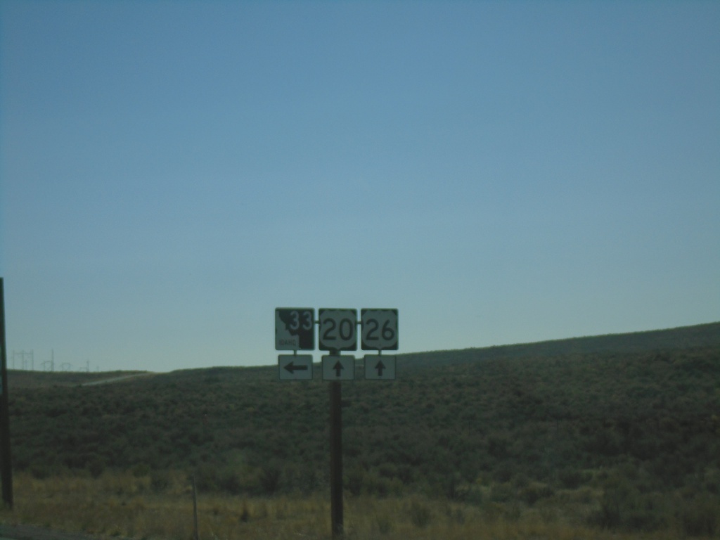
US-20/US-26 East at ID-33
US-20/US-26 East at ID-33 in Butte County.
Taken 09-24-2021

 Howe
Butte County
Idaho
United States
Howe
Butte County
Idaho
United States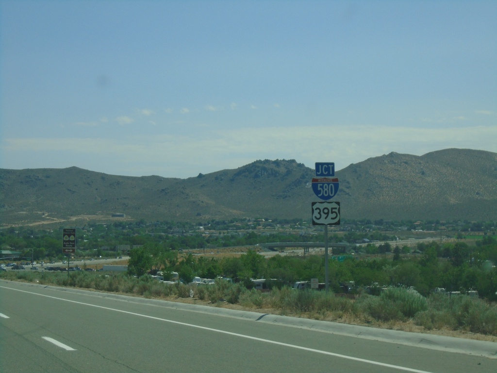
US-50 East Approaching I-580/US-395
US-50 East approaching I-580/US-395 in Carson City.
Taken 07-12-2021


 Carson City
Nevada
United States
Carson City
Nevada
United States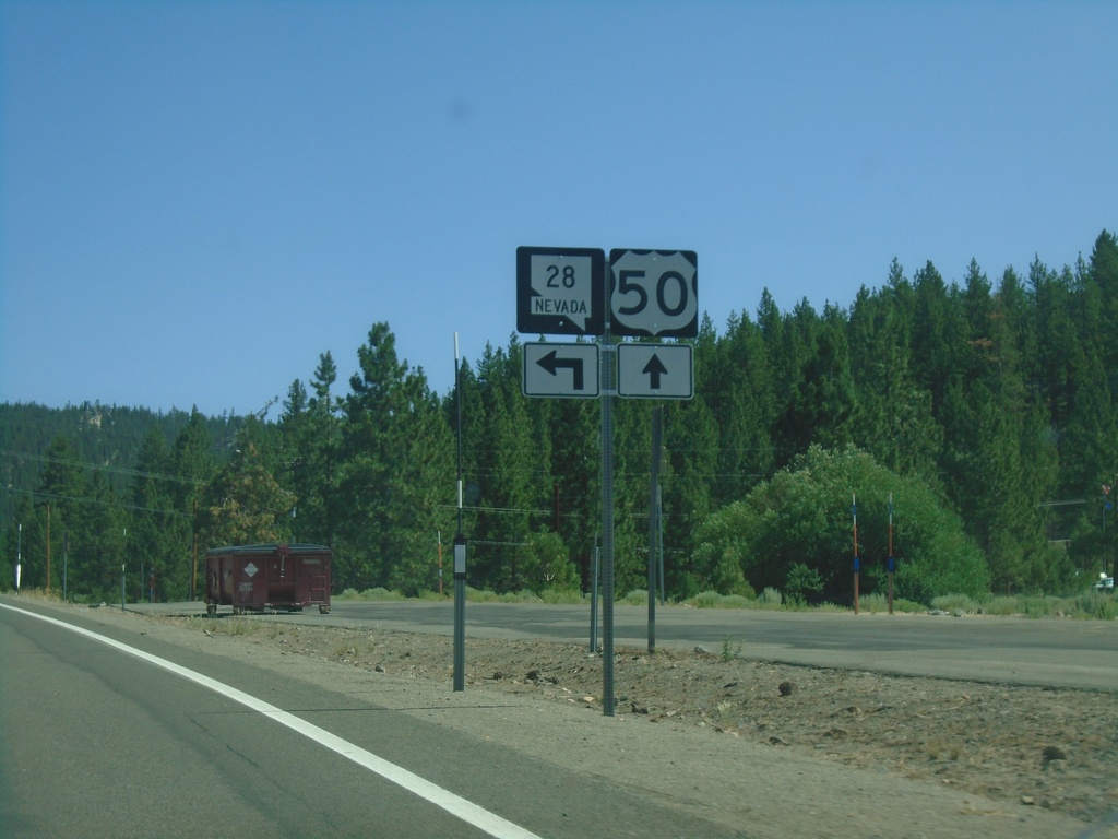
US-50 East at NV-28
US-50 East at NV-28 in Douglas County
Taken 07-12-2021
 Carson City
Douglas County
Nevada
United States
Carson City
Douglas County
Nevada
United States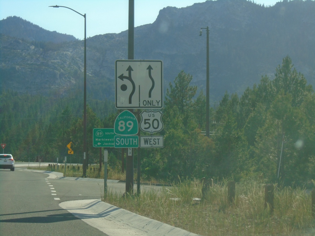
US-50 West/CA-89 South at US-50/CA-89 Split
US-50 West/CA-89 south at US-50/CA-89 split roundabout.
Taken 07-09-2021
 South Lake Tahoe
El Dorado County
California
United States
South Lake Tahoe
El Dorado County
California
United States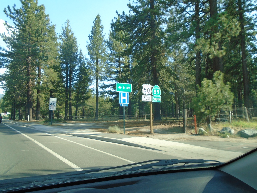
US-50 West/CA-89 South - South Lake Tahoe
US-50 West/CA-89 South in South Lake Tahoe at B St.
Taken 07-09-2021
South Lake Tahoe
El Dorado County
California
United States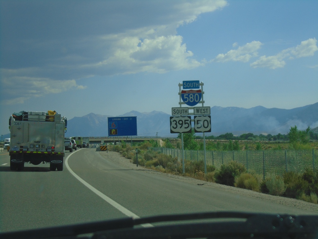
I-580/US-395 South/US-50 West - Carson City
I-580/US-395 South/US-50 West in Carson City
Taken 07-09-2021
Carson City
Nevada
United States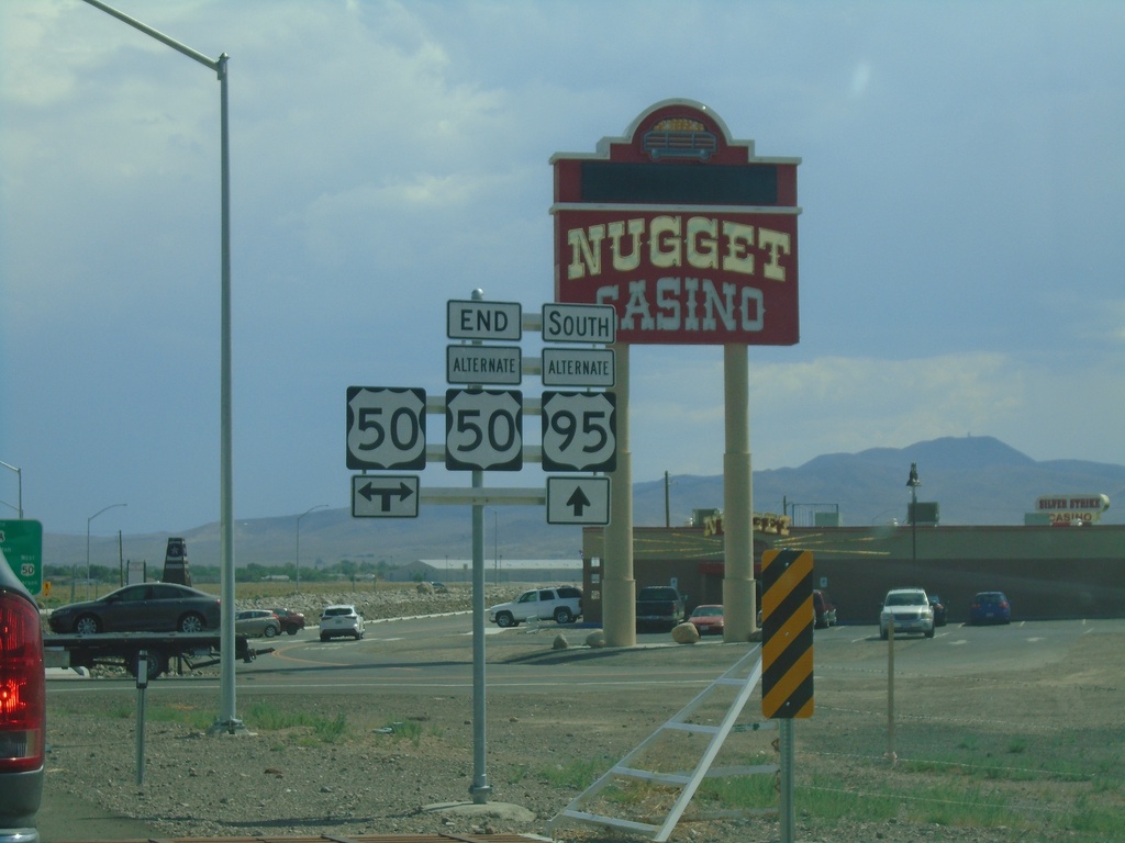
Alt. US-50 West/Alt. US-95 South at US-50
Alt. US-50 West/Alt. US-95 South at US-50. This is the western end of Alt. US-50. Normally the shields for the Alternate routes in Nevada do not spell out the text ALTERNATE - instead they usually read ALT.
Taken 07-09-2021

 Silver Springs
Lyon County
Nevada
United States
Silver Springs
Lyon County
Nevada
United States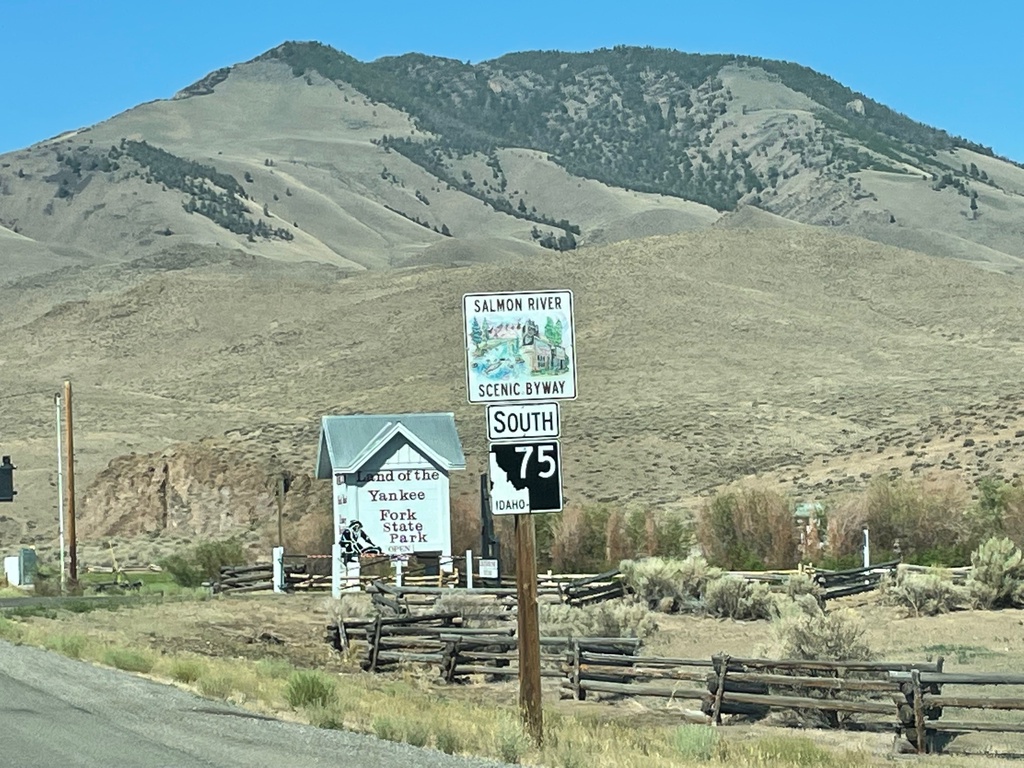
ID-75 South - Salmon River Scenic Byway
ID-75 South - Salmon River Scenic Byway in Custer County.
Taken 07-03-2021
 Challis
Custer County
Idaho
United States
Challis
Custer County
Idaho
United States
US-93 South at ID-75
US-93 South at ID-75 in Custer County
Taken 07-03-2021
 Challis
Custer County
Idaho
United States
Challis
Custer County
Idaho
United States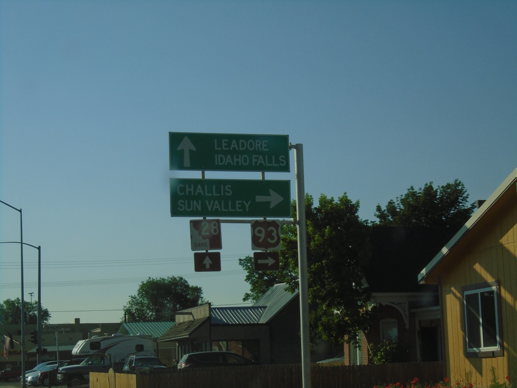
US-93 South at ID-28
US-93 south at ID-28 in Salmon. Turn right to continue south on US-93 to Challis and Sun Valley. Continue straight on Main St. for ID-28 South to Leadore and Idaho Falls.
Taken 07-03-2021
Salmon
Lemhi County
Idaho
United States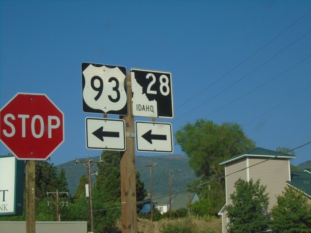
US-93 South/To ID-28 - Main St. Jct.
US-93 South/To ID-28 at Main St. in Salmon. Turn left on Main St. to continue south on US-93 and for ID-28.
Taken 07-03-2021
Salmon
Lemhi County
Idaho
United States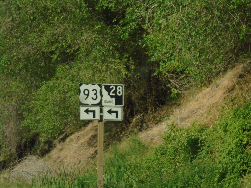
US-93 South/To ID-28 - Salmon
US-93 South/To ID-28 at Main St. in Salmon
Taken 07-03-2021
Salmon
Lemhi County
Idaho
United States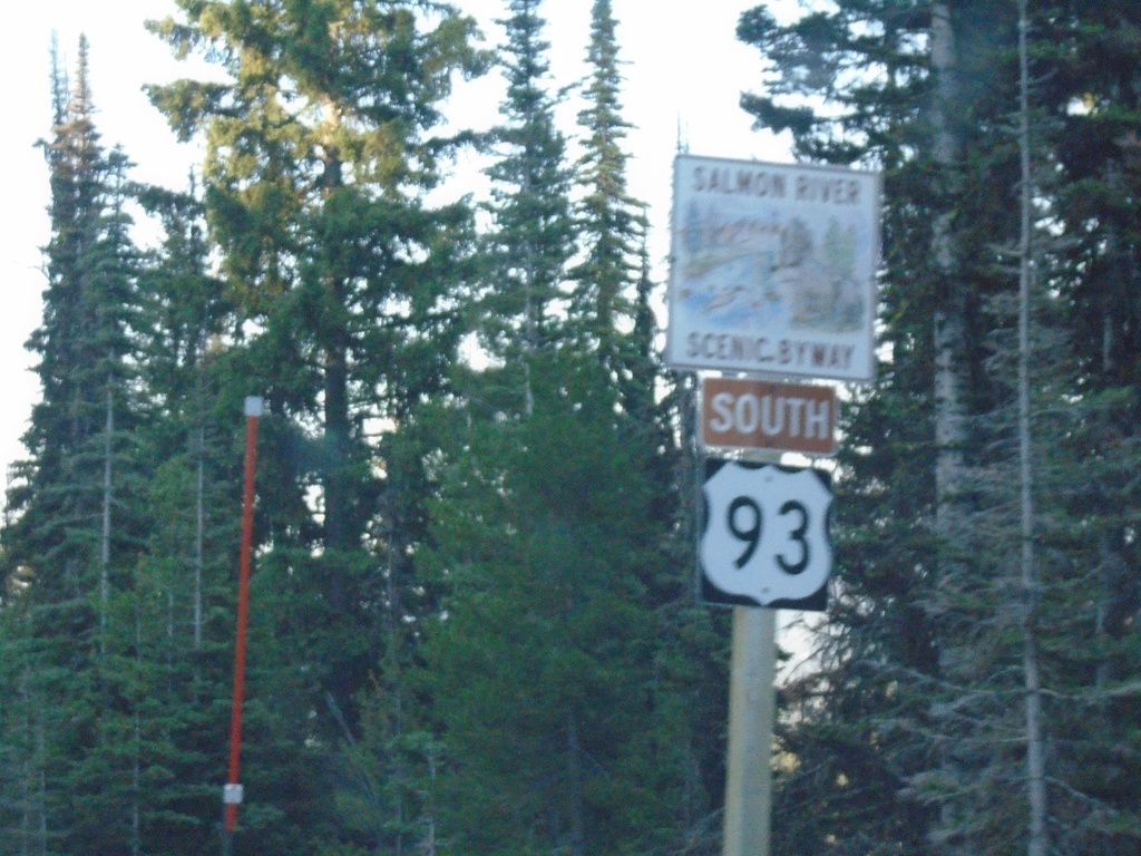
US-93 South - Salmon River Scenic Byway
US-93 South - Salmon River Scenic Byway in Lemhi County.
Taken 07-03-2021
Gibbonsville
Lemhi County
Idaho
United States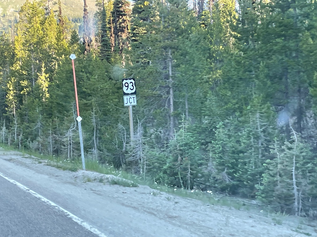
MT-43 West Approaching US-93
MT-43 West approaching US-93. This small stretch of MT-43 between Chief Joseph Pass and Lost Trail Pass is actually in Idaho. There are no markers or other signs that indicate this stretch of highway is in Idaho.
Taken 07-03-2021
 Gibbonsville
Lemhi County
Idaho
United States
Gibbonsville
Lemhi County
Idaho
United States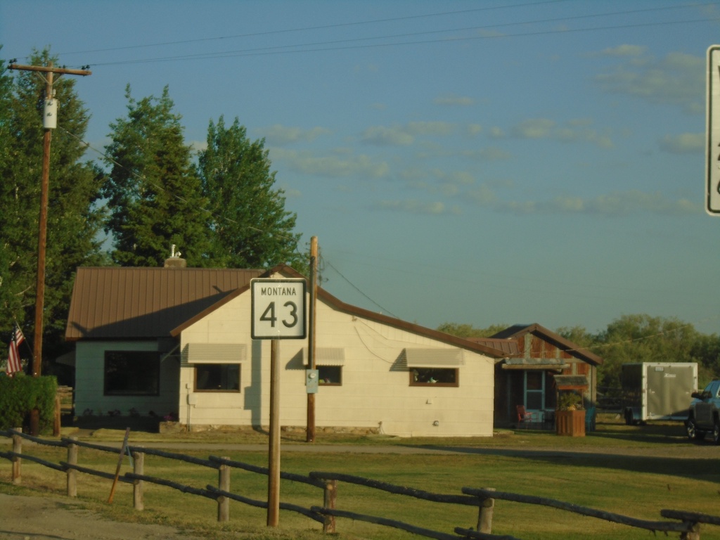
MT-43 West - Wisdom
MT-43 west in Wisdom
Taken 07-03-2021
Wisdom
Beaverhead County
Montana
United States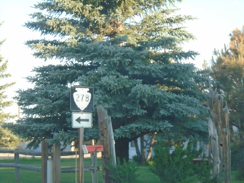
MT-43 West Approaching MTS-278
MT-43 West Approaching MTS-278 in Wisdom.
Taken 07-03-2021
 Wisdom
Beaverhead County
Montana
United States
Wisdom
Beaverhead County
Montana
United States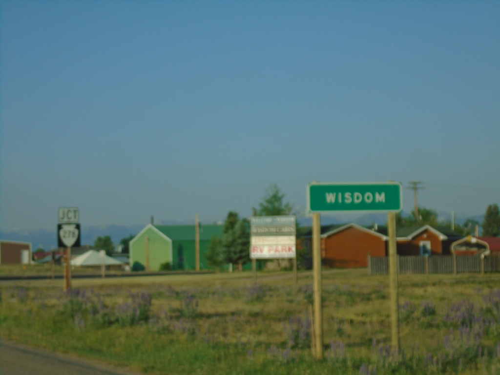
MT-43 West - Entering Wisdom and Approaching MTS-278
Entering Wisdom and approaching MTS-278 on MT-43 west.
Taken 07-03-2021
Wisdom
Beaverhead County
Montana
United States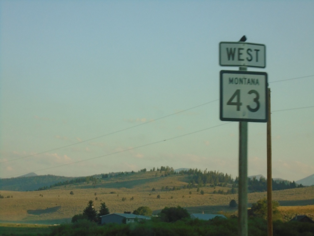
MT-43 West - Deer Lodge County
MT-43 west in Deer Lodge County
Taken 07-03-2021
Wise River
Deer Lodge County
Montana
United States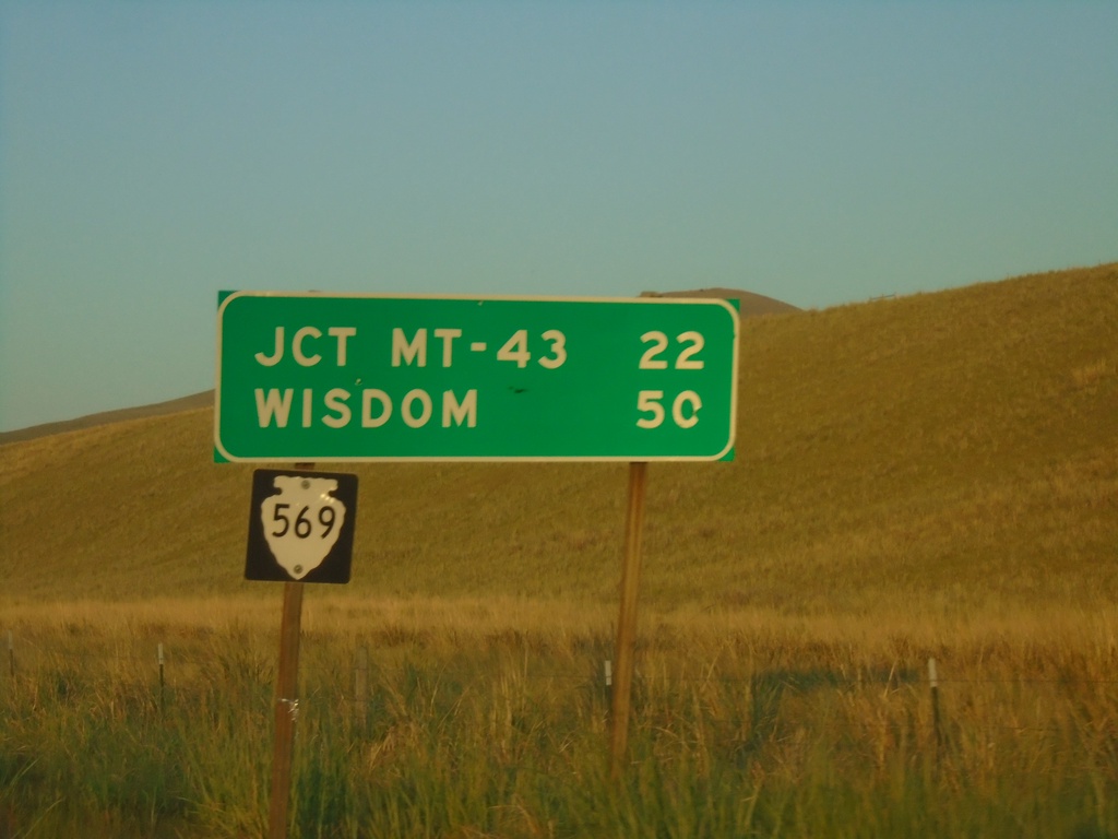
MTS-569 South - Distance Marker
Distance marker on MTS-569 south. Distance to Jct. MT-43 and Wisdom.
Taken 07-03-2021
 Anaconda
Deer Lodge County
Montana
United States
Anaconda
Deer Lodge County
Montana
United States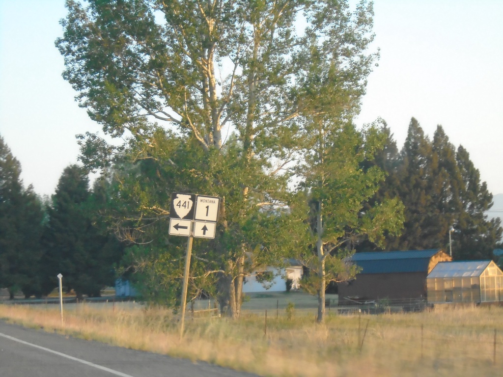
MT-1 West at MTS-441
MT-1 west at MT-441 in Deer Lodge County
Taken 07-03-2021

 Anaconda
Deer Lodge County
Montana
United States
Anaconda
Deer Lodge County
Montana
United States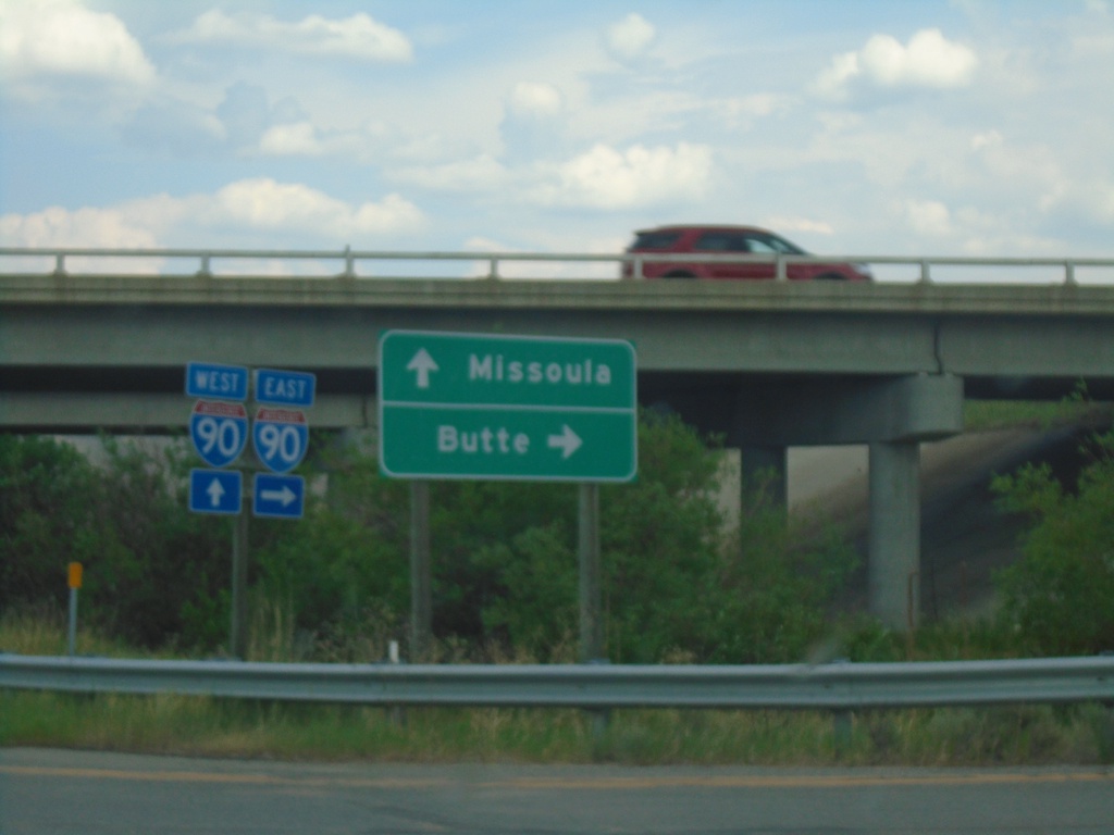
End MT-48 at I-90
End MT-48 at I-90 (Exit 201). Use I-90 East to Butte; I-90 West to Missoula.
Taken 07-02-2021

 Anaconda
Deer Lodge County
Montana
United States
Anaconda
Deer Lodge County
Montana
United States