Signs Tagged With Shield
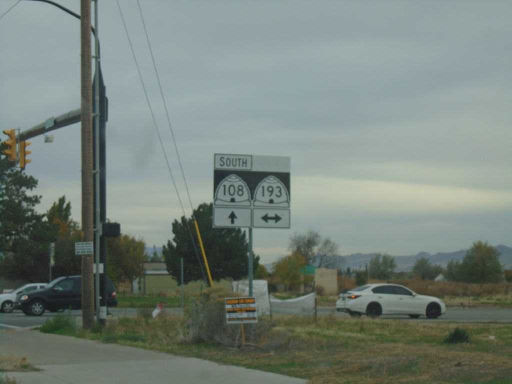
UT-108 South at UT-193
UT-108 South (N 2000 W) at UT-193 in Syracuse.
Taken 10-25-2025

 Syracuse
Davis County
Utah
United States
Syracuse
Davis County
Utah
United States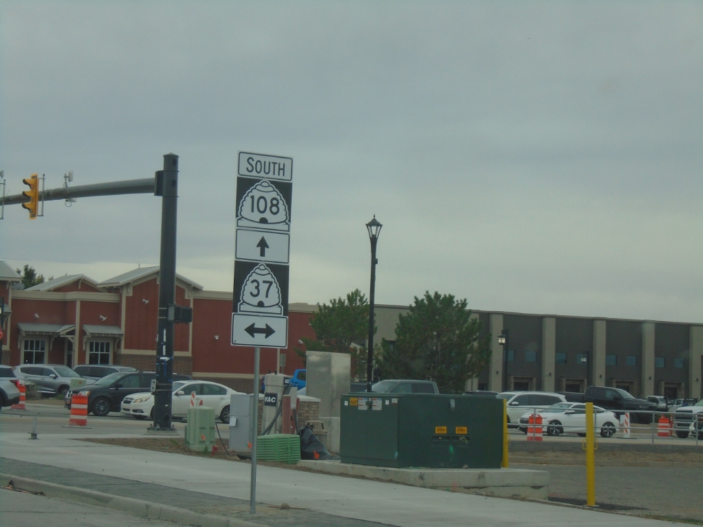
UT-108 South at UT-37
UT-108 South (N 2000 W) at UT-37 (W 1800 N) in Clinton.
Taken 10-25-2025
 Clearfield
Davis County
Utah
United States
Clearfield
Davis County
Utah
United States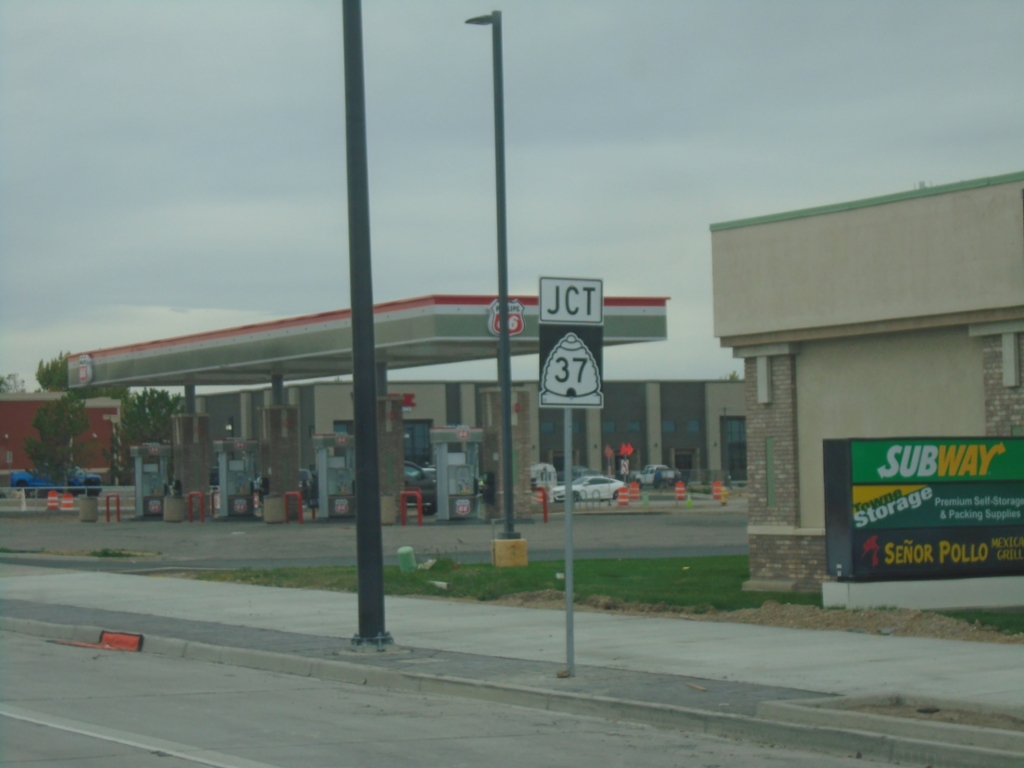
UT-108 South Approaching UT-37
UT-108 South approaching UT-37 in Clinton.
Taken 10-25-2025
Clearfield
Davis County
Utah
United States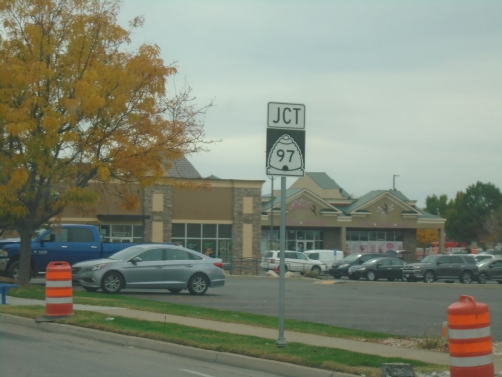
UT-108 South Approaching UT-97 - Roy
UT-108 South (S 3600 W) approaching UT-97 (5600 S) in Roy.
Taken 10-25-2025
 Roy
Weber County
Utah
United States
Roy
Weber County
Utah
United States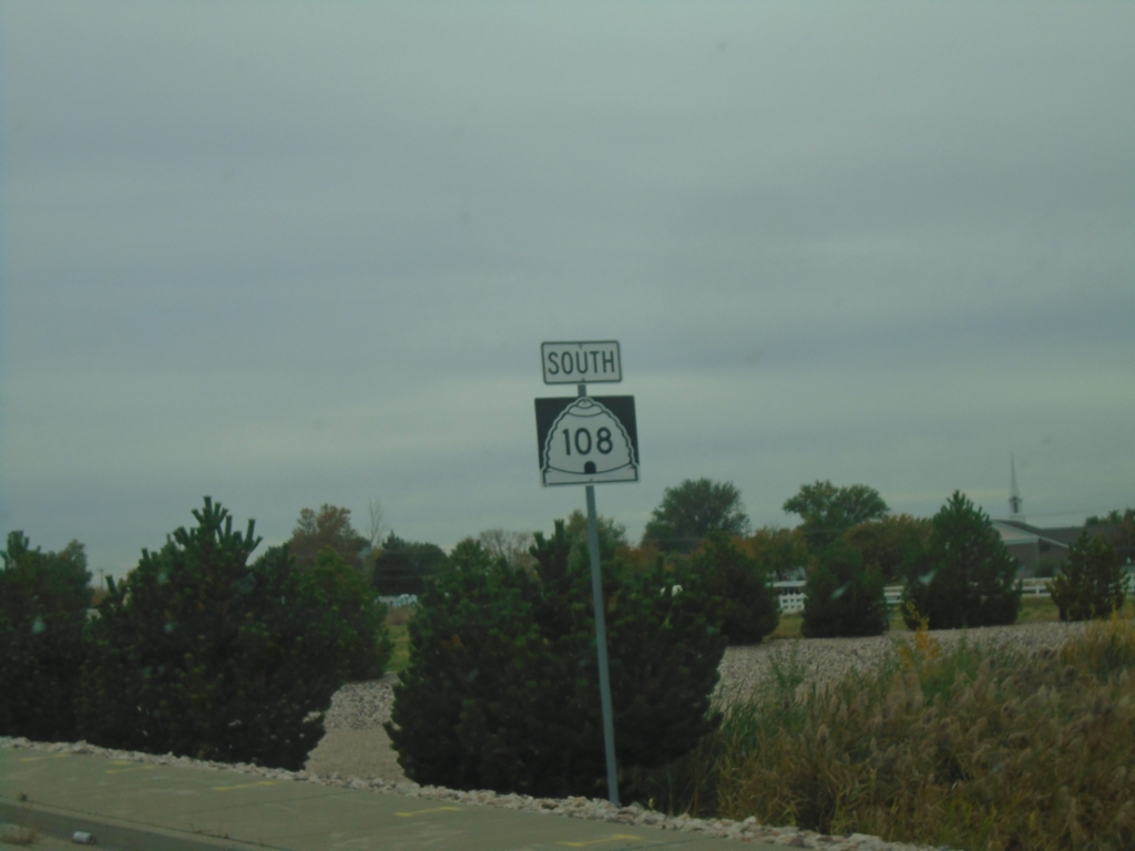
UT-108 South - West Haven
UT-108 South (Midland Drive) in West Haven
Taken 10-25-2025
West Haven
Weber County
Utah
United States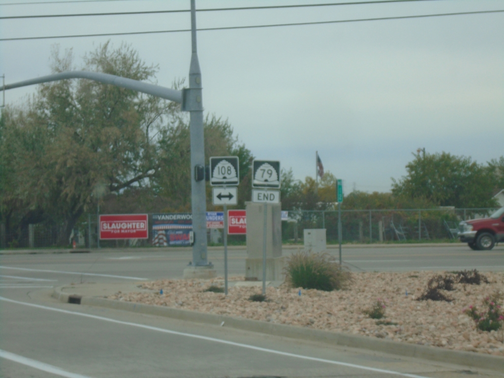
End UT-79 West at UT-108
End UT-79 West (Hinckley Drive) at UT-108 (Midland Drive) in Roy.
Taken 10-25-2025
 Roy
Weber County
Utah
United States
Roy
Weber County
Utah
United States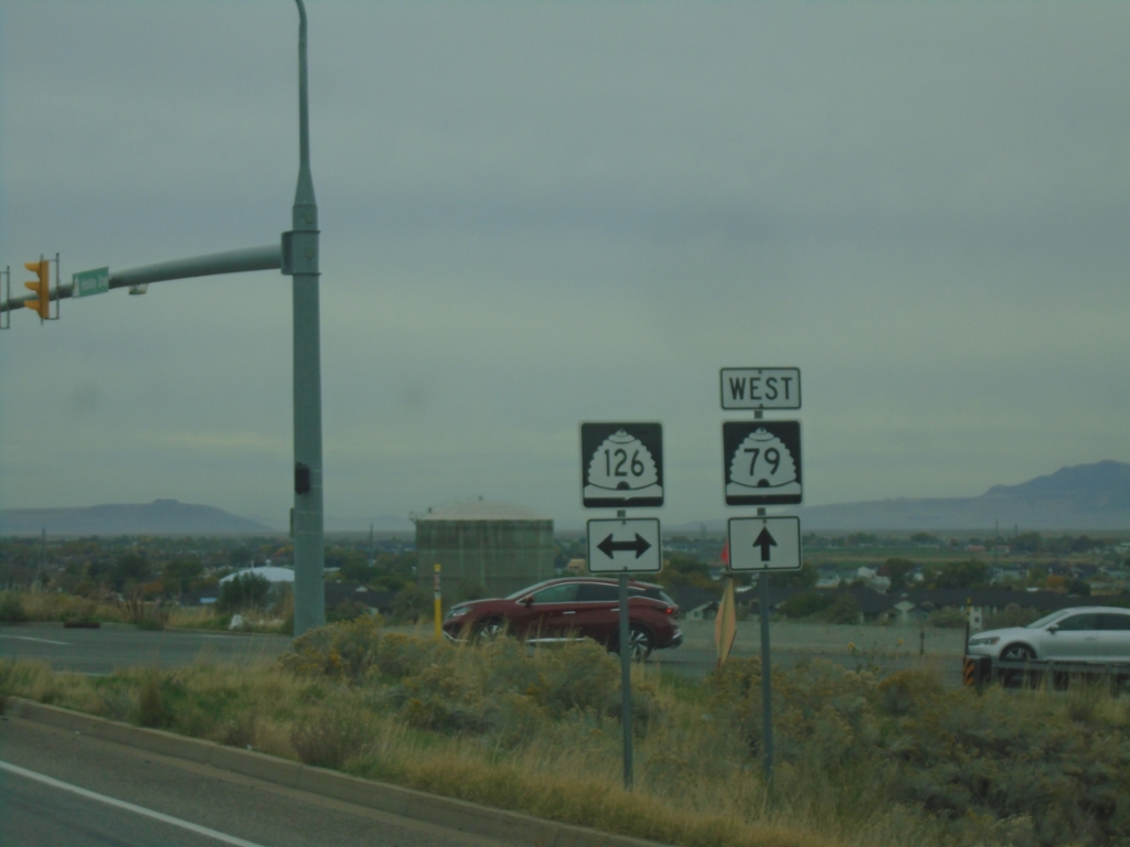
UT-79 West at UT-126 - Roy
UT-79 West at UT-126 in Roy.
Taken 10-25-2025
 Roy
Weber County
Utah
United States
Roy
Weber County
Utah
United States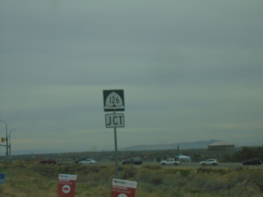
UT-79 West Approaching UT-126
UT-79 West (Hinckley Drive) Approaching UT-126 (South 1900 West) in Roy.
Taken 10-25-2025
Roy
Weber County
Utah
United States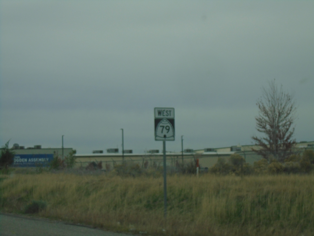
UT-79 West - Ogden
UT-79 (Hinkley Drive) West in Ogden.
Taken 10-25-2025
Ogden
Weber
Utah
United States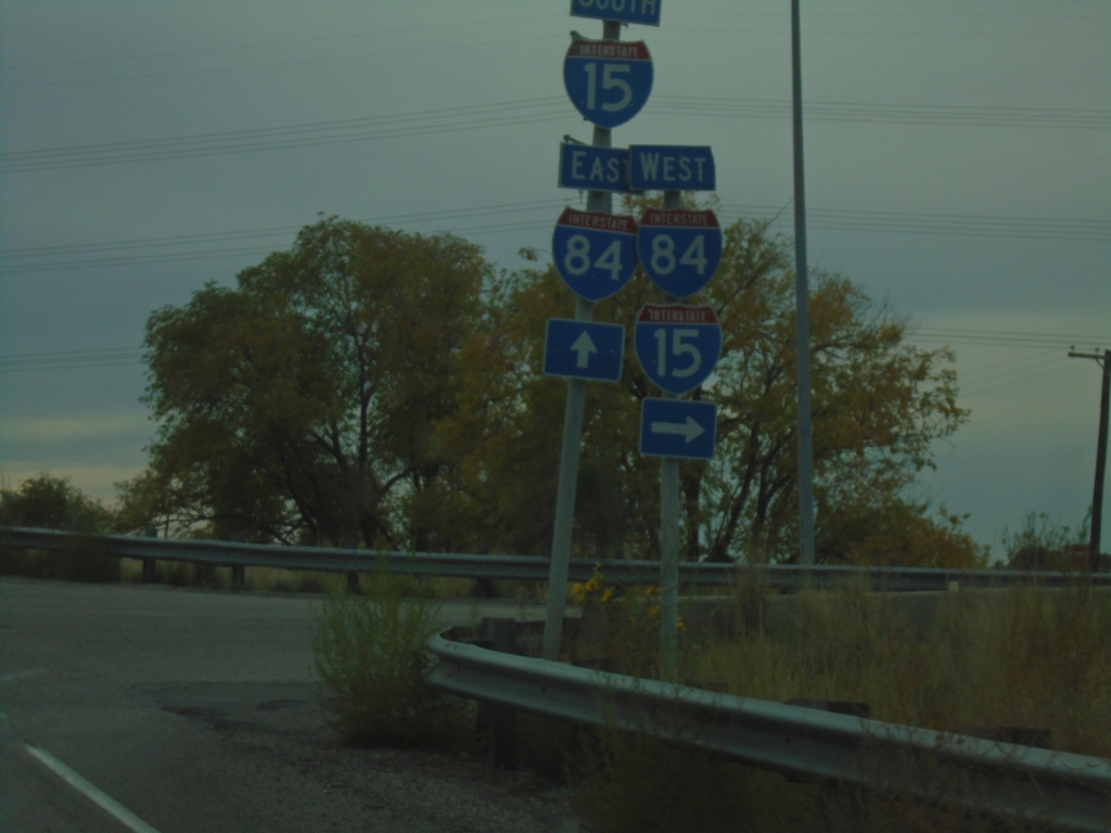
UT-13 South at I-15 North/I-84 West - Exit 376
UT-13 South at I-15 North/I-84 West (Exit 376) onramp.
Taken 10-25-2025


 Elwood
Box Elder County
Utah
United States
Elwood
Box Elder County
Utah
United States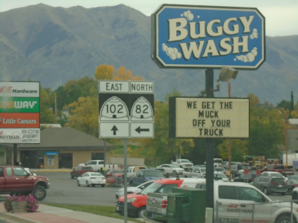
UT-102 East at UT-82 North
UT-102 East (Main St.) at UT-82 North (N 3rd East) in Tremonton.
Taken 10-25-2025

 Tremonton
Box Elder County
Utah
United States
Tremonton
Box Elder County
Utah
United States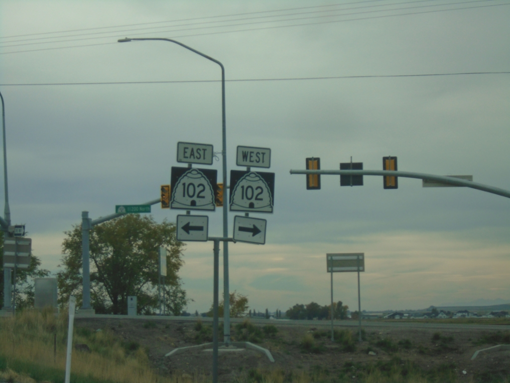
I-84 Exit 40 Offramp at UT-102
I-84 Exit 40 Offramp at UT-102 (W 11200 North) in Tremonton.
Taken 10-25-2025
Tremonton
Box Elder County
Utah
United States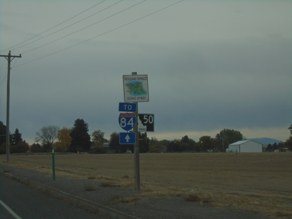
ID-50 - Twin Falls County
ID-50/To I-84 in Twin Falls County. ID-50 is part of the Thousand Springs Scenic Byway.
Taken 10-25-2025
 Kimberly
Twin Falls County
Idaho
United States
Kimberly
Twin Falls County
Idaho
United States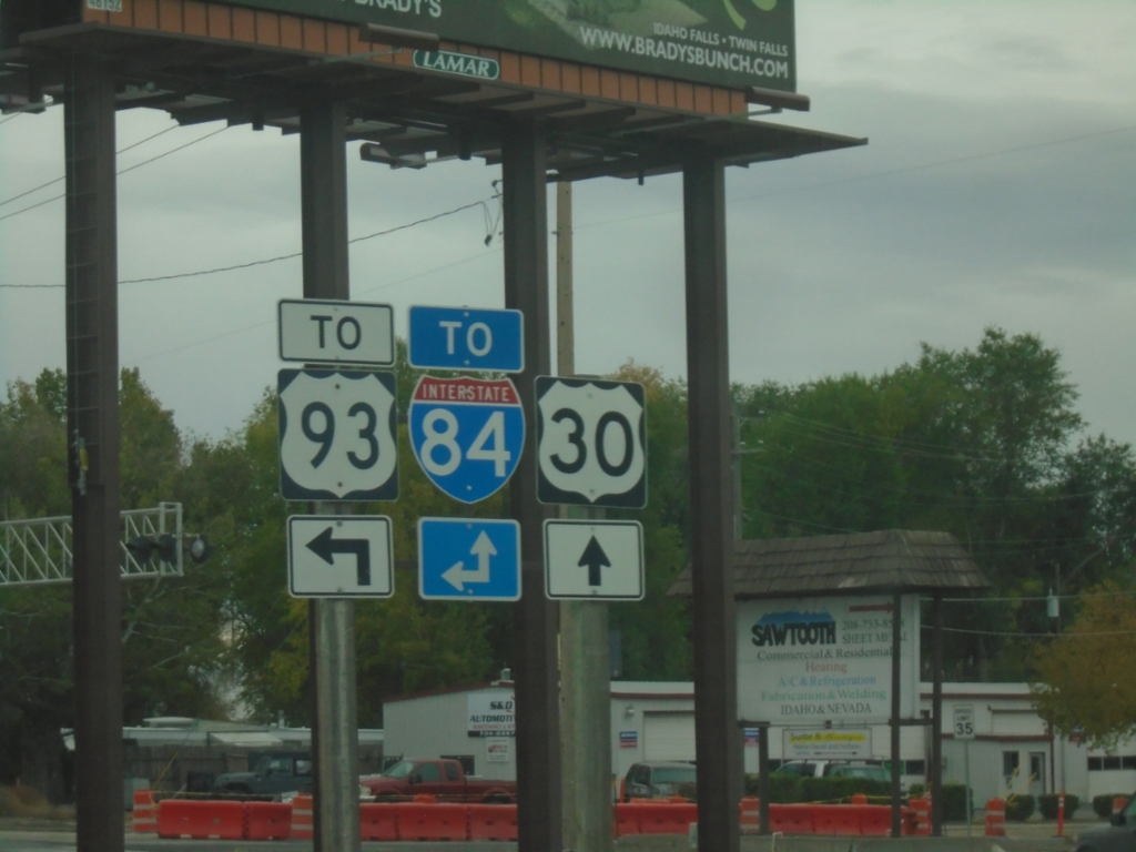
US-30 East at Blue Lakes Blvd.
US-30 East at Blue Lakes Blvd. in Twin Falls. Use Blue Lakes Blvd. north to US-93 and I-84. Continue east on US-30 (Kimberly Road) to I-84.
Taken 10-25-2025

 Twin Falls
 County
Idaho
United States
Twin Falls
Twin Falls County
Idaho
United States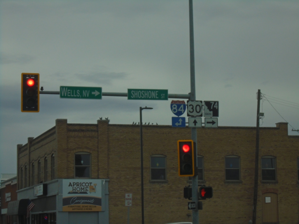
US-30 East at ID-74 - Twin Falls
US-30 East at ID-74 in Twin Falls. Turn right on Shoshone St. for ID-74 South to Wells, Nev. Continue straight on US-30 or north on Shoshone St. for I-84 access.
Taken 10-25-2025
 Twin Falls
 County
Idaho
United States
Twin Falls
Twin Falls County
Idaho
United States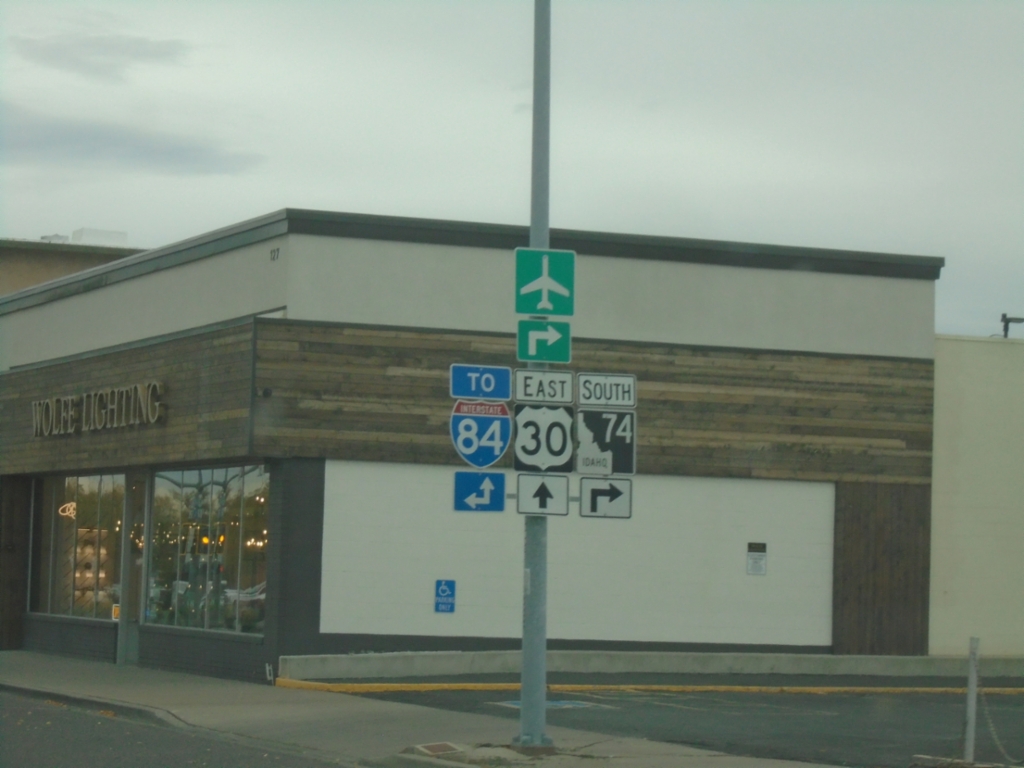
US-30 East at ID-74
US-30 East (2nd Ave West) at ID-74 South (Shoshone St.). Use Shoshone St. North or continue on US-30 east for I-84 access.
Taken 10-25-2025
Twin Falls
Twin Falls County
Idaho
United States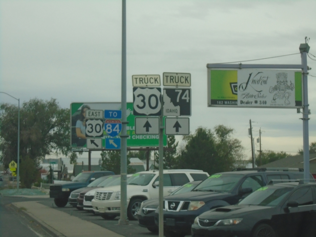
US-30 East/To I-84 - Twin Falls
Merge left on 2nd Ave West to continue on US-30/To I-84. Continue south on Washington St. for US-30 truck route and truck route to ID-74.
Taken 10-25-2025
Twin Falls
Twin Falls County
Idaho
United States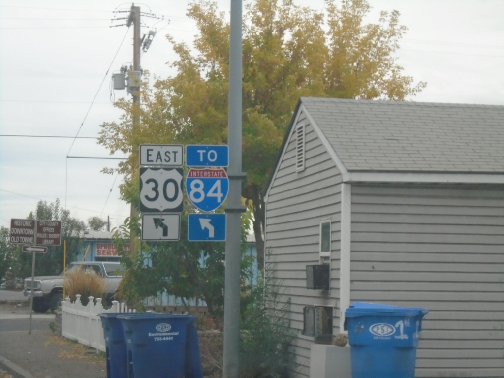
US-30 East/To I-84 - Twin Falls
US-30 East/To I-84 (Washington St. South) at 2nd Ave. W.
Taken 10-25-2025
Twin Falls
Twin Falls County
Idaho
United States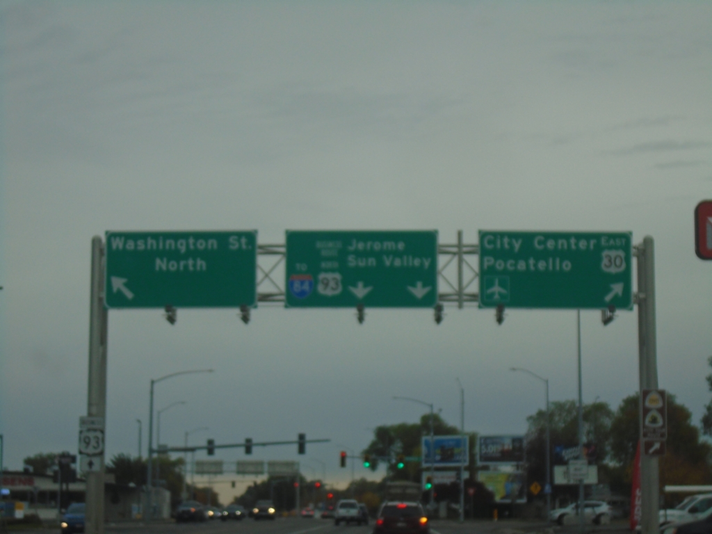
US-30 East/Bus. US-93 North Split - Twin Falls
US-30 East/Bus. US-93 North Split in Twin Falls. Turn right to continue east on US-30 to (Twin Falls) City Center and Pocatello. Continue straight for Bus. US-93/To I-84/Jerome/Sun Valley. Turn left for Washington St. North.
Taken 10-25-2025
 Twin Falls
 County
Idaho
United States
Twin Falls
Twin Falls County
Idaho
United States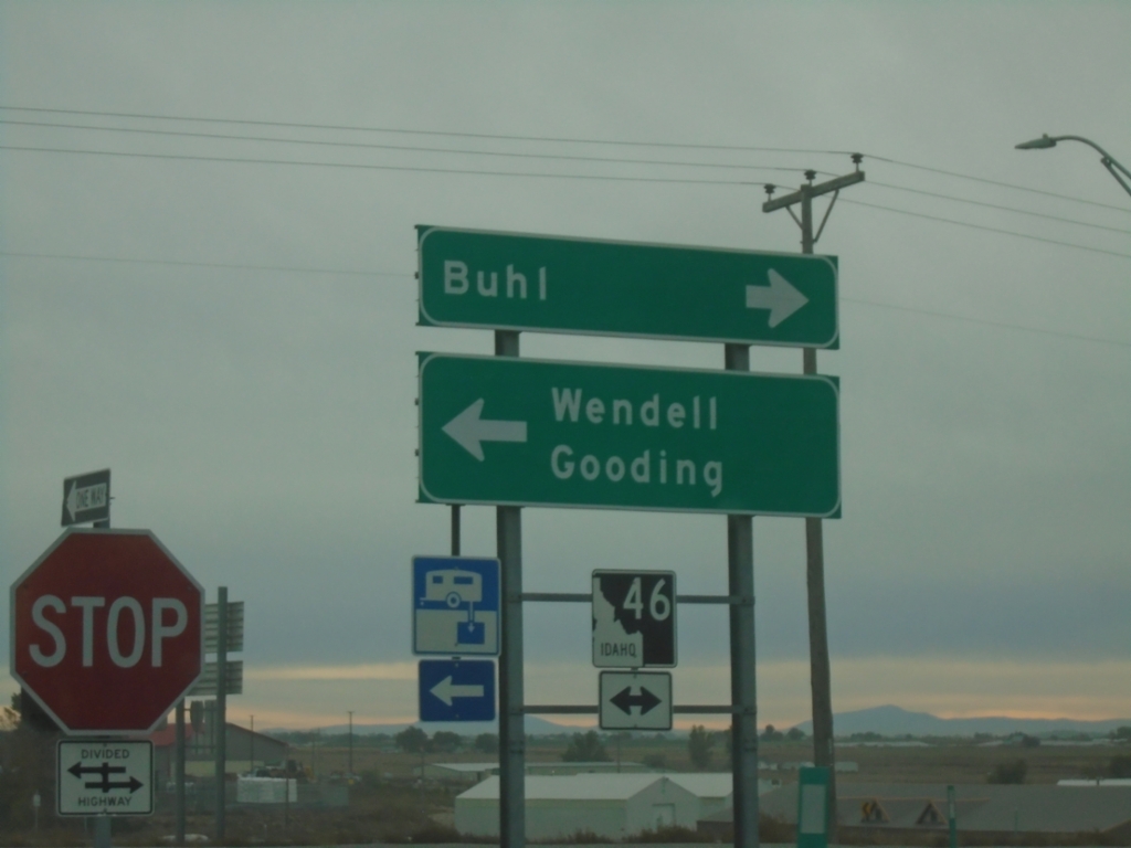
I-84 East at ID-46
I-84 East at ID-46 in Wendell. Use ID-46 north to Wendell and Gooding; ID-46 south to Buhl.
Taken 10-25-2025
 Wendell
Gooding County
Idaho
United States
Wendell
Gooding County
Idaho
United States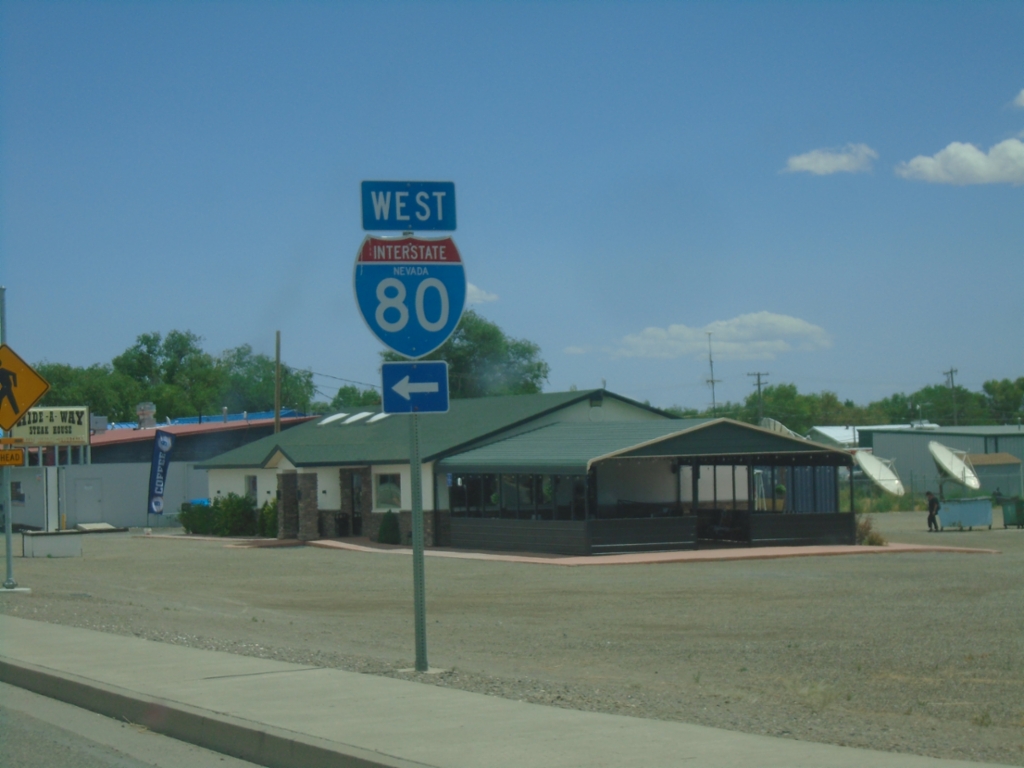
NV-305 North at I-80 West
NV-305 North at I-80 West in Battle Mountain.
Taken 07-22-2025

 Battle Mountain
Lander County
Nevada
United States
Battle Mountain
Lander County
Nevada
United States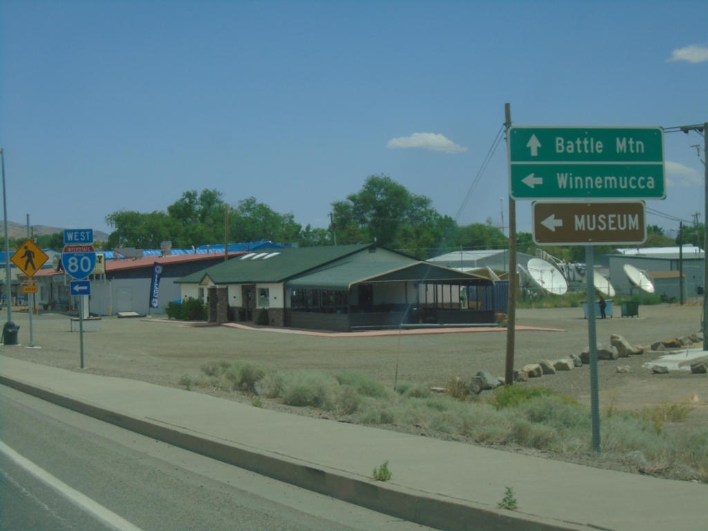
NV-305 North at I-80 West
NV-305 North at I-80 West (Exit 231). Use I-80 west for Winnemucca. Continue north on NV-305 for Battle Mountain.
Taken 07-22-2025
Battle Mountain
Lander County
Nevada
United States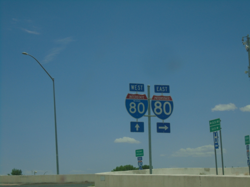
NV-305 North at I-80 - Battle Mountain
NV-305 North at I-80 in Battle Mountain.
Taken 07-22-2025
Battle Mountain
Lander County
Nevada
United States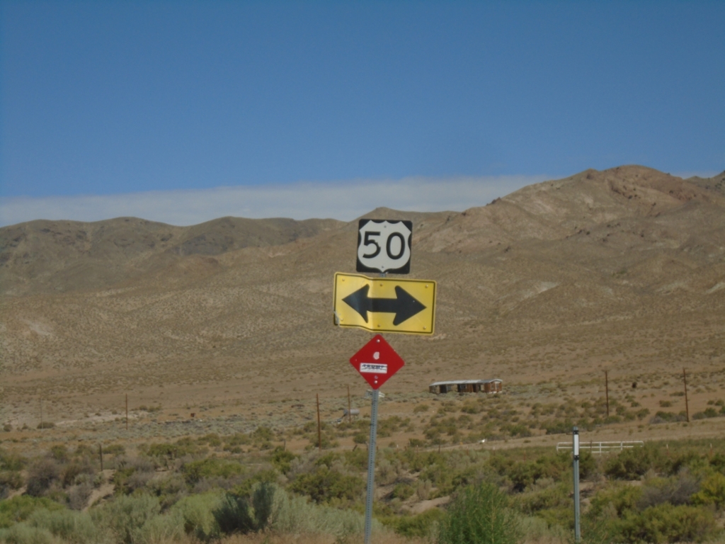
End NV-361 North at US-50 - Middlegate Junction
End NV-361 North at US-50 - Middlegate Junction
Taken 07-22-2025

 Middlegate
Churchill County
Nevada
United States
Middlegate
Churchill County
Nevada
United States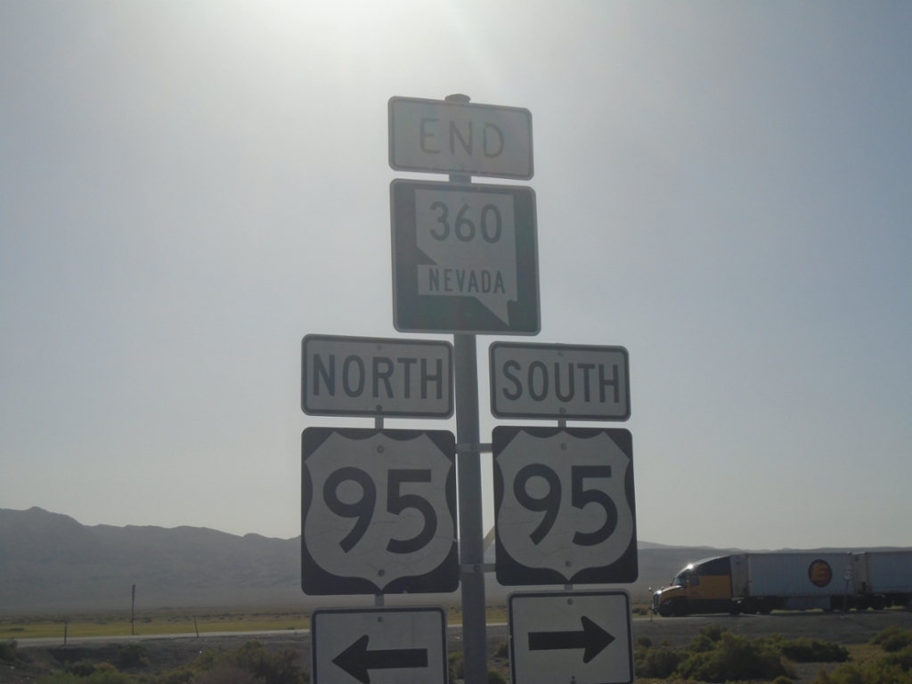
End NV-360 North at US-95
End NV-360 North at US-95 in Mineral County.
Taken 07-22-2025

 Mina
Mineral County
Nevada
United States
Mina
Mineral County
Nevada
United States