Signs Tagged With Shield
US-64 East at NM-38
US-64 East at NM-38 in Eagle Nest.
Taken 06-19-2026

 Eagle Nest
Colfax County
New Mexico
United States
Eagle Nest
Colfax County
New Mexico
United States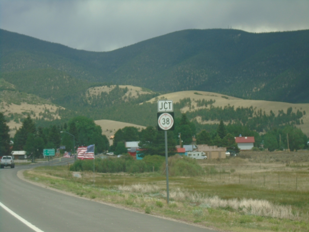
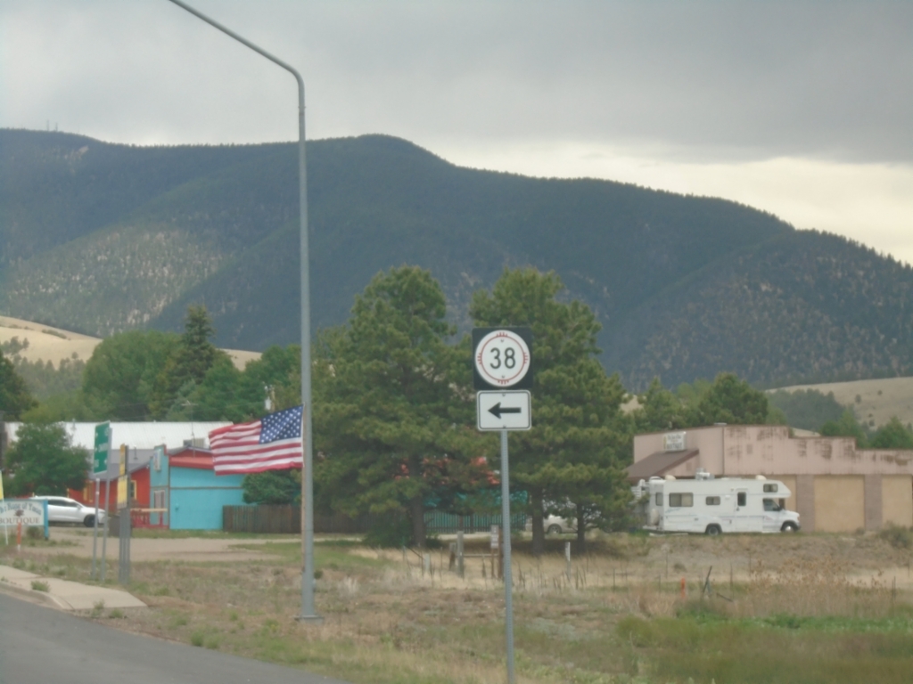
US-64 East Approaching NM-38
US-64 East approaching NM-38 in Eagle Nest.
Taken 06-19-2026
Eagle Nest
Colfax County
New Mexico
United States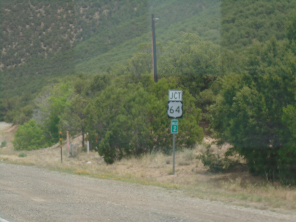
NM-585 East Approaching US-64
NM-585 East (Paseo Del Cañon East) approaching US-64 in Taos.
Taken 06-19-2026
 Taos
Taos County
New Mexico
United States
Taos
Taos County
New Mexico
United States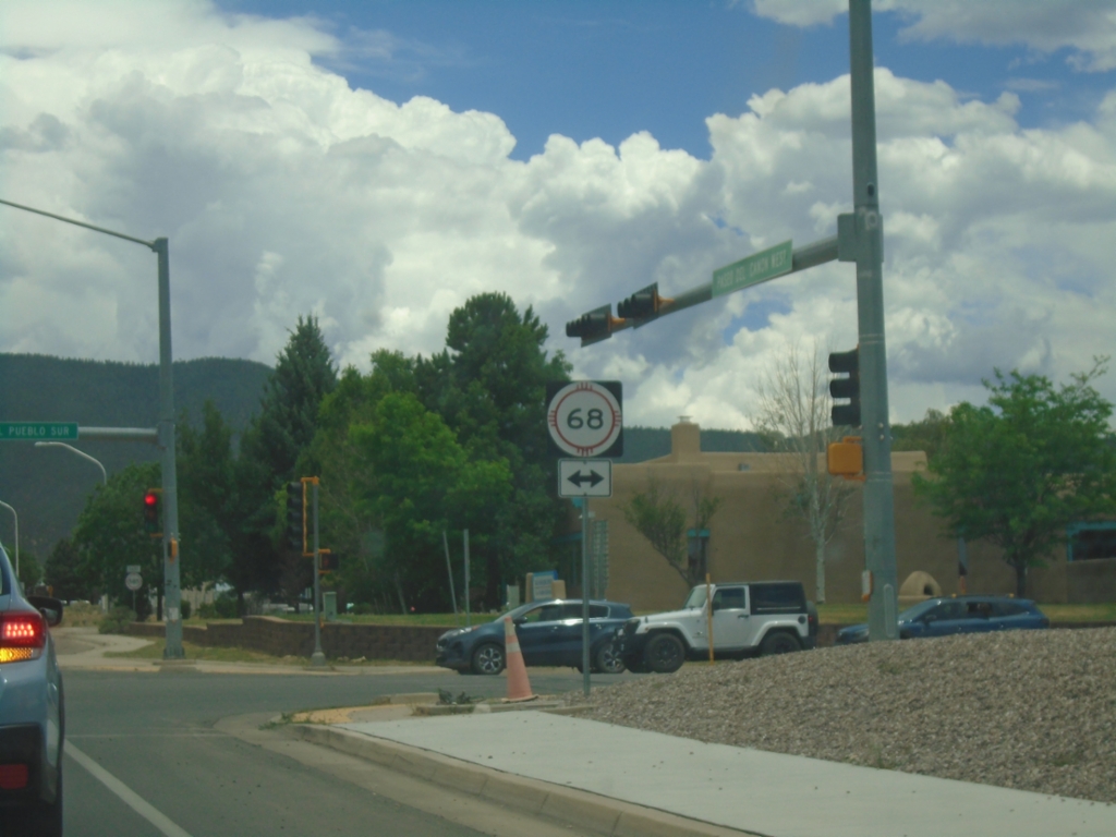
Paseo Del Cañon East at NM-68
Paseo Del Cañon East at NM-68 (Paseo Del Pueblo Sur) in Taos. Continue straight for NM-585/Paseo Del Cañon West.
Taken 06-19-2026
 Taos
Taos County
New Mexico
United States
Taos
Taos County
New Mexico
United States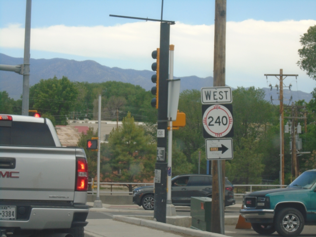
NM-68 South at NM-240 West
NM-68 South (Paseo Del Pueblo Sur) at NM-240 West (Camino De La Placita) in Taos.
Taken 06-19-2026
 Taos
Taos County
New Mexico
United States
Taos
Taos County
New Mexico
United States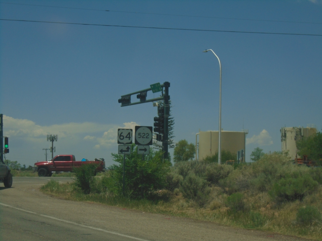
NM-150 South at US-64/NM-522
NM-150 South at US-64/NM-522 in El Prado.
Taken 06-19-2026

 Taos County
New Mexico
United States
Taos County
New Mexico
United States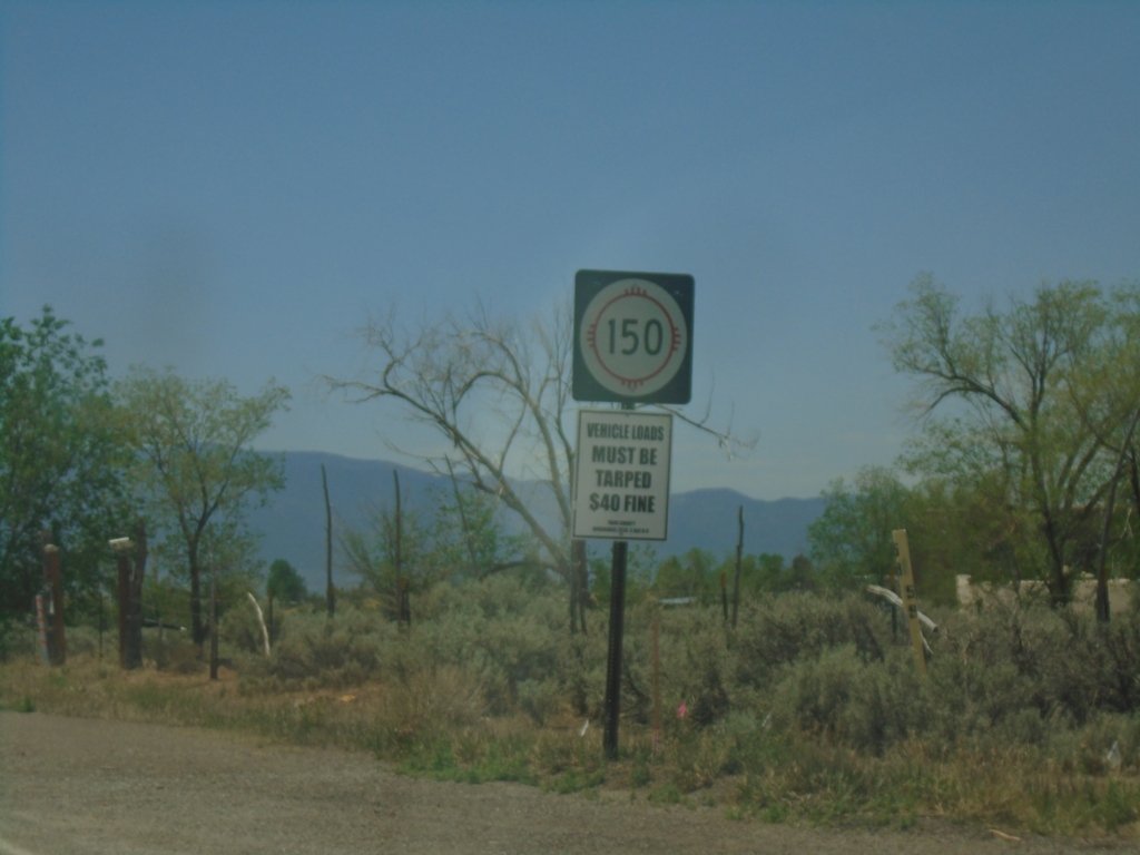
NM-150 South - Taos County
NM-150 South in Taos County
Taken 06-19-2026
Taos Pueblo
Taos County
New Mexico
United States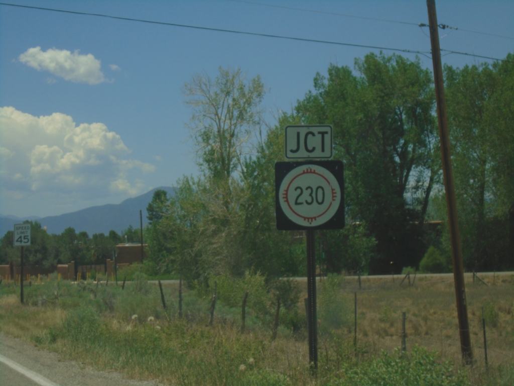
NM-150 South Approaching NM-230
NM-150 South approaching NM-230 in Taos County.
Taken 06-19-2026
 Taos Pueblo
Taos County
New Mexico
United States
Taos Pueblo
Taos County
New Mexico
United States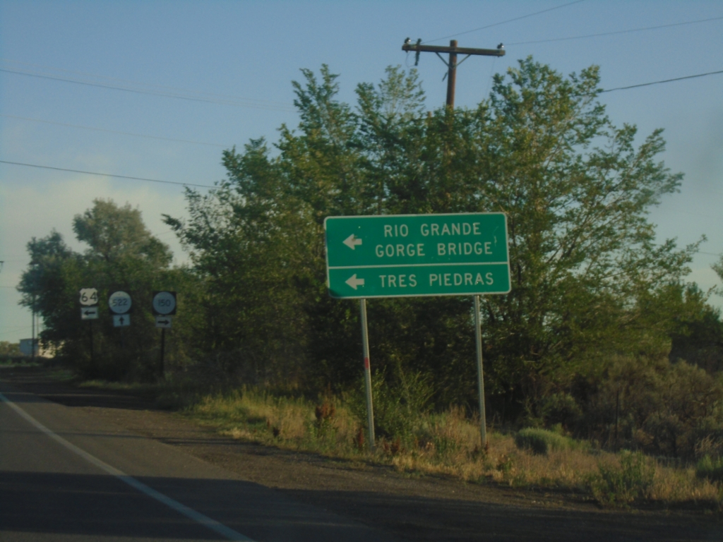
US-64 West at NM-150/NM-522
US-64 west at NM-150/NM-522 junction. Use US-64 for Tres Piedras and Rio Grande Gorge Bridge.
Taken 06-19-2026
El Prado
Taos County
New Mexico
United States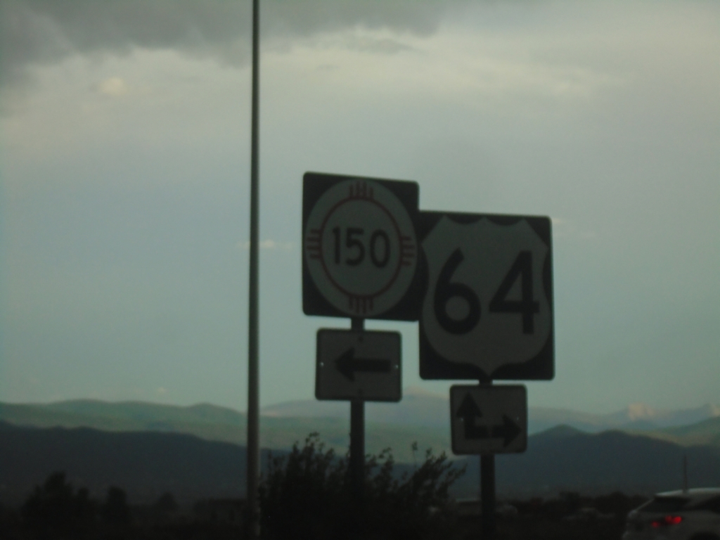
End NM-522 South at US-64 and NM-150
End NM-522 South at US-64 and NM-150 in El Prado.
Taken 06-18-2026
Taos County
New Mexico
United States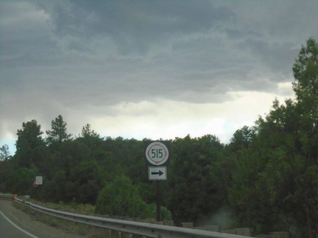
NM-522 South at NM-515
NM-522 South at NM-515 in Taos County.
Taken 06-18-2026
 Questa
Taos County
New Mexico
United States
Questa
Taos County
New Mexico
United States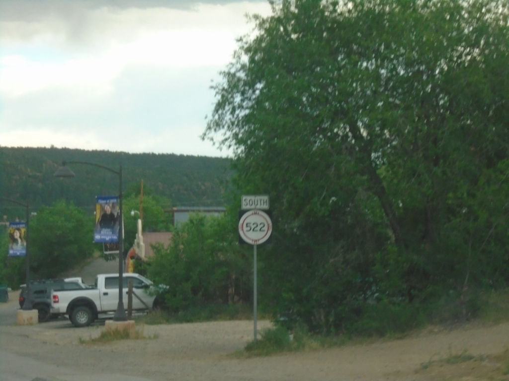
NM-522 South - Questa
NM-522 south in Questa
Taken 06-18-2026
Questa
Taos County
New Mexico
United States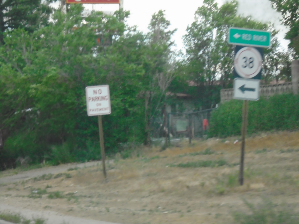
NM-522 South at NM-38
NM-522 South at NM-38 in Questa. Use NM-38 East to Red River.
Taken 06-18-2026
Questa
Taos County
New Mexico
United States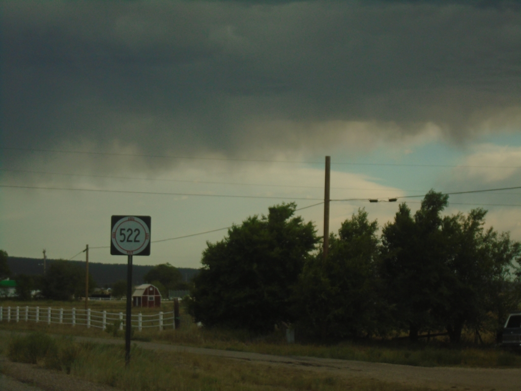
NM-522 South - Questa
NM-522 south in Questa
Taken 06-18-2026
Questa
Taos County
New Mexico
United States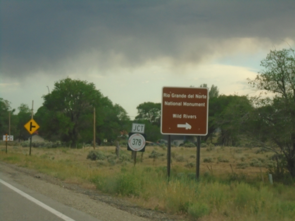
NM-522 South at NM-378
NM-522 South at NM-378 to Rio Grande National Monument and Wild Rivers.
Taken 06-18-2026
 Questa
Taos County
New Mexico
United States
Questa
Taos County
New Mexico
United States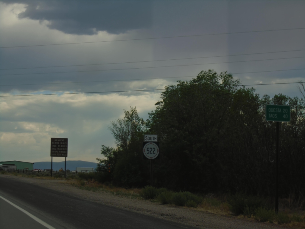
NM-522 South - Distance Marker
Distance marker on NM-522 south to Questa and Taos.
Taken 06-18-2026
Costilla
Taos County
New Mexico
United States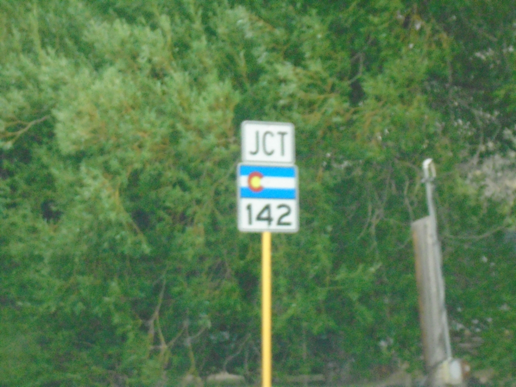
CO-159 South Approaching CO-142
CO-159 South approaching CO-142 in San Luis.
Taken 06-18-2026

 San Luis
Costilla County
Colorado
United States
San Luis
Costilla County
Colorado
United States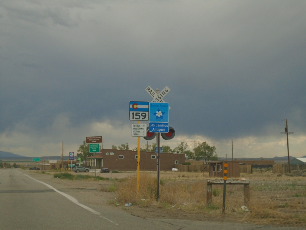
CO-159 South - Fort Garland
CO-159 South / Los Caminos Antiguos Scenic and Historic Byway in Fort Garland.
Taken 06-18-2026
Fort Garland
Costilla County
Colorado
United States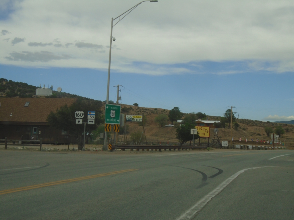
US-160 East at CO-159
US-160 East at CO-159 in Fort Garland.
Taken 06-18-2026
 Fort Garland
Costilla County
Colorado
United States
Fort Garland
Costilla County
Colorado
United States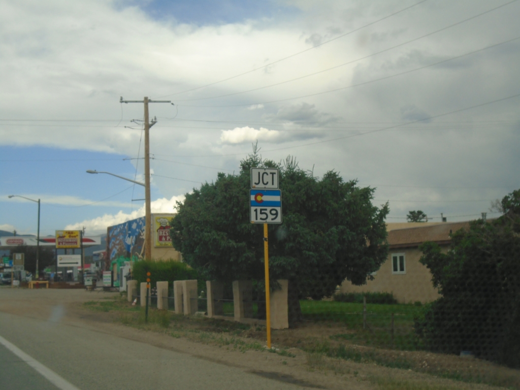
US-160 East Approaching CO-159
US-160 East approaching CO-159 in Fort Garland.
Taken 06-18-2026
Fort Garland
Costilla County
Colorado
United States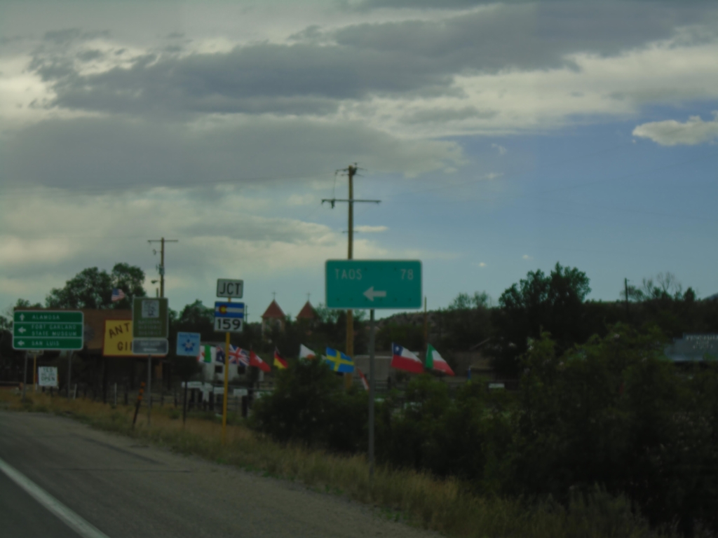
US-160 West Approaching CO-159
US-160 West approaching CO-159 in Fort Garland. Use CO-159 South to Taos (New Mexico), San Luis, and Fort Garland State Museum. Continue west on US-160 for Alamosa.
Taken 06-18-2026
Fort Garland
Costilla County
Colorado
United States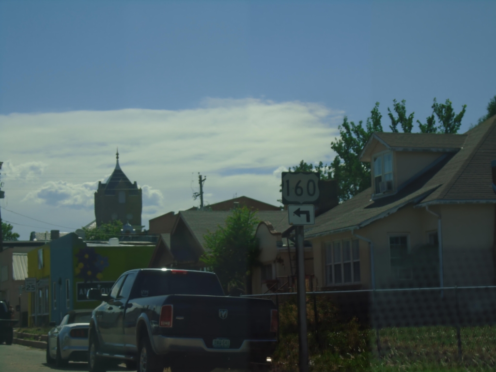
US-160 West Approaching BL-25
US-160 West (E 5th St) approaching BL-25 (Main Street) in Walsenburg. Turn left on Main St. to continue west on US-160.
Taken 06-18-2026
 Walsenburg
Huerfano County
Colorado
United States
Walsenburg
Huerfano County
Colorado
United States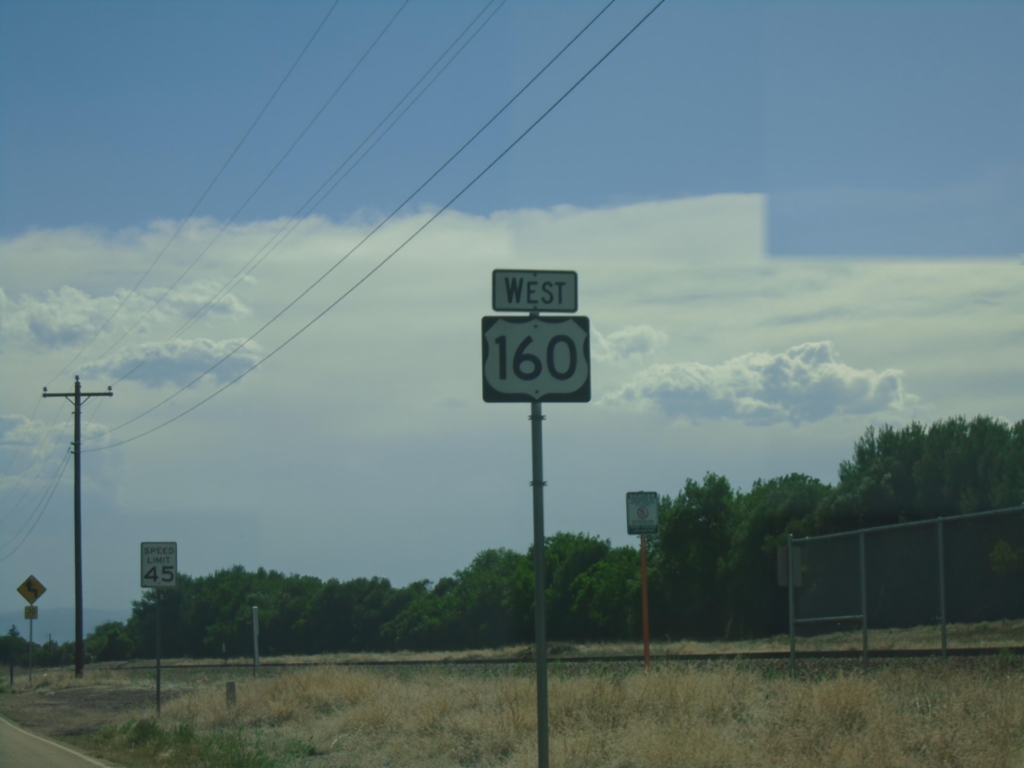
US-160 West - Walsenburg
US-160 west in Walsenburg.
Taken 06-18-2026
Huerfano County
Colorado
United States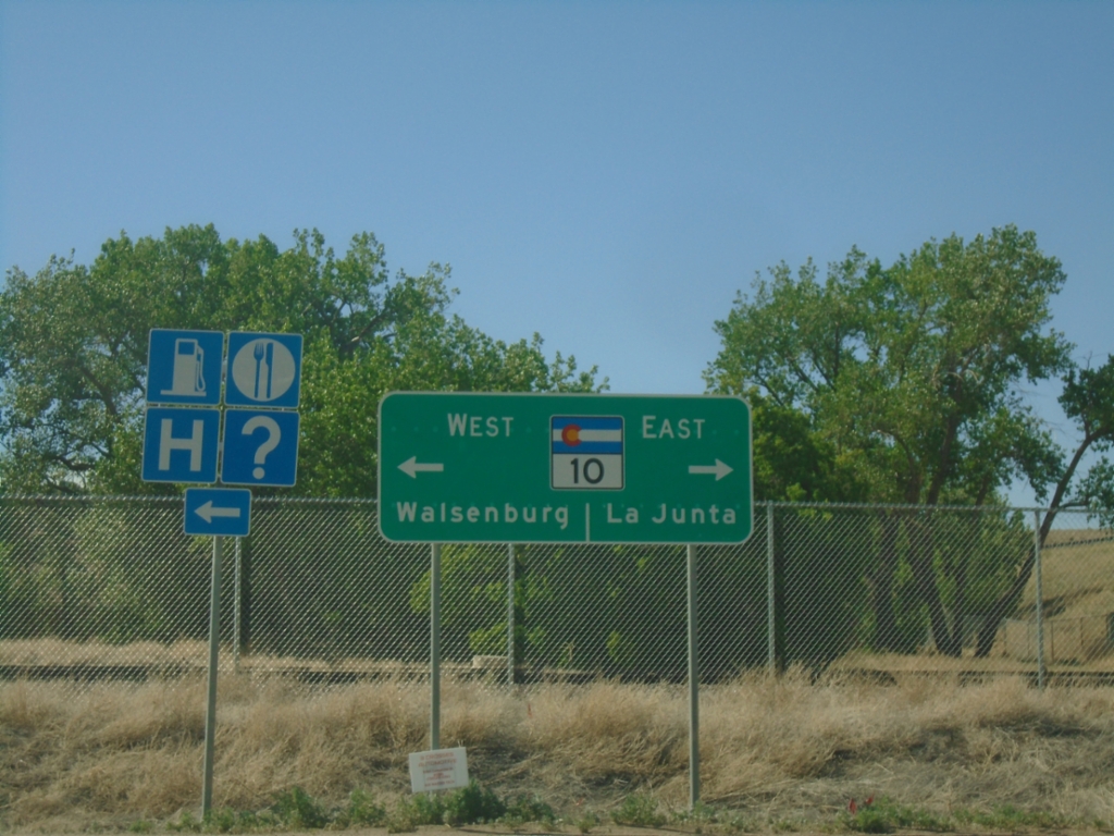
I-25 South at CO-10/US-160 (Exit 50)
I-25 South at CO-10/US-160 (Exit 50) in Walsenburg. Use CO-10 East to La Junta. Use US-160 West to Walsenburg. US-160 is absent from the sign assembly, and it shows CO-10 west going into Walsenburg.
Taken 06-18-2026


 Walsenburg
Huerfano County
Colorado
United States
Walsenburg
Huerfano County
Colorado
United States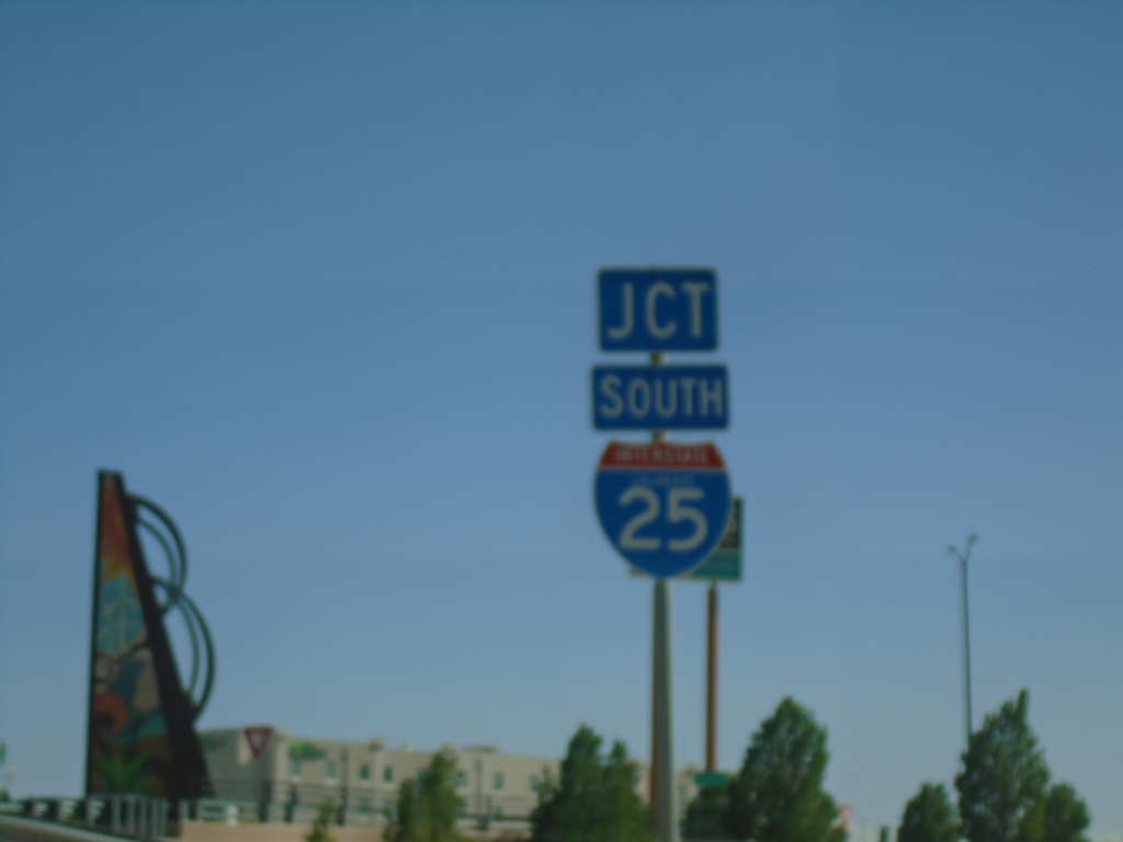
I-25 Frontage Road Approaching I-25 South
I-25 Frontage Road approaching I-25 South (Exit 104).
Taken 06-18-2026
Pueblo
Pueblo County
Colorado
United States