Signs Tagged With Shield
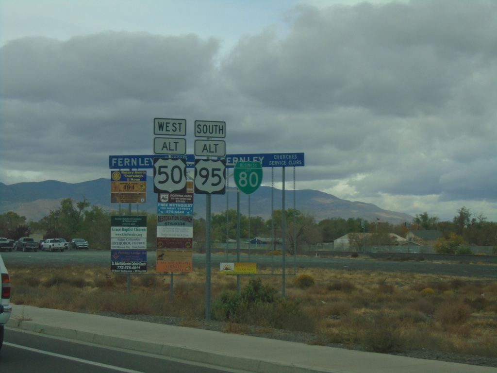
Alt. US-95 South/Alt. US-50 West/BL-80 - Fernley
Alt. US-95 South/Alt. US-50 West/BL-80 on E. Main St. in Fernley
Taken 10-19-2019


 Fernley
Lyon County
Nevada
United States
Fernley
Lyon County
Nevada
United States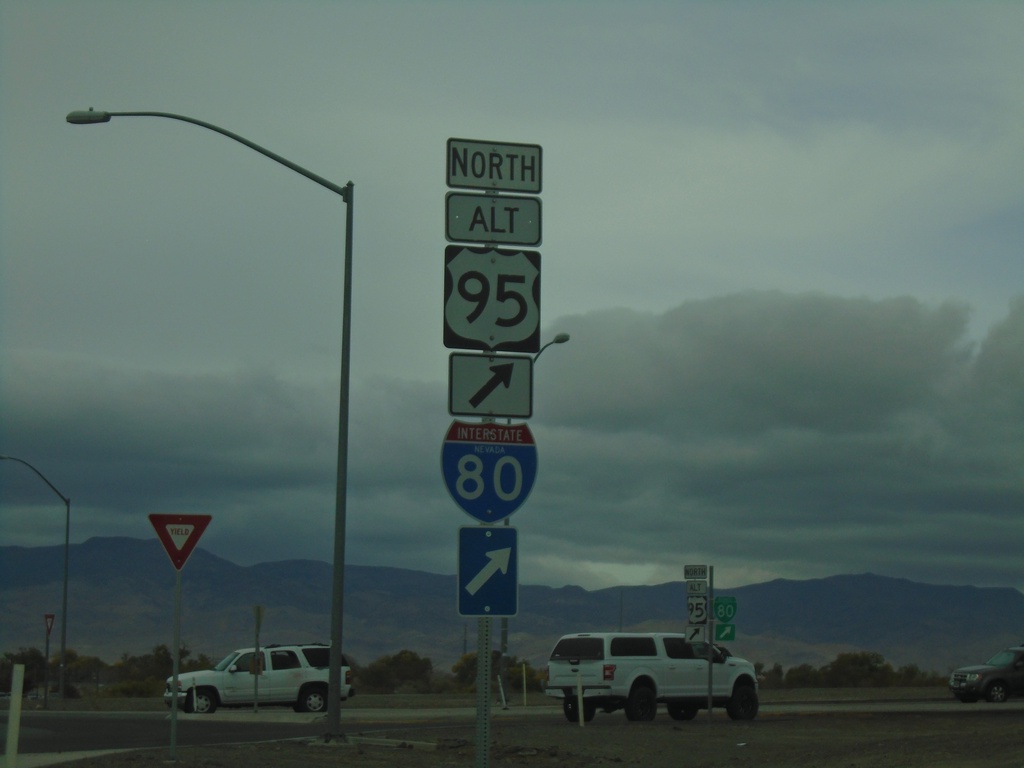
Alt. US-50 West at Alt. US-95 Roundabout
Alt. US-50 West at Alt. US-95 roundabout. Turn right for Alt. US-95 North/To I-80
Taken 10-19-2019
 Fernley
Lyon County
Nevada
United States
Fernley
Lyon County
Nevada
United States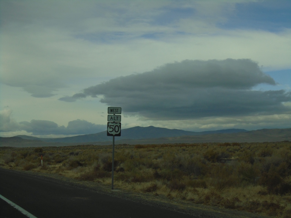
Alt. US-50 West - Churchill County
First Alt. US-50 shield westbound in Churchill County
Taken 10-19-2019
Fallon
Churchill County
Nevada
United States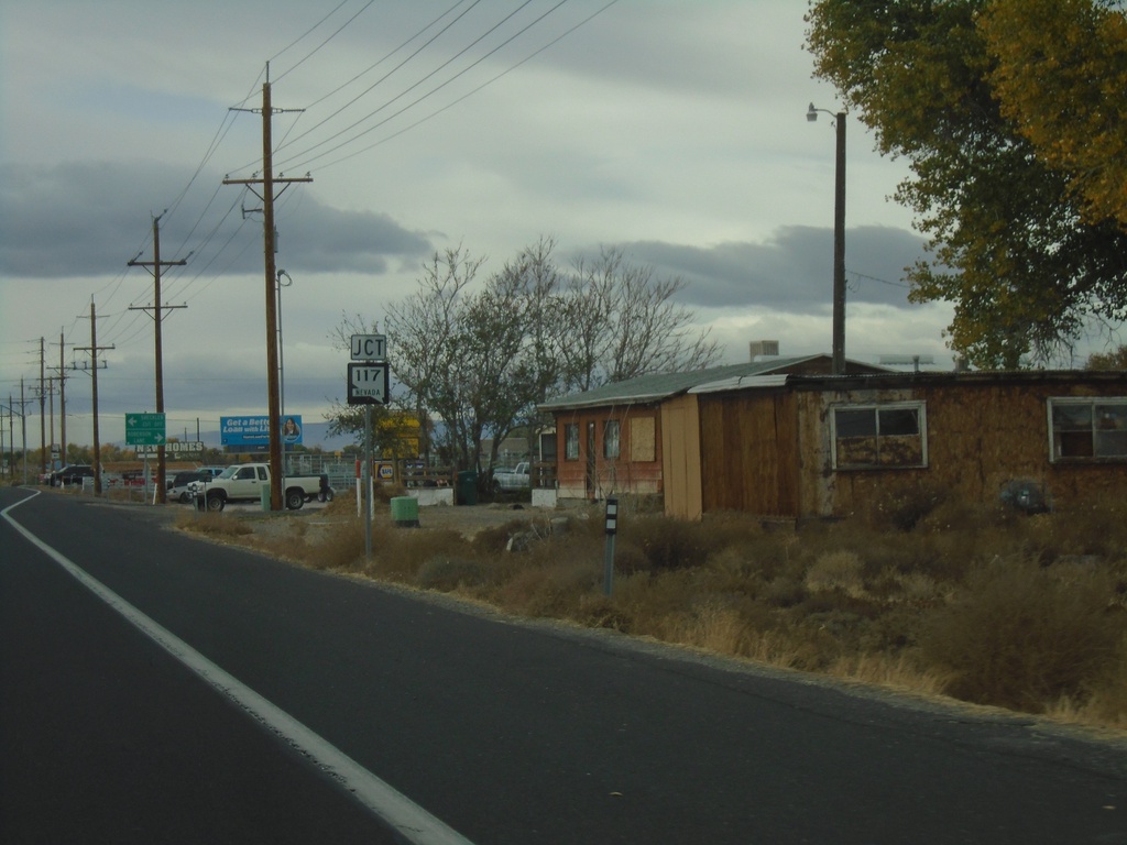
US-50 West Approaching NV-117
US-50 West Approaching NV-117 - Sheckler Cut Off
Taken 10-19-2019

 Fallon
Churchill County
Nevada
United States
Fallon
Churchill County
Nevada
United States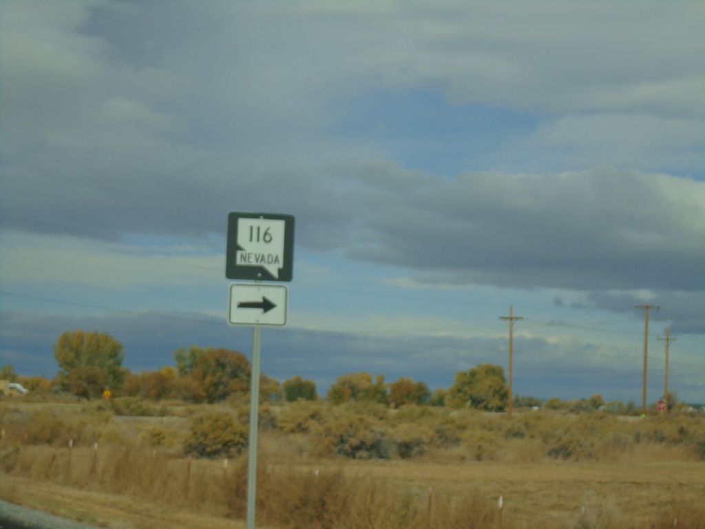
US-50 West Approaching NV-116
US-50 west approaching NV-116 in Churchill County.
Taken 10-19-2019
 Fallon
Churchill County
Nevada
United States
Fallon
Churchill County
Nevada
United States
US-50 West at NV-839 South
US-50 west at NV-839 south to B-17 Naval Range.
Taken 10-19-2019
 Fallon
Churchill County
Nevada
United States
Fallon
Churchill County
Nevada
United States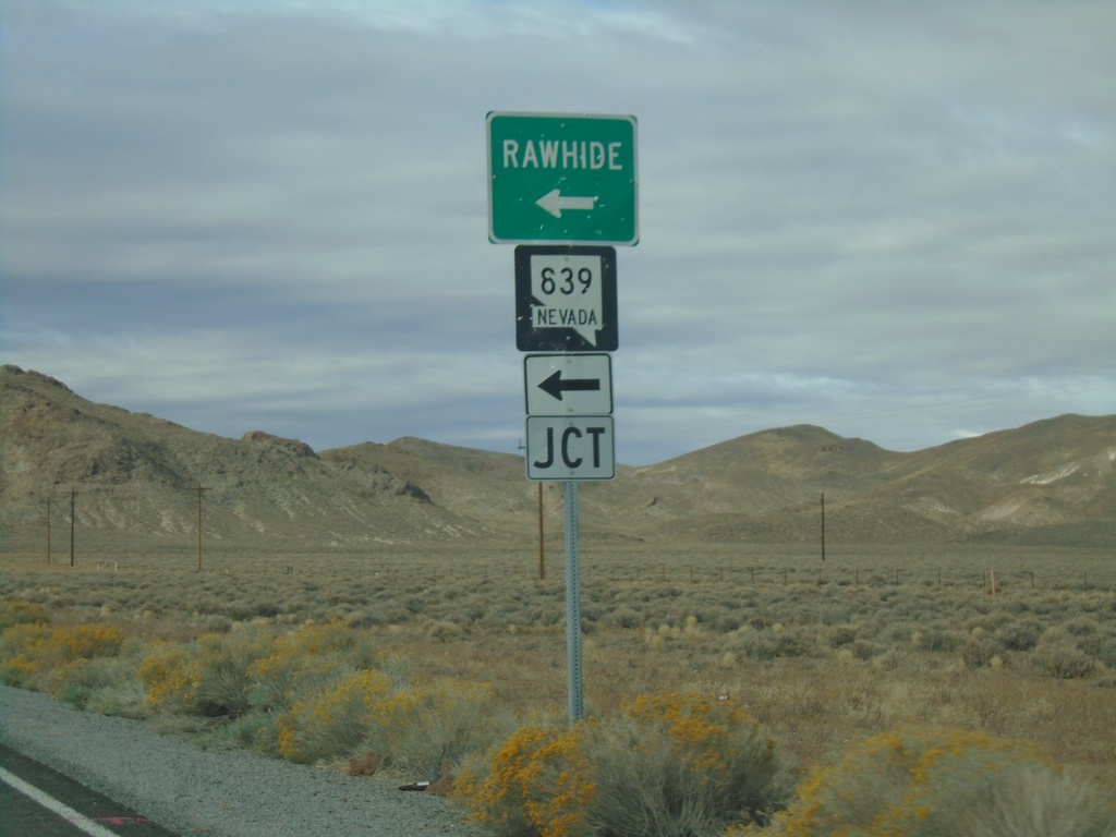
US-50 West at NV-839
US-50 west at NV-839 south to Rawhide.
Taken 10-19-2019
Fallon
Churchill County
Nevada
United States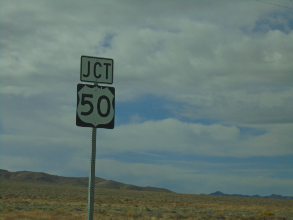
NV-121 South approaching US-50
Junction US-50 on NV-121 south in Churchill County.
Taken 10-19-2019
 Fallon
Churchill County
Nevada
United States
Fallon
Churchill County
Nevada
United States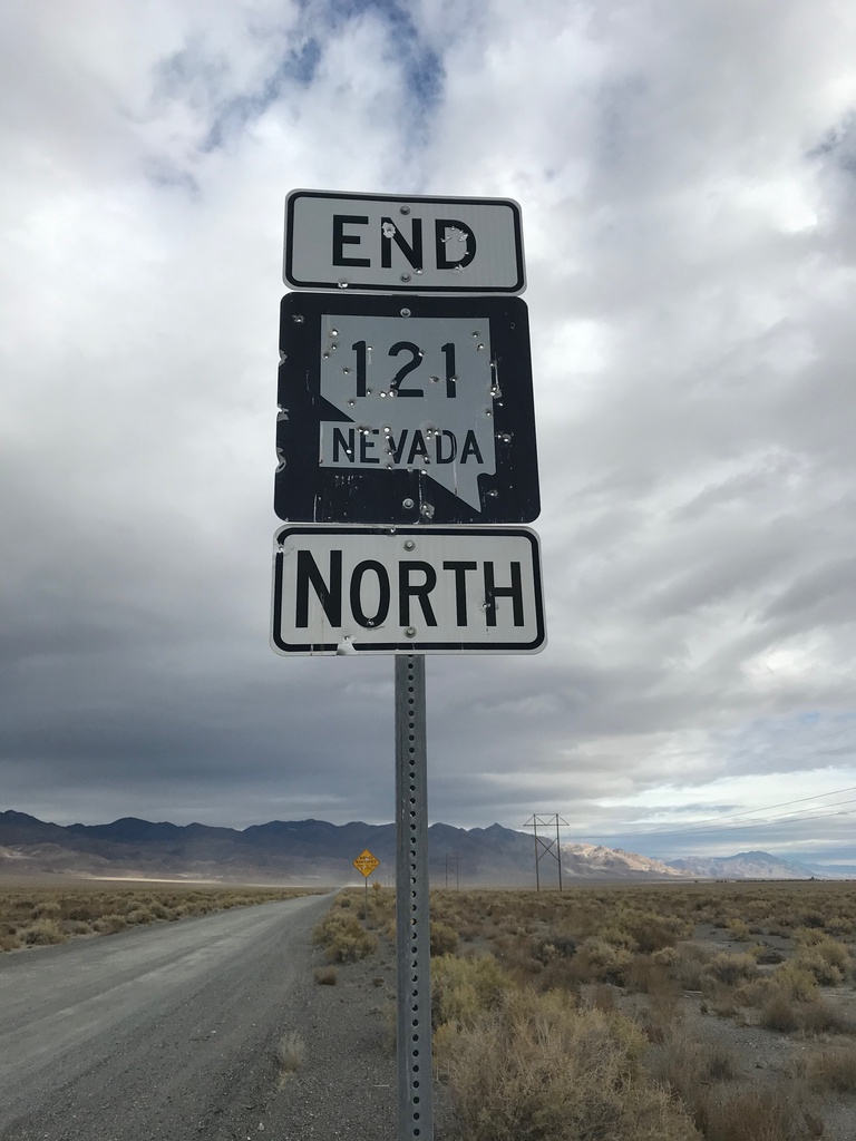
End NV-121 North - Churchill County
End NV-121 North. Unpaved road continues northbound as Dixie Valley Road
Taken 10-19-2019
Fallon
Churchill County
Nevada
United States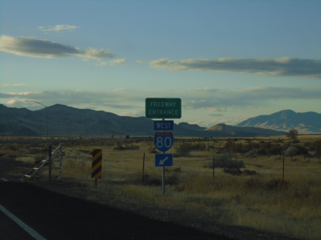
End NV-789 South at I-80 West
End NV-789 South at I-80 West (Exit 194).
Taken 10-18-2019
 Golconda
Humboldt County
Nevada
United States
Golconda
Humboldt County
Nevada
United States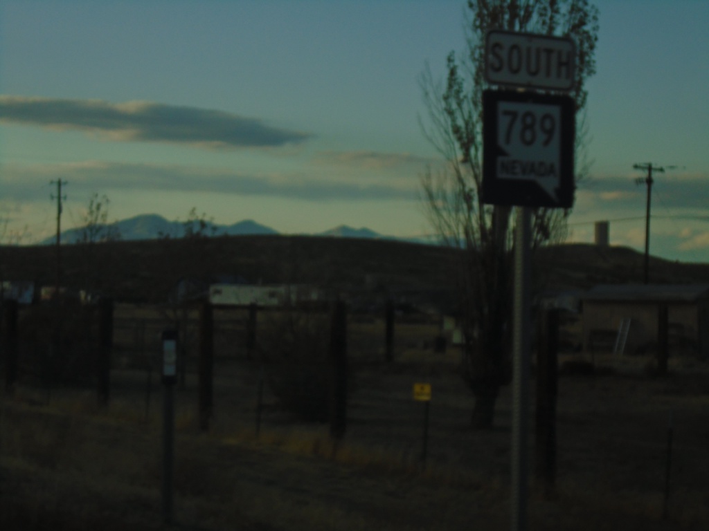
NV-789 South - Golconda
NV-789 south in Golconda.
Taken 10-18-2019
Golconda
Humboldt County
Nevada
United States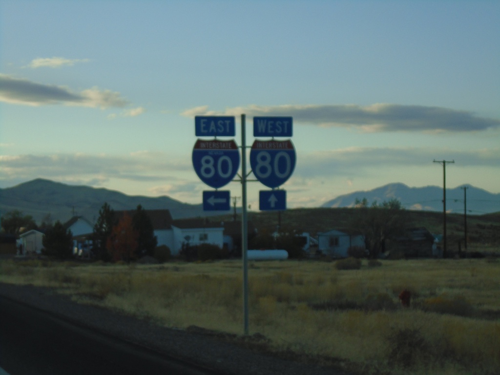
NV-789 South at I-80
NV-789 South at I-80 junction.
Taken 10-18-2019
Golconda
Humboldt County
Nevada
United States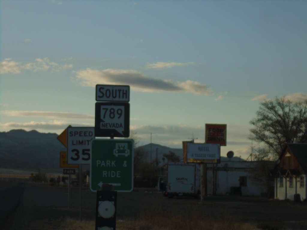
NV-789 South - Golconda
NV-789 South in Golconda
Taken 10-18-2019
Golconda
Humboldt County
Nevada
United States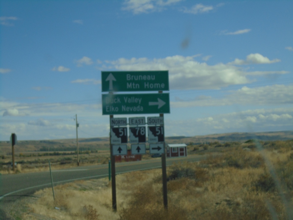
ID-78 East at ID-51
ID-78 East at ID-51 junction in Owyhee County. Continue on ID-78 East/ID-51 North for Bruneau and Mountain Home. Use ID-51 South for Duck Valley and Elko, Nevada.
Taken 10-18-2019

 Bruneau
Owyhee County
Idaho
United States
Bruneau
Owyhee County
Idaho
United States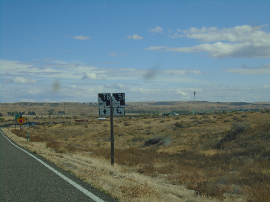
ID-78 East Approaching ID-51
ID-78 East approaching ID-51 in Owyhee County. ID-78 East joins ID-51 north through Bruneau.
Taken 10-18-2019
Bruneau
Owyhee County
Idaho
United States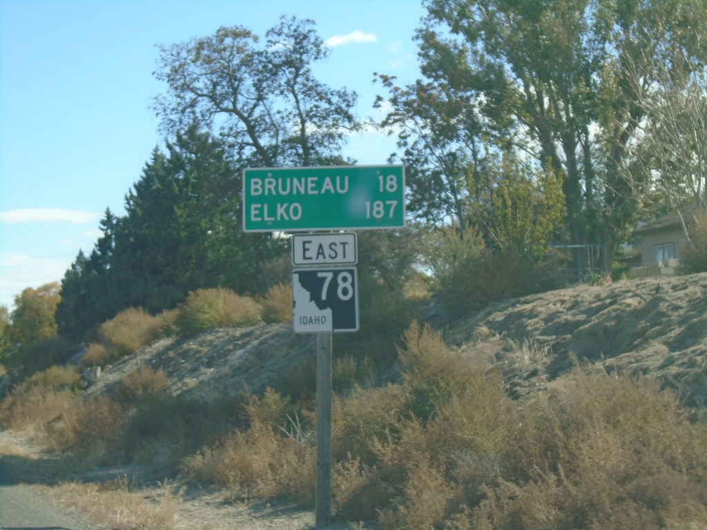
ID-78 East - Distance Marker
Distance marker on ID-78 east. Distance to Bruneau and Elko (Nevada).
Taken 10-18-2019
Grand View
Owyhee County
Idaho
United States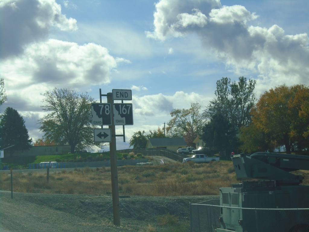
End ID-167 West at ID-78
End ID-167 west at ID-78 in Grand View. ID-167 is the newest state highway in Idaho, formed in May of 2010. ID-167 replaces ID-67 between Mountain Home Air Force Base and Grand View.
Taken 10-18-2019
 Grand View
Owyhee County
Idaho
United States
Grand View
Owyhee County
Idaho
United States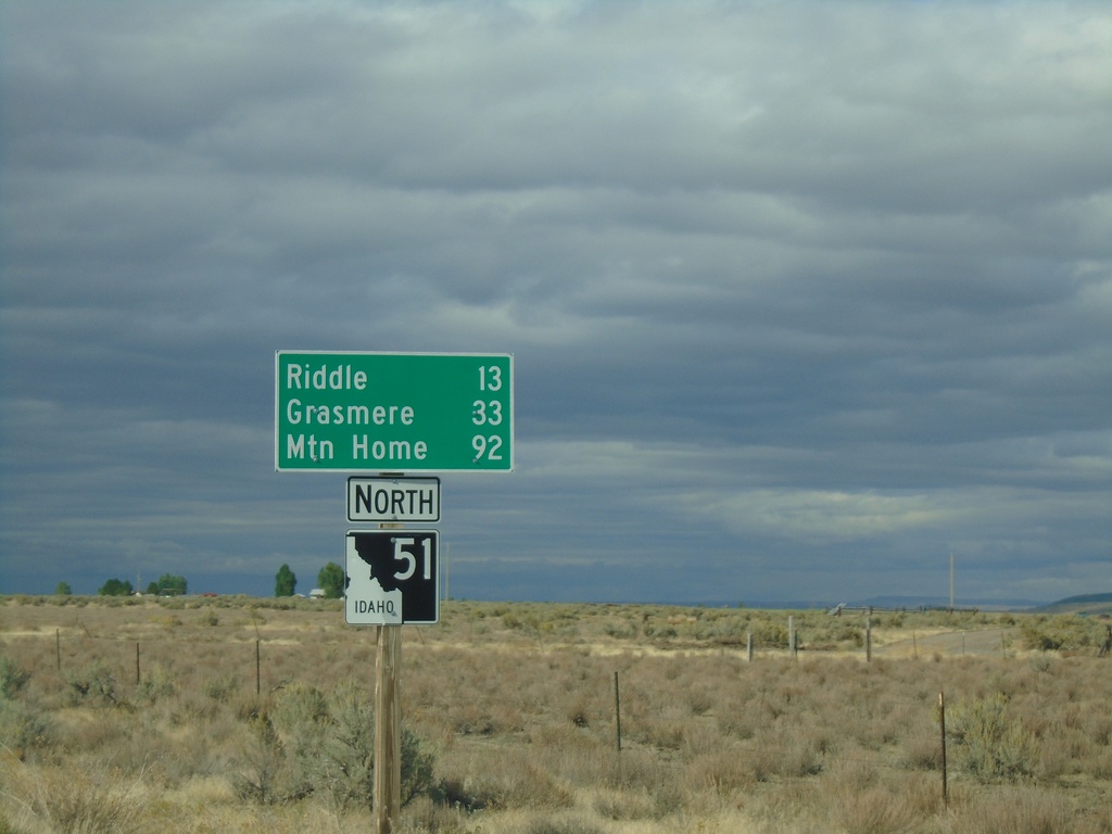
ID-51 North - Distance Marker
Distance marker on ID-51 north. Distance to Riddle, Grasmere, and Mountain Home. This is the first shield and distance marker along ID-51 after the stateline.
Taken 09-28-2019
Owyhee
Owyhee County
Idaho
United States
BL-80 East at I-80
BL-80 East at I-80 (Exit 303) in Elko.
Taken 09-28-2019
Elko
Elko County
Nevada
United States
BL-80 East (Idaho St.) at Jennings Way to I-80
BL-80 East (Idaho St.) at Jennings Way to I-80. Turn left for Jennings Way and I-80 onramps.
Taken 09-28-2019
Elko
Elko County
Nevada
United States
I-80 West Exit 303 Offramp
I-80 West Exit 303 Offramp at BL-80. Turn left for BL-80 (Jennings Way).
Taken 09-28-2019
Elko
Elko County
Nevada
United States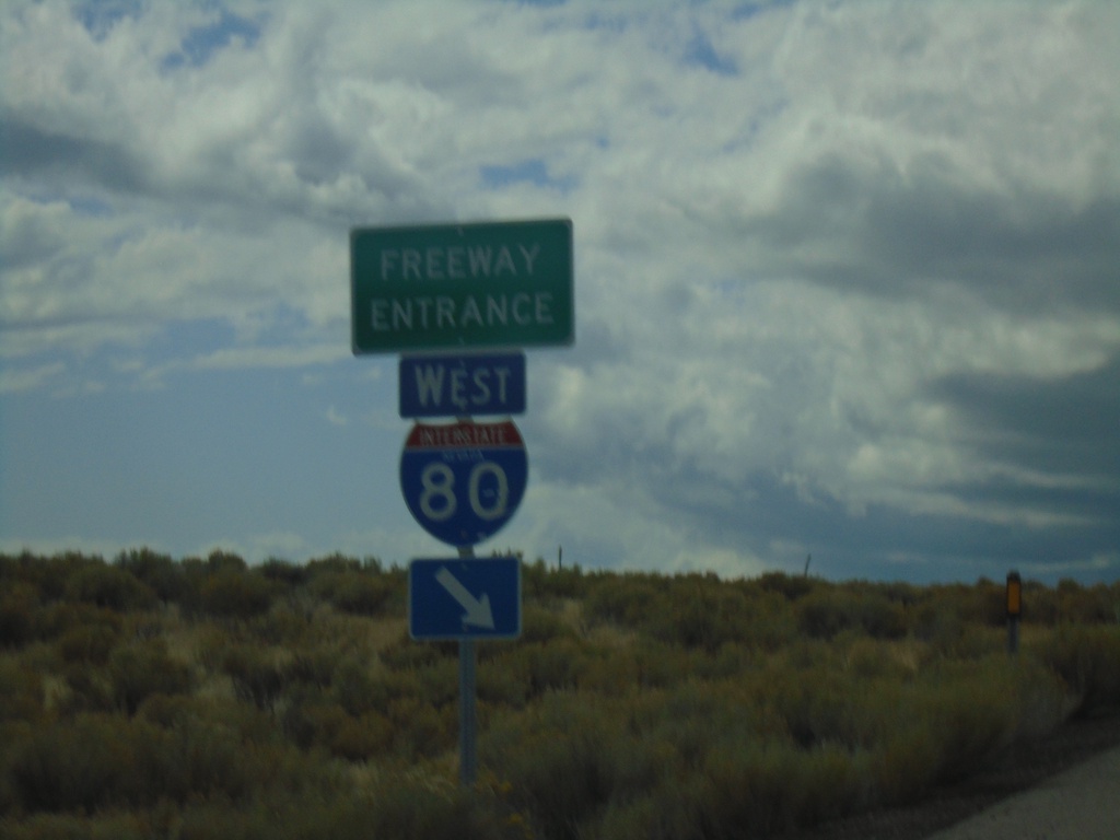
End NV-229 North at I-80 West
End NV-229 North at I-80 West (Exit 321).
Taken 09-28-2019
 Elko
Elko County
Nevada
United States
Elko
Elko County
Nevada
United States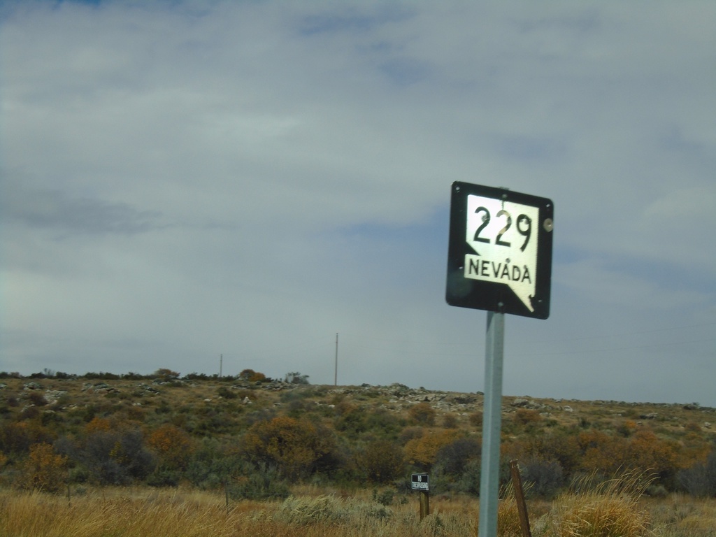
NV-229 North - Elko County
NV-229 North in Elko County
Taken 09-28-2019
Ruby Valley
Elko County
Nevada
United States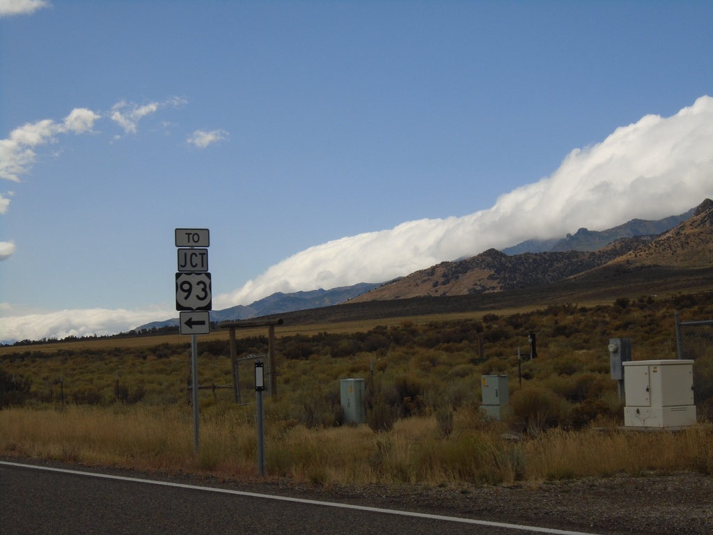
NV-229 South at NV-767
NV-229 South at NV-767 in Elko County. Turn left to continue south on NV-229 and for US-93.
Taken 09-28-2019

 Ruby Valley
Elko County
Nevada
United States
Ruby Valley
Elko County
Nevada
United States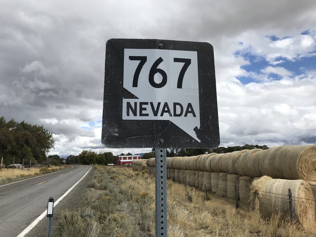
Begin NV-767 North
Begin NV-767 North in the Ruby Valley.
Taken 09-28-2019
Ruby Valley
Elko County
Nevada
United States