Signs Tagged With Shield
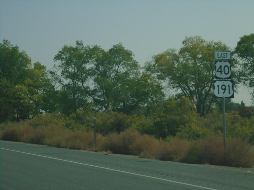
US-40 East/US-191 North - Duchesne County
US-40 East/US-191 North in Duchesne County.
Taken 10-03-2020

 Duchesne
 County
Utah
United States
Duchesne
Duchesne County
Utah
United States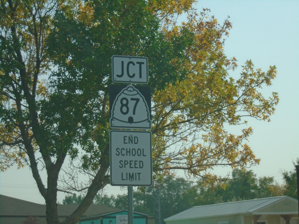
US-40 East/US-191 North Approaching UT-87
US-40 East/US-191 North (E Main St.) approaching UT-87 (Center St.) in Duchesne.
Taken 10-03-2020
 Duchesne
 County
Utah
United States
Duchesne
Duchesne County
Utah
United States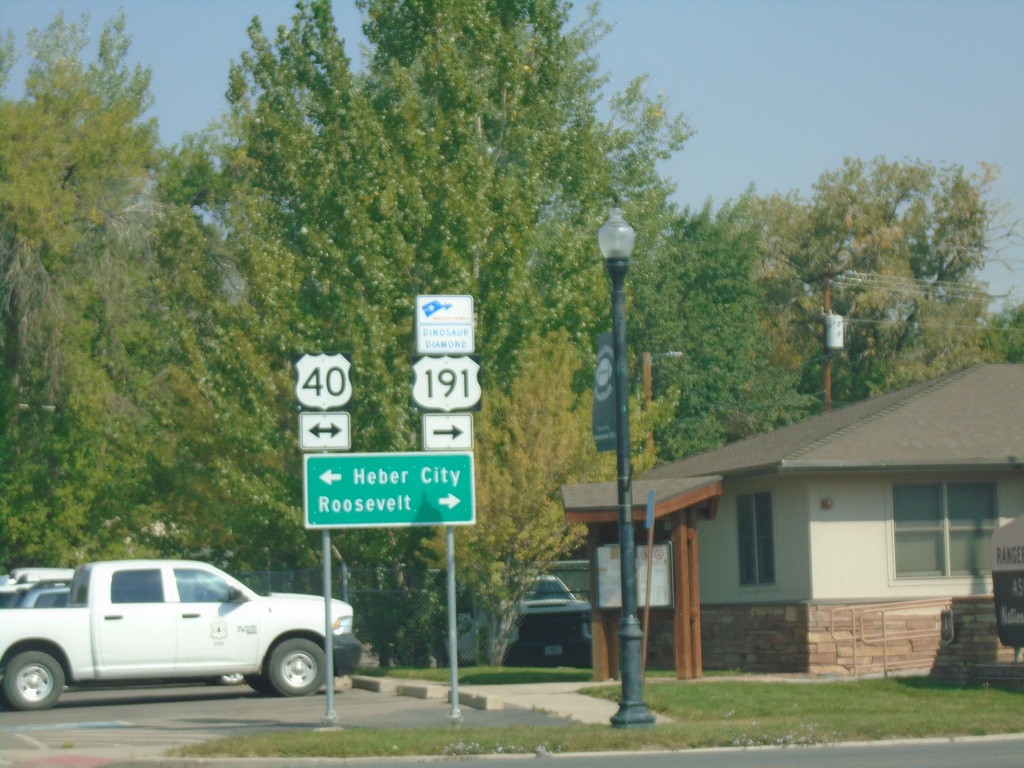
US-191 North at US-40
US-191 North at US-40 in Duchesne. Turn left for US-40 west to Heber City; turn right for US-40 East/US-191 North to Roosevelt. US-191 North joins US-40 eastbound to Vernal. Turn right to continue on the Dinosaur Diamond Byway.
Taken 10-03-2020
Duchesne
Duchesne County
Utah
United States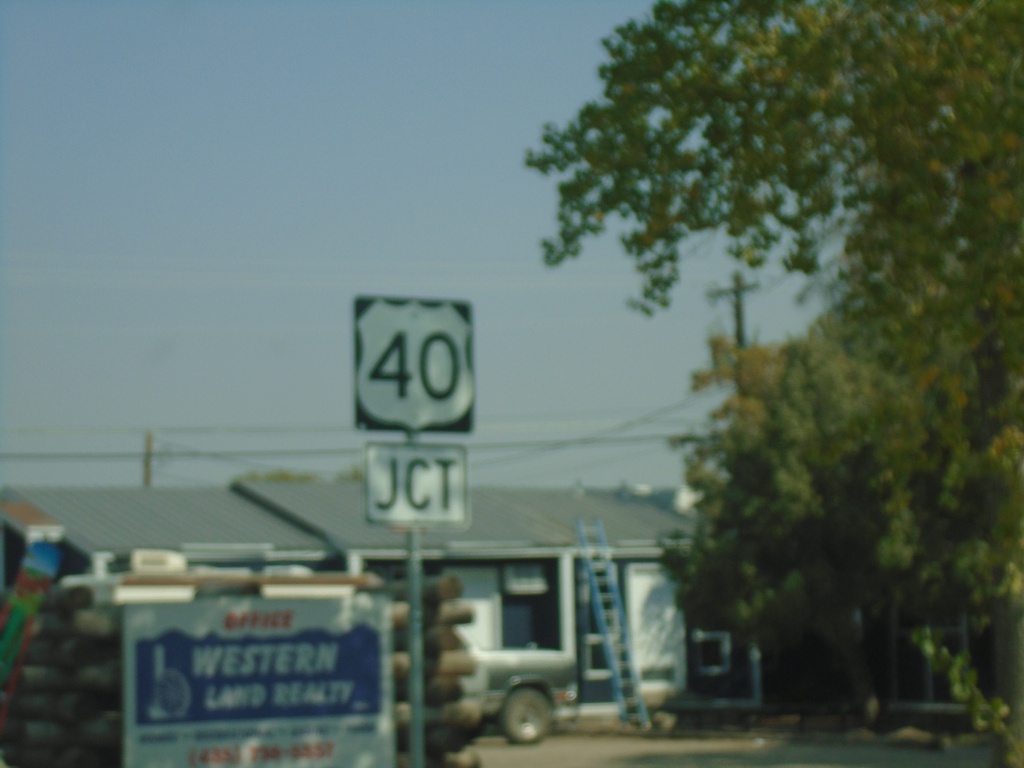
US-191 North Approaching US-40
US-191 North (S 100 W) approaching US-40 in Duchesne.
Taken 10-03-2020
Duchesne
Duchesne County
Utah
United States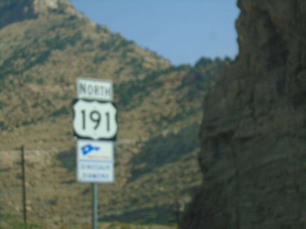
US-191 North - Dinosaur Diamond Scenic Byway
US-191 North - Dinosaur Diamond Scenic Byway in Carbon County.
Taken 10-03-2020
Helper
Carbon County
Utah
United States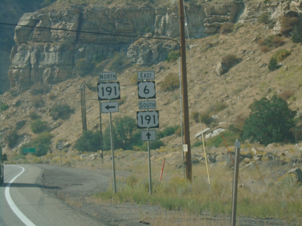
US-6 East at US-191
US-6 east at US-191. Turn left for US-191 north. US-191 south joins US-6 south to Crescent Junction.
Taken 10-03-2020
 Castle Gate
Carbon County
Utah
United States
Castle Gate
Carbon County
Utah
United States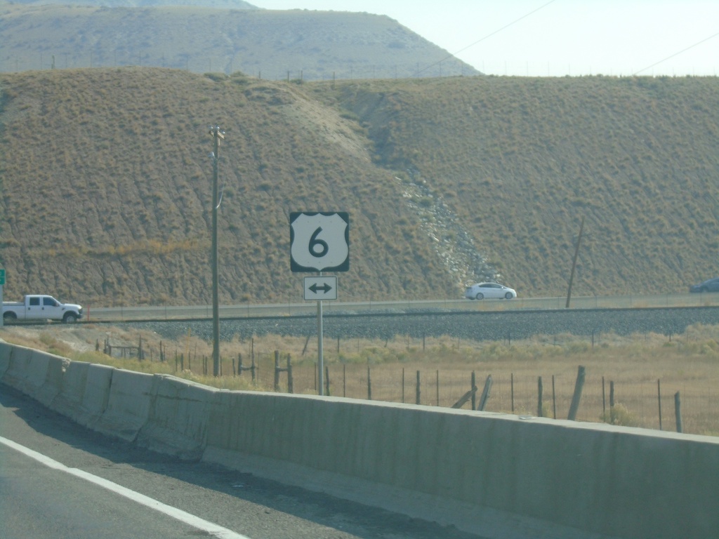
End UT-96 at US-6
End UT-96 at US-6 in Utah County.
Taken 10-03-2020
 Helper
Utah County
Utah
United States
Helper
Utah County
Utah
United States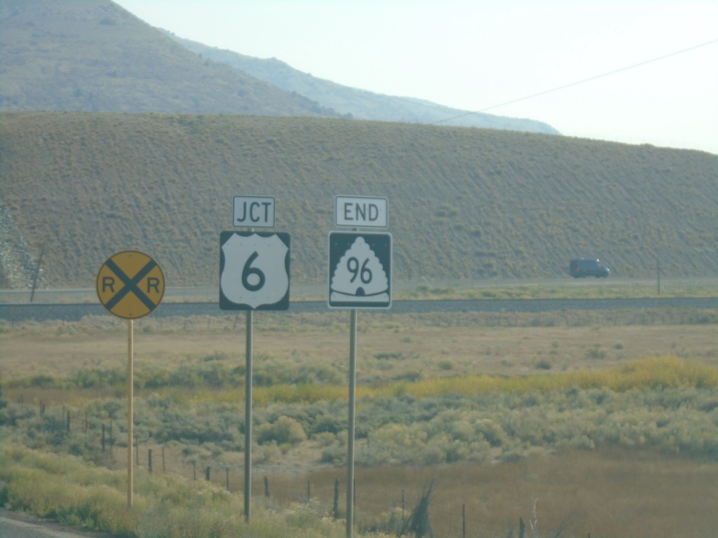
End UT-96 at US-6
End UT-96 at US-6 in Utah County.
Taken 10-03-2020
Helper
Utah County
Utah
United States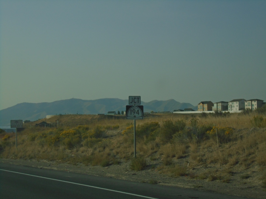
UT-68 South Approaching UT-194 East
UT-68 South approaching UT-194 East (W 2100 North). UT-194 north is an expressway connection between UT-68 and I-15 in Lehi. It will eventually connect to the Mountain View Corridor.
Taken 10-03-2020

 Saratoga Springs
Utah County
Utah
United States
Saratoga Springs
Utah County
Utah
United States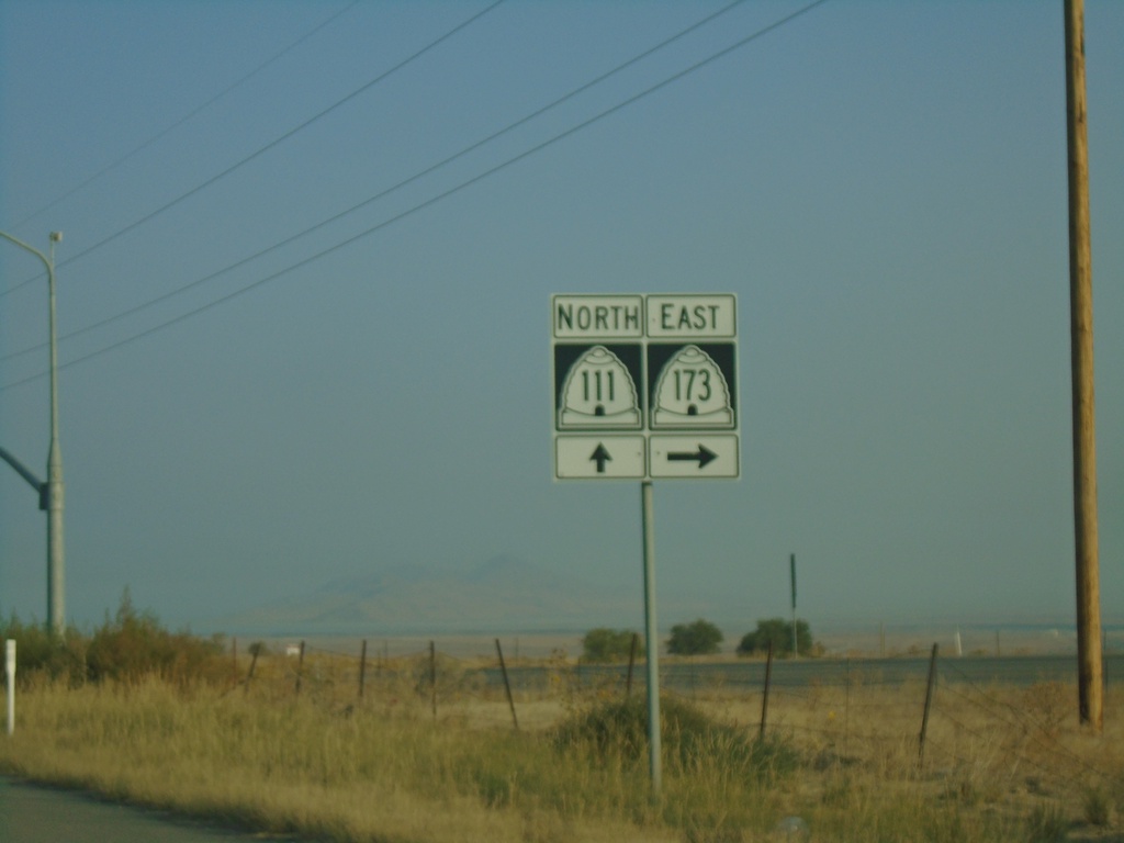
UT-111 North at UT-173
UT-111 North at UT-173 East (5400 South).
Taken 10-03-2020

 West Valley City
Salt Lake County
Utah
United States
West Valley City
Salt Lake County
Utah
United States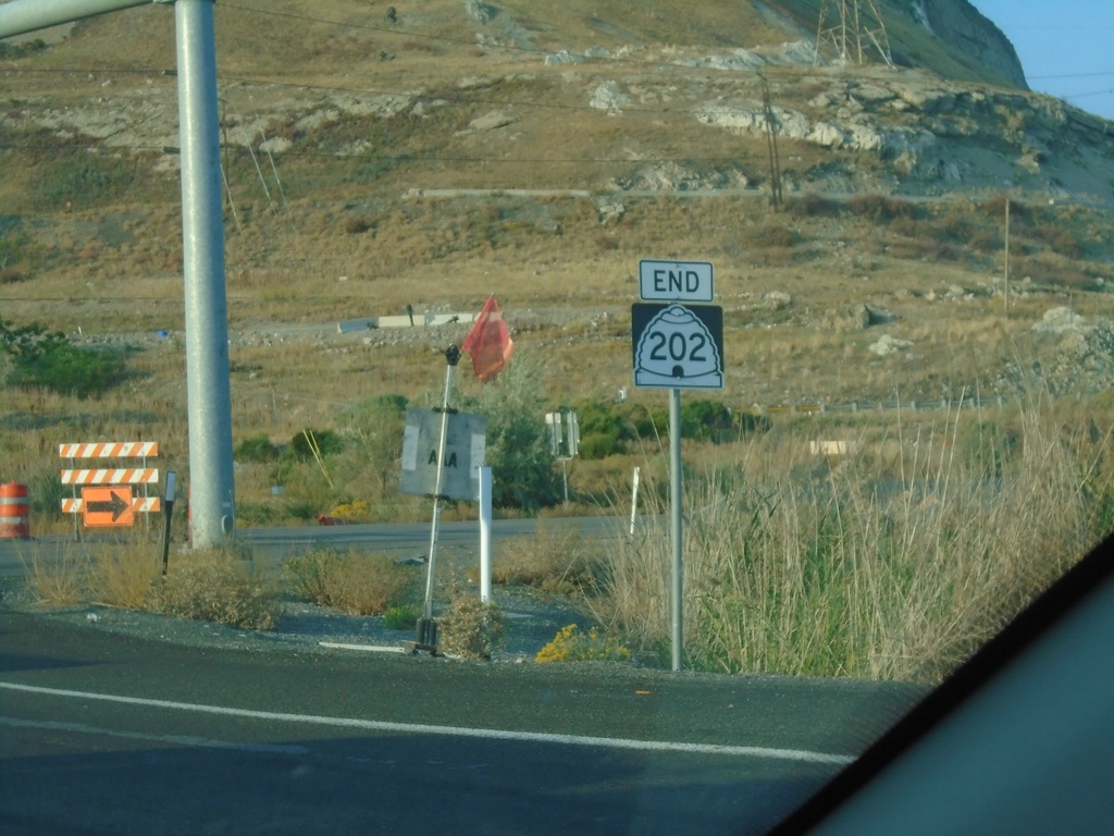
End UT-202 South at UT-201
End UT-202 South at UT-201 in Salt Lake County.
Taken 10-03-2020

 Magna
Salt Lake County
Utah
United States
Magna
Salt Lake County
Utah
United States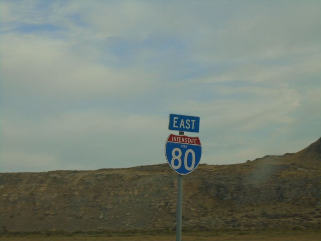
I-80 East - Tooele County
I-80 east in Tooele County.
Taken 10-02-2020
 Dugway
Tooele County
Utah
United States
Dugway
Tooele County
Utah
United States
BL-84/US-30 East Approaching BL-84/US-30 Split
BL-84/US-30 East approaching BL-84/US-30 Split in Bliss. Turn right to continue east on US-30; straight for BL-84/To US-26/To I-84.
Taken 10-02-2020


 Bliss
Gooding County
Idaho
United States
Bliss
Gooding County
Idaho
United States
BL-84/US-30 East - Bliss
BL-84/US-30 East in Bliss.
Taken 10-02-2020
Bliss
Gooding County
Idaho
United States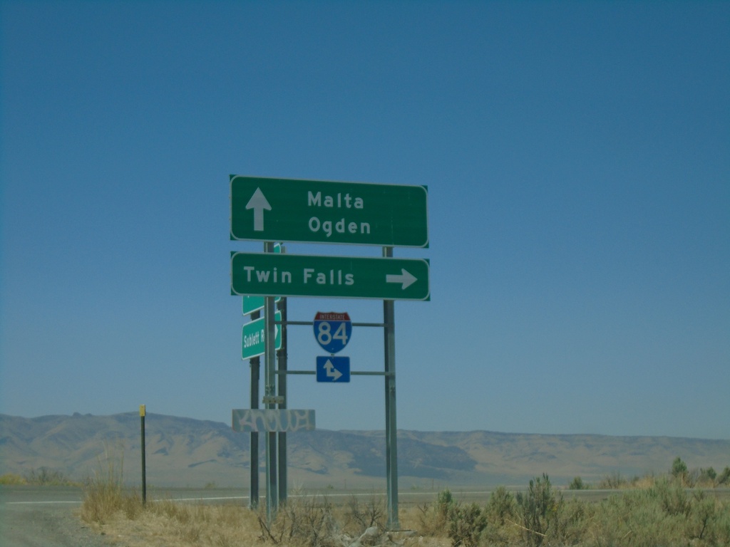
Sublett Road West at I-84
Sublett Road West at I-84 in Cassia County. Use I-84 west for Twin Falls; I-84 east for Ogden (Utah). Continue west on Sublett Road for Malta.
Taken 08-15-2020
Malta
Cassia County
Idaho
United States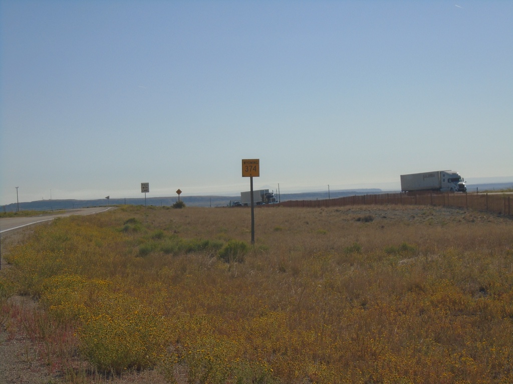
WY-374 East - Sweetwater County
First WY-374 east shield eastbound in Sweetwater County. WY-374 is a frontage road between this location (Cedar Mountain interchange at I-80) and Green River.
Taken 08-15-2020
 Granger
Sweetwater County
Wyoming
United States
Granger
Sweetwater County
Wyoming
United States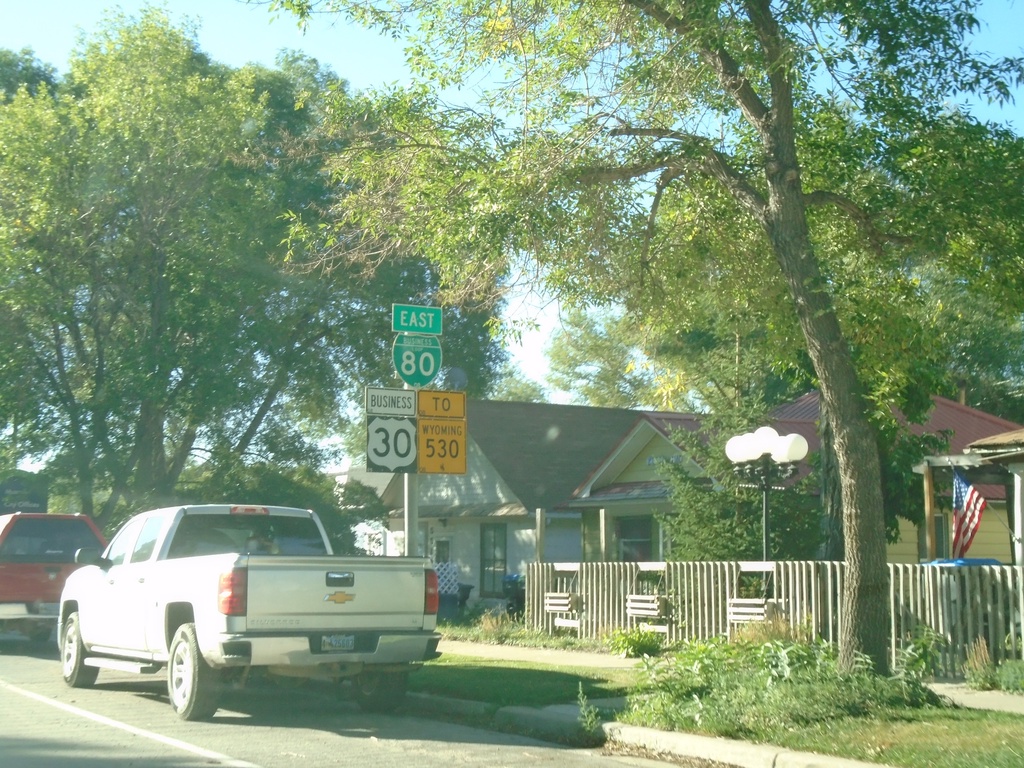
BL-80/Bus. US-30 East/To WY-530 - Green River
BL-80/Bus. US-30 East/To WY-530 on E Flaming Gorge Way in Green River
Taken 08-15-2020


 Green River
Sweetwater County
Wyoming
United States
Green River
Sweetwater County
Wyoming
United States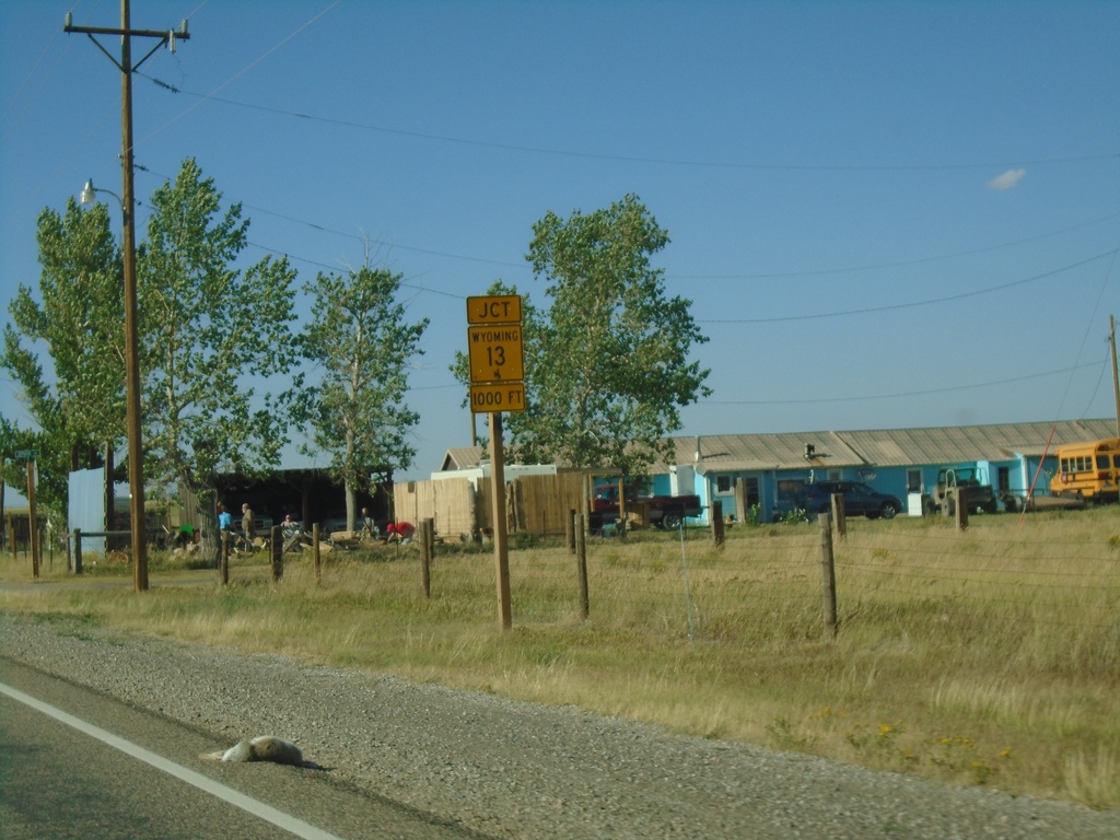
US-30 West/US-287 North approaching WY-13
US-30 West/US-287 North approaching WY-13 in Rock River.
Taken 08-14-2020

 Rock River
Albany County
Wyoming
United States
Rock River
Albany County
Wyoming
United States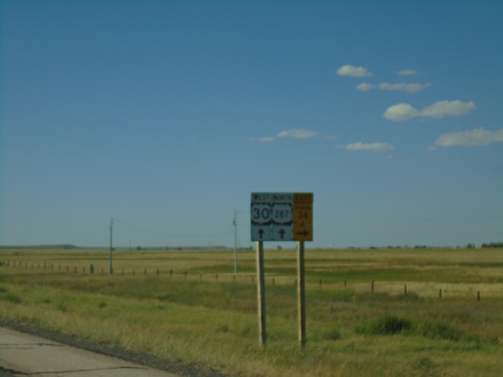
US-30 West/US-287 North Approaching WY-34
US-30 West/US-287 North at WY-34 North in Albany County.
Taken 08-14-2020
 Bosler
Albany County
Wyoming
United States
Bosler
Albany County
Wyoming
United States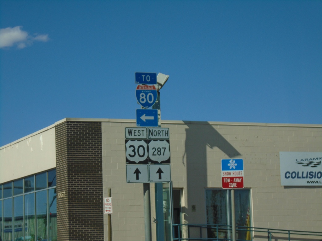
BL-80/US-30 West/US-287 North - Laramie
BL-80/US-30 West/US-287 North (3rd St.) at BL-80 West (Curtis St.). Turn left to continue on BL-80 West/To I-80.
Taken 08-14-2020
Laramie
Albany County
Wyoming
United States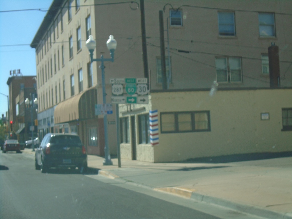
BL-80/US-30 West at US-287
BL-80/US-30 West (Grand Ave.) at US-287 (S 3rd St) in Laramie. Turn left for US-287 South; turn right for BL-80/US-30 West/US-287 North. US-287 north joins US-30 west to Rawlins.
Taken 08-14-2020
Laramie
Albany County
Wyoming
United States
BL-80/US-30 West Approaching US-287
BL-80/US-30 West (Grand Ave) approaching US-287 (S 3rd St.) in Laramie.
Taken 08-14-2020
Laramie
Albany County
Wyoming
United States
WY-210 West Approaching I-80/US-30
WY-210 West (Happy Jack Road) approaching I-80/US-30.
Taken 08-14-2020
 Laramie
Albany County
Wyoming
United States
Laramie
Albany County
Wyoming
United States
BL-80/US-30 West in Pine Bluffs
BL-80/US-30 West in Pine Bluffs. Turn left on Parson St to continue west on BL-80/US-30/To I-80/WY-215.
Taken 08-14-2020
 Pine Bluffs
Laramie County
Wyoming
United States
Pine Bluffs
Laramie County
Wyoming
United States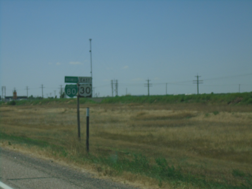
BL-80/US-30 West - Pine Bluffs
BL-80/US-30 West in Pine Bluffs
Taken 08-14-2020
Pine Bluffs
Laramie County
Wyoming
United States