Signs Tagged With Shield
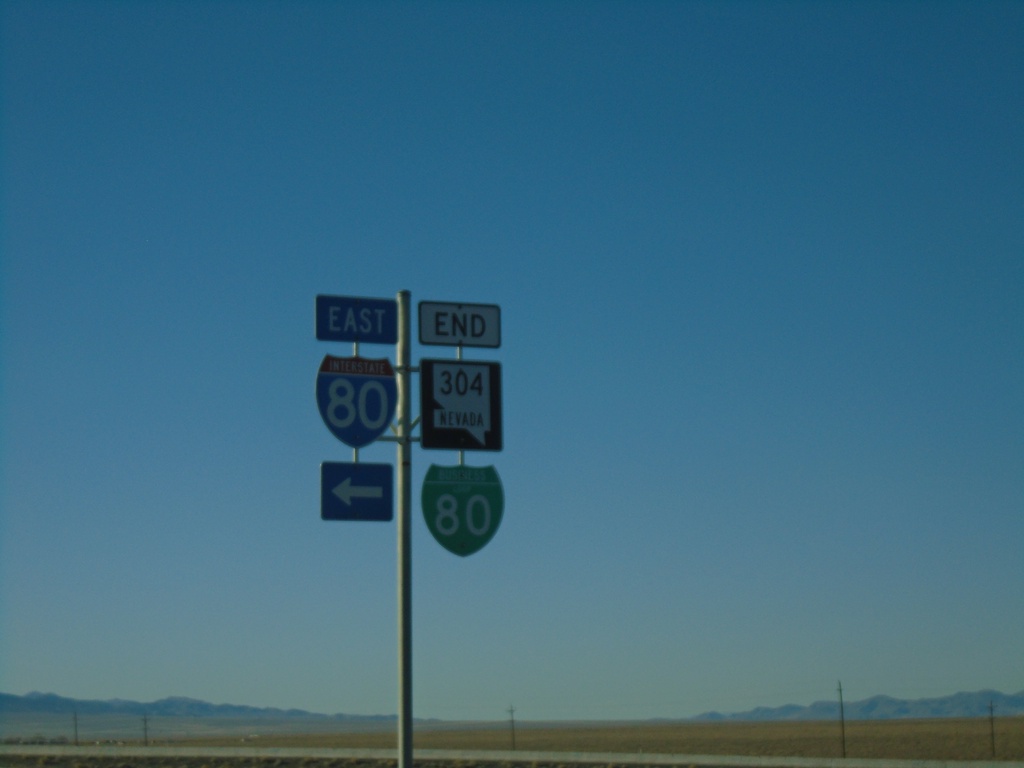
End BL-80/NV-304 East At I-80
I-80 junction (Exit 233) at eastern end of NV-304/BL-80
Taken 10-20-2019


 Battle Mountain
Lander County
Nevada
United States
Battle Mountain
Lander County
Nevada
United States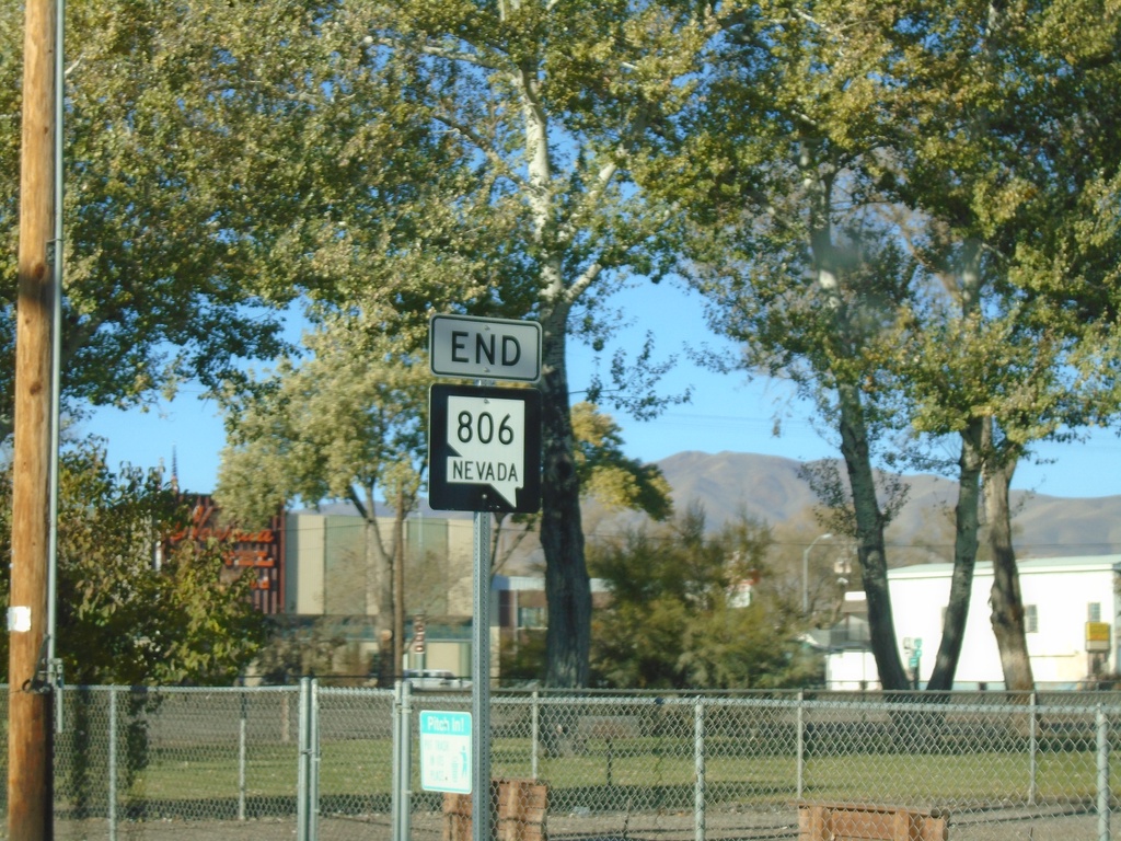
End NV-806 South - Battle Mountain
End NV-806 South (Reese St.) at BL-80/NV-304 in Battle Mountain
Taken 10-20-2019
 Battle Mountain
Lander County
Nevada
United States
Battle Mountain
Lander County
Nevada
United States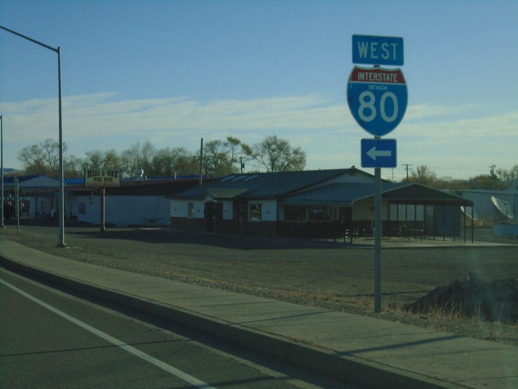
NV-305 North at I-80 West
NV-305 North at I-80 West in Battle Mountain.
Taken 10-20-2019
 Battle Mountain
Lander County
Nevada
United States
Battle Mountain
Lander County
Nevada
United States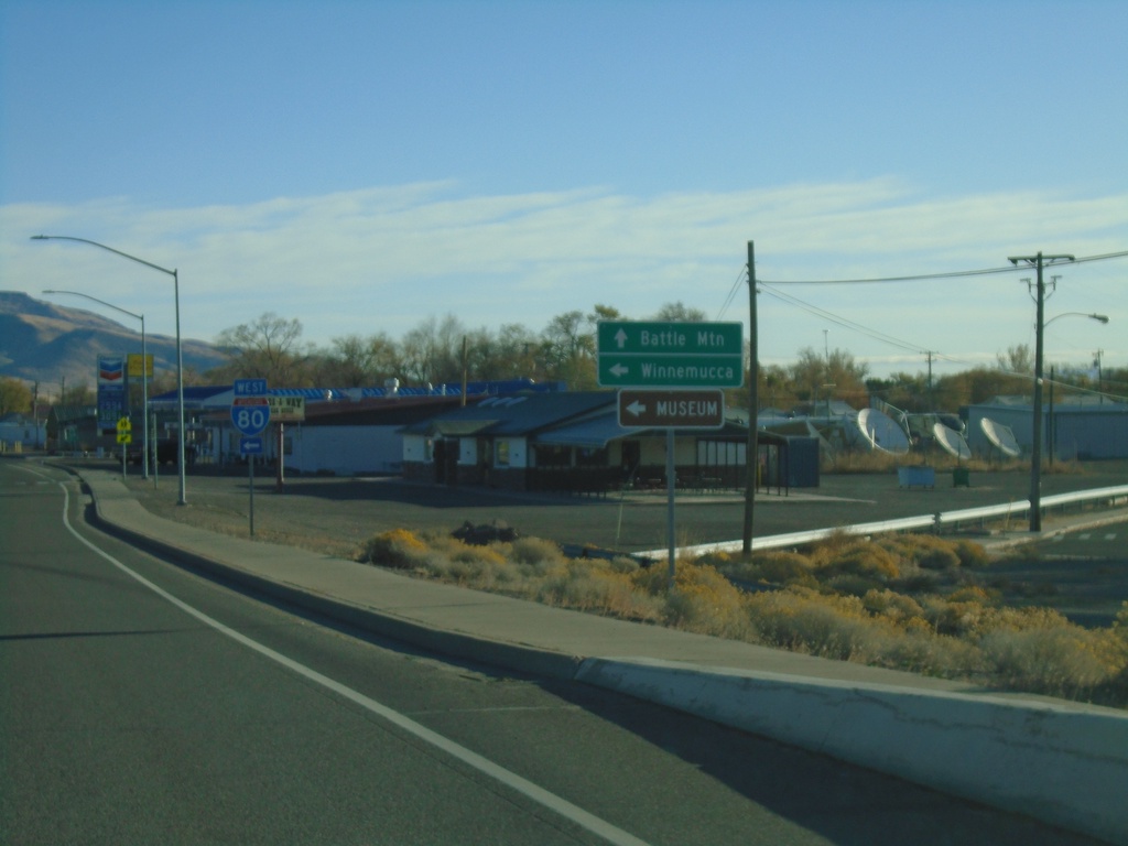
NV-305 North at I-80 West
NV-305 North at I-80 West (Exit 231). Use I-80 west for Winnemucca. Continue north on NV-305 for Battle Mountain.
Taken 10-20-2019
Battle Mountain
Lander County
Nevada
United States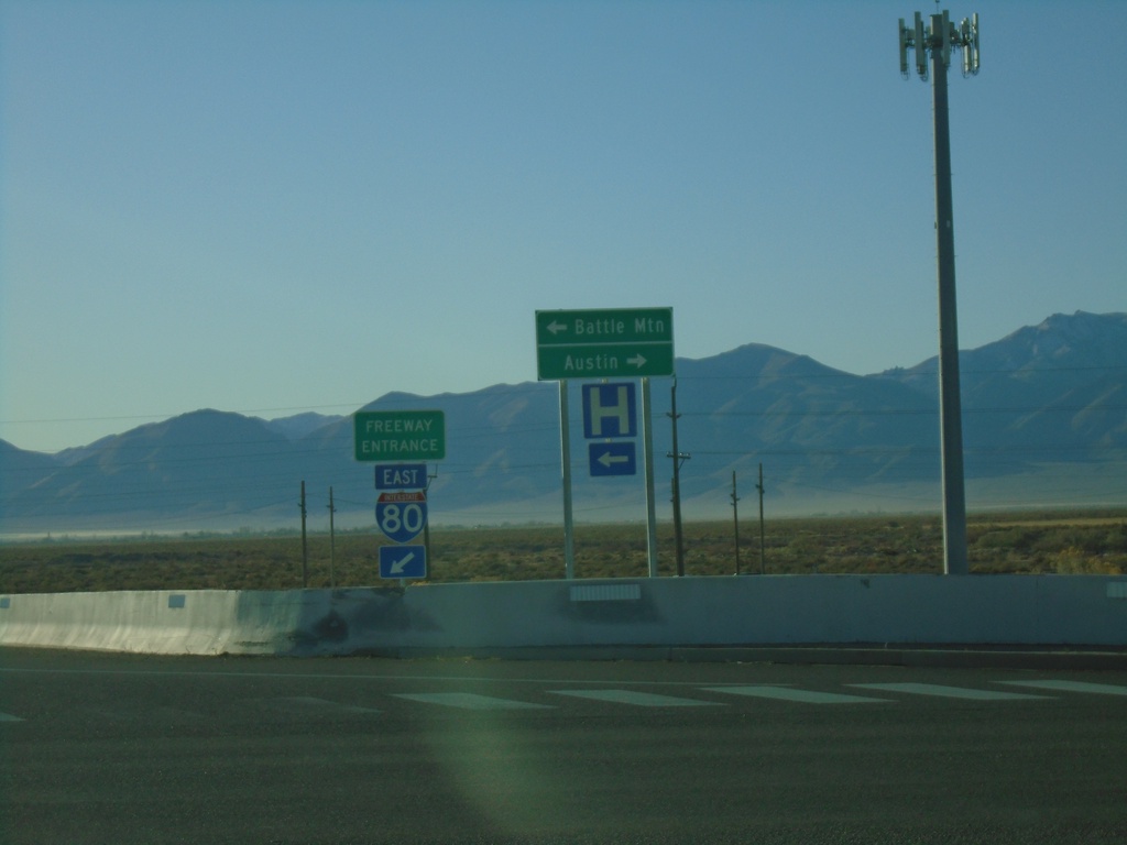
I-80 East Exit 231 Offramp at NV-305
I-80 East Exit 231 Offramp at NV-305 in Battle Mountain. Use NV-305 North for Battle Mountain; NV-305 South for Austin.
Taken 10-20-2019
Battle Mountain
Lander County
Nevada
United States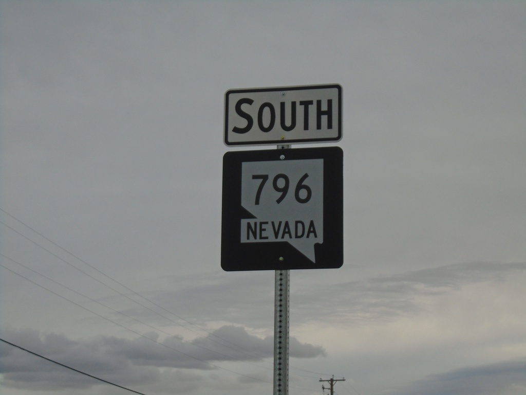
NV-796 South - Winnemucca
NV-796 South (Airport Road) in Winnemucca.
Taken 10-19-2019
 Winnemucca
Humboldt County
Nevada
United States
Winnemucca
Humboldt County
Nevada
United States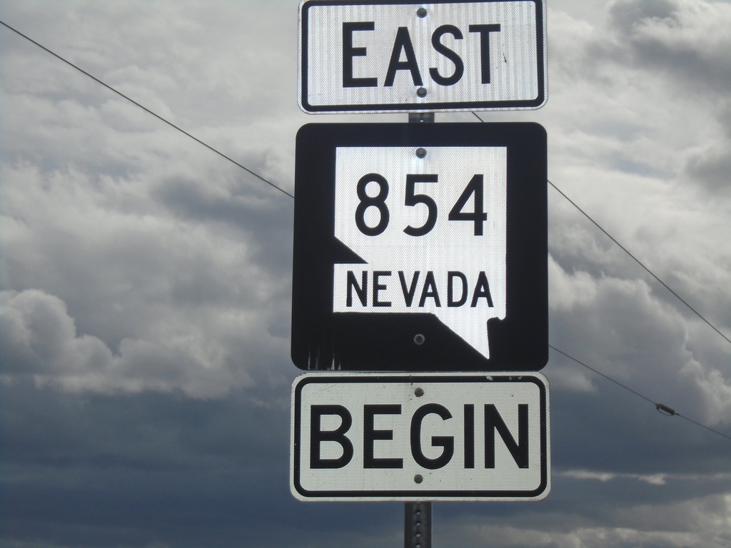
Begin NV-854 East
Begin NV-854 East - Pershing County
Taken 10-19-2019
 Lovelock
Pershing County
Nevada
United States
Lovelock
Pershing County
Nevada
United States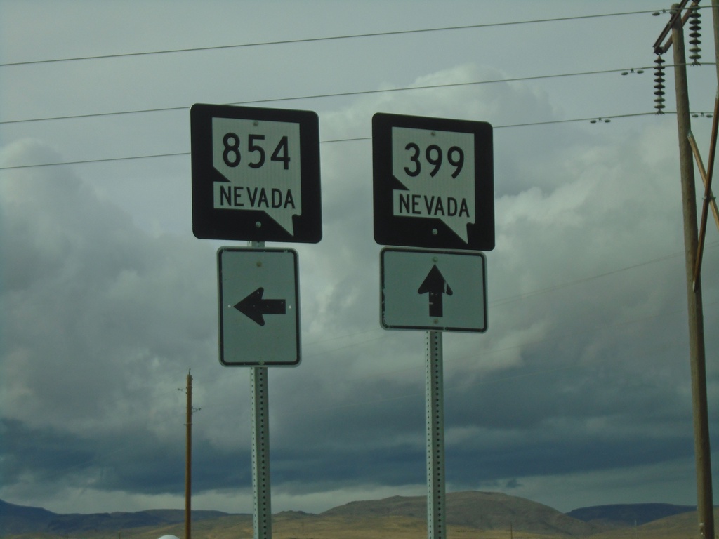
NV-399 West at NV-854
NV-399 West at NV-854 south in Pershing County.
Taken 10-19-2019
 Lovelock
Pershing County
Nevada
United States
Lovelock
Pershing County
Nevada
United States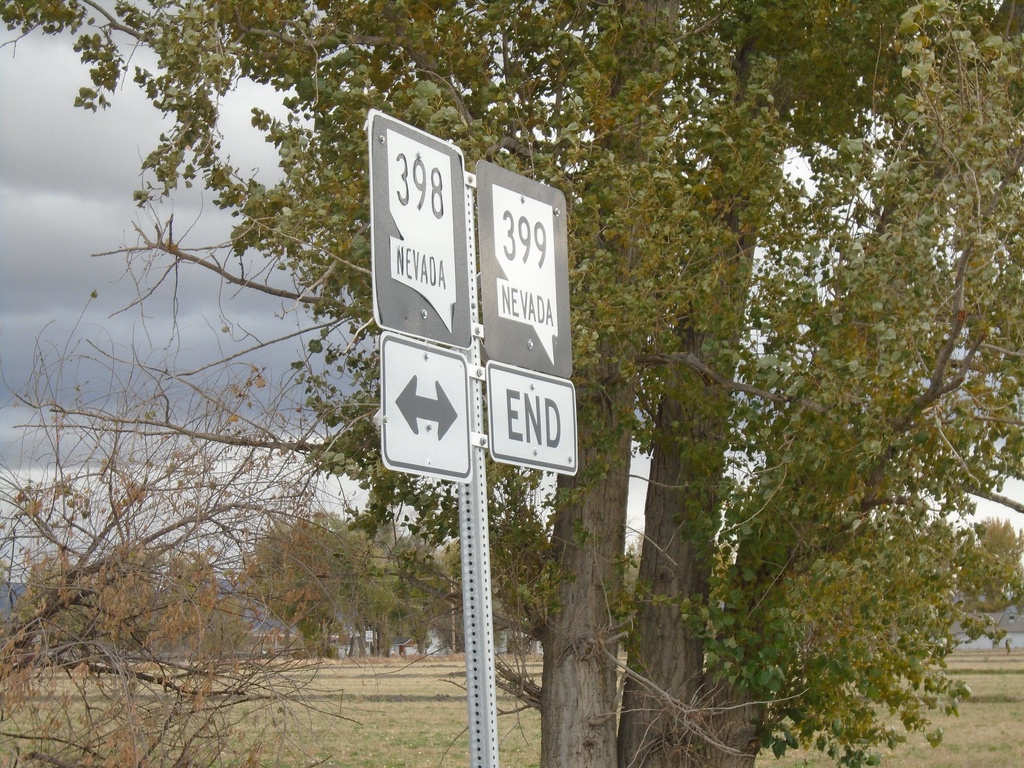
End NV-399 East at NV-398
End NV-399 East (Pitt Road) at NV-398 (N Meridian Road).
Taken 10-19-2019
 Lovelock
Pershing County
Nevada
United States
Lovelock
Pershing County
Nevada
United States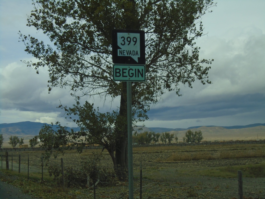
Begin NV-399 West
Begin NV-399 West in Pershing County
Taken 10-19-2019
Lovelock
Pershing County
Nevada
United States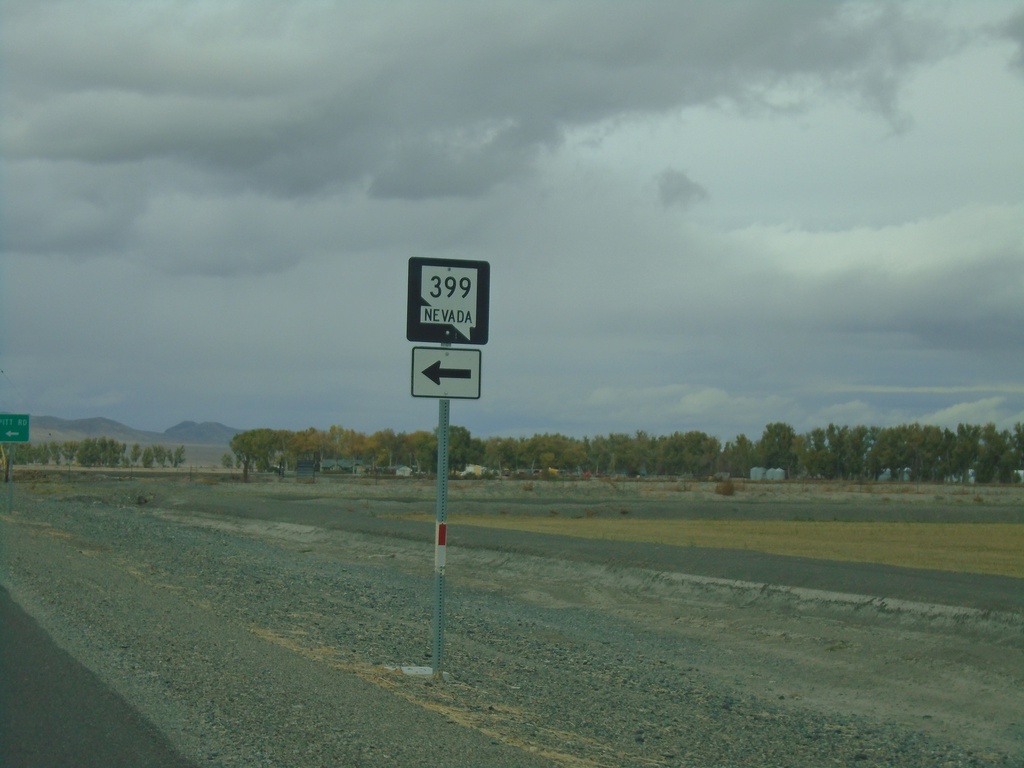
NV-398 North Approaching NV-399
NV-398 North approaching NV-399 in Pershing County
Taken 10-19-2019
Lovelock
Pershing County
Nevada
United States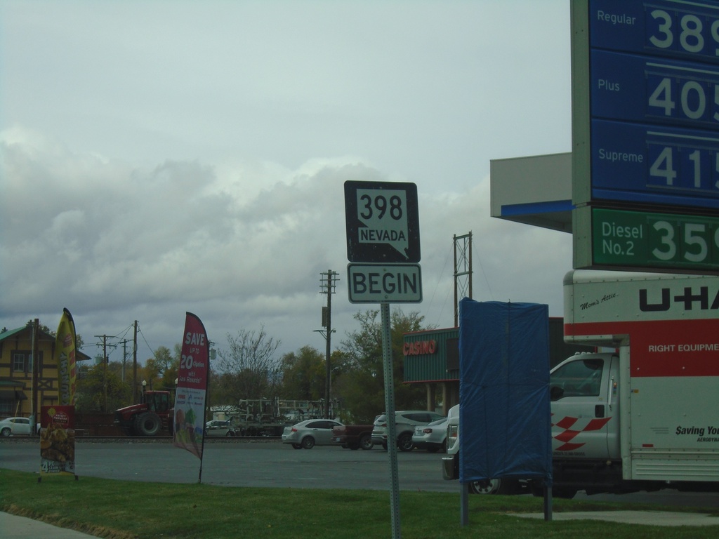
Begin NV-398 North - Lovelock
Begin NV-398 North on Main St. in Lovelock
Taken 10-19-2019
Lovelock
Pershing County
Nevada
United States
End NV-439 North at I-80
End NV-439 North at I-80 East (Exit 32)
Taken 10-19-2019
 Clark
Storey County
Nevada
United States
Clark
Storey County
Nevada
United States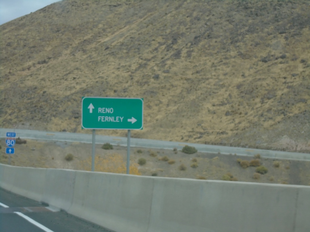
NV-439 North approaching I-80
NV-439 North approaching I-80. Use I-80 west for Reno; I-80 east for Fernley.
Taken 10-19-2019
Clark
Storey County
Nevada
United States
NV-439 North Approaching I-80
NV-439 North Approaching I-80 (Exit 32)
Taken 10-19-2019
Sparks
Storey County
Nevada
United States
NV-439 North - USA Parkway
NV-439 North - USA Parkway.
Taken 10-19-2019
Silver Springs
Lyon County
Nevada
United States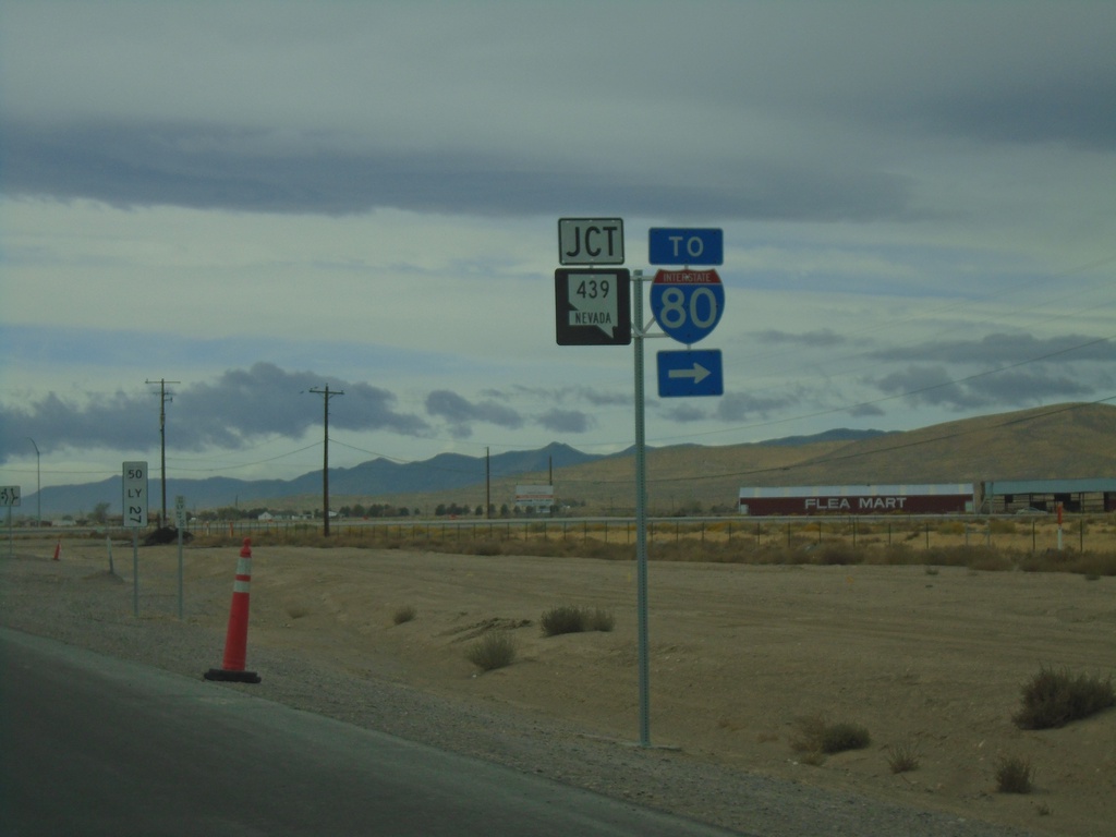
US-50 West Approaching NV-439
US-50 West approaching NV-439/To I-80 in Lyon County.
Taken 10-19-2019
 Silver Springs
Lyon County
Nevada
United States
Silver Springs
Lyon County
Nevada
United States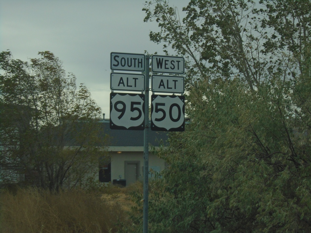
Alt. US-50 West/Alt. US-95 South - Fernley
Alt. US-50 West/Alt. US-95 South in Fernley
Taken 10-19-2019

 Fernley
Lyon County
Nevada
United States
Fernley
Lyon County
Nevada
United States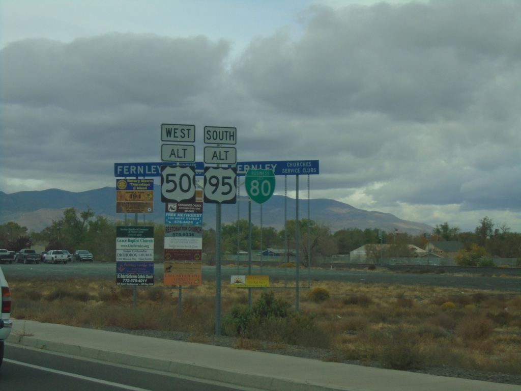
Alt. US-95 South/Alt. US-50 West/BL-80 - Fernley
Alt. US-95 South/Alt. US-50 West/BL-80 on E. Main St. in Fernley
Taken 10-19-2019
Fernley
Lyon County
Nevada
United States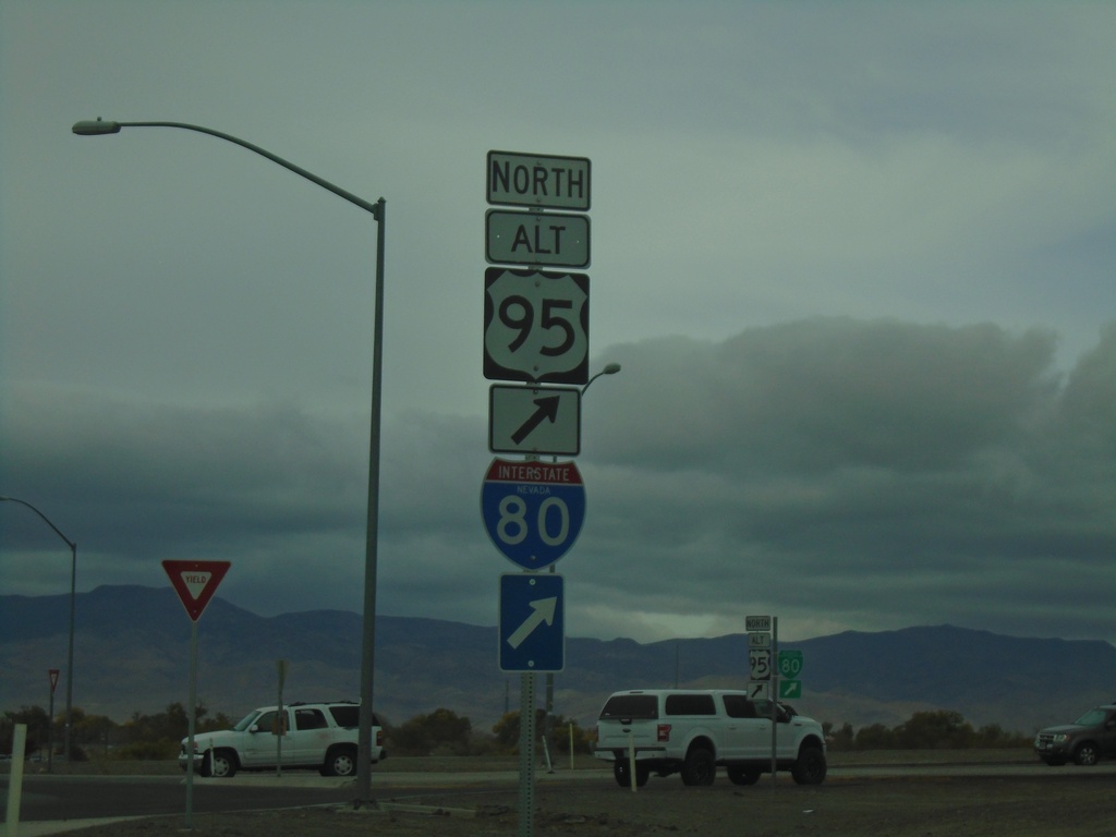
Alt. US-50 West at Alt. US-95 Roundabout
Alt. US-50 West at Alt. US-95 roundabout. Turn right for Alt. US-95 North/To I-80
Taken 10-19-2019
Fernley
Lyon County
Nevada
United States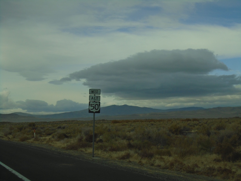
Alt. US-50 West - Churchill County
First Alt. US-50 shield westbound in Churchill County
Taken 10-19-2019
Fallon
Churchill County
Nevada
United States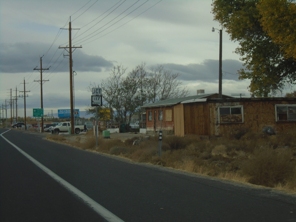
US-50 West Approaching NV-117
US-50 West Approaching NV-117 - Sheckler Cut Off
Taken 10-19-2019
 Fallon
Churchill County
Nevada
United States
Fallon
Churchill County
Nevada
United States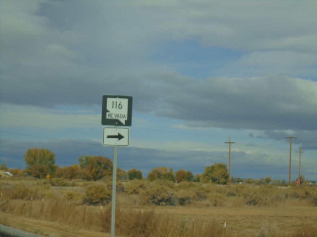
US-50 West Approaching NV-116
US-50 west approaching NV-116 in Churchill County.
Taken 10-19-2019
 Fallon
Churchill County
Nevada
United States
Fallon
Churchill County
Nevada
United States
US-50 West at NV-839 South
US-50 west at NV-839 south to B-17 Naval Range.
Taken 10-19-2019
 Fallon
Churchill County
Nevada
United States
Fallon
Churchill County
Nevada
United States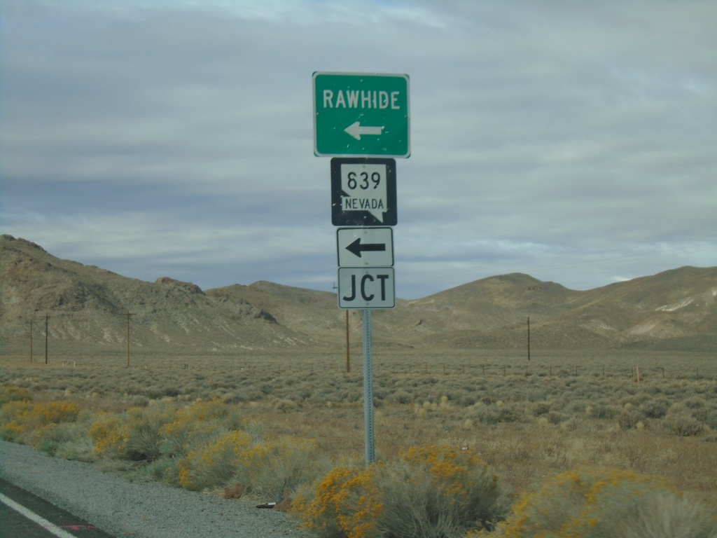
US-50 West at NV-839
US-50 west at NV-839 south to Rawhide.
Taken 10-19-2019
Fallon
Churchill County
Nevada
United States