Signs Tagged With Shield
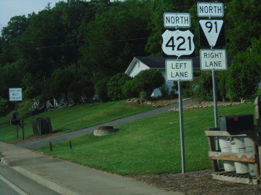
US-412 North Approaching TNS-91
US-412 North Approaching TNS-91 in Mountain City.
Taken 06-23-2019

 Mountain City
Johnson County
Tennessee
United States
Mountain City
Johnson County
Tennessee
United States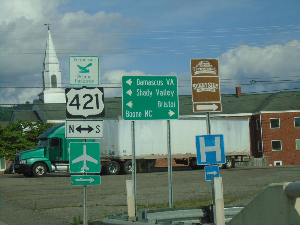
TN-67 East at US-412/TNS-418
TN-67 East at US-412/TNS-418 in Mountain City. Use US-412 South/TN-67 East to Boone, NC. Use US-412 North to Damascus (VA), Bristol, and Shady Valley.
Taken 06-23-2019

 Mountain City
Johnson County
Tennessee
United States
Mountain City
Johnson County
Tennessee
United States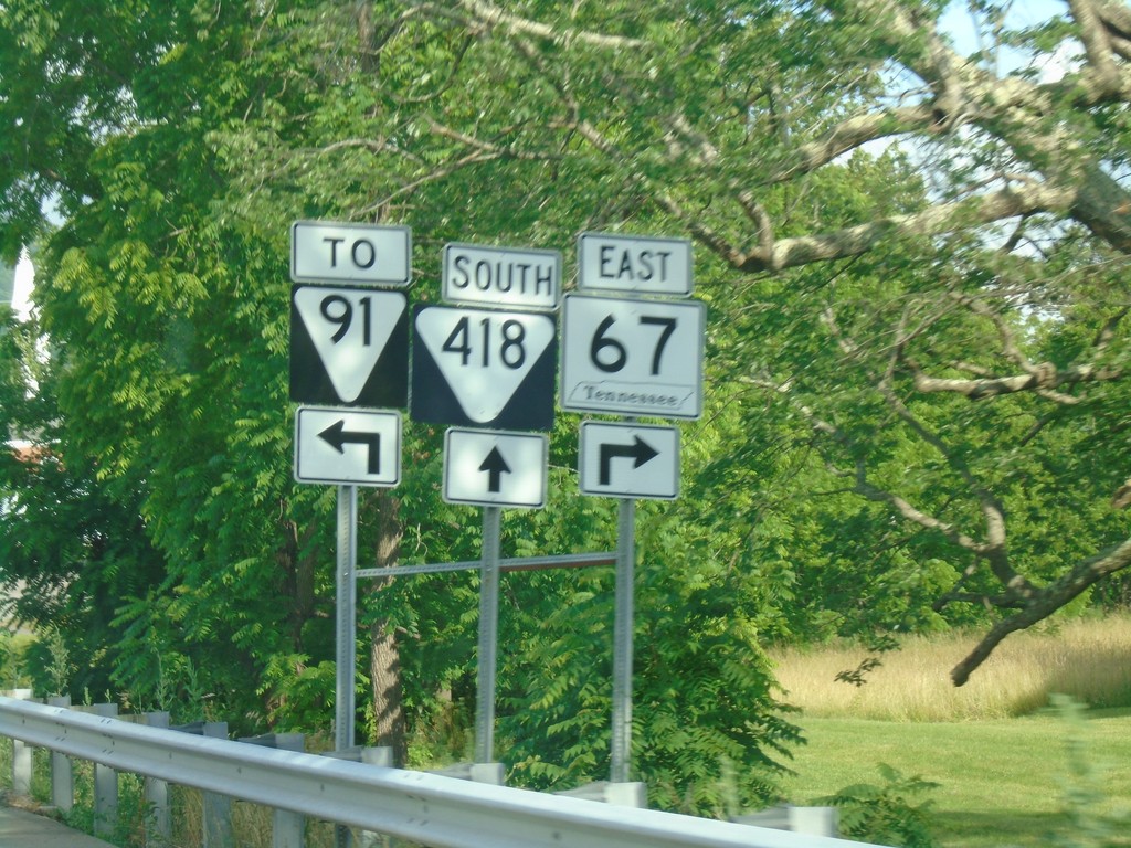
TN-67 East at US-421/TNS-418/To TNS-91
TN-67 East at US-421/TNS-418/To TNS-91 in Mountain City. Turn right to continue east on TN-67.
Taken 06-23-2019
 Mountain City
Johnson County
Tennessee
United States
Mountain City
Johnson County
Tennessee
United States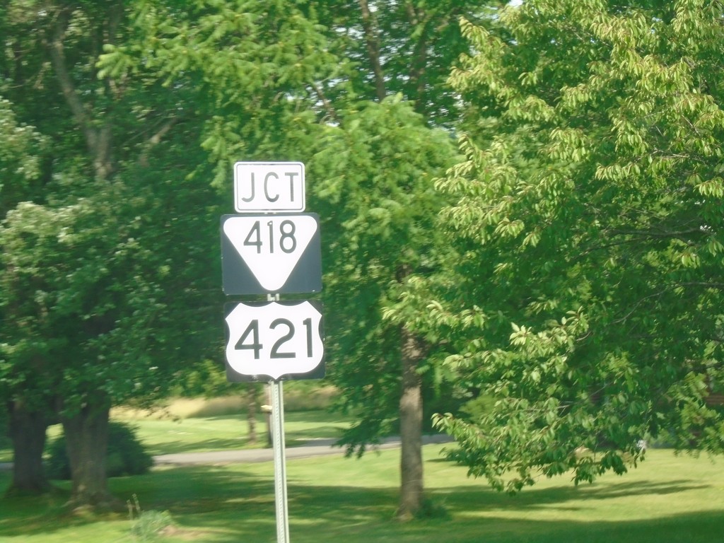
TN-67 East Approaching US-421 and TNS-418
TN-67 East Approaching US-421 and TNS-418 in Mountain City.
Taken 06-23-2019
Mountain City
Johnson County
Tennessee
United States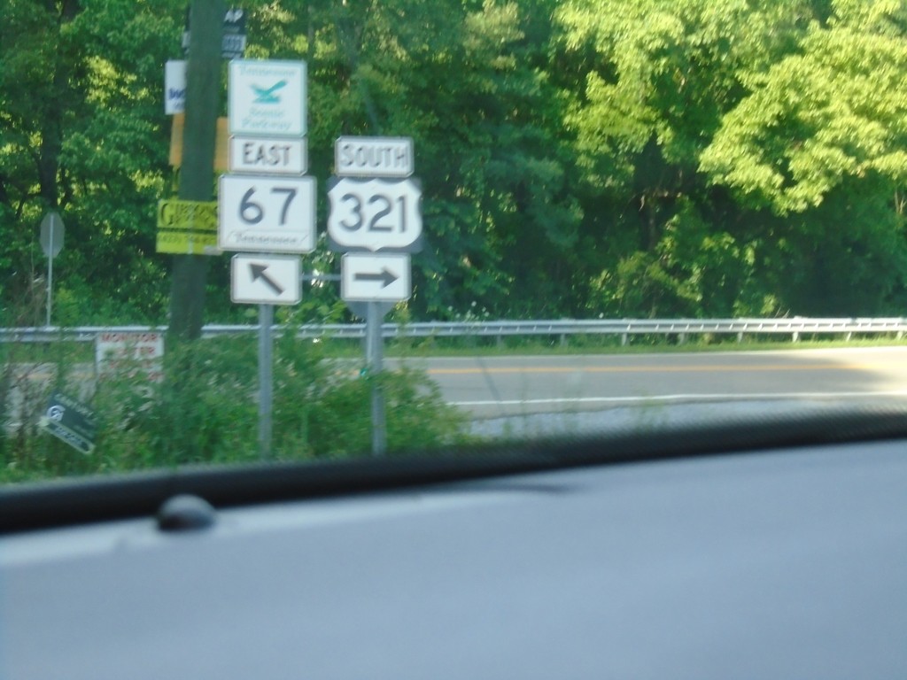
US-321 South/TN-67 East Split in Carter County
US-321 South/TN-67 East Split in Carter County
Taken 06-23-2019
 Butler
Carter County
Tennessee
United States
Butler
Carter County
Tennessee
United States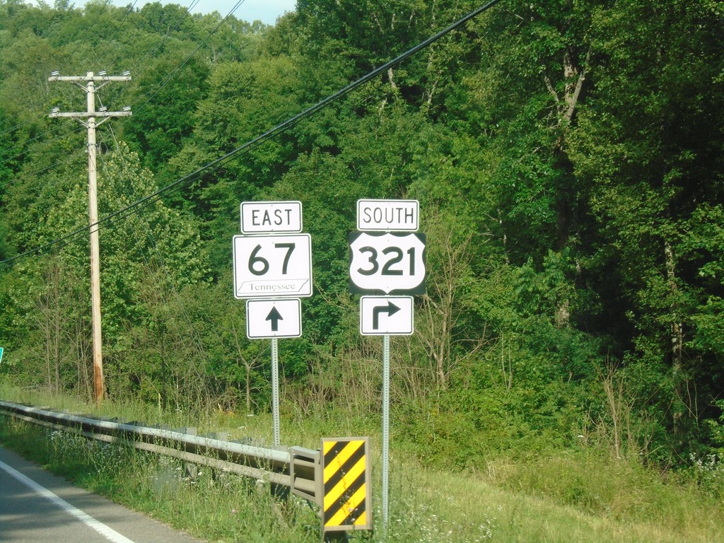
US-321 South/TN-67 East Split
US-321 South/TN-67 East Split in Carter County. Turn right for US-321 South; continue straight for TN-67 East.
Taken 06-23-2019
Butler
Carter County
Tennessee
United States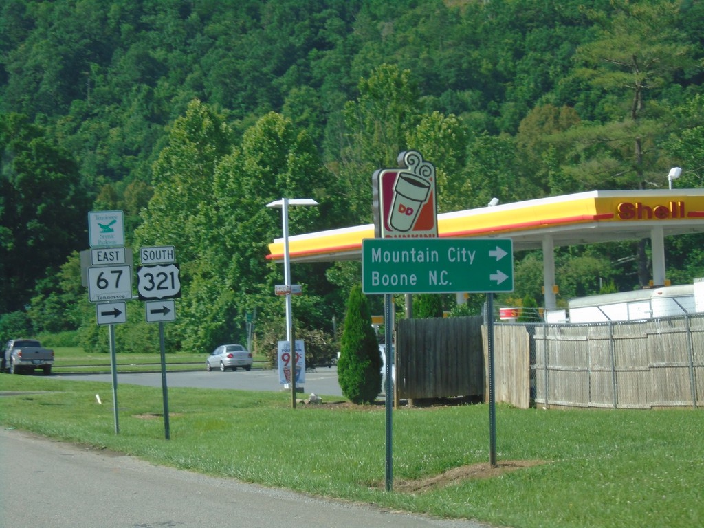
US-19E North at US-321/TN-67 - Hampton
US-19E North at US-321/TN-67 in Hampton. Turn right for US-321 South/TN-67 East to Mountain City and Boone NC. Continue straight for US-19E/US-321 North/TN-67 West.
Taken 06-23-2019
 Hampton
Carter County
Tennessee
United States
Hampton
Carter County
Tennessee
United States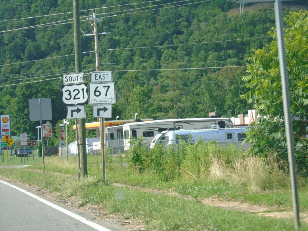
US-19E North at US-321 and TN-67
US-19E North at US-321 and TN-67 in Hampton. Turn right for US-321 South/TN-67 East. Continue straight for US-321 north. US-321 North joins US-19E northbound.
Taken 06-23-2019
Hampton
Carter County
Tennessee
United States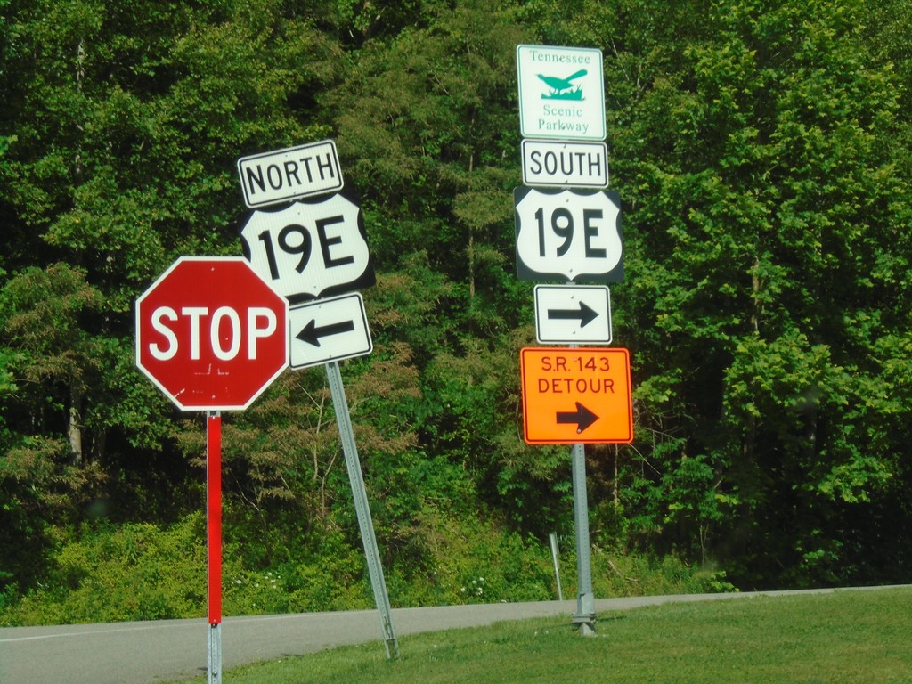
End TNS-173 East at US-19E
End TNS-173 East at US-19E in Carter County.
Taken 06-23-2019
 Hampton
Carter County
Tennessee
United States
Hampton
Carter County
Tennessee
United States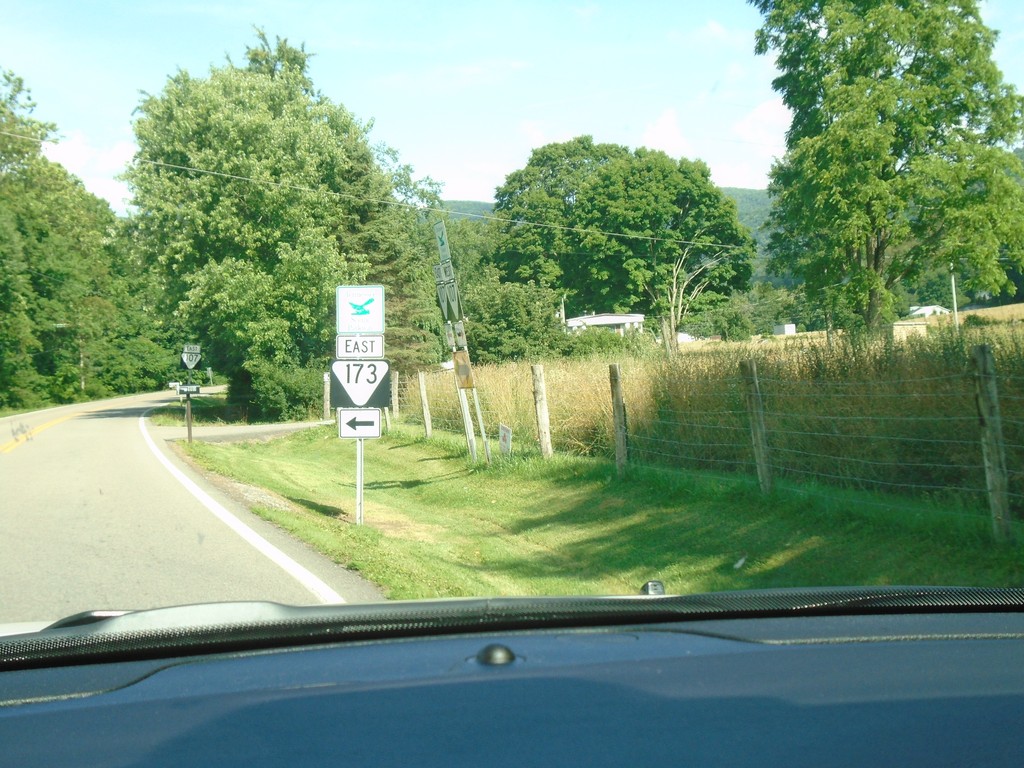
TNS-107/TNS-173 East at TNS-107/TNS-173 Split
TNS-107/TNS-173 East at TNS-107/TNS-173 Split in Unicoi County
Taken 06-23-2019
 Unicoi
 County
Tennessee
United States
Unicoi
Unicoi County
Tennessee
United States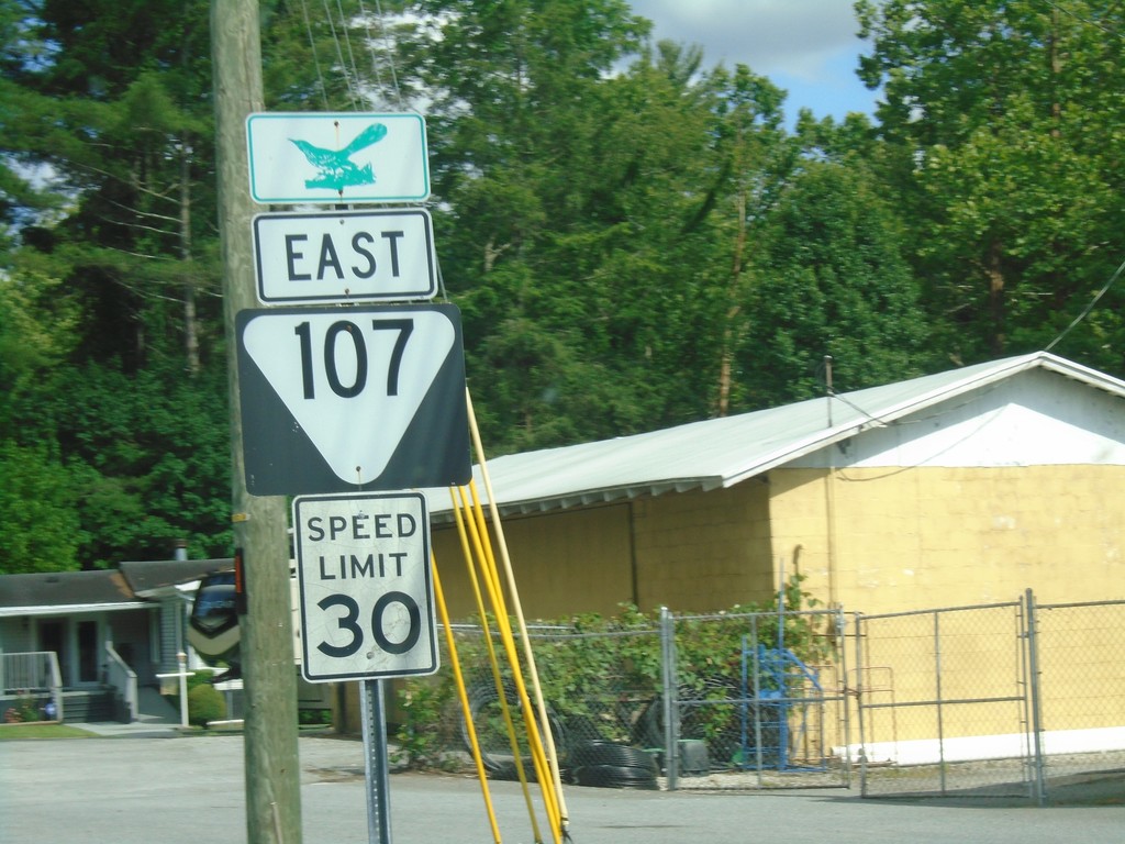
TNS-107 East - Unicoi
TNS-107 East in Unicoi.
Taken 06-23-2019
Unicoi
Unicoi County
Tennessee
United States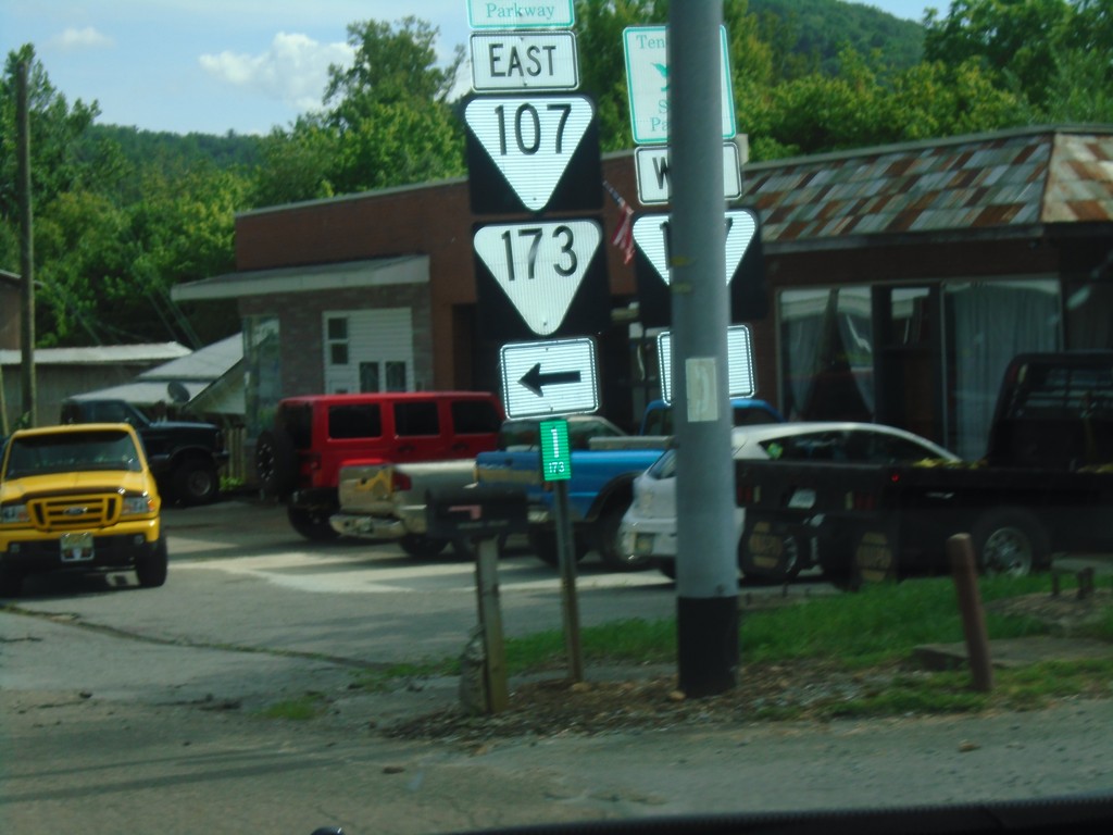
TNS-173 East at TNS-107
TNS-173 East at TNS-107. Turn left for TNS-173 East/TNS-107 East. Continue straight for TNS-107 West.
Taken 06-23-2019
Unicoi
Unicoi County
Tennessee
United States
I-26 Exit 32 Offramp at TNS-173 East
I-26 Exit 32 Offramp at TNS-173 East, a Tennessee Scenic Parkway. Use TNS-173 east for Alt. I-26 junction.
Taken 06-23-2019

 Unicoi
 County
Tennessee
United States
Unicoi
Unicoi County
Tennessee
United States
I-26 West/US-23 North - Unicoi County
I-26 West/US-23 North in Unicoi County. US-23 is a Tennessee Scenic Byway.
Taken 06-23-2019
 Flag Pond
Unicoi County
Tennessee
United States
Flag Pond
Unicoi County
Tennessee
United States
NC-197 at Future I-26/US-19/US-23 Jct.
NC-197 at Future I-26/US-19/US-23 onramp.
Taken 06-23-2019


 Weaverville
Buncombe County
North Carolina
United States
Weaverville
Buncombe County
North Carolina
United States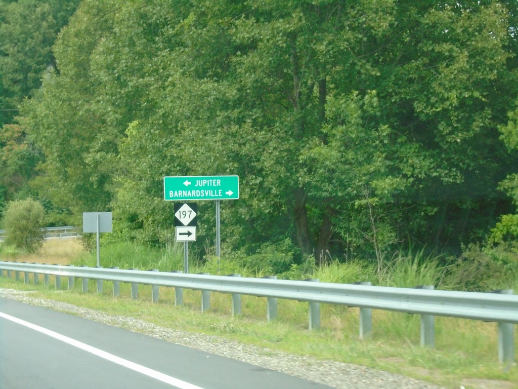
Future I-26 Exit 15 Offramp at NC-197
Future I-26 Exit 15 Offramp at NC-197. Turn right for NC-197 to Barnardsville; left for Jupiter.
Taken 06-23-2019
Weaverville
Buncombe County
North Carolina
United States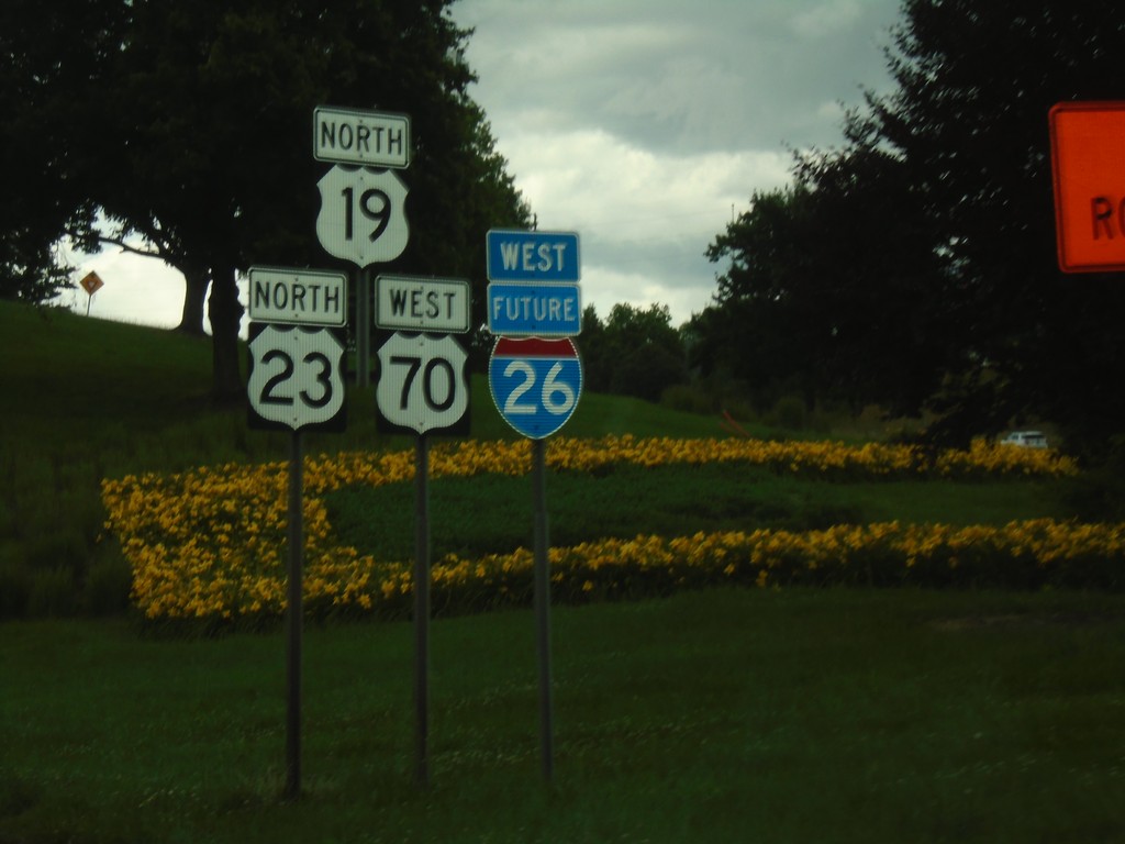
Future I-26/US-23/US-19/US-70 - Asheville
Future I-26/US-23/US-19/US-70 in Asheville
Taken 06-23-2019
 Asheville
Buncombe County
North Carolina
United States
Asheville
Buncombe County
North Carolina
United States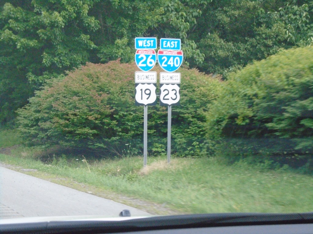
I-26 West/I-240 East/Bus. US-19/Bus. US-23 - Asheville
I-26 West/I-240 East/Bus. US-19/Bus. US-23 in Asheville.
Taken 06-23-2019


 Asheville
Buncombe County
North Carolina
United States
Asheville
Buncombe County
North Carolina
United States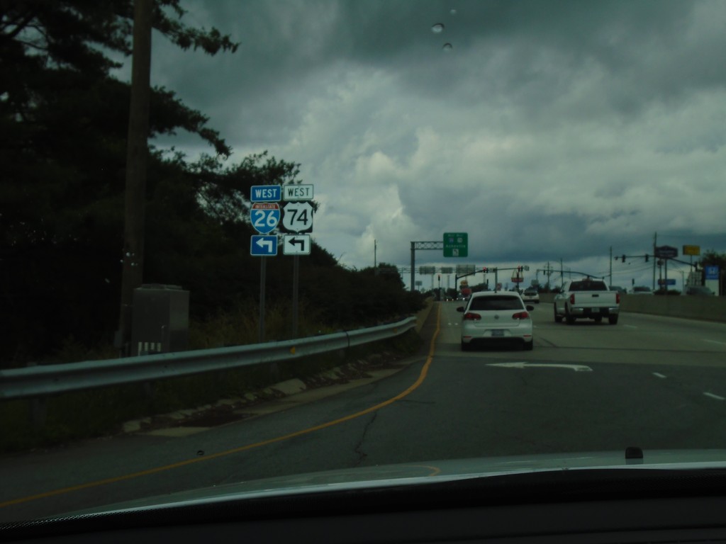
NC-280 East at I-26 West/US-74 West
NC-280 East at I-26 West/US-74 West (Exit 40)
Taken 06-23-2019

 Fletcher
Buncombe County
North Carolina
United States
Fletcher
Buncombe County
North Carolina
United States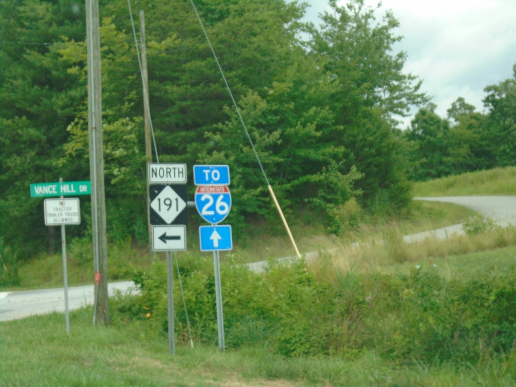
NC-280 East/NC-191 North at NC-191 Split
NC-280 East/NC-191 North at NC-191 Split. Turn left for NC-191 north; continue straight on NC-280 for I-26.
Taken 06-23-2019
 Mills River
Henderson County
North Carolina
United States
Mills River
Henderson County
North Carolina
United States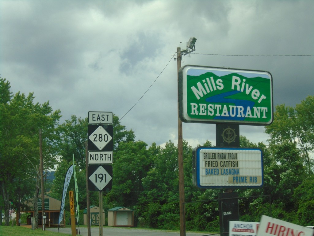
NC-191 North/NC-280 East - Mills River
NC-191 North/NC-280 East in Mills River
Taken 06-23-2019
Mills River
Henderson County
North Carolina
United States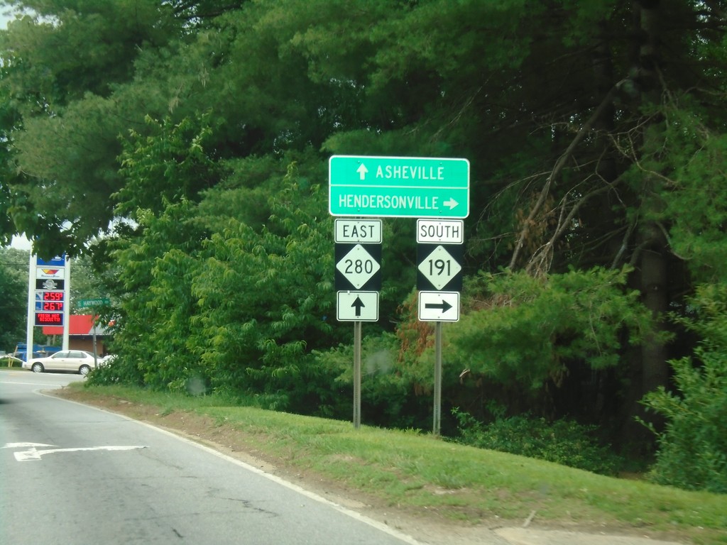
NC-280 East at NC-191 South
NC-280 East at NC-191 South. Use NC-191 south for Hendersonville; continue on NC-280 east for Asheville.
Taken 06-23-2019
Mills River
Henderson County
North Carolina
United States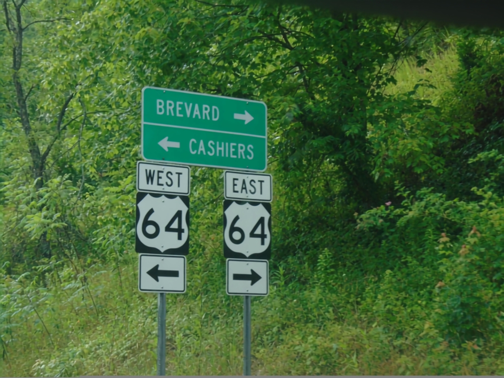
End US-178 West at US-64
End US-178 West at US-64 in Transylvania County. Use US-64 west for Cashiers; US-64 east for Brevard.
Taken 06-23-2019

 Rosman
Transylvania County
North Carolina
United States
Rosman
Transylvania County
North Carolina
United States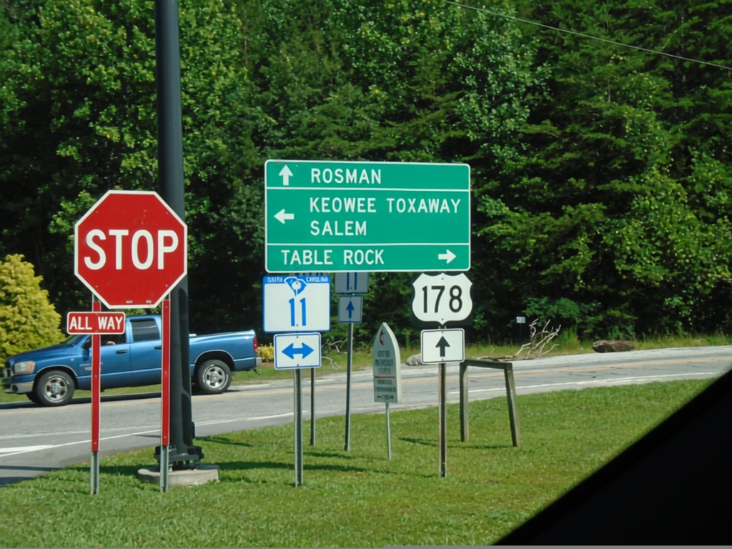
US-178 North at SC-11
US-178 North at SC-11 in Pickens County. Turn right for SC-11 East to Table Rock; left for SC-11 West to Keowee Toxaway and Salem. Continue north on US-178 for Rosman (NC).
Taken 06-23-2019
 Pickens
 County
South Carolina
United States
Pickens
Pickens County
South Carolina
United States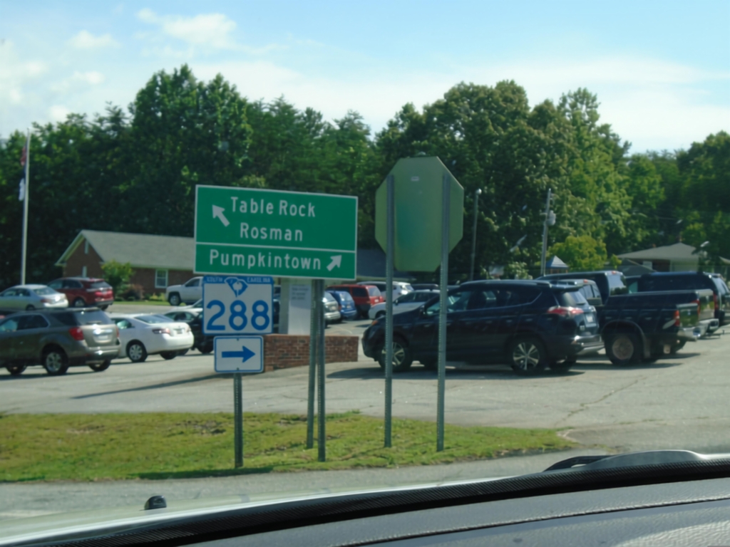
US-178 North at SC-288
US-178 North at SC-288 to Pumpkintown. Continue north on US-178 for Table Rock and Rosman (NC).
Taken 06-23-2019
 Pickens
 County
South Carolina
United States
Pickens
Pickens County
South Carolina
United States