Signs Tagged With Shield
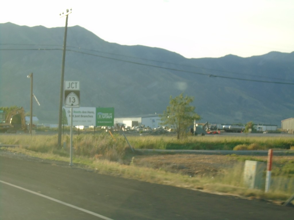
UT-102 East Approaching UT-13
UT-102 East approaching UT-13 in Tremonton.
Taken 08-03-2019

 Tremonton
Box Elder County
Utah
United States
Tremonton
Box Elder County
Utah
United States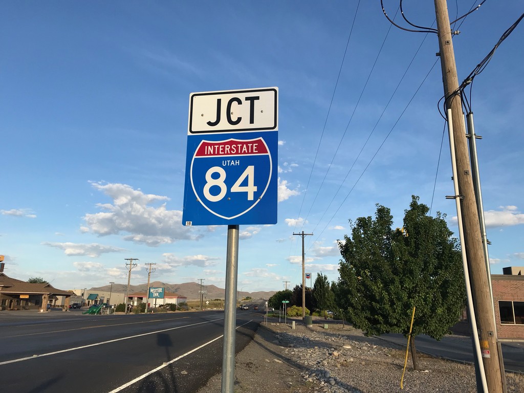
UT-102 West Approaching I-84
UT-102 West approaching I-84 (Exit 40) in Tremonton.
Taken 08-03-2019
 Tremonton
Box Elder County
Utah
United States
Tremonton
Box Elder County
Utah
United States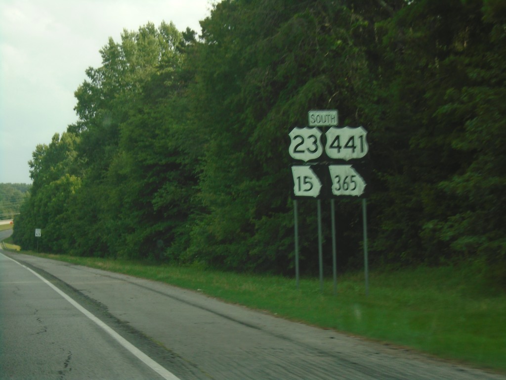
US-23/US-441/GA-15/GA-365 South
US-23/US-441/GA-15/GA-365 South in Habersham County.
Taken 06-24-2019


 Cornelia
Habersham County
Georgia
United States
Cornelia
Habersham County
Georgia
United States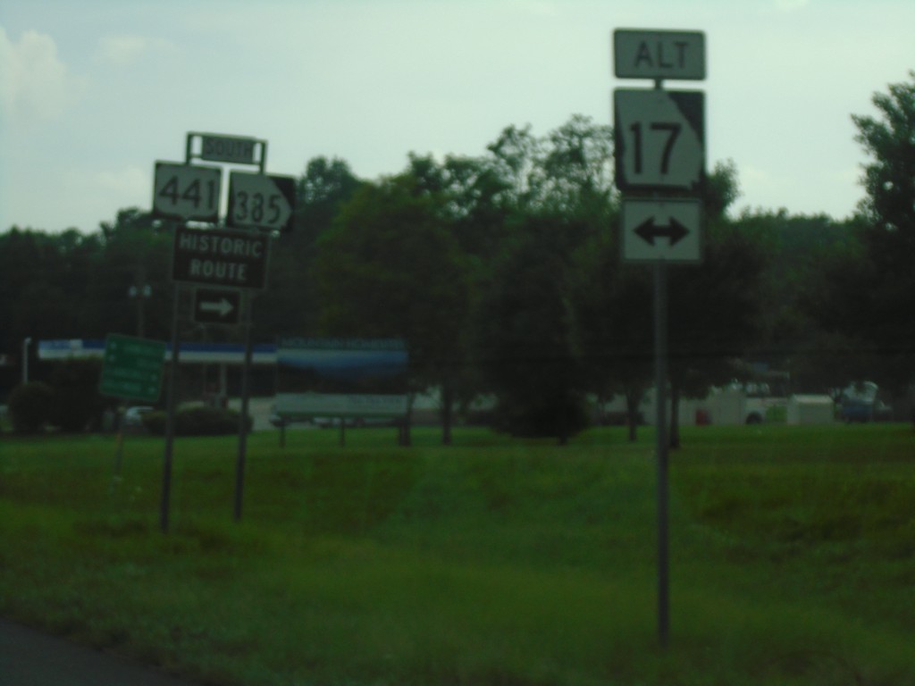
US-23/US-441/GA-15 South at Alt. GA-17/Bus. US-441/GA-385
US-23/US-441/GA-15 South at Alt. GA-17/Bus. US-441/GA-385 in Habersham County.
Taken 06-24-2019


 Clarkesville
Habersham County
Georgia
United States
Clarkesville
Habersham County
Georgia
United States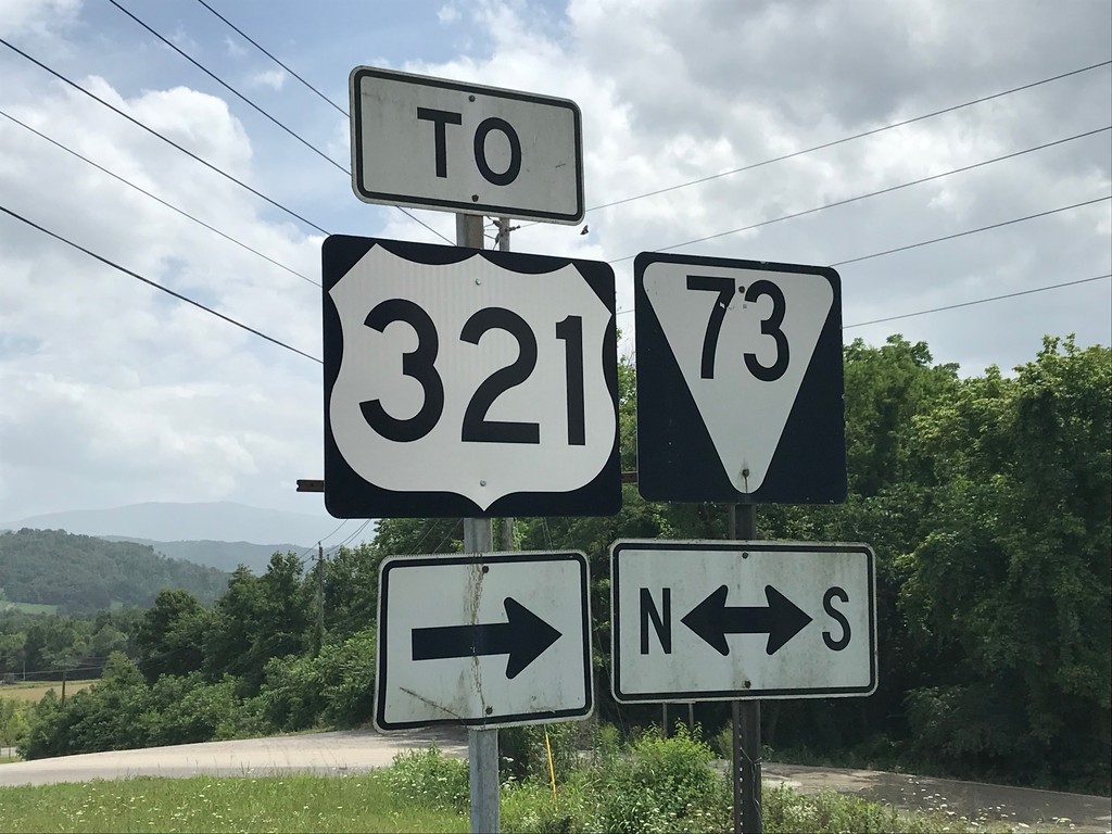
I-40 East Exit 440 Offramp at TNS-73
I-40 East Exit 440 offramp at TNS-73/To US-321
Taken 06-24-2019


 Newport
Cocke County
Tennessee
United States
Newport
Cocke County
Tennessee
United States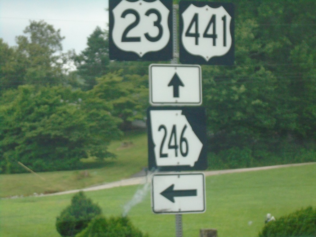
US-23/US-441 South at GA-246
US-23/US-441 South at GA-246 in Rabun County.
Taken 06-24-2019
 Dillard
Rabun County
Georgia
United States
Dillard
Rabun County
Georgia
United States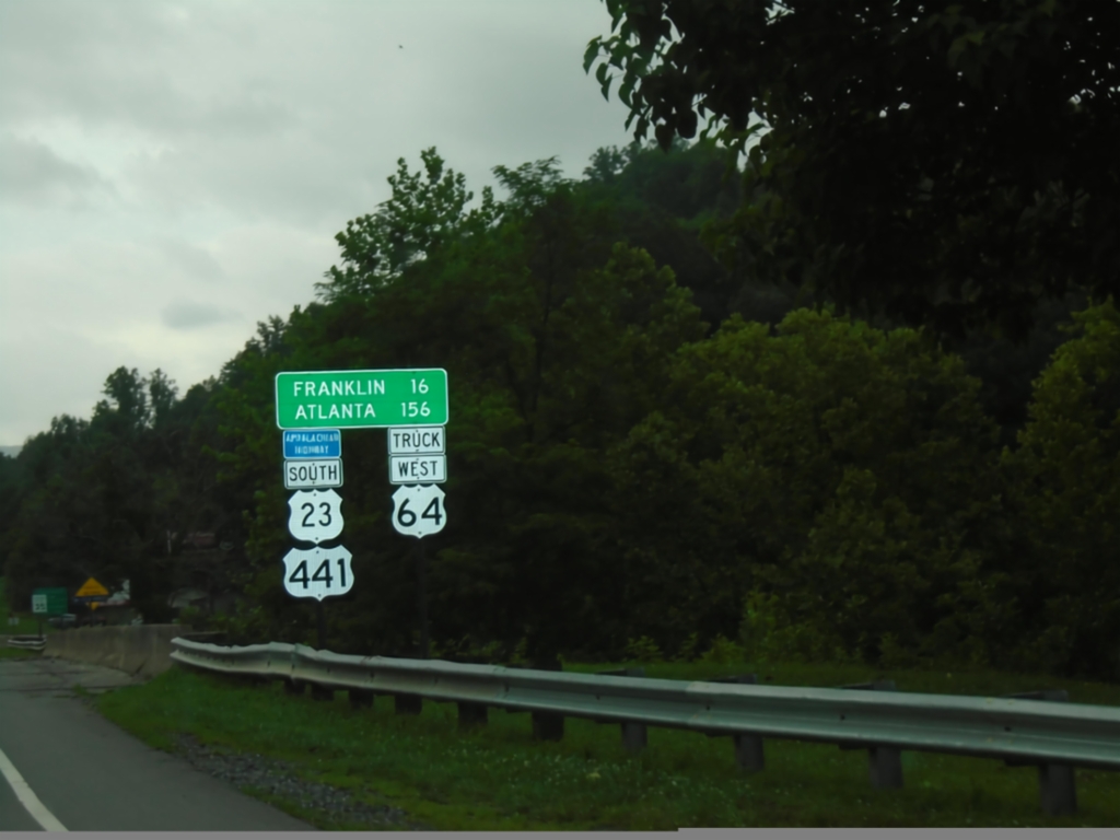
US-23 South/US-441 South/Truck US-64 West - Distance Marker
Distance Marker on US-23 South/US-441 South/Truck US-64 West. Distance to Franklin and Atlanta (GA). This route is part of the Appalachian Development Highway System.
Taken 06-24-2019
Dillsboro
Jackson County
North Carolina
United States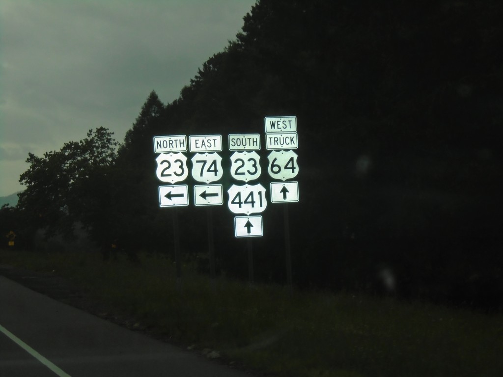
US-23 South/US-441 South at US-74 East/US-23 North
US-23 South/US-441 South at US-74 East/US-23 North onramp. Truck US-64 West follows US-23 South/US-441 South to Franklin.
Taken 06-24-2019
 Sylva
Jackson County
North Carolina
United States
Sylva
Jackson County
North Carolina
United States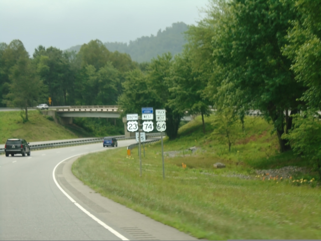
US-23 South/US-74 West/Truck US-64
US-23 South/US-74 West/Truck US-64 in Sylva.
Taken 06-24-2019
Sylva
Jackson County
North Carolina
United States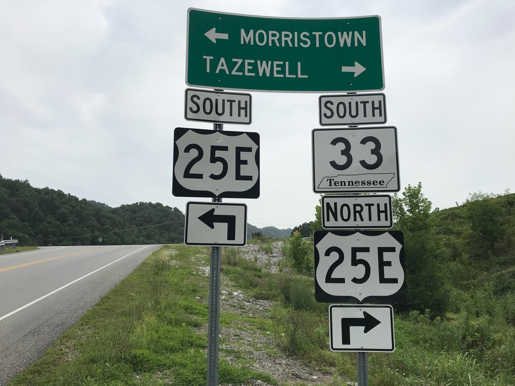
TN-33 South at US-25E
TN-33 South at US-25E in Claiborne County. Turn right for US-25E North/TN-33 South to Tazewell; left for US-25E South to Morristown.
Taken 06-24-2019

 Tazewell
Claiborne County
Tennessee
United States
Tazewell
Claiborne County
Tennessee
United States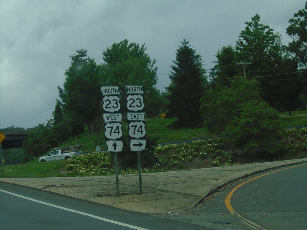
US-276 North at US-23/US-74
US-276 North at US-23/US-74 in Waynesville.
Taken 06-24-2019
 Waynesville
Haywood County
North Carolina
United States
Waynesville
Haywood County
North Carolina
United States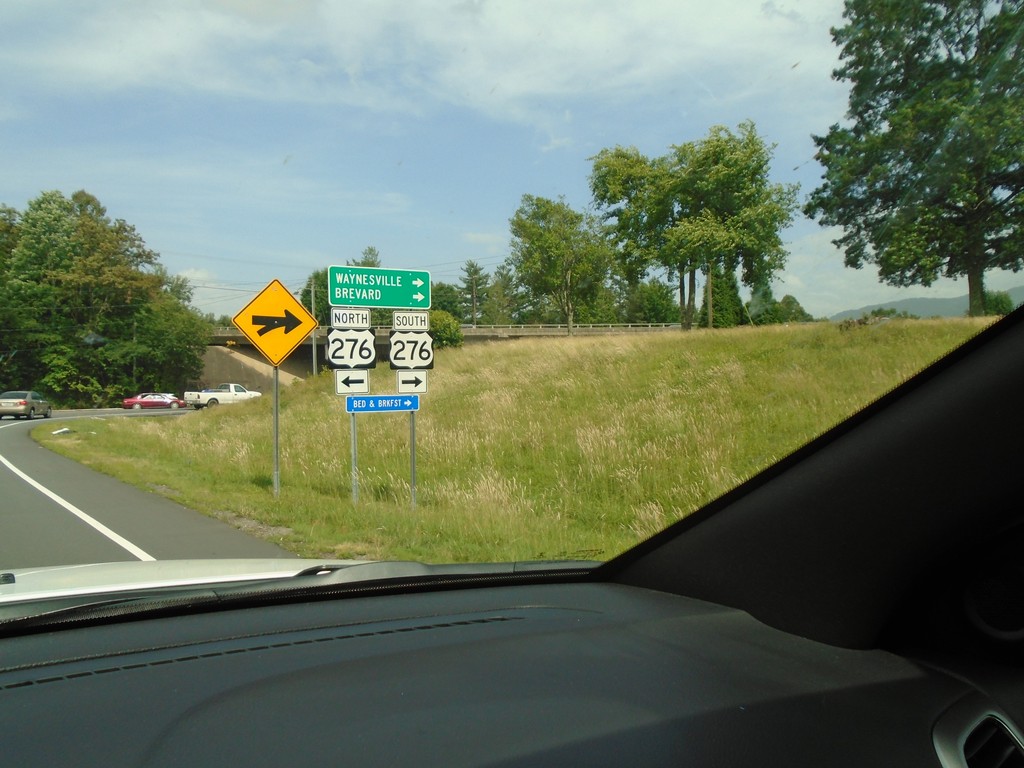
US-23 South/US-74 West Offramp at US-276
US-23 South/US-74 West offramp at US-276. Turn right for US-276 South to Waynesville and Brevard.
Taken 06-24-2019
Waynesville
Haywood County
North Carolina
United States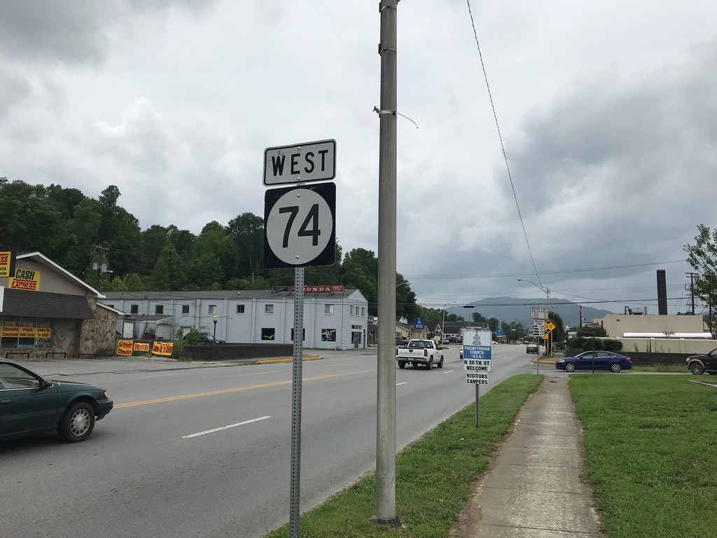
KY-74 West - Middlesboro
KY-74 west (Cumberland Ave.) in Middlesboro.
Taken 06-24-2019
 Middlesboro
Bell County
Kentucky
United States
Middlesboro
Bell County
Kentucky
United States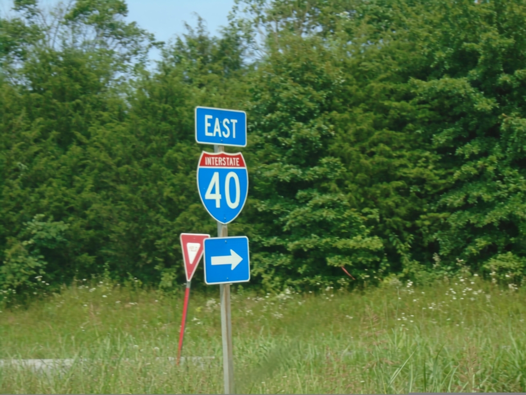
TNS-73 East at I-40 East (Exit 440)
TNS-73 East at I-40 East (Exit 440) in Cocke County.
Taken 06-24-2019
Newport
Cocke County
Tennessee
United States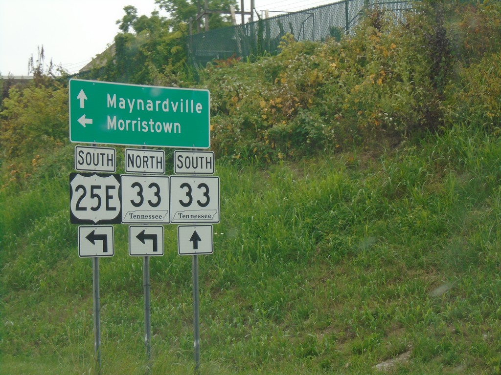
US-25E South at TN-33
US-25E South at TN-33 in Tazewell. Turn left for US-25E South/TN-33 North to Morristown. Continue straight for TN-33 South to Maynardville.
Taken 06-24-2019
Tazewell
Claiborne County
Tennessee
United States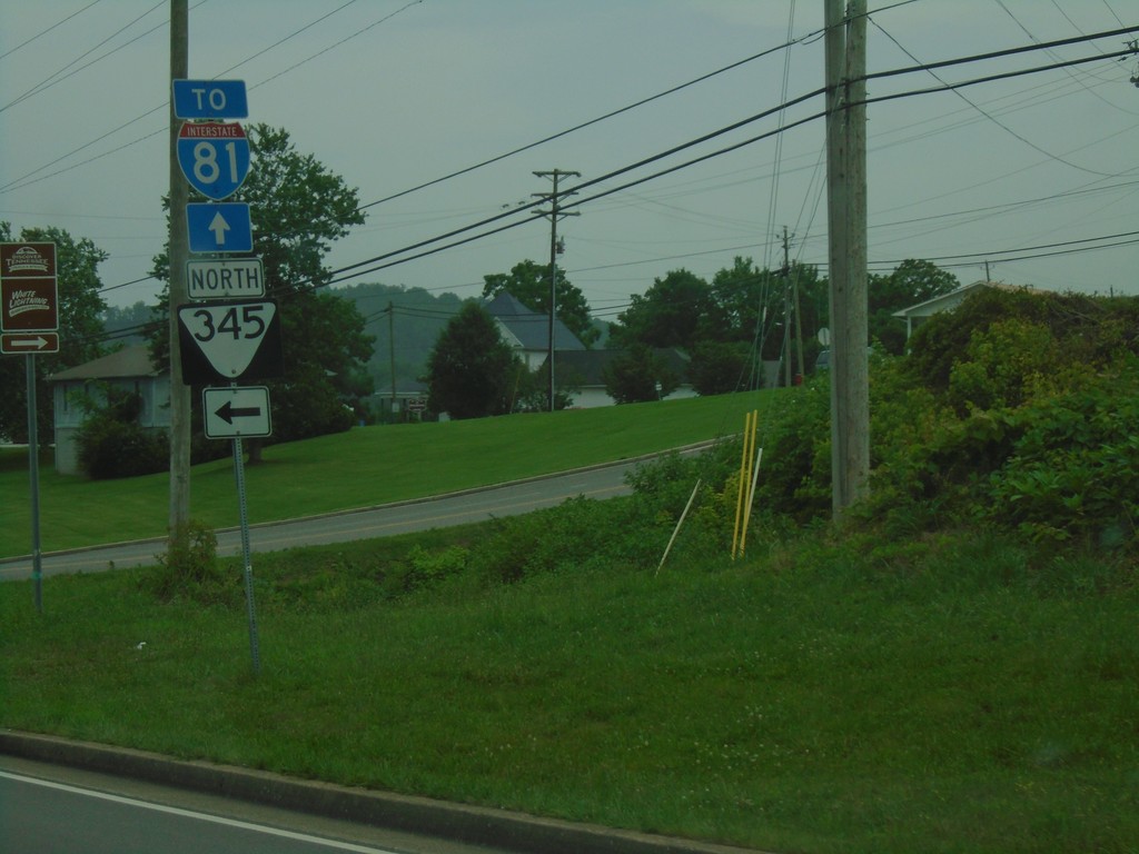
US-25E South at TNS-345
US-25E South at TNS-345 in Tazewell. Use US-25E south for I-81.
Taken 06-24-2019

 Tazewell
Claiborne County
Tennessee
United States
Tazewell
Claiborne County
Tennessee
United States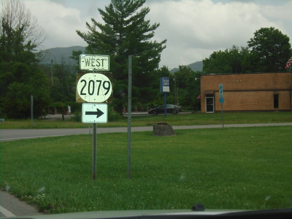
KY-441 East at KY-2079 West
KY-441 East (Bellwood Road) at KY-2079 West (19th St.)
Taken 06-24-2019

 Middlesboro
Bell County
Kentucky
United States
Middlesboro
Bell County
Kentucky
United States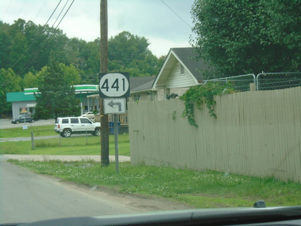
KY-441 Approaching Bellwood Road
KY-441 East (Old Pineville Pike) approaching Bellwood Road. Turn left to continue east on KY-441.
Taken 06-24-2019
Middlesboro
Bell County
Kentucky
United States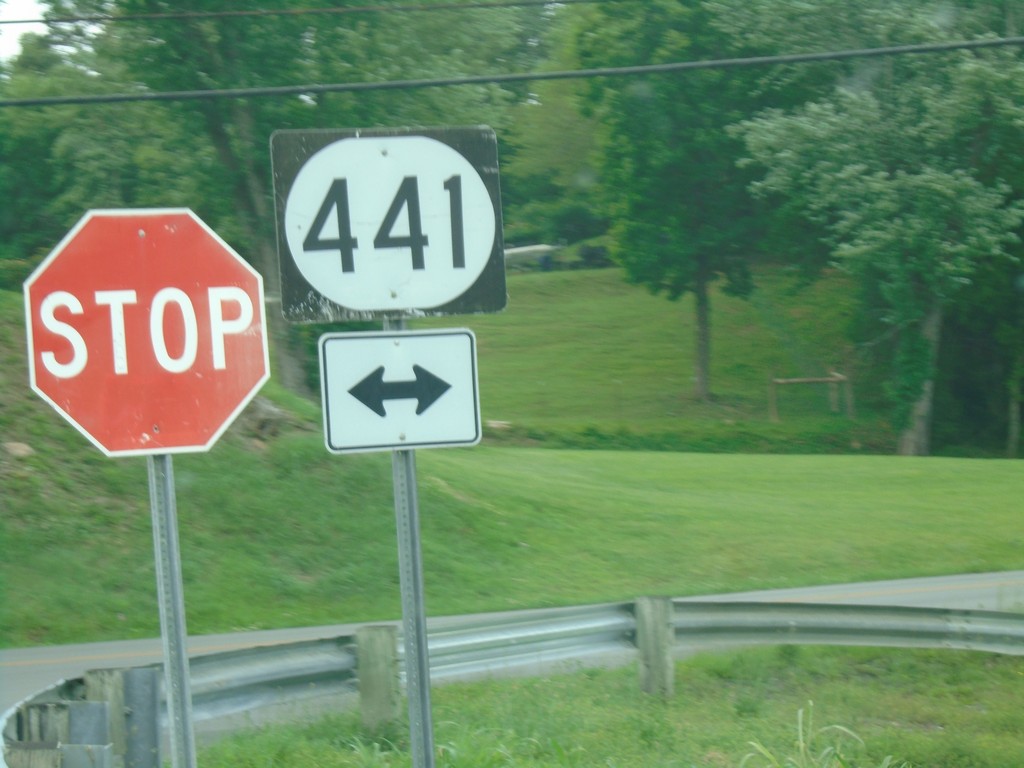
End KY-1599 North at KY-441
End KY-1599 North (Airport Road) at KY-441 (Belt Line Road).
Taken 06-24-2019
 Middlesboro
Bell County
Kentucky
United States
Middlesboro
Bell County
Kentucky
United States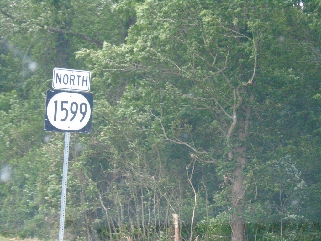
KY-1599 North - Middlesboro
KY-1599 North (Airport Road) in Middlesboro
Taken 06-24-2019
Middlesboro
Bell County
Kentucky
United States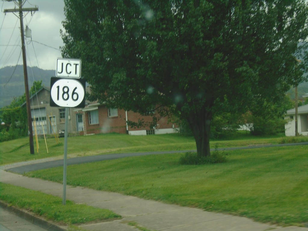
KY-74 West Approaching KY-186
KY-74 West approaching KY-186 in Middlesboro.
Taken 06-24-2019
 Middlesboro
Bell County
Kentucky
United States
Middlesboro
Bell County
Kentucky
United States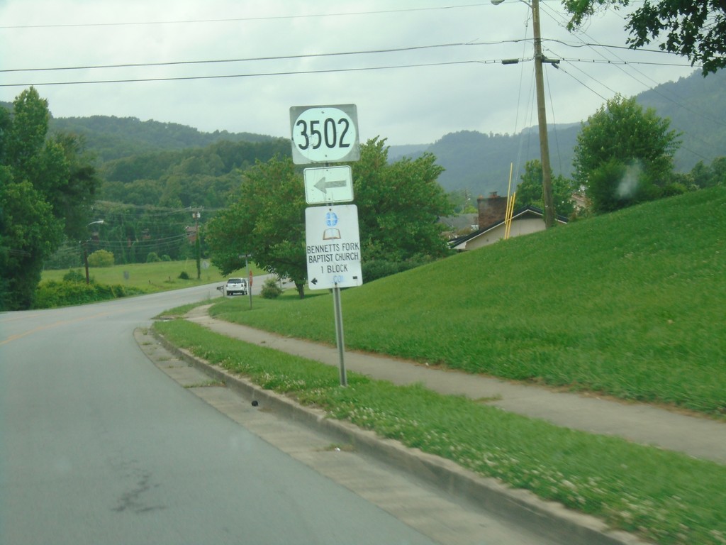
KY-74 West at KY-3502
KY-74 West at KY-3502 in Middlesboro.
Taken 06-24-2019
 Middlesboro
Bell County
Kentucky
United States
Middlesboro
Bell County
Kentucky
United States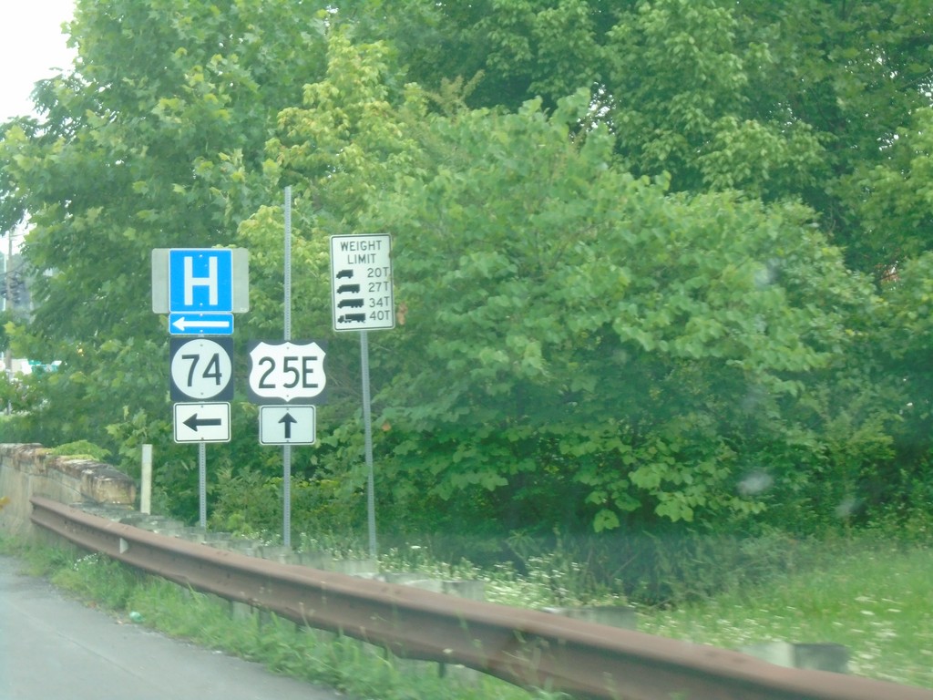
US-25E North at KY-74
US-25E North at KY-74 in Middlesboro.
Taken 06-24-2019
Middlesboro
Bell County
Kentucky
United States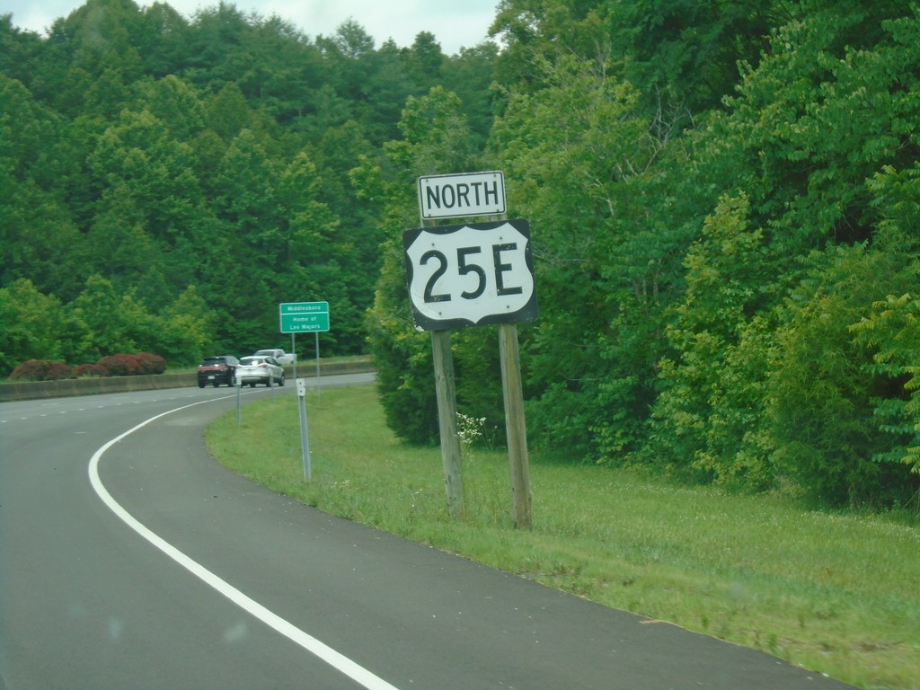
US-25E North - Middlesboro
US-25E North in Middlesboro.
Taken 06-24-2019
Middlesboro
Bell County
Kentucky
United States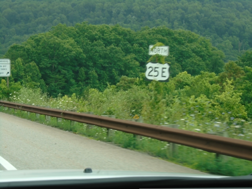
US-25E North - Claiborne County
US-25E North in Claiborne County approaching the Cumberland Gap tunnel.
Taken 06-24-2019
Cumberland Gap
Claiborne County
Tennessee
United States