Signs Tagged With Shield
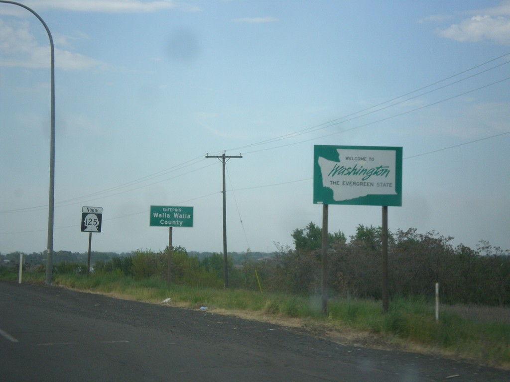
WA-125 North - Welcome To Washington
Welcome to Washington on WA-125 north. Entering Walla Walla County.
Taken 04-29-2018
 Walla Walla
 County
Washington
United States
Walla Walla
Walla Walla County
Washington
United States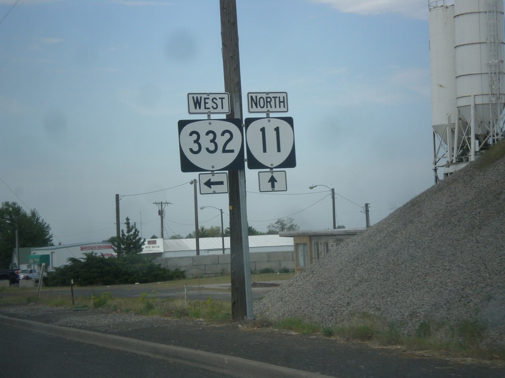
OR-11 North at OR-332 West (Sunnyside Road)
OR-11 North at OR-332 West (Sunnyside Road) in Umatilla County.
Taken 04-29-2018

 Milton-Freewater
Umatilla County
Oregon
United States
Milton-Freewater
Umatilla County
Oregon
United States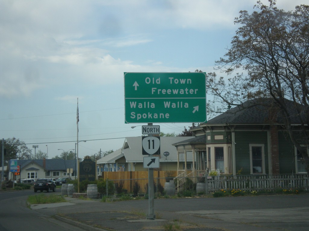
OR-11 North (Main St.) at Columbia St.
OR-11 North (Main St.) at Columbia St. Turn right on Columbia St. to continue north on OR-11 to Walla Walla (WA) and Spokane (WA). Continue straight on Main St. for Old Town Freewater.
Taken 04-29-2018
Milton-Freewater
Umatilla County
Oregon
United States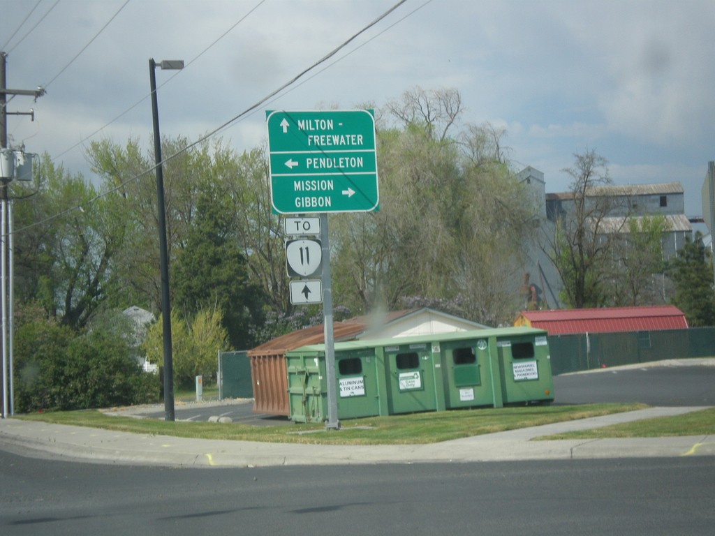
OR-331 North at Mission Road
OR-331 North at Mission Road. Turn right for Mission Road east to Mission and Gibbon. Turn left for Mission Road west to Pendleton. Continue north on OR-331 for OR-11 to Milton-Freewater.
Taken 04-29-2018
 Pendleton
Umatilla County
Oregon
United States
Pendleton
Umatilla County
Oregon
United States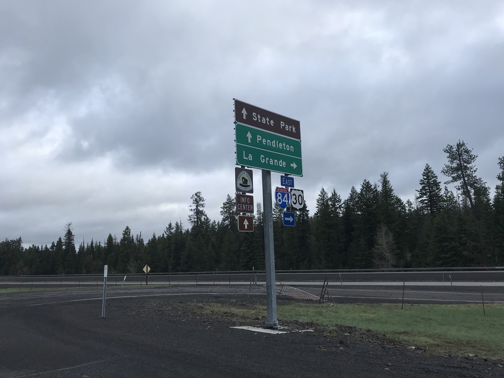
I-84 East Exit 234 Freeway Entrance
I-84 East Exit 234 Freeway Entrance. Use I-84 east for LaGrande. Continue west on Frontage Road for (Emigrant Springs) State Park and I-84 west to Pendleton.
Taken 04-29-2018

 Meacham
Umatilla County
Oregon
United States
Meacham
Umatilla County
Oregon
United States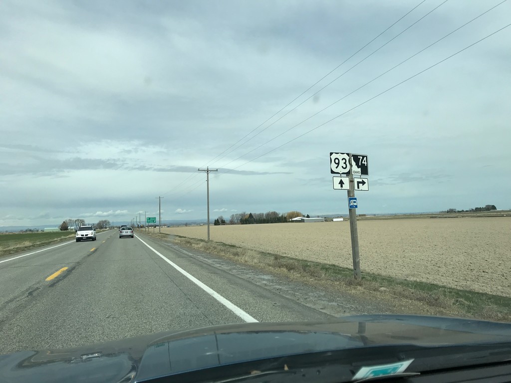
US-93 North Approaching ID-74
US-93 North approaching ID-74 in Twin Falls County.
Taken 03-31-2018

 Filer
Twin Falls County
Idaho
United States
Filer
Twin Falls County
Idaho
United States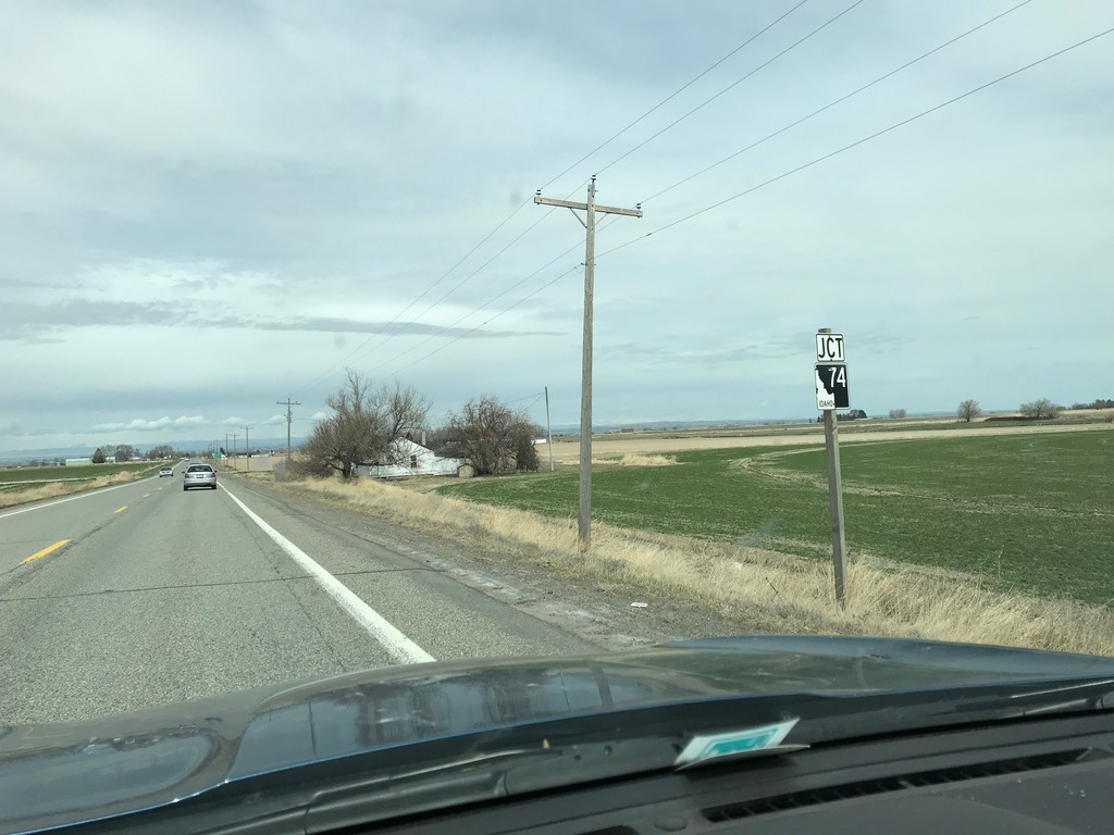
US-93 South Approaching ID-74
US-93 South approaching ID-74 in Twin Falls County.
Taken 03-31-2018
Filer
Twin Falls County
Idaho
United States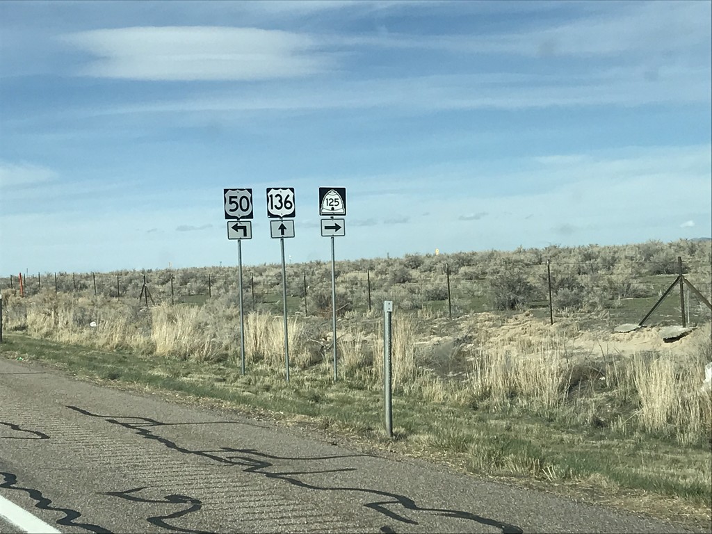
US-50 West at UT-125 and UT-136
US-50 West at UT-125 and UT-136 in Millard County. Turn right for UT-125 east; straight for UT-136 north. Turn left to continue west on US-50. The UT-136 shield is incorrectly marked as US-136.
Taken 03-30-2018


 Delta
Millard County
Utah
United States
Delta
Millard County
Utah
United States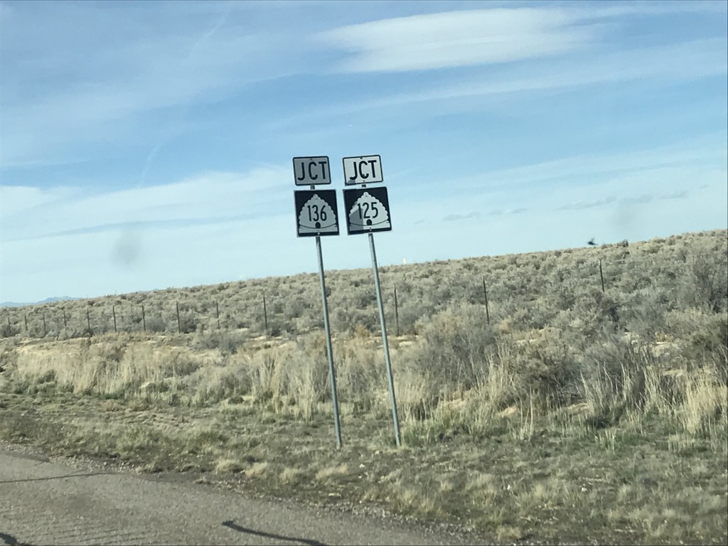
US-50 West Approaching UT-125 and UT-135
US-50 West approaching UT-125 and UT-135 in Millard County.
Taken 03-30-2018
Delta
Millard County
Utah
United States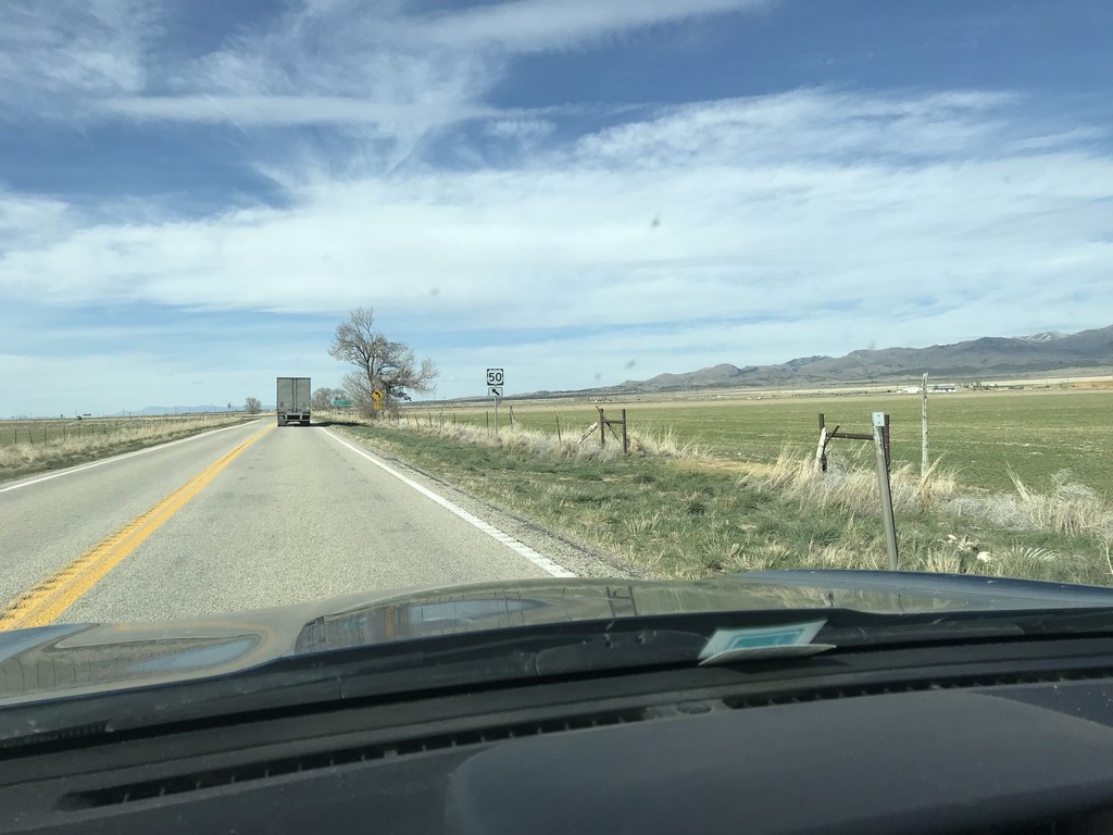
US-50 West - N 3200 W Jct.
US-50 West approaching N 3200 W Junction. Merge left to continue west on US-50.
Taken 03-30-2018
Delta
Millard County
Utah
United States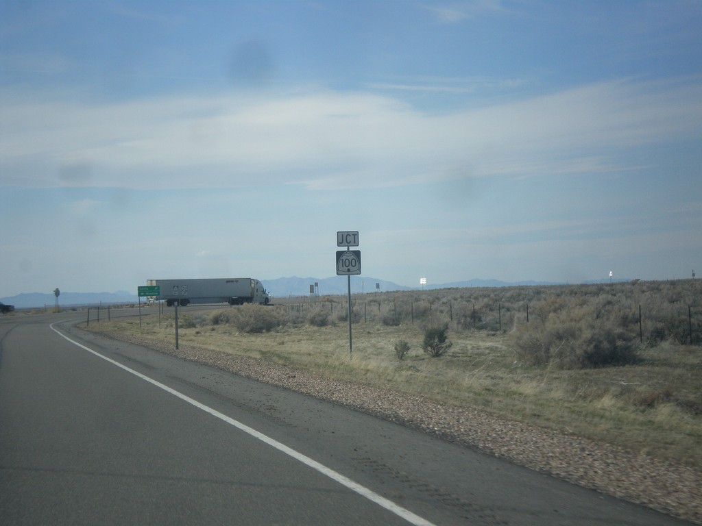
US-50 West at UT-100
US-50 West at UT-100 in Millard County.
Taken 03-29-2018
 Delta
Millard County
Utah
United States
Delta
Millard County
Utah
United States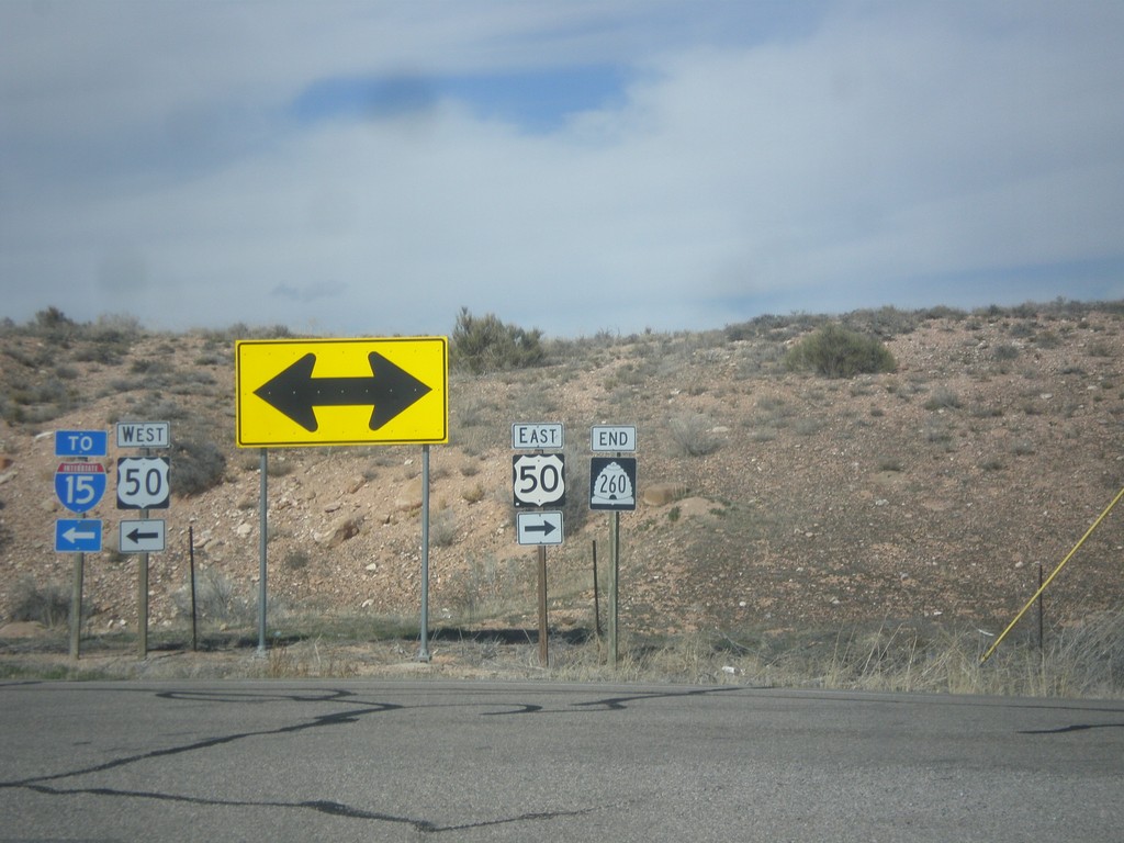
End UT-260 North at US-50
End UT-260 North at US-50. Use US-50 west for I-15 (in Scipio).
Taken 03-29-2018

 Salina
Sevier County
Utah
United States
Salina
Sevier County
Utah
United States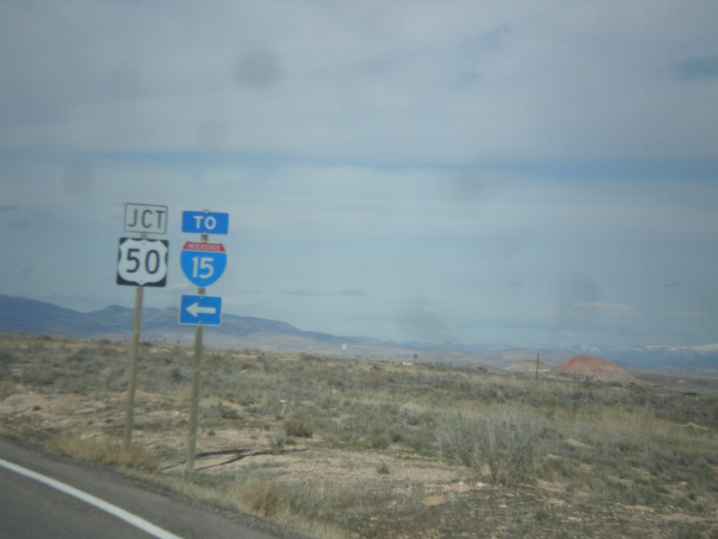
End UT-260 North at US-50
End UT-260 North at US-50. Use US-50 west for I-15 (in Scipio).
Taken 03-29-2018
Aurora
Sevier County
Utah
United States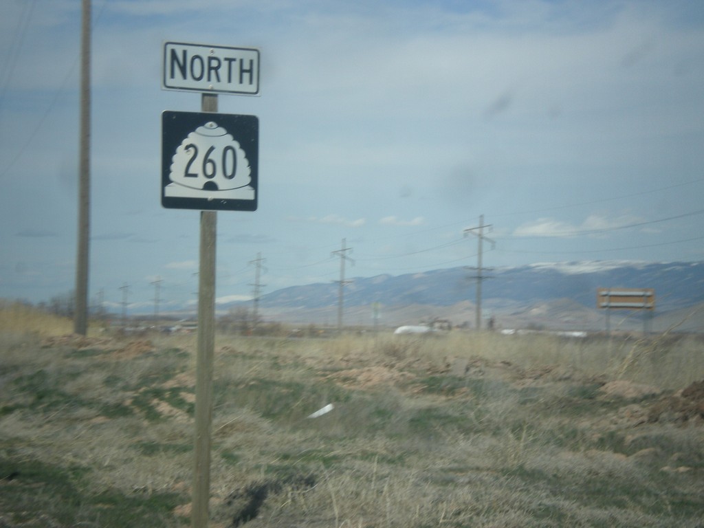
UT-260 North - Sevier County
UT-260 North in Sevier County,
Taken 03-29-2018
Aurora
Sevier County
Utah
United States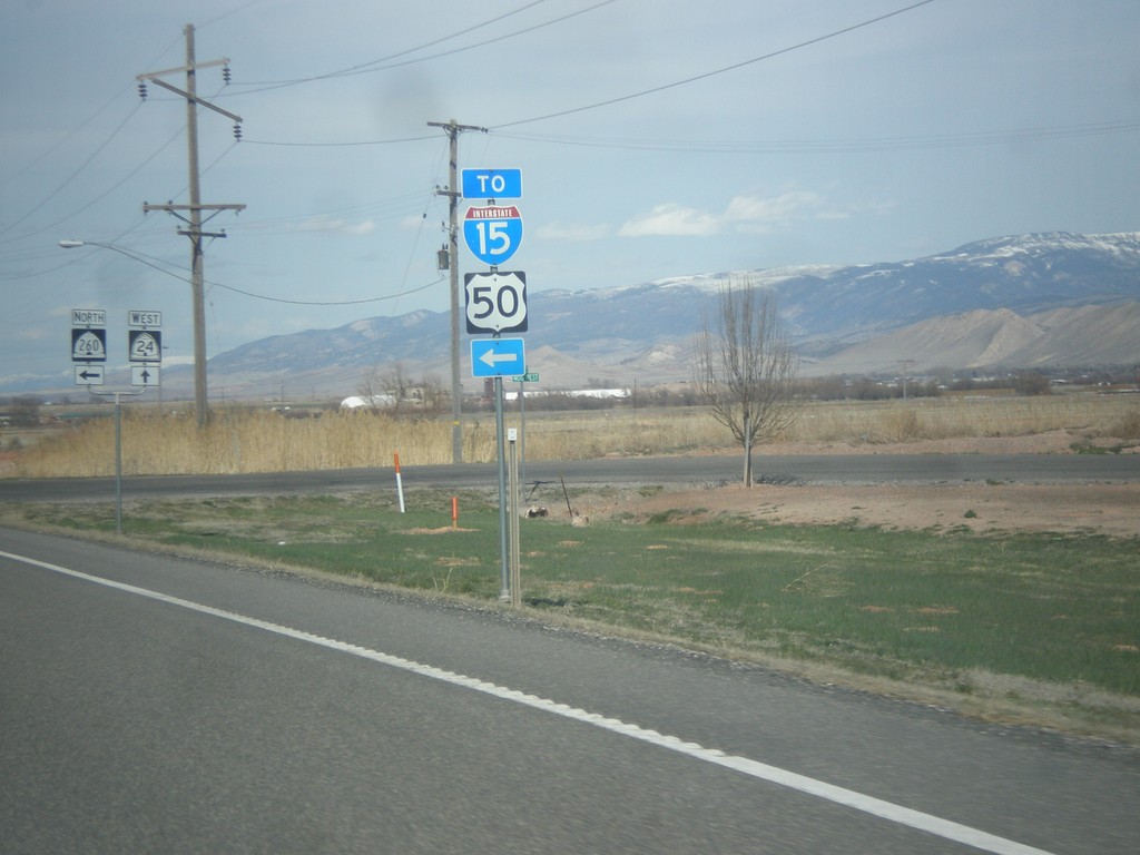
UT-24 East at UT-260 North
UT-24 East at UT-260 North. Use UT-260 for US-50 and I-15 (via US-50).
Taken 03-29-2018
 Aurora
Sevier County
Utah
United States
Aurora
Sevier County
Utah
United States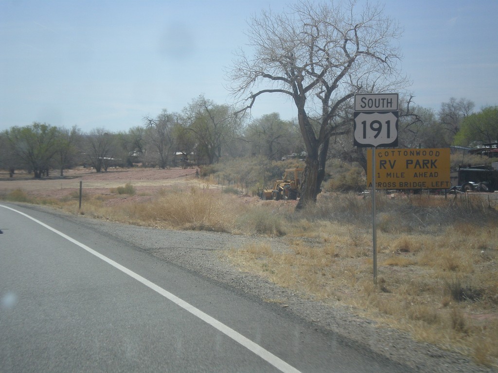
US-191 South - Bluff
US-191 south shield in Bluff.
Taken 03-28-2018
 Bluff
San Juan County
Utah
United States
Bluff
San Juan County
Utah
United States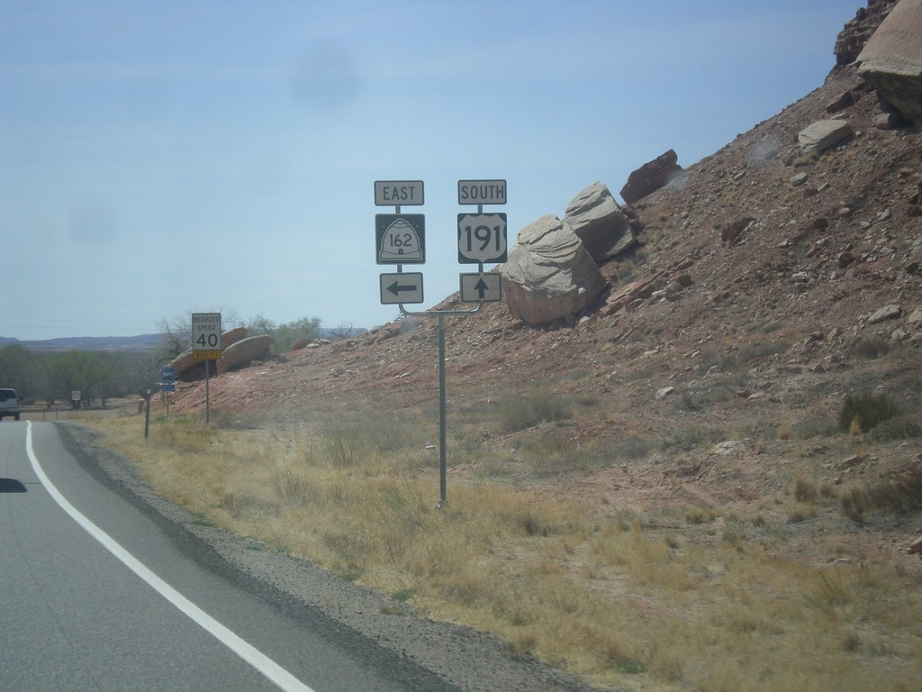
US-191 South at UT-162 East
US-191 South at UT-162 East in Bluff.
Taken 03-28-2018
 Bluff
San Juan County
Utah
United States
Bluff
San Juan County
Utah
United States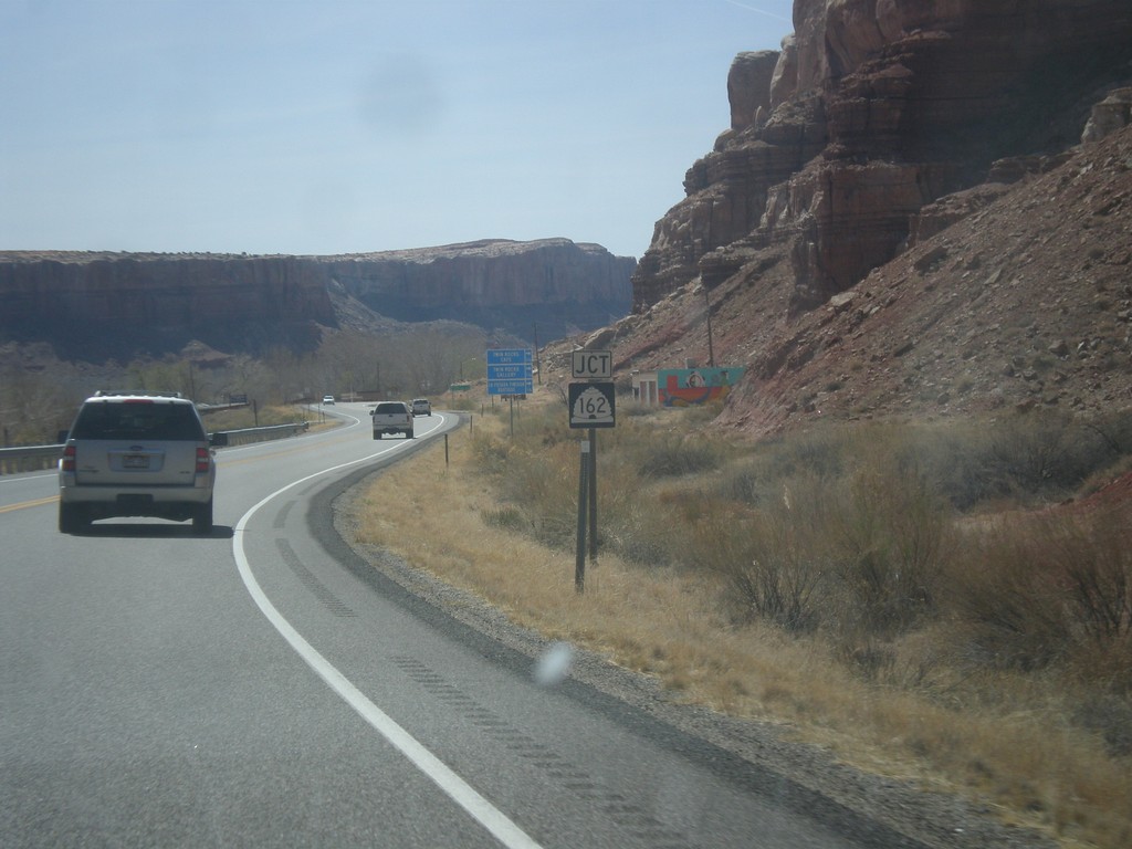
US-191 South Approaching UT-162
US-191 South approaching UT-162 in Bluff.
Taken 03-28-2018
Bluff
San Juan County
Utah
United States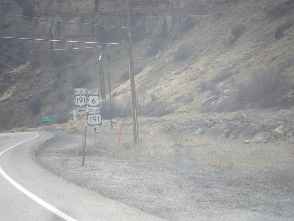
US-6 East at US-191
US-6 east at US-191. Turn left for US-191 north. US-191 south joins US-6 south to Crescent Junction.
Taken 03-24-2018
 Castle Gate
Carbon County
Utah
United States
Castle Gate
Carbon County
Utah
United States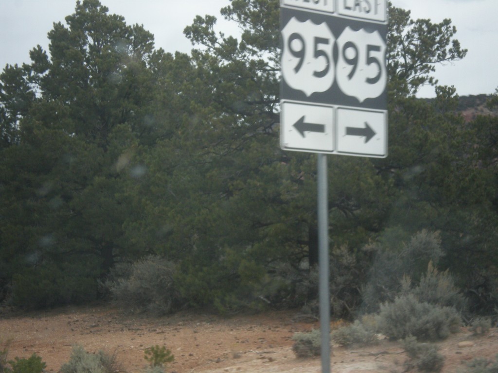
End UT-261 North at UT-95
End UT-261 North at UT-95 in San Juan County. The UT-95 shield is signed incorrectly as US-95.
Taken 03-24-2018

 Lake Powell
San Juan County
Utah
United States
Lake Powell
San Juan County
Utah
United States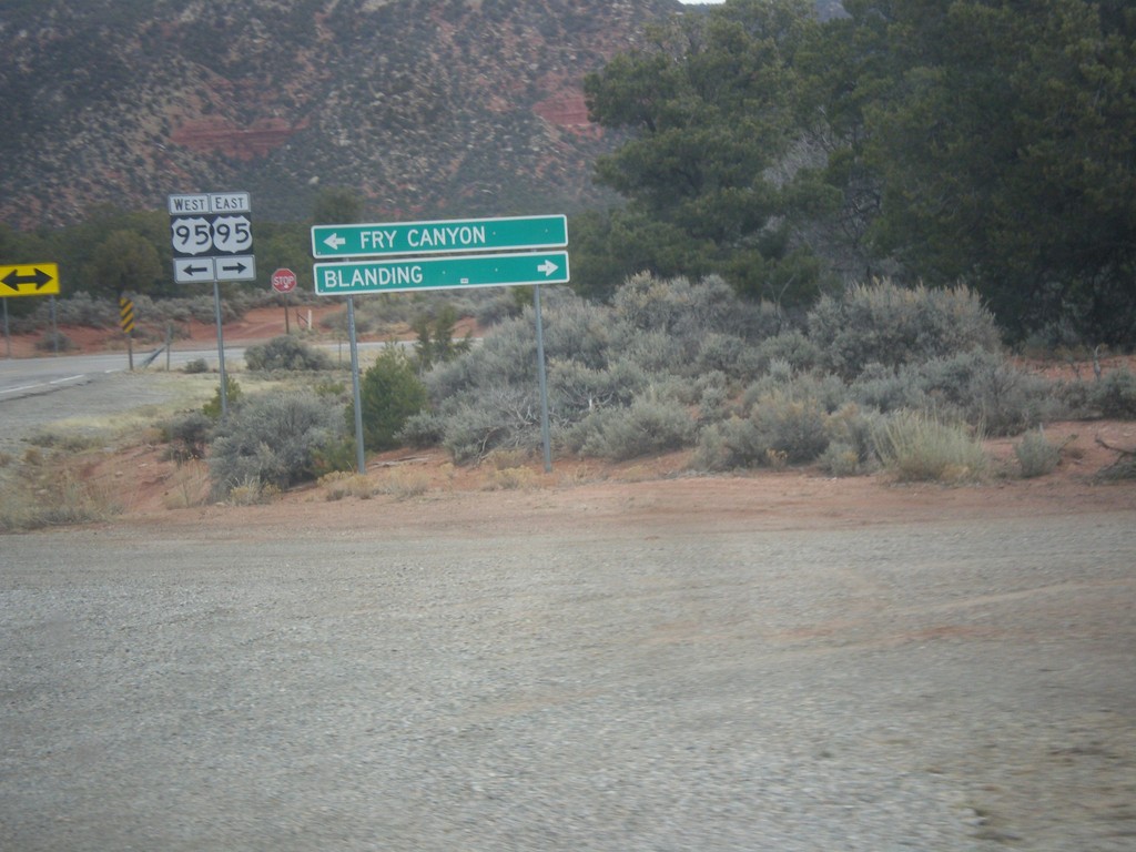
End UT-261 North at UT-95
End UT-261 North at UT-95 in San Juan County. Turn right on UT-95 east for Blanding; left on UT-95 west for Fry Canyon. The UT-95 shield is signed incorrectly as US-95.
Taken 03-24-2018
Lake Powell
San Juan County
Utah
United States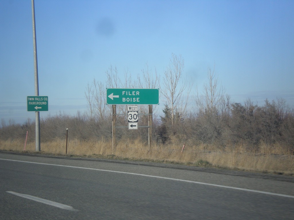
US-93 North at US-30 West
US-93 North at US-30 West to Filer and Boise.
Taken 02-13-2018
Filer
Twin Falls County
Idaho
United States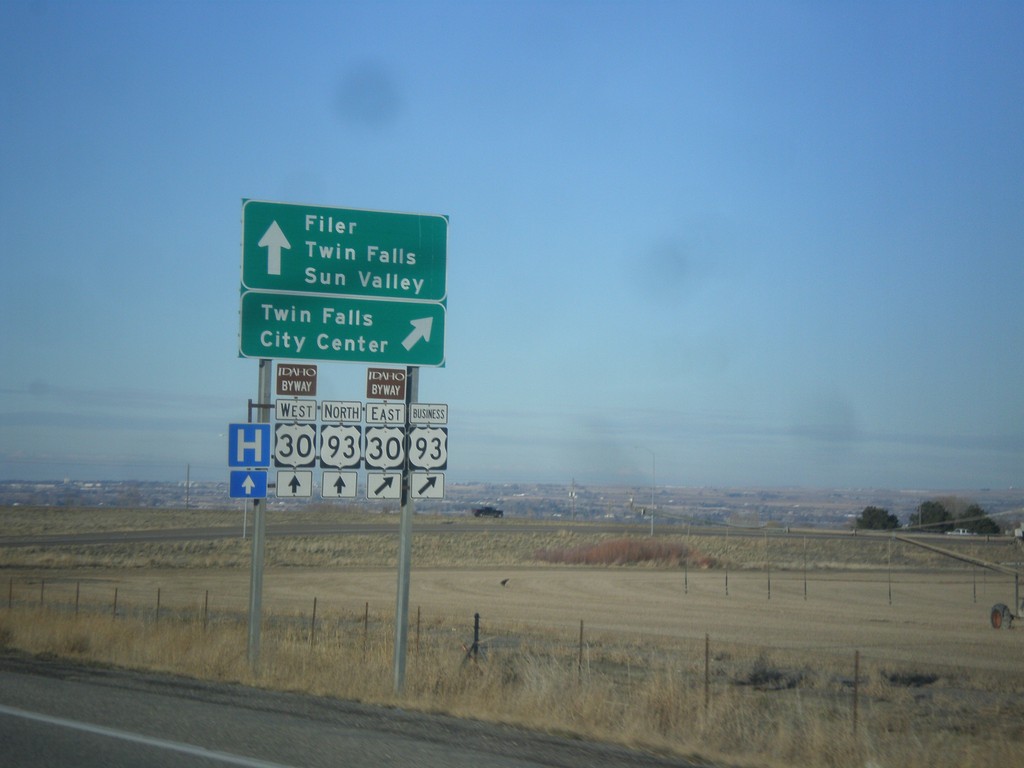
US-93 North at US-30/Bus. US-93
US-93 North at US-30/Bus. US-93 in Twin Falls County. Merge right for Bus. US-93 North/US-30 East to Twin Falls City Center. Continue under overpass for US-93 north to Twin Falls and Sun Valley and for US-30 west to Filer. US-30 is part of the Thousand Springs Scenic Byway.
Taken 02-13-2018
 Filer
Twin Falls County
Idaho
United States
Filer
Twin Falls County
Idaho
United States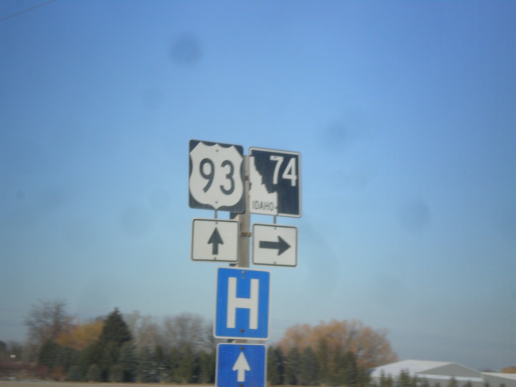
US-93 north at ID-74
US-93 north at ID-74 in Twin Falls County.
Taken 02-13-2018
Filer
Twin Falls County
Idaho
United States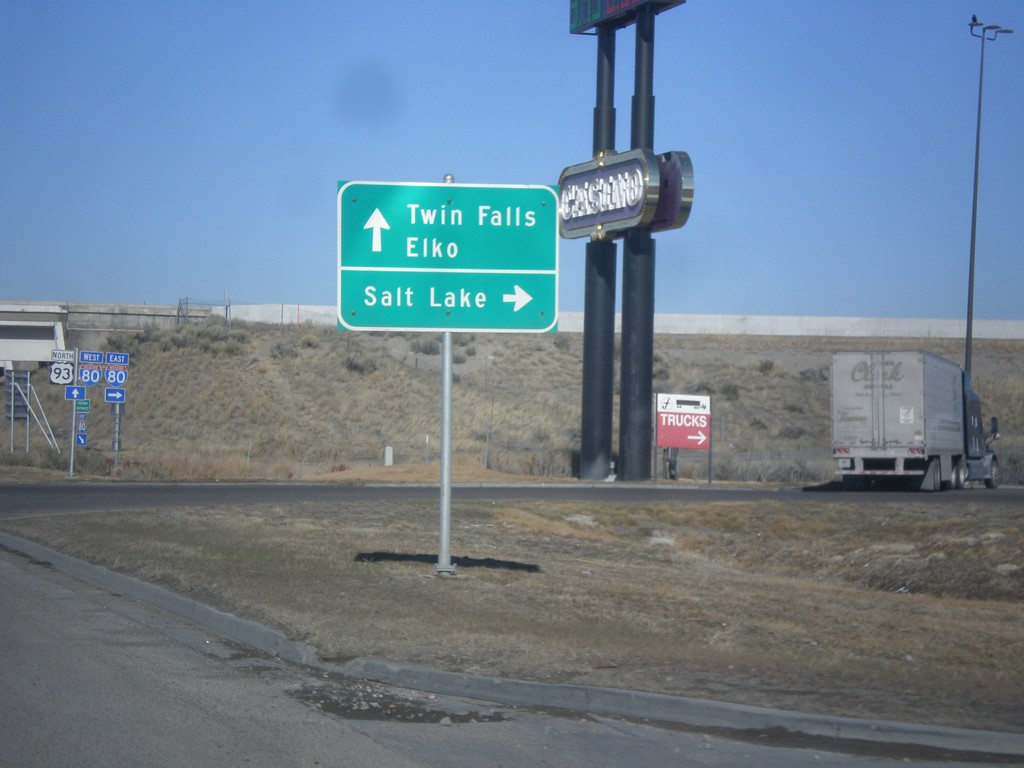
US-93 North at I-80
US-93 north at I-80 (Exit 352). Use I-80 east for Salt Lake. Use I-80 west for Elko. Continue north on US-93 for Twin Falls.
Taken 02-13-2018

 Wells
Elko County
Nevada
United States
Wells
Elko County
Nevada
United States