Signs Tagged With Shield
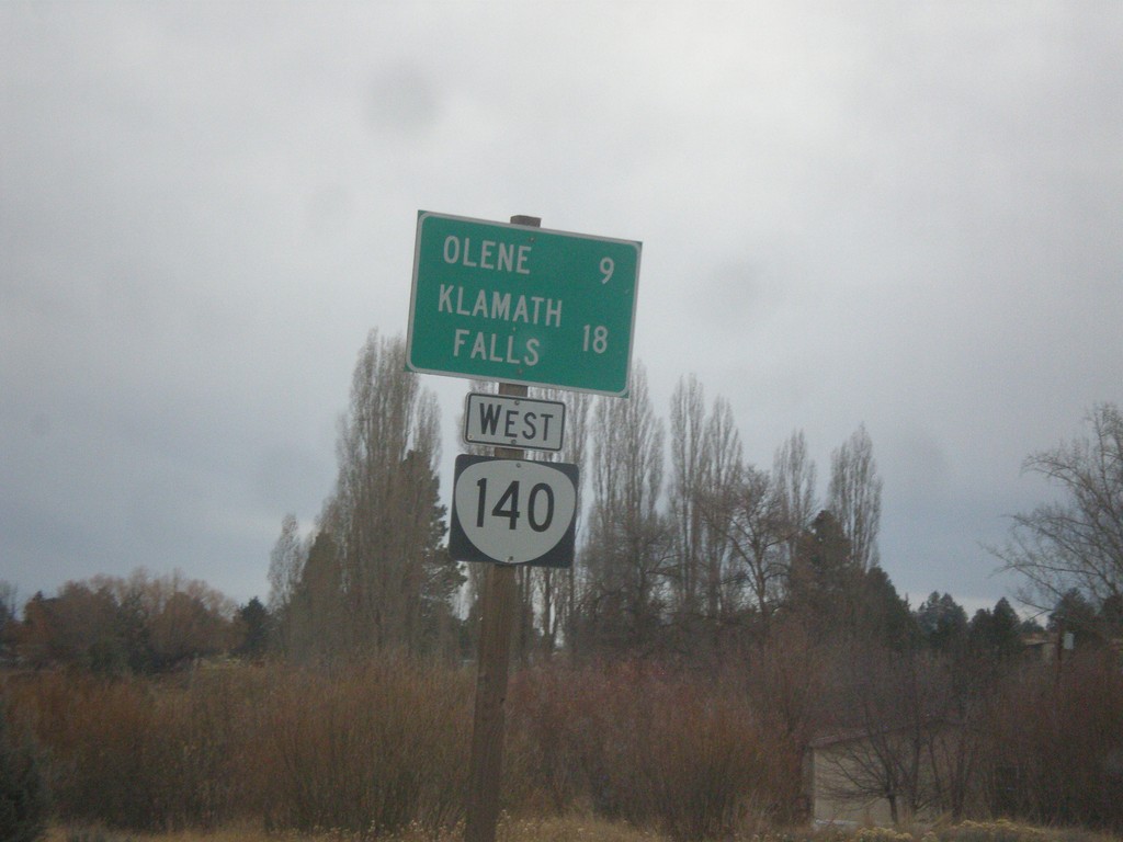
OR-140 West - Distance Marker
Distance marker on OR-140 west. Distance to Olene and Klamath Falls.
Taken 11-19-2017
 Dairy
Klamath County
Oregon
United States
Dairy
Klamath County
Oregon
United States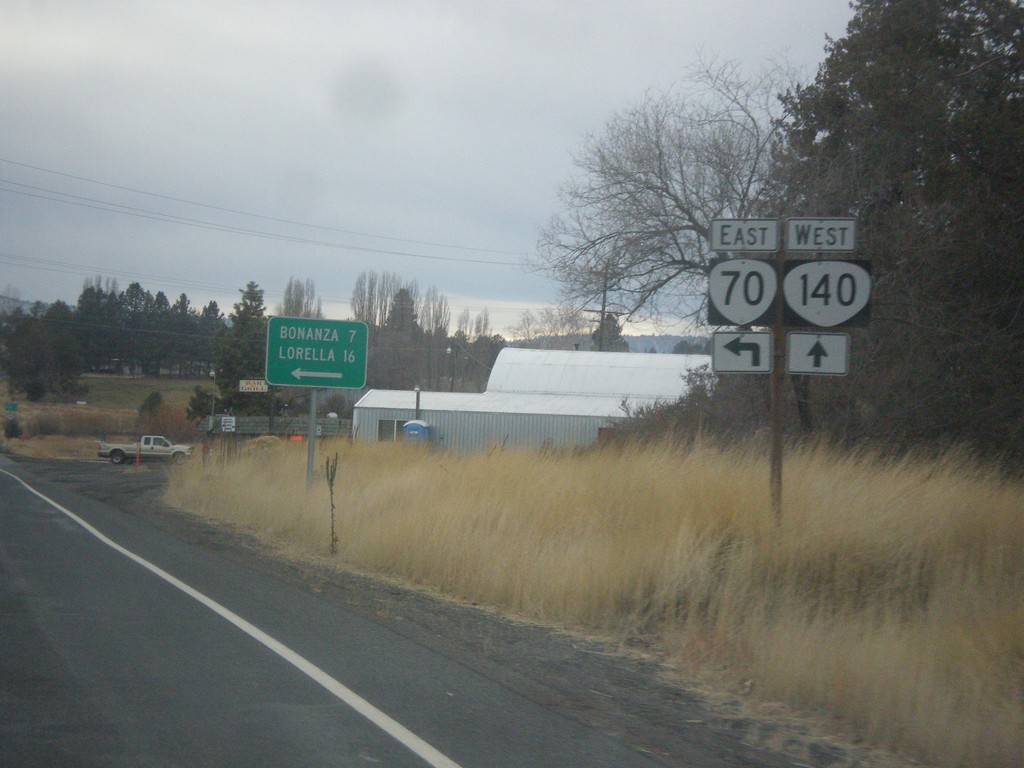
OR-140 West at OR-70
OR-140 West at OR-70 East to Bonanza and Lorella.
Taken 11-19-2017
 Dairy
Klamath County
Oregon
United States
Dairy
Klamath County
Oregon
United States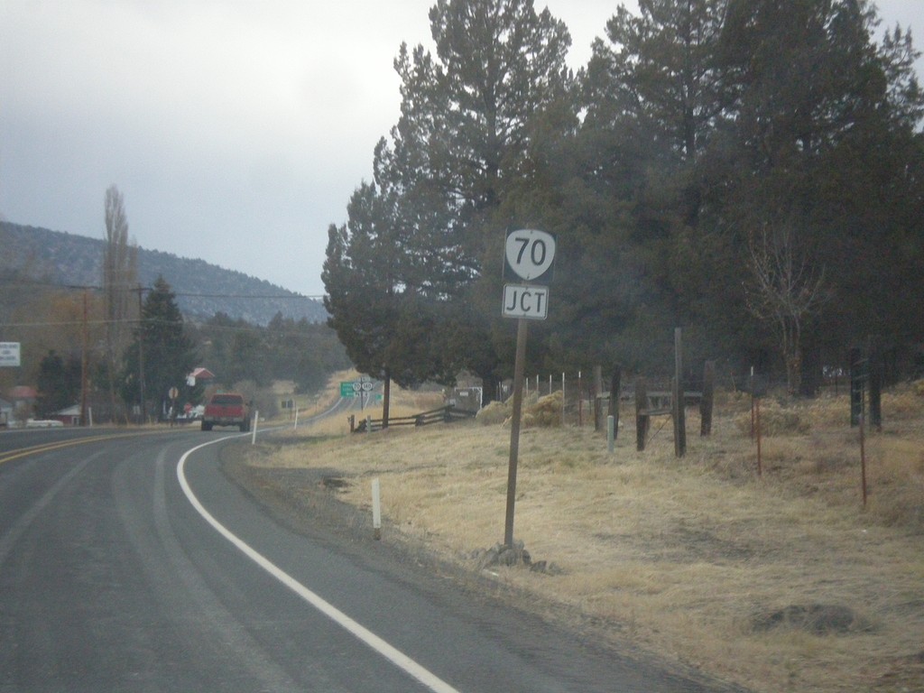
OR-140 West Approaching OR-70
OR-140 West approaching OR-70 in Dairy.
Taken 11-19-2017
Dairy
Klamath County
Oregon
United States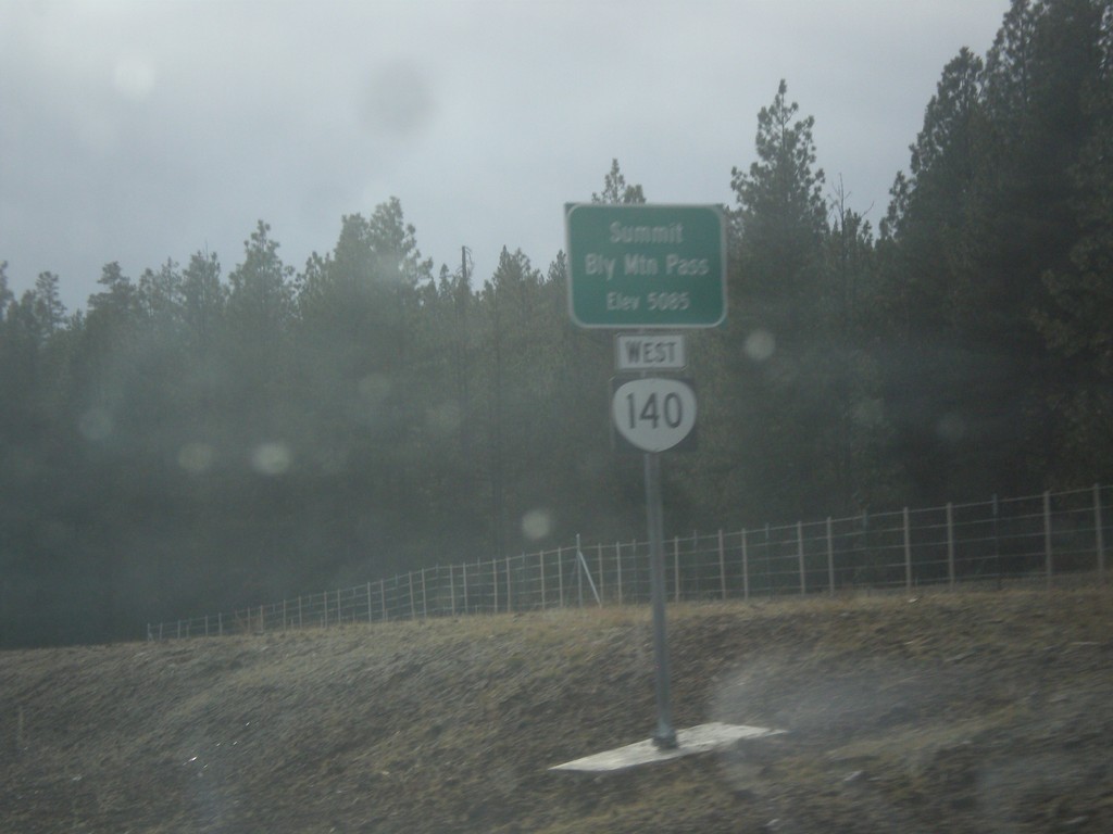
OR-140 West - Bly Mountain Pass
OR-140 west at Bly Mountain Pass. Elevation 5085 Feet.
Taken 11-19-2017
Beatty
Klamath County
Oregon
United States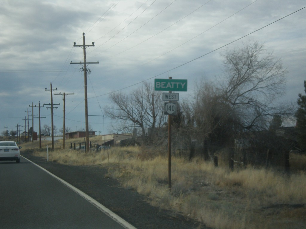
OR-140 West - Beatty
Entering Beatty on OR-140 west.
Taken 11-19-2017
Beatty
Klamath County
Oregon
United States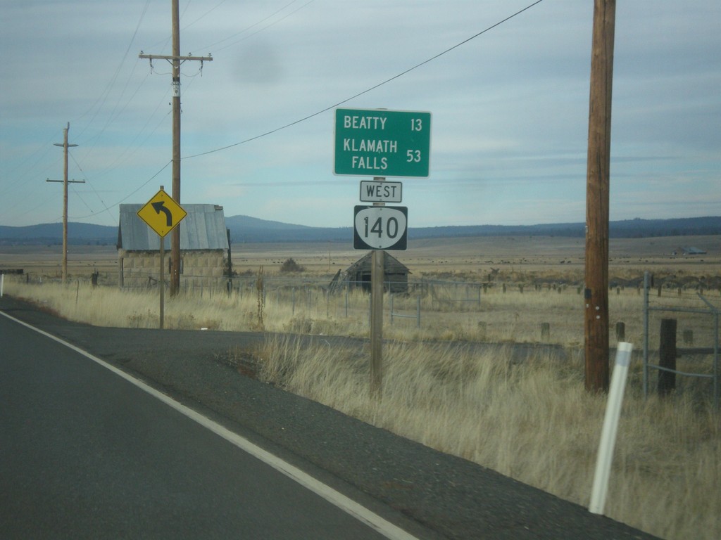
OR-140 West - Distance Marker
Distance Marker on OR-140 east leaving Bly. Distance to Beatty and Klamath Falls.
Taken 11-19-2017
Bly
Klamath County
Oregon
United States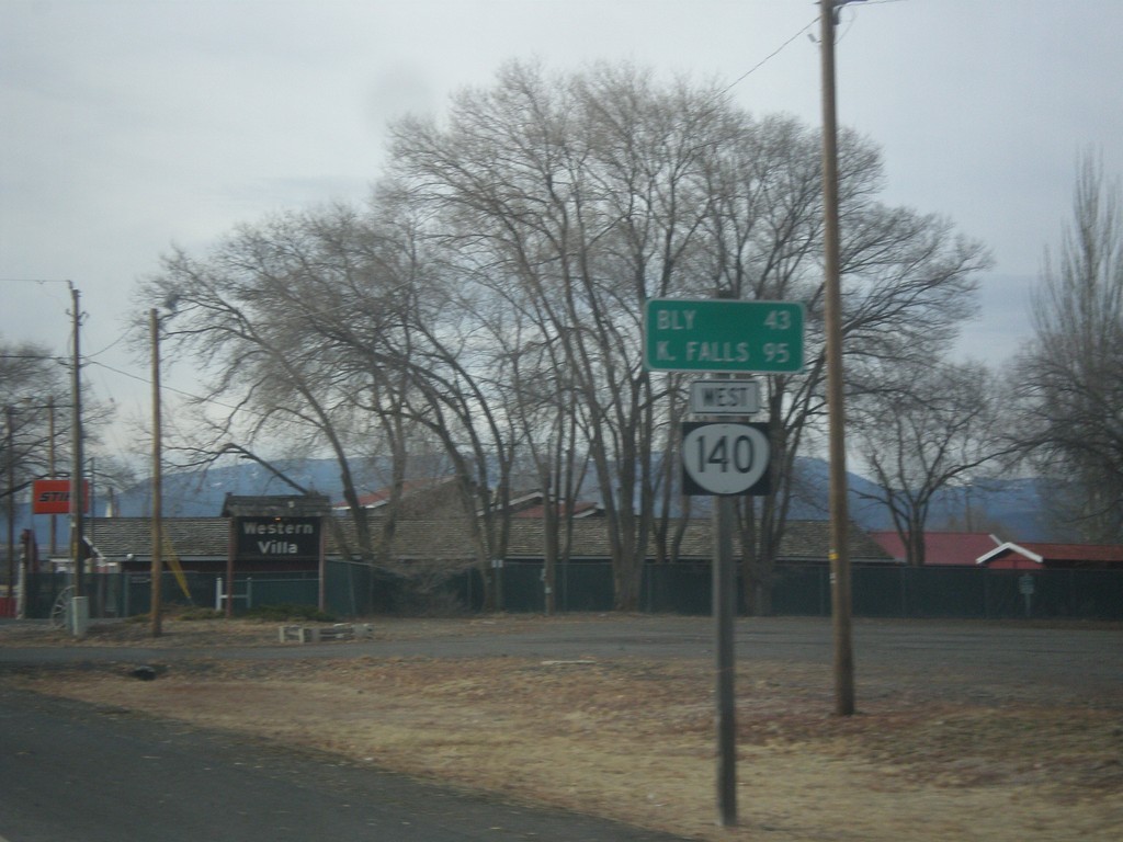
OR-140 West - Distance Marker
Distance marker on OR-140 west. Distance to Bly and Klamath Falls.
Taken 11-19-2017
Lakeview
Lake County
Oregon
United States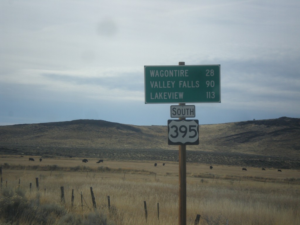
US-395 South - Distance Marker
Distance marker on US-395 south. Distance to Wagontire, Valley Falls, and Lakeview.
Taken 11-19-2017
 Riley
Harney County
Oregon
United States
Riley
Harney County
Oregon
United States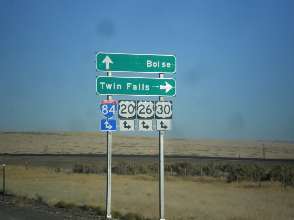
End BL-84 East at I-84 (Exit 90)
End BL-84 east at I-84, Exit 90 onramps. Use I-84/US-20/US-26/US-30 east for Twin Falls; use I-84/US-20/US-26/US-30 west for Boise. This is the western end of the Mountain Home business loop.
Taken 10-29-2017


 Mountain Home
Elmore County
Idaho
United States
Mountain Home
Elmore County
Idaho
United States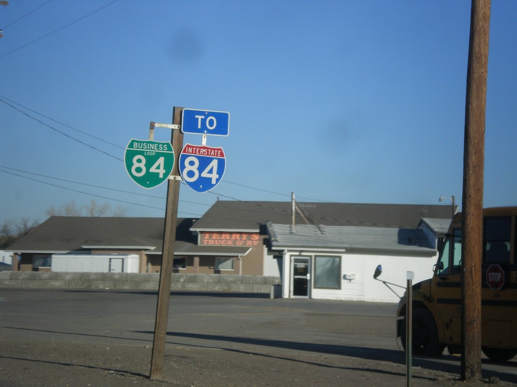
BL-84 West/To I-84
BL-84 West/To I-84 on the west side of Mountain Home.
Taken 10-29-2017
Mountain Home
Elmore County
Idaho
United States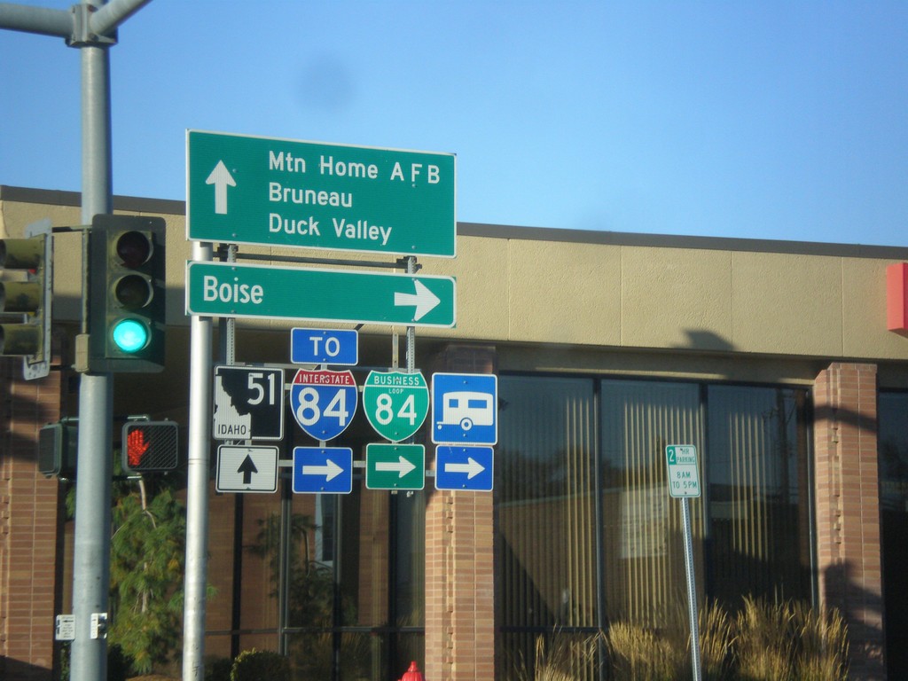
BL-84 West at ID-51 - Mountain Home
BL-84 west at ID-51 in Mountain Home (American Legion Blvd. at N 2nd E). Turn right on N 2nd E to continue west on BL-84 and for I-84 and Boise. Continue straight for ID-51 south to Mountain Home AFB, Bruneau, and Duck Valley (Indian Reservation).
Taken 10-29-2017
 Mountain Home
Elmore County
Idaho
United States
Mountain Home
Elmore County
Idaho
United States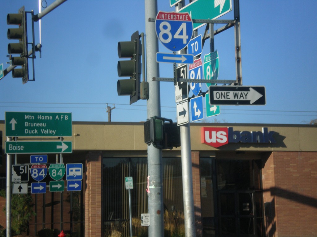
BL-84 West at ID-51 - Mountain Home
BL-84 West at ID-51 in Mountain Home. Turn right on on N 2nd East to continue west on BL-84 and for I-84.
Taken 10-29-2017
Mountain Home
Elmore County
Idaho
United States
BL-84 West - Mountain Home
BL-84 West along American Legion Blvd. in Mountain Home.
Taken 10-29-2017
Mountain Home
Elmore County
Idaho
United States
BL-84 East Approaching I-84/US-30/ID-55
BL-84 East approaching I-84/US-30/ID-55 (Exit 38) in Nampa. This is the east end of the Nampa business loop.
Taken 10-22-2017
 Nampa
Canyon County
Idaho
United States
Nampa
Canyon County
Idaho
United States
BL-84 East - Franklin Road
BL-84 East at Franklin Road junction. Merge right to continue east on BL-84. East of Franklin Road, BL-84 follows Garrity Blvd.
Taken 10-22-2017
Nampa
Canyon County
Idaho
United States
BL-84 East - Nampa
BL-84 East along 11th Ave. North in downtown Nampa
Taken 10-22-2017
Nampa
Canyon County
Idaho
United States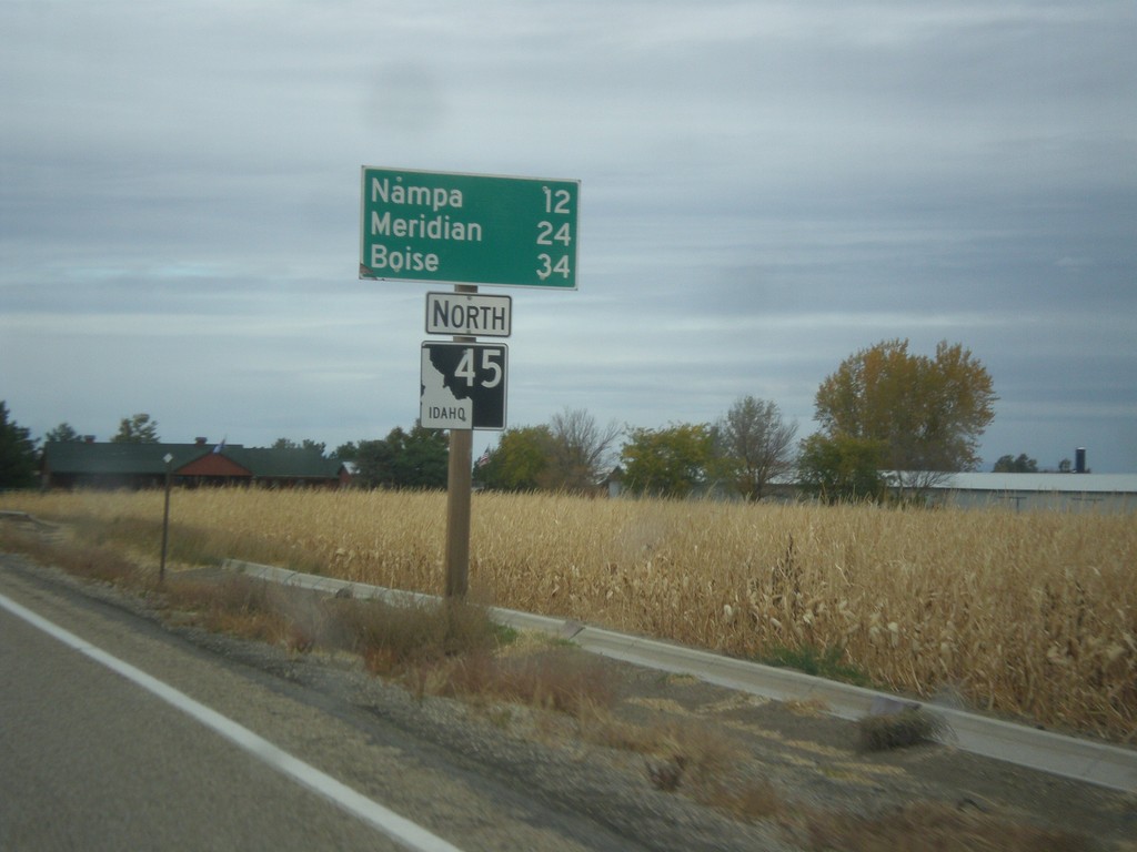
ID-45 North - Distance Marker
Distance maker on ID-45 north. Distance to Nampa, Meridian, and Boise.
Taken 10-22-2017
 Melba
Canyon County
Idaho
United States
Melba
Canyon County
Idaho
United States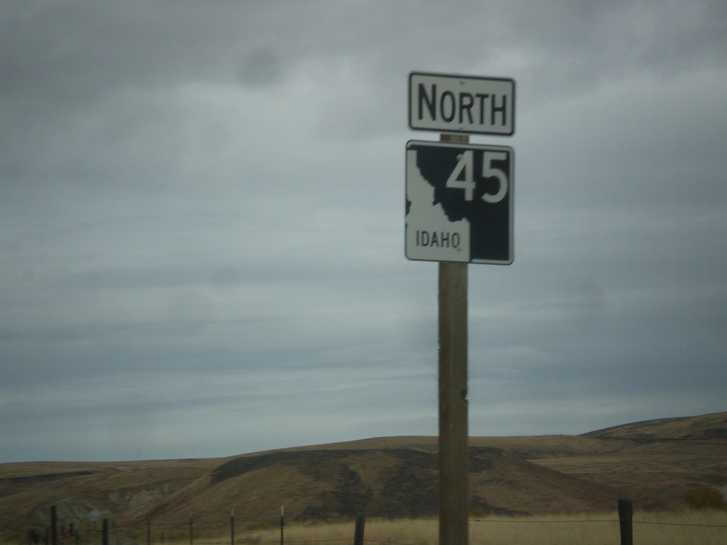
ID-45 North - Canyon County
ID-45 north in Canyon County.
Taken 10-22-2017
Melba
Canyon County
Idaho
United States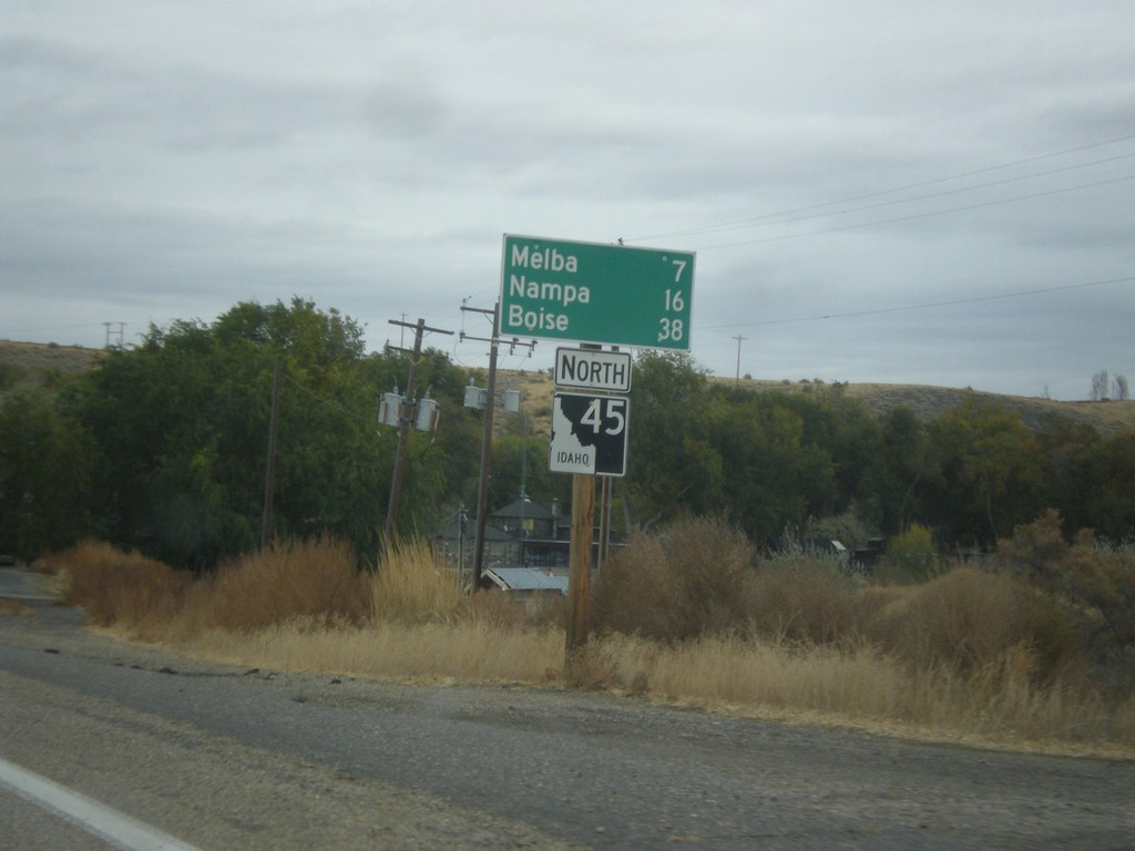
ID-45 North - Distance Marker
Distance marker on ID-45 north. Distance to Melba, Nampa, and Boise.
Taken 10-22-2017
Melba
Owyhee County
Idaho
United States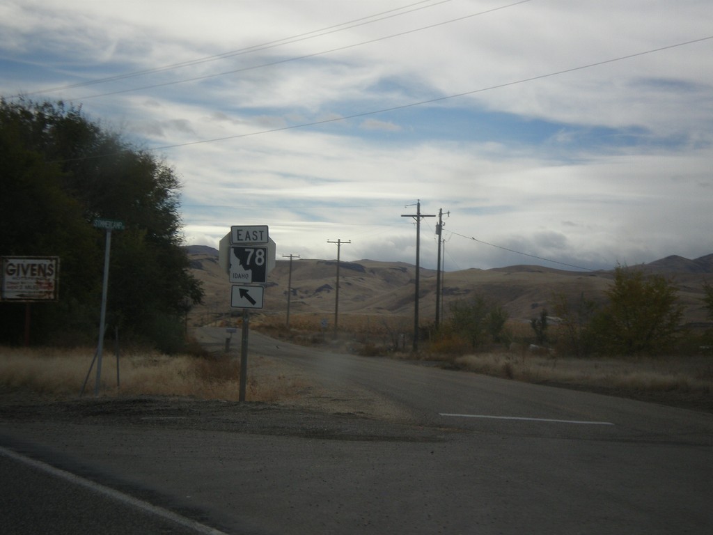
ID-78 East - Sommercamp Road
ID-78 East at Sommercamp Road junction. Merge left to continue east on ID-78.
Taken 10-22-2017
 Melba
Owyhee County
Idaho
United States
Melba
Owyhee County
Idaho
United States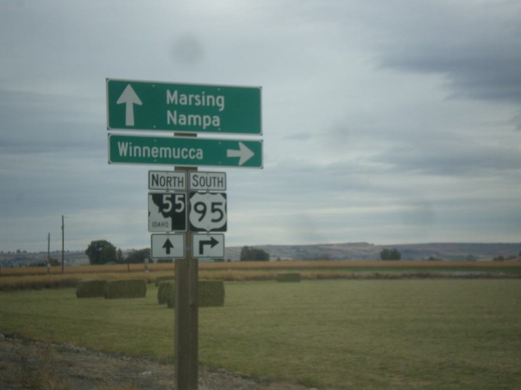
US-95 South Approaching ID-55
US-95 south approaching ID-55. Turn right to continue south on US-95 to Winnemucca (Nevada); straight for ID-55 north to Marsing and Nampa.
Taken 10-22-2017
 Marsing
Owyhee County
Idaho
United States
Marsing
Owyhee County
Idaho
United States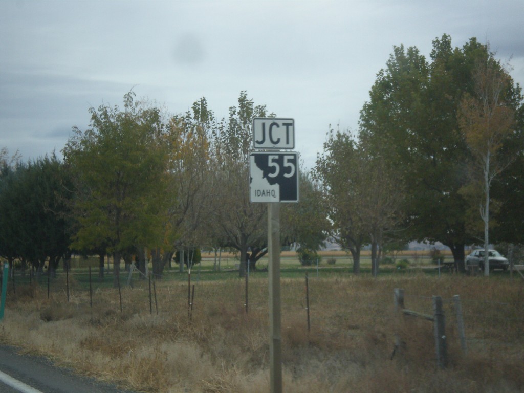
US-95 South Approaching ID-55
US-95 South approaching ID-55 near Marsing.
Taken 10-22-2017
Marsing
Owyhee County
Idaho
United States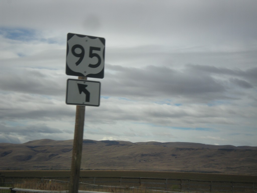
US-95 South at Y Road
US-95 South at Y Road. Merge left to continue south on Y Road.
Taken 10-22-2017
Homedale
Owyhee County
Idaho
United States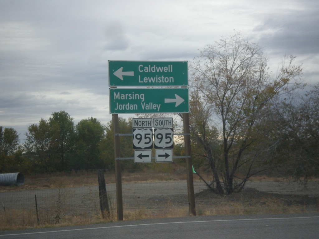
Main St. South at US-95
Main St. South at US-95 in Homedale. Turn left for US-95 north to Caldwell and Lewiston. Turn right for US-95 south to Marsing and Jordan Valley (Oregon).
Taken 10-22-2017
Homedale
Owyhee County
Idaho
United States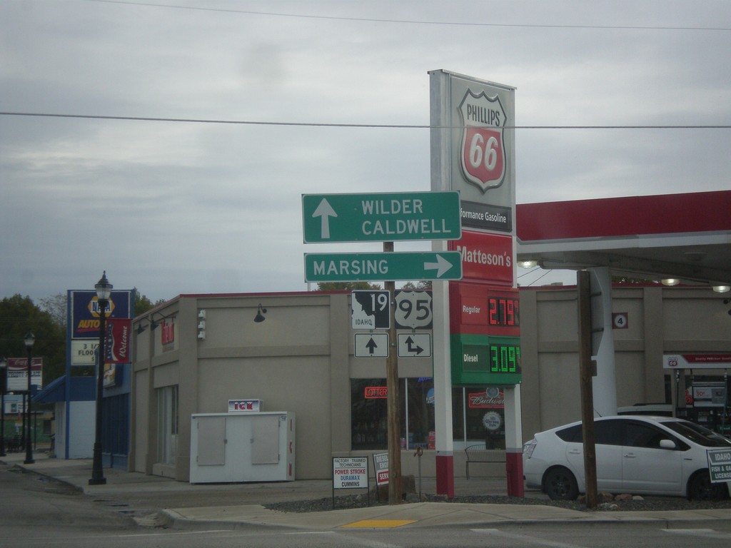
ID-19 East at US-95 in Homedale
ID-19 East at US-95 in Homedale. Turn right for US-95 south to Marsing. Continue straight for US-95 North/ID-19 East to Caldwell and Wilder.
Taken 10-22-2017
 Homedale
Owyhee County
Idaho
United States
Homedale
Owyhee County
Idaho
United States