Signs Tagged With Shield
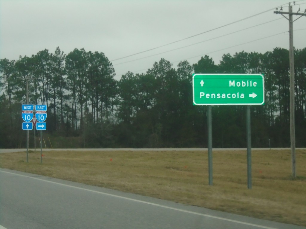
Baldwin Beach Express North at I-10
Baldwin Beach Express North at I-10 in Baldwin County. Use I-10 east for Pensacola (Florida); I-10 west for Mobile.
Taken 12-27-2018
 Robertsdale
Baldwin County
Alabama
United States
Robertsdale
Baldwin County
Alabama
United States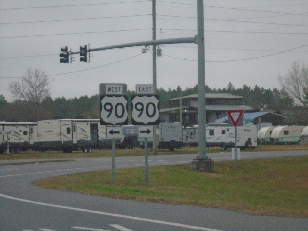
Baldwin Beach Express North at US-90
Baldwin Beach Express North at US-90 in Baldwin County.
Taken 12-27-2018
 Robertsdale
Baldwin County
Alabama
United States
Robertsdale
Baldwin County
Alabama
United States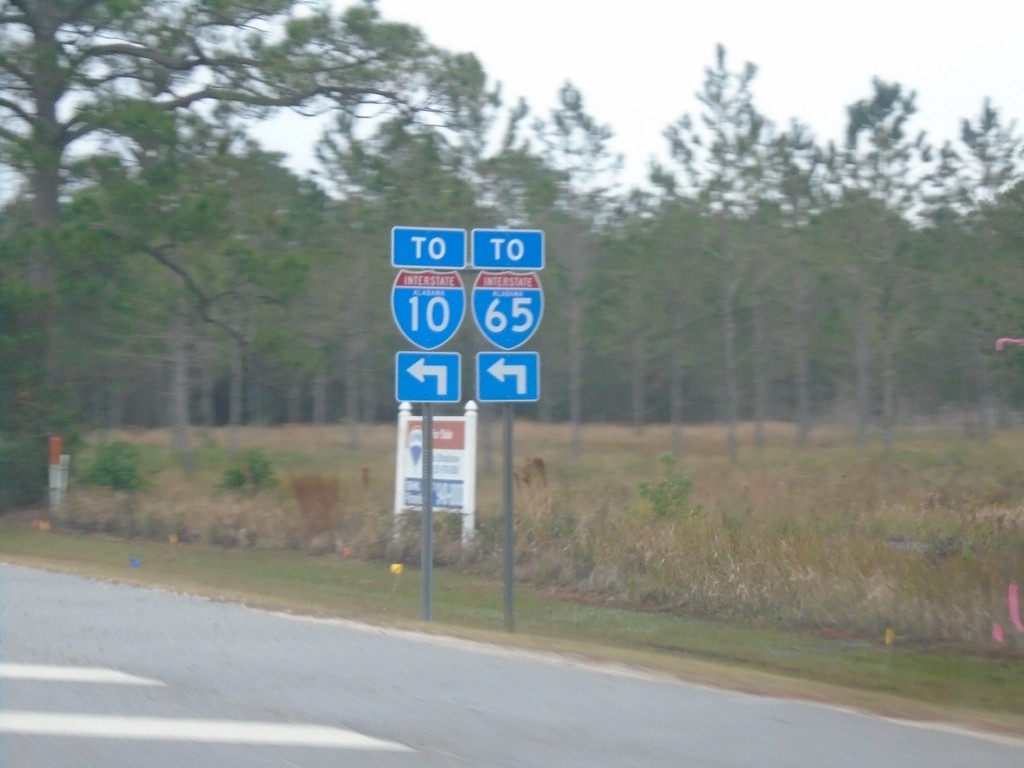
AL-180 East at Foley Beach Express
AL-180 East at Foley Beach Express. Use Foley Beach Express for access to I-10 and I-65.
Taken 12-27-2018

 Orange Beach
Baldwin County
Alabama
United States
Orange Beach
Baldwin County
Alabama
United States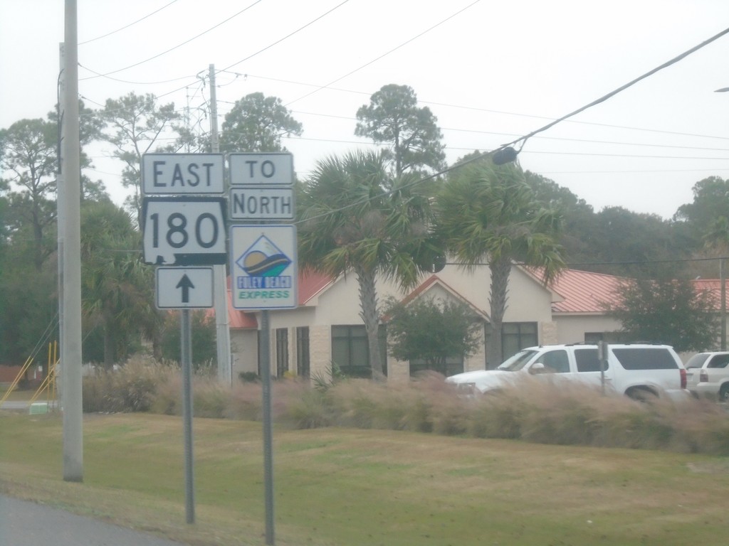
AL-180 East/To Foley Beach Express
AL-180 East/To Foley Beach Express in Gulf Shores.
Taken 12-27-2018
Gulf Shores
Baldwin County
Alabama
United States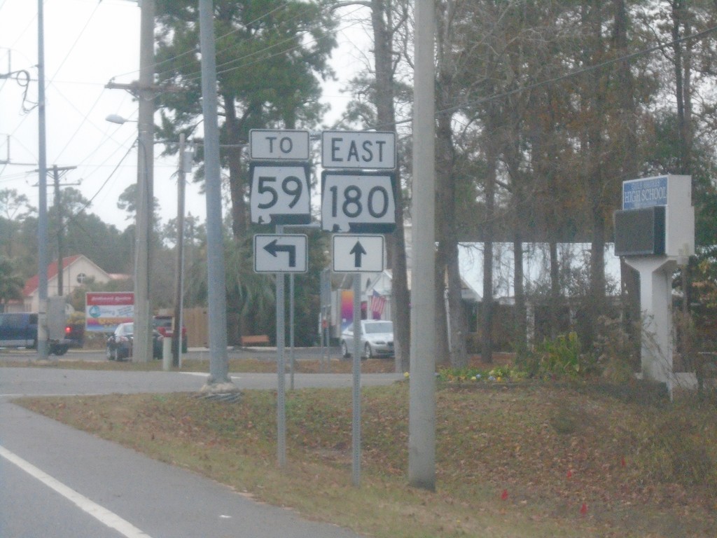
AL-180 East at Dolphin Ave.
AL-180 East at Dolphin Ave. Turn left for AL-59.
Taken 12-27-2018
 Gulf Shores
Baldwin County
Alabama
United States
Gulf Shores
Baldwin County
Alabama
United States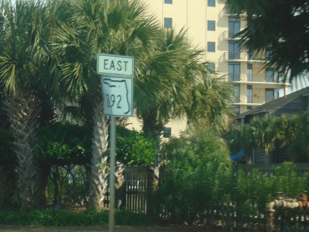
FL-292 East on Perdido Key
FL-292 East on Perdido Key, just east of the Alabama state line. This is the first FL-292 shield in Florida.
Taken 12-26-2018
 Pensacola
Escambia County
Florida
United States
Pensacola
Escambia County
Florida
United States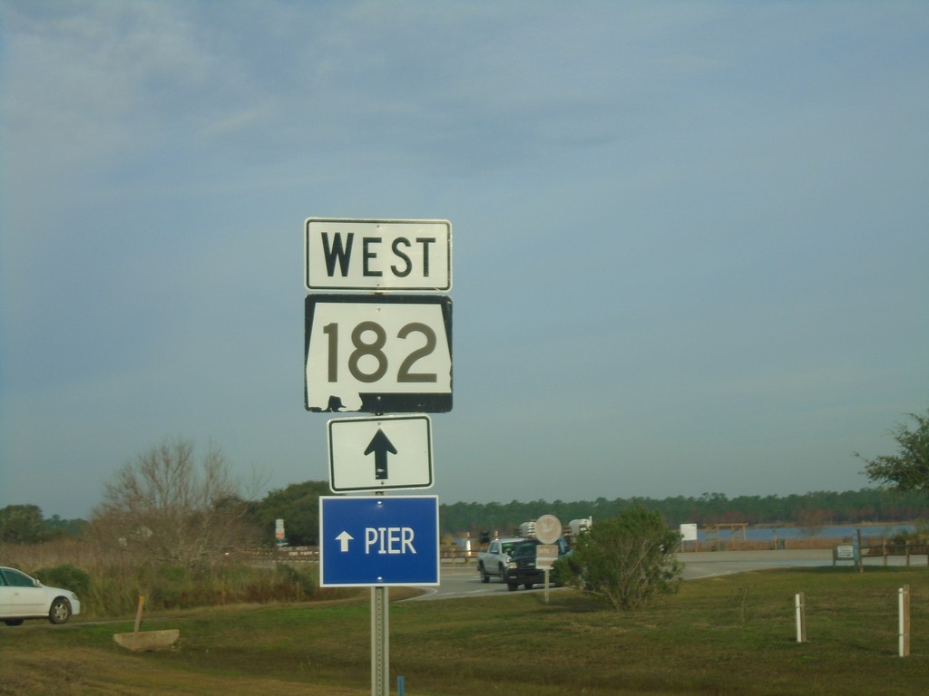
AL-182 East Approaching Gulf State Park Entrance
AL-182 East Approaching Gulf State Park Entrance. Continue straight for AL-182 to the Pier.
Taken 12-26-2018
 Gulf Shores
Baldwin County
Alabama
United States
Gulf Shores
Baldwin County
Alabama
United States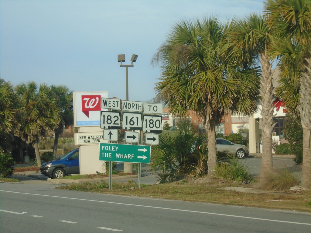
AL-182 West at AL-161 (To AL-180) - Orange Beach
AL-182 West at AL-161 North (To AL-180) in Orange Beach. Turn right on AL-160 for Foley and The Wharf.
Taken 12-26-2018
 Orange Beach
Baldwin County
Alabama
United States
Orange Beach
Baldwin County
Alabama
United States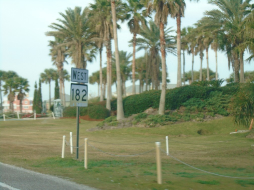
AL-182 West - Orange Beach
AL-182 West in Orange Beach
Taken 12-26-2018
Orange Beach
Baldwin County
Alabama
United States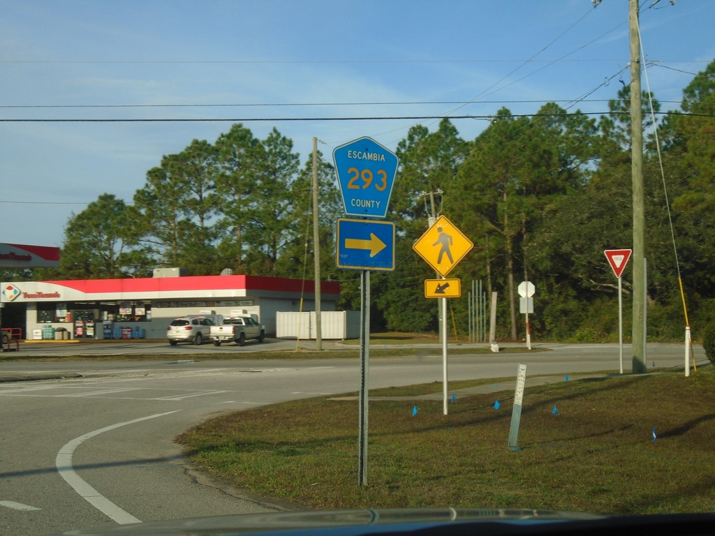
FL-292 West at CH-293
FL-292 West at CH-293 (Bauer Road) in Escambia County.
Taken 12-26-2018
 Pensacola
Escambia County
Florida
United States
Pensacola
Escambia County
Florida
United States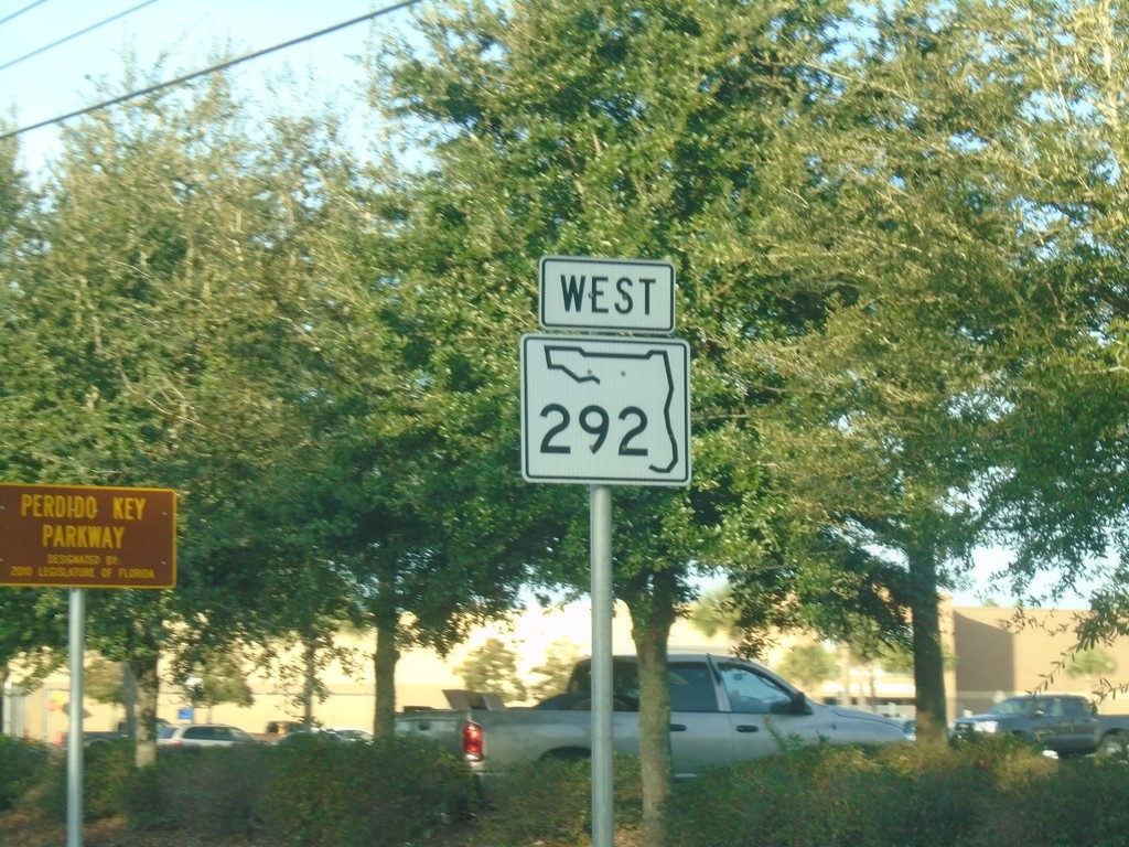
FL-292 West - Perdido Key Parkway
FL-292 West - Perdido Key Parkway.
Taken 12-26-2018
Pensacola
Escambia County
Florida
United States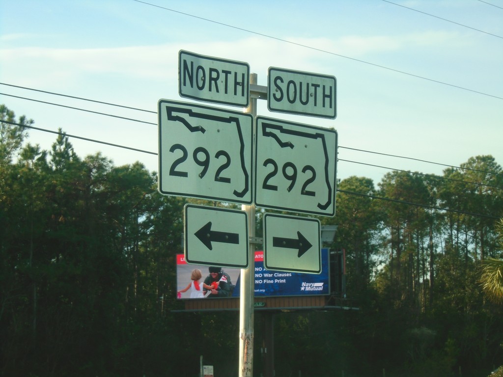
FL-173 South at FL-292
FL-173 South at FL-292 in Escambia County.
Taken 12-26-2018
 Pensacola
Escambia County
Florida
United States
Pensacola
Escambia County
Florida
United States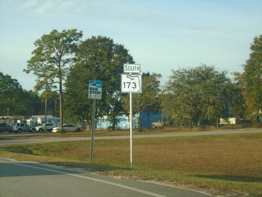
FL-173 South - Escambia County
FL-173 South in Escambia County.
Taken 12-26-2018
Pensacola
Escambia County
Florida
United States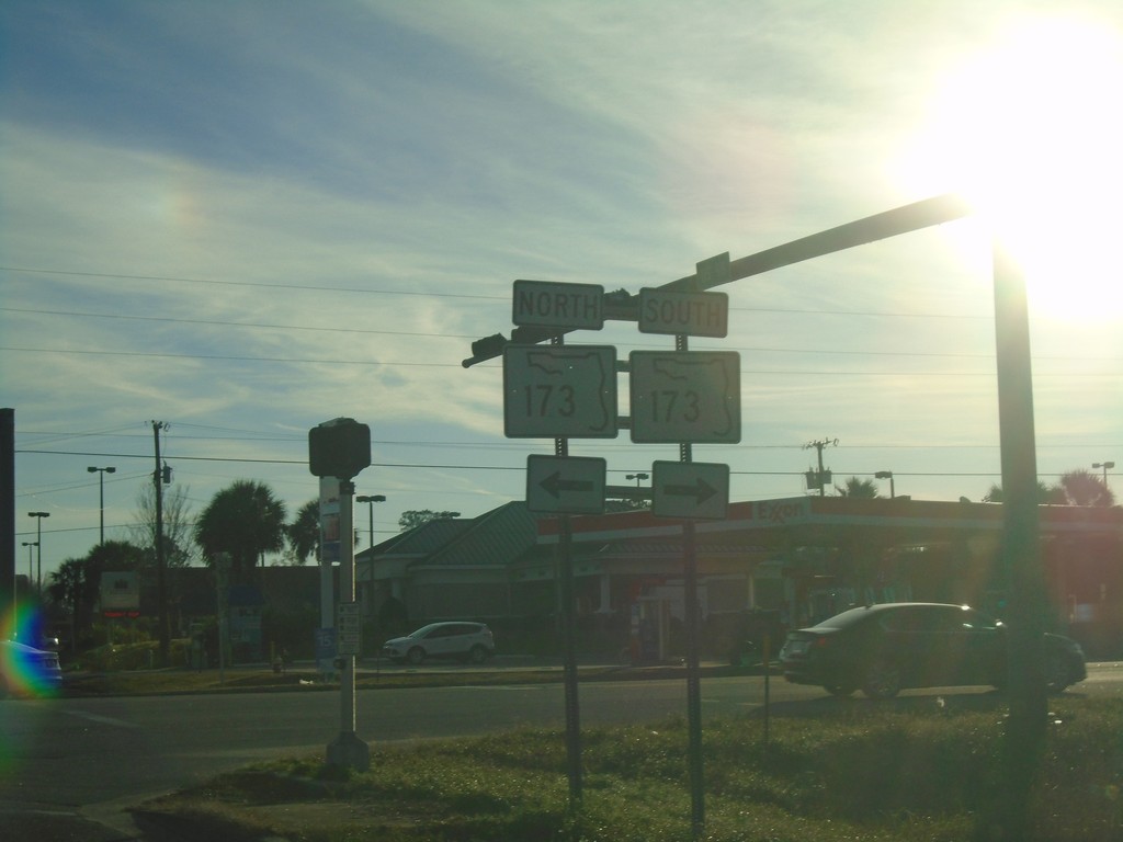
US-98 East at FL-173
US-98 East at FL-173 in Escambia County.
Taken 12-26-2018
 Pensacola
Escambia County
Florida
United States
Pensacola
Escambia County
Florida
United States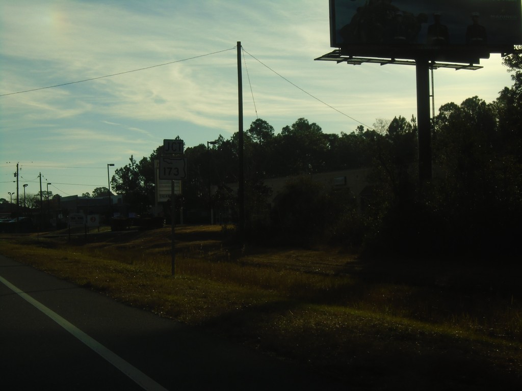
US-98 East Approaching FL-173
US-98 East approaching FL-173 in Escambia County.
Taken 12-26-2018
Pensacola
Escambia County
Florida
United States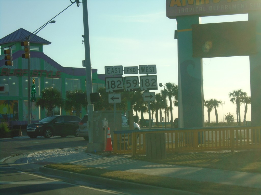
End AL-59 South at AL-182
End AL-59 South at AL-182 in Gulf Shores.
Taken 12-24-2018
Gulf Shores
Baldwin County
Alabama
United States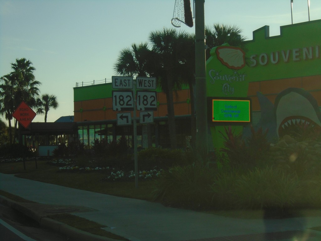
End AL-59 South at AL-182
End AL-59 South at AL-182 in Gulf Shores.
Taken 12-24-2018
Gulf Shores
Baldwin County
Alabama
United States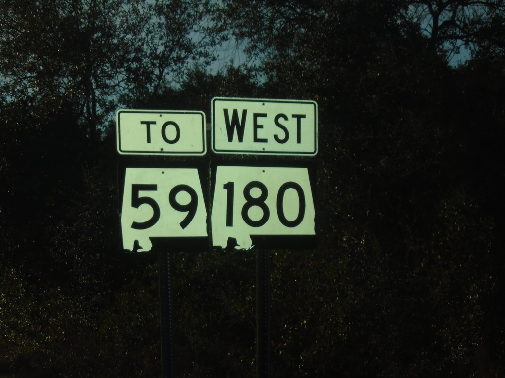
AL-180 West to AL-59 - Gulf Shores
AL-180 West to AL-59 in Gulf Shores
Taken 12-24-2018
Gulf Shores
Baldwin County
Alabama
United States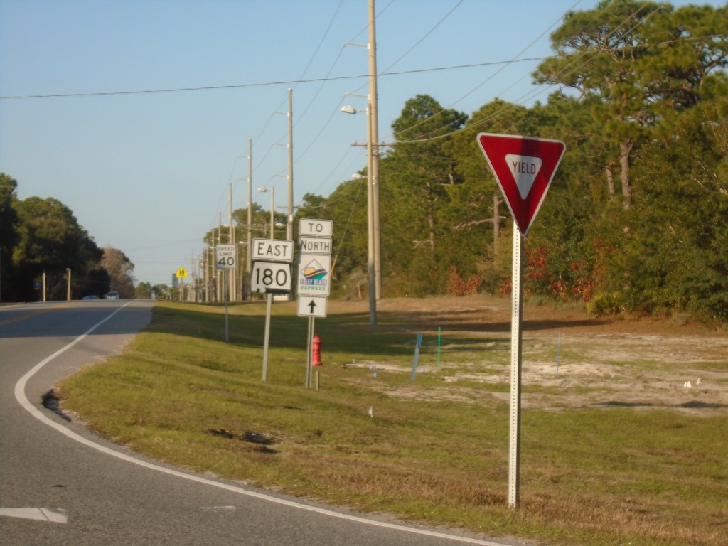
AL-180 East - Gulf Shores
AL-180 east in Gulf Shores.
Taken 12-24-2018
Gulf Shores
Baldwin County
Alabama
United States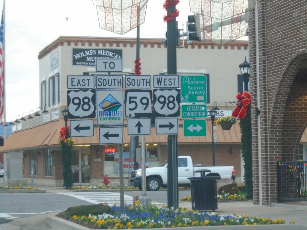
AL-59 South at US-98 - Foley
AL-59 South at US-98 in Foley. Use US-98 East for the Foley Beach Express. US-98 is the Coastal Connection Scenic Byway.
Taken 12-23-2018
Foley
Baldwin County
Alabama
United States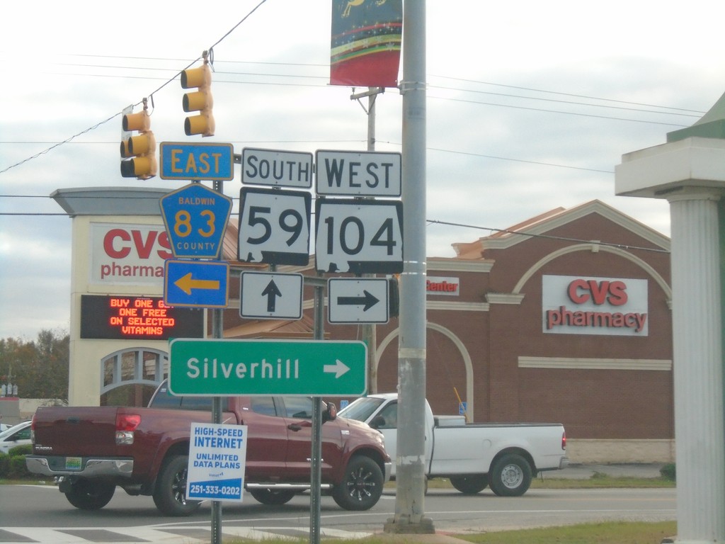
AL-59 South at AL-104/CH-83 - Robertsdale
AL-59 South at AL-104/CH-83 in Robertsdale. Turn right for AL-104 West to Silverhill; left for CR-83.
Taken 12-23-2018

 Robertsdale
Baldwin County
Alabama
United States
Robertsdale
Baldwin County
Alabama
United States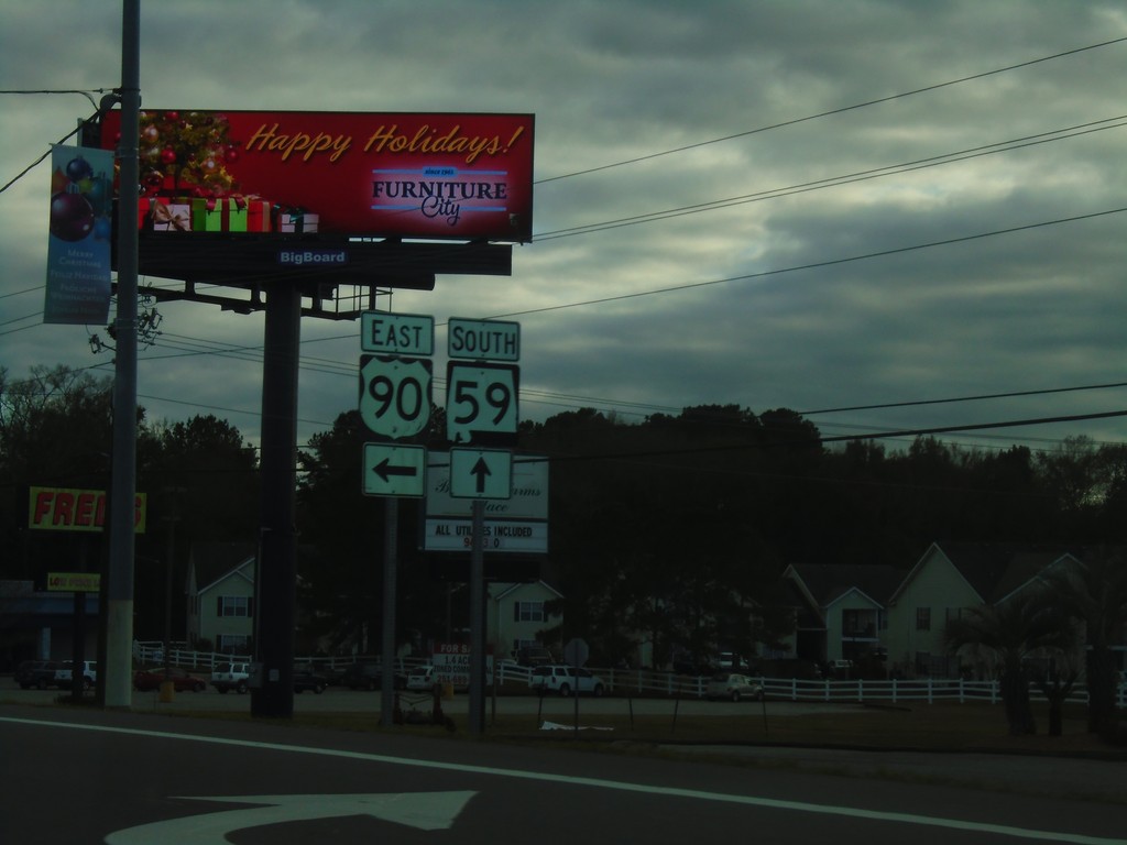
US-90 East/AL-59 South at US-90/AL-59 Split
US-90 East/AL-59 South at US-90/AL-59 Split in Robertsdale. Turn left to continue east on US-90.
Taken 12-23-2018
Robertsdale
Baldwin County
Alabama
United States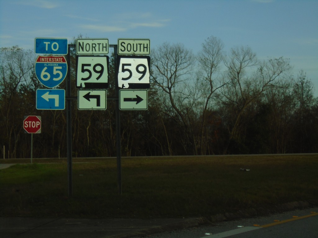
I-10 East - Exit 44 Offramp
I-10 East - Exit 44 Offramp at AL-59. Turn right on AL-59 North to I-65.
Taken 12-23-2018
Loxley
Baldwin County
Alabama
United States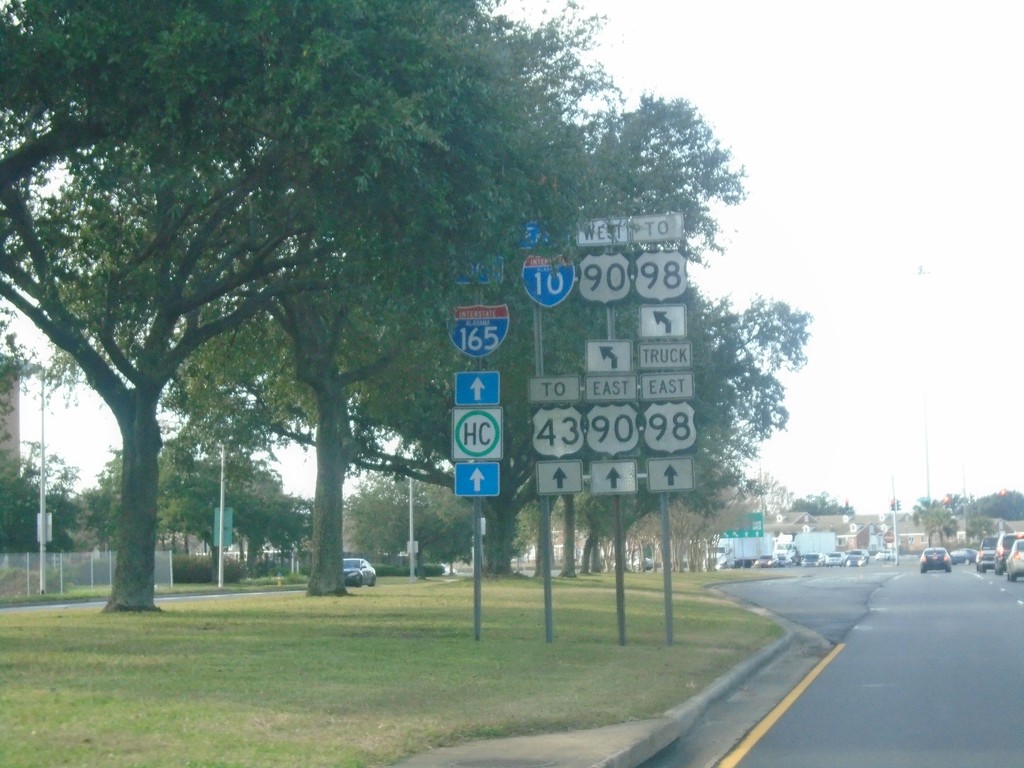
Water St. North at I-165 and US-90
Water St. North at I-165 and US-90 (Beauregard St.). Turn left for US-90 West/To I-10/To US-98. Continue straight for I-165/US-90 East/To US-43/To US-98 Truck
Taken 12-23-2018

 Mobile
 County
Alabama
United States
Mobile
Mobile County
Alabama
United States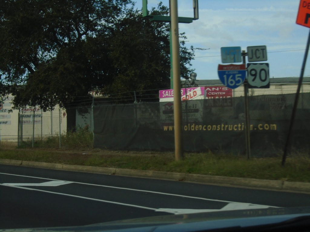
Water St. North Approaching I-165/US-90 Junction
Water St. North approaching I-165/US-90 Junction (Beauregard St.) in Mobile.
Taken 12-23-2018
Mobile
Mobile County
Alabama
United States