Signs Tagged With Shield
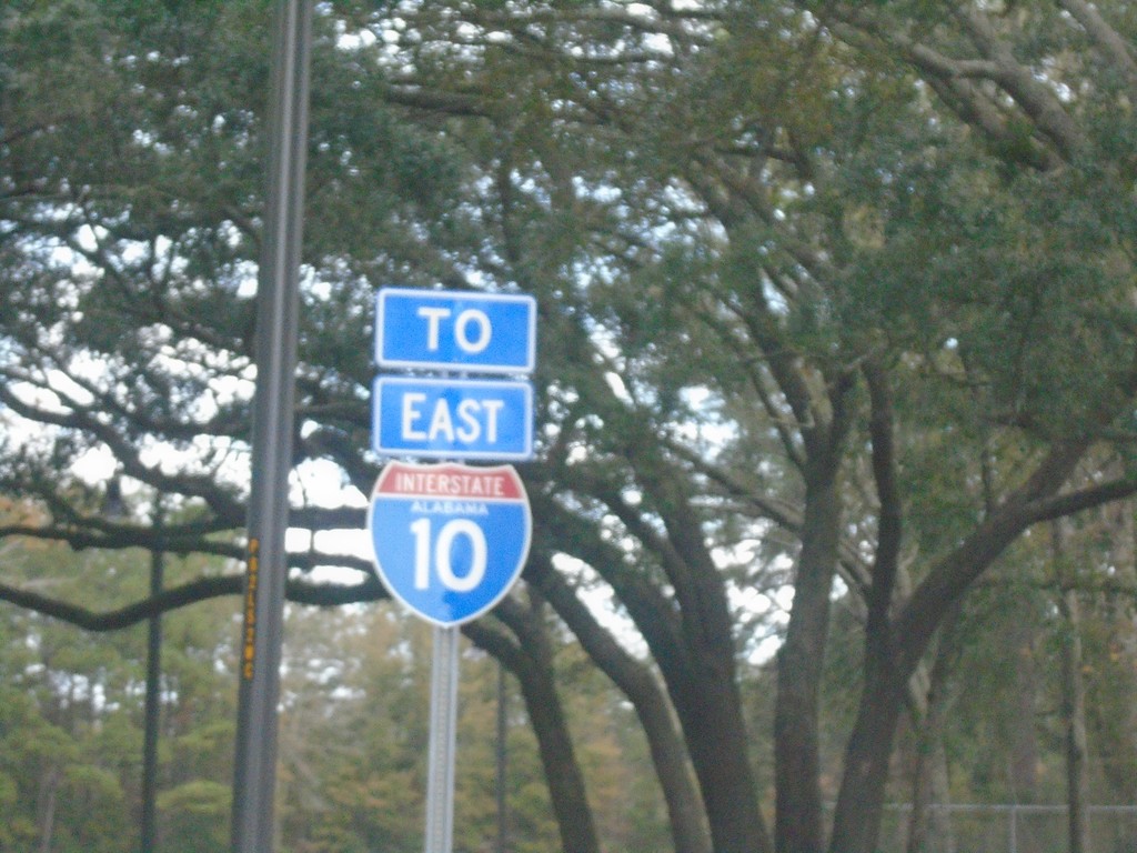
Alabama Welcome Center at I-10 East
Alabama Welcome Center at I-10 East.
Taken 12-23-2018
 Grand Bay
Mobile County
Alabama
United States
Grand Bay
Mobile County
Alabama
United States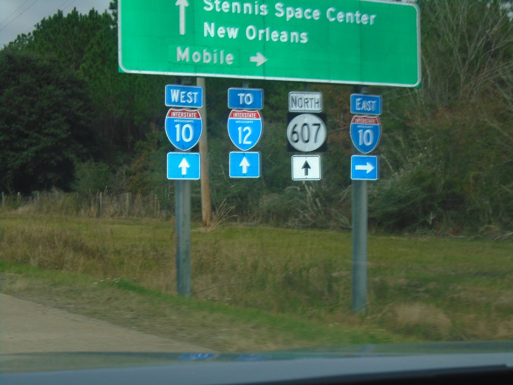
MS-607 North at I-10
MS-607 north at I-10. Use I-10 east for Mobile (AL); I-10 west for New Orleans (LA) and I-12. Continue north on MS-607 for Stennis Space Center. The I-12 shield contains the text MISSISSIPPI, but the highway never enters Mississippi.
Taken 12-23-2018

 Pearlington
Hancock County
Mississippi
United States
Pearlington
Hancock County
Mississippi
United States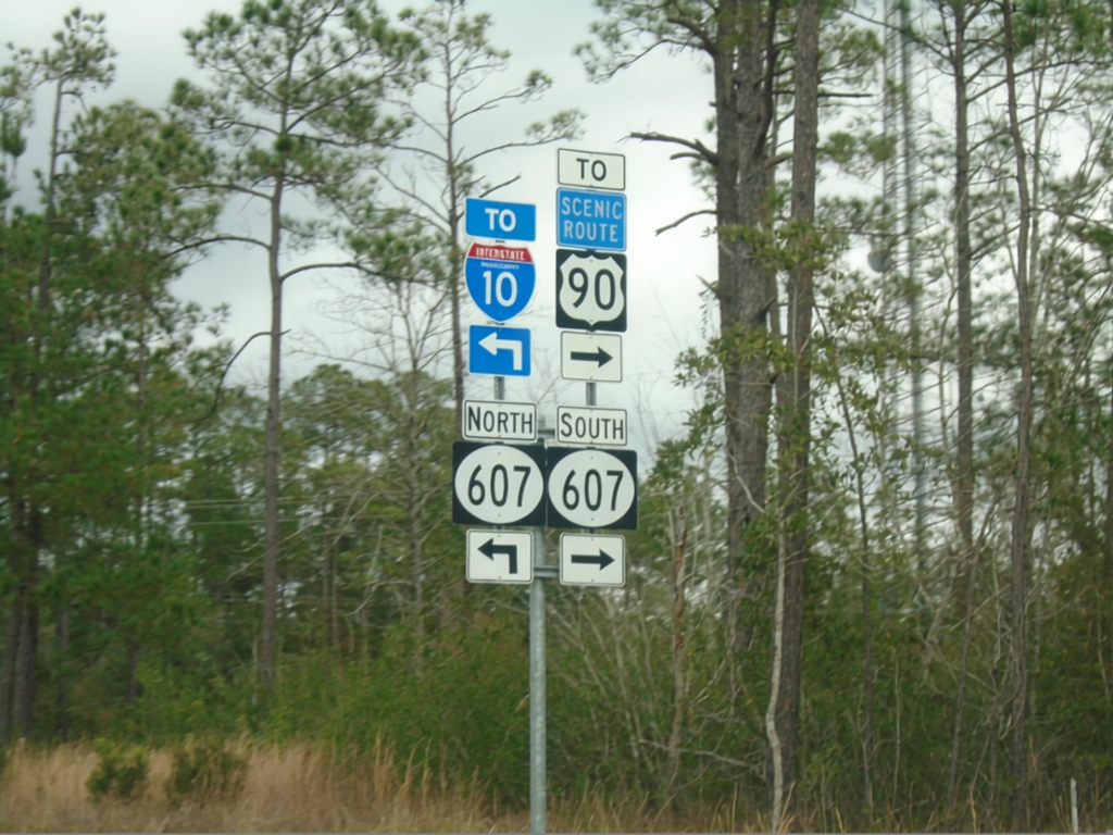
Mississippi Welcome Center Access Road at MS-607
Mississippi Welcome Center Access Road at MS-607. Turn right for MS-607 South to US-90; left for MS-607 North to I-10.
Taken 12-23-2018
 Kiln
Hancock County
Mississippi
United States
Kiln
Hancock County
Mississippi
United States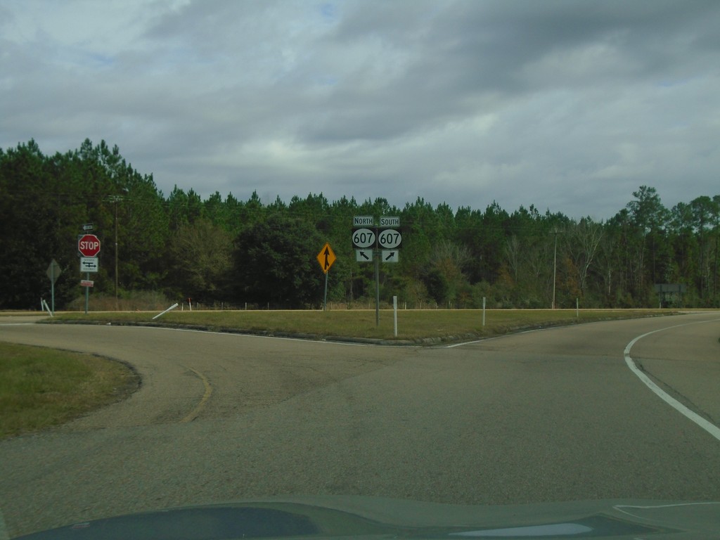
I-10 East Exit 2 Offramp at MS-607
I-10 East Exit 2 Offramp at MS-607 - Hancock County.
Taken 12-23-2018
Pearlington
Hancock County
Mississippi
United States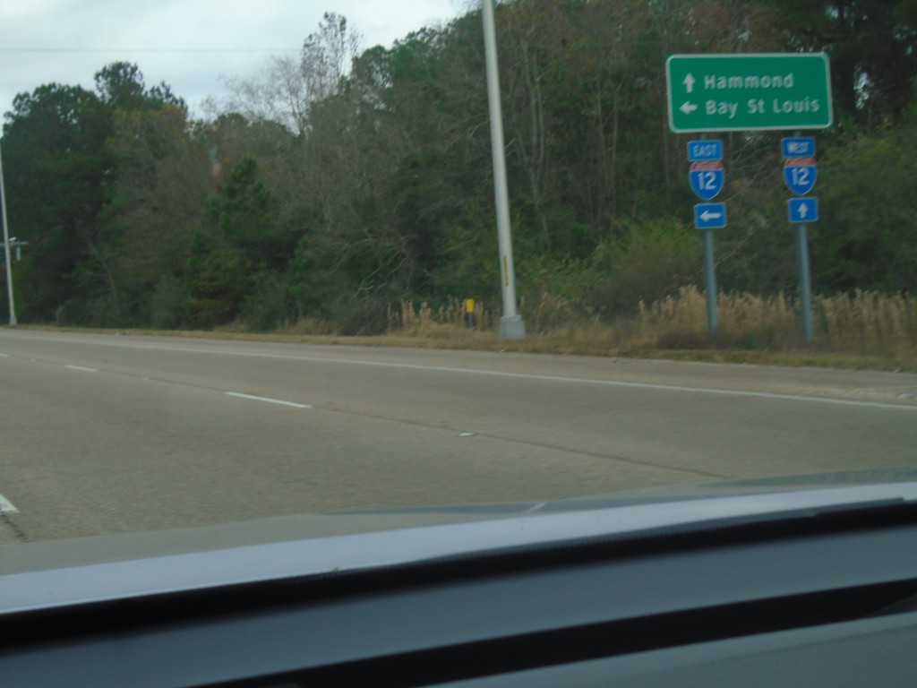
US-11 North at I-12 - Slidell
US-11 North at I-12 in Slidell. Use I-12 east for Bay St. Louis (MS); I-12 west for Hammond.
Taken 12-23-2018
 Slidell
St. Tammany Parish
Louisiana
United States
Slidell
St. Tammany Parish
Louisiana
United States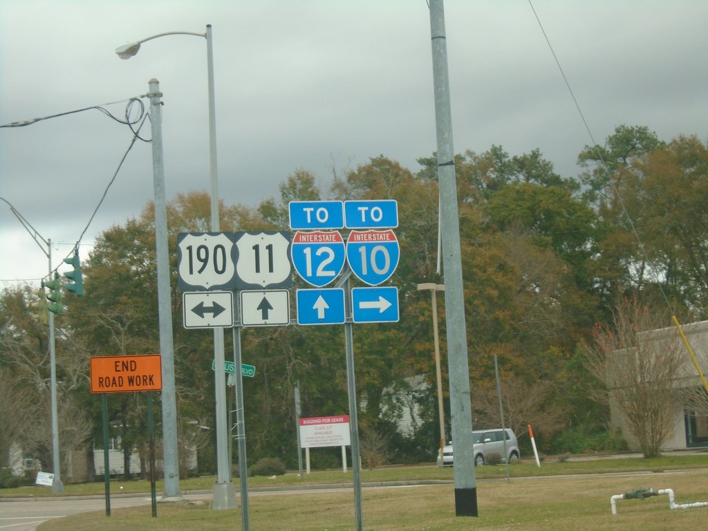
US-11 North at US-190 - Slidell
US-11 North at US-190 in Slidell. Turn right for access to I-10; straight for access to I-12.
Taken 12-23-2018
 Slidell
St. Tammany Parish
Louisiana
United States
Slidell
St. Tammany Parish
Louisiana
United States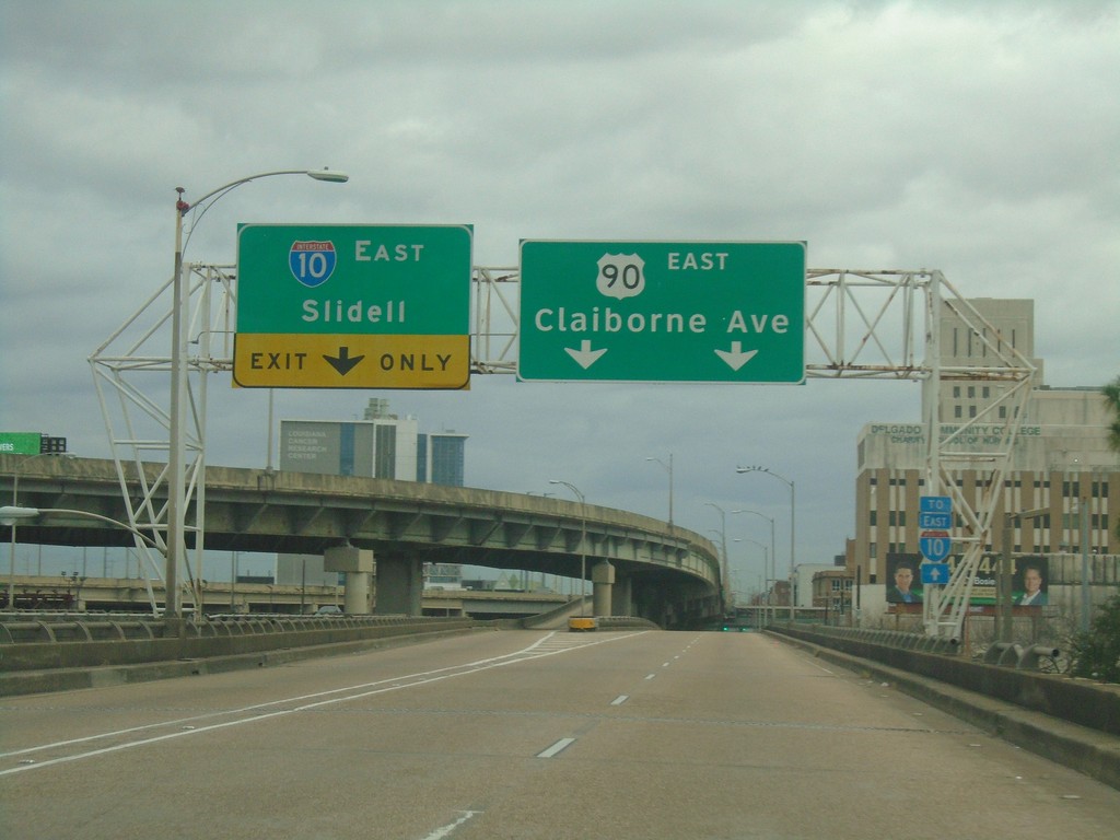
Bus. US-90 East Offramp to US-90 East
Bus. US-90 East offramp to US-90 East. Use right lanes for US-90 East/Claiborne Ave. Use left lanes for I-10 East/Slidell.
Taken 12-23-2018
 New Orleans
Orleans Parish
Louisiana
United States
New Orleans
Orleans Parish
Louisiana
United States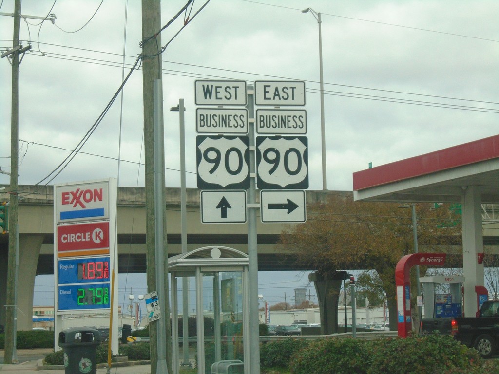
Manhattan Blvd. North at Bus. US-90
Manhattan Blvd. North at Bus. US-90 in Jefferson Parish.
Taken 12-23-2018
Harvey
Jefferson Parish
Louisiana
United States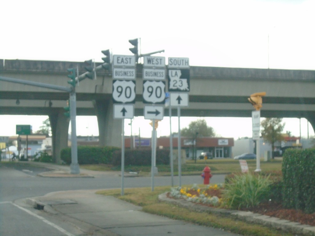
End LA-18 East at Bus. US-90 and LA-23
End LA-18 East (Lafayette St.) at Bus. US-90 (Westbank Expressway Frontage Road) and LA-23 in Gretna.
Taken 12-23-2018

 Gretna
Jefferson Parish
Louisiana
United States
Gretna
Jefferson Parish
Louisiana
United States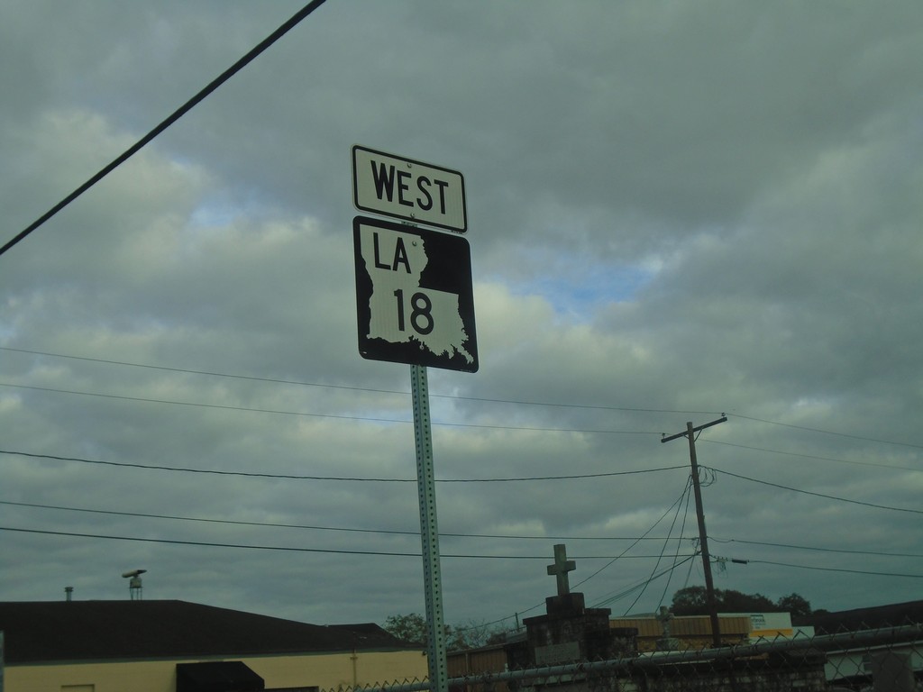
LA-18 West - Gretna
LA-18 west in Gretna (Lafayette St.)
Taken 12-23-2018
Gretna
Jefferson Parish
Louisiana
United States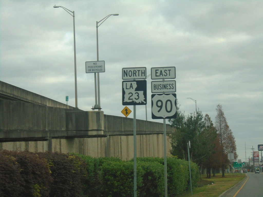
Bus. US-90 East/LA-23 North - Gretna
Bus. US-90 East/LA-23 North on Westbank Expressway Frontage Road in Gretna.
Taken 12-23-2018
Gretna
Jefferson Parish
Louisiana
United States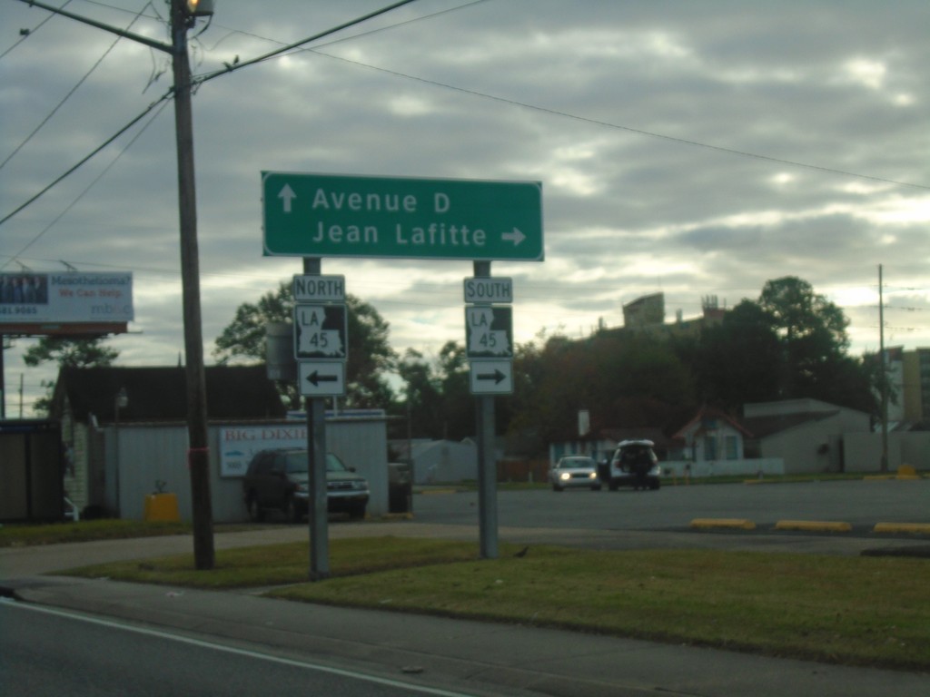
Bus. US-90 Offramp at LA-45
Bus. US-90 Offramp at LA-45. Turn right for LA-45 South to Jean Lafitte. Continue straight for Avenue D.
Taken 12-23-2018
 Marrero
Jefferson Parish
Louisiana
United States
Marrero
Jefferson Parish
Louisiana
United States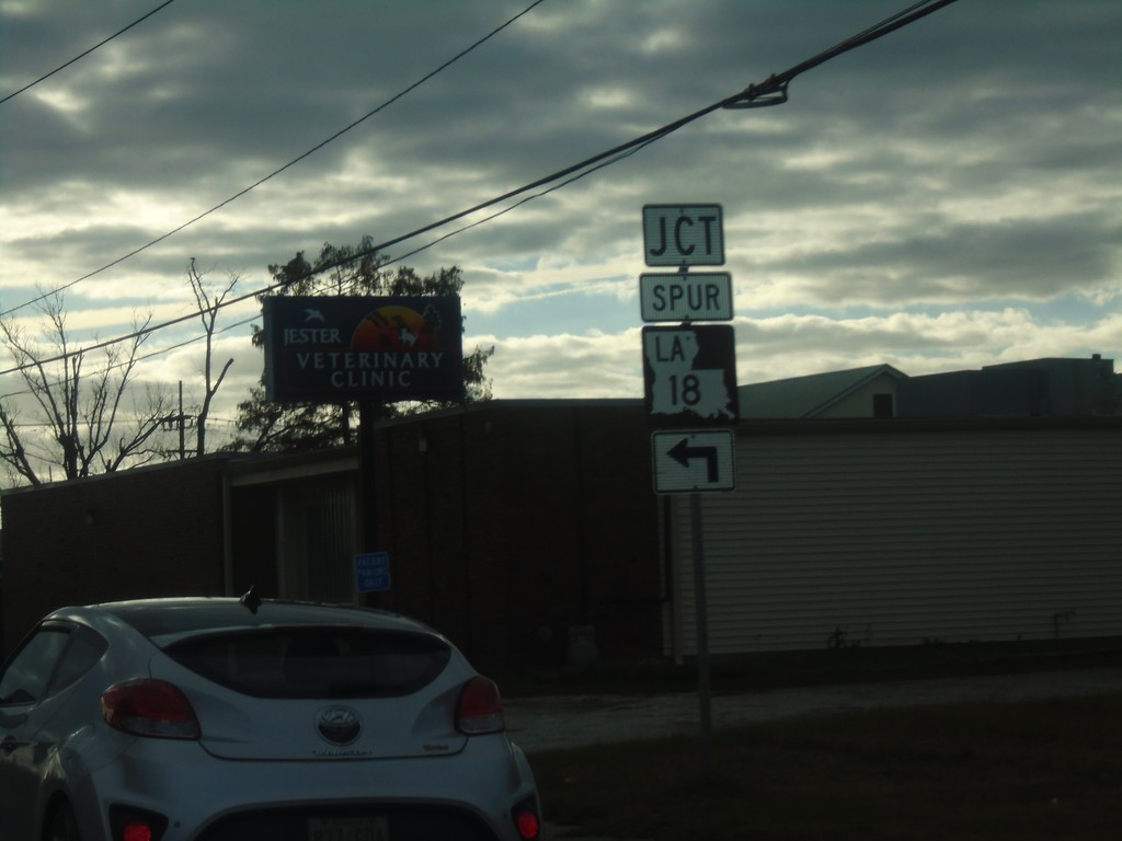
Bus. US-90 East at LA-18 Spur
Bus. US-90 East at LA-18 Spur in Jefferson Parish.
Taken 12-23-2018
Westwego
Jefferson Parish
Louisiana
United States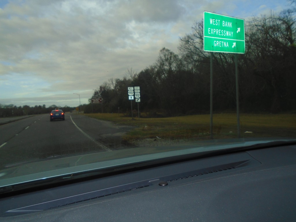
US-90 West At Bus. US-90 East
US-90 West At Bus. US-90 East/Westbank Expressway/Gretna.
Taken 12-23-2018
Avondale
Jefferson Parish
Louisiana
United States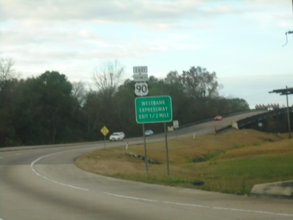
US-90 West Approaching Bus. US-90 East
US-90 West Approaching Bus. US-90 East/Westbank Expressway.
Taken 12-23-2018
Westwego
Jefferson Parish
Louisiana
United States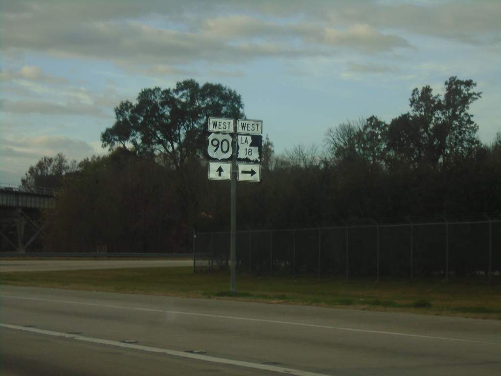
US-90 West/LA-18 West at US-90/LA-18 Split
US-90 West/LA-18 West at US-90/LA-18 split in Jefferson Parish.
Taken 12-23-2018
Nine Mile Point
Jefferson Parish
Louisiana
United States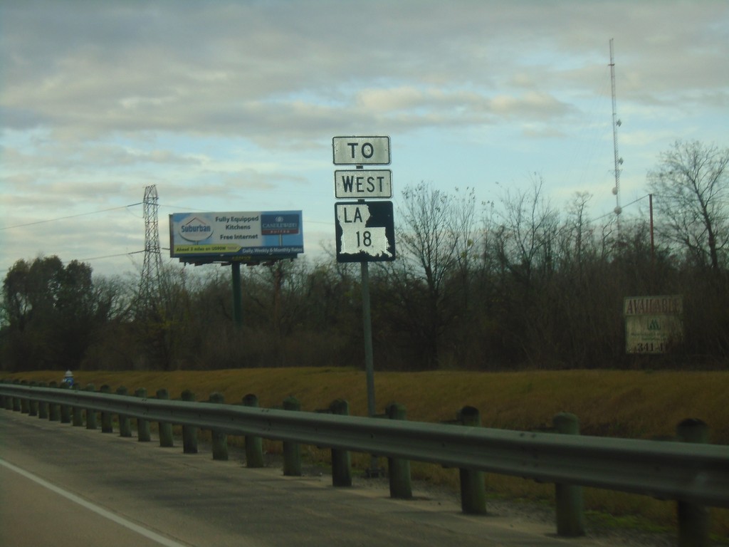
US-90 West/LA-18 West Onramp
US-90 West/LA-18 West onramp.
Taken 12-23-2018
Bridge City
Jefferson Parish
Louisiana
United States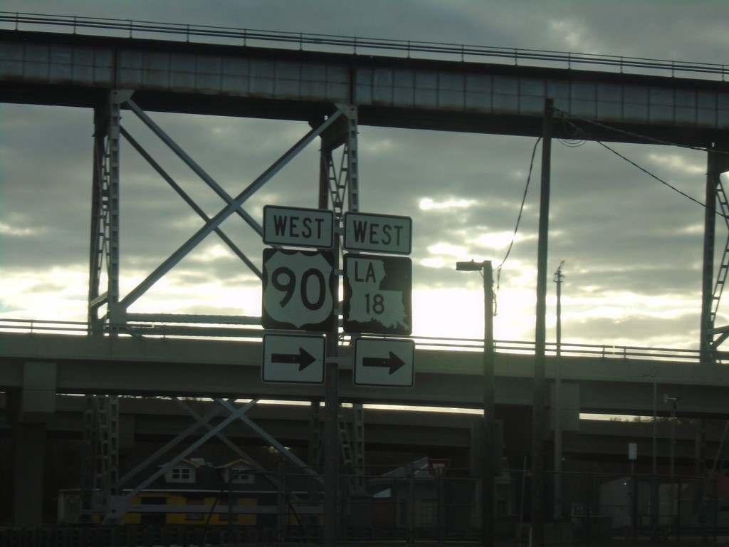
Bridge City Ave. East at US-90/LA-18
Bridge City Ave. East at US-90/LA-18. Turn right for onramp to US-90 West/LA-18 West.
Taken 12-23-2018
Bridge City
Jefferson Parish
Louisiana
United States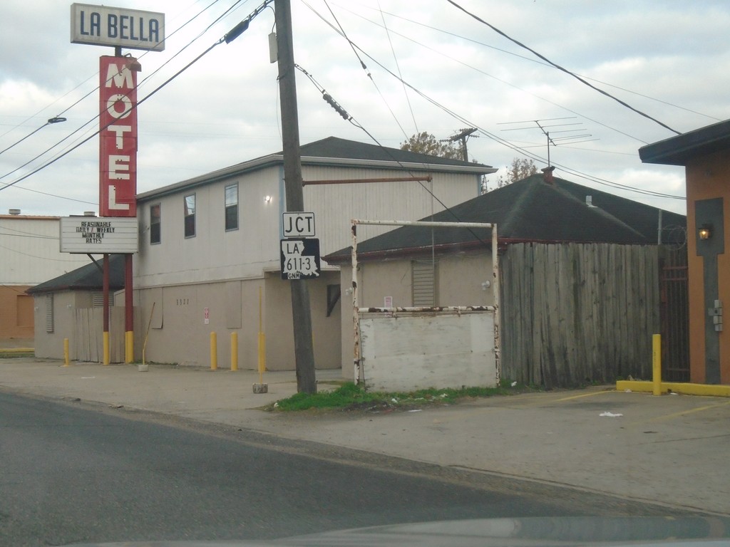
US-90 West Approaching LA-611-3
US-90 West Approaching LA-611-3 (Shrewsbury Road) in Jefferson Parish.
Taken 12-23-2018
 Jefferson
 Parish
Louisiana
United States
Jefferson
Jefferson Parish
Louisiana
United States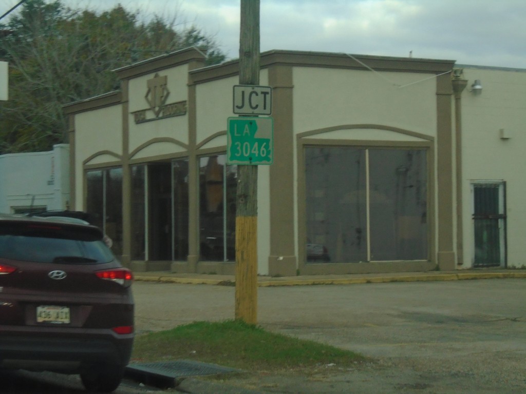
US-90 West Approaching LA-3046
US-90 West approaching LA-3046 (Causeway Blvd.) in Jefferson Parish.
Taken 12-23-2018
 Jefferson
 Parish
Louisiana
United States
Jefferson
Jefferson Parish
Louisiana
United States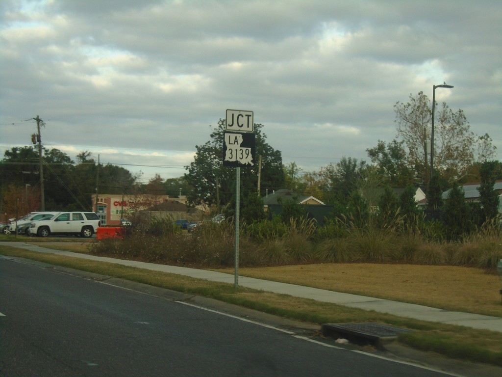
US-90 West Approaching LA-3139
US-90 West Approaching LA-3139 (Deckbar Ave.)
Taken 12-23-2018
 Jefferson
 Parish
Louisiana
United States
Jefferson
Jefferson Parish
Louisiana
United States
US-90 West - Entering Jefferson Parish
Entering Jefferson Parish on US-90 west.
Taken 12-23-2018
Jefferson
Jefferson Parish
Louisiana
United States
US-90 West - New Orleans
US-90 West (Broad St.) in New Orleans.
Taken 12-23-2018
New Orleans
Orleans Parish
Louisiana
United States
Metairie Road East at I-10
Metairie Road East (LA-611-9) at I-10 in New Orleans.
Taken 12-22-2018
 New Orleans
Orleans Parish
Louisiana
United States
New Orleans
Orleans Parish
Louisiana
United States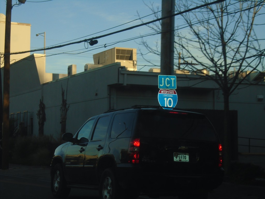
Metairie Road East Approaching I-10
Metairie Road East (LA-611-9) approaching I-10. The I-10 shield contains the text LOUISIANA.
Taken 12-22-2018
New Orleans
Orleans Parish
Louisiana
United States