Signs Tagged With Shield
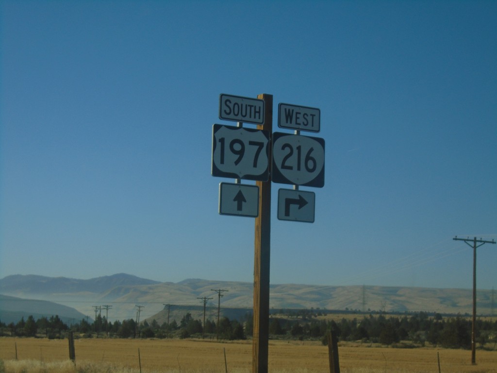
US-197 South/OR-216 West at US-197/OR-216 Split
US-197 South/OR-216 West at US-197/OR-216 Split in Wasco County.
Taken 10-14-2018

 Maupin
Wasco County
Oregon
United States
Maupin
Wasco County
Oregon
United States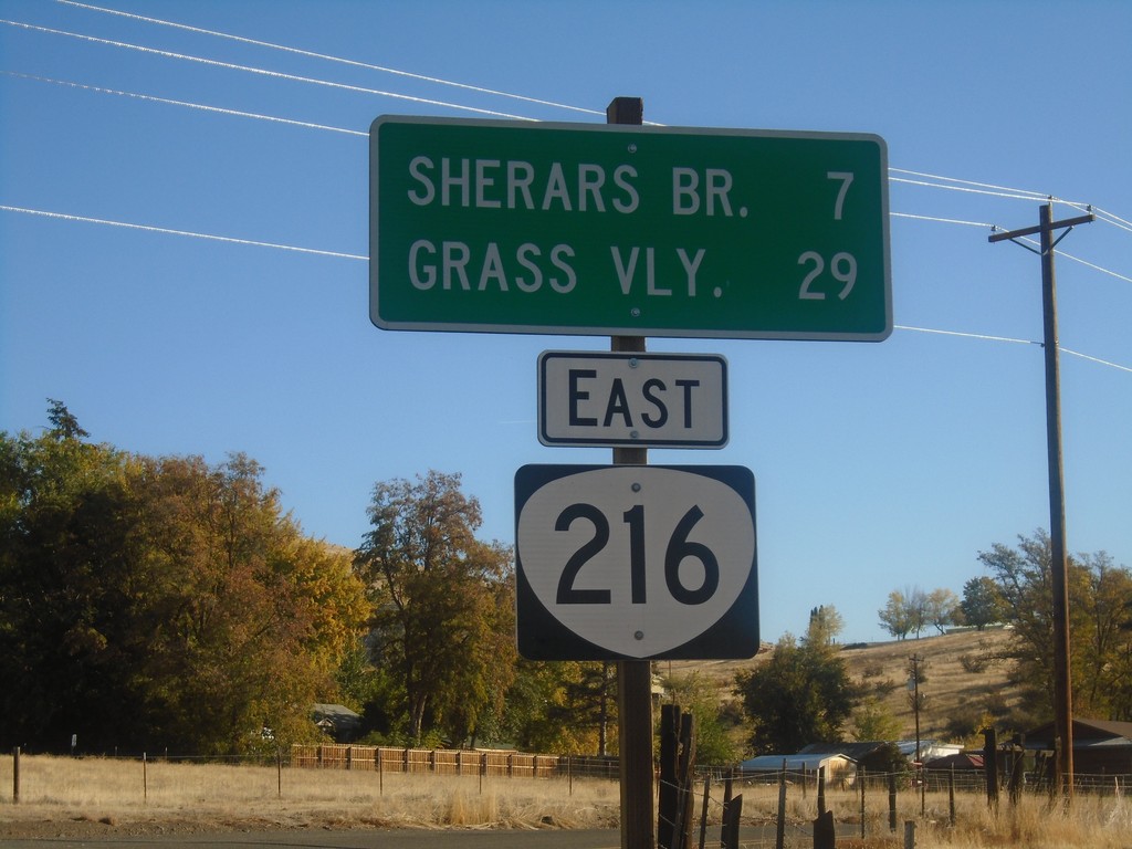
OR-216 East - Distance Marker
Distance marker on OR-216 east. Distance to Sherars Bridge and Grass Valley.
Taken 10-14-2018
Tygh Valley
Wasco County
Oregon
United States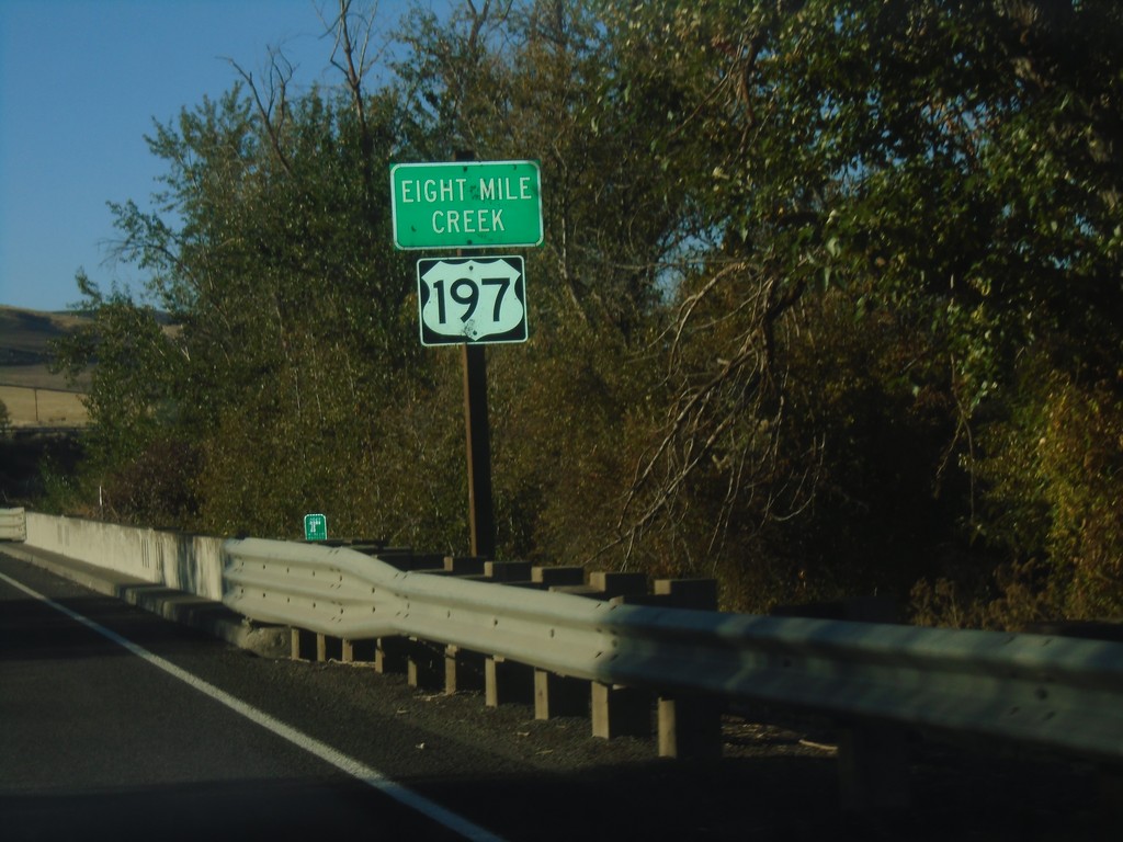
US-197 South - Eight Mile Creek
Eight Mile Creek on US-197 South.
Taken 10-14-2018
Boyd
Wasco County
Oregon
United States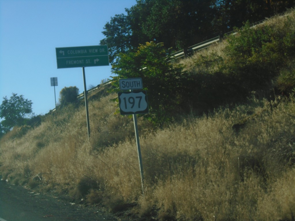
US-197 South - The Dalles
US-197 south in The Dalles.
Taken 10-14-2018
The Dalles
Wasco County
Oregon
United States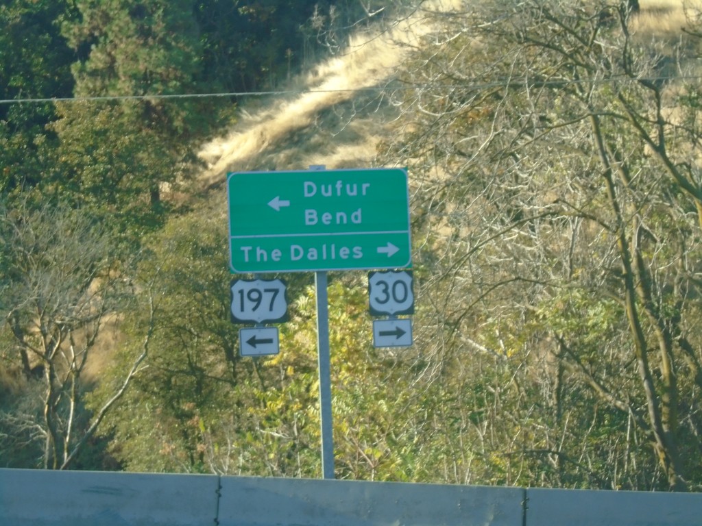
US-197 South/US-30 West at Split
US-197 South/US-30 West at US-197/US-30 split. Turn right for US-30 west to The Dalles. Turn left for US-197 south to Dufur and Bend.
Taken 10-14-2018
 The Dalles
Wasco County
Oregon
United States
The Dalles
Wasco County
Oregon
United States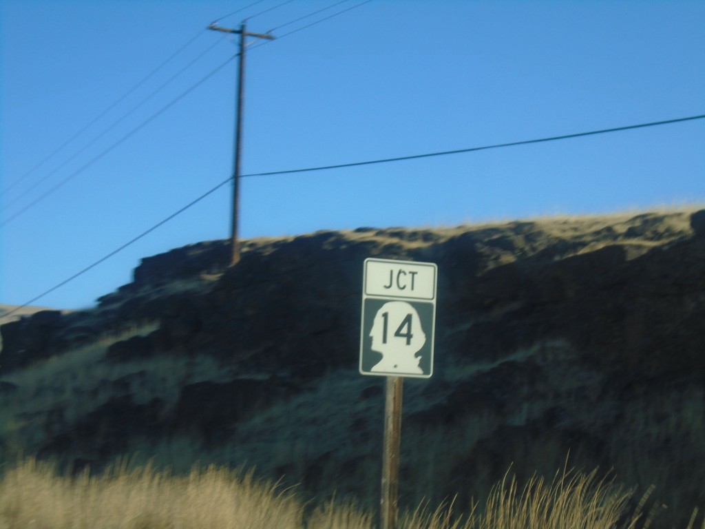
US-197 North Approaching WA-14
US-197 North approaching WA-14 in Klickitat County.
Taken 10-14-2018
 Lyle
Klickitat County
Washington
United States
Lyle
Klickitat County
Washington
United States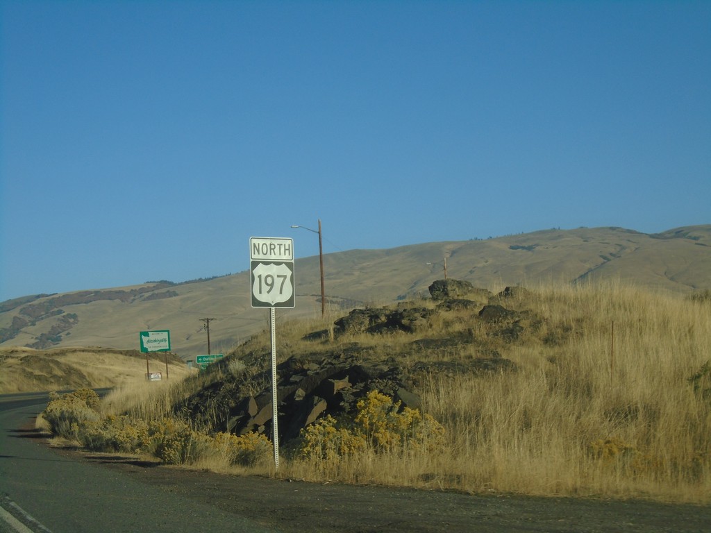
US-197 North - Welcome To Washington
First US-197 north shield in Washington. In the background is the Welcome To Washington sign.
Taken 10-14-2018
Dallesport
Klickitat County
Washington
United States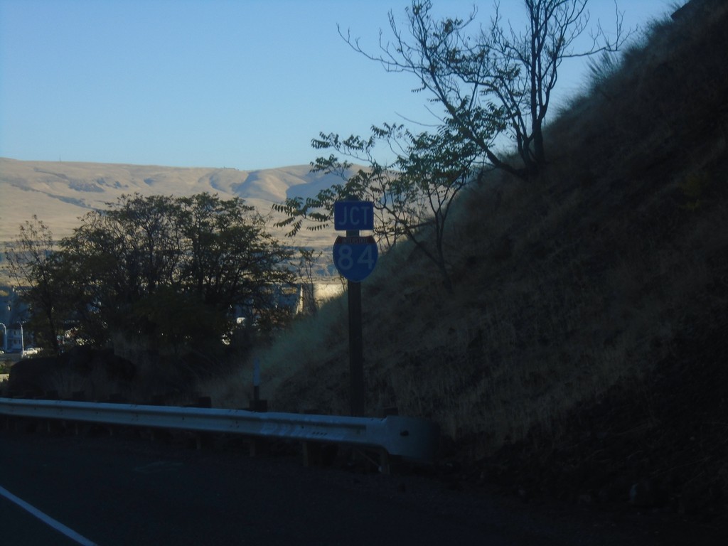
US-197 North/US-30 East Approaching I-84
US-197 North/US-30 East approaching I-84 in The Dalles.
Taken 10-14-2018
 The Dalles
Wasco County
Oregon
United States
The Dalles
Wasco County
Oregon
United States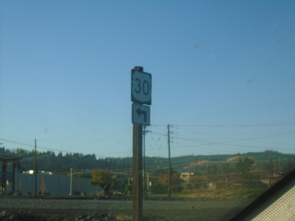
US-30 West - The Dalles
US-30 West (W 2nd St.) at Webber St. Turn left ton Webber St. to continue on US-30 west.
Taken 10-14-2018
The Dalles
Wasco County
Oregon
United States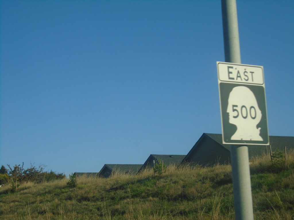
WA-500 East - Vancouver
WA-500 East in Vancouver
Taken 10-13-2018
 Vancouver
Clark County
Washington
United States
Vancouver
Clark County
Washington
United States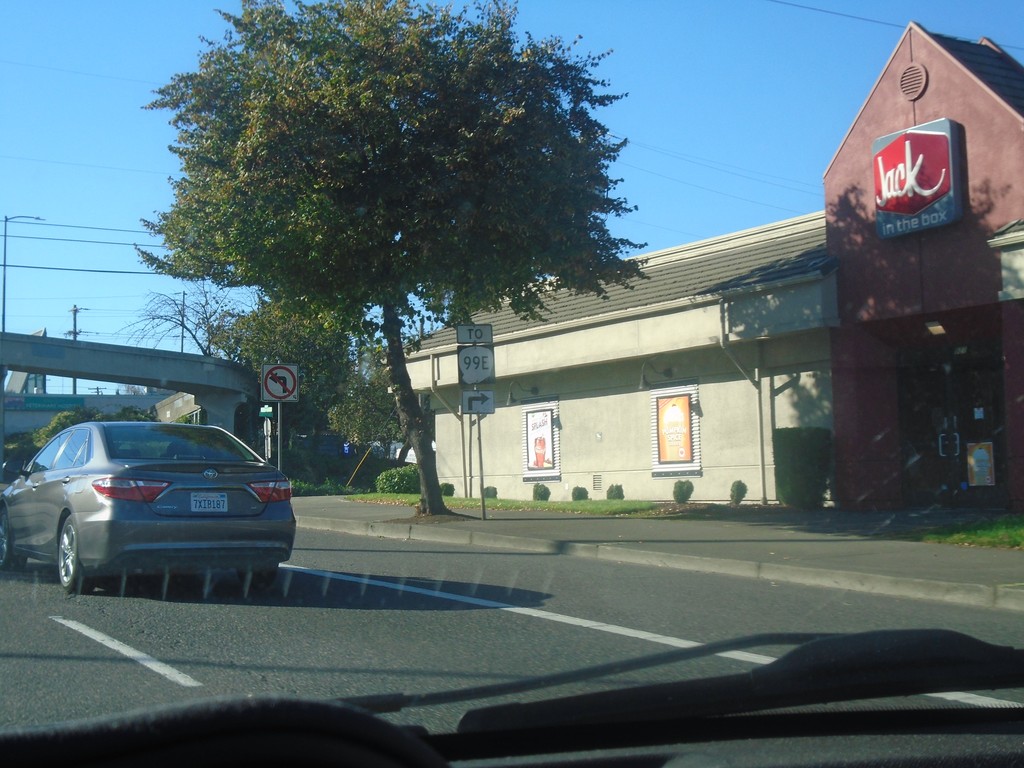
US-26 West at SE 9th Ave (To OR-99E)
US-26 West (SE Powell Blvd.) at SE 9th Ave (To OR-99E).
Taken 10-13-2018

 Portland
Multnomah County
Oregon
United States
Portland
Multnomah County
Oregon
United States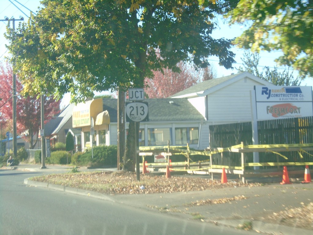
US-26 West Approaching OR-213
US-26 West (SE Powell Blvd.) approaching OR-213 (SE 82nd Ave) in Portland.
Taken 10-13-2018
 Portland
Multnomah County
Oregon
United States
Portland
Multnomah County
Oregon
United States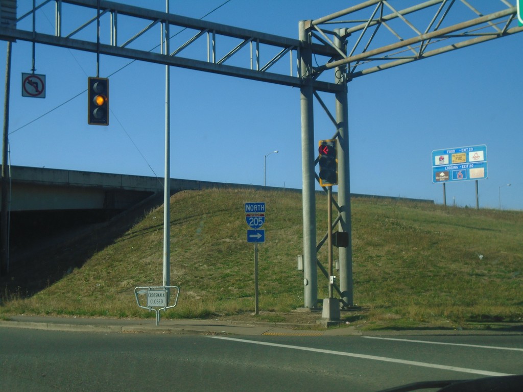
US-26 West at I-205 North
US-26 West at I-205 North in Portland.
Taken 10-13-2018
 Portland
Multnomah County
Oregon
United States
Portland
Multnomah County
Oregon
United States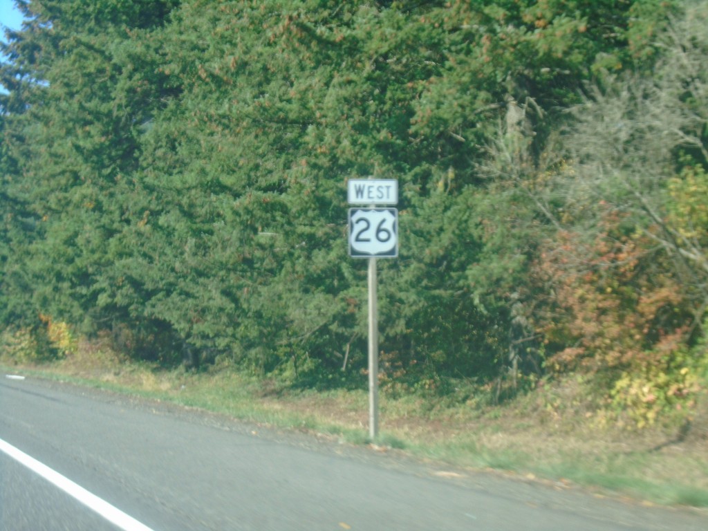
US-26 West - Clackamas County
US-26 west shield in Clackamas County.
Taken 10-13-2018
Boring
Clackamas County
Oregon
United States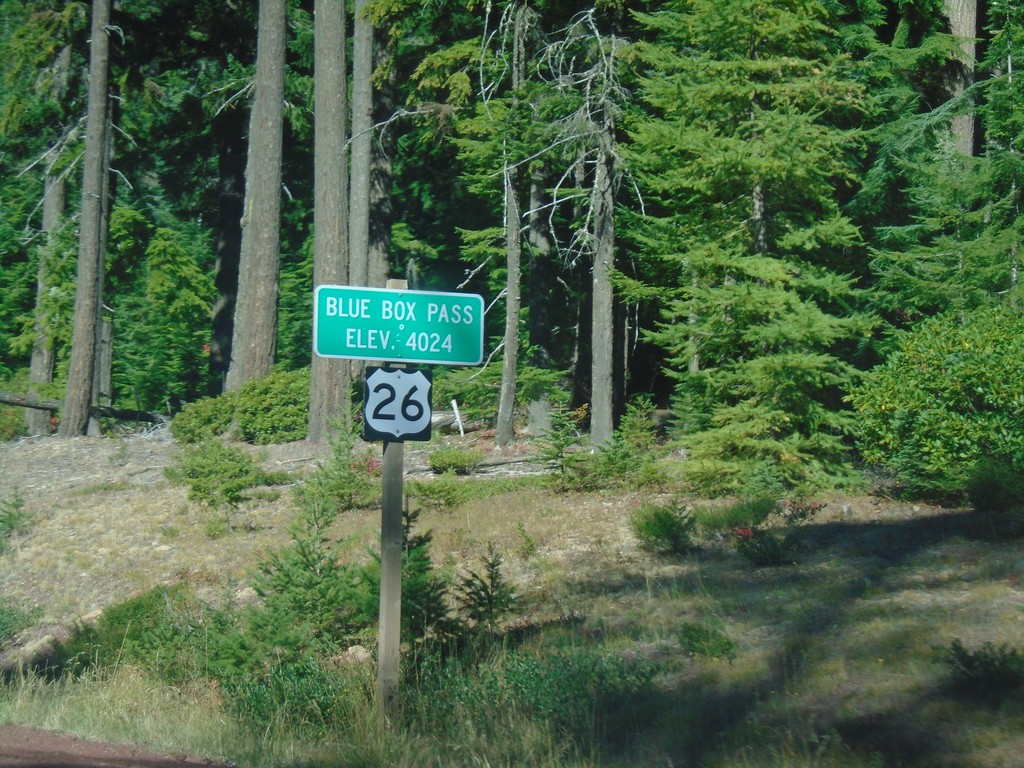
US-26 West - Blue Box Summit
US-26 West at Blue Box Summit - Elevation 4024 Feet.
Taken 10-13-2018
Government Camp
Wasco County
Oregon
United States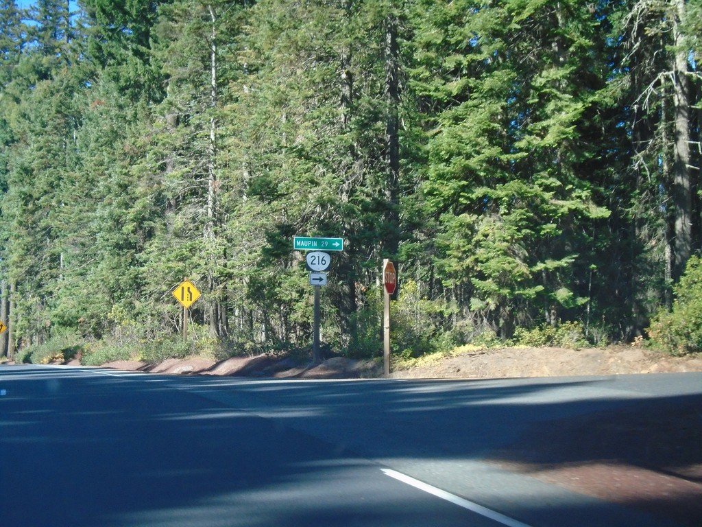
US-26 West at OR-216
US-26 West at OR-216 west to Maupin.
Taken 10-13-2018
Maupin
Wasco County
Oregon
United States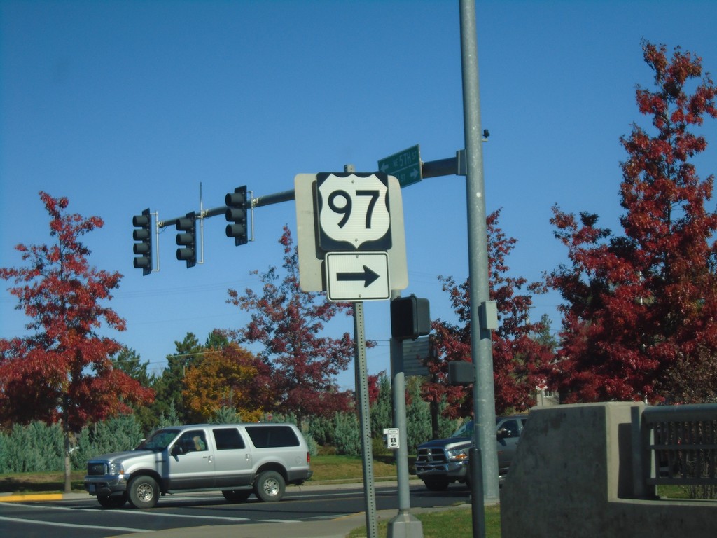
US-97 North/US-26 West at US-26/US-97 Split
US-97 North/US-26 West at US-26/US-97 Split. Turn right to continue north on US-97.
Taken 10-13-2018
 Madras
Jefferson County
Oregon
United States
Madras
Jefferson County
Oregon
United States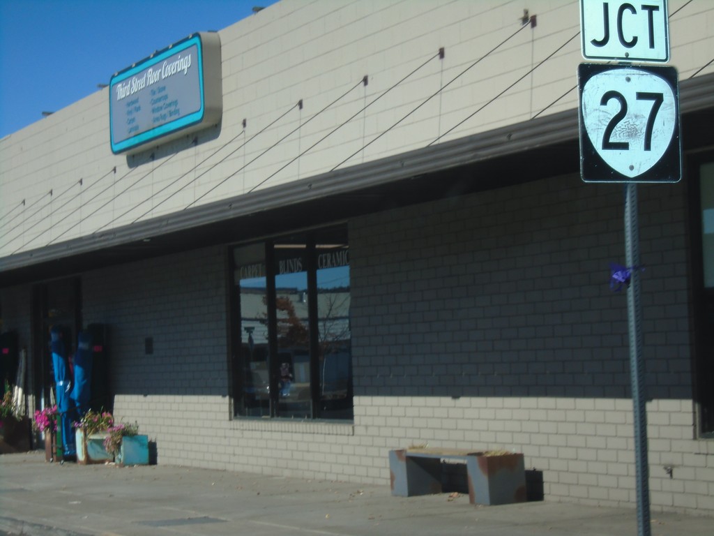
US-26 West Approaching OR-27
US-26 West approaching OR-27 in Prineville.
Taken 10-13-2018
 Prineville
Crook County
Oregon
United States
Prineville
Crook County
Oregon
United States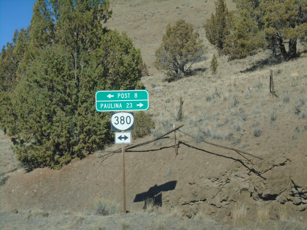
Pine Creek Road at OR-380
Pine Creek Road at OR-380. Turn left for OR-380 west to Post; right for OR-380 east to Paulina.
Taken 10-13-2018
 Prineville
Crook County
Oregon
United States
Prineville
Crook County
Oregon
United States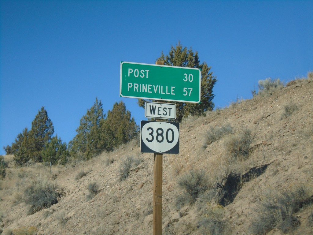
OR-380 West - Distance Marker
Distance marker on OR-380 west. Distance to Post and Prineville. This is the first OR-380 shield on OR-380 westbound.
Taken 10-13-2018
Paulina
Crook County
Oregon
United States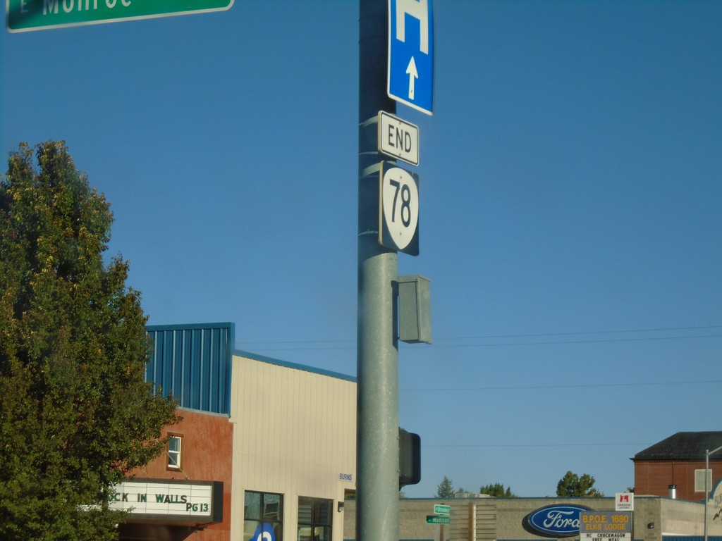
End OR-78 at US-20/US-395
End OR-78 at US-20/US-395 in Burns.
Taken 10-13-2018


 Burns
Harney County
Oregon
United States
Burns
Harney County
Oregon
United States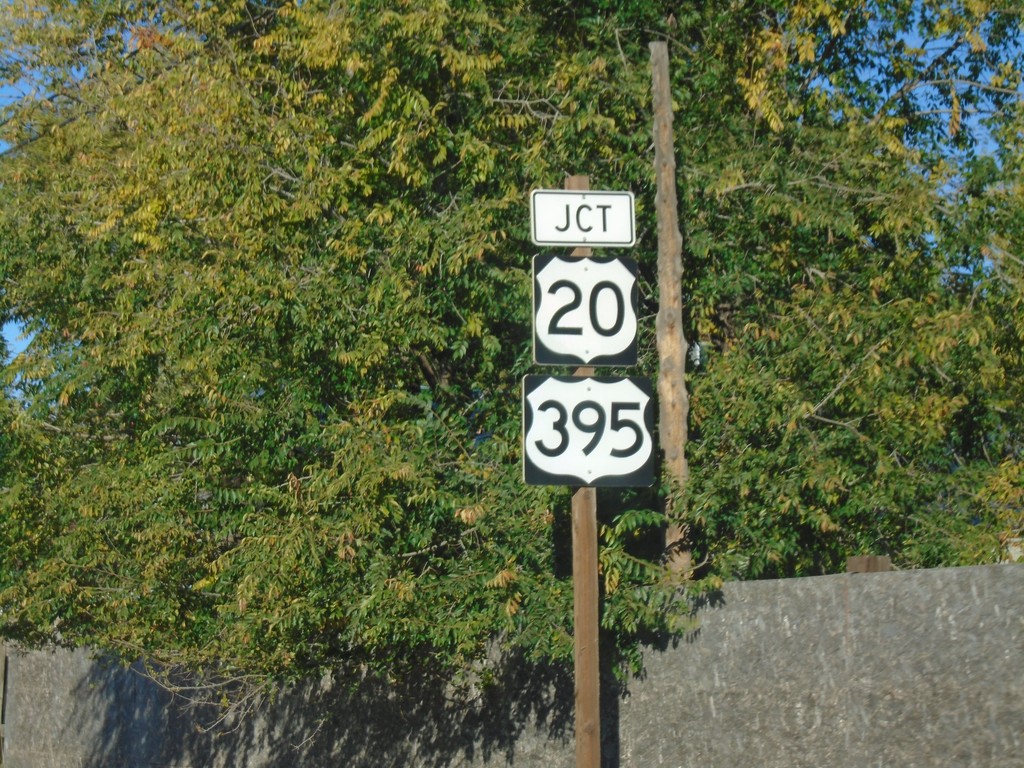
OR-78 West Approaching US-20/US-395
OR-78 West Approaching US-20/US-395 in Burns.
Taken 10-13-2018
Burns
Harney County
Oregon
United States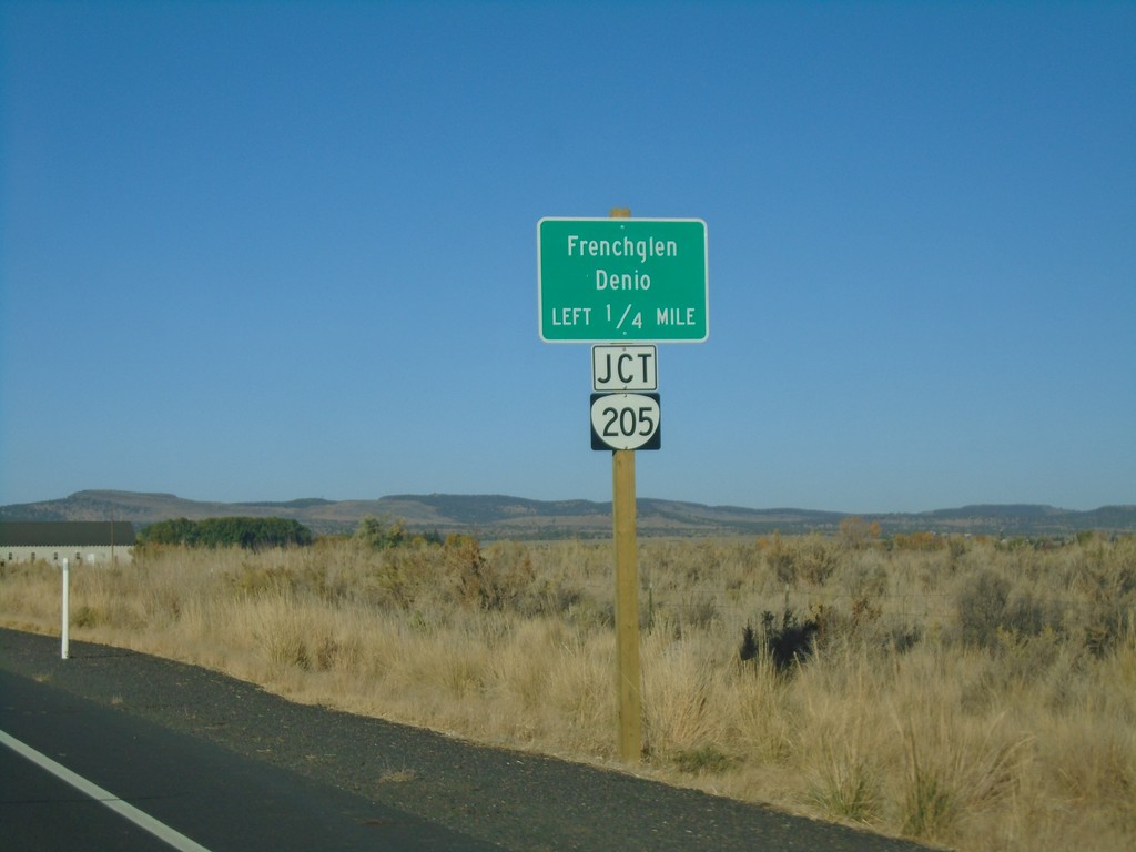
OR-78 West Approaching OR-205
OR-78 West approaching OR-205 south to Frenchglen and Denio (Nevada).
Taken 10-13-2018
 Burns
Harney County
Oregon
United States
Burns
Harney County
Oregon
United States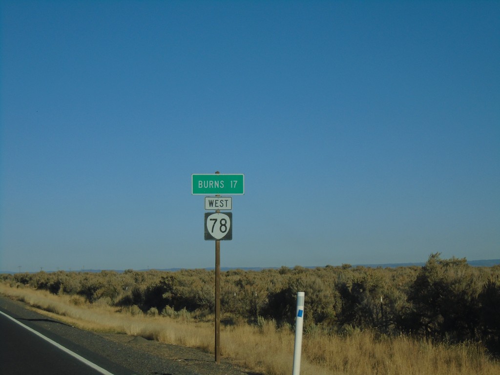
OR-78 West - Distance Marker
Distance marker on OR-78 west. Distance to Burns.
Taken 10-13-2018
Burns
Harney County
Oregon
United States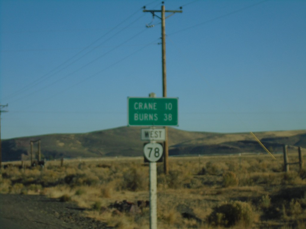
OR-78 West - Distance Marker
Distance marker on OR-78 west. Distance to Crane and Burns.
Taken 10-13-2018
Princeton
Harney County
Oregon
United States