Signs Tagged With Shield
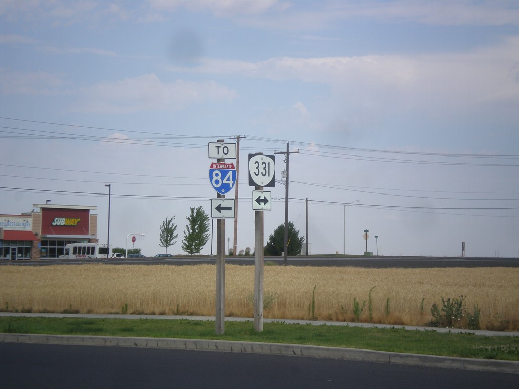
Kusi Road at OR-331
Kusi Road at OR-331. Turn left on OR-331 for I-84.
Taken 07-15-2017
 Pendleton
Umatilla County
Oregon
United States
Pendleton
Umatilla County
Oregon
United States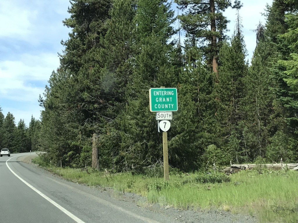
OR-7 West - Grant County
Entering Grant County on OR-7 west.
Taken 07-04-2017
 Sumpter
Grant County
Oregon
United States
Sumpter
Grant County
Oregon
United States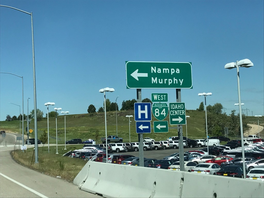
I-84 West - Exit 38 Offramp
I-84 west Exit 38 offramp. Turn left for BL-84 towards Nampa and Murphy. Turn right for the Idaho Center, an event complex.
Taken 05-20-2017


 Nampa
Canyon County
Idaho
United States
Nampa
Canyon County
Idaho
United States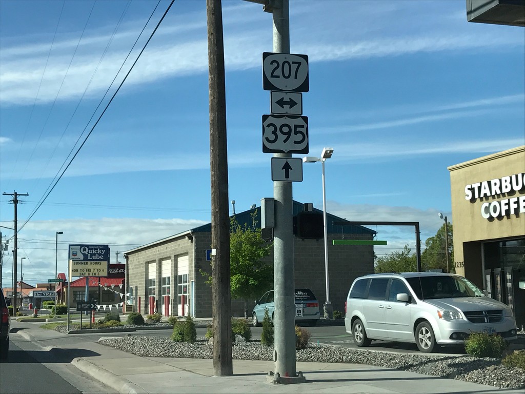
US-395 South at OR-207
US-395 south at OR-207 in Hermiston.
Taken 04-30-2017

 Hermiston
Umatilla County
Oregon
United States
Hermiston
Umatilla County
Oregon
United States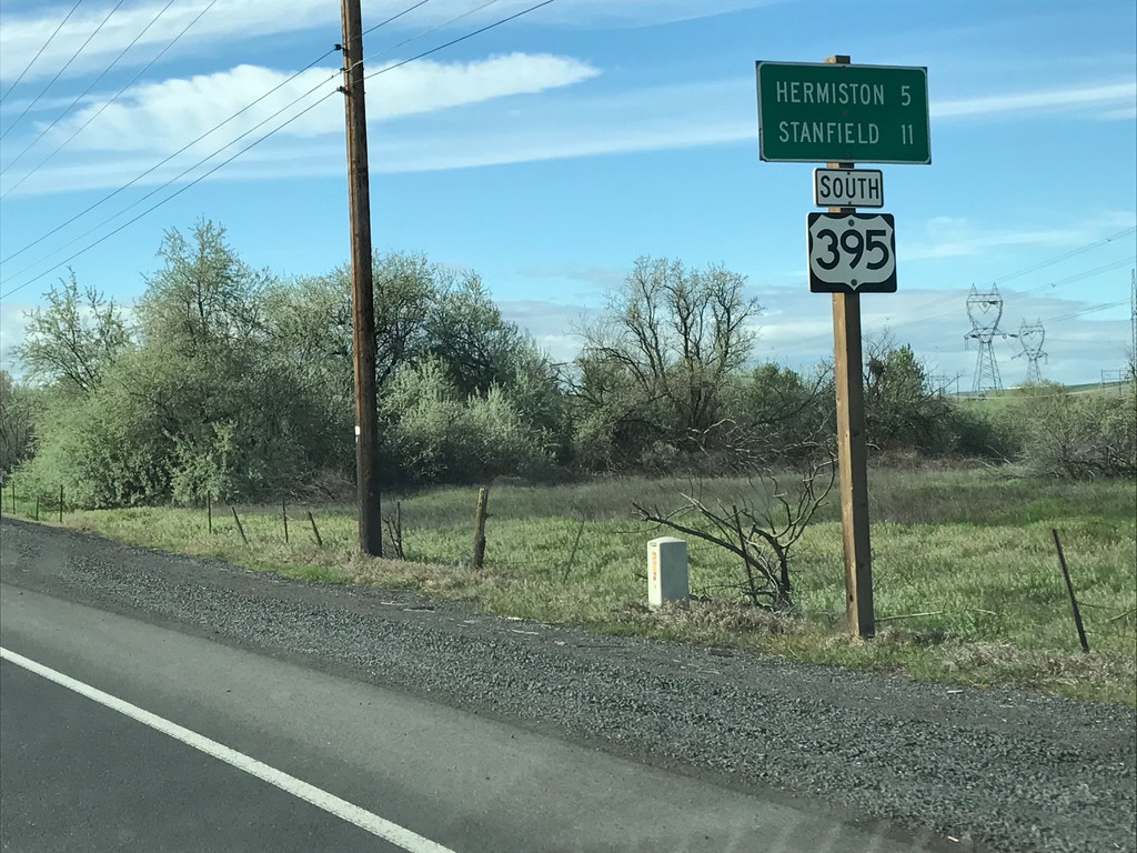
US-395 South - Distance Marker
Distance Marker on US-395 south. Distance to Hermiston and Stanfield.
Taken 04-30-2017
Umatilla
Umatilla County
Oregon
United States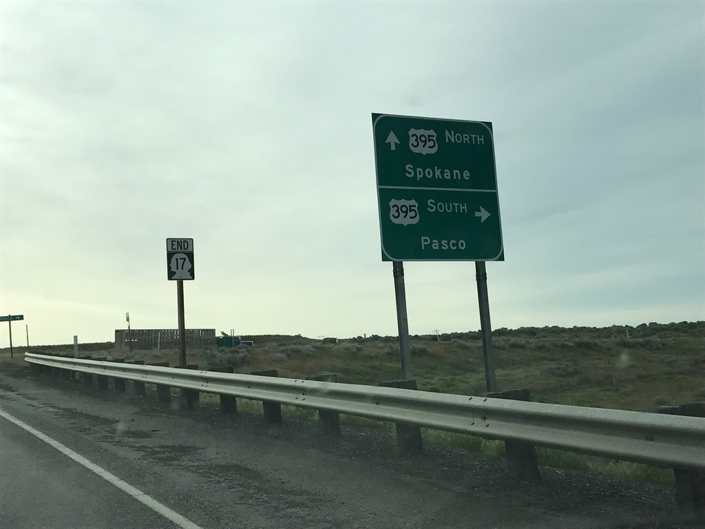
End WA-17 South at US-395
End WA-17 South at US-395 in Franklin County. Use US-395 south for Pasco; US-395 north for Spokane.
Taken 04-30-2017
 Mesa
Franklin County
Washington
United States
Mesa
Franklin County
Washington
United States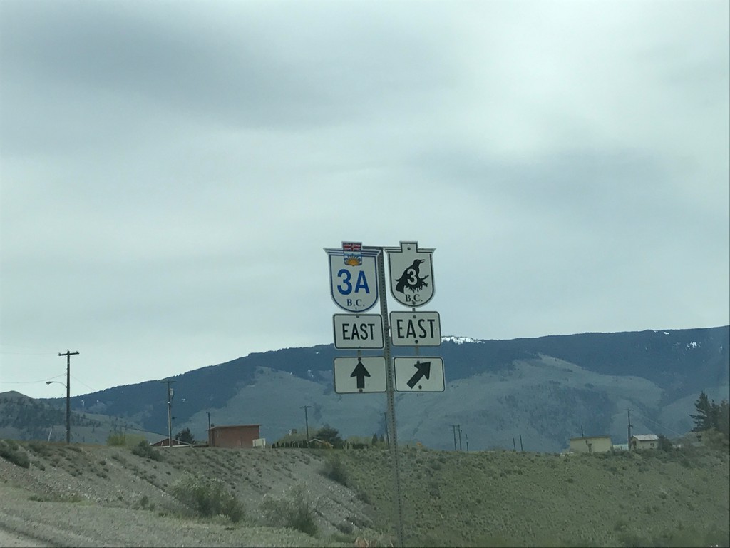
BC-3 East at BC-3A Junction
BC-3 East at BC-3A Junction in Keremeos.
Taken 04-29-2017

 Keremeos
Okanagan-Similkameen
British Columbia
Canada
Keremeos
Okanagan-Similkameen
British Columbia
Canada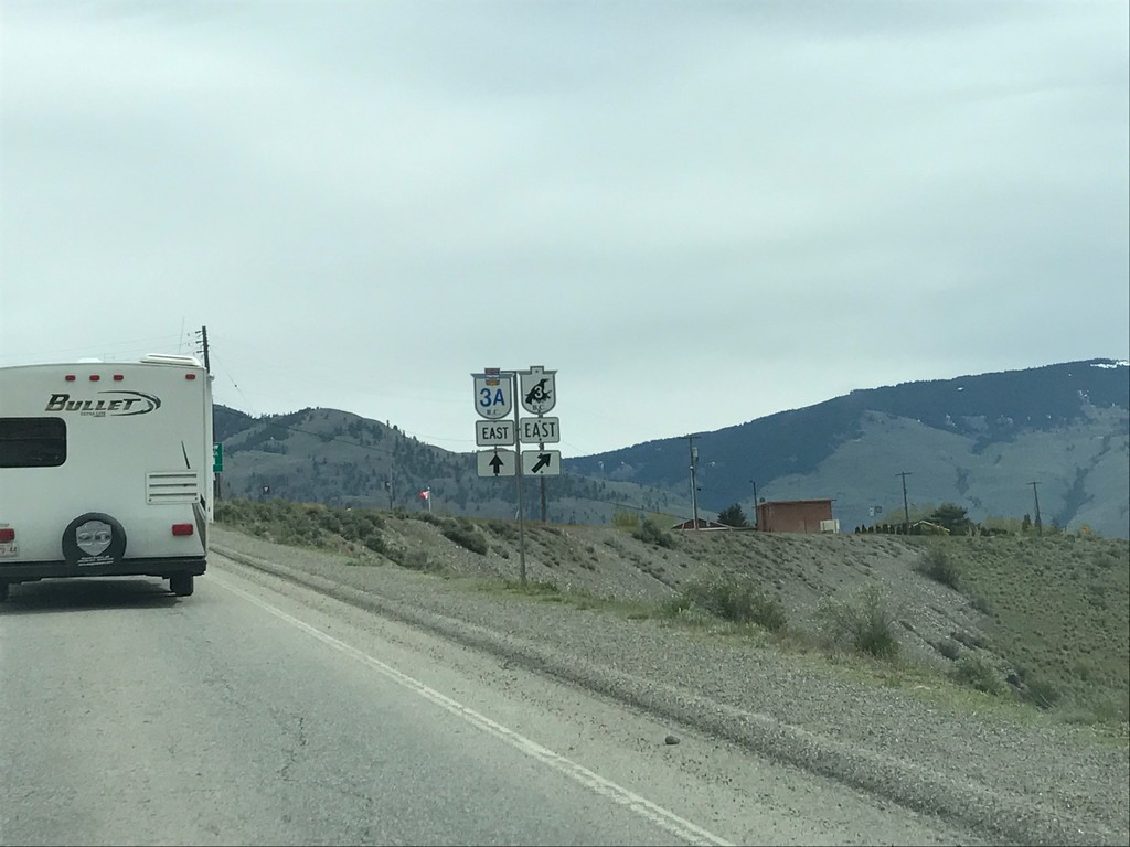
BC-3 East at BC-3A in Keremeos
BC-3 East at BC-3A in Keremeos
Taken 04-29-2017
Keremeos
Okanagan-Similkameen
British Columbia
Canada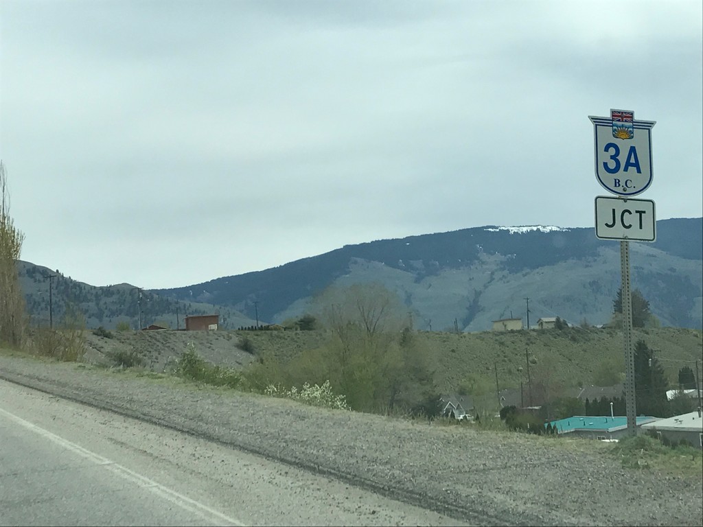
BC-3 East Approaching BC-3A
BC-3 East approaching BC-3A in Keremeos.
Taken 04-29-2017
Keremeos
Okanagan-Similkameen
British Columbia
Canada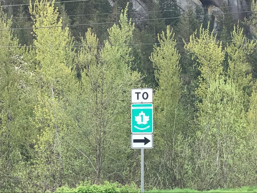
To TC-1 - Leaving Hunter Creek Rest Area
To TC-1 - Leaving Hunter Creek Rest Area in the Fraser Valley Regional District.
Taken 04-29-2017
 Hope
Fraser Valley
British Columbia
Canada
Hope
Fraser Valley
British Columbia
Canada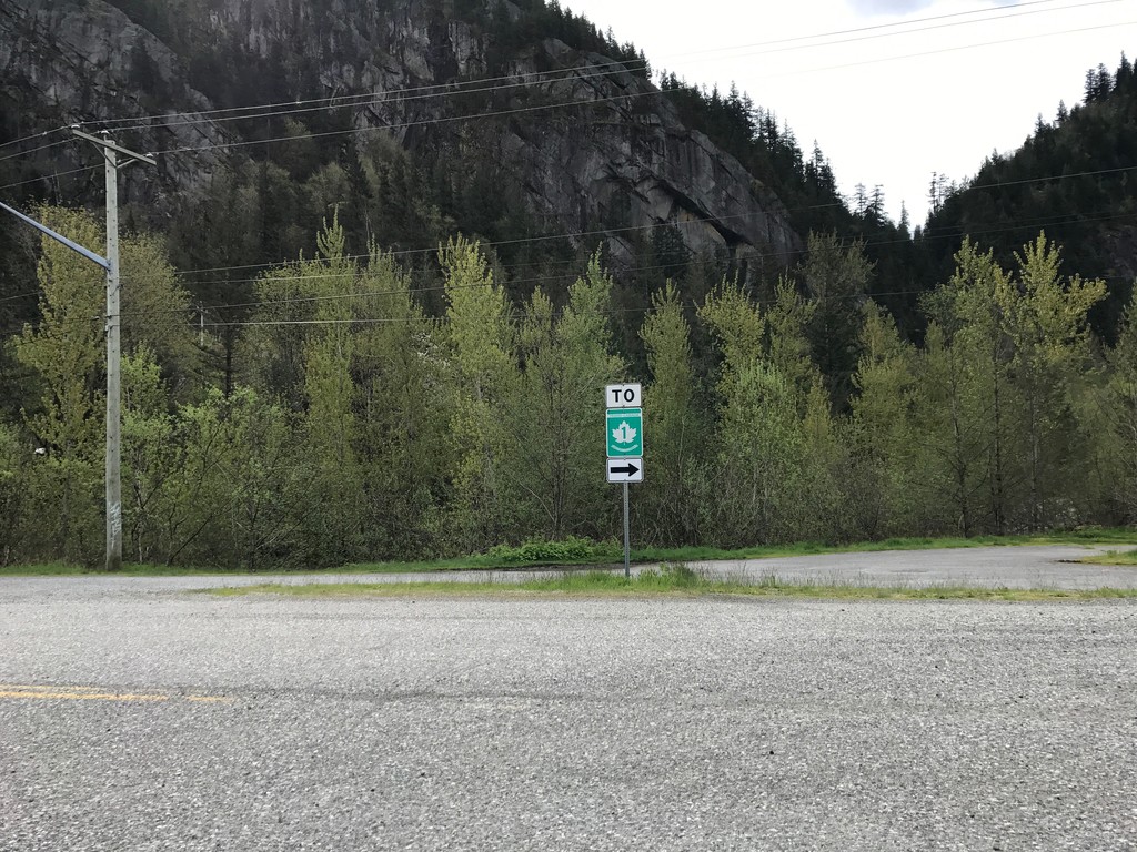
To TC-1 Leaving Hunter Creek Rest Area
To TC-1 - Leaving Hunter Creek Rest Area in the Fraser Valley Regional District.
Taken 04-29-2017
Hope
Fraser Valley
British Columbia
Canada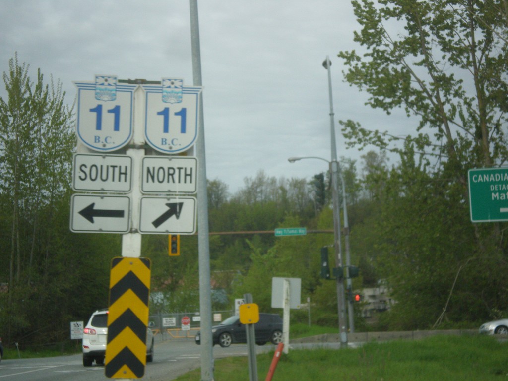
TC-1 East Exit 92 Offramp at BC-11
TC-1 East Exit 92 offramp at BC-11 in Abbotsford.
Taken 04-29-2017
 Abbotsford
Fraser Valley
British Columbia
Canada
Abbotsford
Fraser Valley
British Columbia
Canada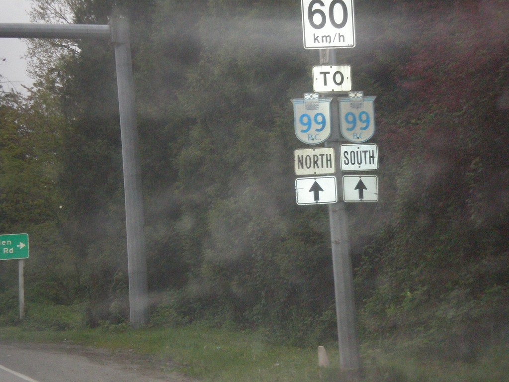
Sea Island Way East Approaching BC-99
Sea Island Way East Approaching BC-99 in Richmond. Speed Limit 60 km/h.
Taken 04-29-2017
 Richmond
Metro Vancouver
British Columbia
Canada
Richmond
Metro Vancouver
British Columbia
Canada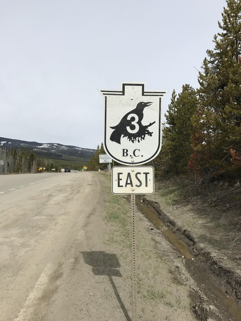
BC-3 East - Sunday Summit
BC-3 East shield at the top of Sunday Summit.
Taken 04-29-2017
Copper Mountain
Okanagan-Similkameen
British Columbia
Canada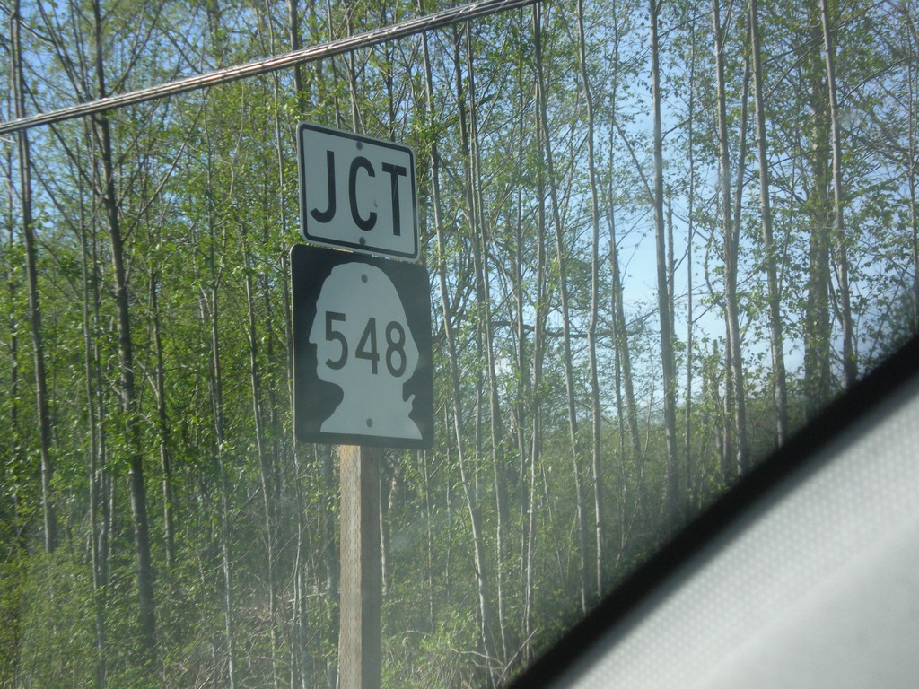
Birch Bay-Lynden Road at WA-548
Birch Bay-Lynden Road at WA-548 (Blaine Road) Junction.
Taken 04-28-2017
 Blaine
Whatcom County
Washington
United States
Blaine
Whatcom County
Washington
United States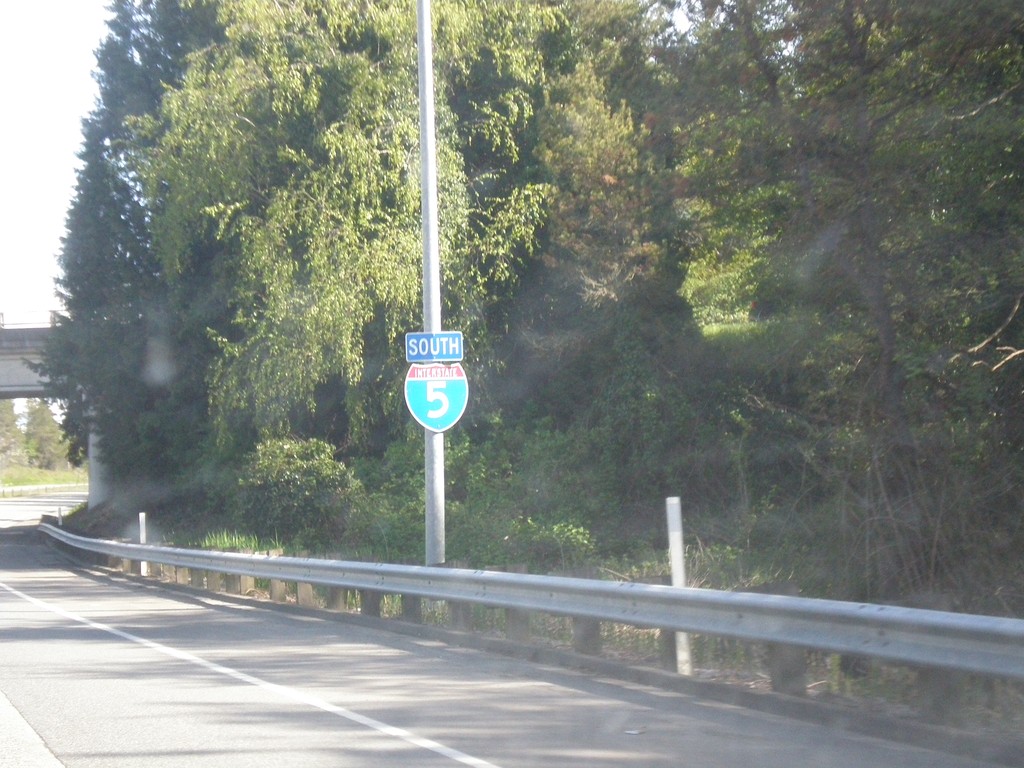
I-5 South - Blaine
I-5 south shield in Blaine, Washington.
Taken 04-28-2017
 Blaine
Whatcom County
Washington
United States
Blaine
Whatcom County
Washington
United States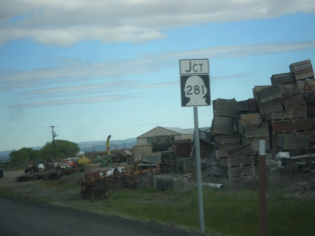
WA-281 Spur North at WA-281
WA-281 Spur North at WA-281 in Grant County.
Taken 04-28-2017
 Quincy
Grant County
Washington
United States
Quincy
Grant County
Washington
United States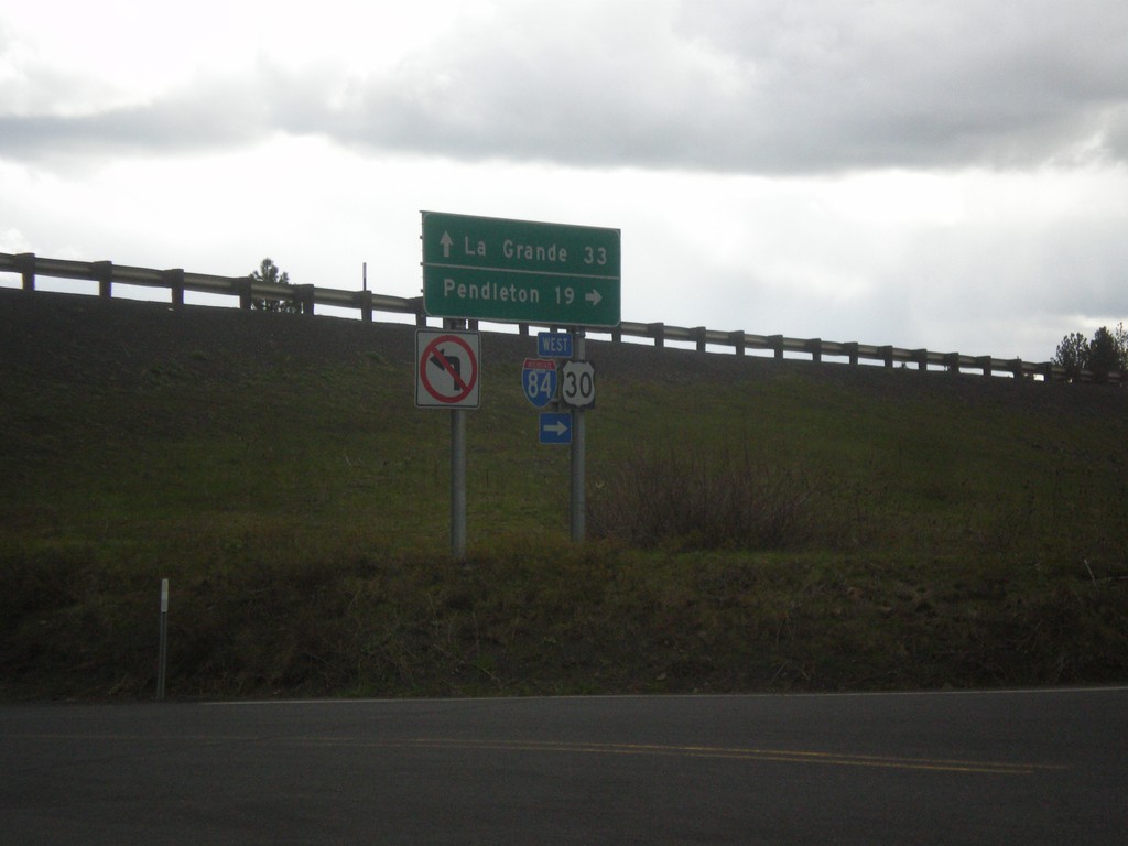
I-84 - Exit 228 Onramp
I-84 - Exit 228 onramp. Use I-84 west to Pendleton; I-84 east to La Grande.
Taken 04-27-2017
Cayuse
Umatilla County
Oregon
United States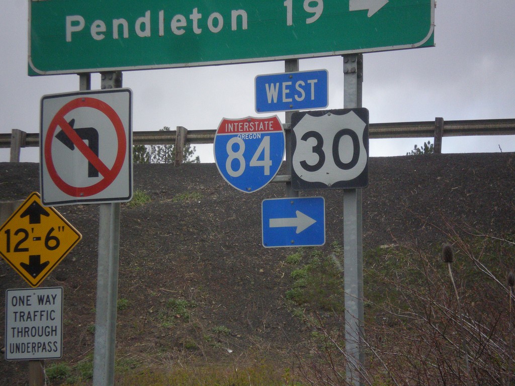
I-84 - Exit 228 Onramp
I-84 - Exit 228 onramp. Use I-84 west to Pendleton; I-84 east to La Grande. The I-84 shield has the text OREGON in it, although it does not fit well with the rest of the font. This is the first time in the last 20 years I have lived in the northwest that I have seen an interstate shield with the text OREGON in it.
Taken 04-27-2017
Cayuse
Umatilla County
Oregon
United States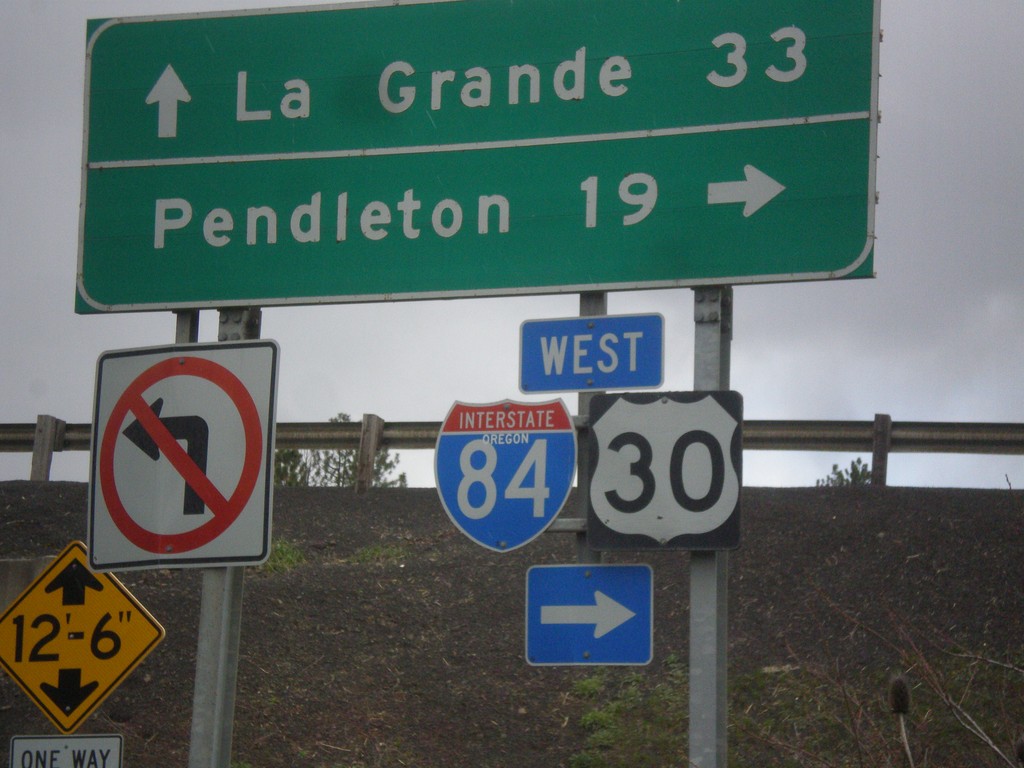
I-84 - Exit 228 Onramp
I-84 - Exit 228 onramp. Use I-84 west to Pendleton; I-84 east to La Grande. The I-84 shield has the text OREGON in it, although it does not fit well with the rest of the font. This is the first time in the last 20 years I have lived in the northwest that I have seen an interstate shield with the text OREGON in it.
Taken 04-27-2017
Cayuse
Umatilla County
Oregon
United States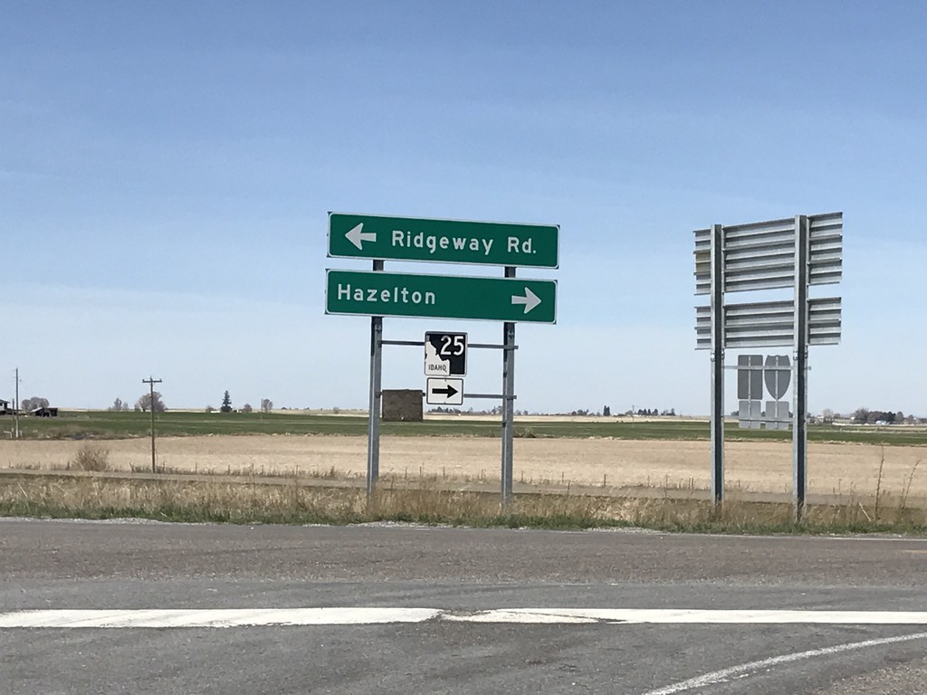
I-84 West - Exit 194 Offramp at ID-25
I-84 - Exit 194 Offramp at ID-25. Turn right to continue west on ID-25 towards Hazleton. Turn left for Ridgeway Road. ID-25 east joins I-84 eastbound to Kasota Road.
Taken 04-01-2017
 Greenwood
Jerome County
Idaho
United States
Greenwood
Jerome County
Idaho
United States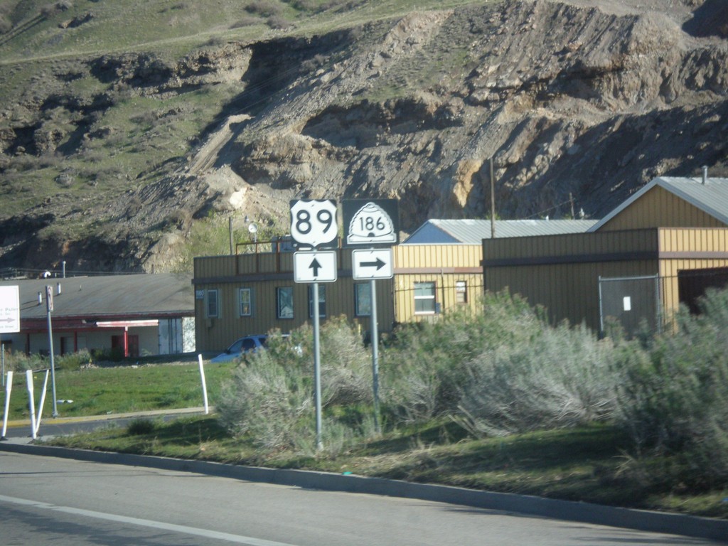
US-89 North at UT-186
US-89 North at UT-186 (Victory Way) in Salt Lake City.
Taken 04-01-2017

 Salt Lake City
Salt Lake County
Utah
United States
Salt Lake City
Salt Lake County
Utah
United States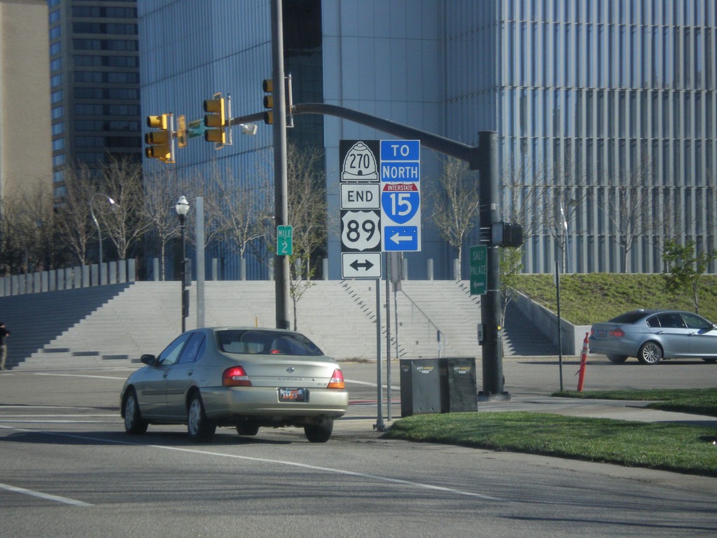
End UT-270 North (West Temple) at US-89 (400 South)
End UT-270 North (West Temple) at US-89 (400 South). Use 400 South for I-15 north.
Taken 04-01-2017

 Salt Lake City
Salt Lake County
Utah
United States
Salt Lake City
Salt Lake County
Utah
United States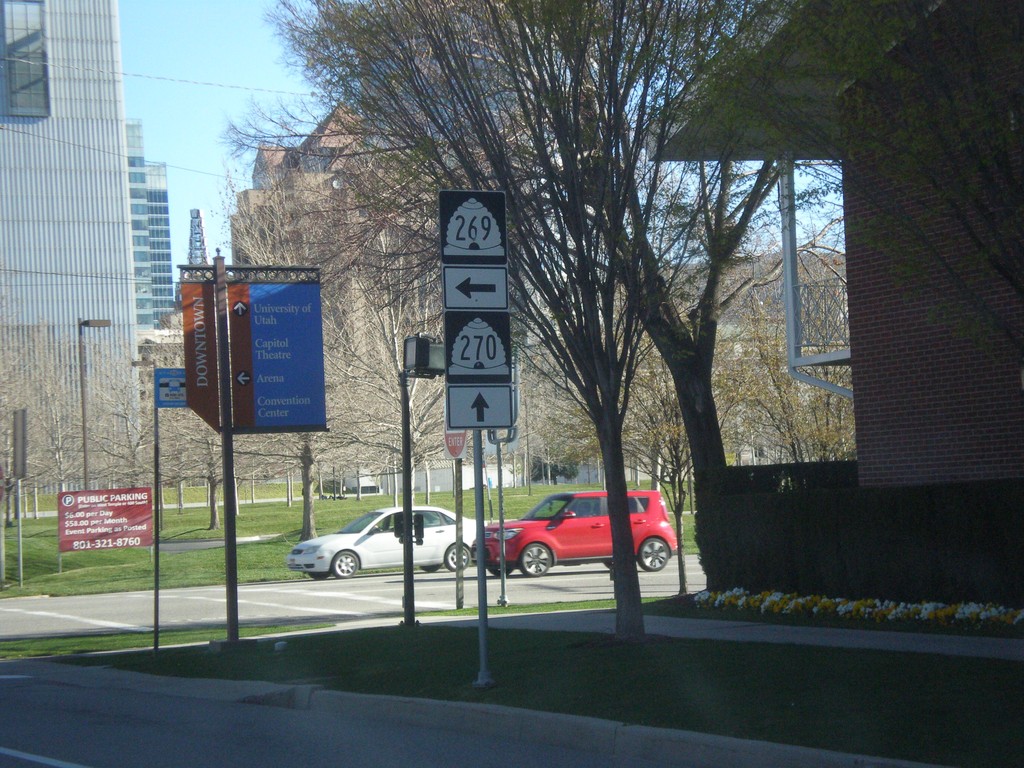
UT-270 North (West Temple) at UT-269 West (500 South)
UT-270 North (West Temple) at UT-269 West (500 South) in Salt Lake City.
Taken 04-01-2017
 Salt Lake City
Salt Lake County
Utah
United States
Salt Lake City
Salt Lake County
Utah
United States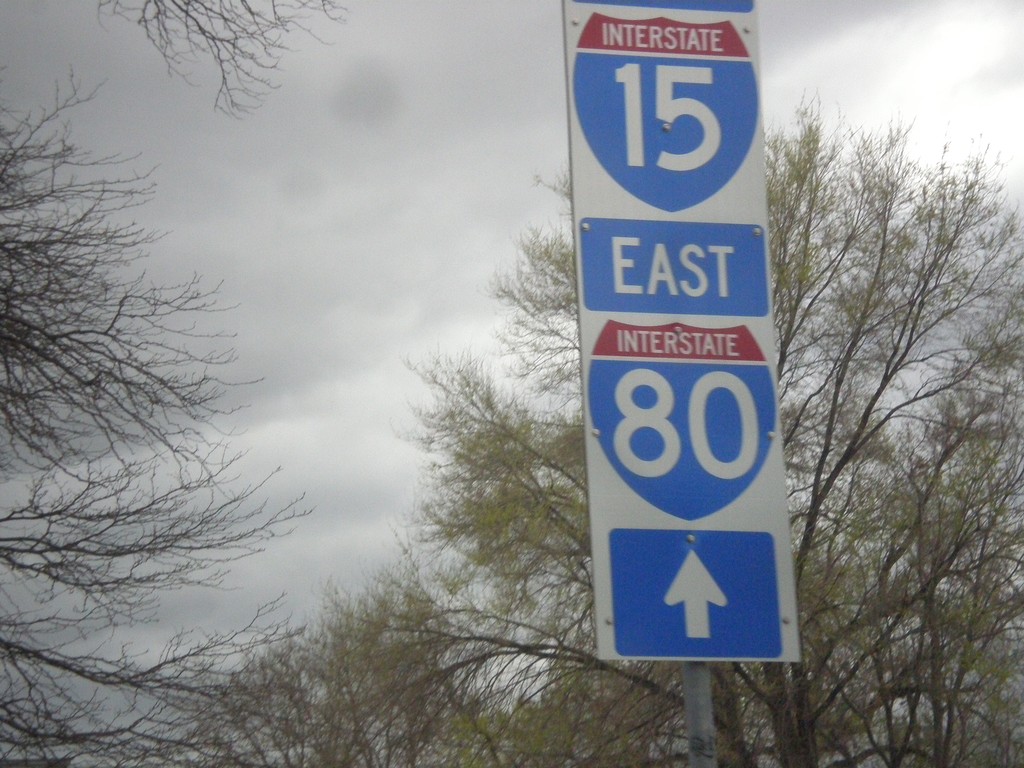
UT-270 South (West Temple) - To I-80 East/I-15 South
UT-270 South (West Temple) - To I-80 East/I-15 South in Salt Lake City. These type of signs directing traffic to I-15 and I-80 with the white background are all over downtown Salt Lake City.
Taken 03-31-2017
 Salt Lake City
Salt Lake County
Utah
United States
Salt Lake City
Salt Lake County
Utah
United States