Signs Tagged With Shield

ID-46 North (Idaho St.) at Main St.
ID-46 North (Idaho St.) at Main St. in Wendell. Turn left for Main St. to I-84.
Taken 10-07-2017
 Wendell
Gooding County
Idaho
United States
Wendell
Gooding County
Idaho
United States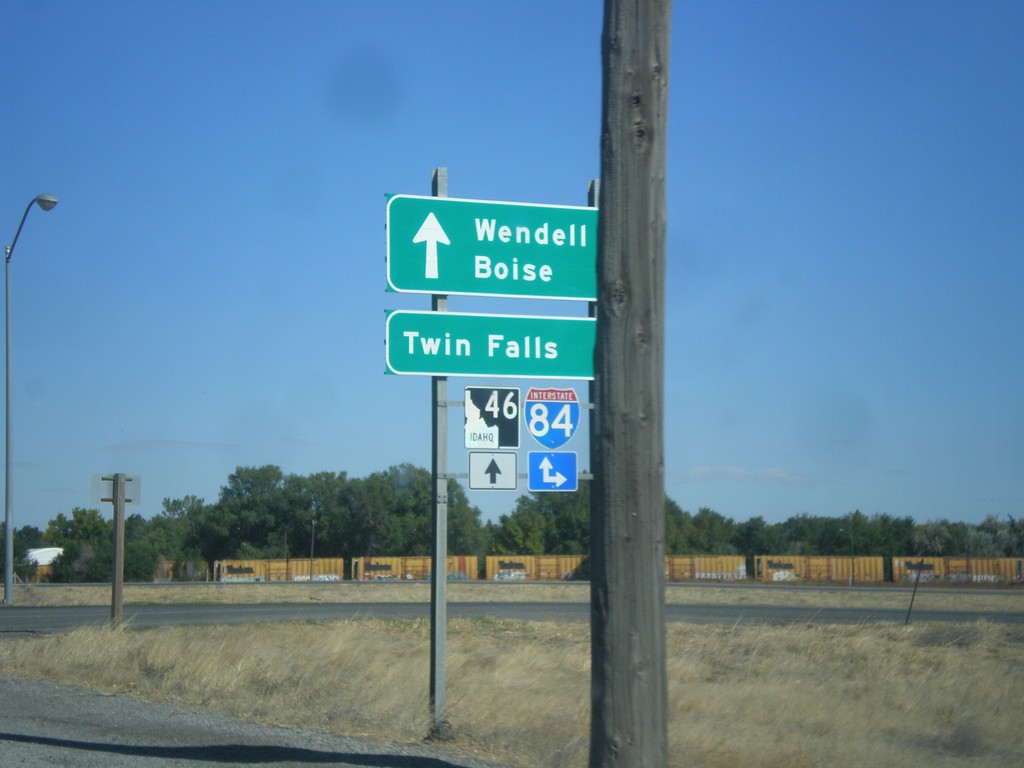
ID-46 North at I-84 Junction
ID-46 north at I-84 junction in Wendell. Use I-84 east to Twin Falls and I-84 west to Boise. Continue north on ID-46 for Wendell.
Taken 10-07-2017
 Wendell
Gooding County
Idaho
United States
Wendell
Gooding County
Idaho
United States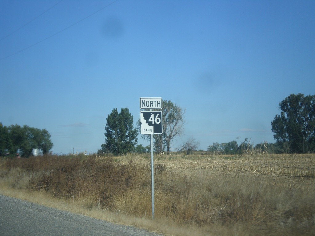
ID-46 North - Gooding County
ID-46 North in Gooding County. This is the first ID-46 shield northbound, about 10 miles north of its beginning in Buhl. The section between Wendell and Buhl was added to the state highway system in the last 5 years.
Taken 10-07-2017
Wendell
Gooding County
Idaho
United States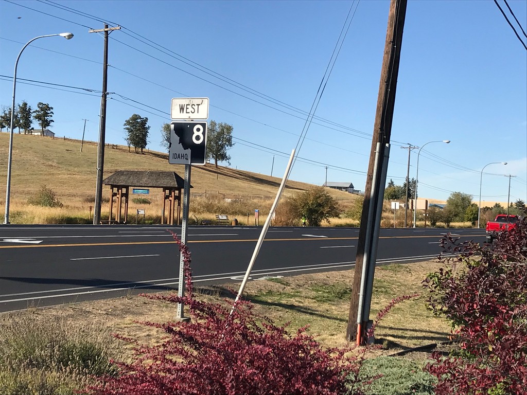
ID-8 West - Moscow
ID-8 west along the Pullman Highway in Moscow.
Taken 10-04-2017
 Moscow
Latah County
Idaho
United States
Moscow
Latah County
Idaho
United States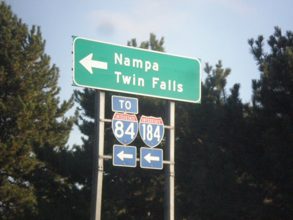
Curtis Road North at I-184 West (Exit 2) Onramp
Curtis Road North at I-184 West (Exit 2) Onramp to I-84, Nampa, and Twin Falls.
Taken 09-23-2017
 Boise
Ada County
Idaho
United States
Boise
Ada County
Idaho
United States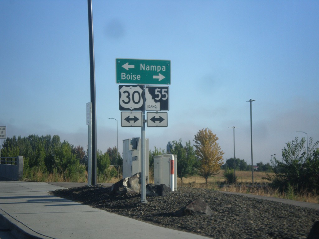
End ID-69 North at I-84/US-30/ID-55
End ID-69 North at I-84/US-30/ID-55. Turn right for (I-84)/US-30 East/ID-55 north to Boise; left for (I-84)/US-30 West/ID-55 South to Nampa.
Taken 09-23-2017


 Meridian
Ada County
Idaho
United States
Meridian
Ada County
Idaho
United States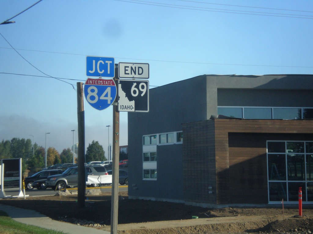
End ID-69 Approaching I-84
End ID-69 approaching I-84 in Meridian.
Taken 09-23-2017
Meridian
Ada County
Idaho
United States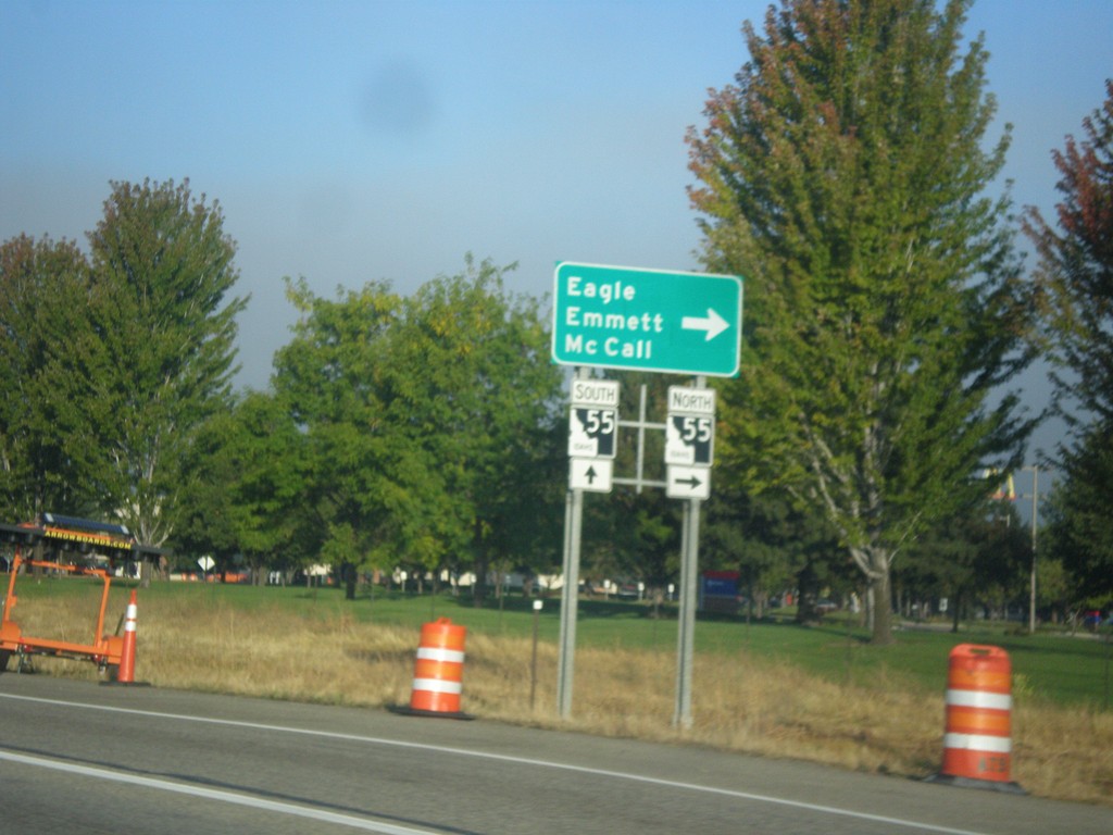
I-84 West - Exit 46 Offramp
I-84 West - Exit 46 Offramp in Meridian. Turn right on ID-55 (Eagle Road) for Eagle, Emmett, and McCall. ID-55 south joins I-84 westbound to Nampa.
Taken 09-23-2017
Meridian
Ada County
Idaho
United States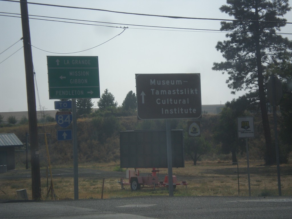
OR-331 South at Mission Road
OR-331 South at Mission Road. Turn left (east) for Misson and Gibbon; turn right (west) for Pendleton. Continue south on OR-331 for LaGrande, I-84, and the Museum-Tamastslikt Cultural Institute.
Taken 09-09-2017
 Pendleton
Umatilla County
Oregon
United States
Pendleton
Umatilla County
Oregon
United States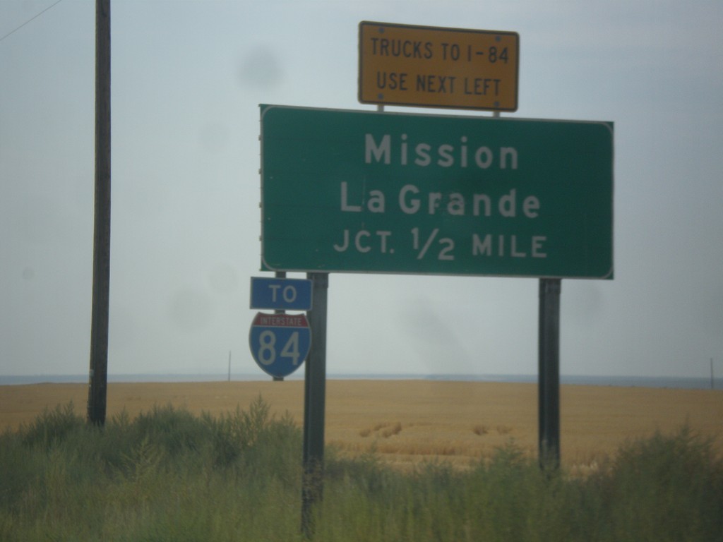
OR-11 South Approaching OR-331
OR-11 South Approaching OR-331 (Mission Highway). Use Mission Highway for Mission and LaGrande. I-84 traffic is encouraged to use the Mission Highway instead of going through Pendleton.
Taken 09-09-2017
 Pendleton
Umatilla County
Oregon
United States
Pendleton
Umatilla County
Oregon
United States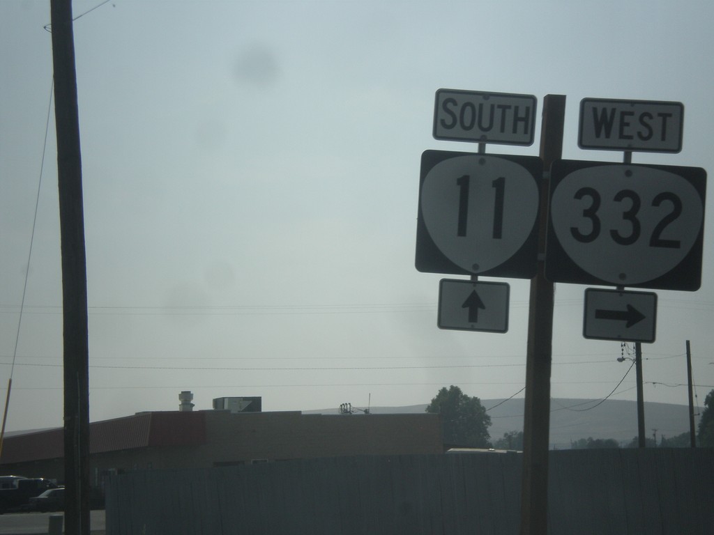
OR-11 South at OR-332
OR-11 south at OR-332 west in Umatilla County.
Taken 09-09-2017
 Milton-Freewater
Umatilla County
Oregon
United States
Milton-Freewater
Umatilla County
Oregon
United States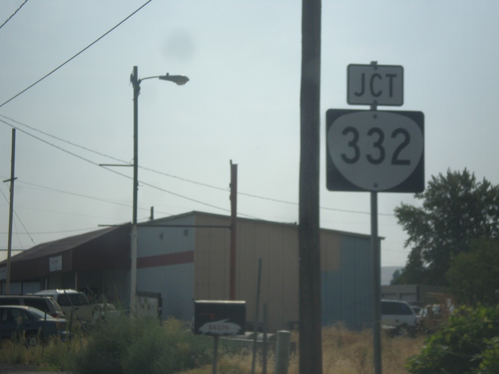
OR-11 South Approaching OR-332
OR-11 South approaching OR-332 in Umatilla County. OR-332 was recently signed as a state highway. In prior years this was just known as the Sunnyside-Umapine Highway #332, but without any route markers.
Taken 09-09-2017
Milton-Freewater
Umatilla County
Oregon
United States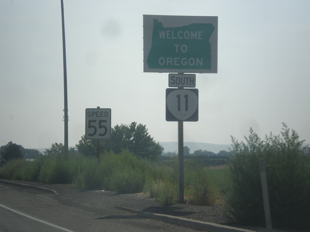
OR-11 South - Welcome To Oregon
Welcome to Oregon on OR-11 south at the Washington-Oregon state line. Also the first speed limit sign in Oregon is in the background - 55 MPH. Most Oregon speed limit signs omit the word Limit.
Taken 09-09-2017
Milton-Freewater
Umatilla County
Oregon
United States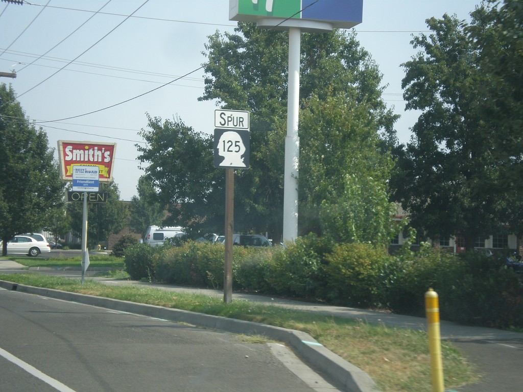
WA-125 Spur East - Walla Walla
WA-125 Spur East in Walla Walla. WA-125 Spur connects the US-12 freeway with WA-125.
Taken 09-09-2017
 Walla Walla
 County
Washington
United States
Walla Walla
Walla Walla County
Washington
United States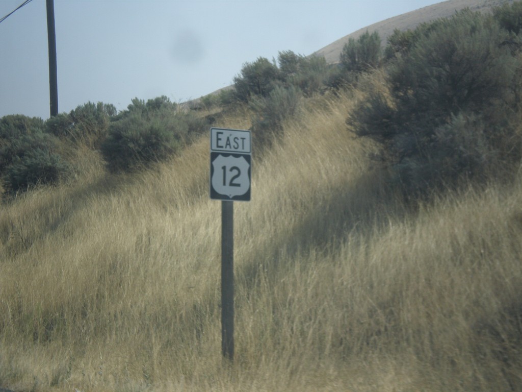
US-12 East - Walla Walla County
US-12 East in Walla Walla County
Taken 09-09-2017
 Burbank
Walla Walla County
Washington
United States
Burbank
Walla Walla County
Washington
United States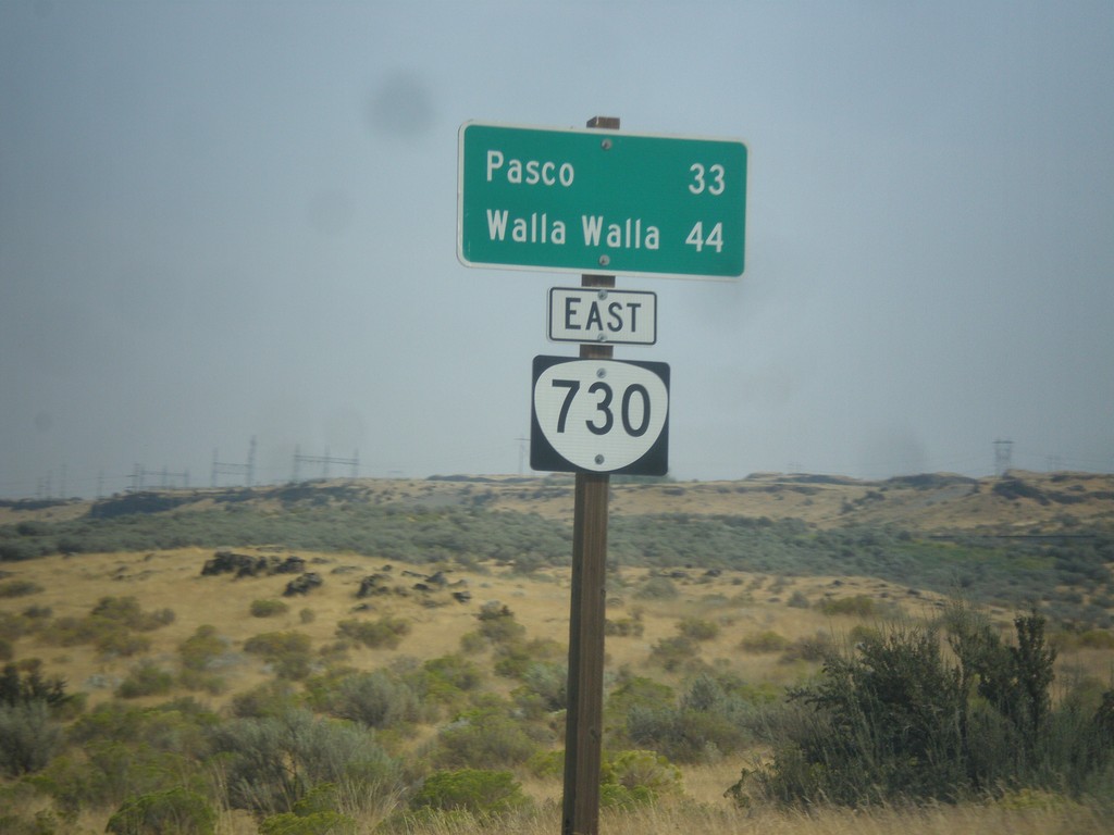
US-730 East - Distance Marker (Signed as OR-730)
Distance marker on US-730 east which is incorrectly signed as OR-730. Distance to Pasco (Washington) and Walla Walla (Washington).
Taken 09-09-2017
 Hermiston
Umatilla County
Oregon
United States
Hermiston
Umatilla County
Oregon
United States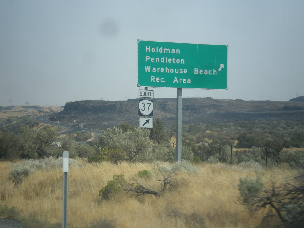
US-730 East at OR-37
US-730 East at OR-37 South at Cold Springs Junction. Use OR-37 south for Holdman, Pendleton, and Warehouse Beach Recreation Area.
Taken 09-09-2017
 Cold Springs Junction
Umatilla County
Oregon
United States
Cold Springs Junction
Umatilla County
Oregon
United States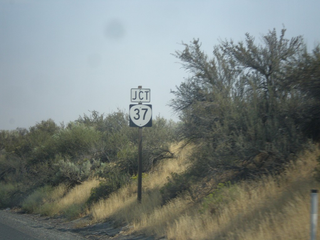
US-730 East Approaching OR-37
US-730 East approaching OR-37 at Cold Springs Junction.
Taken 09-09-2017
Hermiston
Umatilla County
Oregon
United States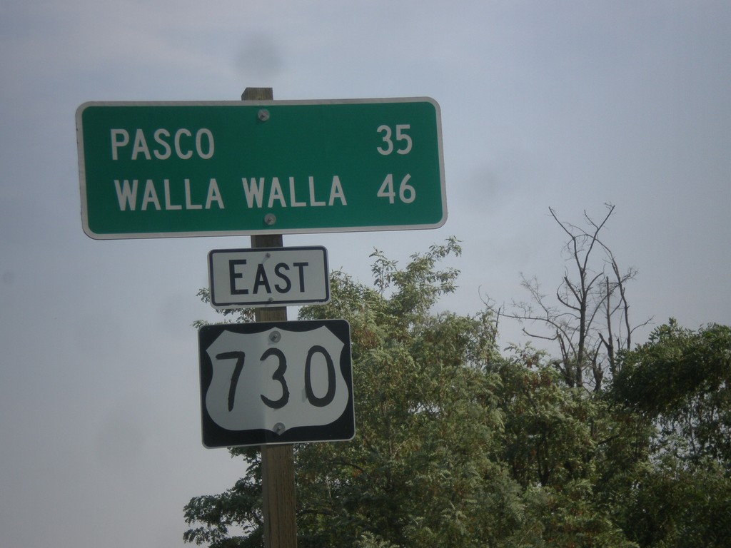
US-730 East - Distance Marker
Distance marker on US-730 east. Distance to Pasco (Washington) and Walla Walla (Washington).
Taken 09-09-2017
Hermiston
Umatilla County
Oregon
United States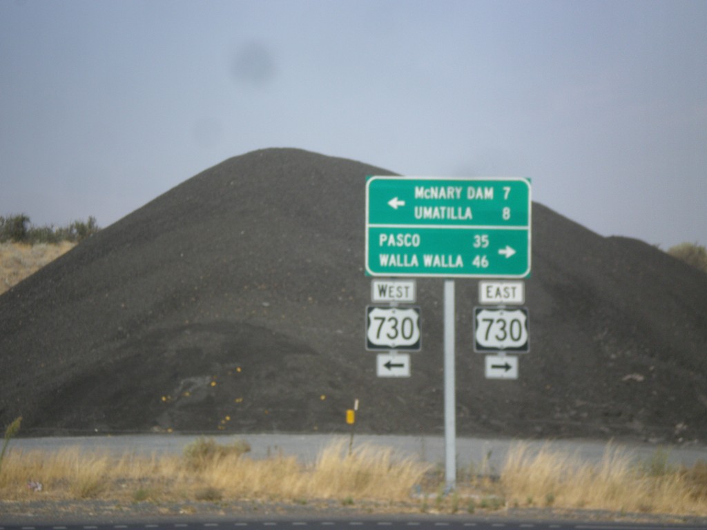
End OR-207 North at US-730
End OR-207 North at US-730 in Umatilla County. Turn left for US-730 west to McNary Dam and Umatilla; turn right for US-730 east to Pasco (Washington) and Walla Walla (Washington).
Taken 09-09-2017
 Riverview
Umatilla County
Oregon
United States
Riverview
Umatilla County
Oregon
United States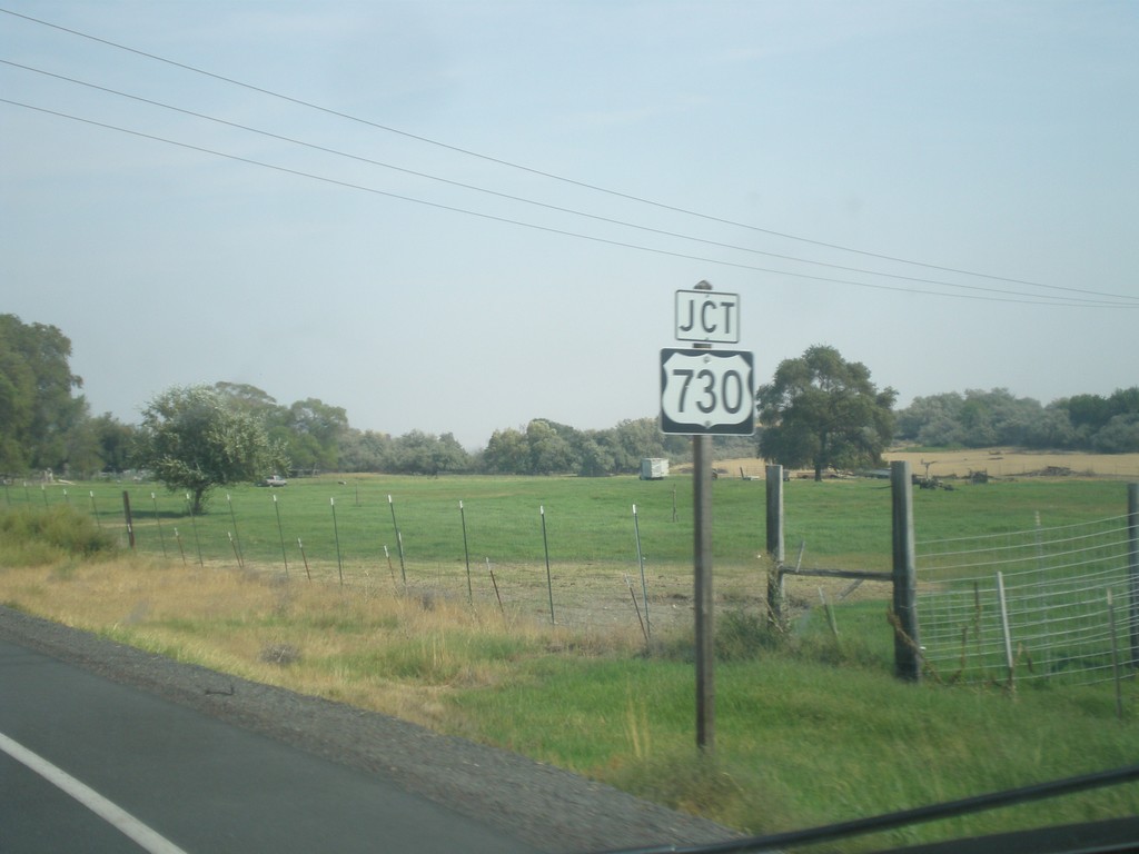
OR-207 North Approaching US-730
OR-207 North approaching US-730 in Umatilla County.
Taken 09-09-2017
Hermiston
Umatilla County
Oregon
United States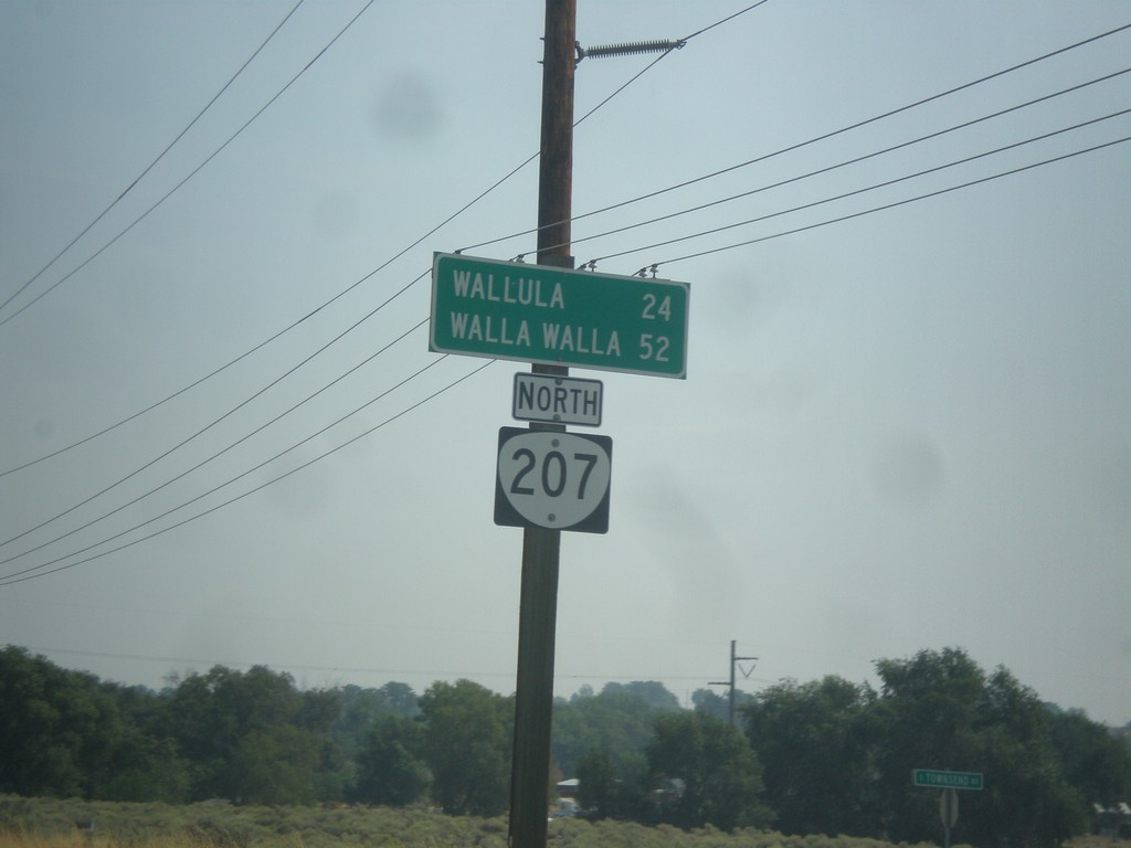
OR-207 North - Distance Marker
Distance marker on OR-207 north. Distance to Wallula (Washington) and Walla Walla (Washington).
Taken 09-09-2017
Hermiston
Umatilla County
Oregon
United States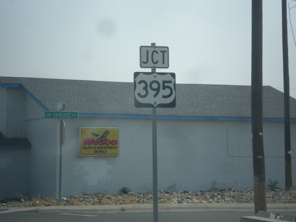
OR-207 North Approaching US-395
OR-207 North approaching US-395 in Hermiston.
Taken 09-09-2017
 Hermiston
Umatilla County
Oregon
United States
Hermiston
Umatilla County
Oregon
United States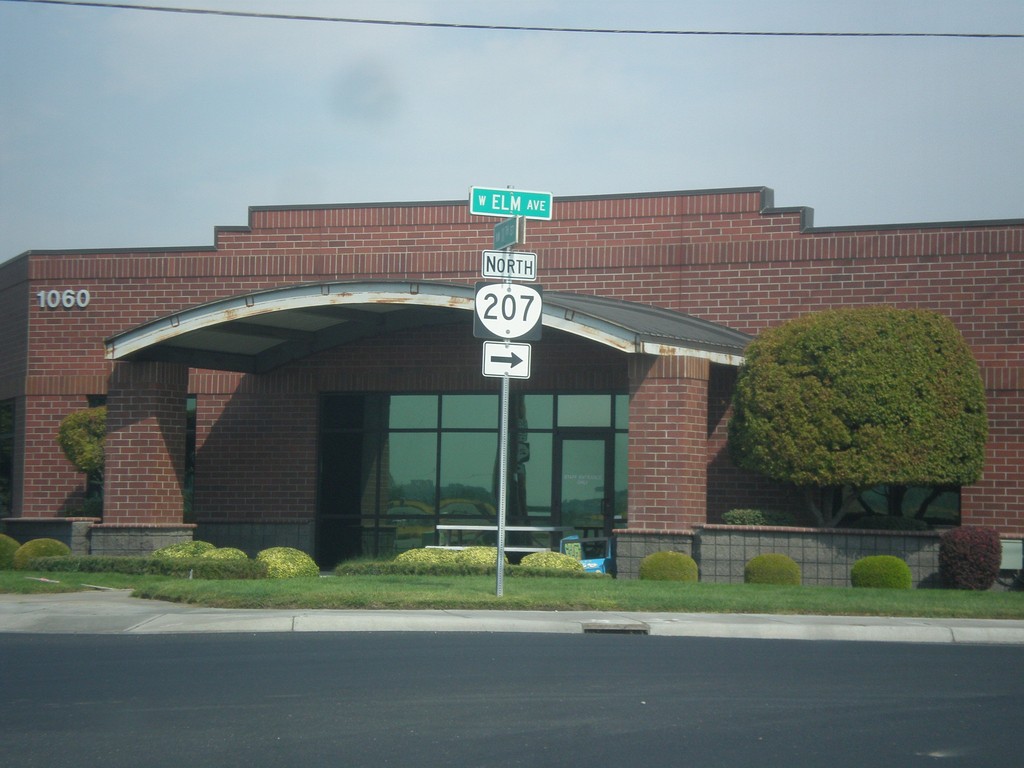
OR-207 North (NW 11th St.) at W. Elm Ave.
OR-207 North (NW 11th St.) at W. Elm Ave. in Hermiston. Turn right on Elm Ave. to continue north on OR-207.
Taken 09-09-2017
Hermiston
Umatilla County
Oregon
United States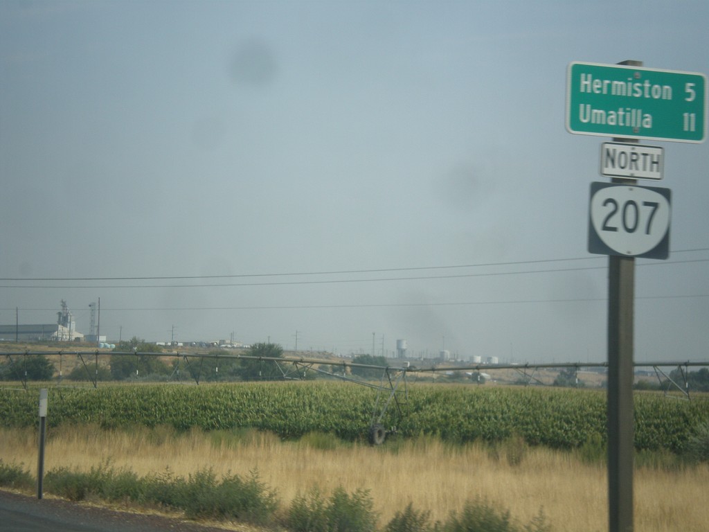
OR-207 North - Distance Marker
Distance marker on OR-207 north. Distance to Hermiston and Umatilla (via US-395).
Taken 09-09-2017
Hermiston
Umatilla County
Oregon
United States