Signs Tagged With Shield
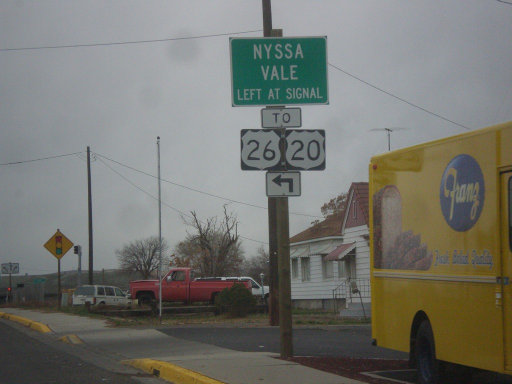
SW 4th Ave. West at OR-201
SW 4th Ave. West at OR-201. Turn left at signal for OR-201 South to US-20/US-26/Nyssa/Vale.
Taken 11-19-2016


 Ontario
Malheur County
Oregon
United States
Ontario
Malheur County
Oregon
United States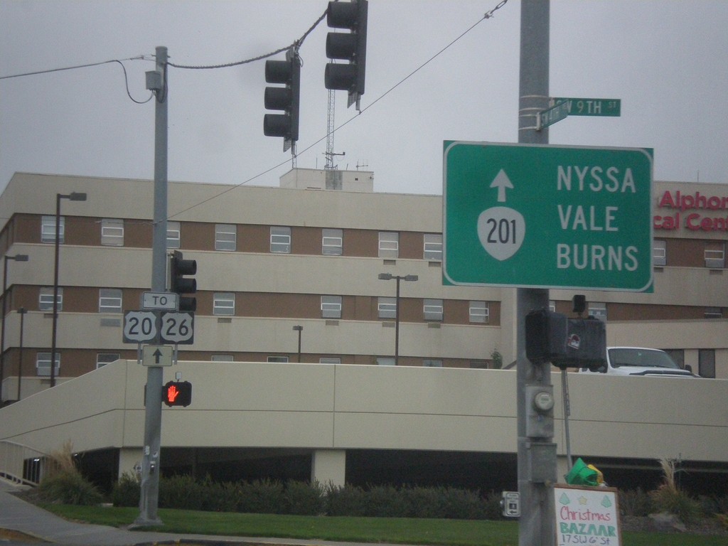
SW 4th Ave West - To OR-201/US-20/US-26
SW 4th Ave West in Ontario at 9th St. Continue west on 4th Ave. for To OR-201/US-20/US-26 to Nyssa, Vale, and Burns.
Taken 11-19-2016
Ontario
Malheur County
Oregon
United States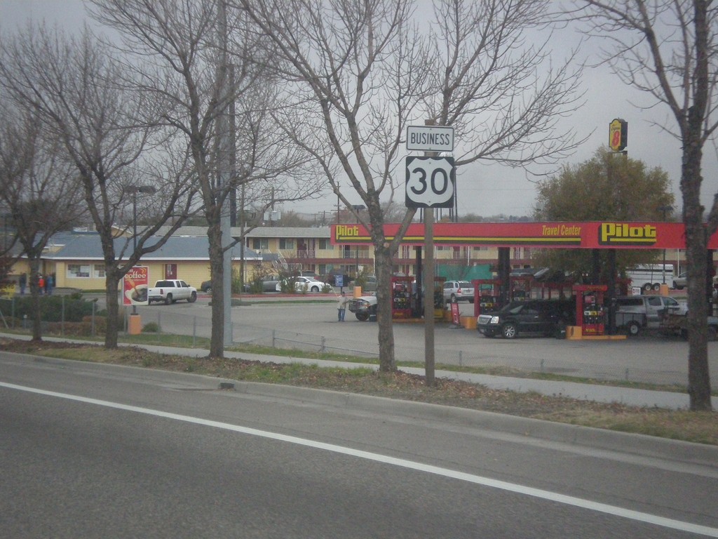
Bus. US-30 West - Ontario
Bus. US-30 West shield on East Idaho Ave. in Ontario
Taken 11-19-2016
 Ontario
Malheur County
Oregon
United States
Ontario
Malheur County
Oregon
United States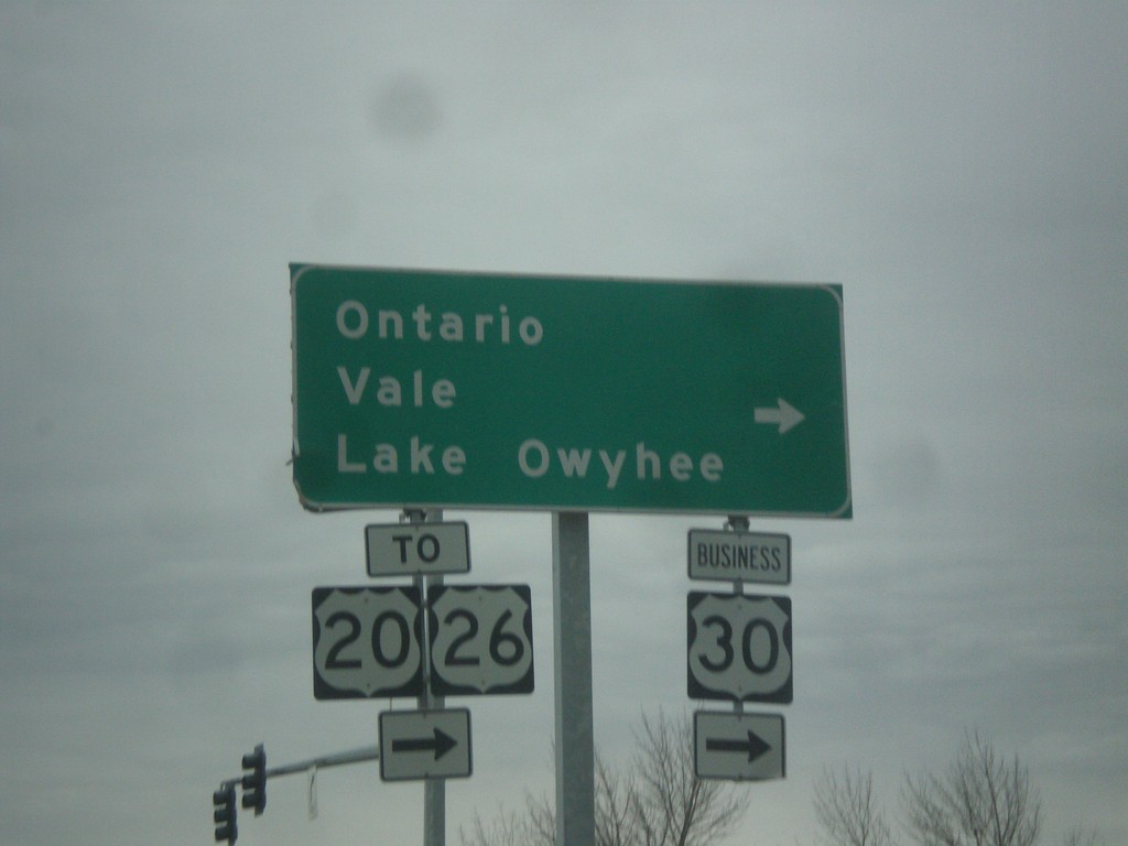
I-84 West Offramp at US-30/Bus. US-30 - Ontario
I-84 West Offramp at US-30/Bus. US-30 Junction in Ontario. Turn right for Bus. US-30 to US-26/US-26/Ontario/Vale/Lake Owyhee.
Taken 11-19-2016

 Ontario
Malheur County
Oregon
United States
Ontario
Malheur County
Oregon
United States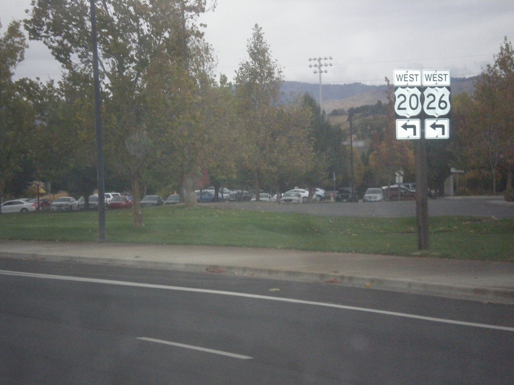
US-20/US-26 West (Broadway Ave.) at Front St.
US-20/US-26 West (Broadway Ave.) at Front St. Turn left on Front St. to continue west on US-20/US-26.
Taken 10-15-2016
Boise
Ada County
Idaho
United States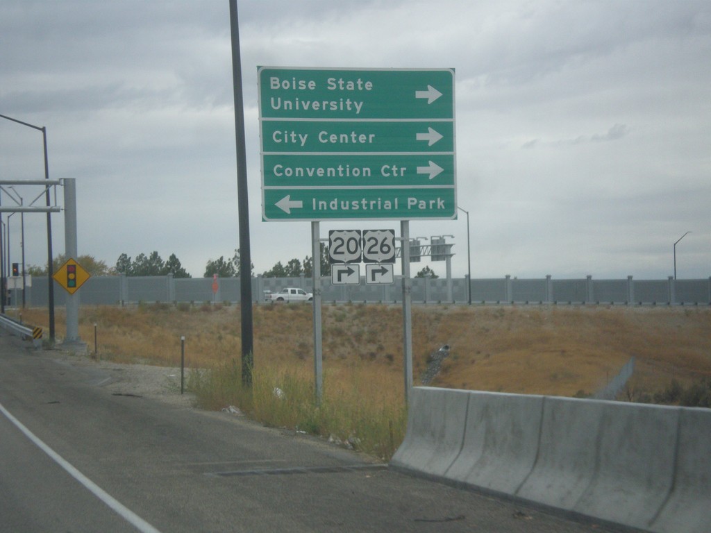
I-84 West Offramp at US-20/US-26 - Broadway Ave.
I-84 West Offramp at US-20/US-26 - Broadway Ave. Turn right on Broadway Ave. to continue west on US-20/US-26, Boise State University, Convention Center, and City Center. Turn left for Broadway Ave. south to Industrial Park. US-20/US-26 leaves I-84 westbound here, and rejoins I-84 in Caldwell.
Taken 10-15-2016
Boise
Ada County
Idaho
United States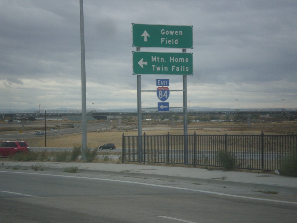
Orchard St. South at I-84 East
Orchard St. South at I-84 East to Mountain Home and Twin Falls. Orchard St. continues south as Gowen Road.
Taken 10-15-2016
Boise
Ada County
Idaho
United States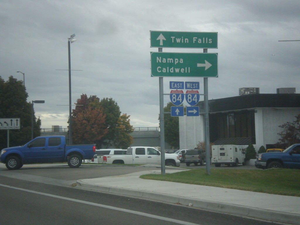
Orchard St. South at I-84
Orchard St. South at I-84. Use I-84 west for Nampa and Caldwell; I-84 east for Twin Falls.
Taken 10-15-2016
Boise
Ada County
Idaho
United States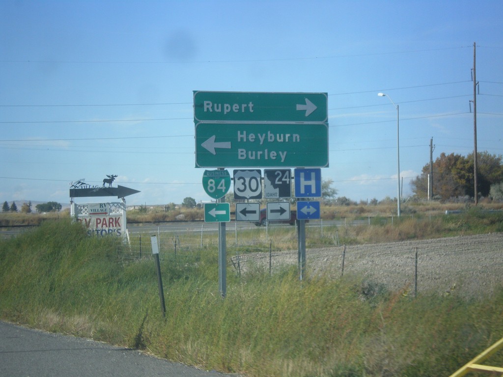
I-84 West Exit 211 Offramp at US-30/ID-24
I-84 west on Exit 211 offramp. Turn right for ID-24 west to Rupert; turn left for BL-84 West/US-30 West to Burley and Heyburn.
Taken 10-09-2016

 Heyburn
Minidoka County
Idaho
United States
Heyburn
Minidoka County
Idaho
United States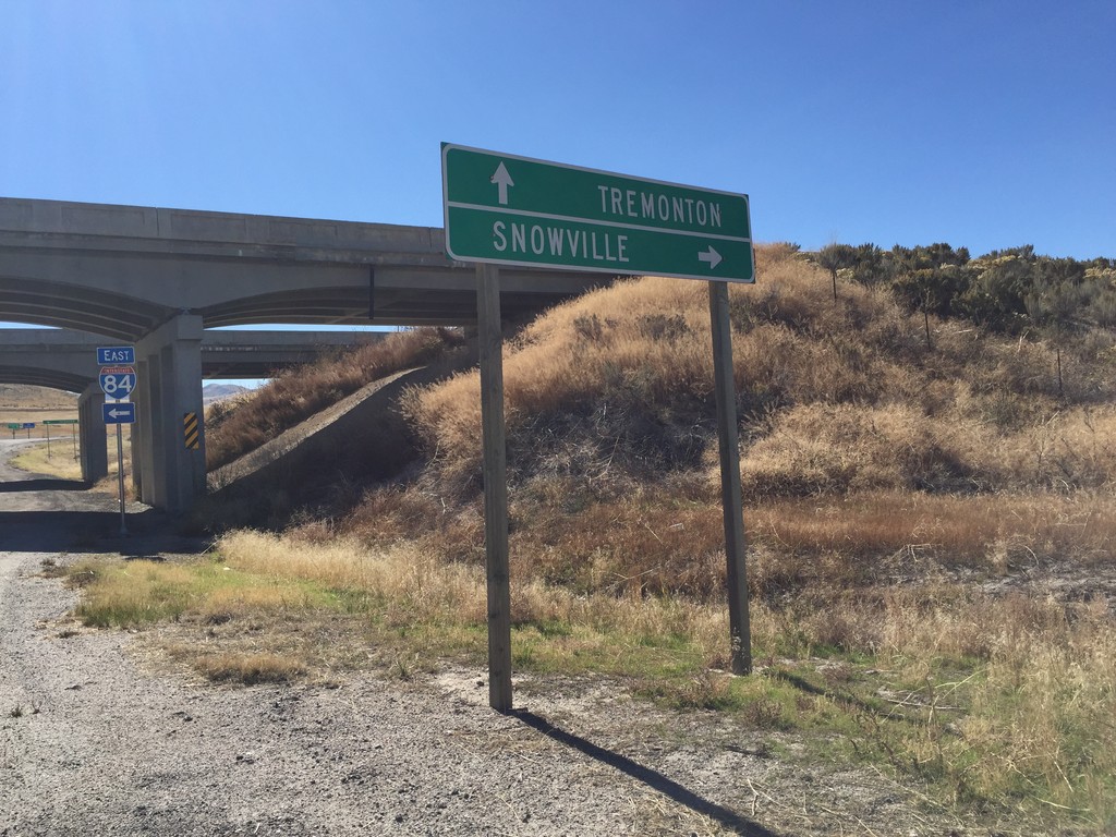
I-84 Onramp at Blue Creek IC
I-84 Onramp at Blue Creek IC in Box Elder County. Use I-84 west to Snowville; I-84 east to Tremonton.
Taken 10-09-2016
Howell
Box Elder County
Utah
United States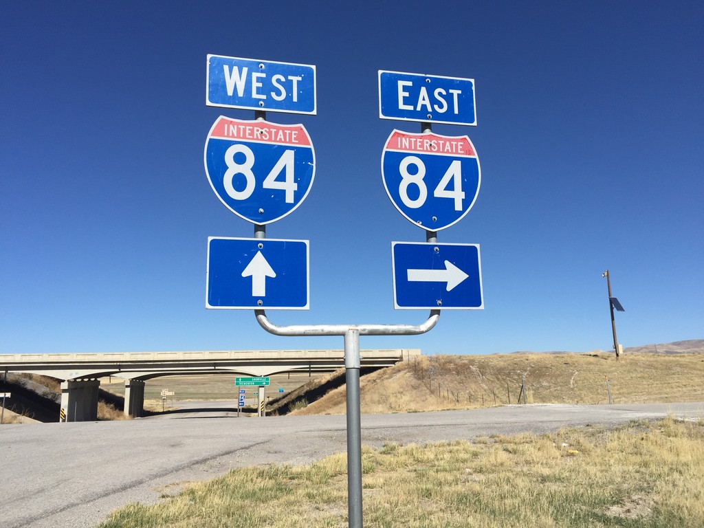
Blue Creek Frontage Road at I-84
Blue Creek Frontage Road at I-84 (Exit 20) in Box Elder County.
Taken 10-09-2016
Howell
Box Elder County
Utah
United States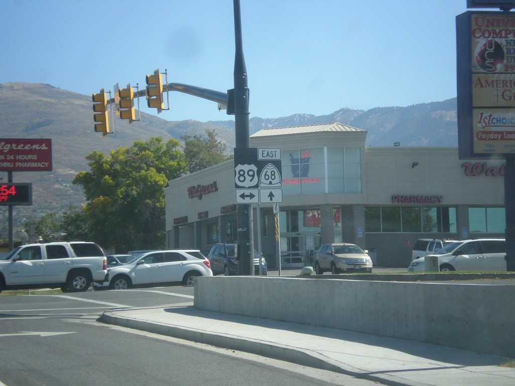
UT-68 East at US-89
UT-68 East at US-89 in Bountiful.
Taken 10-09-2016

 Bountiful
Davis County
Utah
United States
Bountiful
Davis County
Utah
United States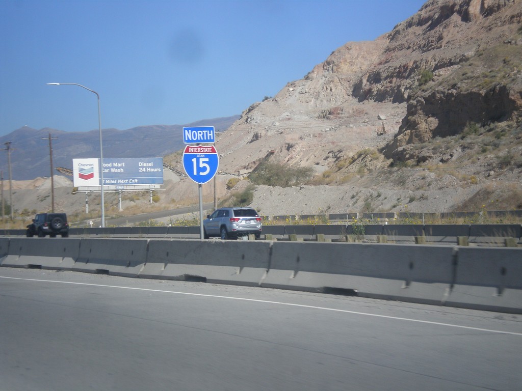
I-15 North - North Salt Lake
I-15 North (UTAH) Shield - North Salt Lake
Taken 10-09-2016
 North Salt Lake
Davis County
Utah
United States
North Salt Lake
Davis County
Utah
United States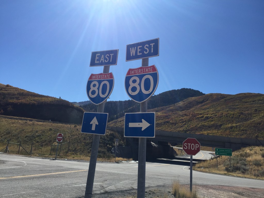
Lambs Canyon at I-80
Lambs Canyon frontage road at I-80 in Salt Lake County.
Taken 10-09-2016
 Summit Park
Summit County
Utah
United States
Summit Park
Summit County
Utah
United States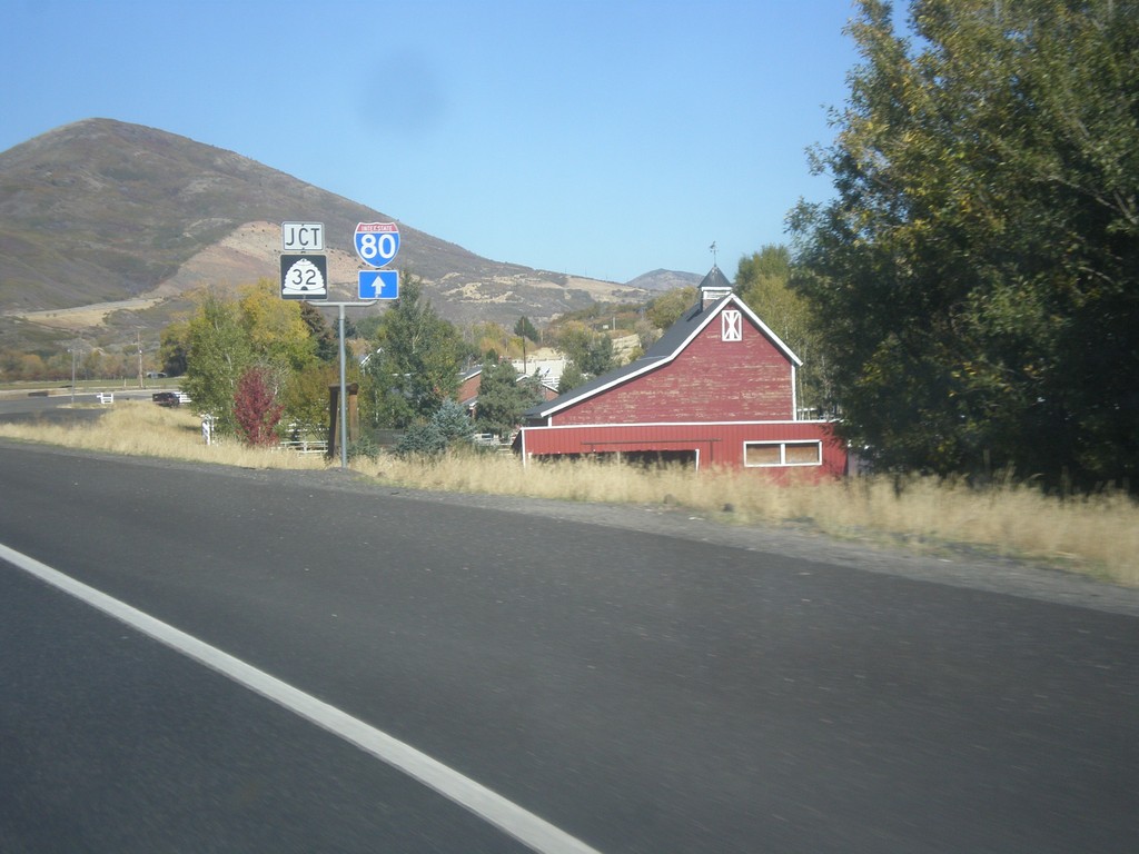
US-40 West at UT-32
US-40 west at UT-32 in Wasatch County. Continue west on US-40 for I-80.
Taken 10-09-2016

 Heber City
Wasatch County
Utah
United States
Heber City
Wasatch County
Utah
United States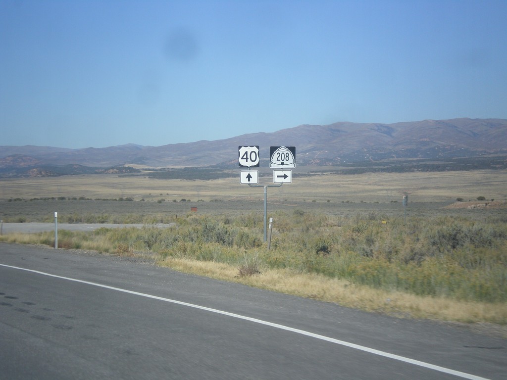
US-40 West at UT-208
US-40 west at UT-208 north in Duchesne county.
Taken 10-09-2016
 Strawberry
Duchesne County
Utah
United States
Strawberry
Duchesne County
Utah
United States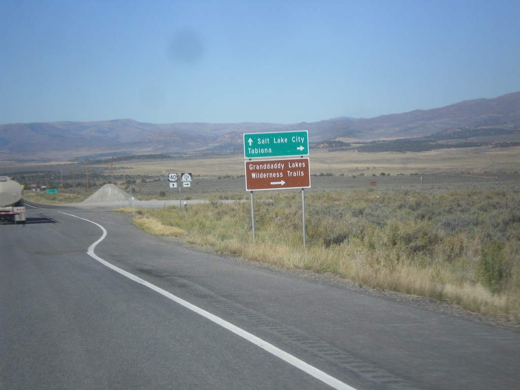
US-40 West Approaching UT-208
US-40 West approaching UT-208 to Tabiona and Granddaddy Lakes Wilderness Trails.
Taken 10-09-2016
Duchesne
Duchesne County
Utah
United States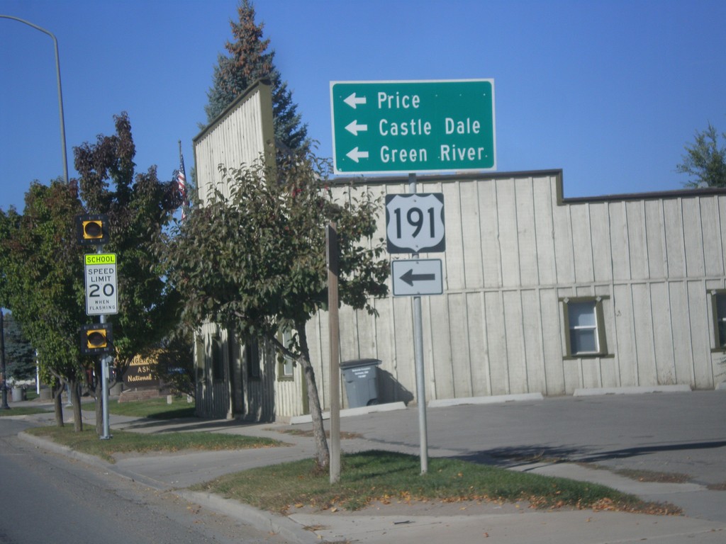
US-40 West/US-191 South at US-191 South
US-40 West/US-191 South at US-191 South in Duchesne. Turn left on US-191 south for Price, Castle Dale, and Green River. US-191 north joins US-40 east to Vernal.
Taken 10-09-2016
 Duchesne
 County
Utah
United States
Duchesne
Duchesne County
Utah
United States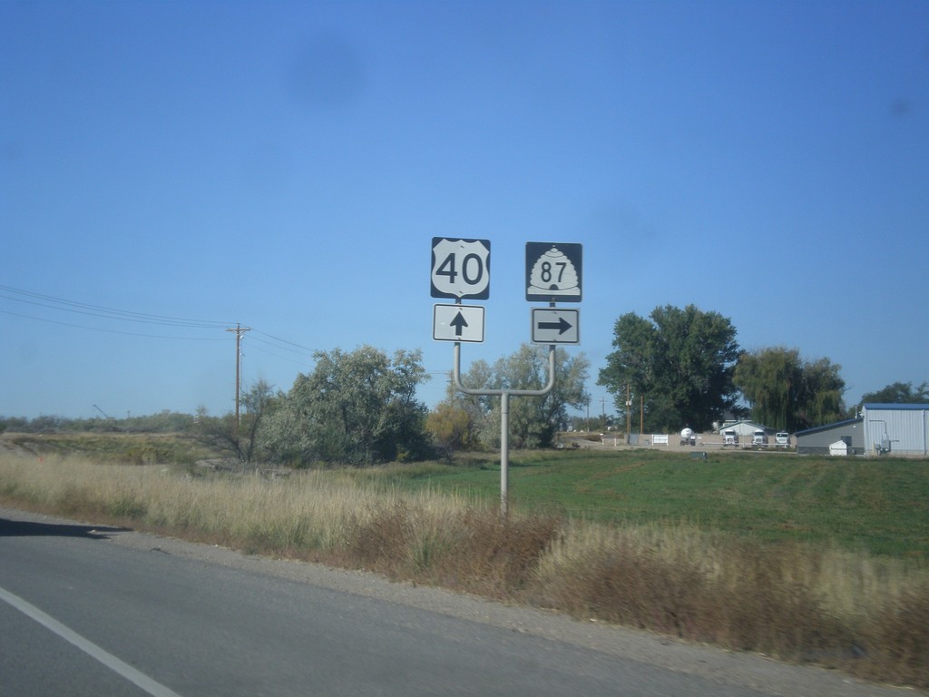
US-40 West/US-191 South at UT-87
US-40 West/US-191 South at UT-87 in Duchesne County.
Taken 10-09-2016
 Roosevelt
Duchesne County
Utah
United States
Roosevelt
Duchesne County
Utah
United States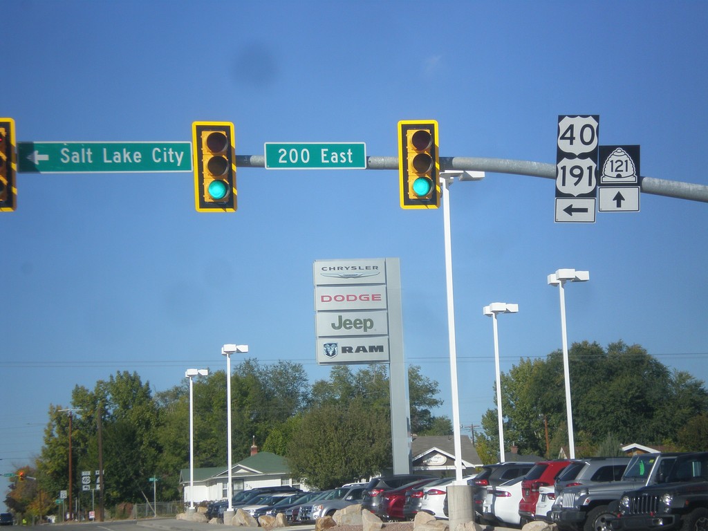
US-40 West/US-191 South at UT-121
US-40/US-191 at UT-121 junction in Roosevelt. Turn left on 200 East to continue on US-40/US-191 towards Salt Lake City.
Taken 10-09-2016
 Roosevelt
Duchesne County
Utah
United States
Roosevelt
Duchesne County
Utah
United States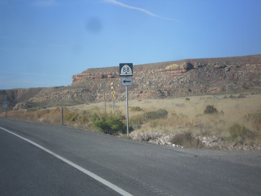
US-40 West at UT-88 South
US-40 West at UT-88 South in Uintah County.
Taken 10-09-2016
 Lapoint
Uintah County
Utah
United States
Lapoint
Uintah County
Utah
United States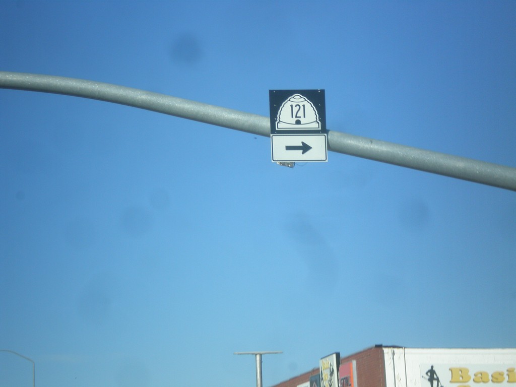
US-40 East at UT-121 West
US-40 east at UT-121 west in Vernal.
Taken 10-09-2016
Vernal
Uintah County
Utah
United States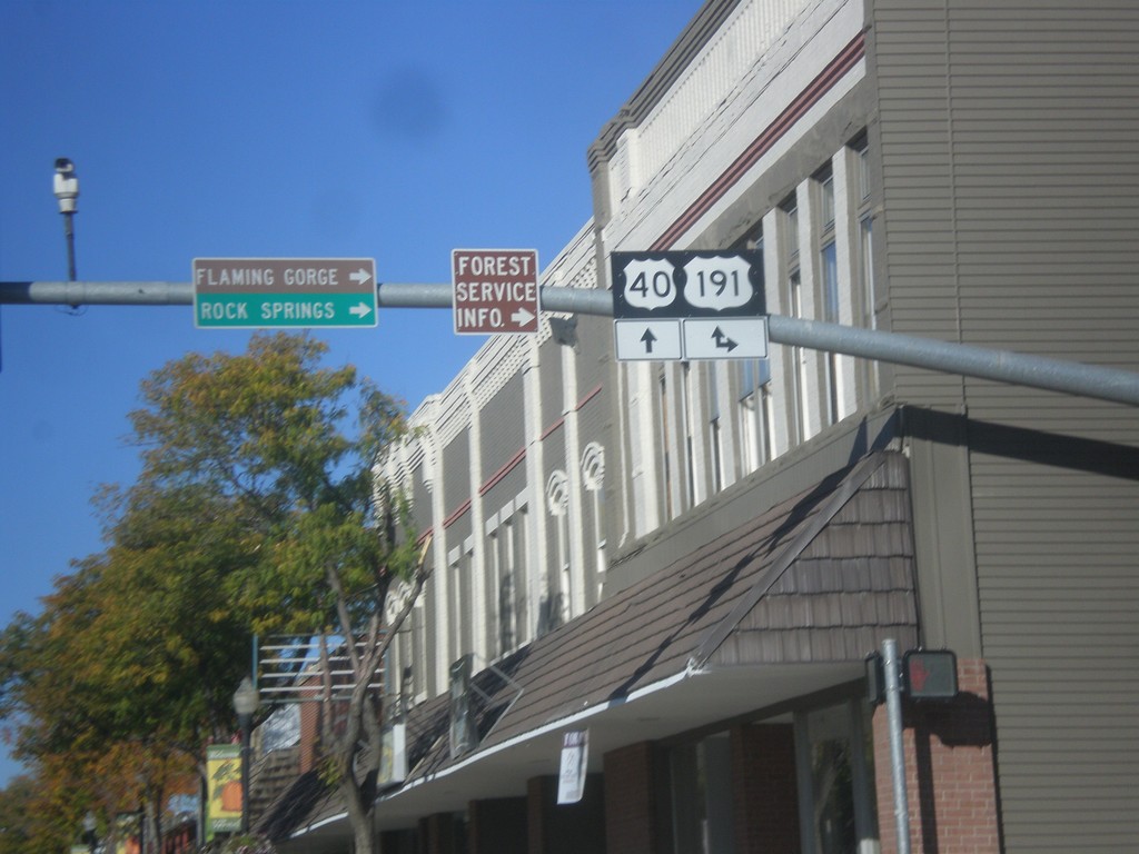
US-40 West at US-191
US-40 West at US-191 north to Rock Springs (Wyoming) and Flaming Gorge. US-191 joins US-40 West to Duchense.
Taken 10-09-2016
Vernal
Uintah County
Utah
United States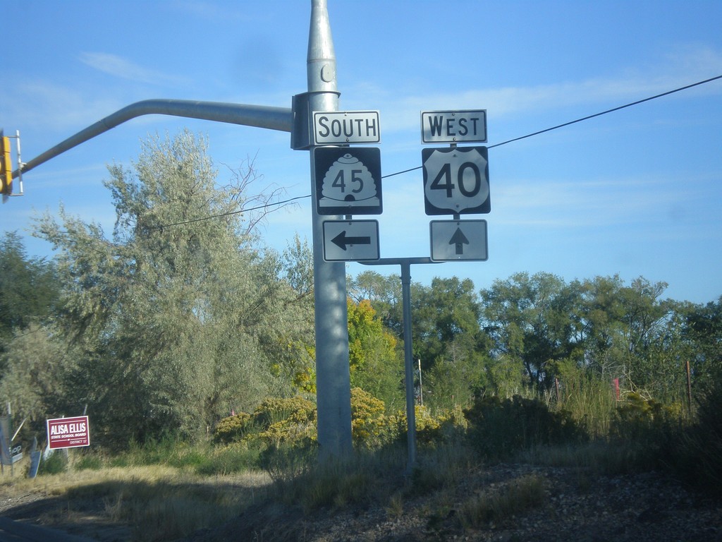
US-40 West at UT-45 South
US-40 West at UT-45 South in Naples.
Taken 10-09-2016
 Vernal
Uintah County
Utah
United States
Vernal
Uintah County
Utah
United States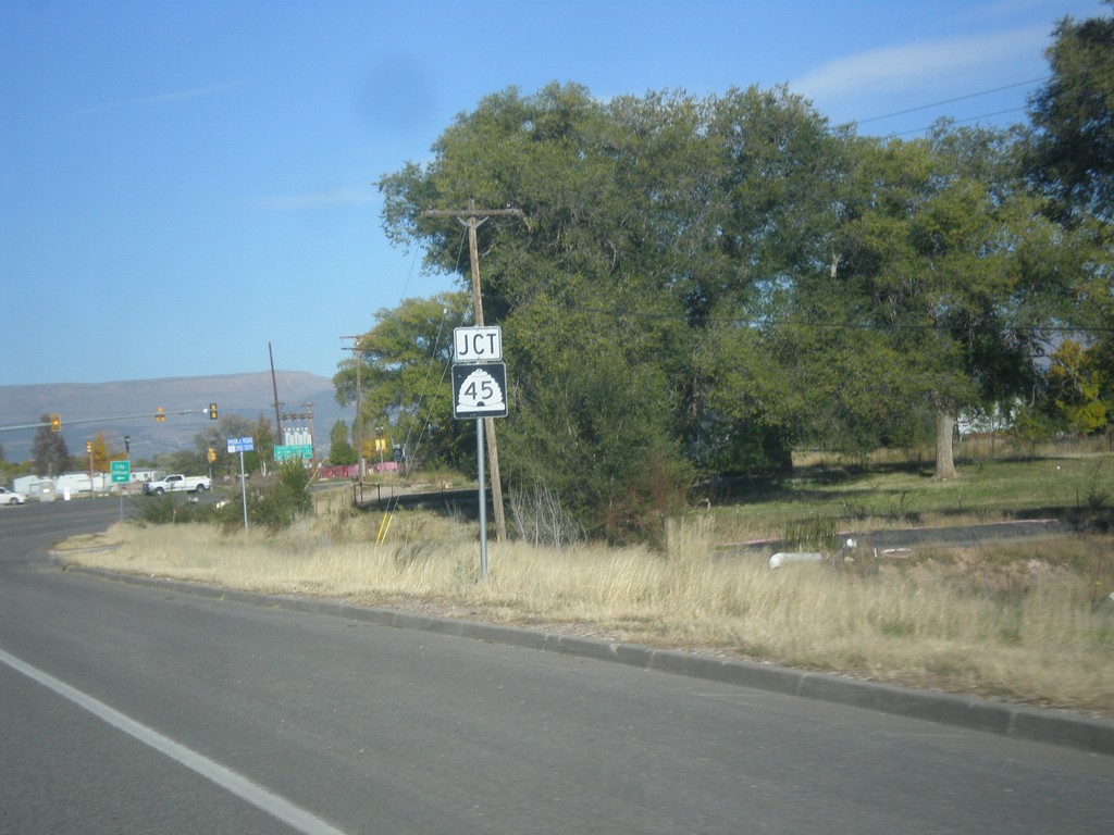
US-40 West Approaching UT-45
US-40 West approaching UT-45 in Naples.
Taken 10-09-2016
Vernal
Uintah County
Utah
United States