Signs Tagged With Shield
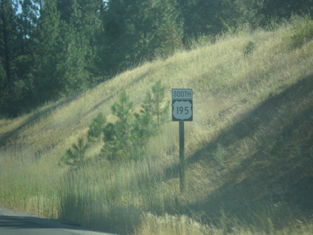
US-195 South - Spokane
First US-195 shield on US-195 southbound. Taken just south of I-90 in Spokane.
Taken 07-29-2017
 Spokane
 County
Washington
United States
Spokane
Spokane County
Washington
United States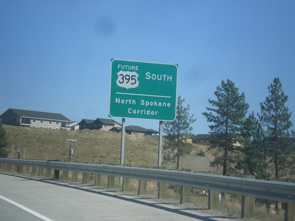
Future US-395 South - North Spokane Corridor
Future US-395 South - North Spokane Corridor. The current alignment of US-395 will be along Division St. until the completion of the North Spokane Corridor.
Taken 07-29-2017

 Spokane
 County
Washington
United States
Spokane
Spokane County
Washington
United States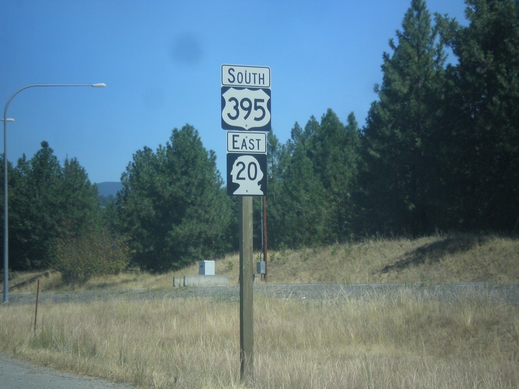
US-395 South/WA-20 East - Kettle Falls
US-395 South/WA-20 East in Kettle Falls
Taken 07-29-2017
 Kettle Falls
Stevens County
Washington
United States
Kettle Falls
Stevens County
Washington
United States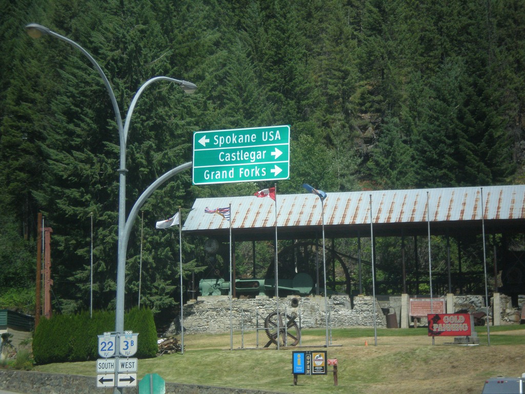
BC-22 South/BC-3B West at BC-22/BC-3B Split
BC-22 South/BC-3B West at BC-22/BC-3B split. Turn right for BC-3B West to Grand Forks and Castlegar. Turn left for BC-22 South to Spokane USA.
Taken 07-29-2017

 Rossland
Kootenay Boundary
British Columbia
Canada
Rossland
Kootenay Boundary
British Columbia
Canada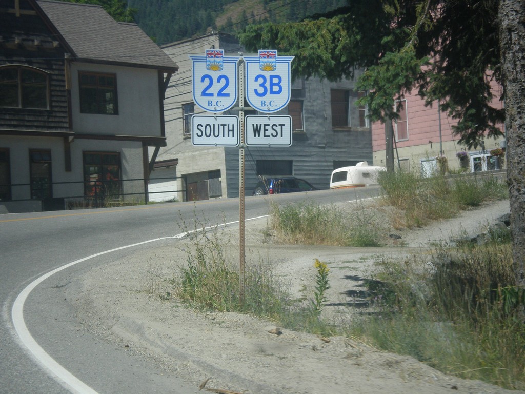
BC-3B West/BC-22 South - Rossland
BC-3B West/BC-22 South - Rossland
Taken 07-29-2017
Rossland
Kootenay Boundary
British Columbia
Canada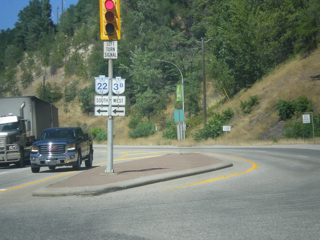
BC-3B West at BC-22 - Trail
BC-3B West at BC-22 in Trail. Turn left for BC-3B West/BC-22 South. Continue straight for BC-22 North. BC-3B west joins BC-22 south to Rossland.
Taken 07-29-2017
Trail
Kootenay Boundary
British Columbia
Canada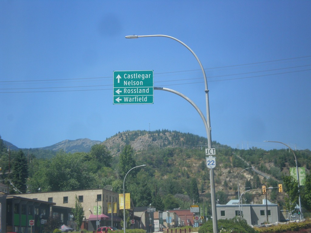
BC-3B West at BC-22 - Trail
BC-3B West at BC-22 in Trail. Use BC-22 north to Castlegar and Nelson. Use BC-22 South/BC-3B West to Warfield and Rossland.
Taken 07-29-2017
Trail
Kootenay Boundary
British Columbia
Canada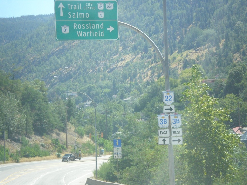
BC-22 South at BC-3B - Trail
BC-22 South at BC-3B in Trail. Turn right for BC-22 South/BC-3A West to Rossland/Warfield. Continue straight for BC-3B to BC-22A/BC-3/Trail City Centre/Salmo. BC-3B West joins BC-22A South to Rossland.
Taken 07-29-2017

 Trail
Kootenay Boundary
British Columbia
Canada
Trail
Kootenay Boundary
British Columbia
Canada
End BC-31A West at BC-6 - New Denver
End BC-31A West at BC-6 in New Denver.
Taken 07-27-2017

 New Denver
Central Kootenay
British Columbia
Canada
New Denver
Central Kootenay
British Columbia
Canada
BC-6 North at BC-31A East
BC-6 North at BC-31A East in New Denver.
Taken 07-27-2017
New Denver
Central Kootenay
British Columbia
Canada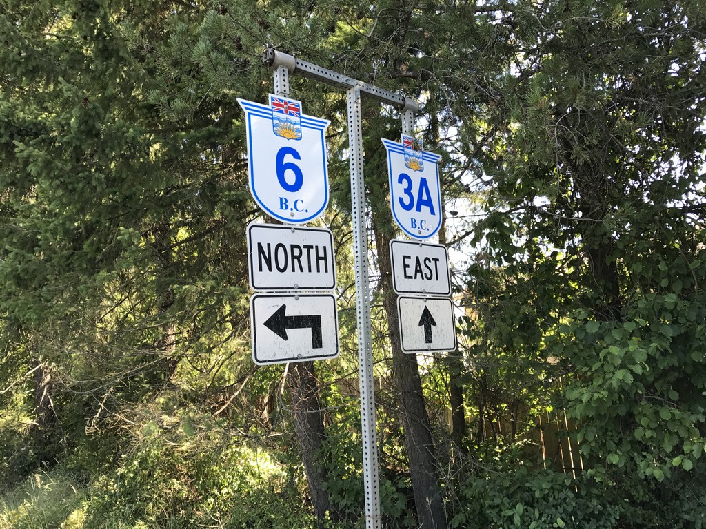
BC-3A East at BC-6
BC-3A East at BC-6. BC-6 south joins BC-3A east to Nelson.
Taken 07-25-2017
 Castlegar
Central Kootenay
British Columbia
Canada
Castlegar
Central Kootenay
British Columbia
Canada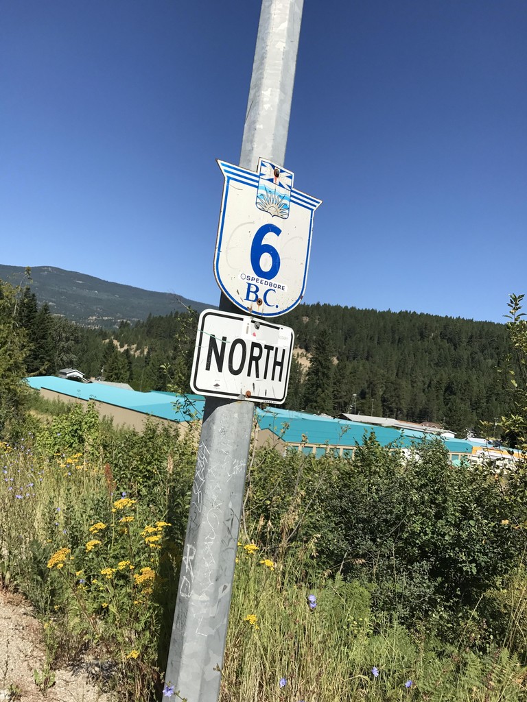
BC-6 North - Crescent Valley
BC-6 North in Crescent Valley.
Taken 07-25-2017
South Slocan
Central Kootenay
British Columbia
Canada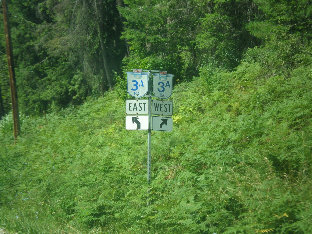
End BC-31 South at BC-3A - Balfour
End BC-31 South at BC-3A in Balfour,
Taken 07-24-2017
 Nelson
Central Kootenay
British Columbia
Canada
Nelson
Central Kootenay
British Columbia
Canada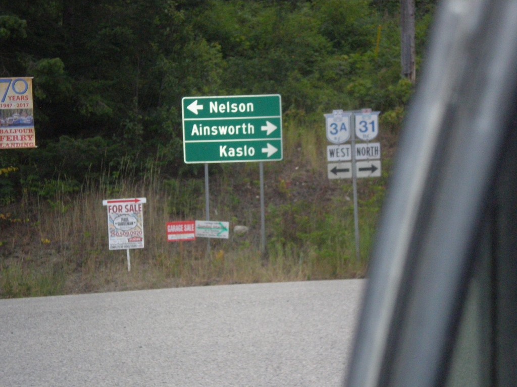
BC-3A West at BC-31
BC-3A West at BC-31 in Balfour, leaving the Kootenay Lake Ferry. Turn right for BC-31 north to Ainsworth and Kaslo. Turn left for BC-3A west to Nelson.
Taken 07-23-2017
Nelson
Central Kootenay
British Columbia
Canada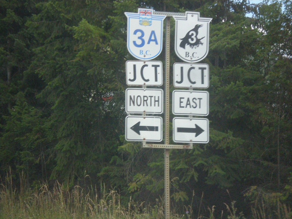
BC-3 East at BC-3A - Creston
BC-3 East at BC-3A in Creston. Turn right to continue east on BC-3.
Taken 07-23-2017
Creston
Central Kootenay
British Columbia
Canada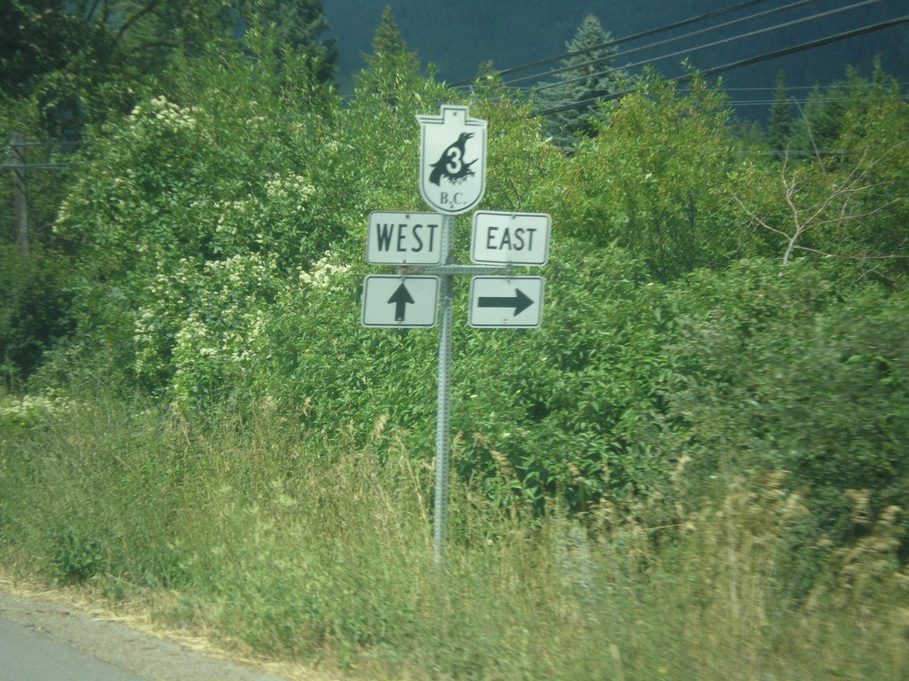
BC-21 North at Erickson Road
BC-21 North at Erickson Road. Turn right for Erickson Road east and BC-3 east. Continue north on BC-21 for BC-3 west.
Taken 07-23-2017
 Creston
Central Kootenay
British Columbia
Canada
Creston
Central Kootenay
British Columbia
Canada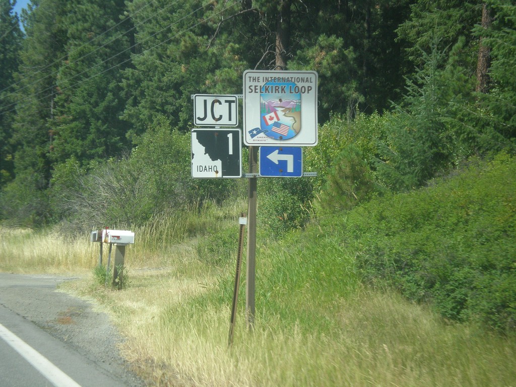
US-95 North Approaching ID-1
US-95 North approaching ID-1 in Boundary County. Use ID-1 north for the International Selkirk Loop.
Taken 07-23-2017

 Bonners Ferry
Boundary County
Idaho
United States
Bonners Ferry
Boundary County
Idaho
United States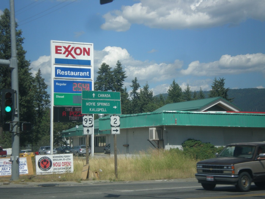
US-95 North/US-2 East at US-95/US-2 Split
US-95 North/US-2 East at US-95/US-2 split. Turn right for US-2 east to Moyie Springs and Kalispell (Montana). Continue north on US-95 for Canada.
Taken 07-23-2017
 Bonners Ferry
Boundary County
Idaho
United States
Bonners Ferry
Boundary County
Idaho
United States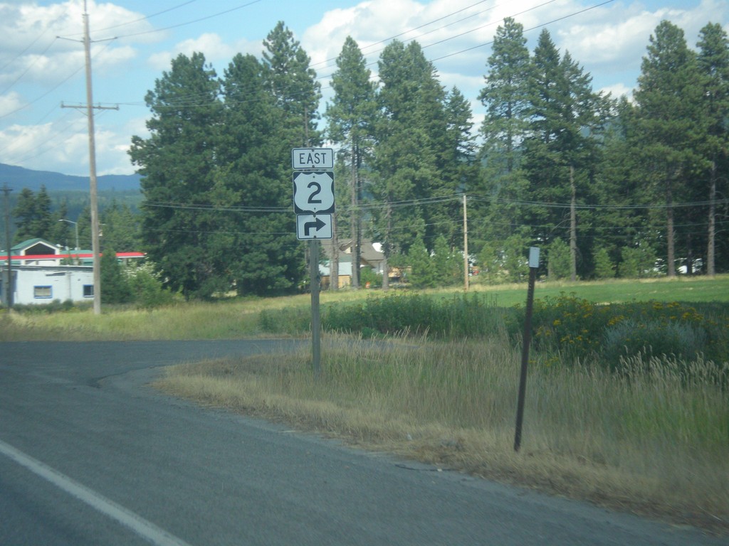
US-95 North/US-2 East approaching US-2
US-95 North/US-2 East approaching US-2. Turn right to continue east on US-2.
Taken 07-23-2017
Bonners Ferry
Boundary County
Idaho
United States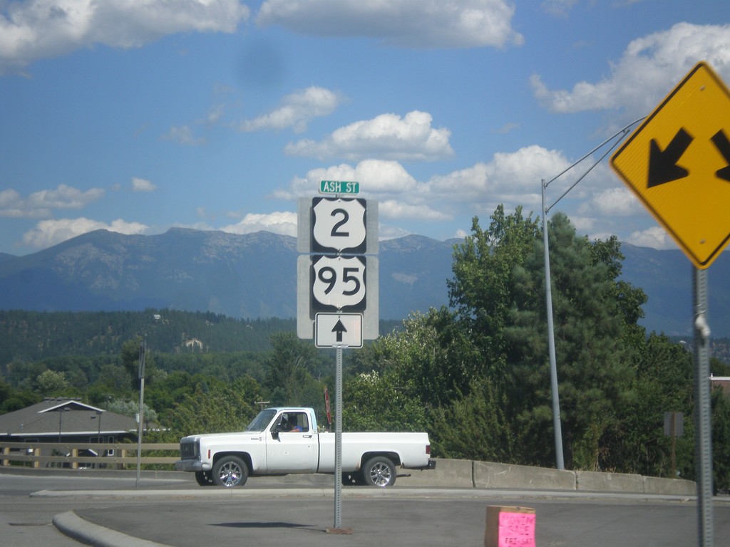
US-95 North/US-2 East - Bonners Ferry
US-95 North/US-2 East at Ash St. in Bonners Ferry
Taken 07-23-2017
Bonners Ferry
Boundary County
Idaho
United States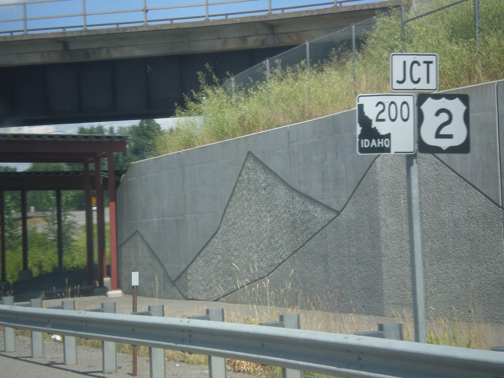
US-95 North Approaching US-2 and ID-200
US-95 North approaching US-2 and ID-200 in Ponderay. US-2 east joins US-95 north to Bonners Ferry. This is also the western end of multi-state highway 200. Highway 200 starts here as ID-200, and crosses Montana, and North Dakota before ending in Minnesota. The ID-200 shield has an inverted color scheme.
Taken 07-23-2017
 Ponderay
Bonner County
Idaho
United States
Ponderay
Bonner County
Idaho
United States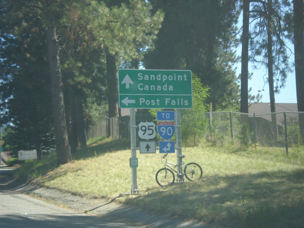
US-95 North - Northwest Blvd. West
US-95 North at Northwest Blvd. West. Use Northwest Blvd. for Post Falls and for I-90 (West). Continue north on US-95 for Sandpoint, Canada and I-90 (East).
Taken 07-23-2017
 Coeur d'Alene
Kootenai County
Idaho
United States
Coeur d'Alene
Kootenai County
Idaho
United States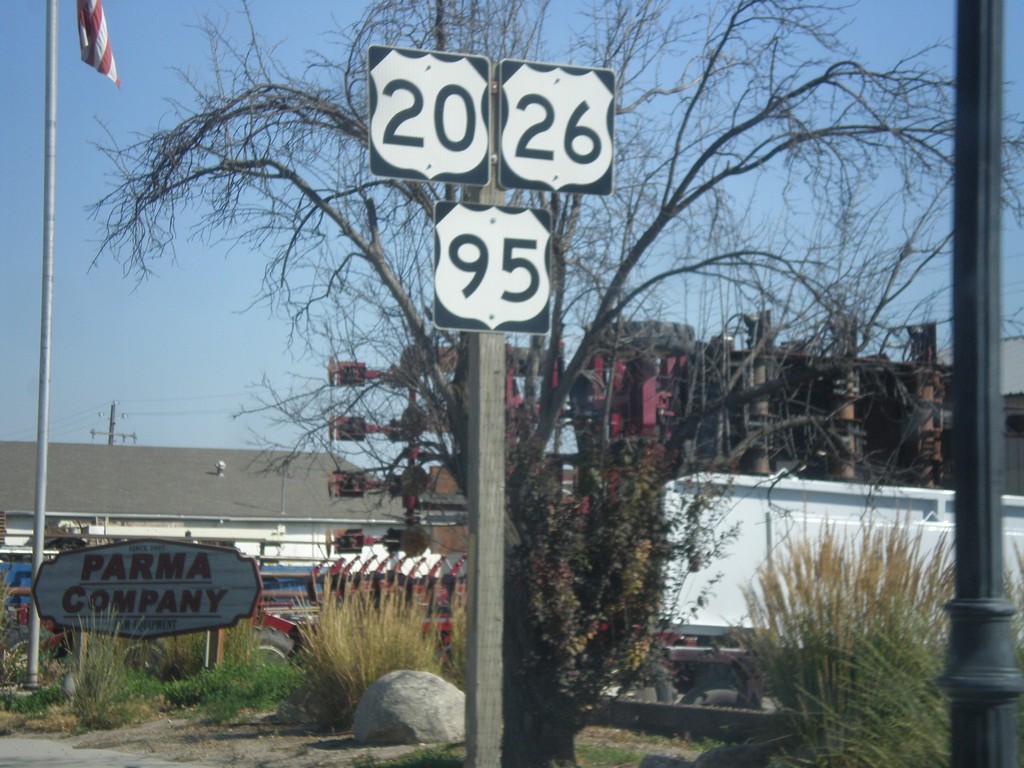
US-20/US-26 East/US-95 South - Parma
US-20/US-26 East/US-95 South in Parma
Taken 07-15-2017

 Parma
Canyon County
Idaho
United States
Parma
Canyon County
Idaho
United States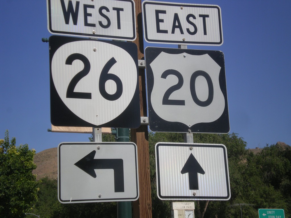
US-20 East Approaching US-26 West - Vale
US-20 east approaching US-26 in downtown Vale. The US-26 shield here has been incorrectly signed using the Oregon state highway shield. So it appears to be a US-20/OR-26 junction.
Taken 07-15-2017
Vale
Malheur County
Oregon
United States
US-26 East Approaching US-20
US-26 east approaching US-20 junction in Vale.
Taken 07-15-2017
Vale
Malheur County
Oregon
United States