Signs Tagged With Shield
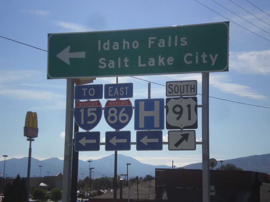
US-91 South at I-86 East (To I-15)
US-91 south at I-86 (Exit 61) onramp. Turn left on I-86 for Idaho Falls, and Salt Lake City via I-15.
Taken 10-04-2015


 Chubbuck
Bannock County
Idaho
United States
Chubbuck
Bannock County
Idaho
United States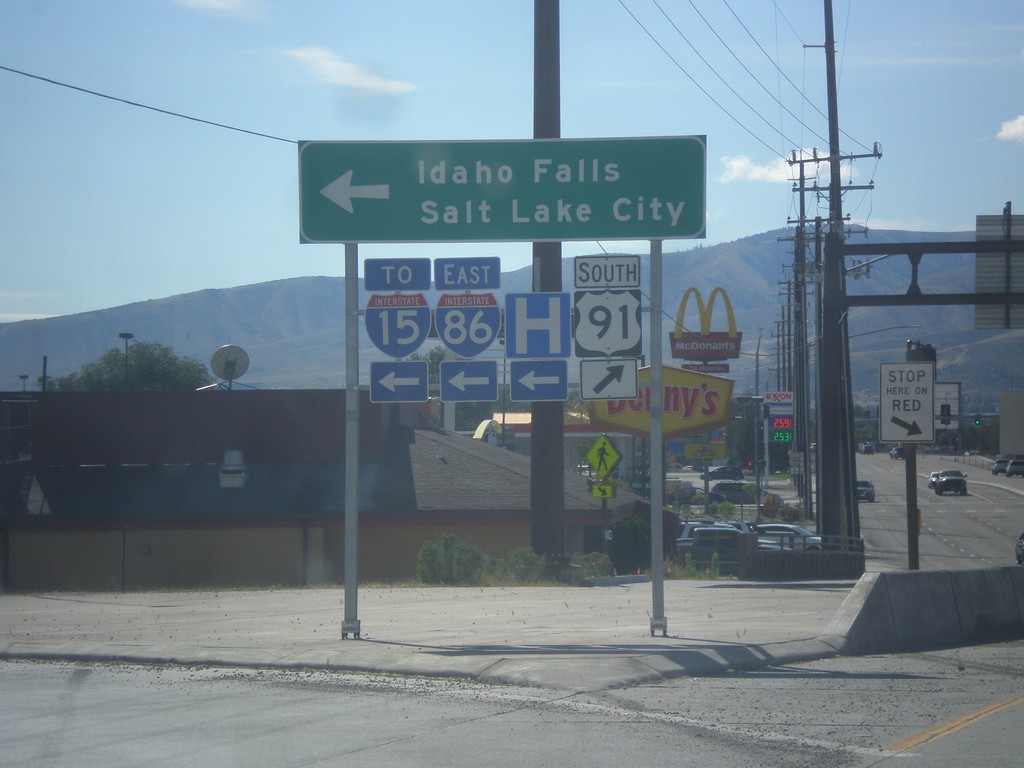
US-91 South at I-86 East (To I-15)
US-91 south at I-86 (Exit 61) onramp. Turn left on I-86 for Idaho Falls, and Salt Lake City via I-15.
Taken 10-04-2015
Chubbuck
Bannock County
Idaho
United States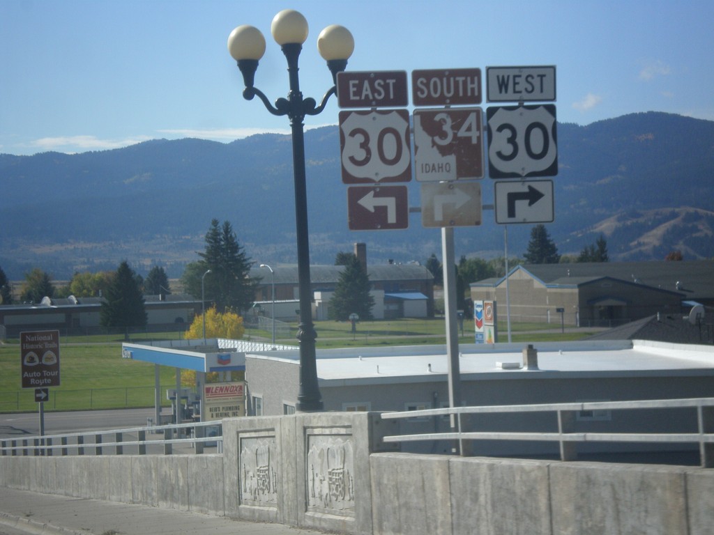
ID-34 South Approaching US-30
ID-34 South approaching US-30 in Soda Springs. ID-34 south joins US-30 east through Soda Springs.
Taken 10-04-2015

 Soda Springs
Caribou County
Idaho
United States
Soda Springs
Caribou County
Idaho
United States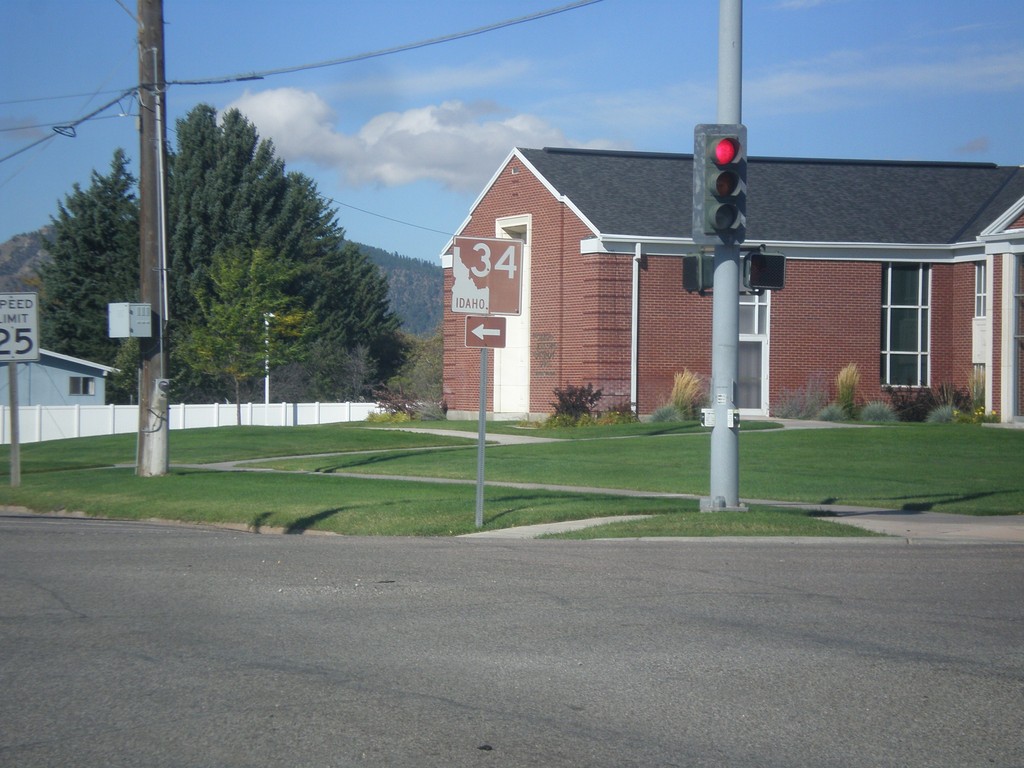
ID-34 South - Soda Springs
ID-34 south (East Hooper Ave.) at S. 3rd St. Turn left to continue south on ID-34.
Taken 10-04-2015
Soda Springs
Caribou County
Idaho
United States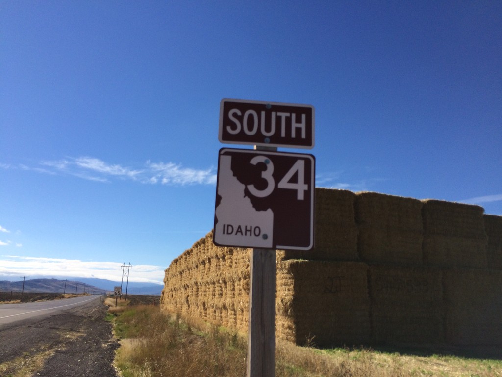
ID-34 South - Caribou County
ID-34 South in Caribou County. The shield is brown because it is part of the scenic/historic byway system, in this case the Pioneer Historic Byway.
Taken 10-04-2015
Conda
Caribou County
Idaho
United States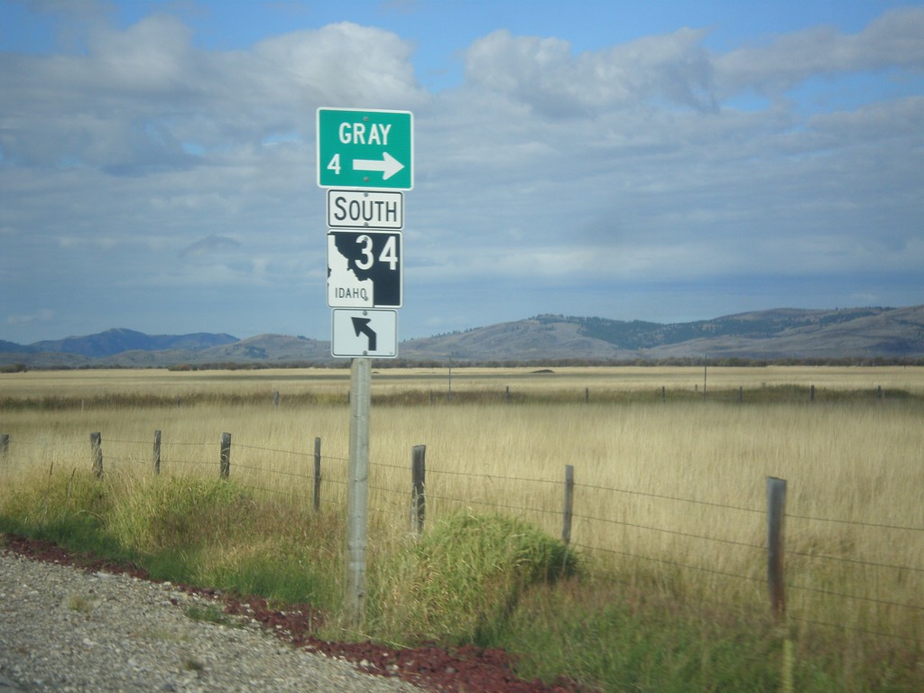
ID-34 South - Gray
ID-34 south at Grays Lake Road north to Gray.
Taken 10-04-2015
Wayan
Caribou County
Idaho
United States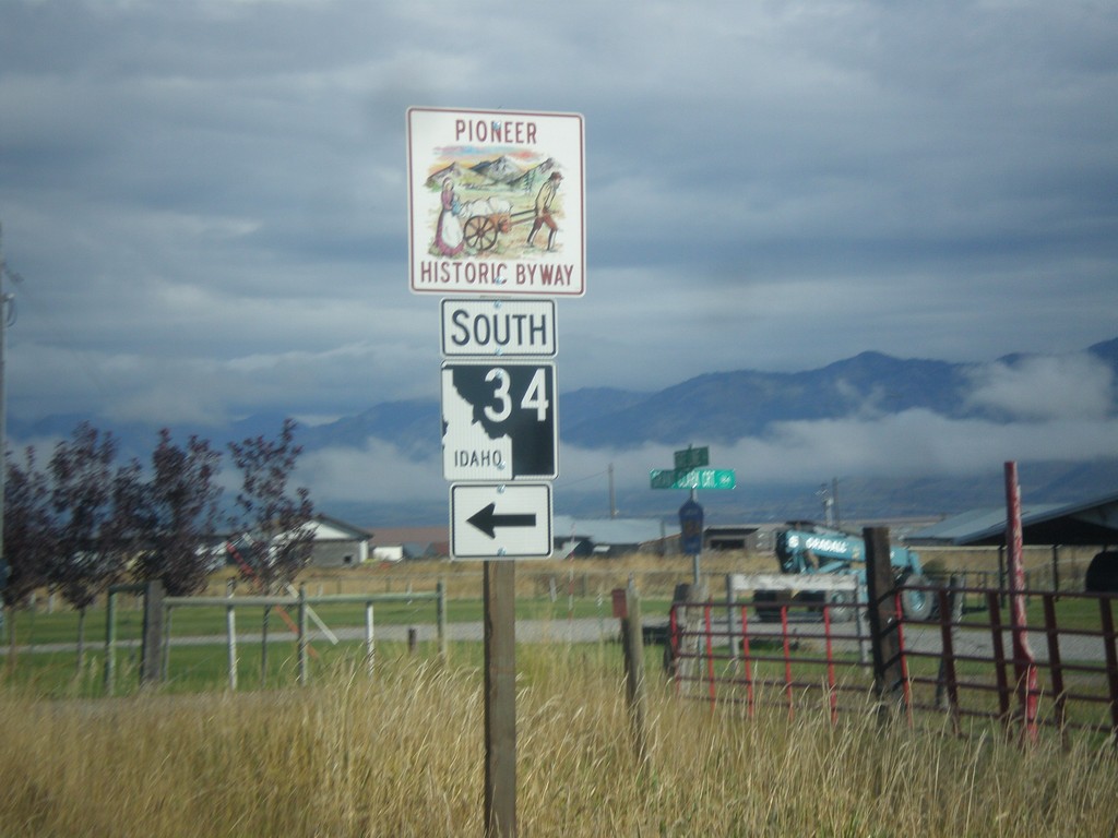
Stateline Road North at ID-34
Stateline Road north at ID-34 south. ID-34 is part of the Pioneer Historic Byway.
Taken 10-04-2015
Freedom
Lincoln County
Wyoming
United States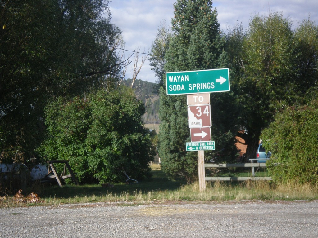
End WY-239 at Stateline Road
Turn right on Stateline Road to access ID-34 to Soda Springs and Wayan (both in Idaho). This sign assembly appears to have been erected by the Idaho Transportation Department. The west side of Stateline Road is in Idaho.
Taken 10-04-2015
 Freedom
Lincoln County
Wyoming
United States
Freedom
Lincoln County
Wyoming
United States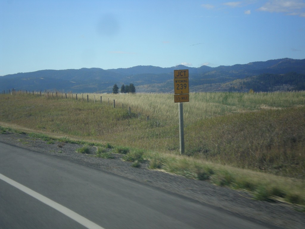
US-89 South Approaching WY-289
US-89 South approaching WY-289 near Freedom.
Taken 10-04-2015
 Freedom
Lincoln County
Wyoming
United States
Freedom
Lincoln County
Wyoming
United States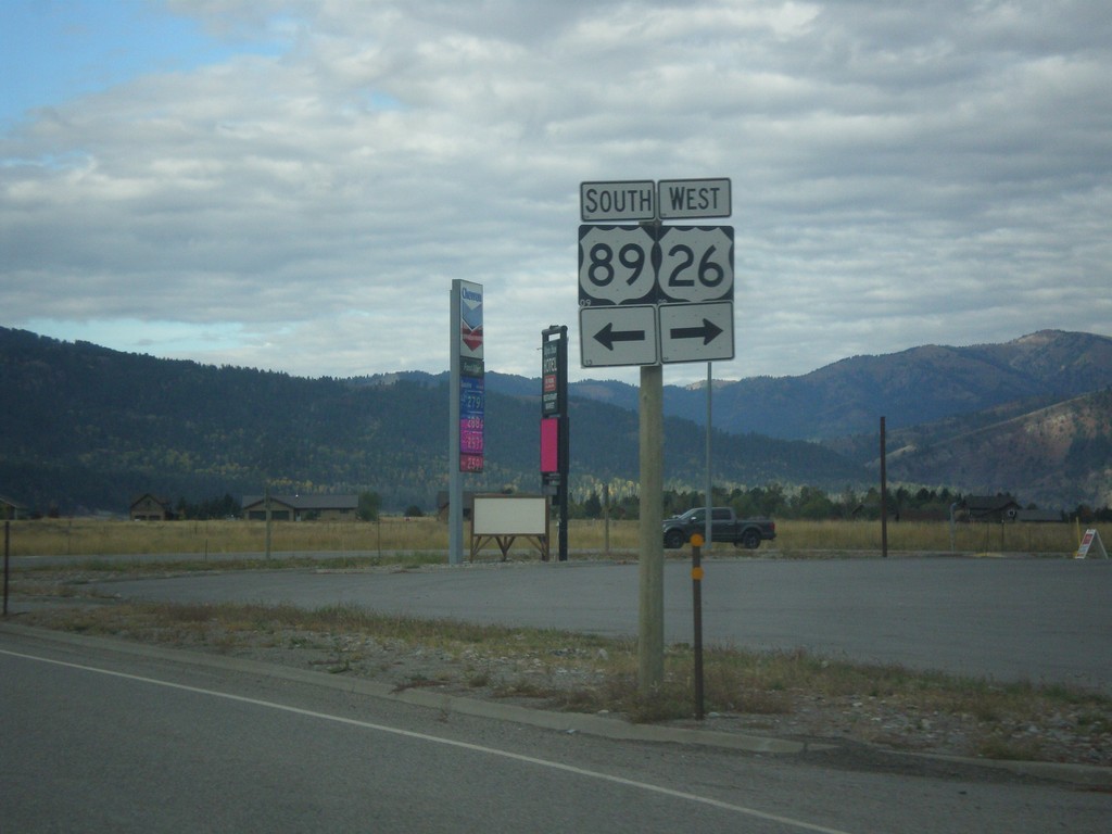
US-26 West/US-89 South at Split
US-26 West/US-89 South at split in Alpine Junction. Turn right for US-26 West; left for US-89 south.
Taken 10-04-2015
 Alpine
Lincoln County
Wyoming
United States
Alpine
Lincoln County
Wyoming
United States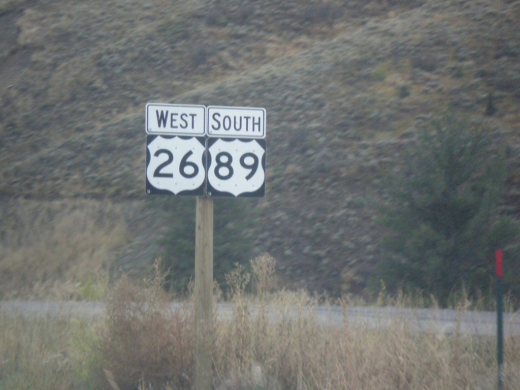
US-26 West/US-89 South - Teton County
US-26 West/US-89 South in Teton County.
Taken 10-04-2015
Jackson
Teton County
Wyoming
United States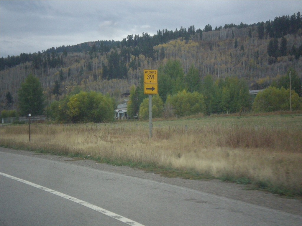
US-26 West - US-89/US-189/US-191 South at WY-391
US-26 West - US-89/US-189/US-191 South at WY-391 junction.
Taken 10-04-2015


 Jackson
Teton County
Wyoming
United States
Jackson
Teton County
Wyoming
United States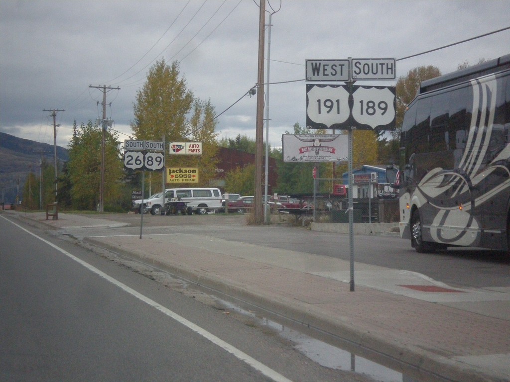
US-26 West - US-89/US-189/US-191 South in Jackson
US-26 West - US-89/US-189/US-191 South in Jackson. Two separate sign posts were used to hold all of the route shields.
Taken 10-04-2015
Jackson
Teton County
Wyoming
United States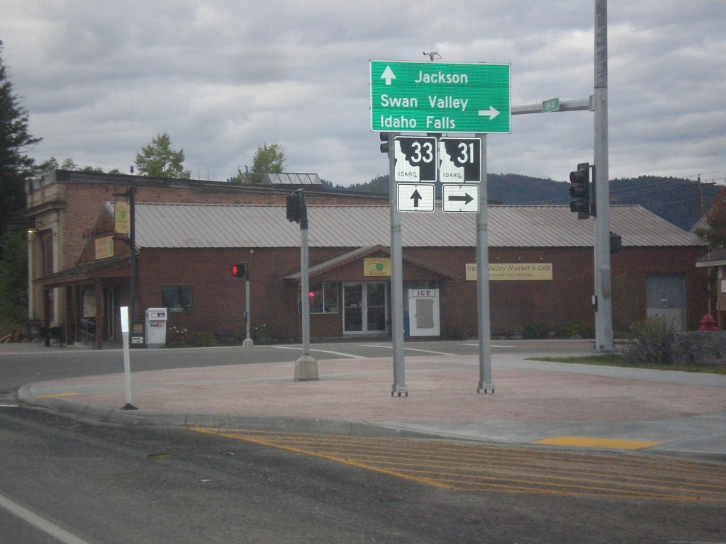
ID-33 East at ID-31
ID-33 East at ID-31 in Victor. Turn right on ID-31 south for Swan Valley and Idaho Falls. Continue straight on ID-33 for Jackson (Wyoming). Teton Scenic Byway leaves ID-33 here and follows ID-31 south.
Taken 10-04-2015

 Victor
Teton County
Idaho
United States
Victor
Teton County
Idaho
United States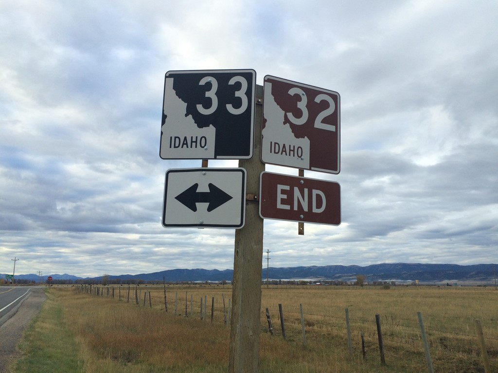
End ID-32 at ID-33
End ID-32 south at ID-33 near Tetonia. The Teton Scenic Byway continues onto ID-33 east, towards Driggs.
Taken 10-04-2015
 Tetonia
Teton County
Idaho
United States
Tetonia
Teton County
Idaho
United States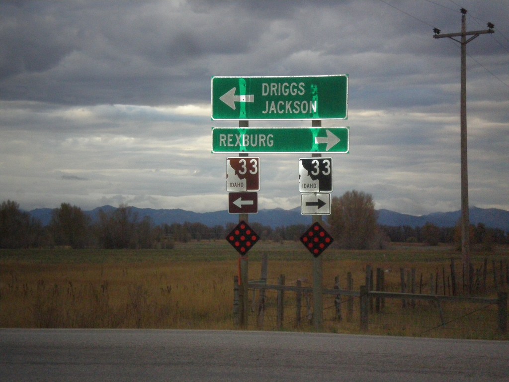
End ID-32 South at ID-33
End ID-32 south at ID-33. Use ID-33 west for Rexburg. Use ID-33 east for Driggs and Jackson (Wyoming). Use ID-33 east to continue on the Teton Scenic Byway.
Taken 10-04-2015
Tetonia
Teton County
Idaho
United States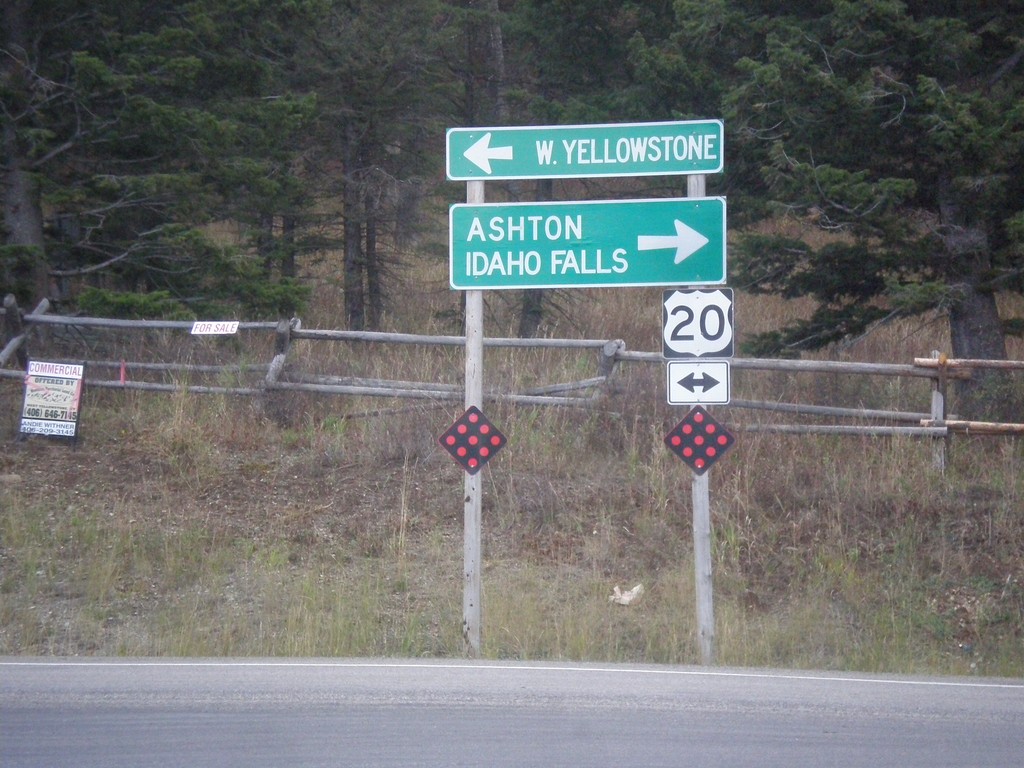
End ID-87 South at US-20
End ID-87 south at US-20, to Ashton, Idaho Falls, and W. Yellowstone.
Taken 10-03-2015

 Island Park
Fremont County
Idaho
United States
Island Park
Fremont County
Idaho
United States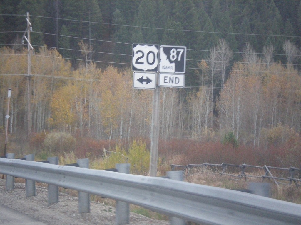
End ID-87 South at US-20
End ID-87 South at US-20 in Island Park.
Taken 10-03-2015
Island Park
Fremont County
Idaho
United States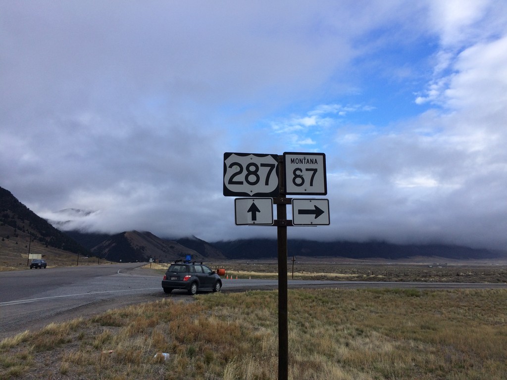
US-287 South at MT-87
US-287 South at MT-87 in Madison County.
Taken 10-03-2015

 Schusters Place
Madison County
Montana
United States
Schusters Place
Madison County
Montana
United States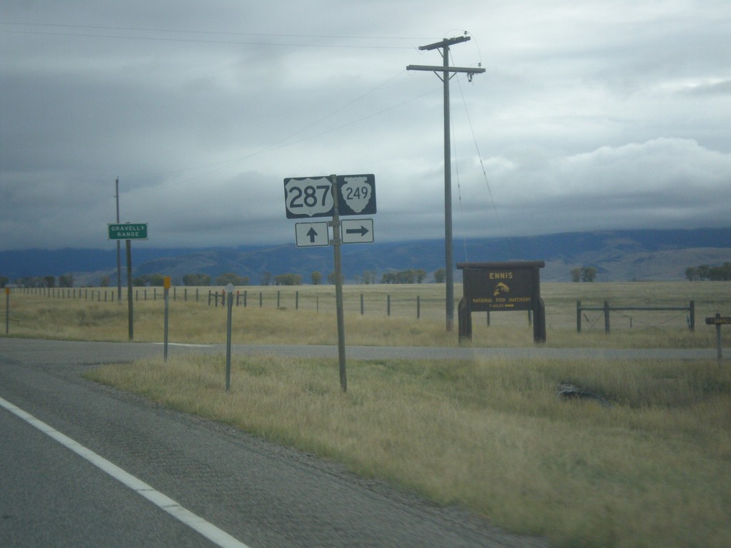
US-287 South at MTS-249
US-287 South at MTS-249 West in Madison County.
Taken 10-03-2015
 Varney
Madison County
Montana
United States
Varney
Madison County
Montana
United States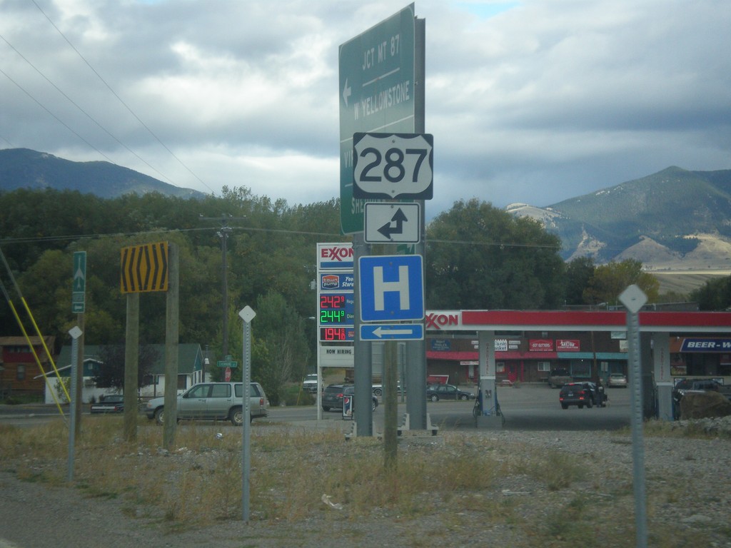
End MT-287 South at US-287
End MT-287 south at US-287 in Ennis. Turn left for US-287 north; straight for US-287 south.
Taken 10-03-2015
 Ennis
Madison County
Montana
United States
Ennis
Madison County
Montana
United States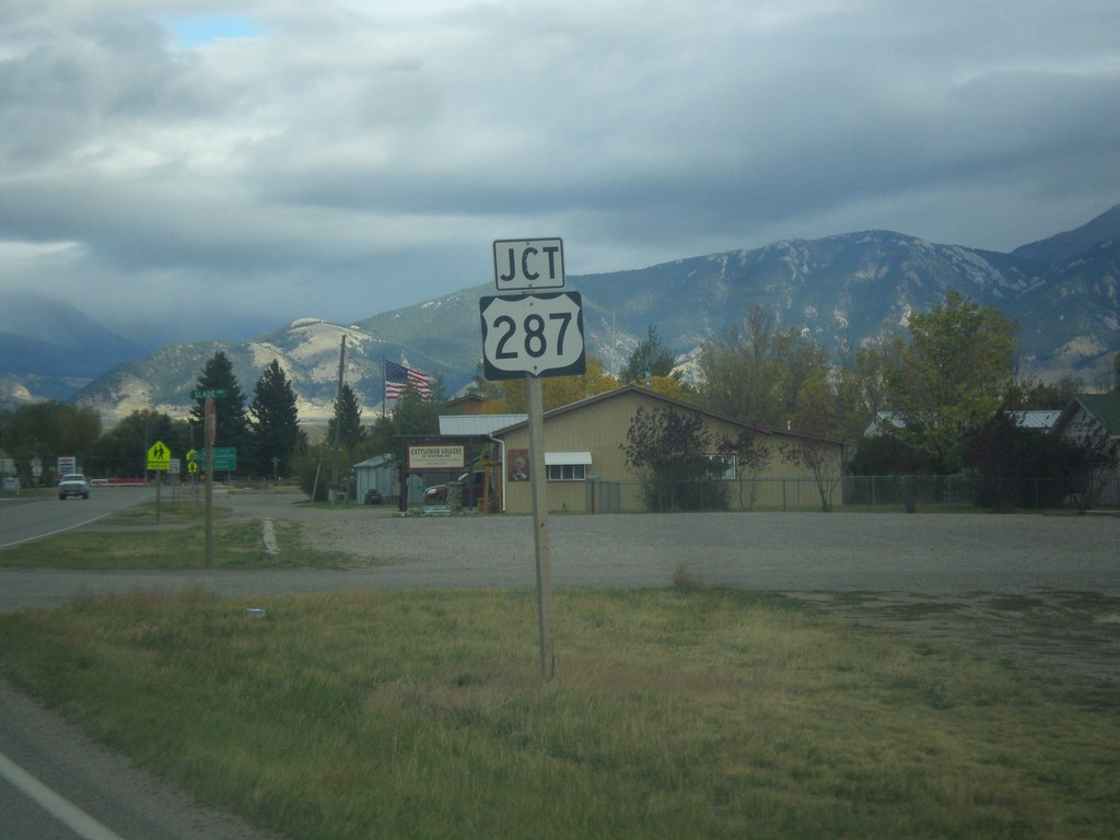
MT-287 South Approaching US-287
MT-287 South approaching US-287 in Ennis.
Taken 10-03-2015
Ennis
Madison County
Montana
United States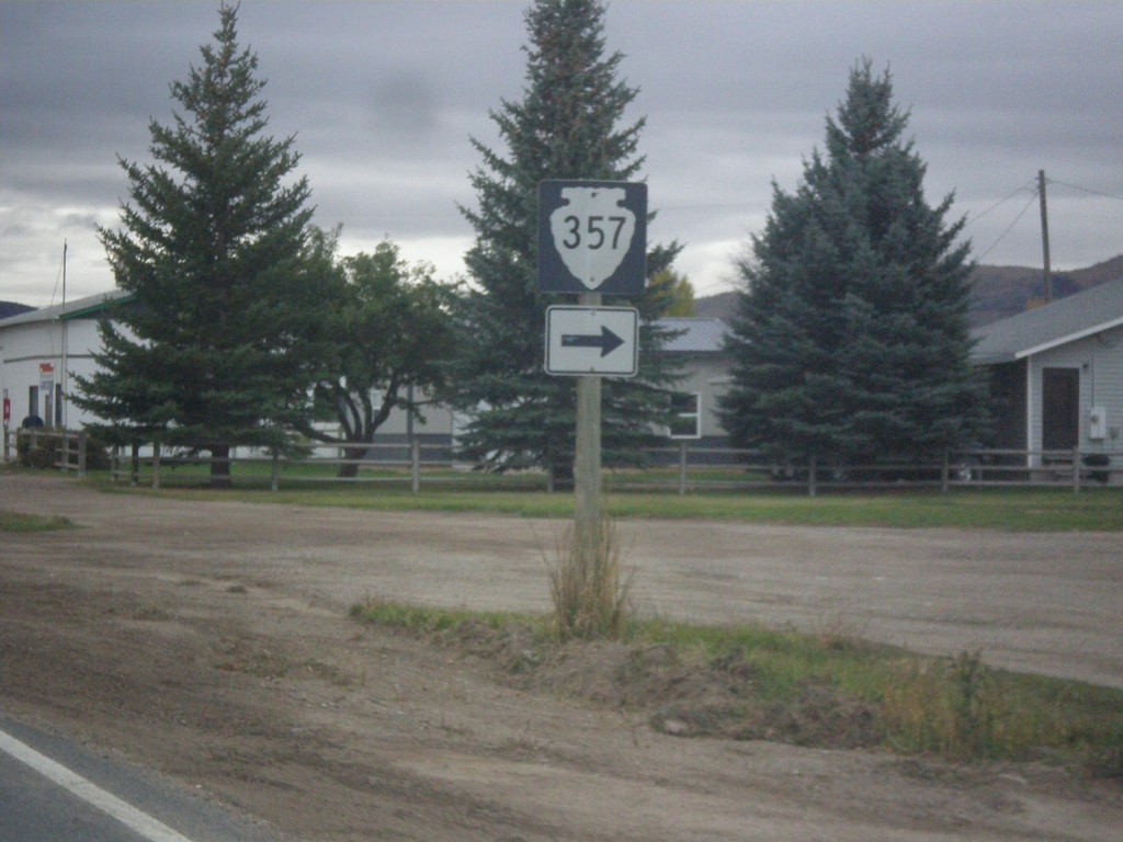
MT-287 South Approaching MTS-357
MT-287 South approaching MTS-357 in Alder.
Taken 10-03-2015
 Alder
Madison County
Montana
United States
Alder
Madison County
Montana
United States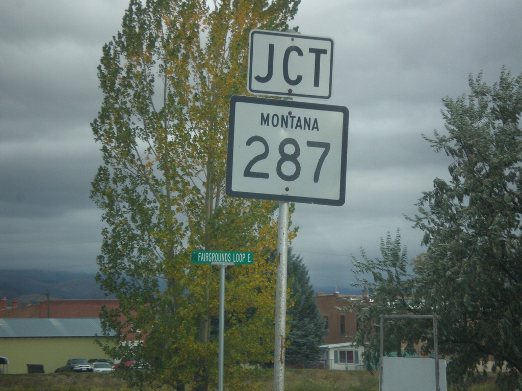
MT-41 North Approaching MT-287
MT-41 North approaching MT-287 in Twin Bridges.
Taken 10-03-2015
 Twin Bridges
Madison County
Montana
United States
Twin Bridges
Madison County
Montana
United States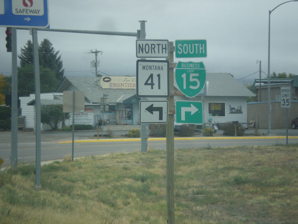
BL-15 South at MT-15
BL-15 South at MT-15 in Dillon. Turn right to continue south on BL-15; left for MT-41 north.
Taken 10-03-2015
 Dillon
Beaverhead County
Montana
United States
Dillon
Beaverhead County
Montana
United States