Signs Tagged With Shield
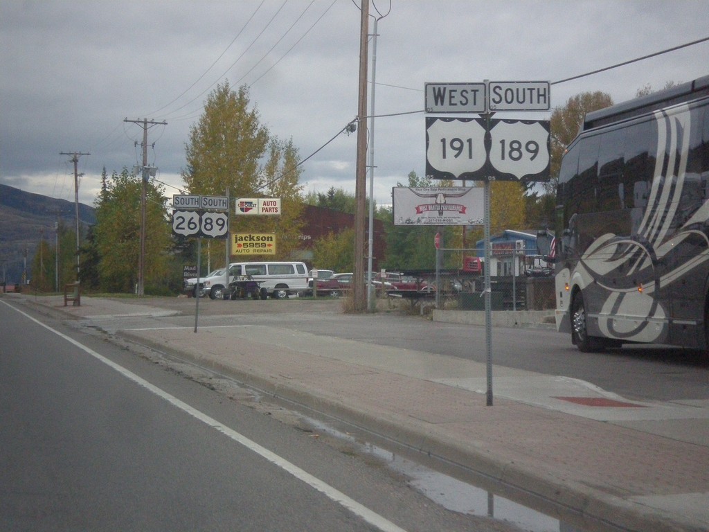
US-26 West - US-89/US-189/US-191 South in Jackson
US-26 West - US-89/US-189/US-191 South in Jackson. Two separate sign posts were used to hold all of the route shields.
Taken 10-04-2015


 Jackson
Teton County
Wyoming
United States
Jackson
Teton County
Wyoming
United States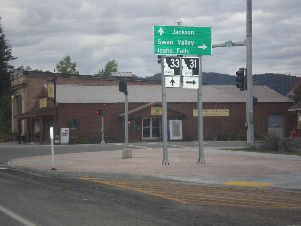
ID-33 East at ID-31
ID-33 East at ID-31 in Victor. Turn right on ID-31 south for Swan Valley and Idaho Falls. Continue straight on ID-33 for Jackson (Wyoming). Teton Scenic Byway leaves ID-33 here and follows ID-31 south.
Taken 10-04-2015

 Victor
Teton County
Idaho
United States
Victor
Teton County
Idaho
United States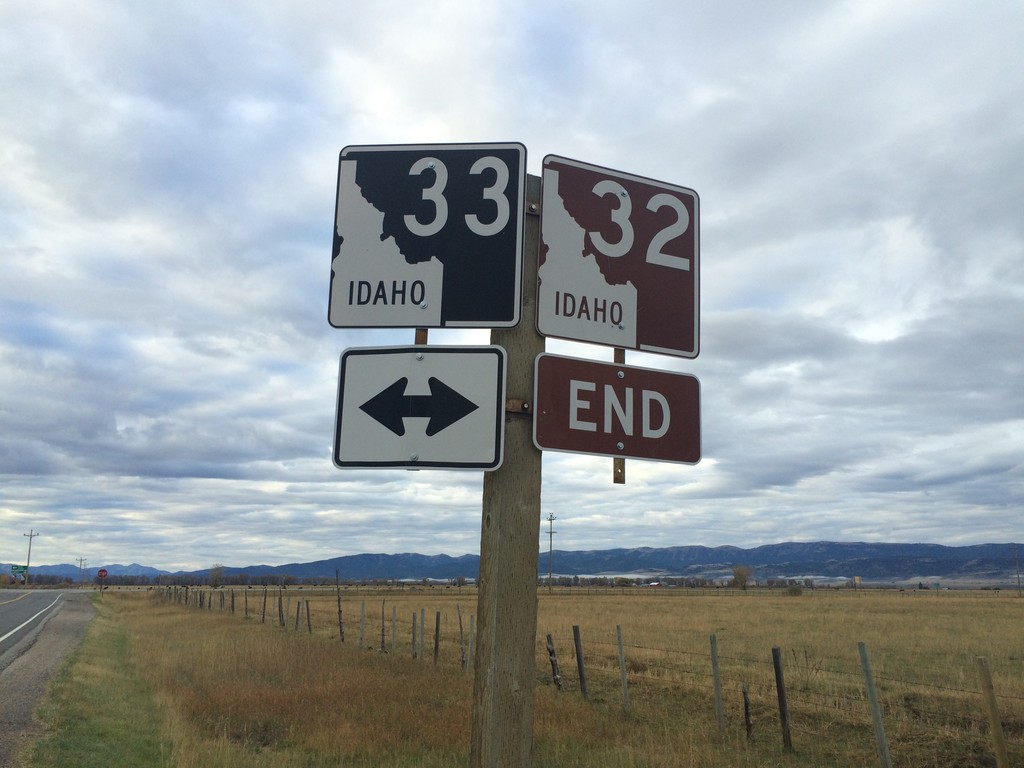
End ID-32 at ID-33
End ID-32 south at ID-33 near Tetonia. The Teton Scenic Byway continues onto ID-33 east, towards Driggs.
Taken 10-04-2015
 Tetonia
Teton County
Idaho
United States
Tetonia
Teton County
Idaho
United States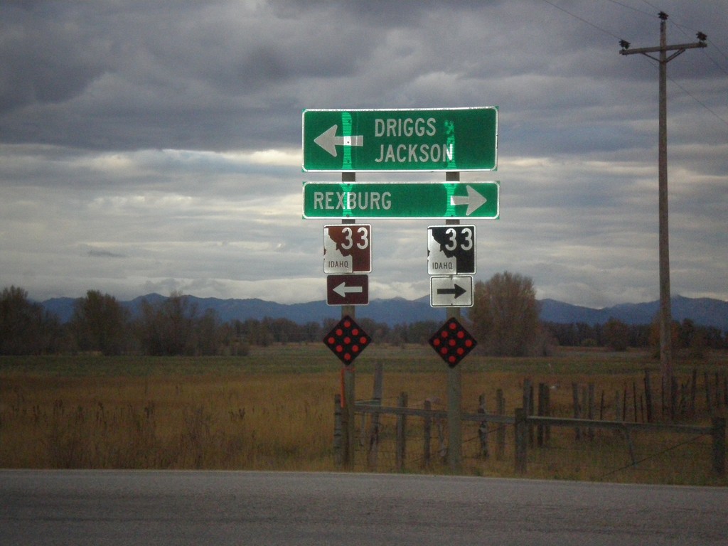
End ID-32 South at ID-33
End ID-32 south at ID-33. Use ID-33 west for Rexburg. Use ID-33 east for Driggs and Jackson (Wyoming). Use ID-33 east to continue on the Teton Scenic Byway.
Taken 10-04-2015
Tetonia
Teton County
Idaho
United States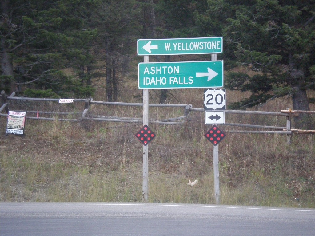
End ID-87 South at US-20
End ID-87 south at US-20, to Ashton, Idaho Falls, and W. Yellowstone.
Taken 10-03-2015

 Island Park
Fremont County
Idaho
United States
Island Park
Fremont County
Idaho
United States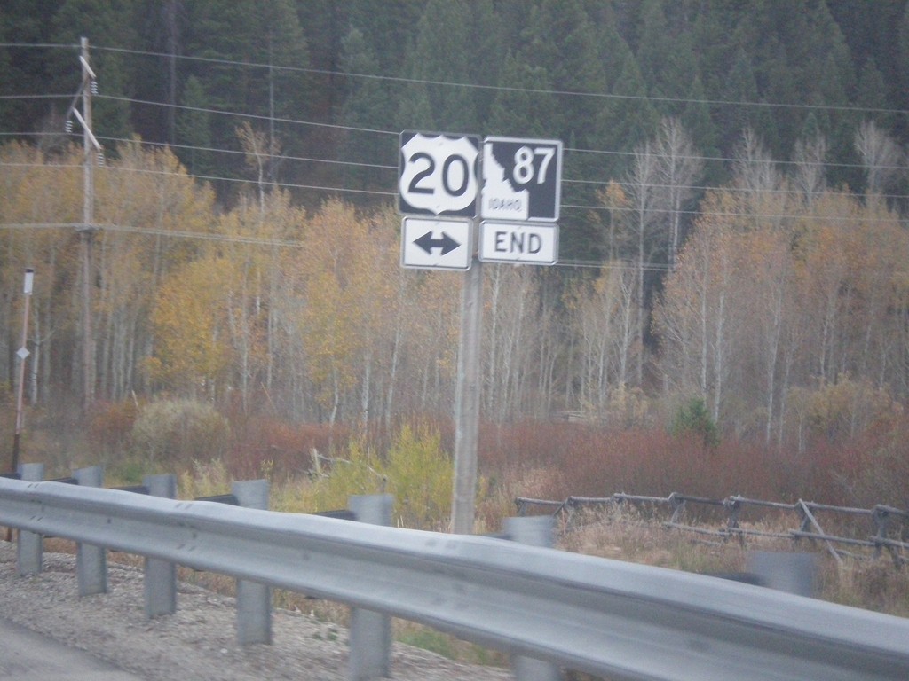
End ID-87 South at US-20
End ID-87 South at US-20 in Island Park.
Taken 10-03-2015
Island Park
Fremont County
Idaho
United States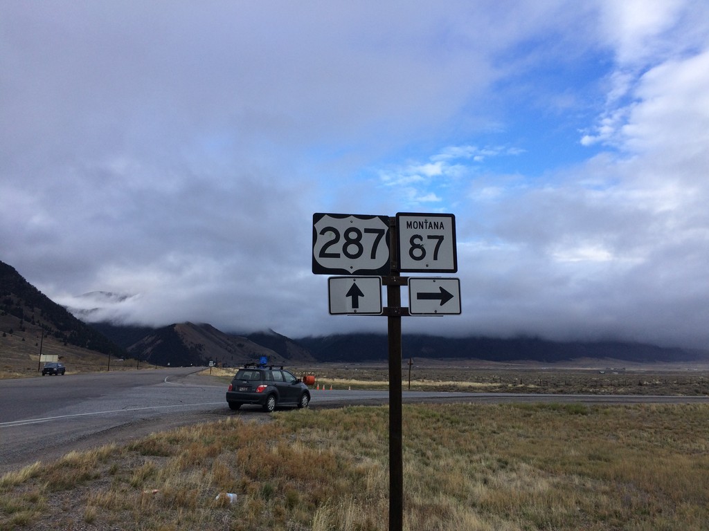
US-287 South at MT-87
US-287 South at MT-87 in Madison County.
Taken 10-03-2015

 Schusters Place
Madison County
Montana
United States
Schusters Place
Madison County
Montana
United States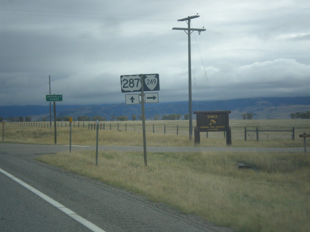
US-287 South at MTS-249
US-287 South at MTS-249 West in Madison County.
Taken 10-03-2015
 Varney
Madison County
Montana
United States
Varney
Madison County
Montana
United States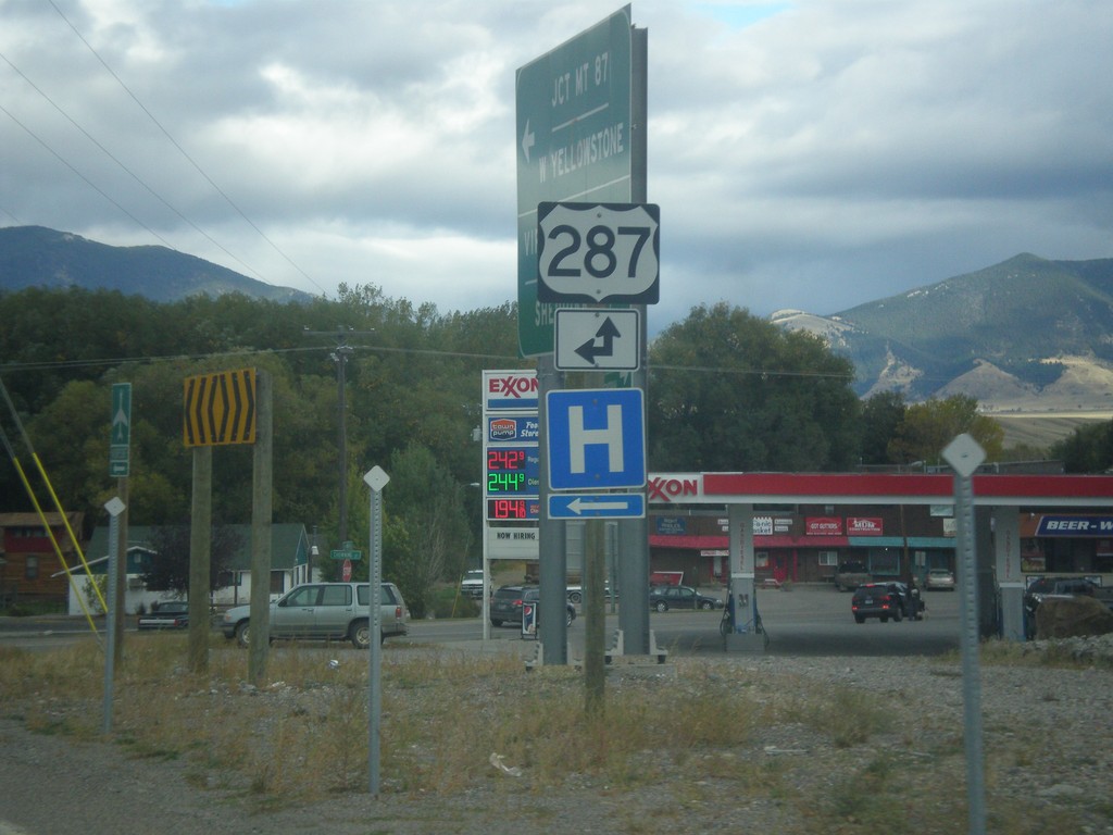
End MT-287 South at US-287
End MT-287 south at US-287 in Ennis. Turn left for US-287 north; straight for US-287 south.
Taken 10-03-2015
 Ennis
Madison County
Montana
United States
Ennis
Madison County
Montana
United States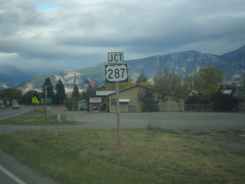
MT-287 South Approaching US-287
MT-287 South approaching US-287 in Ennis.
Taken 10-03-2015
Ennis
Madison County
Montana
United States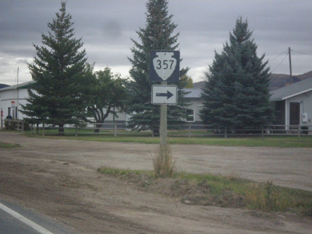
MT-287 South Approaching MTS-357
MT-287 South approaching MTS-357 in Alder.
Taken 10-03-2015
 Alder
Madison County
Montana
United States
Alder
Madison County
Montana
United States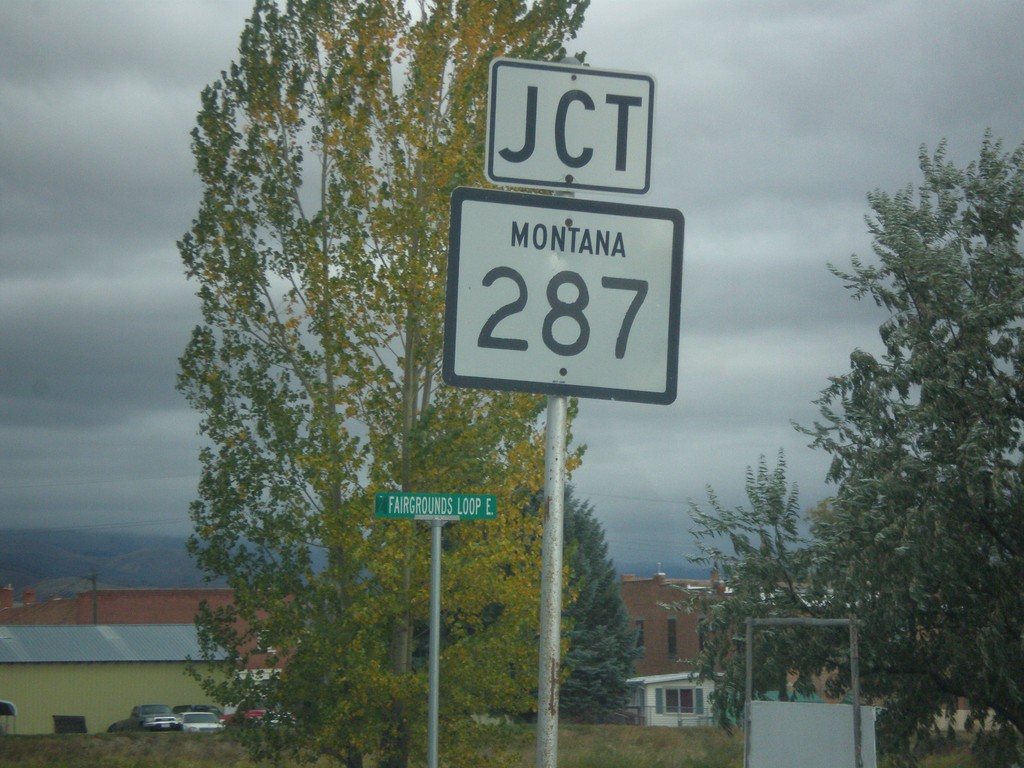
MT-41 North Approaching MT-287
MT-41 North approaching MT-287 in Twin Bridges.
Taken 10-03-2015
 Twin Bridges
Madison County
Montana
United States
Twin Bridges
Madison County
Montana
United States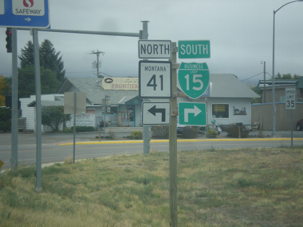
BL-15 South at MT-15
BL-15 South at MT-15 in Dillon. Turn right to continue south on BL-15; left for MT-41 north.
Taken 10-03-2015
 Dillon
Beaverhead County
Montana
United States
Dillon
Beaverhead County
Montana
United States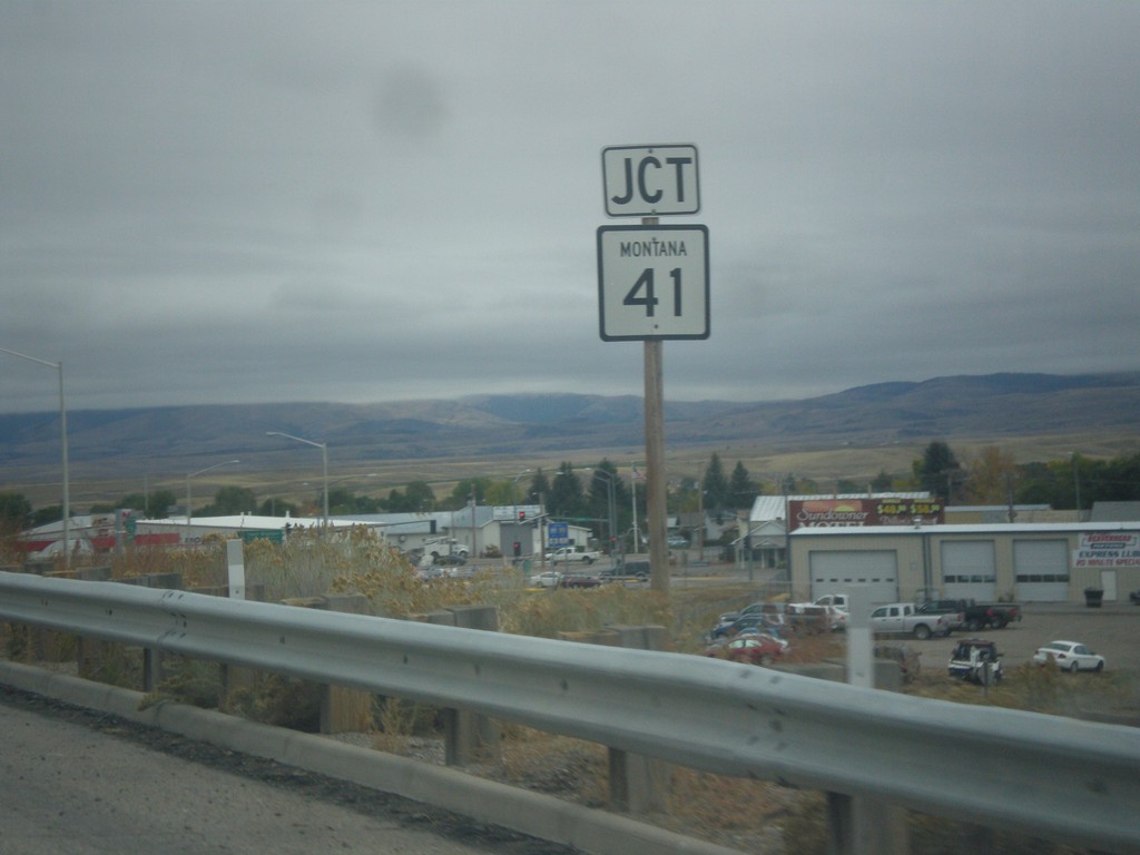
BL-15 South Approaching MT-41
BL-15 South approaching MT-41 in Dillon.
Taken 10-03-2015
Dillon
Beaverhead County
Montana
United States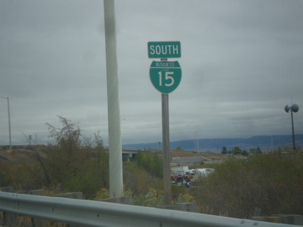
BL-15 South - Dillon
BL-15 South on short spur between I-15 and MT-41 in Dillon.
Taken 10-03-2015
Dillon
Beaverhead County
Montana
United States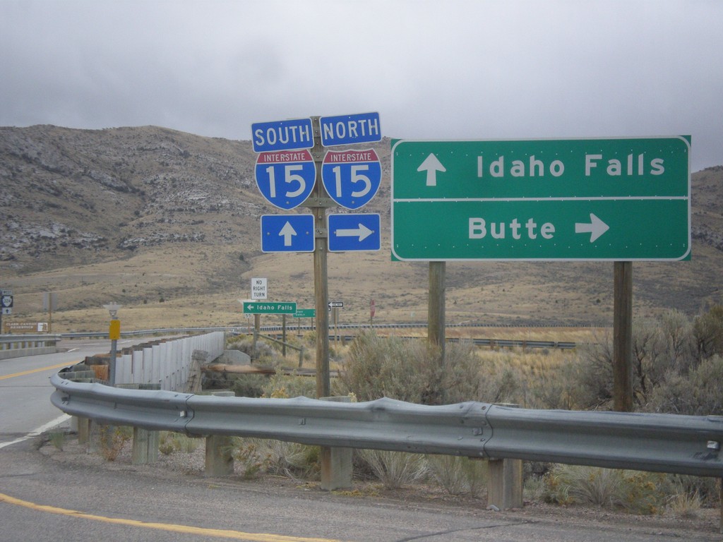
Frontage Road at I-15
Frontage Road at I-15. Turn right for I-15 north to Butte; continue over freeway for I-15 south to Idaho Falls (ID). Continue straight for MTS-324.
Taken 10-03-2015

 Dillon
Beaverhead County
Montana
United States
Dillon
Beaverhead County
Montana
United States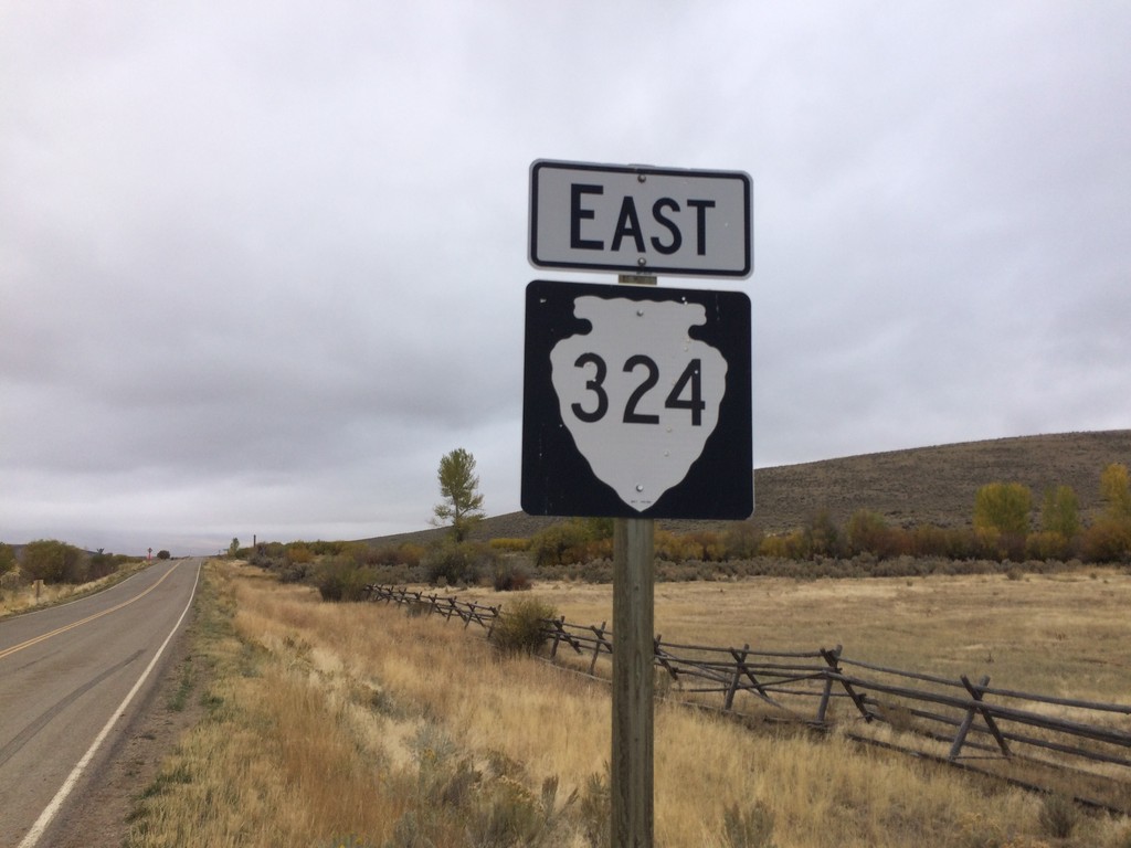
MTS-324 East - Beaverhead County
MTS-324 East - Beaverhead County. This is the first MTS-324 shield on the route eastbound. The first few miles of gravel road from the Idaho stateline did not have any shields, mileposts, or other markings. This sign is when the paved road starts.
Taken 10-03-2015
Dillon
Beaverhead County
Montana
United States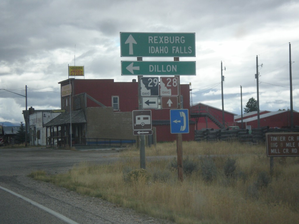
ID-28 South at ID-29
ID-28 south at ID-29 east to Dillon (Montana). Continue south on ID-28 for Rexburg and Idaho Falls.
Taken 10-03-2015

 Leadore
Lemhi County
Idaho
United States
Leadore
Lemhi County
Idaho
United States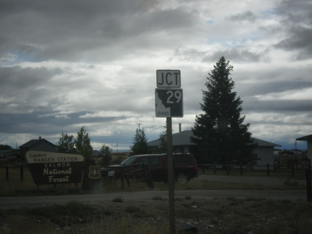
ID-28 South Approaching ID-29
ID-28 South approaching ID-29 in Leadore.
Taken 10-03-2015
Leadore
Lemhi County
Idaho
United States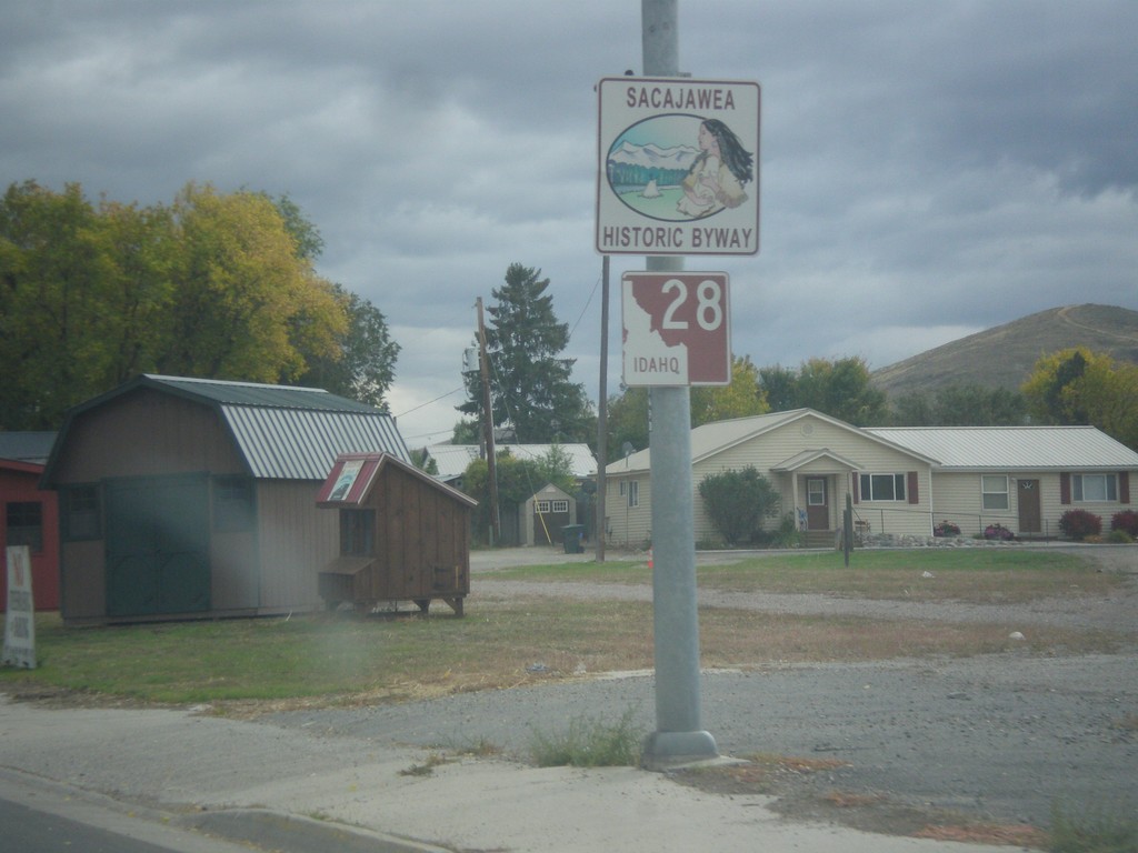
ID-28 South - Sacajawea Historic Byway
Sacajawea Historic Byway on ID-28 South in Salmon.
Taken 10-03-2015
Salmon
Lemhi County
Idaho
United States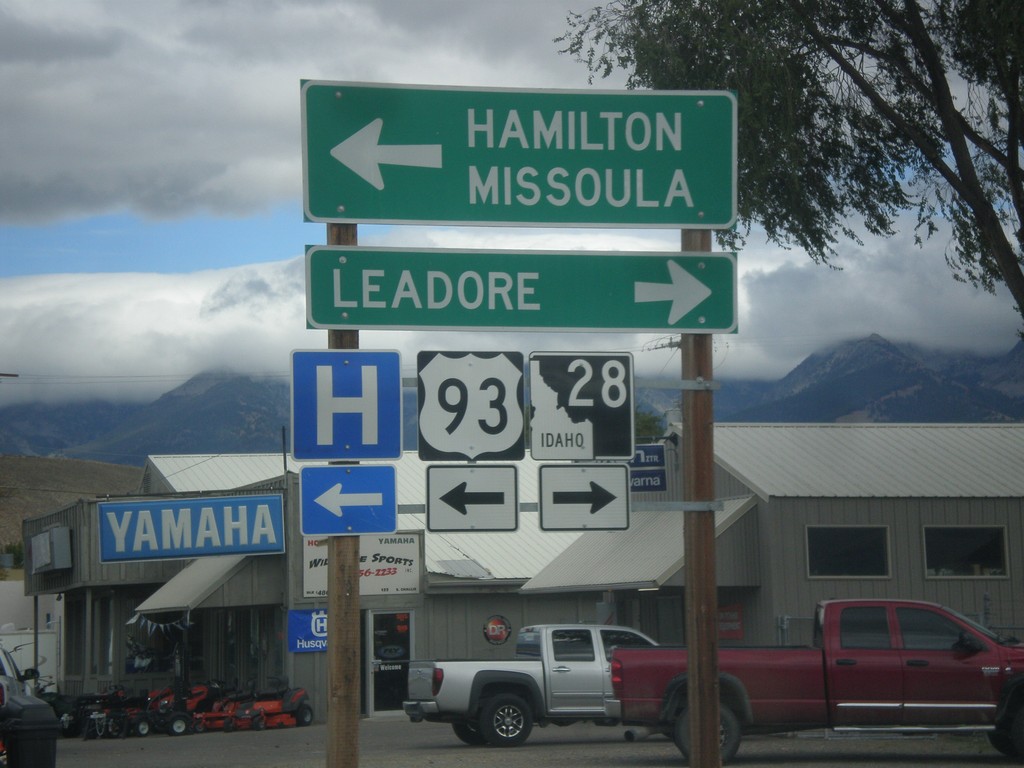
US-93 North at ID-28
US-93 North at ID-28 south to Leadore. Turn left to continue north on US-93 to Hamilton (MT) and Missoula (MT).
Taken 10-03-2015
 Salmon
Lemhi County
Idaho
United States
Salmon
Lemhi County
Idaho
United States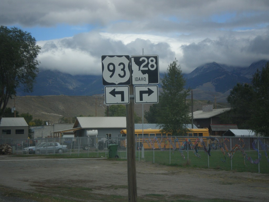
US-93 North Approaching ID-28
US-93 North approaching ID-28 in Salmon. Turn left to continue north on US-93; right for ID-28 south.
Taken 10-03-2015
Salmon
Lemhi County
Idaho
United States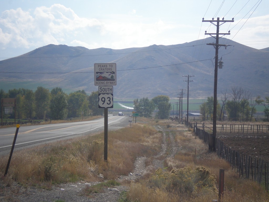
US-93 South - Peaks To Craters Scenic Byway
US-93 South - Peaks To Craters Scenic Byway in Custer County.
Taken 10-03-2015
Challis
Custer County
Idaho
United States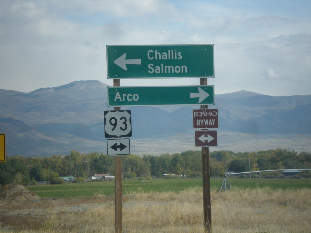
End ID-75 North at US-93
End ID-75 at US-93. Turn left for US-93 north to Challis and Salmon. Turn right for US-93 south to Arco. US-93 north is part of the Salmon River Scenic Byway; US-93 south is part of the Peaks to Craters Scenic Byway.
Taken 10-03-2015
 Challis
Custer County
Idaho
United States
Challis
Custer County
Idaho
United States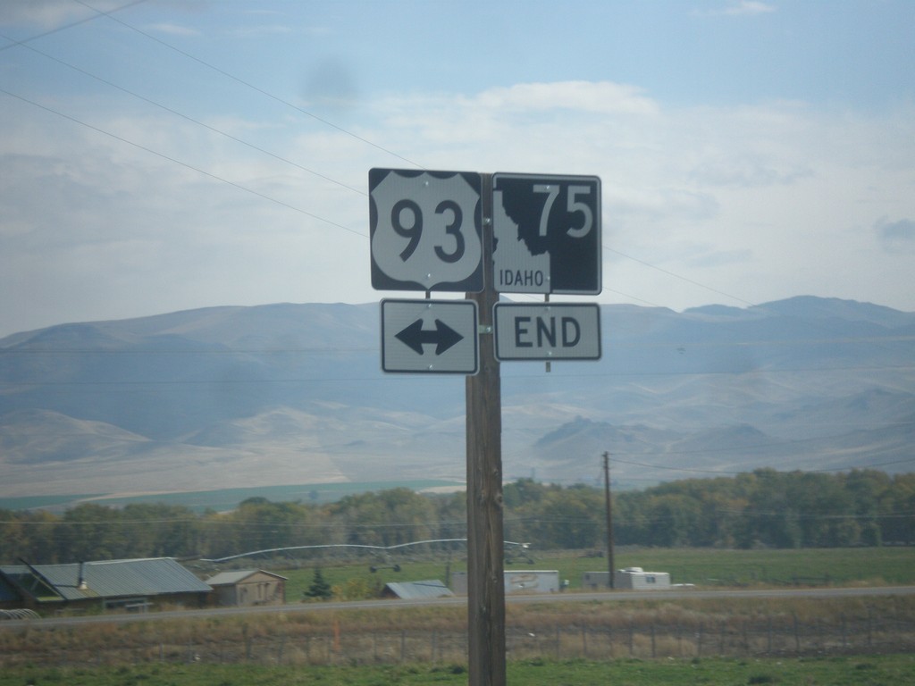
End ID-75 North at US-93
End ID-75 North at US-93 in Custer County.
Taken 10-03-2015
Challis
Custer County
Idaho
United States