Signs Tagged With Sierra Nevada
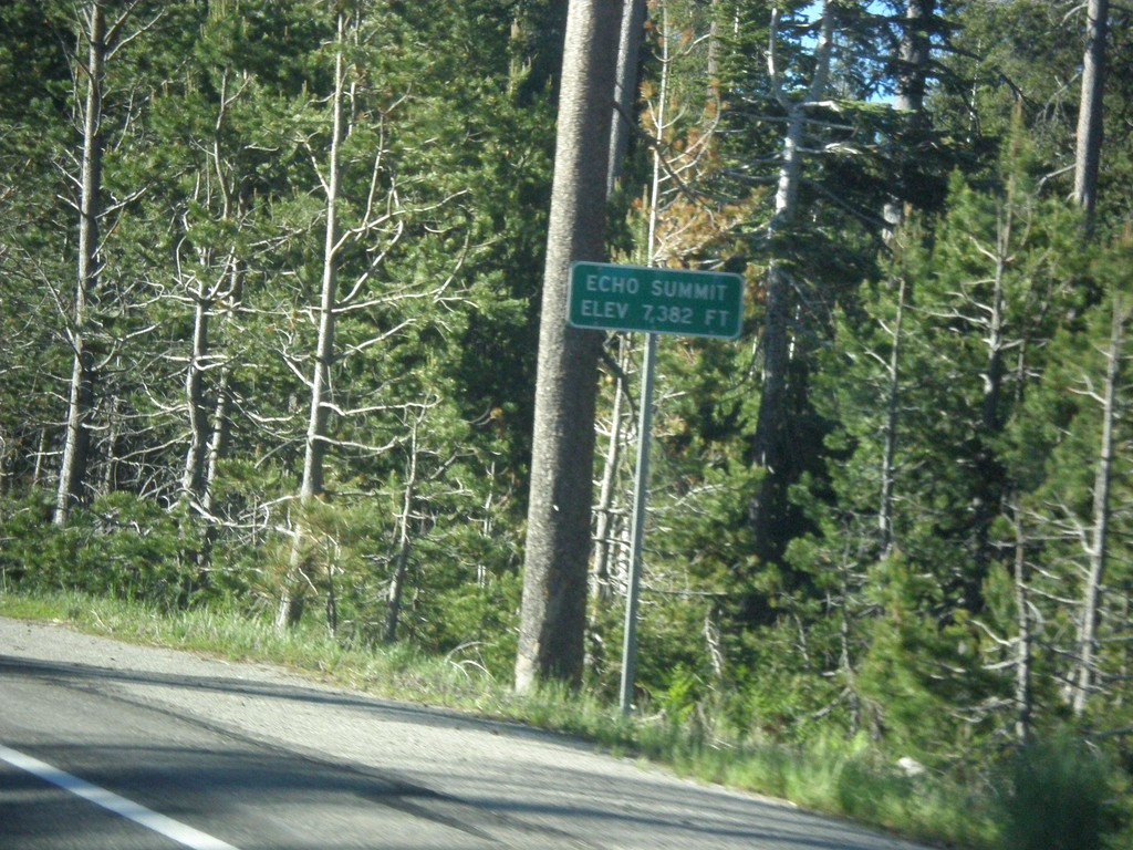
US-50 East - Echo Summit
US-50 each at Echo Summit -Elevation 7382 Feet. This is the summit of the Sierra Nevada on US-50 and the divide between the American River drainage and Lake Tahoe, which drains to the Truckee River.
Taken 06-15-2015
 Nebelhorn
El Dorado County
California
United States
Nebelhorn
El Dorado County
California
United States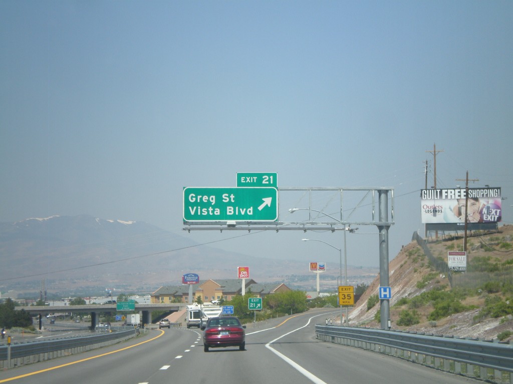
I-80 West - Exit 21
I-80 west at Exit 21 - Greg St./Vista Blvd. This is the first exit in the Reno/Sparks area westbound. The Sierra Nevada are visible in the background of the photo.
Taken 06-09-2011
 Sparks
Washoe County
Nevada
United States
Sparks
Washoe County
Nevada
United States