Signs Tagged With Snow
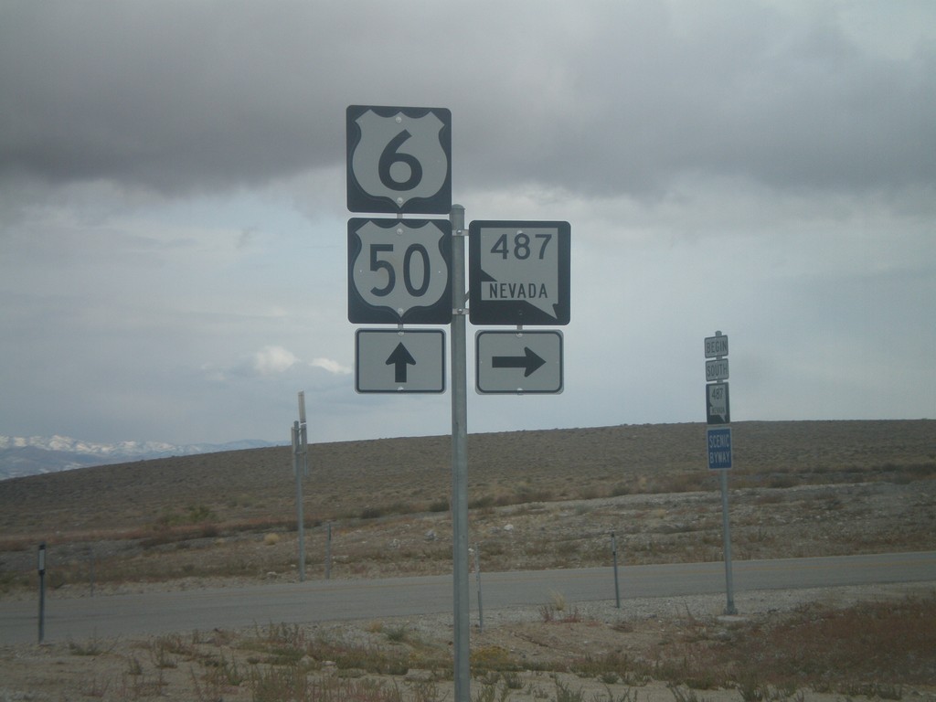
US-6/US-50 East at NV-487
US-6/US-50 East at NV-487.
Taken 10-11-2008


 Baker
White Pine County
Nevada
United States
Baker
White Pine County
Nevada
United States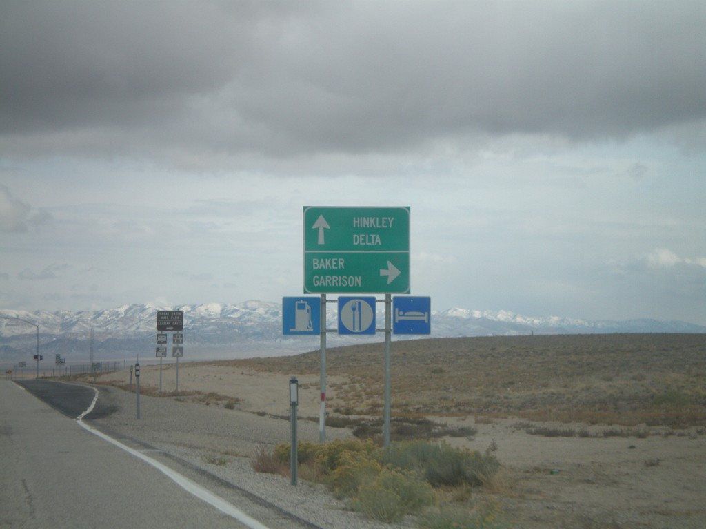
US-6/US-50 East At NV-487
US-6/US-50 east approaching NV-487. Turn right for NV-487 south to Baker and Garrison (Utah). Continue east on US-6/US-50 for Hinkley (Utah) and Delta (Utah).
Taken 10-11-2008
Baker
White Pine County
Nevada
United States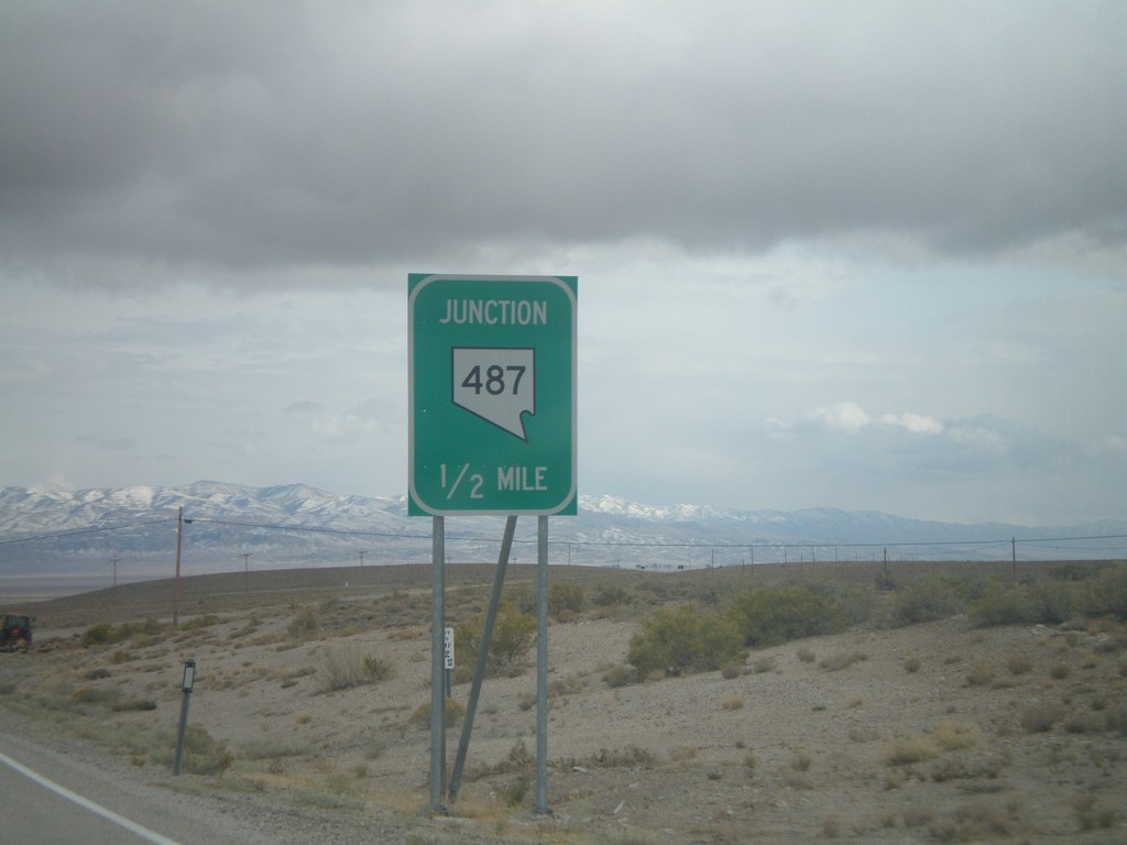
US-6/US-50 East Approaching NV-487
US-6/US-50 East approaching NV-487 in White Pine County.
Taken 10-11-2008
Baker
White Pine County
Nevada
United States
US-93 (Cutout) South of Majors Jct.
US-93 South cutout shield at Majors Junction.
Taken 10-11-2008
 Ely
White Pine County
Nevada
United States
Ely
White Pine County
Nevada
United States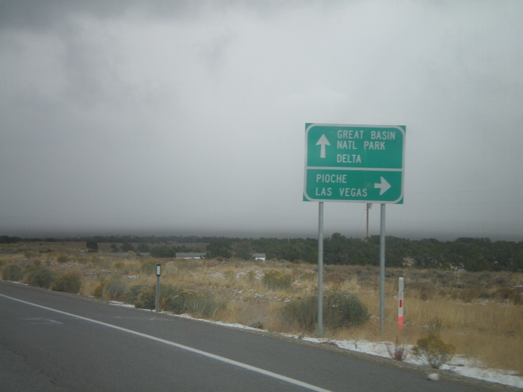
US-50 East/US-6 East/US-93 South at Majors Jct.
US-6 East/US-50 East/US-93 South at Majors Jct. Turn right for US-93 south to Pioche and Las Vegas. Continue straight on US-6/US-50 east for Great Basin National Park and Delta.
Taken 10-11-2008
Ely
White Pine County
Nevada
United States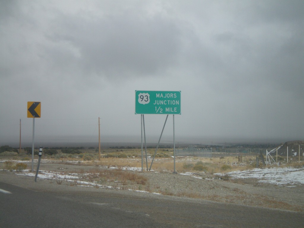
US-50 East/US-6 East/US-93 South Approaching Majors Jct.
US-50 East/US-6 East/US-93 South approaching Majors Jct. Most rural highway junctions in Nevada have a name.
Taken 10-11-2008
Majors Place
White Pine County
Nevada
United States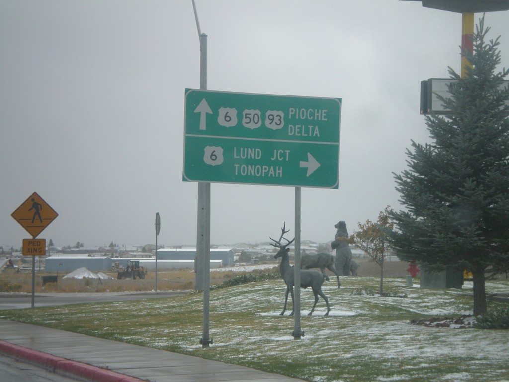
US-93 South/US-50 East at US-6
US-93 South/US-50 East at US-6 junction. US-6 combines with US-93 South to Majors Place; US-6 joins US-50 east to Delta, Utah. Turn right on US-6 west for Lund Junction and Tonopah. Continue straight on US-6/US-50 East/US-93 south for Pioche and Delta (Utah).
Taken 10-11-2008
Ely
White Pine County
Nevada
United States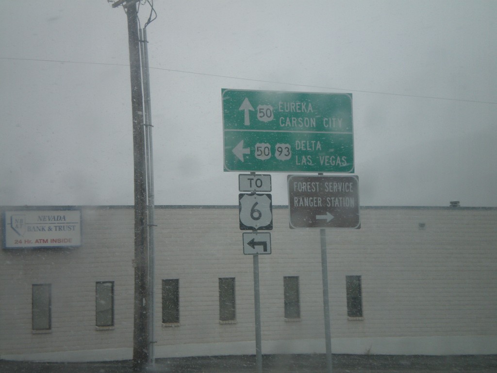
US-93 South at US-50 - Ely
US-93 south at US-50 in Ely. US-50 joins US-93 south to Majors Place. Continue straight for US-50 west to Eureka and Carson City. Turn left for US-93 South/US-50 East to Delta (Utah), Las Vegas, and US-6.
Taken 10-11-2008
Ely
White Pine County
Nevada
United States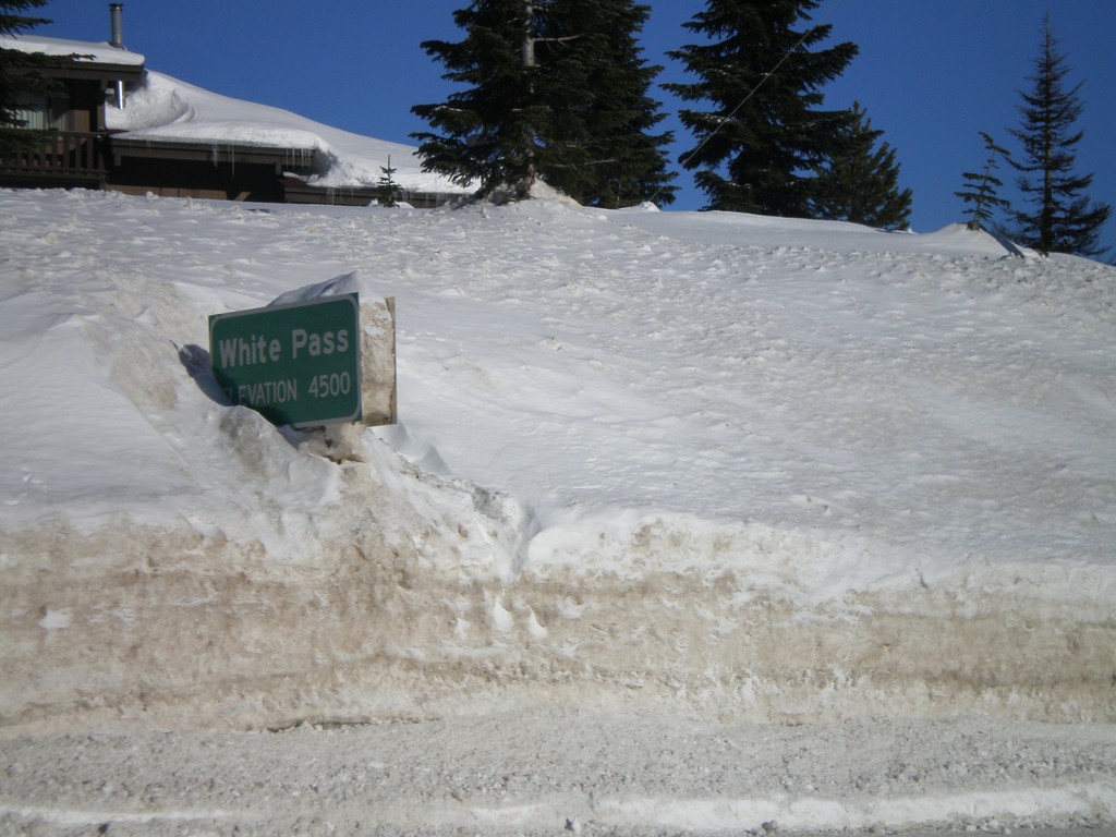
US-12 East - White Pass
US-12 east at White Pass (Elev. 4500 Ft) - the summit of US-12 in the Cascades.
Taken 01-22-2008
 Naches
Yakima County
Washington
United States
Naches
Yakima County
Washington
United States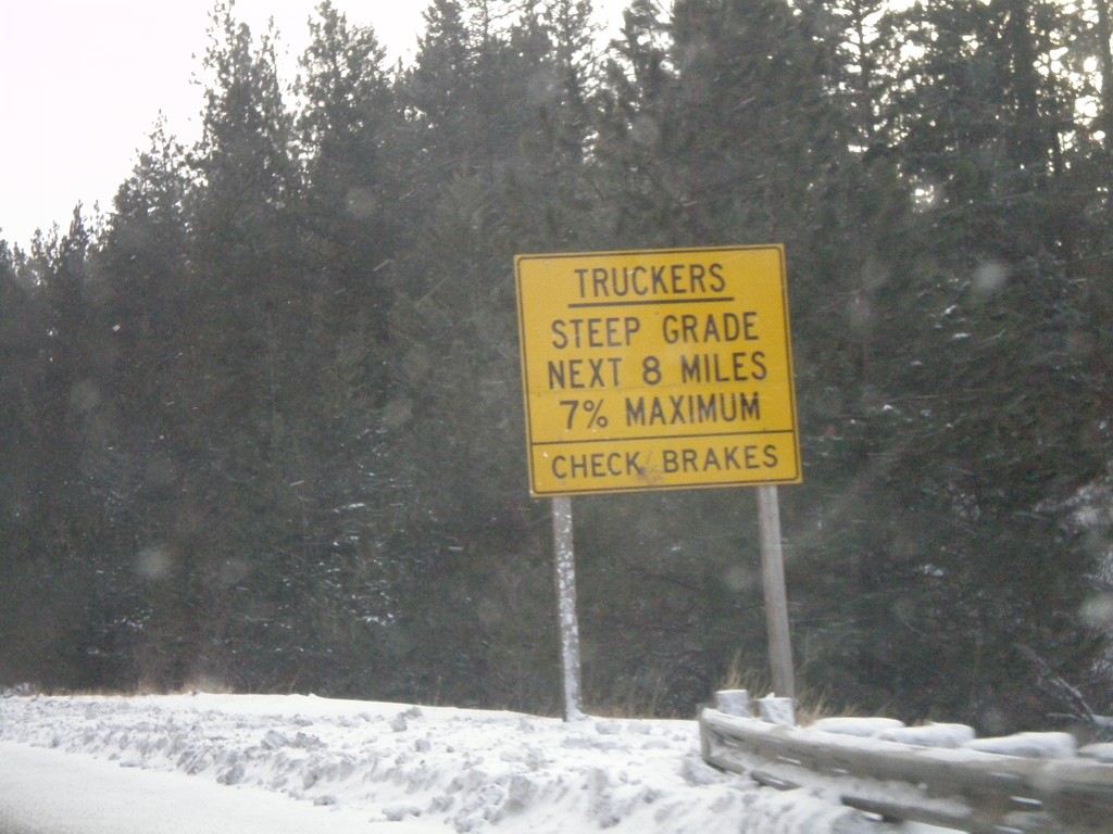
US-95 South - Trucker Warning on White Bird Hill
Trucker warning on US-95 south at the top of White Bird Hill. White Bird Grade is a 8 mile grade with steepness up to 7%.
Taken 12-26-2007
 Grangeville
Idaho County
Idaho
United States
Grangeville
Idaho County
Idaho
United States